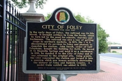
The City of Foley was founded in 1905 by John B. Foley of Chicago. Mr. Foley, who was in the pharmaceutical business, heard about this area from a railroad land agent as they traveled to President William McKinley's funeral in 1901. Mr. Foley . . . — — Map (db m188732) HM
The camellia, often called the Queen of winter flowers, is the state flower of Alabama. Originally from the Orient, the camellia made its way to Europe in the 1600s, then to America and Australia in the 1700s. It now flourishes in the southern . . . — — Map (db m188784) HM
1942, Benjamin DeWitt Cobb, more affectionately known as “B.D.”, was appointed as the lone police officer for the town of Foley. In 1943, another officer was hired and B.D. was appointed as the first Chief of Police. This marked the . . . — — Map (db m81581) HM
Traditionally referred to as "colors", flags have long been used to identify nations, loyalties, and movements. As the sands have shifted through the ages, so too have the colors and loyalties of the Gulf Coast. Displayed here are a small section of . . . — — Map (db m187336) HM
American Forces
158 Men
20 Cannons
Casualties
3 Killed; 5 Wounded
British Forces
852 Men
130 Creek Indians
4 Ships; 80 Cannon
23 Killed; 47 Wounded
On September 11, 1814, HMS Hermes, HMS . . . — — Map (db m187342) HM
Drawn by A. Laccarriere Latour to accompany his book Historical Memoir of the War in West Florida and Louisiana, the above image depicts Fort Bowyer on the right as it appeared during the first battle in 1814. The drawing on the left; . . . — — Map (db m225072) HM
First Alabama soldier to lose life in Civil War.
DeVotie graduated in 1856 from University of Alabama; Presbyterian Theological Seminary at Princeton in 1859. In 1856 at the University of Alabama, he was chief founder of Sigma Alpha . . . — — Map (db m4219) HM
American Forces
370 Men
28 Cannon
Casualties
1 Killed; 18 Wounded
British Forces
3000 Men
38 Ships
28 Cannon (not including those on ships)
13 Killed; 18 Wounded
A map of the Second Battle of Fort . . . — — Map (db m118334) HM
Construction began on August 19th on two artillery positions that were emplaced only 200 yards from the southeast bastion of Fort Morgan. These positions, which were part of Battery Bailey, anchored the southern flank of the Federal siege lines. . . . — — Map (db m118336) HM WM
(East Face):
Tribute dedicated to the memory of the soldiers who gave their lives in the defense of our country here at Fort Morgan.
Here lies the pride of seven flags entombed in our ancestor’s worth, who heard the thunder of the fray . . . — — Map (db m4649) HM
(preface)
"Damn the Torpedoes!" is a familiar battle cry, but there's more to the story! The Mobile Civil War Trail is your guide to military movements and the way of life on and around Mobile Bay in the closing two years of the Civil . . . — — Map (db m87247) HM
After the surrender of Fort Gaines, U.S. General Gordon Granger prepared to besiege Fort Morgan. On August 9, 1864, he moved by transport to Navy Cove and debarked 2,000 men and his siege equipment at the Pilot Town wharf. By 2:00 p.m. he had . . . — — Map (db m87246) HM
This smoothbore, muzzle-loading cannon was one of the
main coast defense weapons in the United States' arsenal when Fort Morgan was completed in 1834. With an eight pound charge of powder the gun could fire a 32 pound solid iron shot about one . . . — — Map (db m87245) HM
6.4” (100 pounder) Parrott Rifle
Designed by Robert Parker Parrott at the outbreak of the Civil War, the Parrott Rifle became one of the most used rifled artillery pieces during the war. With shells that exploded on impact, rifled . . . — — Map (db m69898) HM
Little Lagoon is an eight mile long saltwater lagoon connected to the Gulf of Mexico by a man-made pass.
Major hurricanes periodically breach the southern shoreline of the Lagoon and create a new pass to the Gulf, which soon fills in naturally. . . . — — Map (db m258732) HM
Constructed between 1899 and 1900, the battery was named in honor of Major General Henry Dearborn, a Revolutionary War hero. The battery mounted eight 12” breech-loading mortars. Each mortar weighed 13 tons and was 11’ 9” long. The . . . — — Map (db m69919) HM
Battery Schenck, named for First Lieutenant William Schenck who was killed in action during the Philippine Insurrection, was the second rapid fire battery constructed at Fort Morgan. Completed on June 4, 1900, the battery would sit without guns for . . . — — Map (db m70058) HM
The first of two rapid fire gun batteries, Battery Thomas was named in honor of Captain Evan Thomas, 4th U.S. Artillery, who was killed in action with the Modoc Indians at Lava Beds, California in 1873.
In March 1898, as the nation moved . . . — — Map (db m69826) HM
Established in May 1862 near this location, Camp Withers served as a central point for coordinating picket duties, observing Federal maneuvers along the Alabama coast, and as a station for Alabama's Seventh Cavalry Regiment. It was named in honor of . . . — — Map (db m188734) HM
The Citadel, a large ten sided brick and wood structure, once dominated the Fort’s parade ground. Completed in 1825 as a defensive barracks, it was capable of housing 400 soldiers.
During the Union bombardment on August 22, 1864, the pine . . . — — Map (db m68751) HM
At, or near, this site, the United States, after seizing this point of land from the Spanish in 1813, built Fort Bowyer, a structure of wood and sand.
A small garrison of men courageously fought to defend the fort against two British attacks, one . . . — — Map (db m187339) HM
Officially designated “Pleasure Island” in 1949 by Governor Jim Folsom, the 32 miles of white sandy beaches in Gulf Shores has been a prime fishing and golf destination for Alabamians and tourists. Early Alabama Gulf Coast individuals . . . — — Map (db m52045) HM
Historic 650 miles Water Route along the
Coosa, Alabama and Mobile Rivers
_________
Beginning on the Coosa River at the
Alabama-Georgia State Line
Established 2007 — — Map (db m122443) HM
This Shell Banks Baptist Church rests near the location of the first Indian village in America visited by a white man. This was the Indian village of “Achuse” visited by Admiral Maldonado who was one of De Soto’s officers. He scouted the Florida . . . — — Map (db m66295) HM
On April 8, 1825 General Lafayette bid farewell to Gov. Israel Pickens & others at Mobile Point and departed on steamboat for New Orleans. — — Map (db m271629) HM
Navy Cove. The Mobile Bay shoreline just inside Mobile Point, close to Fort Morgan, is known as Navy Cove. This was the site of Native American villages for over two thousand years. The name came after the British Navy anchored here when Fort . . . — — Map (db m122441) HM
As the U.S. Army modernized at the turn of the 20th century, so too did its military posts. In the stratified society of this period, separate and distinct areas for the various classes of individuals were developed. The Army was little different, . . . — — Map (db m70104) HM
After World War I, the versatile M1918M1 gun and its M1918A1 carriage were adapted for coast defense. Although the gun could be traversed over a wider range than other large guns of the period, it was still unable to adequately track moving . . . — — Map (db m81808) HM
When Fort Morgan was modified between the 1890’s and early 1900’s, an allocation of $7,000.00 was made to build a “Peace” magazine. This building was the central storage area for the powder used by the fort’s guns. If war was expected, . . . — — Map (db m69917) HM
On February 28, 1899, the U.S. Army completed construction of the post Hospital for the garrison of Fort Morgan. At a cost of $7,500.00, the original structure consisted of a two story modern medical facility that was heated by mineral oil. Due . . . — — Map (db m116935) HM
Completed on August 18th, Battery Lincoln was located near the northern end of the Federal siege lines of Fort Morgan. Company “C” of the 20th Iowa Infantry Regiment, under the command of Captain Mark L. Thomson, was detailed to serve . . . — — Map (db m81809) HM
Eager to attack Mobile Bay since 1862, U. S. Admiral David Farragut knew he could not capture control of the lower bay without the support of the army and without a flotilla of ironclad monitors to confront the Confederate ironclad CSS . . . — — Map (db m68815) HM
As the Hartford and Brooklyn steamed into the lower bay, the Tennessee tried to ram both in succession but was too slow and had to let them pass. Admiral Buchanan then exchanged broadsides with the rest of Admiral Farragut’s . . . — — Map (db m69617) HM
At 7:25 a.m., August 5, 1864, Admiral Farragut’s lead monitor Tecumseh steered into the torpedo field at the mouth of Mobile Bay. The admiral had ordered Commander Tunis Craven, the Tecumseh’s captain, to engage the ram . . . — — Map (db m69412) HM
The Citadel, a large ten sided brick and wood structure, once dominated the Fort’s parade ground. Capable of housing 400 soldiers, it served as a defensive barracks for the Fort’s garrison.
During the Union bombardment of Fort Morgan on August . . . — — Map (db m92994) HM
To Wait and Watch
In late August 1864 the Federals controlled Mobile Bay but could not attack Mobile. Admiral Farragut could not reach the city even with his light draft vessels, because the channels in the upper Bay had been obstructed. . . . — — Map (db m187338) HM
The U.S. Model 1918M1 155mm Gun, more commonly known as the “G.P.F.”, was a French heavy artillery piece manufactured in the U.S. for use by the U.S. Army during World War I. Due to the gun’s mobility and hitting power, it was used . . . — — Map (db m69910) HM
In 1841, Raphael Semmes acquired farmland at the head of this bayou. The new homestead was named Prospect Hill. Several of Semmes’ colleagues from the Pensacola Navy Yard obtained nearby property and established “a very nice colony of nautical . . . — — Map (db m71957) HM
“The Red Eagle”
William Weatherford
1765-1824
The Son of a Scotch Trader, Charles Weatherford, and a Creek Indian Princess, Sehoy Tate Weatherford, William was destined to become one of the most powerful leaders of the Wind Clan of the . . . — — Map (db m247506) HM
Front
Lottie has the highest elevation in Baldwin County. A ridge forms a divide where waters to the east flow into Pensacola Bay and waters to the west flow into Mobile Bay. Pine Log Creek begins in Lottie. Pine Log Ditch, used to . . . — — Map (db m122349) HM
Dedicated by the Town of Loxley as a lasting tribute to the men and women who have served,
are presently serving, the Armed Forces of the United States of America. Let us never forget that freedom isn't free. We appreciate your service. — — Map (db m234692) WM
Jenkins Farm
John Wesley Jenkins, born 1874, owned a 40 acre turpentine operation in 1915 when he married Amelia Taylor. With the decline of his turpentine resources, they began growing potatoes. At the time of John Wesley’s death in . . . — — Map (db m155369) HM
As early as 1889 settlers came to this community, then known as Bennett, to farm. In 1891, John E. Loxley, from Michigan, opened a lumber mill he named 'Bennett Mill'. The settlement was later renamed Loxley, honoring the timber merchant. . . . — — Map (db m234691) HM
Front:
Settlement of this area began in the early 1700’s and was expedited by a series of Spanish land grants in the early 1800’s. During the 1819-33 time period a brick factory along the south river bank supplied brick for . . . — — Map (db m66271) HM
Old tales have it that early explorers and even pirate vessels obtained potable water from springs scattered throughout the community of Magnolia Springs. This park is located at the largest of dozens of springs in the area.
In 1865 The . . . — — Map (db m68486) HM
The Village of Montrose. In 1839, Cyrus Sibley of Massachusetts acquired land on the eastern shore of Mobile Bay. Eight years later, a village was formally platted, surveyed, and was called 'Sibley City'. In 1852, it was renamed 'Montrose' as . . . — — Map (db m234963) HM
Front
This area, located along the southern shore of Wolf Bay, was the original 'Downtown' of Orange Beach. Beginning in the 1870's, the two schooners of James C. Callaway anchored near here in the deep-water Boat Basin. The . . . — — Map (db m130682) HM
Transportation into Orange Beach was difficult in the early 1900’s. The First ‘real road’ into the area came through Gulf State Park. It was built about 1948, during the administration of Gov. Jim “Big Jim’ Folsom. It was called a ‘Farm to Market . . . — — Map (db m299165) HM
(front)
The property where the cemetery is located was part of a Spanish Land Grant issued to the Suarez family prior to the War of 1812. In 1925, a United States Land Patent was confirmed and issued. The property has been in use since . . . — — Map (db m71618) HM
The community of Orange Beach goes back to at least
1838, as evidenced by property deeds. As an incorporated
city, it is quite young. Following Hurricane Frederic on
September 12, 1979, with all its publicity, Orange Beach
was 'discovered'! . . . — — Map (db m122462) HM
Front:
Orange Beach was named for the oranges that were grown here and exported until the hard-freezes of 1916. The orange groves are gone, but the name remained. Drawn here by the game they hunted, the early Indians discovered the . . . — — Map (db m81851) HM
Before 1906, Perdido Pass was located three miles east of today's Pass.
It was all a part of Point Ornocor with a short river at its end curving to
the west. The pass was narrow and very dangerous. Alabama Point and
Ono Island did not exist. . . . — — Map (db m122442) HM
Romar Beach began as a large homestead property with three miles of beachfront spanning from Gulf State Park to Hwy 161 in Orange Beach. The original property now covers only 480 feet. It was a true homestead and the owners were required to ‘till . . . — — Map (db m122463) HM
"Alabama's First Farm Winery Since Prohibition"
A 50 acre Muscadine Grape Vineyard was established
at this site in 1972 to produce grapes for Bartels
Winery of Pensacola, Florida. In 1979, legislation
sponsored by Rep. John M. McMillan . . . — — Map (db m122470) HM
“Damn The Torpedoes!” is the familiar battle cry, but there’s much more to the story! The Mobile Bay Civil War Trail is your guide to military movements and the way of life on and around Mobile Bay in the closing two years of the Civil War. Stand . . . — — Map (db m81853) HM
In commemoration of all Sky Soldiers
whose valor and sacrifice in defense of
South Vietnam must never be forgotten
"All Gave Some – Some Gave All" — — Map (db m100946) WM
This earthen mound was part of a redoubt constructed by the 1st Division, U.S. Colored Troops in April, 1865. The regiment saw considerable action against Confederate warships protecting the Blakely River. These earthworks have been preserved as a . . . — — Map (db m100853) HM
Born in Winchester, Virginia, he moved to Missouri where at age 17 he enlisted in the State Guard. In 1861 he became a Private in the Confederate States Army, was captured during the Battle of Wilson's Creek and escaped.
Captain Danner . . . — — Map (db m100880) HM
The earliest outline of a recognizable bay on the northern coast of the Gulf of Mexico was shown on a 1507 map by German cartographer Martin Waldeseemuller–the same map to first apply the name "America" to the New World.
Alonso Álvarez de . . . — — Map (db m100841) HM
A trail used in early times by Indians, Spanish Explorers, French Settlers and later by soldiers during the battle of Spanish Fort 1865. At one time a stream driven train paralleled this trace. Its ancient road bed can still be seen south of this . . . — — Map (db m100877) HM
Named in honor of the 1,810 Men in Gray who defended the eastern approaches to Mobile in the battle of Spanish Fort March 26 ~ April 8-9, 1865. Here Brig. Gen. R. L. Gibson, C.S.A. engaged “…more than 20,000” enemy troops in the last . . . — — Map (db m100878) HM
Twenty-nine Union field guns, manned by men of the 3d Indiana,
1st Illinois and 2d Iowa Batteries, shelled these Confederate trenches
for 13 consecutive days and nights. The fact that these trenches were
never breached, attests to the courage of . . . — — Map (db m100873) HM
Confederate Redoubt No. 3
Capt. Cuthbert Slocomb of the 5th Company, Washington Artillery of New Orleans, commanded Redoubt No. 3, also known as Battery Blair,
consisted of one 8-inch Columbiad, two 12-pound Napoleons, one 3-inch ordinance . . . — — Map (db m168270) HM
Confederate Redoubt No. 4
Redoubt No. 4 was part of the Confederate line known as Red Fort. Capt. John Phillip’s Tennessee Light Artillery manned the redoubt until they were relieved on April 4, 1865 by Garrity's Alabama Light Artillery. Lt. . . . — — Map (db m120341) HM
Confederate Redoubt No. 5
Also called the Sandbag Battery, Redoubt No. 5 was originally commanded by Lt. Andrew Hargrove of Lumsden's Tuscaloosa Battery, Company F, 2nd Alabama Light Artillery Battalion. During the early stages of the . . . — — Map (db m168290) HM
From this Confederate Fort 15 heavy artillery guns, repelled elements of 2 Union Army Corps, routed 5 ironclad monitors attacking up the Blakely River and for 13 days helped prevent the capture of Mobile until after General Lee's Surrender at . . . — — Map (db m100911) HM
Highest point along 2 miles of Confederate battle lines extending east and north. Here 200 soldiers from Georgia, Louisiana & Arkansas, held off a numerically superior Union Force for thirteen days and nights in the last battle of the War Between . . . — — Map (db m100913) HM
Dedicated to the men of the Confederate States of America who valiantly fought for our American liberties, "Governments are instituted among men, deriving their just powers from the consent of the governed... whenever any form of government becomes . . . — — Map (db m100936) HM
Courts met under "Jury Oak" early 1800s. Judge presided while sitting on tree limb. Public executions held at nearby "hanging tree". — — Map (db m221963) HM
Built of red clay, armed with 12 heavy guns and served by 307 crack
Confederate Artilleryman from Batteries Perry (Tenn.) Phillips (Tenn.) Lumsden (Ala.) and Garrity (Mobile, Ala.). It was the keystone in the defense of Spanish Fort, 1865. — — Map (db m100868) HM
During the Revolutionary War, France, Spain, Britain, and the United States were interested in the fate of this region. In March 1780, Spanish forces captured Mobile. They established a palisaded fort with trenches (one mile north of here) to . . . — — Map (db m61451) HM
Saluda Hill Cemetery is a private historical cemetery established in 1824. Among the graves here is that of Zachariah Godbold, the only known Revolutionary War veteran buried in Baldwin County. Many Blakeley residents and Confederate soldiers also . . . — — Map (db m81854) HM
Manned with sailors and commanded by Lt. Commander Gillis of the U.S.S. Milwaukee, which was sunk by a Confederate torpedo in Blakeley River. Armed with two 4.2 in. Parrott rifled cannon firing projectiles weighing 30 lbs., these guns fired on . . . — — Map (db m266005) HM
Rendezvous for Indians, Spanish, French and English Explorers. In 1865, Three Confederate Brigades, outnumbered 10 to 1, engaged the Army of West Mississippi (Union Forces) in the last battle of the War Between the States. March 26~April 9, 1865. — — Map (db m100844) HM
Spanish Fort is the gateway to the second largest delta in the United States. The Mobile-Tensaw, River Delta is 30 miles long and 12 miles wide. It covers more than 200,000 acres of swamps, river bottomlands and marshes and is considered the best . . . — — Map (db m285174) HM
Late on March 26, C.S. General St. John Liddell withdrew into the relative safety of Fort Blakeley and Spanish Fort, Liddell, assisted by General Francis Cockrell, assumed personal responsibility for the defense of Blakeley and put the defense of . . . — — Map (db m88990) HM
Canby brought up his heavy guns from Stark’s Landing a process that took several days, beginning on the 28th. Supported by the Federal monitors, Chickasaw and Winnebago, Canby tried to pound the enemy into submission The Confederates naturally . . . — — Map (db m88991) HM
On the evening of April 8th, 1865, while the Confederate fortifications were being shelled by Union artillery, the 8th Iowa Infantry advanced from near this point to the Confederate left and captured a part of the works, in hand to hand fighting. . . . — — Map (db m100883) HM
At dusk on April 8, 1865, 300 yards west of this site, the Union Army's 8th lowa Infantry and three Illinois Regiments breached the Confederate main line of resistance. Under the cover of night, troops holding the thin gray line spiked their guns . . . — — Map (db m100855) HM
Incorporated in 1814 by the legislature of the Mississippi Territory, prior to Alabama's statehood, the town of Blakeley was envisioned by the founder Josiah Blakeley as a premier trading canter and a rival to Mobile as a port owing to its deep . . . — — Map (db m280482) HM
The Union First Parallel
The main Union siege line during the Battle of Spanish Fort ran along this ridge. Brig. Gen. Eugene Carr's Division occupied the right flank of the Union line between here and Minette Bay. Carr's men initially . . . — — Map (db m100857) HM
Near this site was the location of the first of twenty-two artillery positions the Union army set up to bombard the Confederate fortifications of Spanish Fort. The Confederate forces were under the command of Brig Gen. Randall Gibson. Battery Tracy, . . . — — Map (db m120331) HM
Union Siege
Battery No. 21
Located on this bluff overlooking Minette Bay, Battery No. 21 anchored the right flank of Maj. Gen. Edward Canby's Army of West Mississippi during the Battle of Spanish Fort. Maj. Gen. Andrew Smith's XVI Army . . . — — Map (db m120339) HM
Dedicated to all women veterans
who have served, sacrificed
and suffered for our nation.
Your patriotism and courage are greatly
appreciated and will never be forgotten.
[Seals of the U.S. Army, Air Force, Navy, Marine Corps & . . . — — Map (db m100943) WM
Don't weep for me
O' Land of the free
When it was my time to fall
'Twas for my country's call
'Twas for the land that I loved
That I gave my all
And for the land that I loved,
I did freely give
And in her freedom
And . . . — — Map (db m122607) WM
Korean War
The Forgotten War
Remembered
1950 - 1953
In honor of all who served
and in memory of those who died
Freedom is not free
More than 8000 MIA's still unaccounted for
Reverse
The . . . — — Map (db m122618) WM
In honor of all who served in Southeast Asia during the Vietnam war. “Welcome home"
This nation should never forget the more than 58,000 who paid the ultimate sacrifice in the service of our country or the ones who were left behind. . . . — — Map (db m122644) HM WM
World War II
December 1941 - September 1945
Dedicated to all who served at
home and abroad - military and civilian
Pacific Theater • European Theater
Asian Theater • African Theater
{Reverse}
. . . — — Map (db m122673) WM
World War I
1914 – 1918
Unites States Casualties
126,000 Killed - 234,000 Wounded
Reverse
World War I, also known as the Great War, the European War and in the United States, the war to end all wars, was a . . . — — Map (db m122615) WM
William Bartram, America’s first native born artist - naturalist, passed through Baldwin County during the Revolutionary era, making the first scientific notations of its flora, fauna and inhabitants. As the appointed botanist of Britain’s King . . . — — Map (db m81855) HM
27 July 1813 – Battle of Burnt Corn
30 August 1813 – Fort Mims Massacre
31 August 1813 – Kimbell – James Massacre
2 September 1813 – Attack at Fort Sinquefield
13 September 1813 – Wood's Bluff . . . — — Map (db m122631) HM WM
Front:
Historic Stockton
Modern Stockton is situated on a hill just above the original settlement, which was abandoned around 1840 because of Yellow Fever outbreaks. No verified source for the town name exists. Most likely it was . . . — — Map (db m66390) HM
Site of one of Alabama’s first sawmills. In 1811, Joshua Kennedy engaged Jesse Ember to build two water-powered sawmills, convertible to grist mills, for a total of $1400. The mills were operated by Kennedy through 1820; were burned twice, once by . . . — — Map (db m66379) HM
Here on the banks of the Tensaw River -- named for the Tensa Indian tribe whose principal village was located at this place -- Major Robert Farmar developed a plantation c. 1772. Farmar was one of the most prominent and controversial Alabamians of . . . — — Map (db m66380) HM
In 1799 the first public school in Alabama was built just north of this site at Boatyard Lake in the Tensaw Community. More than 90 small schools dotted Baldwin County in the early twentieth century. This one room school was built in 1920 by African . . . — — Map (db m122669) HM
Weight: 17,200 pounds
Bore: 13 inches
Maximum Range: 4,325 yards (almost 2.5 miles)
Cast in Ft. Pitt, PA in 1862
Largest piece of artillery used in the Civil War, It was used
for sea coast fortifications or on mortar boats for . . . — — Map (db m122473) HM
First known as Baldwin Presbyterian Church, members met in 1847, in Old Union Church near John Gallagher Springs. In 1903, the membership was moved to this site and the name was changed to Stockton Presbyterian Church. In 1956, the membership moved . . . — — Map (db m66387) HM
4624 entries matched your criteria. Entries 101 through 200 are listed above. ⊲ Previous 100 — Next 100 ⊳