313 entries match your criteria. Entries 201 through 300 are listed.⊲ Previous 100 — The final 13 ⊳
Windmills Historical Markers
Windmills have been used by humanity for more than a millennia to harness power for a variety of work. The series includes markers describing actual windmills and replica non-working windmills built for tourism, novelty, or other purposes. (It does not include markers that simply include the word Windmill in the text.)
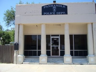
On South Main Street at Broadway Street (Texas Highway 207), on the right when traveling south on South Main Street.
In 1880s, capital of Panhandle area. Settled when slaughter of buffalo sent Indians to live on reservations. Terminus of Santa Fe Railway, 1887. Here immigrant trains brought colonists, who plowed old Indian range into wheat fields and civilization. . . . — — Map (db m55889) HM
On Avenue F Northwest (U.S. 287) at North Main Street, on the right when traveling east on Avenue F Northwest.
Born 1840. Came from Illinois to Texas, 1859. During Civil War rose from private, 1st Texas Artillery, to Colonel in 16th Cavalry. Was in bloody battles of Shiloh, Chickamauga, Nashville, Richmond. After war, when "didn't have 2 pairs of pants", . . . — — Map (db m96647) HM
On Farm to Market Road 1585 2.5 miles west of State Highway 214, on the left when traveling west.
Once encompassing more than 33,000 acres, the area known locally as the Old Surratt Territory is representative of the late-19th century settlement and ranching history of the vast grasslands of the Texas Panhandle. Marshall Surratt (1849-1927), . . . — — Map (db m167632) HM
Organized 1892. Present church was erected in 1918 to replace structure destroyed by cyclone. Lindsay settlers, Germans whose lives centered in the church, furnished much manual labor for the building and saved old windmill towers to be used as . . . — — Map (db m245784) HM
On 11th Street (Loop State Highway 466) at Avenue E (State Highway 163), on the right when traveling west on 11th Street.
A native of Illinois, E. M. Powell was a surveyor and railroad engineer in Kentucky before moving to Texas in 1874. He worked as a surveyor during the railroad construction boom in Texas in the 1870s, taking parcels of land in payment for his . . . — — Map (db m143982) HM
Focus for civic life in early Ozona. City founder E. M. Powell provided the water well equipped with 18-foot windmill, a water trough, and a small cypress tank.
At first meeting of Crockett County Commissioners Court, July 22, 1891, under a . . . — — Map (db m116594) HM
On Water Works Drive, on the right when traveling north.
This site was selected for the Crockett County seat in 1891 because of a producing water well (200' northwest). Joe Moss, who drilled for water throughout the area, dug the well for E. M. Powell (1847-1925), railroad surveyor, financier, and land . . . — — Map (db m116593) HM
On Farm to Market Road 651 north of Farm to Market Road 1471, on the left when traveling north.
The community of Big Four lies a few miles north of Crosbyton. The W.H. Hames and M.A. Reynolds families moved here in 1902 and 1909, respectively, and four houses were built on land owned by the Morrison brothers around one windmill which supplied . . . — — Map (db m104780) HM
On South Coppell Road at West Bethel Road, on the right when traveling north on South Coppell Road.
This Park commemorates the rich history of the town of Coppell, which began here in the late 1870s along present Bethel and Coppell Roads. This was downtown Coppell, the location of general stores, a post office, a bank, a drug store, blacksmiths, . . . — — Map (db m151084)
Donated by Zelda Vinyard Johnston, this windmill was originally constructed on the Charles P. Nance farm, specifically located on O’Guinn creek which cuts through the western half of the escarpment known geographically as Balcones Formation, and . . . — — Map (db m173247)
On East 1st Street (U.S. 60) at South Main Street, on the right when traveling east on East 1st Street.
A wind-driven machine for pumping water. Its use made gardening easier and led to irrigated farming on arid High Plains. With barbed wire, it enabled settlers and stockmen to penetrate region in 1870s.
Town had name “Windmill City” . . . — — Map (db m56021) HM
On North Grant Avenue, on the right when traveling north.
Seat of justice for Ector, created out of Tom Green County in 1887 and organized in 1891.
The 1891 courthouse was frame, the remodelled town sanitarium, moved to the present square. Its first floor had rooms for the sheriff, court clerks and . . . — — Map (db m118220) HM
On Interstate 20 at milepost 104, on the right when traveling east.
A range of flat-topped ridges and cliffs stretching from Texas panhandle to 20 miles south of this point and extending into New Mexico. The name also refers to tough limestone that caps ridges. Rising sharply 200 to 1,000 ft. above plains. This . . . — — Map (db m86921) HM
On North Pearl Street at Hamilton Street, on the right when traveling north on North Pearl Street.
Built 1910 by Y.B. Reed, who in 1894 had bought out grandfather and uncle Burgher and Burgher. A complete hardware store: had plows, binders, hay balers, hand tools. Sold wagons and buggies, nails, wire, hinges, nuts, bolts. Harness division made . . . — — Map (db m163343) HM
On County Highway 399 north of County Highway 230, on the right when traveling north.
This low rainfall area, limited usually to grazing, was colonized in 1907 by C. W. Post, creator of Post Foods, and a philanthropist. By introducing new agricultural techniques, he was able to make farming profitable for colonists.
Cotton, . . . — — Map (db m110575) HM
On South Broadway Street 0.2 miles south of East 3rd Street, on the left when traveling south.
Founded 1907 by industrialist C. W. Post.
Early abundant water supply by windmills above Caprock. Later from White River Lake. Extensive ranching and farming. Postex Cotton Mills, making sheets and pillowcases, furnish year-round employment. . . . — — Map (db m110759) HM
Near State Park Road 27 at Farm to Market Road 2506.
Historic Markers and Memorials
The creation of what is now the Fannin Battleground State Historic Site began in 1913, when the Hanleys, owners of the land, deeded 10 acres to the state. The next year, a cement wall four feet high . . . — — Map (db m234640) HM
Near State Park Road 27 at Farm to Market Road 2506.
People make the site their own
Improvements to the site were made throughout the 1920s. A two-story bandstand was constructed and dedicated on March 2, 1928. People flocked to the location for community events such as picnics, parties, . . . — — Map (db m192340) HM
Near State Park Road 27 at Farm to Market Road 2506.
Brings a Pavilion to the Site
In 1935, Texans prepared to celebrate the 100th anniversary of the Texas Republic. Projects planned included improvements to the Fannin site. The most significant addition was the construction of a . . . — — Map (db m192346) HM
On Interstate 27 Frontage Road at County Route 40, on the right when traveling north on Interstate 27.
In 1887 Joseph B. Leach and his brothers, John and Dee, immigrated to this area from Liberty, Kentucky. Joseph filed on a 160-acre homestead and built a half-dugout and sod house and a windmill. The Leach brothers often hauled freight for Plainview . . . — — Map (db m91332) HM
Near West Travis Street at South Grove Street, on the right when traveling west.
The servant’s wing, water tower, and the lush gardens are reminders that the Starr family enjoyed a comfortable lifestyle.
Helping Hands
Over the years, the Starr family employed cooks, maids, drivers,
gardeners, handymen, and nurses for . . . — — Map (db m246137) HM
On Interstate 35 1.5 miles north of Pine Street, on the right when traveling north.
The first known windmill was built by the ancient Alexandrian architect Heron, designed for powering a pipe organ. Of course the most famous windmills in literature were those encountered by the eccentric Spanish knight Don Quixote. Cervantes . . . — — Map (db m286884) HM
On Interstate 35 0.8 miles south of County Road 3111, on the right when traveling south.
The first known windmill was built by the ancient Alexandrian architect Heron, designed for powering a pipe organ. Of course the most famous windmills in literature were those encountered by the eccentric Spanish knight Don Quixote. Cervantes . . . — — Map (db m288127) HM
On North Street at Fritter Street, on the left when traveling north on North Street.
In 1885 Dr. William Partrick commissioned adjoining commercial spaces at this site, operating a drug store in the single story and a dry goods store and hotel in the two-story section. Later outbuildings included a beer vault, windmill, elevated . . . — — Map (db m55426) HM
On North Main Street (Business Interstate 35) at Center Street, on the right when traveling south on North Main Street.
For many years, water scarcity stunted settlements in La Salle County. Wells and windmills failed to solve the problem. In 1910, Joseph Cotulla explored and brought in artesian water from a depth of 2200 feet. Situated on his own ranch, the well . . . — — Map (db m118751) HM
On Phelps Avenue at Delano Avenue, on the right when traveling east on Phelps Avenue.
Yellowhouse Division of 3,050,000-acre XIT Ranch built (1887) a 132-foot windmill southwest of here. Set in a canyon, it had to be tall to catch breezes and pump water. It was known as the World's Tallest Windmill until it was toppled by winds in . . . — — Map (db m304493) HM
On County Road 191 0.1 miles north of County Road 190, on the right when traveling north.
Near the turn of the 20th Century, large numbers of German and Czech immigrants settled in Lavaca County. To educate the influx of children, the County created numerous rural school districts. In the 1880s, a small, private school known as the . . . — — Map (db m293446) HM
On County Road 298 0.1 miles east of County Road 293, on the right when traveling west.
School trustees Ernest Meyer, W. M. Krause and Otto Henkhaus purchased two acres here from August and Anna Seifert in 1897. The two-room frame Evergreen schoolhouse was built at this site and in 1903 an additional two acres were added to the . . . — — Map (db m293445) HM
On Witting Road (County Highway 277) 0.1 miles south of Farm to Market Road 340.
In the 1870s to 1880s a considerable number of German-speaking immigrants migrated to northwestern Lavaca County. One of them was George Witting, who was a wealthy commission merchant originally from Columbus, Texas. Witting became a large landowner . . . — — Map (db m206435) HM
On Farm to Market Road 958 0.2 miles west of State Highway 95, on the right when traveling west.
School-age children in this part of Lavaca County first attended the Broom Weed school on South Mustang Creek as early as 1885. Mary Singer taught all the children in a single classroom. In 1890 the crude frame schoolhouse was deemed inadequate, . . . — — Map (db m291836) HM
On County Road T 0.8 miles east of County Road 17, on the right when traveling east.
The Texas Legislature created Lipscomb County in 1876, naming it for early Texas Statesman Abner Lipscomb. Approximately ten years later, J.W. Arthur settled in this vicinity and built a wood and sod structure that he used as a general store and . . . — — Map (db m129604) HM
Near Fourth Street west of Flint Avenue (U.S. 82), on the left when traveling west.
One-room schools were built to serve the families of cowboys, ranches and homesteaders. Classroom furniture was homemade, and wooden boards were painted black for chalkboards. A bucket of water from a well or stream provided drinks for everyone, . . . — — Map (db m135238) HM
Near 4th Street west of Flint Avenue, on the left when traveling west.
(left side)
JA Oat Bin
c. 1890
This water tank was first used around 1890 in the Griffin pasture on the JA Ranch in Palo Duro Canyon, Texas. It held a reserve water supply for 3,000 head of cattle. Moved to the ranch . . . — — Map (db m136050) HM
On Texas Ranger Trail at North Interstate 35 Frontage Road, on the right when traveling north on Texas Ranger Trail.
Before 1875 in Texas, cattle roamed over thousands of acres of public land, and free grazing became a tradition. After 1875, however, an increasing farm populace tended to protect crops and other property with barbed wire fences which were . . . — — Map (db m177985) HM
On Farm to Market Road 1788 0.4 miles north of Interstate 20, on the left when traveling north.
First known as the junction of many trails and site of the last Comanche raid into Texas.
In 1881 the Texas and Pacific Railroad was built, equi-distant between El Paso and Fort Worth, this became known as Midland. First settler was a sheepman . . . — — Map (db m86699) HM
On West Main Street east of Oak Street, on the right when traveling east.
Rail service to Colorado City began on April 16, 1881, when a Texas & Pacific supply train arrived with materials for the construction of a freight and passenger depot in the town. Completed the following month at the foot of Oak Street, it was . . . — — Map (db m120406) HM
On West Main Street at Elm Street, on the right when traveling east on West Main Street.
Railroad made this "Cattle Capital of West Texas" in 1880s. Cattlemen Frank Byler, Clay Mann, Winfield Scott, C.C. Slaughter and others brought herds here early as 1877, when last of the buffalo were being exterminated. A Texas Ranger unit was . . . — — Map (db m120407) HM
On North Water Street north of Peoples Street, on the left when traveling north.
One of the earliest industries in Corpus Christi was a mill erected at this site by Captain John Anderson (1813-1898), a Swedish-born seafarer who brought his family to Texas in 1852. Anderson built a house here in the 1850s, when this property was . . . — — Map (db m134449) HM
On East Main Avenue at North 5th Street, on the right when traveling west on East Main Avenue.
Robstown began in 1903 at the merger point of the Texas-Mexican and the St. Louis, Brownsville and Mexico Railroads. The town grew rapidly after the arrival of land developer George H. Paul. He organized the George H. Paul Land Co., acquired . . . — — Map (db m118052) HM
This cemetery was formerly established by the Weatherford Town Council in 1863 when lots were surveyed and the exact cemetery location was staked. Previous interments were made in the unmarked streets of the town. The mayor directed those remains . . . — — Map (db m62676) HM
On Farm to Market Road 1172 0.1 miles north of Ranch to Market Road 145, on the left when traveling north.
In 1902, Thomas Kelly bought 55,136 acres of the capitol syndicate’s Red Tower Camp (part of the original XIT Ranch). Kelly developed the Star Ranch with thirty windmills plus bunkhouses, corrals, outbuildings and a schoolhouse. The ranch was . . . — — Map (db m167625) HM
On 25th Street (U.S. 180) at Avenue R, on the right when traveling east on 25th Street.
Seat of justice for Scurry County, created 1876 and organized 1884. Local landholders--R. H. Allen, Fred Barnard, R. H. Looney, C. C. McGinnis, C. H. McGinnis, T. N. Nunn, W. H. Snyder and H. A. Travekes--donated lots in center of town for . . . — — Map (db m88850) HM
On North Water Avenue at East Main Street, on the right when traveling north on North Water Avenue.
Pioneers seeking grazing land in arid Sutton County needed a reliable source of water. In 1887 Sonora's closest well, one of five in the county, was three miles away. Using a horse-driven drill, Charlie Adams sank the town's first well in 1889 at . . . — — Map (db m117930) HM
On South Main Street 0.1 miles north of East Texas Street, on the right when traveling north.
"The wind goeth toward the south, and turneth about unto the north; it whirleth about continually, and the wind returneth again according to his circuits."
Ecclesiastes 1:6
Standing alone on the prairie...perhaps the most visible . . . — — Map (db m194102) HM
On East Hudgins Street at South Main Street, on the right when traveling west on East Hudgins Street.
Water was a great blessing on the Grape Vine Prairie. Whether from
Denton Creek, a hand-dug well, or drawn from below ground by the
rhythmic movement of a windmill's sucker rod, water's availability
meant life for Grapevine settlers and . . . — — Map (db m193701) HM
On West Cheryl Avenue east of Irwin Drive, on the left when traveling east.
Founded by Thomas O. Perry and La Verne Noyes, the Aermotor Windmill was introduced in the United States in 1888. The Aermotor Windmill was instrumental in the development of Texas; inhabitable land was no longer limited to regions with a natural . . . — — Map (db m253363) HM
On Lubbock Road (U.S. 62), on the right when traveling south.
I am the land. A bath, hot meal, freight, sugar, coffee,
needle and thread, plows, and news. The needs of my
people determined the businesses established here.
Before there were highways, Sulphur Draw offered
a winding trail for freight . . . — — Map (db m164534) HM
On Lubbock Road (U.S. 62), on the right when traveling south.
I am the land. Cowboys, cattle and horses, leather,
sagebrush – ranching. My plentiful grass drew cattle
and cowboys to my land.
In the late 1800s free range, 10-year state leases and
land purchases provided grassland for large . . . — — Map (db m164523) HM
On Koberlin Street at North Malone Street, on the right when traveling east on Koberlin Street.
Oscar (1856-1927) and Martha Geissler Eckert (1871-1934), both German immigrants to the U.S., purchased this lot in 1910. Oscar and his brother Henry built this residence, except for the brickwork, completing the . . . — — Map (db m160884) HM
On North Main Street south of West Forrest Street, on the right when traveling south.
Originally called "Plaza de la Constitución" by Martin de Leon, the founder of Victoria, this square was included as part of an early 1830s survey of Victoria by Jose M. Carbajal, son-in-law of De Leon. Carbajal's survey expanded on the founder's . . . — — Map (db m95352) HM
This 48-foot-deep hand-dug well measures six feet in diameter. The date of, or the persons responsible for the digging of this well are not known. The earliest reference is in March, 1856, when the Baylor Trustees authorized President Burleson to . . . — — Map (db m166794) HM
On North Johnson Street at East Broad Street (U.S. 80), on the right when traveling north on North Johnson Street.
Mineola settlers chose this area, nicknamed "the Forks of the River," for its abundance of water. The town's first water service was administered by A. W. Front, who made daily deliveries to his 50 clients. A water well was located on this site as . . . — — Map (db m139014) HM
Civilian Conservation Corps
Camp DG-32 (Co. 234)
1935-1942
During the Great Depression of the 1930s, CCC Camps were scattered all over the USA. They provided gainful employment to youth of the nation with work on public service . . . — — Map (db m131990) HM
Peter Oxholm designed the plans for the Annaberg sugar factory and windmill in 1797. Enslaved African craftsmen constructed the buildings while the plantation was under the ownership of "slave trader, merchant, and shipbuilder" James Murphy. The . . . — — Map (db m291782) HM
George Francis was born into slavery on Annaberg Plantation during the first decade of the 1800s. When he was enslaved, Francis gained influence that gave him opportunities beyond the reach of the other enslaved people. After inheriting two acres . . . — — Map (db m291778) HM
The sugar boom created an economy built on the brutal enslavement of human beings. The strength, experience, and intelligence of enslaved people guided every aspect of sugar production from cultivation to refinement. Beginning with piles of sugar . . . — — Map (db m291786) HM
The building you are standing in once housed a complete sugar factory. The extracted cane juice flowed from the windmill or animal mill, through gutters, and into this boiling room.
Each sugar factory operation required an artisan "sugar . . . — — Map (db m291784) HM
If there was a steady breeze, cane was brought to the windmill. Revolving sails turned a central shaft, rotating the rollers and crushing the stalks. Juice ran down the rollers into the gutter and flowed downhill to the factory.
The windmill, as . . . — — Map (db m60779) HM
On South Union Street just north of Gibbon Street, on the left when traveling north.
Now a city park, Windmill Hill got its name from the windmill built here on Miller's Cliff by inventor John R. Remington in 1843. With soothing winds and a grand view of the busy port, the hill was the scene of fashionable promenades and numerous . . . — — Map (db m143377) HM
Near Burke Lake Road (Virginia Route 645) south of Shiplett Boulevard, on the right when traveling north.
It is estimated that this windmill was erected in the late 1800s and provided fresh water to the house. A long rod was connected from the top of the windmill to a large well underneath. As wind blew, the windmill would rotate and the rod would slide . . . — — Map (db m129158) HM
On North Mary Peake Boulevard 0.3 miles south of West Walker Road, on the right when traveling south.
The Todd Farmhouse, a Queen Anne style home with four bedrooms, was built in 1898. When the New Deal helped to finance the African-American development of Aberdeen Gardens, the Todd Farm and others adjoining int made up Aberdeen's 440 acres, in . . . — — Map (db m166459) HM
Near Young Street west of Lankford Highway (U.S. 13), on the right when traveling west. Reported missing.
Numerous water-powered gristmills existed on the Eastern Shore of Virginia from the 1600's until as late as the 1930's. Water from streams or tides turned undershot waterwheels operating the sometimes very dangerous machinery used to rotate heavy . . . — — Map (db m107029) HM
Near Effingham Street at Crawford Parkway, on the right when traveling north.
The Naval Hospital faces a peninsula surrounded by the Elizabeth River. In 1636, Captain Thomas Willoughby received a land grant from the King of England that included this peninsula. The land was used as a plantation and changed owners several . . . — — Map (db m83941) HM
On James River Drive (Virginia Route 10) at Flowerdew Hundred Road (County Route 639), on the right when traveling west on James River Drive.
Four miles north of here, Governor Sir George Yeardley established Flowerdew Hundred settlement by 1619. In 1621 a windmill was built there, the first one recorded in English North America. In response to English expansion in Powhatan lands, such an . . . — — Map (db m11659) HM
On 36th Street just west of Atlantic Avenue, on the right when traveling west.
The First Landing at Cape Henry
The rich heritage and unique history of Virginia Beach includes one of the most significant events in American history. This important event took place along the Atlantic coastline of Virginia Beach more than . . . — — Map (db m165185) HM
On Water Street (County Route 1020) 0.1 miles east of Mathews Street, on the right when traveling west.
History of the Original Yorktown Windmill
Built in 1711 by William Buckner, the Yorktown Windmill was a guidepost on the York River for nearly two centuries. After retiring from his post as Surveyor General of Virginia, Buckner purchased . . . — — Map (db m77781) HM
Near Water Street west of Buckner Street when traveling west.
For over 100 years, one of Yorktown’s most prominent landmarks was a tall, wooden “smock” windmill that stood at the edge of the steep bluff near here. A rotating cap with sails sat atop the tower and could be turned with a long tail pole to face . . . — — Map (db m64639) HM
On this scenic knoll about Port Gardner Bay, Wyatt and Bethel Rucker built a large family residence in 1905. This was a visible sign of success for the Ruckers who arrived at the peninsula as pioneers of modest means in 1889.
The Ruckers began . . . — — Map (db m235622) HM
This house, built in 1905-1906 as part of the Mukilteo
Light Station, was designed by Carl W. Leick. The first
family to occupy this house was that of the first
Assistant Lighthouse Keeper, David O. Kinyon.
The photo shows how the original light . . . — — Map (db m159828) HM
Near State Highway 13 at Old Highway 13, on the right when traveling east.
Built by Finnish immigrant and homesteader, Jacob (Tapola) Davidson, it served Old-Brule and Lakeside in the South Shore region from 1904 to 1926. Constructed of native materials, it was used for milling locally grown grains for both animal and . . . — — Map (db m76206) HM
On North Main Street (State Highway 26) 0.1 miles north of Wisconsin Street, on the right when traveling south.
In 1920 Wilbur Sisson established the first section of his Peony Gardens at this location. In 1929 he hired Jesse Phillips as his assistant and eventual partner to design and build a gateway arch and windmill for the entrance. These structures were . . . — — Map (db m48438) HM
On County Road T 0.2 miles east of State Route 23, on the right when traveling east.
In 1844, Richard and Mallie (Mary) Lloyd-Jones and their seven children left rural Wales to seek religious freedom and opportunity in America. Unitarians by belief, farmers by occupation, they endured the hardships of immigration, the loss of one . . . — — Map (db m90106) HM
Near Interstate 90 at milepost 168, 5.1 miles south of State Route 59, on the right when traveling south.
Flowing through rich agricultural land, the Rock River provided needed water power for local Wisconsin industries. Among the earliest in the 1840s were flour and lumber mills, followed in the 1850s by woolen and paper mills and, later, cotton . . . — — Map (db m22725) HM
Near State Highway 387 at Ranch Drive, on the right when traveling west.
"In the beginning when Wright was first taking shape and becoming its own place it was the spring of 1949 when the Wyoming Highway Department began constructing the Reno Junction Maintenance Camp. It was located about two and a half miles south of . . . — — Map (db m242956) HM
Near Interstate 80 at Elk Mountain Arlington Road.
The area near the Wagonhound Rest Area has played an important role in western transportation since the earliest days of human activity in the Rock Mountain west. The area has provided Wyoming's earliest inhabitants, explorers, westbound settlers, . . . — — Map (db m47142) HM
The first Caucasian residents of this area came as prospectors following the Black Hills Gold Rush. In 1876 the glitter of gold led them from the large mining camps of Lead and Deadwood westward to Sand Creek, located near this site. Instead of . . . — — Map (db m45535) HM
On East 3rd Street (U.S. 20) 0.1 miles east of Holly Street, on the right when traveling west.
This Redwood Water Tank was built by the Wyoming Central Railway in 1886. It was first filled by a windmill, then by other types of pumps. It stored water for the steam engines that pulled the trains. It is one of only six remaining in the nation. . . . — — Map (db m41961) HM
On East 3rd Street (U.S. 20) near 3rd Avenue, on the right when traveling west.
Redwood Water Tank was built to furnish water for the Fremont, Elkhorn, Missouri Valley Railroad steam engines. This line which was part of the Northwestern Line and later became the Chicago Northwestern Railroad that came to Lusk on July 13, 1886. . . . — — Map (db m98289) HM
On Wickham Terrace at Bartley Street on Wickham Terrace.
The oldest surviving building in Queensland, the Windmill, was constructed by convicts in 1828 to grind flour and maize meal as food for the Moreton Bay Penal Settlement. A stone and brick building, it contained two pair of mill stones - one pair . . . — — Map (db m100365) HM
Near 9 Avenue Southeast 0.3 kilometers east of 6 Street Southeast, on the left when traveling east.
Names of Calgary streets, parks, buildings and landmarks honour and recall people and places from our fascinating history. George C. King Apartments and Footbridge George C. King was the first NWMP to set foot on the site where Fort Calgary . . . — — Map (db m221648) HM
On Water Street, on the right when traveling south.
A cornerstone of Yarmouth's economy from its first settlement, fishing continues to the present day to be an important aspect of life in the community. Yarmouth fishermen have always pursued a diversity of species: lobsters, scallops, cod, . . . — — Map (db m106323) HM
On Sandwich Street north of Mill Street, on the right when traveling south.
3:1 | Windmills on the Detroit River Numerous windmills were found along the extent of the Detroit River in the early 19th century. The windmill pictured below is similar to the one which was situated diagonally from the Duff-Baby House. . . . — — Map (db m282518) HM
On Provincial Highway 2 west of Church Street, on the right when traveling east.
In this vicinity, the site of a shipyard used during both the late French and early British periods, a village plot was laid out in 1824 for Jehiel and Ziba Phillips. Adjacent to it George Longley, a recent English emigrant, acquired an estate on . . . — — Map (db m89996) HM
On Windmill Road close to Leeds and Grenville Road (County Route 2), on the right when traveling east.
English: After the 1837 Rebellions many rebels fled to the United States where a few joined American sympathizers in a new attempt to overthrow British rule in Canada. On 12 November 1838 they landed 190 men here and seized this windmill and . . . — — Map (db m83433) HM
On Windmill Road close to Leeds and Grenville Road (County Route 2), on the right when traveling east.
English:
Prelude to the Battle
In 1837 the British army and loyal militia crushed the first armed revolt in Upper and Lowr Canada. Many rebels fled to the United States. The exiles joined with American sympathisers to form a secret . . . — — Map (db m284007) HM
Near Windmill Road 0.3 kilometers south of King Street East (County Route 2).
You are standing on a battlefield where men fought and died. This battle took place in November 1838, during the Canadian rebellions. One side fought to "liberate" Canada from British rule. The other side rallied to protect their homes . . . — — Map (db m284008) HM
On Rue Mont Carmel close to Rue des Grisons, on the left when traveling west.
English:
On this height, called Mont Carmel, there stood in 1690 a stone wind-mill whereon was mounted a battery of three guns, and which served for a redoubt during the siege of Quebec by Phips. It was called “Le Cavalier du . . . — — Map (db m81325) HM
On Rue de la Marina close to Chemin d'Étiopie, on the right when traveling north.
Seigneurial manor site where the second seigneur, Aleandre (Isaac) Berthier, lived as well as the Rigauville, Dunière-Dénéchaud families. Today this site is called Hameau Dunière-Dénéchaud in honor of the last two seigneur of the Seigneurie of . . . — — Map (db m80671) HM
Le moulin est la maison sont des exemples bien conservés de bâtiments que l'on retrouvait sur une seigneurie. Construit en 1707-1708, ce bâtiment circulaire représente le type de moulin le plus courant en Nouvelle-France. Les . . . — — Map (db m278031) HM
On Avenue Saint-Charles at Harwood Boulevard (Autoroute 20), on the right when traveling south on Avenue Saint-Charles.
[Français] 1770 Michel Chartier de Lotbinière cède ses propriétés à son fils, Michel-Eustache-Gaspard-Alain. Pourtant destiné à une carrière militaire, la conquête de 1760 et les revers de fortune de sa . . . — — Map (db m269393) HM
On Trans-Canada Highway (Provincial Highway 1) 4.6 kilometers east of Provincial Road 614, on the right when traveling east.
The "76" Ranch took its name from the brand used by the Powder River Ranch in Wyoming. When Sir John Lister-Kaye bought the ranch’s entire herd of cattle for his land development, he kept the brand and took the name “76”. This was the site of the . . . — — Map (db m201571) HM
On Provincial Highway 26 0.1 kilometers north of Railway Avenue East, on the right when traveling north.
This windmill was erected by the people of Edam and District to celebrate the 75th anniversary of the Province of Saskatchewan and to honour the original Dutch settlers, some from Edam, Holland who homesteaded in this area during the period 1904 – . . . — — Map (db m211875) HM
On Route of Baupaume (Route D929) south of Route D107, on the right when traveling south.
The ruin of Pozières Windmill which lies here was the centre of the struggle in this part of the Somme battlefield in July and August 1916 It was captured on August 4th by Australian troops who fell more thickly on this ridge than on any . . . — — Map (db m253281) HM WM
On Route de Baupaume (Route D929) south of Route D107, on the right when traveling south.
The Windmill Site
In those forty-five days Australians had launched nineteen attacks... They knew their constant advance during a time of deadlock would compare with any other achievement on the Somme.
[Charles Bean, . . . — — Map (db m253278) HM
On Route de Bapaume (Route D929) west of Route D73, on the left when traveling west.
Pozieres France (Windmill Site) The German front line in mid-1916 was on the high ground over-looking the Anche Valley from Thiepval to Pozieres. The British
stormed this line on 1 July 1916 and that day suffered 60,000 casualties. . . . — — Map (db m253418) HM
On Rue de la Bonne at Rue du Chevalier de la Barre, on the right when traveling north on Rue de la Bonne.
Parc Marcel Bleustein-Blanchet
dit Parc de la Turlure
Aménagé sur les flancs de la Butte Montmartre,
le parc offre une vue plongeante sur l'Est parisien.
Les pergolas recouvertes de plantes grimpantes
contrastent avec la . . . — — Map (db m271609) HM
On Rue Dorval at Avenue Charles DeGaulle when traveling west on Rue Dorval.
Ancienne "rue du moulin", elle devait son nom au moulin à vent construit par Jean-Jacques de Hesmes on 1541. Le roi François 1er en avait
donné l'autorisation. De tous temps, c'était la rue qui avait le moins d'habitants mais elle . . . — — Map (db m203635) HM
Nutzung der Windenergie hat im küstennahen Flachland Tradition, allein in den Wallanlagen befanden sich im 18. Jh. 15 Windmühlen. Die erste Mühle an diesem Standort geht auf das Jahr 1699 zurück. Sie wurde
von zahlreichen Bränden . . . — — Map (db m287812) HM
1699 erteilte der Bremer Rat dem Müller Moritz Meier die Erlaubnis zum Bau einer Mühle auf der Gießhausbastion (heutiger Standort). Diese alte Bockwindmühle brannte 1832 ab, worauf der Mühlenbaumeister Erling einen Galerieholländer . . . — — Map (db m287775) HM