On Rhett Street at Nash Street, on the right when traveling north on Rhett Street.
Between the Civil War and the construction of the Panama Canal in 1904, local residents and investors desperately sought to surpass Wilmington by building a rail link to the Appalachian coal fields. Smithville would become the first refueling stop . . . — — Map (db m6227) HM
On N. Lord Street at W. Nash Street, on the right when traveling south on N. Lord Street.
1915–1965, columnist and author. “The Old Man and the Boy,” were youthful remembrances of his material grandfather, Captain Edward Atkins, in this house. — — Map (db m4800) HM
On River Road Southeast (North Carolina Route 133) 0.2 miles north of George II Highway Southeast ( Route 87), on the left when traveling north.
Maj. Gen. Howe was the
commander of Southern
Dept. of the Continental
Line, 1776-78, & N.C.'s
highest ranking officer.
Lived 4½ miles east. — — Map (db m267525) HM
On Rhett Street north of Monroe Street, on the right when traveling north.
“Nor even this hour shall want its charm / For side-by-side still fondly we’ll keep / And calmly in each others arms / Together linked go down the deep.” —From the marker for Emeline L. Taylor and Major George Taylor who were swept from the . . . — — Map (db m6229) HM
On East Nash Street west of Howe Street ( Highway 211), on the right when traveling west.
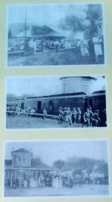
January 1916. Founded in 1893, the Southport Volunteer Fire Department was officially organized with the election of officers and adoption of a constitution and by laws on 21 January, 1916. Authorized purchase of the city’s first fire alarm bell . . . — — Map (db m5996) HM
On Ferry Road (State Highway 211) at the Deep Point Marina exit road, on the left when traveling east on Ferry Road.
Barbadian planter turned pirate made North Carolina his base, 1718. Captured in naval battle few miles east. Hanged in Charleston. — — Map (db m101979) HM
Thanks for our freedom
This Memorial, dedicated on November 11, 2015, and funded by private donations, honors the Men and Women Who Have Served Our Nation.
It was made possible through the heart, vision, dedication, and tireless efforts . . . — — Map (db m105916) WM
Near St Phillips Road SE 0.6 miles east of Plantation Road, on the left when traveling east.
This is a reproduction 32-pounder cannon, 'similar to those at Fort Anderson during the Civil War. It is a Pattern 1846 gun. The term "32-pounder" refers to the weight of the iron shot it fired.
In April 1861, when the U. S. Navy abandoned the . . . — — Map (db m284181) HM
Near St Phillips Road SE 0.6 miles east of Plantation Road, on the right when traveling south.
Brunswick homes were similar in style to those built in the West Indies or Caribbean. The main structure on this lot was quite impressive, measuring about 22 feet by 29 feet with a 10-foot-wide porch across the front. There were also several . . . — — Map (db m284501) HM
On St. Philips Road east of River Road ( Highway 133).
Brunswick Town State Historic Site was established on land donated to the State of North Carolina in December, 1952, by James Laurence Sprunt and his four sons, James Laurence Sprunt, Jr., Kenneth Murchison Sprunt, Samuel Nash Sprunt, and Laurence . . . — — Map (db m5535) HM
When Maurice Moore planned Brunswick in 1725, conflict between England and Spain was imminent. The War of Jenkins' Ear, later King George's War, began in 1739. As the war progressed, Spaniards began attacking English settlements up the Cape Fear . . . — — Map (db m284504) HM
A memorial to Colonel Maurice Moore, gentleman and soldier of the King, who in the year of our lord 1725 founded in a wilderness The Town of Brunswick reserving for the glory of God the tract of land on which was built this parish church . . . — — Map (db m6510) HM
Begun 1861. Named in honor of General Joseph R. Anderson, then commanding military district.
The Fort, under command of Brig. Gen. Johnson Hagood, suffered a severe bombardment by a Federal fleet and attack by Federal army under Maj. Gen. J. M. . . . — — Map (db m6494) HM
Near St. Philips Road SE 0.6 miles east of Plantation Road when traveling east.
In 1861–1862, Col. William Lamb and Maj. John Hedrick constructed Fort Anderson, one of several Confederate strongholds that protected Wilmington, a major blockade-running port. They enlarged Fort St. Philip (for St. Philip’s Anglican Church on your . . . — — Map (db m284189) HM
On River Road SE (State Highway 133) at Plantation Road (Local Road 1529), on the left when traveling south on River Road SE.
Large Confederate fort stands 2 mi. E. After a strong Union attack it was evacuated Feb. 18, 1865, resulting in the fall of Wilmington. — — Map (db m6438) HM
On St. Philips Road at Plantation Road on St. Philips Road.
Ordained 1707; came to America 1708. Served in many churches in area as missionary of Society for the Propagation of the Gospel, 1732–1755. — — Map (db m6483) HM
Near St Phillips Road SE 0.6 miles east of Plantation Road, on the right when traveling east.
"Janet Schaw, visiting Carolina in 1775, found there much that was not to her liking but the women she regarded with admiration."
Julia Cherry Spruill, Women's Life and Work in the Southern Colonies p.64
Margaret . . . — — Map (db m284643) HM
On Plantation Road 0.1 miles east of River Road (Route 133), on the left when traveling south.
House built c. 1725, subsequent additions. Home first of Roger Moore, later of Gov. Benjamin Smith, still later of James Sprunt. ¾ mi. E. — — Map (db m167688) HM
On River Road (State Highway 133) at Plantation Road, on the left when traveling south on River Road.
Anglican, built under act of 1751. Graves of Governors Arthur Dobbs and Benjamin Smith and U.S. Justice Alfred Moore. Ruins 2 mi. S.E. — — Map (db m6467) HM
Near St Phillips Road SE 0.6 miles east of Plantation Road, on the right when traveling south.
Twelve graves were found beneath the floor of the church, most concentrated near the altar. Important people were buried inside the church as a sign of status.
Archaeology has revealed eight large footings in the church which supported the . . . — — Map (db m284492) HM
Near St Phillips Road SE 0.6 miles east of Plantation Road SE when traveling east.
Fort Anderson contained two main batteries that could mount ten seacoast guns. Battery A is parallel to the river channel. Its 32-pounder guns could fire directly into ships trying to sail up river. Battery B could defend against both land and . . . — — Map (db m284187) HM
Near St Phillips Road SE 0.6 miles east of Plantation Road SE, on the left when traveling east.
Fixed fortifications located on waterways were difficult to properly defend against steam-driven warships. Ideally, they relied on heavy cannons and naval vessels for protection. However, the Confederacy lacked the industrial capacity to . . . — — Map (db m284433) HM
On College Place east of Town Mountain Road (State Highway 694), on the right when traveling east.
Founded October 31, 1887 by Mr. and Mrs. Lewis M. Pease and later donated to the Women's Home Missionary Society of the Methodist Episcopal Church, Allen Home for Girls, named in honor of English Quaker benefactor, Mrs. Marriage Allen, . . . — — Map (db m298447) HM
Welcome to the Blue Ridge, an area steeped in tradition and recognized world-wide as a crossroads of natural and cultural richness. The Parkway serves to tie together a diverse landscape and lifestyle-connecting the past with the present and . . . — — Map (db m299616) HM
The original Biltmore Dairy Bar began as an extension of the estate's dairy operations, established in 1897 as part of George Vanderbilt's vision of Biltmore as a self-sustaining farm.
Thanks to the prized herd of Jersey cows, the dairy . . . — — Map (db m179297) HM
On Approach Road, on the right when traveling south.
The success of the final design of Biltmore House and its home grounds was the result of
the strong collaborative effort between George Vanderbilt, his architect Richard Morris Hunt,
and Frederick Law Olmited, who designed and executed a plan for . . . — — Map (db m209739) HM
George W. Vanderbilt, following the recommendation of landscape architect Frederick Law Olmsted, was the first American landowner to implement scientific forestry, the management and conservation of forest lands, on a large scale. He hired Gifford . . . — — Map (db m58507) HM
On South Market Street south of Sycamore Street, on the right when traveling south.
Asheville's first official school building for black children, built in 1892. Destroyed by fire in the great tragedy of 1917, seven students died. In 1922 the famous Stephen's Lee High School was erected in it's place, becoming a beacon for black . . . — — Map (db m209939) HM
On Approach Road, on the left when traveling south.
"...in the year 1891 there was not, I repeat, a single acre of forest under forestry anywhere in the United States...My work in Biltmore Forest began February 3, 1892...Thus Biltmore Forest became the beginning of practical Forestry in America."
. . . — — Map (db m209738) HM
On Swannanoa River Road (State Highway 81) at Biltmore Avenue, on the right when traveling east on Swannanoa River Road.
Devastated western N.C. and western Piedmont; destroyed homes, crops, mills, bridges. Four lives lost, July 16, near main gate of Biltmore Estate. — — Map (db m97531) HM
As work progressed on Biltmore Estate, his last and largest private project, Frederick Law Olmsted observed, "It is a great work of peace we are engaged in and one of these days we shall all be proud of our parts in it." It was Olmsted who . . . — — Map (db m175856) HM
On Approach Road north of Glen Road, on the right when traveling north.
As you traveled up Biltmore's Approach Road, what did you notice about the landscape? You may be surprised to learn that the winding road, lush vegetation, and trickling streams were all designed as an experience which would affect your . . . — — Map (db m209737) HM
On Overlook Road south of Springside Road (County Route 3506), on the left when traveling south.
Early in 1861, Buncombe County farmer William Riley Powers joined the Rough and Ready Guards (Co. F, 14th North Carolina Infantry). The regiment was assigned to southeastern Virginia. There, Confederate Gen. Benjamin Huger discharged Pvts. Powers . . . — — Map (db m75532) HM
On South Market Street at Sycamore Street, on the right when traveling south on South Market Street.
Lynching in America
Between 1865 and 1950, thousands of African Americans were victims of mob violence and racial terror lynching across the United States. Following the Civil War, white Southerners fiercely resisted equal rights for African . . . — — Map (db m246650) HM
On Riverside Drive (State Highway 251) south of Pearson Bridge Road, on the right when traveling south.
Congressman, 1895-1901; U.S. Minister to Persia, 1902-07, and to Greece and Montenegro, 1907-09. His home, “Richmond Hill,” was ½ mile N.W. — — Map (db m209952) HM
On Hendersonville Road, on the right when traveling south.
The expedition led by Gen. Griffith Rutherford against the Cherokee, September, 1776, passed nearby on the banks of the Swannanoa River. — — Map (db m2279) HM
On Running Cedar Road 0.2 miles east of Frederick Law Olmsted Way, on the left when traveling east.
Celebrate Sassafras! Native Americans have used this lovely, slender native tree for millennia. The brittle bark, which glistens with small crystals, makes an excellent tea and flavors sarsparilla (root beer). The very young spring leaves are . . . — — Map (db m291257) HM
Near Approach Road 0.2 miles north of The Glen Road, on the right when traveling south.
Before considering designs for his future home, George Vanderbilt brought landscape architect Frederick Law Olmsted to assess the potential of the land Vanderbilt had purchased. Olmsted agreed with Vanderbilt that distant views of the Blue Ridge . . . — — Map (db m209740) HM
Near Victoria Road 0.1 miles south of Oakland Road, on the right when traveling south.
After John Brown’s raid on Harpers Ferry, Virginia, in 1859, new militia companies were formed in the South. Businessman William W. McDowell, whose wife acquired this house from her father’s and brother’s estates, raised a company called the . . . — — Map (db m75524) HM
On Victoria Road south of McDowell Street (U.S. 25), on the right when traveling south.
The Religious of Christian Education, an
order of nuns originally from France,
established Hillside Convent School on
January 6, 1908. In 1910, the school was
moved to this site and renamed St.
Genevieve~of~the~Pines. For eight decades,
the . . . — — Map (db m57479) HM
Near Frederick Law Olmsted Way 1.2 miles west of Brevard Road (State Highway 191).
This central garden pays homage to North Carolina's long history of quilting. The flowers and plants represent some of the most popular traditional block patterns used in Appalachian quilts. The garden uses a technique called tessellation . . . — — Map (db m169047) HM
On Haywood Road (Business U.S. 19/23) near Balsam Avenue, on the right when traveling west.
Writer of fiction and poetry. "Fielding Burke," her pen name. Author of Call Home the Heart and Highland Annals. Home, 1925-68, was 1/4 mile N. — — Map (db m57222) HM
On Biltmore Plaza at Kitchen Pl on Biltmore Plaza.
Near and West of this spot at Gum Spring The County of Buncombe
was organized on April 16, 1792
under act of the
General Assembly of North Carolina
Erected by The National Society of the Colonial Dames Of America
In the State of . . . — — Map (db m12831) HM
On Charlotte Street just south of East Chestnut Street, on the right when traveling north.
Helen Morris Lewis suffrage leader who founded NC Equal Rights Association here at Mayor Thomas Patton's home in November 1894. — — Map (db m209102) HM
Near South Market Street north of Eagle Street, on the right when traveling south.
Eagle Street traditionally has been the commercial, cultural, and professional center of the African-American community. The YMI Cultural Center, commissioned by George W. Vanderbilt in 1892 as the Young Men's Institute, was renovated in the 1980s. . . . — — Map (db m98367) HM
On College Street near Oak Street and Valley Street, on the right when traveling east.
Established in 1887 to
teach African Americans
in western N.C. Emerged
as residential preparatory
school for Black women.
Was ⅓ mi. NE until 1974. — — Map (db m274253) HM
On College Street (U.S. 74) near Coxe Avenue, on the right when traveling west.
Since 1902, when the first city auditorium
was built here, this area has been a center
for entertainment and the preservation of
Southern Appalachian culture. Acclaim has
gone to composer Boscom Lamar Lunsford
and playwright Hubert Hayes for . . . — — Map (db m36176) HM
Dedicated to the memory of
Samuel Ashe
1725 - 1813
Distinguished North Carolinian
Governor, Statesman and Jurist
in whose honor
the City of Asheville was named
— — Map (db m30120) HM
On Biltmore Avenue (U.S. 25) at Eagle Street, on the right when traveling north on Biltmore Avenue. Reported permanently removed.
Building the Block
Gateway to Community
As you turn down Eagle Street, you'll find yourself in The Block. This revitalizing district was crucial to the culture, economy and history of Asheville's African American community for more . . . — — Map (db m283144) HM
Near Eagle Street at Davidson Drive, on the right when traveling east.
When the war began, more than 15 percent of Buncombe County’s residents were enslaved people. James Patton housed slaves behind his Eagle Hotel (straight ahead), where they worked as waiter, maids, grooms, cooks, and trail guides. Three blocks to . . . — — Map (db m75507) HM
On O Henry Avenue at Battle Square, on the right when traveling north on O Henry Avenue. Reported missing.
Near the end of the Civil War in 1865, Confederate Battery Porter was positioned uphill to your right on Stony Hill, at that time the highest point in Asheville. The battery included four 12-pounder field pieces known as Napoleons, a model 1857 . . . — — Map (db m75505) HM
Near South Market Street north of Eagle Street, on the right when traveling south.
James Vester Miller was chief brickmason for the 1925 Municipal Building. The cornucopias over the side doorway mark the entrance to the City Market, located there from 1926 to 1932. Of slave parentage, Miller achieved renown as a craftsman, . . . — — Map (db m98368) HM
1927
Buncombe
County Court House
Erected by the People of
Buncombe County
Board of County Commissioners
Hon.E.M.Lyda
Chairman
Hon.W.E.Johnson~Hon.W.E.McLean
Burgin Pernnell
County Attorney
L.E.Jarrett
County . . . — — Map (db m18694) HM
Wall Street takes its name from the stone wall below, built to retain Battery Park Hill. The alley between the wall and buildings was used for deliveries. Until the mid-1920s, when Wall Street was paved and a sidewalk laid to span the alley, access . . . — — Map (db m209883) HM
On North Market Street north of East Walnut Street, on the right when traveling north.
This playhouse was built by W.O.
Wolfe in 1900 for the Wolfe
children. It was moved from the
family homesite at 92 Woodfin
Street for preservation in 1955. — — Map (db m267496) HM
On Market Street at Collage Street on Market Street.
Asheville's central square has long served the
needs of government and commerce. From
1892 to 1926 a massive city hall with a bell
tower dominated the east end. The building
housed police and fire departments in addition
to municipal offices. . . . — — Map (db m17062) HM
On Biltmore Avenue (U.S. 25) at Eagle Street, on the right when traveling north on Biltmore Avenue.
Gateway to Community
As you turn down Eagle Street, you'll find yourself in The Block, one of several Black business districts in Asheville. This area has been important to the culture, economy, and history of Asheville's Black community . . . — — Map (db m283145) HM
On North Lexington Avenue at West Walnut Street, on the right when traveling north on North Lexington Avenue.
Weaving a Movement
It was here — just north of Asheville — where artist and teacher Frances Goodrich first saw a stunning woven coverlet. Throughout the 20th century, the work of Goodrich and others, including Eleanor Vance, Charlotte Yale, . . . — — Map (db m283137) HM
On South Pack Square at Biltmore Avenue ( Route 25), on the right when traveling east on South Pack Square.
City Center
Historically, the intersection before you was an important crossroads for the exchange of goods and livestock. The Buncombe Turnpike, completed in 1828, followed the original trading path created by Native Americans, stretching . . . — — Map (db m283133) HM
On Court Plaza at College Street (Alternate U.S. 74), on the right when traveling south on Court Plaza.
Buncombe County was named for Edward Buncombe (1742-1778), a North Carolina plantation owner who served in the Revolutionary War and died of injuries sustained in the Battle of Germantown.
The county was formed in 1792 from vast tracts of . . . — — Map (db m229427) HM
Near South Spruce Street south of College Street (Alternate U.S. 74), on the right when traveling north.
In 1926 Asheville and Buncombe County officials considered erecting matching government buildings on Court Plaza. The city chose Douglas Ellington's Beaux-Art design with its Art Deco embellishments. The county, however, rejected Ellington's plan . . . — — Map (db m224090) HM
On Battery Park Avenue at Wall Street, on the right when traveling east on Battery Park Avenue.
Asheville's Flat Iron Building, completed in 1926, boats triangular proportions and rich ornamentation like its predecessor in New York City. Albert C. Wirth designed this structure to house professional offices and shops. Typical of rapid . . . — — Map (db m187804) HM
Colonel Frank Coxe opened the first Battery Park Hotel in 1886. The rambling structure on a hill top became internationally prominent, catering to famous guests. In the early 1920s Edwin W. Groves purchased the property. He built a brand new . . . — — Map (db m30224) HM
On Eagle Street at South Spruce Street, on the right when traveling west on Eagle Street.
Churches and schools have always been vital public institutions in Black communities. Church picnics, suppers, and food and clothing drives foster community support. While Jim Crow laws and segregation denied Black citizens equal rights, church . . . — — Map (db m267540) HM
On Biltmore Avenue (U.S. 25) at Eagle Street, on the right when traveling north on Biltmore Avenue.
An ornamental eagle perched high in front of
the Eagle Hotel one block south. Irish
immigrant James Patton opened the hostelry in
1814. Almost opposite the Eagle, the
Swannanoa Hotel began operation in 1878,
making South Main Street - now . . . — — Map (db m57588) HM
On Court Plaza south of College Street, on the right when traveling south.
Colonel Robert K. Morgan and his B-17 bomber crew of WWII's "Memphis Belle"
were the first to complete twenty-five combat missions over German-occupied
Europe. At a time when bomber casualties reached eighty percent, their
exceptional . . . — — Map (db m215041) HM WM
On Court Plaza at South Spruce Street, on the left when traveling west on Court Plaza.
Born in Rutherford County, NC, James Vester Miller was the son of a slave, Louisa, and her master. After the Civil War, his mother came to Asheville with her 3 children.
Miller's interest in bricklaying began at 10 years old. Developing his . . . — — Map (db m283143) HM
On Broadway Street (U.S. 25) north of East Walnut Street, on the right when traveling north.
English-born Richard Sharp Smith came to Asheville in 1890 as supervising architect of the Biltmore House. Buildings and residences he later designed gave the city much of its architectural flair. On this block on what was once the Buncombe . . . — — Map (db m187803) HM
On College Street (Alternate U.S. 74) at South Spruce Street, on the right when traveling east on College Street.
Lynching in America
Thousands of Black people were the victims of racial terror lynching in the United States between 1865 and 1950. After the Civil War, the 13th, 14th, and 15th Amendments to the U.S. Constitution ended slavery and extended . . . — — Map (db m205149) HM
On West Walnut Street east of North Lexington Avenue, on the right when traveling east.
Just off the square, which was the commercial center, Water Street catered to farmers bringing their products into Asheville for barter. When its natural springs began disappearing in the late 1800s, Water Street was renamed Lexington Avenue. . . . — — Map (db m283136) HM
Near North Pack Square (Alternate U.S. 74) at South Market Street, on the right when traveling east.
W.O. Wolfe's tombstone shop, fondly recalled by his son, Thomas in Look Homeward Angel, once stood on this corner. During the boom of the 1920s, real estate developer L.B. Jackson purchased the property from Julia Westall Wolfe and built . . . — — Map (db m97548) HM
On Eagle Street at South Spruce Street, on the right when traveling east on Eagle Street.
Founded in 1880 by Rev. Robert Rumley and moved to present location during the tenure of his successor, Rev. Jacob Nelson. Rev. John Hairston oversaw further expansion and installation of large pipe organ. Present building was designed by . . . — — Map (db m267544) HM
On Biltmore Avenue (U.S. 25) at Ashton Street, on the right when traveling north on Biltmore Avenue.
Oscar Wong was born in Jamaica to
Chinese parents and immigrated to the
United States to attend Notre Dame. After a successful engineering career, he moved to Asheville. In 1994, he opened Highland Brewing Company, the city's first legal brewery . . . — — Map (db m283056) HM
Near South Market Street (Alternate U.S. 74) at South Pack Square, on the right when traveling south.
Until electricity was introduced in the late 1880s, gas and kerosene lamps provided lighting in Public Square—now Pack Square. Horse-head fountains, fed from a reservoir on Beaucatcher Mountain, were affixed to lampposts at the east and west . . . — — Map (db m98364) HM
On Haywood Street, on the right when traveling south.
A Spanish "master of the arch," Raphael Guastavino brought a soaring elegance to American architecture, artfully using layers of thin clay tiles to build vaults, domes, and roofs in more than a thousand buildings.
In 1890, he joined the . . . — — Map (db m209933) HM
On Battery Park Avenue, on the right when traveling east.
Making Way for Change
At the turn of the 20th century, this city block was the site of Battery Porter Hill, a ridge measuring seven stories high topped by the original Battery Park Hotel. With its Queen Anne elegance, the resort's 500 . . . — — Map (db m209937) HM
Near College Street (Alternate U.S. 74) at Court Plaza.
What began as a small show in a city festival resulted in two of the most
important cultural events in the region. In 1928, the Asheville Chamber of
Commerce asked musician and folk historian Bascom Lamar Lunsford to
arrange a folk song and dance . . . — — Map (db m229414) HM
On Haywood Street at West Walnut Street, on the right when traveling south on Haywood Street.
Asheville's bustling, cosmopolitan scene in the 1920s led to the opening of many department stores and exclusive shops along these three blocks of Haywood Street. For fifty years the area thrived until suburban malls lured shoppers away. . . . — — Map (db m209928) HM
On Court Plaza south of College Street, on the right when traveling south.
The U.S. Supreme Court Decision, Plessy v. Ferguson (1896), legalized segregation in public facilities. Asheville began providing schools for Black students in 1888. From 1923 to 1965, Asheville's Stephens-Lee High School was nationally . . . — — Map (db m282512) HM
On Haywood Street, on the left when traveling south.
A Lyrical Legacy
Asheville's musical legacy is woven from the melodies of many cultures and genres, passed down through generations. Cherokee flutes and drums met Scots-Irish reels and ballads when European settlers arrived in the region. . . . — — Map (db m209935) HM
On Court Plaza at College Street, on the left when traveling north on Court Plaza.
(panel 1)
The Asheville Black Cultural Trail
Dignity, Humanity, and Agency
Did you know that Black people helped create this region's first non-Indigenous households? Did you know that Black people helped build Asheville and . . . — — Map (db m282513) HM
On Court Plaza at College Street, on the left when traveling north on Court Plaza.
(panel 1)
The Asheville Black Cultural Trail
Dignity, Humanity, and Agency
Did you know that Black people helped create this region's first non-Indigenous households? Did you know that Black people helped build Asheville and . . . — — Map (db m282514) HM
On Biltmore Avenue (U.S. 25) north of South Market Street, on the right when traveling north.
The Bunkum Stone is a sister to the Barney Stone in Ireland. It is said that kissing the Bunkum Stone confers the gift of loquacity.
The Bunkum Stone is named in honor of Felix Walker, the US Congressman from Buncombe County (1820) for whom . . . — — Map (db m305007) HM
On South Pack Square (Alternate U.S. 74) east of Biltmore Avenue (U.S. 25), on the right when traveling east.
Buncombe County was carved out of a magnificent mountain landscape etched by indigenous trails and scattered settlements. The bill creating the county was ratified on January 14, 1792.
In 1793, the county's first official courthouse, a jail and . . . — — Map (db m98370) HM
6724 entries matched your criteria. Entries 401 through 500 are listed above. ⊲ Previous 100 — Next 100 ⊳