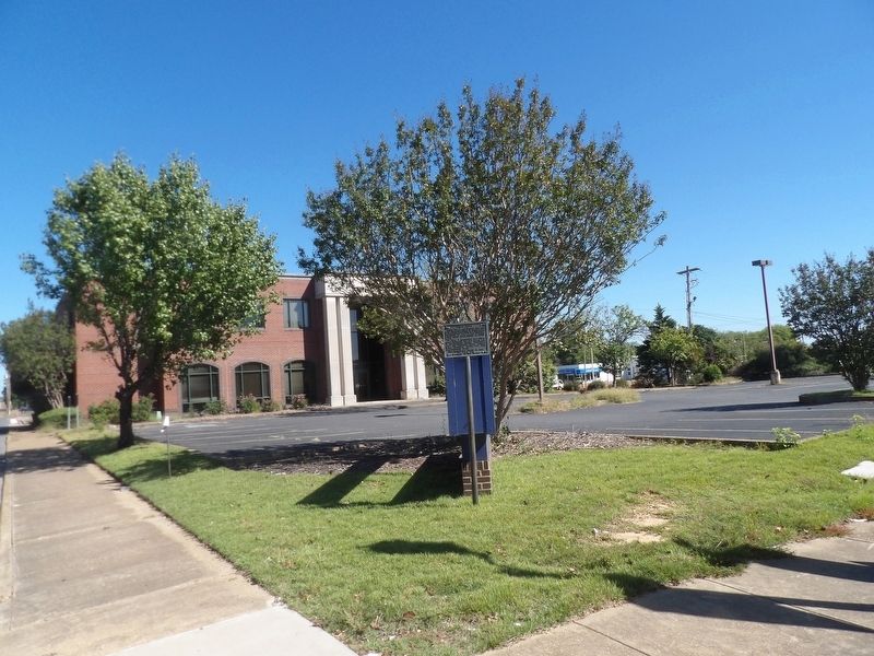
This site
When the Clark County seat was
moved from Greenville to Arkadelphia
in 1842, until completion of a permanent
structure in 1844, a log building
which stood here served as court
house.
In 1860 a handsome two-story
brick . . . — — Map (db m234844) HM
Clark County was created by the legislature of Missouri Territory on Dec. 15, 1818 and named for the territorial governor, William Clark. It comprised, roughly, all of the present Clark, Hot Spring, Garland, Pike and Dallas counties. Early county . . . — — Map (db m121379) HM
East face
When the last trumpet
is sounded, may each one
answer the roll call
of the heavenly army.
South face
"The principles for
which they fought live
eternally." erected by
the Harris Flanagin Chapter, . . . — — Map (db m121961) WM
Indians in primeval times, DeSoto in 1541, and pioneers in the 1800s and Confederates during the Civil War obtained salt from the creek and old well here. John Hemphill in 1812 opened one of the first manufactories in Arkansas, a salt refinery. — — Map (db m200778) HM
John S.T. Callaway owned forty
acres, including this site, after
receiving a United States land patent
for it in 1836. Then, in 1842, Benjamin S.
Duncan purchased the land at a
sheriff's auction and platted
Duncan's Addition in 1858.
Today, . . . — — Map (db m234829) HM
At this site the first public or “free” school in Arkadelphia was opened in 1870. Early teachers included R.D. Hearn, Elizabeth Webb, Harriet Crow, John Gordon & Dutie Casey. — — Map (db m234848) HM
Here, during Reconstruction years, were the offices of the Freedmen's Bureau. The building was, at different times, used as a harness shop, grocery store, barber shop and saloon, and for many years was a residence. — — Map (db m234853) HM
As settlers began arriving in this area around 1812, the need for religious services became a top priority among the residents. Brush arbor meetings were held every summer. Soon a log structure was built along the creek that marked the beginning of . . . — — Map (db m184576) HM
PHS
Dedicated
This landmark is erected on the original site of Peake School built on land donated by Mr. Ed Peake in 1928, and is dedicated to the faculties and staffs who encouraged and prepared us to compete on an equal level with the best . . . — — Map (db m234859) HM
Used in the production of salt
from the water of the Saline
Bayou one mile east of Arkadelphia
by John Hemphill pioneer salt
maker of Arkansas territory, circa
1814. Given to the Henderson
State Teachers College museum
by the family of Capt. . . . — — Map (db m201033) HM
Near this site on April 1, 1864 Confederate General Joseph O. Shelby caught up with and attacked the rear guard of Union General Frederick Steeles army. Union General Samuel A. Rice, in charge of the supply, pontoon and brigade trains, rushed to . . . — — Map (db m121180) HM
Near this site was the original public school building for black students in the Arkadelphia public school system. Noted principals: Ms. P.A. Holmes 1872-1873, John Ed Peake 1877-1881, 1897-1898, 1904-1906 & Sam Hildreth 1907-1914, 1916-1939. The . . . — — Map (db m234864) HM
East & South of this point was
The Blakely Graveyard
in this first public burying
place of the community, the
early settlers were interred.
It remained in use until 1869
when it was closed to future
burials by the city council. . . . — — Map (db m200782) HM
Dr. W.D. and Ida Feaster were notable African American civic leaders and educators in Arkadelphia in the 20th century. Originally from South Carolina, they were educated at colleges and universities on the East Coast. In 1906 they moved to . . . — — Map (db m253950) HM
Confederate Manufacturing
Arkadelphia was a manufacturing center for Confederate Arkansas early in the Civil War. Gen. Thomas Hindman established a powder works and an arsenal in 1862, producing guns, cannon, bullets, shells, wagons and . . . — — Map (db m96557) HM
In the Hotel Hall which formerly stood on the site of this building was organized on January 21st 1892 the Concatenated Order of the Hoo-Hoo a society composed of lumbermen and those in allied industries and having for its object the promotion . . . — — Map (db m234904) HM
Skirmishes at Okolona
Gen. Frederick Steele’s Union army left Little Rock on March 23, 1864, for a planned invasion of Texas, but it was April 2 before they faced organized Confederate attacks. Gen. Joseph Shelby attacked the Union wagon train . . . — — Map (db m200735) HM
"In this house I learned to walk and talk. I learned to pray I learned to read and I learned to count by number cards my grandparents tacked on the kitchen window."
— President Clinton, Dedication Speech at
the . . . — — Map (db m161922) HM
Created by the Randolph Rose Collection using the Lost Wax Cast Bronze method, these sculptures are titled "All Aboard." The Group Portrays a Train Conductor calling a woman and her daughter to catch a train in the 1920's.
First settled in . . . — — Map (db m246093) HM
Bill Clinton lived in this
house with his mother and
stepfather, Roger Clinton, from
1950 until 1953. During those
years, the future president
attended kindergarten and first
grade. Billy, as he was known
then, loved to play with . . . — — Map (db m159746) HM
This tree is believed to have been planted in 1912 when the railroad station was built. Local residents remember the days when its limbs were so long that they nearly touched the ground. A cannon sat next to this tree prior to World War II but this . . . — — Map (db m161918) HM
The last bag of mail hung on this pole was October 14, 1967 at Ward, Arkansas. This was also the final day of operation for the Railway Post Office in the state. — — Map (db m161919) HM
In 1909, the merchants of Hope paid to have the names of their business imprinted into a sidewalk which led from the old Garland School to Fair Park.
A portion of those squares were removed in 1995 for use in this new sidewalk at the train . . . — — Map (db m161920) HM
March 12, 1999. On this day two Hope natives
visited the Hope Visitor Center and museum.
President William Jefferson Clinton, in town to
dedicate his restored birthplace house, was
escorted through the center by life-long friend
Thomas Franklin . . . — — Map (db m161917) HM
This two man inspection car was built in 1948 by Fairmont Railway Motors. Signalmen especially, relied on this motor car for transportation as they inspected signals, automatic switches and crossing gates.
Known for its light weight and easy . . . — — Map (db m161915) HM
The culmination of the Camden, AR. and the Red River, LA. campaigns was to capture Texas. Two Union armies were to join at Shreveport and move West. Gen. Steele was defeated in AR. and Gen. Banks in LA. The wounded from the Battle of Prairie De Ann . . . — — Map (db m246084) HM
When Union troops occupied Little Rock on Sept. 10, 1863, Arkansas's Confederate government relocated to Washington, using the 1836 Hempstead County Courthouse as their Capitol building. The legislature met here Sept. 22 to Oct. 2, 1864, and the . . . — — Map (db m245665) HM
(Left Side)
True to their native soil. They gave their lives to a cause that was lost. Their survivors will never suffer their memory to perish.
(Right Side)
Erected by our citizens to the memory of the Confederate . . . — — Map (db m245989) WM
More than 19 companies formed in Hempstead County to fight for the Confederacy, starting with the "Hempstead Rifles," who mustered in on May 4, 1861. These local men served in the Confederate Congress - Grandison D. Royston and Rufus K. Charles . . . — — Map (db m245848) HM
Home-site of Dr. Isaac Newton Jones and Elizabeth Littlejohn Jones
Benefactors of James Black, maker of the Bowie knife. Parents of Daniel Webster Jones, Arkansas Governor 1897-1901. — — Map (db m244939) HM
In 1831 James Black, a silversmith, made for Col. James Bowie the original Bowie Knife. Black made the knife, but it was Bowie who made it famous. This shop was reconstructed in 1960 by the Pioneer Washington Restoration Foundation Inc. with funds . . . — — Map (db m245401) HM
"Let the broad mantle of Masonic charity be thrown over their errors, whatever the may have been, and may their virtues be cherished in the memory of those who survive."
Grand Master Elbert H. English 1859-1868
Erected by the most . . . — — Map (db m245567) WM
The Washington Post Office is the oldest continuous postal facility in Arkansas, having been established as Hempstead Courthouse Post Office, Arkansas Territory, February 23, 1820. This building provided by the Pioneer Washington Foundation -- . . . — — Map (db m244819) HM
Near this spot in 1837 Robert Messer built the first house in Center Point. A few years later John Russey opened the first store. Center Point acquired its name and post office in 1848, and became an incorporated town in 1859.
Held by the . . . — — Map (db m121163) HM
At least four Confederate companies were recruited in what is now Howard County, including three serving in the 19th Arkansas Infantry, which trained near Center Point. The 19th Arkansas was part of the garrison at Arkansas Post when it was . . . — — Map (db m121146) HM
Howard County was created on
April 17, 1873, from parts of
Hempstead, Pike, Polk, and
Sevier counties. The first
county seat was Centre Point.
After the completion of a
railroad to Nashville in
1885, the city grew rapidly.
In 1905 after a . . . — — Map (db m274166) HM
Isaac C. Perkins was the founder of the city
of Nashville and the Mine Creek Baptist
Church which later became the First Baptist
Church of Nashville. He was the first
president of the Arkansas Baptist
Convention (1848). He spent most of . . . — — Map (db m274163) HM
Anderson Ferry, on Little River 2 miles north of this point, was in operation during the early 1800's. It served the pioneers traveling to southwest Arkansas and Texas on the Old Southwest Trail. Anderson Ferry provided a passage from Old Paraclifta . . . — — Map (db m121276) HM
Little River County was formed 1867 out of lands taken from Hempstead and Sevier Counties by Act 104 of the Arkansas Legislature approved March 7, 1867. The Act fixed the temporary county seat at the home of William M. Freeman, which was ½ mile . . . — — Map (db m121273) HM
This property has been placed on the National Register of Historic places by the United States Department of the Interior.
Founders Odessa Smith, Newton Smith, Dan Smith, Thelma Skies, Shelba Clowdis
Alleene Birth Place of Chet Lauck The Lum . . . — — Map (db m172967) HM
Rocky Comfort, made the County Seat of Little River County in 1868, continued as such until 1880, when it was moved to Richmond and from there the Seat of Justice was moved to Ashdown. — — Map (db m121243) HM
The Arkansas Constitutional Convention of 1868 located the permanent county seat at Rocky Comfort, where it remained until 1880. The first term of court was held there August 4, 1868. A frame court house was erected with offices on the first floor . . . — — Map (db m121277) HM
Erected in honor of members of this community who so heroically served in the Armed ForcesWorld War II 1941-1945 and dedicated to the sacred memory of those who sacrificed their lives for Democracy, Peace and Justice — — Map (db m297396) WM
Confederate Camp at Richmond
On Aug. 28, 1864, Confederate Gen. Sterling Price led an army from Camden on a raid that took them through Missouri, Kansas and the Indian Territory before they returned to Arkansas at Laynesport in Little . . . — — Map (db m121143) HM
In the fall of 1851, three Mills brothers
headed west, one by water, one by land and
one to Texas. This brought Joel Mills wife,
Kitura Burke Bird and family from Henderson Co., Tennessee to Sevier County, now known as Little River County. . . . — — Map (db m121361) HM
In this area in 1541 a Spanish expedition from Florida commanded by Hernando De Soto encountered fierce resistance from the Indians, whom they described as the best fighting men they had met. De Soto then turned to the southeast and descended the . . . — — Map (db m201572) HM
This region was once the home of the Caddo Indians, whose settlement and town were scattered over what is now southwestern Arkansas, northeastern Texas and northwestern Louisiana. The Caddo River, which flows near this point, and Caddo Gap itself . . . — — Map (db m201016) HM
About a mile south of this point is the natural gap or narrows of the Caddo River, famed in history and legend. A pioneer road through the gap connected Fort Smith with Old Washington and other points, with a toll bridge spanning the river. The . . . — — Map (db m201469) HM
Settled before 1850, the first village was located near the natural gap or narrows of the Caddo River. The coming of the Gurdon and Fort Smith Railroad in 1907 led to the construction of the present town on what was formerly the Jim Vaught . . . — — Map (db m201387) HM
World War I Frank Alexander • Sherman Horn • Joseph B. Howard • Jimmy L. Qualls • Nyram C. Rains • Arthur R. Wallace • Bill J. Williams • John Cearley • Henery Curtis • Drayton Raines . . . — — Map (db m262792) WM
The county seat of Montgomery
County was established on its present
site in 1842, the year the county was
created and to the place (now Mt. Ida)
was given the name, Montgomery Court
House. In 1850 the name of the town was
changed to Salem but . . . — — Map (db m200633) HM
In memory of
the 382 men of Montgomery Co. Arkansas
who served in the Confederate States Army
1861 — 1865
4th AR. Inf. Co. C.
4th AR. Inf. Co. F.
33rd AR. Inf. Co. I.
Lest We Forget — — Map (db m226211) WM
Montgomery County men served in several Confederate units during the Civil War. The “Montgomery Hunters” (Co. F) and “Caddo Rifles” (Co. C) joined the 4th Arkansas Infantry in 1861. Co. I, 33rd Arkansas Infantry was raised at Caddo Gap in 1862, and . . . — — Map (db m200630) HM
• Caddo Indian burials were exposed accidentally during construction at this site in October, 1988. Subsequent archeological excavations by Ann Early identified 2 burials, a small cluster of residential features, and artifacts dating from the . . . — — Map (db m202077) HM
Ouachita County Training School (OCTS) was formed in 1949 when the Cotton Belt Rosenwald School, which had operated at this site since 1929, consolidated with two other area Rosenwald Schools. OCTS included a high school and offered many courses, . . . — — Map (db m286438) HM
The 1st Kansas Colored Infantry, a regiment that included many former Arkansas slaves, was formed in August 1862, the first black unit recruited during the war. 1st Kansas troops were the first black men to see combat, losing 10 killed and 12 . . . — — Map (db m56624) HM
On January 20, 1944 near this spot, 8 brave airmen of the United States Army Air Forces lost their lives when their B-26 Medium Bomber crashed and burned about 1:37 PM.
397th Bomb Group 598th Bomb Sqdn.
In Memoriam
• 1st Lt. George . . . — — Map (db m212209) HM WM
In the fall of 1864, much of the Confederate infantry in Arkansas was ordered to move to Camden to protect the approaches to Texas during General Sterling Price’s absences in being transferred to the Missouri Campaign.
In September 1864, . . . — — Map (db m106889) HM WM
John Nunn, a pioneer settler, donated a square at Fabre’s Landing in 1842, on which was created the first court-house in Ouachita County. The name of the settlement was soon afterwards changed from Fabre’s Landing to Camden. The county was given the . . . — — Map (db m107081) HM
This is one of nine Civil War fortifications that were
constructed in 1863-64 by Confederate soldiers and
slaves under the command of Camden lawyer, Colonel
Alexander Hawthorn.
Located atop a steep hill well over a mile southeast of
Redoubt . . . — — Map (db m200821) HM
This is one of nine Civil War fortifications that were
constructed in 1863-64 by Confederate soldiers and slaves
under the command of Camden lawyer, Colonel Alexander
Hawthorn.
This massive earthen redoubt contained a battery of . . . — — Map (db m200797) HM
This is one of nine Civil War fortifications that were
constructed in 1863-64 by Confederate soldiers and
slaves under the command of Camden lawyer, Colonel
Alexander Hawthorn.
This square earthworks faced west and held as many as
six . . . — — Map (db m200805) HM
This is one of nine Civil War fortifications that were
constructed in 1863-64 by Confederate soldiers and
slaves under the command of Camden lawyer, Colonel
Alexander Hawthorn.
Located at the highest elevation between Willow, . . . — — Map (db m200813) HM
This is one of nine Civil War fortifications that were
constructed in 1863-64 by Confederate soldiers and
slaves under the command of Camden lawyer, Colonel
Alexander Hawthorn.
Located along a ridge some one hundred yards south of
the . . . — — Map (db m200802) HM
To the Confederate women
Whose pious ministration
To our wounded soldiers,
Soothed the last hours of those
Who died far from the objects
Of their tenderest love;
Whose domestic labors
Contributed much to supply
The wants of . . . — — Map (db m305155) HM WM
At about 9:30 a.m. Federal
patrols made contact with
Confederate scouts near Poison Spring. Colonel Williams
parked his wagons two and
three abreast, as close together
as possible. He ordered the
First Kansas to the front forming a line, and . . . — — Map (db m201023) HM
Here on April 18, 1864 a Union forage train of 200 wagons escorted by 1170 men was attacked and captured by Confederate troops commanded by Generals John S. Marmaduke and Samuel B. Maxey. The wagons were loaded with corn for the Union army of . . . — — Map (db m242745) HM
Critical Shortage of Food and Forage...
More than three weeks of marching
and fighting depleted Steele's sup-
plies. His troops had been on half
rations for more than two weeks and
unauthorized foraging was widespread.
The capture of . . . — — Map (db m201020) HM
Williams, despite being outnumbered, defended the train as long as possible,
hoping for reinforcements from Camden. After a short and hotly contested
engagement at close range, the black troops broke ranks, retreating in chaos.
The Confederates . . . — — Map (db m201024) HM
Confederate Units
Task Force - Brigadier General Samuel B. Maxey
Brigadier General William L. Cabell
1st Arkansas Cavalry Col. J.C. Monroe
2nd Arkansas Cavalry Col. T. J. Morgan
4th Arkansas Cavalry Col. A. Gordon
7th Arkansas . . . — — Map (db m201026) HM
The Poison Springs Battle Ground, less than three miles westward, was the scene of an important action contributing to the retreat of the Federal Army under General Steele from Camden and south Arkansas to Little Rock. A surprise attack by the . . . — — Map (db m242743) HM
The Federal government's unsuccessful Red River Expedition in April, 1864 was the last major invasion of Confederate territory west of the Mississippi River. Its aim was to capture Shreveport, Louisiana, open Texas to Federal occupation and acquire . . . — — Map (db m201019) HM
Due to their reputation for fierce fighting, Colonel Williams positioned
the First Kansas Colored Infantry to guard the Union train against the
heaviest Confederate onslaught. They successfully repulsed two enemy
attacks, but with heavy losses. . . . — — Map (db m201025) HM
Legendary singer and guitarist Glen Campbell was born in Billstown, Arkansas on April 22, 1936. He died in Nashville, Tennessee on August 8, 2017 after a courageous battle with Alzheimer's disease. Campbell brought country music to the mainstream as . . . — — Map (db m184564) HM
The history of commercial diamond mining in Arkansas is complex and fascinating.
Through much of the 20th century, the land that makes up today's diamond search
area was divided. It was bought, sold, and leased numerous times. Local farmer . . . — — Map (db m274583) HM
Near here on August 20, 1975, W.W. Johnson, of Amarillo, Texas, found the largest diamond recorded since the Crater of Diamonds became an Arkansas State Park in 1972.
While . . . — — Map (db m274757) HM
In 1948, Glen L. Martin leased property to build
a diamond processing plant. Martin's plant operation
lasted only eight months after recovering less than
250 carats of diamonds. The original location of
the Martin Plant has been preserved. Its . . . — — Map (db m274185) HM
Authentic Ore Cart Used in
commercial mining operations
owned By Roscoe Johnston, who
operated The Arkansas Diamond Mine
Tourist Attraction, 1962-1968
Donated By James Taylor
In Memory of Roscoe Johnston — — Map (db m274176) HM
Over 85,000 crater diamonds have been found. Each year an average of 600 are found.
1924 - The Uncle Sam, 40.23 carats
1956 - The Star of Arkansas, 15.33 carats
1956 - The Eisenhower, 6.11 carats
1960 - The Gary Moore, 6.43 carats Over . . . — — Map (db m274210) HM
Ever since John Huddleston discovered the first diamonds here in 1906, people
have wondered what lies under the volcanic soil in Southwest Arkansas. How deep
and how large is this diamond deposit?
From 1990 to 1997, Arkansas State Parks . . . — — Map (db m274572) HM
8.52 carats (rough) 4.60 carats (cut)
On June 24, 2015, Bobbie Oskarson of Longmont,
Colorado, found a perfect, capsule-shaped
diamond near this location.
Oskarson decided to visit the Crater of Diamonds
after seeing the park on an Arkansas . . . — — Map (db m275304) HM
Near this site in August 1906, local farmer and
amateur treasure hunter John Wesley Huddleston
discovered the first diamonds in Pike County,
Arkansas.
According to one of many accounts, Huddleston
was panning for gold on his farmland one . . . — — Map (db m274880) HM
Henry Merrell
Henry Merrell, known as the "Industrial Missionary to the South," was born in Utica, N.Y., in 1816. He moved to Arkansas in 1856 and built an industrial complex in Pike Co. He helped draft an anti-secession resolution in . . . — — Map (db m121147) HM
James Archer prospected diamonds for 30 years, almost full time
since his retirement in 1987. During that time he found over 5,000
diamonds and helped countless others enjoy and understand what had
become his favorite pastime.
He cheered . . . — — Map (db m274214) HM
The first diamonds found in Pike County, Arkansas were discovered
in August 1906 by John Wesley Huddleston. These stones were
sent to Charles S. Stifft, a Little Rock jeweler, who confirmed they
were genuine diamonds. Stifft described them as . . . — — Map (db m274212) HM
Side A This is a re-creation of a mine shaft
built in the early 1900s. It reportedly
covered a 60-foot-deep test hole. Austin Millar commercially mined the property from 1914 to 1919, when a fire devistated his production facilities. Side B . . . — — Map (db m274216) HM
4.21 carats (rough) Marvin Culver, of Nowata, Oklahoma, unearthed a large, canary yellow diamond near this location on
March 12, 2006.
Culver and his family decided to visit the park
after watching a television program featuring the
Crater . . . — — Map (db m274879) HM
The first court house in Pike County, built of logs, was erected on the site of the town of Murfreesboro, which was laid out as a site for the county seat in 1833. — — Map (db m121284) HM
108 entries matched your criteria. The first 100 are listed above. The final 8 ⊳