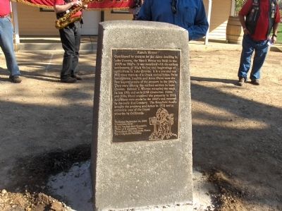
Considered by some to be the oldest dwelling in Lake County, the Ranch House was built in the 1850’s to 1860’s. It was associated with the earliest settlement of High Valley and beginnings of agriculture in Lake County. It is a one and one half . . . — — Map (db m26738) HM
This sulphur mine also produced quicksilver and
became one of most noted producers in world.
First worked for sulphur in 1865 and in four
years produced total of 2,000,000 pounds.
Reopened and developed for quicksilver in 1873
and credited with . . . — — Map (db m240310) HM
Oldest building in Lake County. Erected of stone in 1853-4 by Robert Sterling, whose wife was first white woman in Coyote Valley. Rebuilt in 1894. Headquarters of the Guenoc Land Grant and the first store in the valley. — — Map (db m16127) HM
Built by Charles Stone and Andy Kelsey on land purchased from Salvador Vallejo. Constructed by forced Indian labor, causing much resentment and culminating in murder by Indians of both Stone and Kelsey in the fall of 1849. Their remains are beneath . . . — — Map (db m121713) HM
Lake County’s century-old classic courthouse, designed by A.P. Pettit in 1871, served as the seat of county government from 1871 until 1968 when it was replaced by the new courthouse. Among the court’s landmark cases were the White Cap murders, a . . . — — Map (db m152479) HM
In January of 1867 the Clearlake Lodge #30 I.O.O.F. was organized in Lower Lake. The hall was built in 1868. The Lodge originally has 7 members, D.M. Hanson being the first Noble Grand. — — Map (db m42337) HM
Built by Leslie P. Nichols and brother in 1877, it was the only schoolhouse in the county made of bricks from a local kiln. The school was two stories high. The top floor was used as the town hall, and school was held on the lower floor. It housed . . . — — Map (db m42352) HM
Built in 1876 at the height of the quicksilver mining boom, the Lower Lake stone jail was a response to rapid town growth and the urgent need for civil order. Stephen Nicolai, one of the first stone masons in Lower Lake, built the jail from local . . . — — Map (db m8509) HM
The Old Bull Trail Road ran from Napa Valley to Middletown. It was built by volunteers in the 1850’s. A number of grades were 35 percent. It was an official road in 1861 and abandoned in 1868. St. Helena Toll Road also ran from same points. Was . . . — — Map (db m171749) HM
Built in 1921 by J.A. Youngreen, the Bank of Upper Lake was a tribute to the prosperity of the area. This was a farming center with extensive cattle and sheep production. The Blue Lake bean developed here by Adolphus Mendenhall became the foundation . . . — — Map (db m140004) HM
Scene of a battle between U.S. soldiers under command of Captain Lyons and Indians under Chief Augustine, April 14th, 1850.
Dedicated as an historical monument by the Native Sons of the Golden West
May 20th, 1942 — — Map (db m1055) HM WM
One-fourth mile west is the island called Bo-no-po-ti (Old Island), now Bloody Island. It was a place for native gatherings until May 15, 1850. On that date, a regiment of the 1st Dragoons of the U.S. Cavalry, commanded by Capt. Nathaniel Lyon and . . . — — Map (db m171748) HM
Freshwater Marsh
A freshwater marsh once surrounded Bloody Island prior to land reclamation
efforts that began in the late 19th century. Native plants within marshes around
Clear Lake included tules (Scirpus acutus), rushes (Juncus sp.), . . . — — Map (db m143781) HM
The original building was destroyed in the fire of 1924. Six months later the present building opened as a hardware store. It has the pressed concrete walls and pressed tin ceiling typical of fire measures taken when the town was rebuilt.
As . . . — — Map (db m49116) HM
The building at 2424 Main Street was the home of R.G. Reynolds. The "Drug and Prescription Store" pictured here was approximately where the current post office is and belonged to the same Doc Reynolds and Godwin Scudamore. They might have had the . . . — — Map (db m139841) HM
This redwood paneled craftsman style building was constructed in 1916. The architect was no less than the nephew of Henry Wordsworth Longfellow. Members of the community donated time and money to build the library. Most notable of the donators was . . . — — Map (db m48413) HM
League's Store, destroyed in the fire of 1924, housed the beginnings of both the Odd Fellows Hall and the Harriet Lee Hammond Library. The post office moved here when the library opened in 1916. The Griner Brothers eventually built and relocated . . . — — Map (db m61079) HM
This site stared as a Meat Market in 1906, then became the Ice House.
Ice was originally brought down from the "ice pond" in the hills and stored at the Ice House. Later it was manufactured here at the Ice Plant in 300 pound blocks that were . . . — — Map (db m49333) HM
The International Order of Odd Fellows Lodge #241 established themselves in Upper Lake in 1876. The present structure was completed in 1898 at a cost for land and building of $3,109.02. This mutual aid society hosted numerous activities through the . . . — — Map (db m55398) HM
This was one of three livery stables in Upper Lake in the 1880's. As far back as 1870, Upper Lake was the terminus of both the Cloverdale and Clearlake stage lines, bringing tourists to the famous mineral waters of Witter Springs, Saratoga Springs . . . — — Map (db m48989) HM
From three livery stables in the
late 1800's to three gas stations in
the 1900's, Upper Lake kept up with
current modes of transportation.
Greyhound bus had a depot in Upper
Lake and there was at one time three
car dealerships in town.
There . . . — — Map (db m135524) HM
Local Pomo groups fished and hunted waterfowl within marshes and adjacent waters. Hunting parties
trapped waterfowl using large nets, while individual hunters used snares and slings. The Pomo used
nets, brush dams, and basket traps to catch fish. . . . — — Map (db m143666) HM
Sometime before 1874, Rufus Tallman and his wife Mary Ellen established the Tallman Hotel on this site. When it burnt down in 1895, they rebuilt. The name was changed to Riffe's Hotel when their daughter Winnyford and their son-in-law Hank Riffe . . . — — Map (db m49060) HM
From the late 1860's to the present
day businesses have come and gone
in Upper Lake. At the time of the 1924
fire the concrete building at 9449 Main
was Doc Niderost's Home Pharmacy
complete with soda fountain. It not
only survived the fire . . . — — Map (db m136514) HM
Since its humble beginnings, Upper Lake's strategic position drew an enterprising and hard working population. The town bustled with activity as the terminus for the Clear Lake and Cloverdale stage lines. Visitors to local resorts and hot springs . . . — — Map (db m140003) HM
At the time of the first Spanish settlement in California in 1769, the native Pomo had inhabited Lake County for at least 10,000 years. When Mexico became independent of Spain in 1822, secularization af the Mission system provided rich land grants . . . — — Map (db m144283) HM
Before 1850
Before European settlement, the Pomo peoples occupied much of the North Coast of California. The Navarro River formed the boundary between the Northern and Central Pomo. Navarro Beach was seasonally occupied as a place to . . . — — Map (db m116795) HM
Storekeeper, W.W. Boone settled in Southern Anderson Valley among families that brought the Scottish and Midwestern patterns of speech in the mid 1890’s. Young men picked hops, sheared sheep, and displayed marvelous whit, cleverness, and . . . — — Map (db m64259) HM
Our Captain's voice boomed above the roar of the surf. "Heave about! Turn the ship!"
With a mighty jolt a rock took our rudder and punched a hole in her hull. The Frolic was sinking and none of us knew how to swim! Captain Faucon, bless . . . — — Map (db m96476) HM
For thousands of years, the Cum-a-Lul Pa'Mu (Coastal Pomo) and neighboring Indian tribal groups have set up seasonal camps within a few hundred yards of this beach to gather the sea's valuable food resources.
Fishing
Pomo caught . . . — — Map (db m96677) HM
The clatter of lumber and the shouts of longshoremen at Laguna Point began in 1883. Schooners and steamships moored here to take on loads of Mendocino's valuable redwood lumber
Laguna Point
In 1883, the Laguna Point loading operation . . . — — Map (db m96629) HM
The first inhabitants of Round Valley were the Yuki who resided here for thousands of years in harmony with their natural surroundings. In 1854, Europeans settlers entered the valley. In 1856, conflicts between settlers and Yuki escalated and to . . . — — Map (db m78169) HM
The dynamite stored in this little bunker was used to blast the area's first railway tunnel starting in 1892. The tunnel, built by Union Lumber Company, runs through the ridge dividing the Pudding Creek and Noyo River Watersheds.
Powder . . . — — Map (db m96561) HM
Cast in England and brought around the Horn. First bell in Fort Bragg. It
hung in the steeple from 1890-1952. It summoned worshipers to church, sounded
fire alarms and curfew. — — Map (db m152830) HM
Established in this vicinity June 11, 1857 by 1st Lieutenant Horatio Gate Gibson, 3rd Artillery, later Brigadier General, US Army. Named by Gibson in honor of his former company commander, Braxton Bragg, later General, C.S.A. Abandoned in October . . . — — Map (db m10585) HM
The last remaining structure and once the original quartermaster’s storehouse and commissary of Fort Bragg Military Post 1857-1864, then located near Laurel and Redwood Avenues. — — Map (db m10586) HM
This state forest is named in honor of Jacob Green
Jackson (1817-1901), founder of the Caspar Lumber
Company. His motto "Walk Humbly - Deal Justly," was
exemplified by his operation and that of his
successor and grandson, Casimir Jackson . . . — — Map (db m153770) HM
This Freedom Tree is dedicated by the City of Fort Bragg to Major William F. Mullen, MIA, and all other permanently disabled, MIA and POW veterans of the Vietnam Conflict in gratitude for their sacrifices. — — Map (db m153493) WM
The strange and beautiful objects found along this beach started out as trash. Until 1959, this site was Fort Bragg's garbage dump. Years of smoldering fires and salt-water spray melted and twisted old cars, household trash, electric materials, . . . — — Map (db m96556) HM
The first plane owned by the Union Lumber Company
landed on this airstrip in 1949. Company executives
traveled by air from San Francisco to oversee mill
operations or to go on summer and holiday vacations.
Planes took off and landed here for the . . . — — Map (db m152602) HM
Long ago, young Lucy Cooper became annoyed by the wind that blew her clothing around. She brought sacred acorn meal from her house and offered it to the wind. The wind stopped.
Lucy Cooper's Pomo village, called Kah-la-deh-mun, . . . — — Map (db m96564) HM
In 1893 David Franklin Parrish, his wife, Sarah Linebough Parrish, six daughters and four sons, “set out for Fort Bragg...to raise potatoes and peas on the bluffs by the ocean.” David had worked with Luther Burbank in Santa Rosa during . . . — — Map (db m64773) HM
The Weller House
as been placed on the
National Register
of Historic Places
by the United States
Department of the Interior
c.1886
[Statement of Significance: 1886; Frame; clapboarding; 2 1/2 stories; modified . . . — — Map (db m12025) HM
You would have heard the buzz of saw blades, the roar of trains and trucks moving logs in and lumber out, the blast of steam from the smoke stack, and the set-your-watch-by-it blow of the lunch whistle. But that's all gone now.
The old mill that . . . — — Map (db m96562) HM
Sakha on the Sonoma Coast in the 1800's:
Historical records show that at least 16 Sakha people lived at Fort Ross (1812-1842). Serving Russian fur traders as guides across their Siberian homeland, the Sakha were pressed into service in . . . — — Map (db m198880) HM
Since time immemorial, this monolith has been revered by Pomo
people as the home of Frog Woman, the consort of coyote, and a
special being in her own right. For native people it is a place of sacred
power and a reminder of the connection we . . . — — Map (db m221628) HM
Originally named Sanel after the native
Sanelanos people, the town was founded in 1859
when a store, saloon, and blacksmith shop were
opened. It became Hopland in 1880 owing to the
predominance of hops in the local economy.
Prohibition . . . — — Map (db m152609) HM
Original construction started in 1888 and completed in 1890
by founder and pioneer William Thatcher. This Queen Anne
style hotel was built to welcome weary travelers arriving by
stagecoach and railroad.
Standing at the center of the small . . . — — Map (db m298146) HM
Left panel:
The Pinches Stable was located here during the late eighteen-hundreds. During that time horses were the key element for travel and people passing through town boarded them here.
Right panel:
Laytonville's . . . — — Map (db m91801) HM
Ladd Construction Co. Plane Crash Site
9:03 AM November 6, 2007
In memory of our crew
Mark William Christopher
May 8, 1949
November 6, 2007
Tom Daniel Capener
September 17, 1965
November 6, 2007
Bruce George Mandville . . . — — Map (db m189614) HM
Erik Albertson, first Worshipful Master of Mendocino Lodge No. 179, Free and Accepted Masons, undertook construction of this Masonic Hall in 1866.
Albertson carved "Time and the Maiden," the statue which adorns the roof, out of a single virgin . . . — — Map (db m96627) HM
This is one of the oldest Protestant churches in continuous use in California. Organized as the Presbyterian Church on November 6, 1859, the building, constructed of redwood, was dedicated on July 5, 1868. — — Map (db m10600) HM
The Point Cabrillo Light Station was built in 1908 by the US Lighthouse Service to protect the "Doghole Schooners" that plied the lumber trade between San Francisco and the Redwood Coast. These steam ships and sailing vessels were known for their . . . — — Map (db m543) HM
California State Landmark #927
C.A. 1854
[California Registered Historical Landmark description states: One of the oldest of California's Chinese houses of worship in continuous use, the temple may date back as far as 1854, though its . . . — — Map (db m143483) HM
Confusion Hill was officially listed by the California Office of Historic Preservation as a State Point of Historical Interest 1/29/10
Confusion Hill was opened in 1949 by George Hudson. It consisted of a Gift
Shop, Snack Bar . . . — — Map (db m120663) HM
In the woods across the road behind you lies the mausoleum of Minnie Stoddard Lilley, a homesteader, pioneer and teacher of early Mendocino County. From 1904 to 1936 Stoddard taught in a one room schoolhouse in the Andersonia/Percy area. For many . . . — — Map (db m102242) HM
This site and natural landmark has been a welcome guide to safe navigation for ships along the rugged Mendocino coast since 1870, destroyed by 1906 earthquake, two years later stately tower was erected. — — Map (db m64770) HM
(This monument is made up of three plaques. The first plaque is on the front.)
This monument is dedicated to the fifteen young men from Yawatahama, Japan who sailed 11,000 kilometers across the Pacific in a 15 meter wooden boat to realize . . . — — Map (db m64325) HM
This sturdy iron-front building may have been a lesson learned from the April 1906 earthquake. The Dispatch Democrat newspaper reported on August 17, 1906 that a "deep cellar is being dug for a new brick building." Henry Meyer, who had come . . . — — Map (db m96482) HM
In 1905 J.W. Eversole moved his highly successful furniture and undertaking business in to this new building. The structure was very modern with large plate glass windows, full plumbing and the first concrete foundation in Ukiah. The 2nd floor . . . — — Map (db m96481) HM
John McGlashan, rancher and businessman, built an ornate two story business house on this corner in 1890. It became the home of the Ukiah Post Office and later the Ukiah Mercantile Exchange. The building was lost in the great fire of 1917. In its . . . — — Map (db m96554) HM
This wonderful example of Italianate style was built in 1882 and expanded in 1906, adding more offices, a dining room, kitchen and bathrooms.
The Ukiah chapter of IOOF was formed in 1870 and their building was the grandest structure of its . . . — — Map (db m80696) HM
This 1924 Beau Art/classical style building is the second building on this site for the Masons.
Their original 1872 wooden hall burned in 1923. No expense was spared to make this lodge the showcase of Ukiah. The lodge sported a blue Chinese . . . — — Map (db m96480) HM
This house, constructed in 1911-12, is a unique craftsman style redwood building which incorporates northwestern Indian designs into its architecture. The sun house was designed by George Wilcox and John W. and Grace Carpenter Hudson. Dr. Hudson was . . . — — Map (db m71925) HM
The Marks Family were early merchants in Mendocino County.
In 1899 they held a grand opening for an elegant new department store at
this location and by 1905 had become prominent local citizens.
This corner building is the most visible structure . . . — — Map (db m152829) HM
On June, 28, 1897 Ukiah became the 118th telephone exchange in California, when the Sunset Telephone Company started providing service. Minnie Smith Scott was the first manager and operator. Female operators were fondly called "Hello Girls", There . . . — — Map (db m96477) HM
Native Americans used these springs for thousands of years before Frank Marble "discovered" them in 1848. William Day established the resort here in 1854. Ukiah Vichy represents one of the oldest continuously operating mineral springs resorts in . . . — — Map (db m78163) HM
Honoring all who served
All gave some, some gave all
Comptche
John F Hollister ·
Jun 27 1970
Covelo
Clyde E Rains · Mar 4 1969
Lewis L Short ·
Aug 7 1969
Fort Bragg
Daniel G Dawson · Nov 6 1964
John P Patton . . . — — Map (db m161063) WM
This building was constructed in
1915 with grants from the Women's
Improvement Club, Carnegie
Foundation, and the City of
Willits. The total cost of
construction was $1,000. It
served continuously as a library
to the Greater Willits area . . . — — Map (db m152605) HM
Sitting before you is a vintage 1947 Model Ford Truck. This model is part of a line of post-war era trucks built during 1942 to 1947. These half-ton pickups featured a stronger frame compared to its predecessors, along with a more modern suspension . . . — — Map (db m251284) HM
This historic grist mill known as the “Bale Mill” was erected by Dr. E.T. Bale, Grantee Carne Humana Rancho, in 1846. The mill with its surrounding land was deeded to the Native Sons of the Golden West by Mrs. W.W. Lyman. Restored . . . — — Map (db m18672) HM
The site of the City Hall originally held the Bedlam Opera House, named after a niece of Sam Brannan, founder of Calistoga. Burned to the ground at the turn of the Century, it was rebuilt and completed in 1902.
Originally built to house . . . — — Map (db m18560) HM
Built by Sam Brannan for the Napa Valley Railroad in 1868 one year before the completion of the Transcontinental Railroad. Second oldest remaining railroad station in California. Northern terminus of the Napa Valley Railroad and its successors the . . . — — Map (db m143495) HM
The Calistoga Sam Brannan center, including the Sharpsteen Museum and the Sam Brannan Cottage, is dedicated to Calistoga’s early pioneers.
The complex, named for Sam Brannan, Calistoga’s original entrepreneur, will preserve and perpetuate the . . . — — Map (db m18587) HM
Edward Bale sailed from England to California in the 1830s and settled in Monterey where he was named surgeon-in chief of the Mexican Army by General Mariano Vallejo. In 1839 he married Vallejo’s niece, Maria Soberanes, and in 1841 was granted a . . . — — Map (db m18635) HM
The hot mineral therapy pool was constructed back in the 1930s. Much like the native Wappo Indians, guests considered the hot mineral therapy pool to have spiritual, healing and rejuvenating properties. Guests would sooth what ailed them by enjoying . . . — — Map (db m251280) HM
This Property
MOUNT VIEW HOTEL
Has been placed on the
NATIONAL REGISTER
OF HISTORICAL PLACES
By the United States
Department of the Interior — — Map (db m18598) HM
Just a stones throw to the north, running through the Palisades, is Oat Hill Mine Road.
A narrow and picturesque trail today, it was once used to carry over 160,000 flasks of quicksilver valued at more than $5,000,000 from the Oat Hill Mine to the . . . — — Map (db m54750) HM
You are now standing in front of the Old Faithful Capped Geyser, which was capped in 1916, the same year it was drilled. In the mid-1900s, this geyser was put back into service, providing nutrient- rich mineral water to the Old Faithful Hot Mineral . . . — — Map (db m251282) HM
Water for the Old Faithful Geyser of California comes from an underground river that is 350°F (177°C) and lives 2 miles below the earth's surface. When it flows over the hot molten magma deep in the earth, it boils, expands and is collected in . . . — — Map (db m251278) HM
This small but mighty steam well was built back in the 1930s. It served a variety of purposes, but was especially useful when it came to cooking. Cooking with steam is a practice that goes back thousands of years. This particular steam well was used . . . — — Map (db m121732) HM
Dating back to the 1860’s, this cemetery served as a final resting place for many of the famous of Napa Valley pioneers. It wasn’t until 1885 that this cemetery site was surveyed and was permanently established as a cemetery known today as Pioneer . . . — — Map (db m54525) HM
Born in Virginia in 1806, Reason moved west in successive leaps and arrived in California in 1846 escaping by one day the Sierra snow that trapped the Donner Party. "Captain" Tucker led the first and participated in, later rescue efforts. Reason . . . — — Map (db m40745) HM
This tablet, placed by the Club Women of Napa County, marks the site of the cabin occupied in 1880 by Robert Louis Stevenson and bride, while he wrote The Silverado Squatters.
Doomed to know not winter, only spring, a being trod the flowery . . . — — Map (db m121970) HM
Built circa 1862, this cottage was part of the original
Brannan's Hot Springs Resort grounds, moved to this location
and fully restored in 1978.
Dedicated to the memory of Samuel Brannan, founder of Calistoga,
pioneer, promoter, . . . — — Map (db m243200) HM
Founded in 1862 by Jacob Schram. This was the first hillside winery of the Napa Valley. Robert Louis Stevenson, visiting here in 1880, devoted a chapter of his “Silverado Squatters” to Schramsberg and its wines. Ambrose Bierce and Lilly . . . — — Map (db m52168) HM
Among the first houses of Calistoga was
John York’s log cabin, constructed in October
1845. Rebuilt as part of the home of the Kortum
family, it was used as a residence until razed
in 1930. Nearby was the cabin of David Hudson
also built in . . . — — Map (db m240913) HM
A Revived Spirit
The Calistoga Depot building is the historical heart of the town - it was built by Sam Brannan in 1868 to welcome visitors to Calistoga’s unique splendors. As the second oldest train depot in California and the culmination of . . . — — Map (db m286490) HM
This is the first tree discovered by Charles Evans (Petrified Charley) in 1870. Robert Louis Stevenson wrote about this tree and his encounter with Petrified Charley in his book the “Silverado Squatters”. This tree is named in honor of their . . . — — Map (db m248026) HM
The large black and white image is taken from a photograph of a
1962 Carithers Department Store window that was designed and
created by the artist's German immigrant father, Hubert Huether.
The department store building was acquired and . . . — — Map (db m153443) HM
The large black and white image is taken from a photograph of
a 1962 Carithers Department Store window that was
designed and created by the artist's German immigrant father,
Hubert Huether. The department store building was acquired
and . . . — — Map (db m153491) HM
These buildings were constructed alongside the Embarcadero de Napa by Captain Albert Hatt, a seafarer who came to California in 1864. The building was used as a warehouse and for sale of merchandise. The second floor housed a roller rink. The 1886 . . . — — Map (db m54770) HM
Historic Events in Napa History
Alan Sheep's historical mosaic reveals the Napa Valley's role in the epic of the American West. The work of art captures the essence of the Napa Valley story, its glories and its tragedies.
"The . . . — — Map (db m92524) HM
352 entries matched your criteria. The first 100 are listed above. Next 100 ⊳