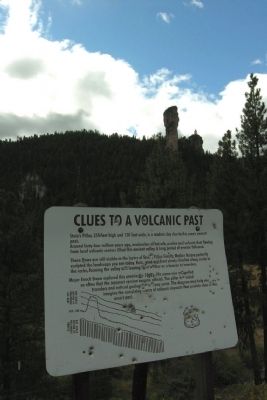
Stein's Pillar, 350 feet high and 120 feet wide, is a modern day clue to this area's ancient past.
Around forty-four million years ago, avalanches of hot ash, pumice and volcanic dust flowing from local volcanic centers filled this ancient . . . — — Map (db m64448) HM
This Memorial
was dedicated August 7, 1938
by the
Crook County Pioneer Association
in grateful remembrance of
the heroic early settlers of
the Central Oregon Country
whose bravery, intelligence and industry
blazed the trail . . . — — Map (db m114268) HM
"Klondike Kate" (Kitty Rockwell) was also known as the "Queen of the Yukon" during the Klondike Gold Rush and came to Bend in 1914. She made a small fortune in the Yukon as the region's leading singer and dancer but fell in love with Alex Pantages, . . . — — Map (db m157837) HM
Pilot Butte was a beacon for travelers.
On a day sometime in the year 1813, and Indian lookout, from one of several tribes summering in this vicinity, might have “hiked the butte” and from here observed an exploration party . . . — — Map (db m63090) HM
A.J. Tucker came to Bend in 1916 with $180.00 in his pocket. His first work in Bend was building boats and guiding hunting parties from the eastern United States.
Tucker soon set his sights on building, and went on to create several of . . . — — Map (db m157707) HM
A.M. Drake and his wife Florence set camp at the bank of the Deschutes River in June 1900 enticed by the 1894 Federal Carey Act, which encouraged private enterprise to reclaim and develop desert land by building irrigation systems and . . . — — Map (db m157945) HM
In 1905, the Aune brothers opened a livery stable and feed store on Bond Street and soon expanded it sot that by 1908, their large barn occupied one-half of the block on the east side of the street. The Aune brothers specialized in providing heavy . . . — — Map (db m157556) HM
The dam and powerhouse were built in 1910 and 1913 respectfully by the privately-owned Bend Water, Light and Power Company. and were subsequently sold to the Pacific Power and Light Company. The dam, which holds back the waters of the Deschutes . . . — — Map (db m157894) HM
Frontier towns had a long way to go before achieving the fire fighting capabilities of more established communities and fires were an ever-present threat; firefighters had their hands full just getting to the scene. In 1918, Tom Carlon took over as . . . — — Map (db m157911) HM
Partners Floyd Dement and George Childs started a hardware business in 1912 and relocated to this building in 1918. The two worked together until 1935 when they had a falling out and dissolved their partnership. Neither one ventured too far, . . . — — Map (db m157560) HM
Honoring the men and women of Bend who have served, are serving and will serve to defend our freedom during times of peace and war. Remembering the POW, the MIA, and those named below who have made the supreme sacrifice. They will not be forgotten. . . . — — Map (db m113347) WM
The R.N.Bushwalter's Sport Store was the first full-service sporting goods business in Central Oregon. "Buck" -as he was known, offered auto accessories, a large selection of guns, ammunition and fishing tackle, The first pair of skies sold in . . . — — Map (db m157626) HM
The Capitol Theatre was built as the "Carmody Theatre" in 1914 by Dennis Carmody, who placed a "C" on the back of each seat. B.A. "Dutch" Stover bought the theatre in the 192-s and to avoid purchasing new seats, changed the name of the theatre to . . . — — Map (db m157914) HM
This plaque is all that is left of the homesite of Clyde McKay, a man who irrevocably shaped the destiny of Bend. McKay persuaded Eastern lumber interests to expand operations in Bend and join him in forming The Bend Company. This company purchased . . . — — Map (db m157705) HM
Built by A.C. Lucas in 1904 at the corner of Wall Street and Newport Avenue, the Colonial Inn began life as the Pilot Butte Inn. It was move north of its original site in 1916 to make room for a new, larger Inn and was re-named the "Colonial Inn." . . . — — Map (db m157890) HM
For ladies traveling alone, the Cozy Hotel was the only respectable hotel in town. In those days, The Bend Bulletin printed the guest list of the three "higher class" hotels in town; the Cozy was among them. With its twenty-foot ceilings in . . . — — Map (db m157562) HM
The county court was created along with the establishment of Deschutes County in 1916. For the first nineteen years, county offices and the courthouse leased space in the O'Kane Building, then county rented the former Central School from the school . . . — — Map (db m157846) HM
William P. Downing arrived in Bend in 1902, traveling from Bemidji, Minnesota. He got the idea of selling lunches to millworkers, and parlayed the operation into a restaurant on Bond Street. Following the American dream of expansion, he set his . . . — — Map (db m157558) HM
Height: 80+ feet
Circumference: Approximately 80 feet
Age: 300+ years
This grove of old-growth Ponderosa Pines shaded the extensive lawn of the 1901 A.M. Drake home in the future sited of Bend. Drake's Pilot Butte Development Co. . . . — — Map (db m157654) HM
Water flowed across the high desert country during glacial times carving the Dry River Canyon visible beyond the marker. Near this part of Hwy 20, the canyon deepens from about 20 to 200 feet in less than half a mile. It continues northwest for two . . . — — Map (db m283956) HM
Eddie Williamson was Bend's first major auto dealer. He arrived in Bend with his family as youngster in 1916. When he was still young, his family moved to Eugene, but Eddie stayed behind and learned the automobile business. After owning several . . . — — Map (db m157913) HM
The original First Baptist church, erected on this site in 1904, was the first church building constructed in Bend. It was built on land obtained on May, 7, 1904, form A.M. Drake, Bend's founder, for $1.00 on the condition that no liquor would be . . . — — Map (db m157835) HM
Covered wagons poured into the Willamette Valley for over a quarter of a century before Euro-American settlers arrived here in great numbers. Alexander M. Drake, who arrived at the spot in 1900, was one of the first to realize the high prospects . . . — — Map (db m157706) HM
The Goodwillie-Allen-Rademacher House, built in 1904, is one of the oldest Craftsman Bungalow style homes in Oregon, and is the last remaining house from that era on the east side of Mirror Pond. This house was officially listed in the National . . . — — Map (db m157653) HM
On This Site
stood Oregon's
Historic
Pilot Butte Inn
1917 - 1973
This gate was one quaint feature of a Bavarian-style hotel described by author Irvin Cobb as "the finest little hotel in America." It was a popular stopping place . . . — — Map (db m157891) HM
This site marks the home of Kathleen "Klondike Kate" Rockwell, about whom the book "The Life & Legend of Kitty Rockwell, Queen of the Yukon" was written. Much of that legend was made here in Central Oregon, where she took up a homestead in 1914. . . . — — Map (db m157838) HM
To supply the lumber mills with logs, entire mobile towns were created in the woods to house the men and their families who cut down the trees. The towns were movable camps conveyed by railroad cars. From 1916, these temporary towns, or logging . . . — — Map (db m113935) HM
Purportedly the largest outdoor swimming tank in the state in the 1920s was located in Bend on the banks of the Deschutes River, just downstream from Pioneer Park. The 50 x 150 foot steel tank held 330,000 gallons of water. The water came directly . . . — — Map (db m157950) HM
Geologists say the volcanic activity of this area occurred less than 6000 years ago. Lava which exuded from the south side of this butte flowed to the west and blocked the Deschutes River, deflecting it from its former channel. This formed the . . . — — Map (db m68673) HM
(Marker #1) Welcome LAVA RIVER CAVE is one of Oregon's longest (5466 feet) uncollapsed lava tubes. About 100,000 years ago, this conduit carried 2000° F. (1100° C.) lava from an upslope vent to lower areas on the flanks of the Newberry . . . — — Map (db m92909)
The original facade on the Liberty Theater was a dazzling white stucco adorned with musical instruments in relief. The theater had a combined seating capacity of five hundred on the ground floor and balcony. This is the oldest movie theatre left . . . — — Map (db m157612) HM
The bustling marketplace you see today, filled with shops, theaters, restaurants, entertainment and recreation was once the site of the largest pine sawmills in the country.
Back in the 1920s, they were busy, noisy and dusty mills, each . . . — — Map (db m113931) HM
Trees were felled in the woods and hauled to the Deschutes River where they floated downstream to the mills.
The final steps of this log-to-lumber journey occurred as the wet lumber, known as green wood, exited the mill on the green chain.
As . . . — — Map (db m113933) HM
Nicholas Paul Smith's hardware store was a welcome sight in Bend because up until then supplies has to be brought in from Shaniko by stagecoach. Quick to spot a trend, Smith was the first to sell gasoline to the increasing number of automobile . . . — — Map (db m157652) HM
The facade styling of this building was ambitious for the time and it helped to popularize the unique brick used as the building material. The bricks were made of clay for the Bend Brickyard west of town and fire white sand from the Ice Caves south . . . — — Map (db m157651) HM
In its time, O'Donnell Field was one of the largest outdoor arenas in the state and was used for baseball and football games, track and field meets, rodeos, and by traveling carnivals and the Clyde Beatty Circus. It was built in 1916 for $400 and . . . — — Map (db m157844) HM
Hugh O'Kane, an illegal immigrant from Ireland, built the magnificent O'Kane Building. Regarded as the finest example of the Chicago Mercantile Style in Bend, it is still the largest commercial structure in downtown Bend.
O'Kane's role, as a . . . — — Map (db m157557) HM
The Bend Bulletin occupied several buildings over the years, but this building is perhaps the most historically significant since The Bend Bulletin operated from this site from 1940 to 1966. On May 15, 1963, the newspaper changed it's . . . — — Map (db m157610) HM
Construction of the Old Post Office established the presence of the federal government in this area.
It was a project of the Public Buildings Program, a federal agency created by President Herbert Hoover.
As one of the first buildings with . . . — — Map (db m113264) HM
This complex ecosystem nurtures a variety of plants and animals.
Vast, sage-covered plains begin at the eastern foot of the Pilot Butte and stretch dramatically to the east and south. This is Oregon’s fabled “High Desert”. The . . . — — Map (db m63094) HM
Although Pete Pierson was the original blacksmith, he soon sold his business to Joe Egg, who ran the business for fifty years. As late as 1973, Egg was well-known in Bend and Redmond as an ace blacksmith. In that year, Egg told The Bulletin . . . — — Map (db m157708) HM
This is the site of the Pilot Butte Inn, which was known far and wide as an excellent small hotel. Built by Philips Brooks of the Brooks Mill Family, the Inn was the focal point for community activities for many years. A massive lava rock fireplace, . . . — — Map (db m157947) HM
In 1936, partners Maren Gribskov and Eleanor Bechen were looking to expand their restaurant operation and build their own facility in the English Tavern style. They found the perfect location overlooking the Deschutes River. The named for the large . . . — — Map (db m157944) HM
Clyde McKay first came to Bend in 1900 and returned every year thereafter until he moved his family to Bend in 1911. That same year he formed the Bend Company, which purchased the Drake holdings, including the original townsite, a sawmill and power . . . — — Map (db m157655) HM
Although named for A.M. Pringle, it was Maurice Cashman who purchased the half-finished building and who is most associated with it. Cashman turned the building into a premier retail space that housed several stores. Al Eriksen bought the building . . . — — Map (db m157942) HM
This cableway was installed in 1905 by the United States Geological Survey to measure the river's flow.
Today instruments sense and record the elevation of the water surface.
This information is relayed by satellite into computers of water . . . — — Map (db m114253) HM
Evan A. Sather opened this two-story mercantile business and called it the Pine Tree Store because of a pine tree that grew through the front sidewalk. The upstairs was known a Sather Hall and became a popular gathering place for civic and social . . . — — Map (db m157625) HM
You may already know about pipelines. Oil, water and gas, chemicals, medicine and food flow to us through pipes and tubes. Pipelines are a naturally efficient way to move fluid from one place to another. Nature constructs marvelous . . . — — Map (db m92910)
Huge trees were felled in the woods and the logs were transported by railroad to town. They were then dropped into the Deschutes River to await their turn in the mill. The river was a perfect storage place for the logs. The natural flow of the . . . — — Map (db m113936) HM
In the beginning...there were old growth trees.
The small community, first called Farewell Bend from the nearby big bend in the Deschutes River, could have been called “Pilot Butte” if the 1901 recommendation of Postmaster William . . . — — Map (db m63089) HM
From the woods to the Deschutes River, the log was hoisted by the bull chain into the mill from the river to the log deck.
It was then directed to the band saw in one of the three head rigs, where the process began.
It was the head sawyer's . . . — — Map (db m113919) HM
The mills may be gone, but their legacy is apparent all around us. The lumber companies spurred Bend's growth and they helped a lot of folks raise their families in this area. Today we see evidence of Mill B every time we look at the three iconic . . . — — Map (db m113932) HM
The original Tower Theatre was built in 1940 in about three months by two shifts of workers employed by local contractor, Fred Van Matre. The building was dominated by the large "Tower" sign that rose 40 feet above the building to a height of 78 . . . — — Map (db m157624) HM
The railroad brought the outside world to Bend's doorstep, and the builders of what was then the Taggert Hotel knew exactly how to capitalize on it. Located just one block from the depot, the hotel was a modern, fireproof structure with electricity . . . — — Map (db m157946) HM
In 1897 a multi-purpose log cabin was built on this site by the Deschutes River. It was nicknamed the Trappers Cabin because trappers often used it for storage. Church services were sometimes held in the cabin and it was the original office of . . . — — Map (db m266539) HM
Frank T. Johns—Social Labor Party candidate for the presidency of the United States finished his address near this memorial then responded to a call for help from two boys who had fallen into the river from the footbridge upstream. Here Frank T. . . . — — Map (db m266536) HM
A double tragedy occurred in the Deschutes River beside Drake Park on May 21, 1928. Frank T. Johns, a candidate for United States President, was on the campaign trail in Bend delivering a speech when he heard cries for help. Jack Rhodes, a local . . . — — Map (db m266537) HM
With an ingenious mechanism, horses lifted and pulled huge, heavy logs over rugged terrain.
Photo caption 1
Use your imagination for a moment and step back in time. From 1916 to 1929, the nearby forest was bustling with more than 200 . . . — — Map (db m266540) HM
The petrified portions of Dawn Redwood (Metasequoia) trees were donated to the city of Bend by “Klondike Kate” Rockwell (1876-1957). An avid rockhound, she discovered these petrified wood stumps on her homestead near Brothers, Oregon, and they were . . . — — Map (db m266538) HM
In 1851 the immigrant trains used this spot to ford the Deschutes River on their trek to western Oregon. Upon departing, the earliest known train named it Farewell Bend and it is from this origin that the present City of Bend derived its name . . . — — Map (db m266533) HM
Where people lived near obsidian, their lives and cultures were transformed. They used and celebrated the glassy gift of volcanoes to manufacture tools, weapons, jewelry, sculptures, and ceremonial objects. To ancient Central American people, the . . . — — Map (db m72437) HM
The furnaces of the earth brought spectacular change to this land 1300 years ago. A new, rough, glassy environment offered a harsh home for the heartiest plants and animals. Past cultures prized the shiny black rock for their survival. Today, the . . . — — Map (db m72434)
This majestic pine is the biggest of its species ever recorded. It was a giant before the Oregon Territory was established, enduring centuries of fire, insects, disease, and human impact.
Recently half of its crown was lost to weather, . . . — — Map (db m114266) HM
The entire surface of this remarkable flow is glass, a liquid that cooled without crystallizing. The striking differences you see from rock to rock are due to the number and size of bubbles.
Why is everything glass?
Whether natural or . . . — — Map (db m72435)
First came a violent eruption of pumice and ash. Then glassy lava oozed from the ground.
(Graphic Index)
1 Magma Chamber
From deep hot regions, liquid rock called magma accumulated in a chamber 2 to 4 miles (3 to 6 km) below the . . . — — Map (db m72436)
Ages ago a river flowed across the high desert country in the rock canyon several hundred yards beyond this marker. The prehistoric river drained a large Ice Age lake that formed from the blocking of normal drainage in the area by lava flows. The . . . — — Map (db m157842) HM
This memorial honors all American Veterans who, although separated by generations, shared a common, undeniable goal – to valiantly protect our country’s freedoms.
The memories of these American Veterans will continue to live on whenever and . . . — — Map (db m279409) WM
Harold and Dorothy Barclay moved to the Sisters Country in 1936 and lived in a one room cabin, south of town near Whychus Creek. They were founders and builders of the Barclay Logging Company, which employed approximately 100 area residents and . . . — — Map (db m279378) HM
An early settler, stockman, blacksmith and businessman in the Sisters area; Hardy Allen and wife Daisy moved to Sisters in 1905. Hardy’s father, Albert Allen, had arrived in Oregon on the Meek Lost Wagon Train in 1845.
The Allen’s built this . . . — — Map (db m279388) HM
The Gist Hotel stood west of this spot until the fire of 1924 destroyed it, as well as the Hardy Allen Blacksmith Shop at this location and other buildings in town. The fire started while Hattie Gist was back in her garden picking strawberries for . . . — — Map (db m279381) HM
The hotel was built in 1912 by local businessman and Spanish American War veteran John Dennis. Hot and cold water was available to each of the original 19 guest rooms, and every room was supplied with heat from a hot air furnace located in the . . . — — Map (db m113631) HM
On this site was this little cafe which subsequently evolved into the current restaurant. The Ponderosa Café, built in 1934 became Ladd’s Café around 1945. Owner Arthur Ladd was on the Sisters City Council at the time. After his death, new owner . . . — — Map (db m279405) HM
Built in 1925 by the Leithausers, an early Sisters family. The structure served as a general store until 1950, when a new store was built two lots to the West. Over the years, the building has been used as a barber shop, variety store, yarn mill and . . . — — Map (db m158083) HM
In 1950, the Leithauser family built this building as a new modern supermarket to expand their grocery business from the small building two lots east. As the town grew, they added a variety store and barbershop. Hours were long, particularly during . . . — — Map (db m279400) HM
The original site of the library was on Cascade Street. Money to purchase the land was raised by area residents and businesses and construction material was donated by local mills. The library officially opened in 1939. The 14' x 20' structure has . . . — — Map (db m279384) HM
On this site was the old Owl Tavern, a favorite watering hole in old Sisters. If the walls could talk, there would be stories of pranks, the confiscation of the brand new slot machine, gunshots, horses and even a camel being ridden through the doors . . . — — Map (db m279403) HM
On this site in 1895, the Robert Smith General Store was a substantial building owned by brothers Alex and Robert Smith, who also platted the town in 1901. The second floor was used for dances and Odd Fellows Lodge Meetings. The store catered to . . . — — Map (db m279376) HM
This was the first church built in Sisters in 1914. Although designated as Presbyterian, it was more of a non-demoninational community effort. John and Myrtle Dennis donated the land, Perit Huntington hauled in the foundation rocks, Joe Duckett . . . — — Map (db m279387) HM
On this site was Sorenson’s Auto Court and the first service station in Sisters. It was built about 1924 when more automobiles were coming through town. Chris Sorenson kept adding motel units with attached carports in a U-shape around the Shell . . . — — Map (db m279399) HM
You are standing on the shore of a lake that may seem old but in geologic terms was formed yesterday. Fish Lake continues to change, seasonally and through the decades.
Around three thousand years ago an eruption of Nash Crater formed Fish Lake . . . — — Map (db m70950)
The original structure on this site was owned by the Aitken family and called the Sisters Drug Store. It also housed the town post office. The upstairs was used by the Forest Service to store records. It was destroyed by the fire of 1923. Shortly . . . — — Map (db m158082) HM
Welcome to historic Fish Lake.
Now a quiet and peaceful place, it was once filled with the hustle and bustle of people working and traveling across the Cascades.
Nearby is the Fish Lake Remount Depot which has been in continuous use as a . . . — — Map (db m62025) HM
In November 1942 the cattle contentedly grazing on what is now Sunriver’s great meadow found themselves suddenly replaced by dozens of energetic construction workers. Laboring through what was called “the worst winter since 1919,” they completed a . . . — — Map (db m231867) HM WM
Peter Skene Ogden was born at Quebec in 1794. He explored Central Oregon for the Hudson's Bay Company in 1825 and in December of that year discovered Crooked River not far from this spot. He died at Oregon City in 1854.
Land for this park was . . . — — Map (db m80487) HM
Fort Harney, on the former Malheur Indian Reservation, was named for Gen. Wm. S. Harney, who took command of the Military Department of Oregon, Sept. 13, 1858. The fort was established Aug. 10, 1867, and became a permanent Military Post. By order of . . . — — Map (db m63026) HM
Pioneer Cattleman and Artisan in Wrought Iron
Designer of Harney County's Early Cattle Brands
Organized Two Pioneer Cooperatives
Sponsored Lumber Milling as Our Second Industry
Harney County's First Water Master
Resident 1883 – . . . — — Map (db m305058) HM
Weary Oregon Trail emigrants, eager to ease travel or gain mileage, often attempted cutoffs and shortcuts. While many of these alternate routes proved successful, others did not--they became roads to ruin for some and the end of the trail for . . . — — Map (db m63032) HM
On February 9, 1945 at approximately 10 PM this aircraft, a Consolidated B-24D, serial number 42-40427,
crashed at this location in the Pueblo Mountains. The plane was on a "round robin" navigation training
mission from Gowen Field near Boise, . . . — — Map (db m275414) HM
Dedicated to those from Jefferson County who went to war.
They never came home.
World War I
Orlie I. Alexander • Paul A. Burson • Walter M. Eaton • Earl Elliott • Joseph O. Gans • Dallas R. Gregory • Harry F. Gunnison • George S. . . . — — Map (db m113268) WM
On April 12, 1915 Jefferson County purchased a jail cell unit from E.T. Barnum Iron Works of Detroit Michigan. It consisted of a steel grating cage with two cells with a front prisoner's corridor. This unit was shipped by rail to the temporary newly . . . — — Map (db m112869) HM
The Veteran War Memorial Plaza is dedicated
to the air pioneers and U.S. Army Corp pilots,
crew members and military personnel from
Jefferson County who served in World War II.
At one time, the Madras Airport was the "Madras Army Airbase, . . . — — Map (db m112870) HM WM
Throughout the 20th century, traffic increased dramatically on US Highway 97 - from a few vehicles per day in the 1920's to over 8,000 by the 1990's! After 70 years, the Crooked River (High) Bridge (1926) though still structurally sound was unable . . . — — Map (db m80488) HM
first panel
Rex T. Barber was one of 16 fighter pilots who participated in the famous - and then Top Secret - “Yamamoto” mission, which helped turn the tide of World War II against the Japanese.
Born in Culver, Oregon, in . . . — — Map (db m113386) HM
This magnificent view is preserved and protected by the efforts of the Oregon Roadside Council, which initiated and secured the passage of the Oregon Scenic Areas Act in 1961. 3585 scenic miles of highways were surveyed and selected by the Council. . . . — — Map (db m113382) HM
This park is named for Peter Skene Ogden, 1793-1854. In the fall of 1825, Ogden led a Hudston's Bay Company trapping party on the first recorded journey into central Oregon, crossing the country to the north and east into the Crooked River Valley . . . — — Map (db m67889) HM
Central Oregon's roads were primitive at best during the early 1900s. Until the 1920s, US Highway 97 was a collection of unpaved roads. Prior to construction of the Crooked River (High) Bridge in 1926, the only nearby crossing was a small, . . . — — Map (db m67888) HM
The Oregon Trunk Railway Bridge, constructed in 1911, was the first structure to cross this spectacular gorge. Prior to construction the only crossing of the Crooked River in this region was located about a mile upstream, where the canyon's sheer . . . — — Map (db m80490) HM
238 entries matched your criteria. The first 100 are listed above. Next 100 ⊳