94 entries match your criteria.
United States Daughters of 1812, National Society Historical Markers
Marker placed, donated or sponsored by the National Society United States Daughters of 1812. The N.S.U.S.D. of 1812 was founded in 1895 and has 41 active Chapters.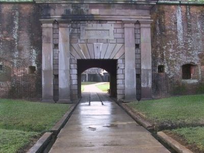
By Sandra Hughes, November 27, 2001
Fort Morgan
| 1 ► Alabama, Baldwin County, Gulf Shores — Fort Bowyer War of 1812 — |
| On Dixie Graves Highway, on the right when traveling south. | |||
| 2 ► Alabama, Baldwin County, Tensaw — Fort Mims Massacre — |
| Near Fort Sims Road, 0.3 miles north of Boatyard Road (County Road 80). | |||
| 3 ► Alabama, Etowah County, Attalla — Camp Wills — |
| On 5th Avenue Northeast (U.S. 431) at Cleveland Avenue, on the right when traveling south on 5th Avenue Northeast. | |||
| 4 ► Alabama, Mobile County, Dauphin Island — British Occupation of Dauphin Island — February - April 1815 — |
| Near Bienville Boulevard east of Albatross Street, on the right when traveling east. | |||
| 5 ► Alabama, Tallapoosa County, Daviston — Jackson Trace — |
| Near Battlefield Park Tour Road. | |||
| 6 ► Arkansas, Pulaski County, Little Rock, Downtown — Gen. James Miller — |
| Near West Markham Street at Ashley Street, on the right when traveling west. | |||
| 7 ► Arkansas, Pulaski County, Little Rock, Downtown — War of 1812 Memorial — |
| Near West Markham Street at Ashley Street, on the right when traveling west. | |||
| 8 ► Arkansas, Pulaski County, Little Rock, Macarthur Park — Home of Robert Crittenden — |
| On Scott Street at East 7th Street, on the right when traveling north on Scott Street. | |||
| 9 ► Arkansas, Pulaski County, Little Rock, Macarthur Park — MacArthur Park World War Memorial — |
| Near East 9th Street. | |||
| 10 ► Arkansas, White County, Beebe — Saint Genevieve Trail and the Old Military Road — |
| On Swinging Bridge Road east of Stoney Point Church Road, on the left when traveling east. | |||
| 11 ► Arkansas, White County, Searcy — Spanish Land Grant to John Fayac — |
| On Davis Drive at Old Searcy Landing Drive, on the right when traveling north on Davis Drive. | |||
| 12 ► Connecticut, New Haven County, Madison, Madison Center — Captain Frederick Lee — 1776 - 1831 — Citizen of Madison and Hero of War of 1812 — |
| On Meeting House Lane just west of Island Avenue. | |||
| 13 ► Delaware, Sussex County, Lewes, Lewes Historic District — The Bombardment of Lewes — |
| On Front Street, on the right when traveling north. | |||
| 14 ► District of Columbia, Washington, Northeast Washington, Capitol Hill — Residence of Albert Gallatin — |
| On Constitution Avenue Northeast (Alternate U.S. 1) at 2nd Street Northeast, on the right when traveling west on Constitution Avenue Northeast. | |||
| 15 ► Florida, Duval County, Jacksonville, Urban Core — Duval County — Created August 12, 1822, named for Governor William Pope Duval — 1884 — 1915 — |
| On E Bay Street. | |||
| 16 ► Florida, Miami-Dade County, Miami — Dade County — Created Jan. 28, 1836, Named for Major Francis Langhorn Dade — 1784 - 1815 — |
| On West Flagler Street at NW Miami Court, on the left when traveling east on West Flagler Street. | |||
| 17 ► Georgia, Bibb County, Macon — War of 1812 Bicentennial Celebration — |
| On Woolfolk Street at Smith Street, on the right when traveling east on Woolfolk Street. | |||
| 18 ► Georgia, Camden County, St. Marys — 20-2 — Point Peter Battery and the War of 1812 — |
| On Spinnaker Road at USS Kamehameha Avenue, in the median on Spinnaker Road. | |||
| 19 ► Illinois, Bond County, Greenville — War of 1812 Soldiers Buried in Bond County — |
| Near College Avenue at 3rd Street (Illinois Route 127), on the left when traveling west. | |||
| 20 ► Illinois, Cook County, Chicago, Near South Side — Battle of Fort Dearborn — August 15, 1812 — |
| On Calumet Ave at 18th Street, on the right on Calumet Ave. | |||
| 21 ► Illinois, LaSalle County, Ottawa — War of 1812 Soldiers at Ottawa Avenue Cemetery — |
| Near Boyce Memorial Drive near Ottawa Avenue. | |||
| 22 ► Illinois, Sangamon County, Springfield — Soldiers of the War of 1812 — |
| On East Adams Street west of Sixth Street, on the left when traveling west. | |||
| 23 ► Indiana, Tippecanoe County, Battle Ground — The Battle of Tippecanoe — November 7, 1811 — |
| On Battleground Avenue west of Railroad Street, on the right when traveling north. | |||
| 24 ► Kentucky, Hart County, Munfordville — 2 — Hart County — Created Jan. 19, 1819 Named for — Capt. Nathaniel G. T. Hart — |
| On Dixie Highway / Main Street (U.S. 31W) south of Union Street (State Road 357), on the left when traveling south. | |||
| 25 ► Louisiana, St. Bernard Parish, Chalmette — Chalmette Battlefield — |
| On West St. Bernard Highway (State Highway 46) at Battlefield Road, on the right when traveling east on West St. Bernard Highway. | |||
| 26 ► Louisiana, St. Bernard Parish, Chalmette — Chalmette Monument — |
| On Battlefield Road. | |||
| 27 ► Louisiana, St. Tammany Parish, Madisonville — War of 1812 Memorial — |
| Near Main Street north of St. John Street, on the right when traveling north. | |||
| 28 ► Maryland, Anne Arundel County, Annapolis — Site of Old Fort Severn — |
| On Cooper Road, 0.1 miles south of Santee Road. | |||
| 29 ► Maryland, Baltimore, Irvington — Mary Pickersgill — |
| On Wilkens Aveune. | |||
| 30 ► Maryland, Baltimore, Locust Point Industrial Area — Francis Scott Key — |
| Near Constellation Plaza, 0.1 miles east of Wallace Street, on the right when traveling east. | |||
| 31 ► Maryland, Cecil County, Fredericktown — Fort Duffy — |
| On School House Lane, on the right when traveling west. | |||
| 32 ► Maryland, Prince George's County, Croom — Charles Town — |
| On Mount Calvert Road, 2.4 miles east of Croom Road (Maryland Route 382), on the right when traveling east. | |||
| 33 ► Maryland, Prince George's County, Upper Marlboro — Dr. William Beanes — 1749 - 1828 — |
| Near Oden Bowie Drive at Elm Street. | |||
| 34 ► Michigan, Wayne County, Detroit, Downtown Detroit — 242 — War of 1812 Dead |
| On Washington Boulevard at Michigan Avenue (U.S. 12) on Washington Boulevard. Reported permanently removed. | |||
| 35 ► Missouri, St. Charles County, O'Fallon — Fort Zumwalt — |
| On Jessup Drive West just south of Veterans Memorial Parkway, on the right when traveling south. | |||
| 36 ► Nebraska, Douglas County, Omaha — Fort Lisa — |
| On John J Pershing Dr at Hummel Rd, on the left when traveling north on John J Pershing Dr. | |||
| 37 ► New Jersey, Mercer County, Trenton, Downtown — General Zebulon Montgomery Pike — Born in New Jersey January 5, 1779 — Died April 27, 1813 — |
| Near Barrack Street just north of West Lafayette Street, on the left when traveling north. | |||
| 38 ► New York, Albany County, Albany, Arbor Hill — Brig. Gen. Abraham Ten Broeck — 1734-1810 — |
| Near Ten Broeck Place north of Ten Broeck Street, on the left when traveling east. | |||
| 39 ► New York, Jefferson County, Belleville — Carrying Cable Route — |
| On Butterville Road (County Route 75) north of John's Lane, on the left when traveling north. | |||
| 40 ► New York, Jefferson County, Ellisburg — Carrying Cable Route — |
| On New York State Route 289 at Lee Road, on the right when traveling north on State Route 289. | |||
| 41 ► New York, Jefferson County, Sackets Harbor — 1913 Centennial Monument — The Battlefield of Sackets Harbor — |
| Near Washington Street east of Ontario Street. | |||
| 42 ► New York, Jefferson County, Sackets Harbor — Carrying Cable Route — |
| On Smithville Road (County Route 75) north of New York State Route 3, on the right when traveling north. | |||
| 43 ► New York, Jefferson County, Sackets Harbor — In Memory of the War of 1812 — |
| On Dodge Avenue. | |||
| 44 ► New York, Jefferson County, Watertown — County of Jefferson — 1784 • 1815 — |
| On Arsenal Street (New York State Route 3/12) at Sherman Street, on the right when traveling east on Arsenal Street. | |||
| 45 ► New York, Monroe County, Rochester, Downtown — County of Monroe — |
| On Main St. W at Fitzhugh St, on the right when traveling east on Main St. W. | |||
| 46 ► New York, New York County, Manhattan, East Village — Daniel D. Tompkins — A Great American — |
| On E 10th Street at Stuyvesant Street, on the left when traveling east on E 10th Street. | |||
| 47 ► New York, New York County, Manhattan, Morningside Heights — New York City Defenses During the War of 1812 — |
| On Amsterdam Avenue south of W 118th Street, on the right when traveling south. | |||
| 48 ► New York, Niagara County, Lewiston — British Landing — |
| On Lower River Road (New York State Route 18F) south of Pletcher Road, on the left when traveling north. | |||
| 49 ► New York, Niagara County, Lewiston — Tuscarora Heroes Monument — Skaru:rę? Kayękwatihčayę'hčreh — |
| On Center Street (New York State Route 18F) at Portage Road, on the left when traveling west on Center Street. | |||
| 50 ► New York, Wayne County, Sodus Point — Battle of Sodus Point — |
| On New York State Route 14, on the right when traveling north. | |||
| 51 ► New York, Wayne County, Williamson — From the Nearby Ravine — |
| On Washington Street at Mill Street, on the right when traveling west on Washington Street. | |||
| 52 ► Ohio, Allen County, Spencerville — Site of the 86 Acre Homestead of Dye Sunderland — |
| On Fort Amanda Road at Sunderland Road, on the right when traveling west on Fort Amanda Road. | |||
| 53 ► Ohio, Athens County, Athens — Margaret Snowden — First White Woman — 1798 - 1932 — |
| On Fisher Road (County Road 17) 0.1 miles west of University Heights Drive, on the right when traveling west. | |||
| 54 ► Ohio, Auglaize County, Kossuth — The 77 Unknown Soldiers — |
| On Ohio Route 198, 0.2 miles south of Deep Cut Road (Local Highway 230), on the right when traveling north. | |||
| 55 ► Ohio, Defiance County, Defiance — 7-20 — Winchester's Camp #2 / Preston Island — |
| On East River Drive (Ohio Route 424) west of Maywinn Road, on the right when traveling east. | |||
| 56 ► Ohio, Defiance County, Independence — 6-20 — Winchester's Camp No. 3/Fort Starvation / The Old Kentucky Burial Grounds — |
| On Ohio Route 424, 1.1 miles east of Indepedence Road (County Route 185), on the right when traveling east. | |||
| 57 ► Ohio, Franklin County, Columbus, Franklinton — Franklinton — |
| On West Broad Street (U.S. 40) at North Gift Street, on the right when traveling west on West Broad Street. | |||
| 58 ► Ohio, Hamilton County, North Bend — William Henry Harrison — |
| On Cliff Road just north of Brower Road, on the right when traveling north. | |||
| 59 ► Ohio, Huron County, Havana — Boughton Road — |
| On Old Military Road at North Greenfield Road (County Road 7), on the right when traveling north on Old Military Road. | |||
| 60 ► Ohio, Jefferson County, Steubenville — This Old Federal Land Office — |
| Near South Third Street east of Adams Street. | |||
| 61 ► Ohio, Lucas County, Toledo, Center City — Lucas County — Created June 20, 1835 — Named for Governor Robert Lucas — |
| Near Adams Street east of North Michigan Street (Ohio Route 25), on the left when traveling east. | |||
| 62 ► Ohio, Lucas County, Toledo, Lagrange — Peter Navarre — 1785 – 1874 — |
| On Windemere Boulevard at Manhattan Boulevard, on the right when traveling east on Windemere Boulevard. | |||
| 63 ► Ohio, Madison County, London — First White Settlers of Madison County — |
| On Main Street (Ohio Route 68) at High Street (U.S. 42), on the left when traveling north on Main Street. | |||
| 64 ► Ohio, Ottawa County, Marblehead — In Memory of Mason, Simonds & Mingus — |
| On East Bay Shore Road close to Seneca Trail, on the right when traveling east. | |||
| 65 ► Ohio, Richland County, Mansfield — Mansfield Blockhouse — United States Daughters of 1812 — |
| Near Brinkerhoff Avenue, 0.2 miles south of Park Avenue West (State Route 430), on the right when traveling south. | |||
| 66 ► Ohio, Ross County, Chillicothe — Chillicothe — Capital of the Northwest Territory and First Capital of Ohio — |
| On North Paint Street near East Main Street (U.S. 50), on the left when traveling north. | |||
| 67 ► Ohio, Wood County, Bowling Green — County of Wood — Created February 12, 1820 - Named for — Colonel Eleazer Derby Wood — |
| Near East Court Street east of North Prospect Street, on the left when traveling east. | |||
| 68 ► Oklahoma, Mayes County, Pryor — Nathaniel Hale Pryor — b. Amherst County, Virginia, 1772 — d. June of 1831 — |
| On Adair Street at NE 1st Street, on the right when traveling north on Adair Street. | |||
| 69 ► Oklahoma, Muskogee County, Fort Gibson — Seventh United States Infantry — 1824-1936 — |
| On North Garrison Avenue at East Hazen Lane, on the right when traveling north on North Garrison Avenue. | |||
| 70 ► Oklahoma, Ottawa County, Wyandotte — Modoc Church — |
| On 679th Road, 0.4 miles south of 100th Road (Oklahoma Highway 10C), on the left when traveling south. | |||
| 71 ► Oklahoma, Sequoyah County, Salisaw — Sequoyah Waterfall Memorial — |
| Near State Highway 101, 1 mile north of East 1040 Road, on the right when traveling north. | |||
| 72 ► Pennsylvania, Allegheny County, Pittsburgh, Central Downtown Historic District — McClurg Iron Foundry — |
| On Fifth Avenue at Smithfield Street, on the right when traveling north on Fifth Avenue. | |||
| 73 ► Pennsylvania, Allegheny County, Pittsburgh, Lower Lawrenceville — Soldiers and Sailors of the War of 1812 — |
| 74 ► Pennsylvania, Lancaster County, Lancaster — The War of 1812 — |
| On Penn Square. | |||
| 75 ► Pennsylvania, Philadelphia County, Philadelphia, East Germantown — Soldiers of the War of 1812 — |
| On Germantown Avenue, on the right when traveling north. | |||
| 76 ► South Carolina, Charleston County, Mount Pleasant — 10-10 — War of 1812 Encampment — |
| On Carr Street, on the left when traveling east. | |||
| 77 ► South Carolina, Colleton County, Jacksonboro — The Burial Site of Captain John Herbert Dent — |
| On ( SC-64 )Charleston Hwy, on the right when traveling west. | |||
| 78 ► Tennessee, Davidson County, Nashville, Green Hills — Natchez Trace — |
| On Golf Club Lane at New Natchez Trace, on the left when traveling west on Golf Club Lane. | |||
| 79 ► Tennessee, Hamilton County, Chattanooga, City Center — Hamilton County — |
| On Georgia Avenue just north of East 7th Street, on the left when traveling north. | |||
| 80 ► Tennessee, Roane County, Kingston — Roane County War of 1812 Memorial — |
| Near Court Street east of North Kentucky Street (Tennessee Highway 58), on the left when traveling east. | |||
| 81 ► Tennessee, Sumner County, Castalian Springs — Cragfont — |
| On Cragfont Road, 0.6 miles north of Hartsville Pike (Tennessee Route 25), on the right when traveling north. | |||
| 82 ► Tennessee, Williamson County, Franklin — U.S.D. 1812 — |
| Near Natchez Trace Parkway (at milepost 426.3), on the right when traveling north. | |||
| 83 ► Texas, Bexar County, San Antonio, Alamo Plaza — Soldiers of the War of 1812 Who Fought for Texas — |
| 84 ► Texas, Calhoun County, Port Lavaca — Half Moon Reef Lighthouse — Built 1858 • Retired 1942 — |
| On State Highway 35 at Half Moon Drive (State Highway 238), on the right when traveling east on State Highway 35. | |||
| 85 ► Texas, Tarrant County, Fort Worth, Sundance Square — 1784 Tarrant County 1815 — Organized Aug 5, 1850-Named for — General Edward H. Tarrant — |
| On West Weatherford Street (State Highway 347 Spur) at Main Street, on the left when traveling east on West Weatherford Street. | |||
| 86 ► Texas, Taylor County, Abilene — "I Shall Never Surrender or Retreat" — |
| On Oak Street at S. 4th Street on Oak Street. | |||
| 87 ► Virginia, Fredericksburg — James Monroe 1758 - 1831 — |
| Near Charles Street south of William Street, on the right when traveling south. | |||
| 88 ► Virginia, Hampton, Downtown — War of 1812 Veterans Interred or Memorialized in this Historic Cemetery — |
| On West Queens Way just west of West Queens Court, on the right when traveling west. | |||
| 89 ► Virginia, Petersburg — Drilling Ground — |
| Near South Sycamore Street (Alternate U.S. 301) at Liberty Street, on the right when traveling north. | |||
| 90 ► Virginia, Prince William County, Dumfries — Revolutionary War Patriots and War of 1812 Veterans — |
| Near Mine Road near King Street. | |||
| 91 ► Virginia, Richmond, North Side — Shockoe Hill Cemetery — Revolutionary War and War of 1812 Veteran Burials — |
| Near Hospital Street at North 4th Street, on the left when traveling west. | |||
| 92 ► Virginia, Richmond, Shockoe Slip — Bell Tavern — |
| On East Main Street at North 15th Street, on the left when traveling east on East Main Street. | |||
| 93 ► Virginia, Virginia Beach, Northwest — Founders and Veterans of Lynnhaven Parish Church — Interred in this Cemetery and Surrounding Area — Old Donation Church — |
| Near N Witchduck Road, 0.2 miles north of Cathedral Drive. | |||
| 94 ► British Overseas Territories, Bermuda, St George's Parish, Town of St. George's — American Prisoners of the War of 1812 who died in Bermuda — United States Daughters of the War of 1812 — |
| On King Street, on the left when traveling east. | |||