2027 entries match your criteria. The first 100 are listed. ⊳
Historical Markers and War Memorials in Minnesota
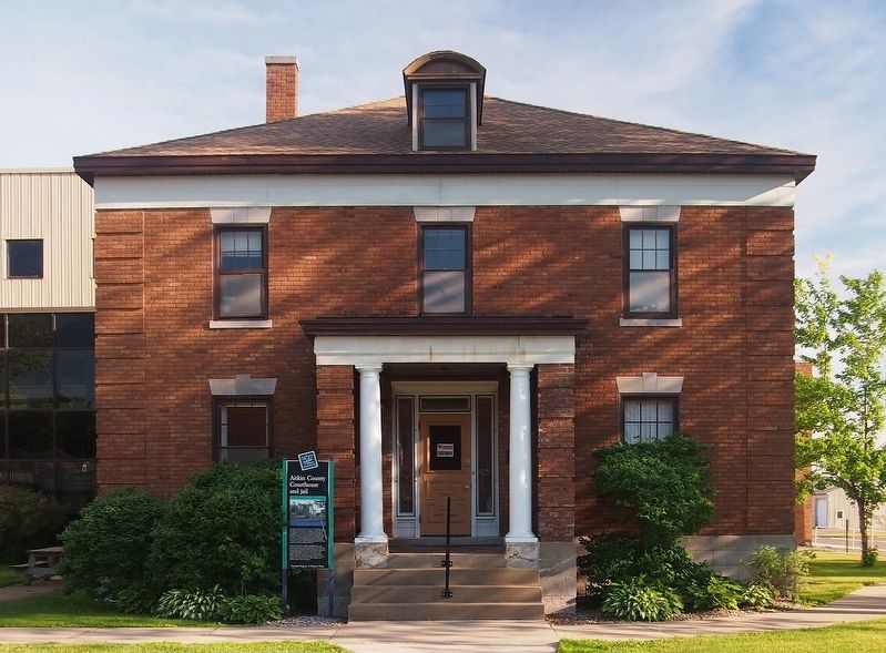
By McGhiever, June 10, 2016
Aitkin County Courthouse and Jail Marker
| 1 ► Minnesota, Aitkin County, Aitkin — Aitkin County Courthouse and Jail — Northeast Minnesota: The Wild North — |
| On 2nd St NW, on the right when traveling east. | |||
| 2 ► Minnesota, Aitkin County, East Lake — CCC Camp 2705 — Rice Lake National Wildlife Refuge — |
| Near 363rd Lane, on the left when traveling west. | |||
| 3 ► Minnesota, Aitkin County, East Lake — From Railroad Tracks to Refuge Road — |
| On 363rd Lane at Minnesota Route 65, on the right when traveling west on 363rd Lane. | |||
| 4 ► Minnesota, Aitkin County, East Lake — Mandy Lake — Rice Lake National Wildlife Refuge — |
| On Mandy Lake Access at 363rd Lane, on the left when traveling west on Mandy Lake Access. | |||
| 5 ► Minnesota, Aitkin County, Libby — "Tell him I blame him for the children we have lost...." — Aish-ke-bo-go-ko-zhe (Flat Mouth), December 3, 1850 — |
| Near State Highway 65, 0.6 miles 224th Place, on the right when traveling north. | |||
| 6 ► Minnesota, Aitkin County, Libby — Big Sandy Lake Reservoir — |
| On State Highway 65, on the right when traveling north. | |||
| 7 ► Minnesota, Aitkin County, Libby — Sandy Lake Post — |
| Near 531st Lane east of Highway 65, on the right when traveling north. | |||
| 8 ► Minnesota, Aitkin County, Libby — The Ojibwe's Sandy Lake Journey — |
| On State Highway 65, on the right when traveling north. | |||
| 9 ► Minnesota, Aitkin County, Libby — Where River Roads Met — |
| On Minnesota Route 65, 0.2 miles south of 528th Lane, on the right when traveling north. | |||
| 10 ► Minnesota, Aitkin County, McGregor — Glacial Lake Aitkin / Peat — |
| Near State Highway 210 at State Highway 65. | |||
| 11 ► Minnesota, Anoka County, Anoka — Aaron Greenwald — |
| On West Main Street at Park Street, on the right when traveling east on West Main Street. | |||
| 12 ► Minnesota, Anoka County, Anoka — Anoka Post Office — Circa 1916 — |
| On E. Main Street at S. 3rd Avenue, on the right when traveling east on E. Main Street. | |||
| 13 ► Minnesota, Anoka County, Anoka — Bridging the Mississippi — |
| Near South Ferry Road, 0.3 miles east of South Ferry Street (U.S. 169). | |||
| 14 ► Minnesota, Anoka County, Anoka — Circle of Life — |
| Near South Ferry Road, 0.3 miles east of South Ferry Street (U.S. 169). | |||
| 15 ► Minnesota, Anoka County, Anoka — Father Louis Hennepin's Exploration in 1680 — |
| On 1st Avenue at East Main Street, on the right when traveling south on 1st Avenue. | |||
| 16 ► Minnesota, Anoka County, Anoka — Fireman's Grove — |
| Near South Ferry Road, 0.3 miles east of South Ferry Street (U.S. 169). | |||
| 17 ► Minnesota, Anoka County, Anoka — Highway of Exploration — |
| Near South Ferry Road, 0.3 miles east of South Ferry Street (U.S. 169). | |||
| 18 ► Minnesota, Anoka County, Anoka — Logbooms Meet Sawmills — |
| Near South Ferry Road, 0.3 miles east of South Ferry Street (U.S. 169). | |||
| 19 ► Minnesota, Anoka County, Anoka — Perseverance Needed — |
| Near River Avenue, 0.1 miles west of 1st Avenue. | |||
| 20 ► Minnesota, Anoka County, Anoka — River Highways — |
| Near South Ferry Road, 0.3 miles east of South Ferry Street (U.S. 169). | |||
| 21 ► Minnesota, Anoka County, Anoka — Robert W. Akin — Akin Riverside Historic Promenade — |
| On Bridge Square. | |||
| 22 ► Minnesota, Anoka County, Anoka — Rum River Dam — |
| Near North 2nd Avenue north of Jackson Street, on the left when traveling north. | |||
| 23 ► Minnesota, Anoka County, Anoka — The Gathering Place — Akin Riverside Historic Promenade — |
| Near River Avenue, 0.1 miles west of 1st Avenue. | |||
| 24 ► Minnesota, Anoka County, Anoka — The Stone House — Akin Riverside Historic Promenade — |
| Near 1st Avenue south of East Main Street, on the right when traveling south. | |||
| 25 ► Minnesota, Anoka County, Anoka — Ticknor House — Circa 1867 — |
| On Jefferson Street west of 3rd Avenue, on the right when traveling east. | |||
| 26 ► Minnesota, Anoka County, Anoka — Washburn Saw Mill — |
| On 2nd Avenue south of Harrison Street, on the right when traveling south. | |||
| 27 ► Minnesota, Anoka County, Anoka — Where Cultures Meet — |
| Near South Ferry Road, 0.3 miles east of South Ferry Street. | |||
| 28 ► Minnesota, Anoka County, Anoka — Where Land and Water Meet — |
| Near South Ferry Road, 0.3 miles east of South Ferry Street (U.S. 169). | |||
| 29 ► Minnesota, Anoka County, Anoka — Who Lived Here / Neighborhood Names / Building a Community — Akin Riverside Historic Promenade — |
| Near 2nd Avenue west of Rivers Pointe Court. | |||
| 30 ► Minnesota, Anoka County, Anoka — Why Settle Here? / Time to Play — |
| Near River Avenue, 0.1 miles west of 1st Avenue. | |||
| 31 ► Minnesota, Anoka County, Anoka — Windego Park Auditorium — Circa 1914 — |
| On Ferry Street at the footbridge over the Rum River, on the right when traveling north on Ferry Street. | |||
| 32 ► Minnesota, Anoka County, Coon Rapids — Coon Rapids Dam Regional Park — Mississippi National River and Recreation Area-Partner Site — East Visitor Center — |
| On Egret Blvd. | |||
| 33 ► Minnesota, Anoka County, Ham Lake — The Swedish Evangelical Lutheran Church of Ham Lake — |
| On Swedish Drive NE, on the right when traveling east. | |||
| 34 ► Minnesota, Anoka County, Ramsey — Ice Age Souvenir — Great River Road Minnesota — |
| On U.S. 10, 0.8 miles east of Cleveland Street, on the right when traveling east. | |||
| 35 ► Minnesota, Anoka County, Ramsey — AN-RMC-008 — Itasca Village Townsite — |
| On U.S. 10, 0.8 miles east of Cleveland Street, on the right when traveling east. | |||
| 36 ► Minnesota, Anoka County, St. Francis — History of the Rum River — |
| On Rum River Blvd NW at Bridge St NW (County Road 24), on the right when traveling north on Rum River Blvd NW. | |||
| 37 ► Minnesota, Becker County, Audubon — Cook Homestead — |
| Near County Highway 11, 1.5 miles south of U.S. 10, on the left when traveling south. | |||
| 38 ► Minnesota, Becker County, Audubon — Home Again — |
| On County Highway 104, 0.5 miles south of 220th Street. | |||
| 39 ► Minnesota, Becker County, Detroit Lakes — Becker County Courthouse — |
| On Lake Avenue just north of Frazee Street, on the right when traveling north. | |||
| 40 ► Minnesota, Becker County, Detroit Lakes — Detroit Lakes — A City with a Past — |
| On Frontage Road (U.S. 10) 0.1 miles south of North Shore Drive, on the right when traveling south. | |||
| 41 ► Minnesota, Becker County, Detroit Lakes — Detroit Lakes Carnegie Library — |
| Near Washington Avenue at Frazee Street, on the left when traveling north. | |||
| 42 ► Minnesota, Becker County, Detroit Lakes — The Woods Trail — |
| On Frontage Road, on the right when traveling south. | |||
| 43 ► Minnesota, Becker County, Ponsford — Bad Medicine Lake — |
| On State Highway 113, on the right when traveling east. | |||
| 44 ► Minnesota, Becker County, Rochert — Old Indian Trail — |
| On County Road 29, 1 mile south of County Road 26, on the left when traveling south. | |||
| 45 ► Minnesota, Becker County, Shoreham, Lake View Township — Red River Ox Cart Trail — Becker County — |
| Near County Route 17 near U.S. 59. | |||
| 46 ► Minnesota, Becker County, Tamarac National Wildlife Refuge — Old Government Road — |
| On County Route 143, 0.7 miles west of Egg Lake Trail. | |||
| 47 ► Minnesota, Becker County, Waubun — St. Columba Mission — |
| Near 370th Street, on the left when traveling east. | |||
| 48 ► Minnesota, Beltrami County, Bemidji — Beltrami County History — |
| On Beltrami Avenue NW at 6th Street NW, on the right when traveling south on Beltrami Avenue NW. | |||
| 49 ► Minnesota, Beltrami County, Bemidji — Bemidji's Great Northern Depot — |
| On Minnesota Avenue Southwest just south of 1st Street West, on the left when traveling south. | |||
| 50 ► Minnesota, Beltrami County, Bemidji — Carnegie Library — 1910 — |
| On Bemidji Avenue North (State Highway 197) at 5th Street Northwest, on the right when traveling north on Bemidji Avenue North. | |||
| 51 ► Minnesota, Beltrami County, Bemidji — First Reserve Unit in the United States Called into Active Service in World War I — |
| On Bemidji Avenue North (State Highway 197) just north of 4th Street Northwest, on the right when traveling north. | |||
| 52 ► Minnesota, Beltrami County, Bemidji — 473 — Great Northern Depot — |
| On Minnesota Avenue Southwest just south of 1st Street West, on the left when traveling south. | |||
| 53 ► Minnesota, Beltrami County, Bemidji — Historic Beltrami Camp — |
| On State Park Road Northeast, on the left when traveling north. | |||
| 54 ► Minnesota, Beltrami County, Bemidji — Paul Bunyan and Babe — |
| On Bemidji Avenue North (State Highway 197) at 3rd Street Northwest, on the right when traveling north on Bemidji Avenue North. | |||
| 55 ► Minnesota, Beltrami County, Turtle River — Native American Fishing on the Turtle River — A Fishing Camp — |
| Near Three Island Access. | |||
| 56 ► Minnesota, Beltrami County, Turtle River — Pottery Types of the Turtle River and Three Island Lake — Pottery of the Past Provides Clues — |
| 57 ► Minnesota, Beltrami County, Waskish — Harry Davidson — |
| On Washkish Road NE south of Glabby Road NE. | |||
| 58 ► Minnesota, Beltrami County, Waskish — Ludlow Island History — |
| Near State Highway 72, 2 miles south of County Road 77, on the left when traveling north. | |||
| 59 ► Minnesota, Beltrami County, Waskish — The Big Bog's Caribou Band — |
| Near State Highway 72, on the left when traveling north. | |||
| 60 ► Minnesota, Beltrami County, Waskish — The Bog That Couldn't Be Tamed — |
| Near State Highway 72, on the left when traveling north. | |||
| 61 ► Minnesota, Beltrami County, Waskish — The Marina — |
| Near State Highway 72, on the left when traveling north. | |||
| 62 ► Minnesota, Beltrami County, Waskish — The Old Waskish Town Site — |
| Near Waskish Road NE (County Road 40) west of State Route 72. | |||
| 63 ► Minnesota, Beltrami County, Waskish — The Patterned Peatland: Rare and Valuable — |
| Near State Highway 72, on the left when traveling north. | |||
| 64 ► Minnesota, Beltrami County, Waskish — Where There is Smoke / Forests of the Agassiz Lowlands — |
| On Hillman Drive NE (County Highway 9) at Big Bog State Recreation Area entrance road, on the right when traveling south on Hillman Drive NE. | |||
| 65 ► Minnesota, Benton County, Gilman — Gilman Veterans Memorial — |
| On 115th Street Northeast (County Highway 5/62) at State Highway 25, on the right when traveling west on 115th Street Northeast. | |||
| 66 ► Minnesota, Benton County, Sauk Rapids — Minnesota Territory 1849-1858 / Benton County Takes Shape — |
| On 1st Street North just south of 3rd Avenue North, on the right when traveling north. | |||
| 67 ► Minnesota, Big Stone County, Clinton — St. Pauli Lutheran Church — |
| Near U.S. 75 at County Road 60, on the right when traveling north. | |||
| 68 ► Minnesota, Big Stone County, Clinton — The Chicago, Milwaukee, St. Paul & Pacific Depot — built circa 1885 — |
| Near Main Street near Center Street, on the right when traveling east. | |||
| 69 ► Minnesota, Big Stone County, Graceville — Graceville — |
| On St Marys Avenue (Minnesota Route 28 at milepost 22), 0.9 miles west of U.S. 75, on the right when traveling west. | |||
| 70 ► Minnesota, Big Stone County, Odessa — Welcome to Odessa — |
| On County Route 28 at Bloomington Ave. N, on the right when traveling east on County Route 28. | |||
| 71 ► Minnesota, Big Stone County, Ortonville — A Glacial Wall of Water — |
| Near U.S. 12, 0.1 miles west of U.S. 75, on the left when traveling west. | |||
| 72 ► Minnesota, Big Stone County, Ortonville — Big Stone County Courthouse — National Register of Historic Places — |
| Near 2nd Street Southeast (Minnesota Route 7) north of Lincoln Avenue, on the right when traveling north. | |||
| 73 ► Minnesota, Big Stone County, Ortonville — Geology of Minnesota — Ortonville Region — |
| Near U.S. 12, 0.1 miles west of Route 75. | |||
| 74 ► Minnesota, Big Stone County, Ortonville — Paul Bunyan's Boat-Anchor — |
| Near U.S. 12, 0.1 miles west of US Hwy 75. | |||
| 75 ► Minnesota, Blue Earth County, Judson — Welsh Churches — |
| On State Highway 68 at 227th Lane, on the right when traveling east on State Highway 68. | |||
| 76 ► Minnesota, Blue Earth County, Lake Crystal — Lake Crystal and the Railroad — |
| On East Robinson Street east of North Main Street (County Highway 76), on the right when traveling east. | |||
| 77 ► Minnesota, Blue Earth County, Mankato — Amos Owen Garden of American Indian Horticulture — |
| On Warren Street north of Stadium Road, on the left when traveling east. | |||
| 78 ► Minnesota, Blue Earth County, Mankato — Blue Earth - Nicollet Counties Vietnam Veterans Memorial — |
| On Stoltzman Rd near Rasmussen Woods Rd, on the right when traveling south. | |||
| 79 ► Minnesota, Blue Earth County, Mankato — Childhood Home of Frances "Bick" Kenney — Literary Landmarks Register — |
| On Center Street at E. Lewis Street, on the right when traveling south on Center Street. | |||
| 80 ► Minnesota, Blue Earth County, Mankato — Childhood Home of Maud Hart Lovelace — Author of the Betsy-Tacy Book Series — Literary Landmarks Register — |
| On Center Street at E. Lewis Street, on the right when traveling north on Center Street. | |||
| 81 ► Minnesota, Blue Earth County, Mankato — Civil War Monument — |
| On Lincoln Street at Grove Street on Lincoln Street. | |||
| 82 ► Minnesota, Blue Earth County, Mankato — Dakota (Sioux) Memorial – 1862 — |
| On East Main Street at North Riverfront Drive on East Main Street. | |||
| 83 ► Minnesota, Blue Earth County, Mankato — Early European Explorers — Minnesota River Valley History Walk — |
| On Civic Center Plaza (Hickory Street) west of S. 2nd Street, on the right when traveling west. | |||
| 84 ► Minnesota, Blue Earth County, Mankato — Early Settlers — Minnesota River Valley History Walk — |
| On Civic Center Plaza (Hickory Street) west of South 2nd Street, on the right when traveling west. | |||
| 85 ► Minnesota, Blue Earth County, Mankato — Granary — |
| On Mill Road near State Highway 68. | |||
| 86 ► Minnesota, Blue Earth County, Mankato — Highland Park — Mankato's "First" City Park — |
| On Weaver Street east of Warren Street, on the right when traveling east. | |||
| 87 ► Minnesota, Blue Earth County, Mankato — Ho-Chunk / Winnebago — |
| On Minnesota River Trail, on the right when traveling south. | |||
| 88 ► Minnesota, Blue Earth County, Mankato — Hubbard House — |
| On South Broad Street at Warren Street on South Broad Street. | |||
| 89 ► Minnesota, Blue Earth County, Mankato — Kenney House — |
| On East Lewis Street at Center Street, on the right when traveling west on East Lewis Street. | |||
| 90 ► Minnesota, Blue Earth County, Mankato — Korean War — 1950 - 1953 — |
| On E Main St at S Riverfront Dr, on the right when traveling west on E Main St. | |||
| 91 ► Minnesota, Blue Earth County, Mankato — Lincoln Park — |
| On South Broad Street north of Lincoln Street, on the right when traveling north. | |||
| 92 ► Minnesota, Blue Earth County, Mankato — Maud Hart Lovelace — 1892-1980 — |
| On Center Street at East Lewis Street, on the right when traveling north on Center Street. | |||
| 93 ► Minnesota, Blue Earth County, Mankato — Minnesota River Steamboating — |
| 94 ► Minnesota, Blue Earth County, Mankato — Minnesota State Parks — Windows on Minnesota’s Landscapes — Explore Minnesota's Prairie as Minneopa State Park — |
| Near Gadwall Road west of 547th Avenue. | |||
| 95 ► Minnesota, Blue Earth County, Mankato — Native Americans — Minnesota River Valley History Walk — |
| On Civic Center Plaza (Hickory Street) at S. 2nd Street, on the right when traveling west on Civic Center Plaza (Hickory Street). | |||
| 96 ► Minnesota, Blue Earth County, Mankato — Navigating the River — Minnesota River Valley History Walk — |
| On Civic Center Plaza (Hickory Street) west of South 2nd Street, on the right when traveling west. | |||
| 97 ► Minnesota, Blue Earth County, Mankato — Ott Cabin — |
| Near Mound Avenue west of Spence Street. | |||
| 98 ► Minnesota, Blue Earth County, Mankato — Ray Erlandson Park — |
| 99 ► Minnesota, Blue Earth County, Mankato — Seppman Mill — |
| Near Mill Road near State Highway 68. | |||
| 100 ► Minnesota, Blue Earth County, Mankato — Sibley Park — |
| Near Mound Avenue west of Spence Street. | |||
2027 entries matched your criteria. The first 100 are listed above. Next 100 ⊳