(Tablet 1)
This boulder marks a boundary line between United States territory and Indian lands which existed for fourteen years.
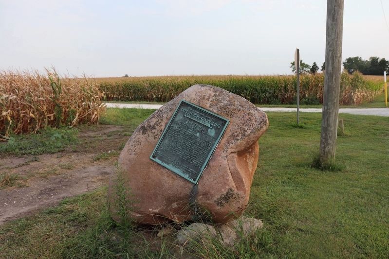
At St. Mary's Ohio on October 2, 1818, a treaty was made and concluded between Jonathan Jennings, Lewis . . . — — Map (db m71919) HM
In October 1818, Purchasing Commissioners Lewis Cass, Benjamin Parke and Governor Jonathan Jennings acquired Indian claims on the land shown on this marker. About one-third of modern Indiana, was involved in this transaction. — — Map (db m21517) HM
This lot is dedicated to the memory of
Vincent and Eileen Schwartz
lifetime residents of Fowler, Indiana
They proudly served our country during WWII Vince in the Army Eileen in the Navy Both were active members of the American Legion . . . — — Map (db m240678) WM
Side One
Standard-bred colt (sire Joe Patchen, dam Zelica) foaled 1896 Oxford, Benton County; raised by Daniel A. Messner, Jr. on this farm. A natural pacer, trained for harness racing, a very popular sport in late 1800's and early 1900's. . . . — — Map (db m8546) HM
(( Front (“A - C”) - - Side ))
In Honor of All
Civil War Veterans
of Blackford County
( Row One )
Henry B. Adams • Watson Adams • William W. Adams • David V. Addison • Philip H. Albright • Elijah H. Alexander • . . . — — Map (db m54347) WM
Blackford County's second courthouse, featuring a 165 foot high clock tower, was built on foundation stones from nearby Montpelier quarries. At a cost of $129,337.83, this Richardsonian Romanesque structure was constructed 1893-1895. Listed in . . . — — Map (db m41465) HM
(( Front Center Panel ))
To honor the men and the women of
Blackford County
who fought in Korea and Vietnam
and to the heroes who gave
their lives on land,
on the sea, and in the sky
that mankind might live in freedom
we . . . — — Map (db m54423) WM
In Memory
of the
Revolutionary Heroes
who rest in Blackford County
David Kirkpatrick • John Mills
John Saxon • John Twibell • Thomas Miles
Erected by
The Nancy Knight Chapter
Daughters of the American . . . — — Map (db m54624) HM
(( Front of Base ))
“Lest We Forget”
Those from Blackford County who
answered their Country’s call in the
World War,
Apr. 6th 1917 to Nov. 11th 1918.
“Our Boys”
(( Obverse of Base ))
When the . . . — — Map (db m54272) WM
((( Center Panel )))
Dedicated to the Honor and Sacrifice of
our men and women of Blackford County
who served our Country in World War II
——— 1941 — ★ — 1945 ———
in Honor . . . — — Map (db m54607) WM
Placed on the National Register of Historic Places June 13, 1986, by the United States Department of the Interior in cooperation with the Indiana Department of Natural Resources, Division of Historic Preservation. — — Map (db m222241) HM
In 1920, a small group of women in Hartford City founded Sigma Phi Gamma, a non-scholastic sorority dedicated to friendship and philanthropy. The sorority expanded across Indiana, the U.S., and into Canada by 1929. To fulfill its mission of service, . . . — — Map (db m231195) HM
In honor of astronaut Kevin Ford, native son of Montpelier, Indiana, Blackford County, pilot of the Space Shuttle Discovery "STS 128" — — Map (db m222232) HM
F-84 F Thunder Streak
donated to City of Montpelier
by
U. S. Air Force and the 122nd
Tactical Fighter Wing, Indiana
Air National Guard
September 12, 1970 — — Map (db m222236) WM
Forever honoring the pioneers of Montpelier and the community who built the foundation for the freedom we cherish today.
1836 - 1976 — — Map (db m222231) HM
Reserved by U.S. to Chief Francois Godfroy of the Miami Nation of Indians by treaty at St. Mary's, Ohio, 6 October 1818, 3,840 acres on Salamonie River at La Petite Prairie, Harrison Township, Blackford County; reserve lands sold 1827, 1836. — — Map (db m63825) HM
This plaque is erected in honor of the Montpelier alumni who taught in Montpelier schools
Adrian Burris Geary 1898 • Bessie Slater 1899 • Mary Dailey Black 1900 • Grace A Maddox 1903 • Charles B. Anthony 1907 • Grace Kitterman Smith 1908 • . . . — — Map (db m238632) HM
Prominent educator and statesman Herman B. Wells was born in Jamestown, Indiana. During the Great Depression, he directed research for the Indiana Bank Commission, producing state banking reforms. In 1938, Wells was elected President of Indiana . . . — — Map (db m175678) HM
Jamestown War Memorial
Dedicated to the
memory of all
Veterans of all Wars
Great is he who
lays down his life for
his Country in the name
of Freedom.
Erected by the people
in the year of Our Lord . . . — — Map (db m43762) WM
Enroute to Washington, D.C., to become 16th President of the U.S., addressed citizens of Lebanon and Boone County from rear of railroad passenger car at this place on the evening of February 11, 1861. — — Map (db m3811) HM
( Center - Engraved in Stone: )
In Memory of our
Boone County Veterans
who Bravely Served
in Our Wars.
Erected by The American Legion
Brown - Dolson Post 113
Lebanon, Ind.
( Left Bronze Plaque: ) . . . — — Map (db m21359) WM
In Memory
of Revolutionary Soldiers
Buried in
Boone County Indiana
Arthur Andrews 1753 - - 1834
John Ferguson 1759 - - 1839
William Gipson 1753 - - 1835
James Hill 1745 - - 1854
Henry Johns 1757 - - 1833
John Leap 1735 - - . . . — — Map (db m241648) WM
A progressive politician and lifelong Democrat, Ralston met the challenges posed by Indiana’s transition to a more urban and industrial state. Born 1857 in Ohio, he opened a law office in 1886 in Lebanon, where he lived until elected governor in . . . — — Map (db m175673) HM
The Boone County REMC built Indiana's first electric cooperative line to the Clark Woody farm 5 miles west of this site with funds borrowed from the Rural Electrification Administration, July 22, 1935. — — Map (db m27673) HM
Ka-wi-a-ki-un-gi Village "Place of Thorns" (Thorntown) was center of 64,000 acre Thorntown Indian Reserve. Granted to Eel River Miamis in 1818, ceded to U.S. in 1828. — — Map (db m21352) HM
Black southerners established a thriving, free community around Thorntown in Sugar Creek Township by the early 1850s. Most became farmers and some owned property, despite Indiana's constitutional prohibition of black settlement. By 1870, this . . . — — Map (db m174247) HM
Albert S. White, for whom Whitestown is named, was president of the Indianapolis & Lafayette Railroad. White was a United States senator and Representative from Indiana and a leading abolitionist. He was appointed to a select federal commission by . . . — — Map (db m175788) HM
Commemorating the historic Lafayette & Indianapolis Railroad. On May 1st, 1865, at 1:07a.m., the Lincoln Funeral Train passed through Whitestown with mourners lining the tracks in the middle of the night to pay homage to the assassinated 16th U.S. . . . — — Map (db m175790) HM
Abraham Lincoln enroute to Washington as President Elect on February ll, 1861 addressed the Citizens of Zionsville at the Railroad Depot which stood on this site. — — Map (db m8326) HM
Located in Eagle Township in Boone County, Indiana, this
intact family farmstead includes a farmhouse and related
outbuildings, and was named a Historic District on the
National Register of Historic Places by the National Park
Service in 2011.
. . . — — Map (db m231487) HM
With proceeds from the sale of 170,580 acres of Indian land granted by the Federal Government, Indiana built its first north-south road. Surveyed 1829, passable by 1834, "completed" in 1837, its cost was $242,000.00. — — Map (db m67191) HM
Site of
First Post Office, Lot No. 4, 1853
Postmaster: John W. Vaughn
First Dry Goods Store and Grocery Store, Lot No. 4, 1852
Wiley & Vaughn
First House erected
John Miller’s hous, Lot No. 1, 1852
and Boarding House
Zion . . . — — Map (db m175807) HM
Patrick H. Sullivan, 1794-1879, was the first white settler in Boone County, 1823, and built the first log cabin. In 1857, he bought this site and lived here until 1872. He served in the War of 1812. — — Map (db m67190) HM
On these grounds stood one of Zionsville’s first and finest hostelries. It was a two story frame structure, erected in Civil War days, and razed in 1938. It served as a rooming house, meeting place, and occasionally as the village social . . . — — Map (db m175824) HM
In the beautiful Eagle Creek valley of southeastern Boone County, a new town was planned on land owned by Elijah and Mary "Polly" Cross.
Convinced by Lebanon businessman William Zion, a director of the Lafayette & Indianapolis Railroad, the . . . — — Map (db m8328) HM
The Brown County Jamboree began
informally in Bean Blossom as a free
outdoor show featuring local musicians.
Gradually commercialized and
professionally promoted, the Jamboree
drew large crowds by 1941, including
attendees from other . . . — — Map (db m206706) HM
Theodore Clement Steele (1847-1926) lived and painted south of here, 1907-1926. Member of Hoosier Group of American impressionists, his landscape paintings captured picturesque panoramas characteristic of area. Property is State Historic Site; . . . — — Map (db m242256) HM
( West - Plaque )
Lest We Forget
From its inception in 1836, Brown County has given freely its sons and daughters to serve in the quest for World Peace. Its sacrifices began in 1846 with the Mexican War, and continued through the . . . — — Map (db m63223) WM
Photographer, artist, and newspaper columnist Frank Hohenberger moved to Nashville in 1917. Through his black and white, large format photographs, he documented the residents, artists, daily life, traditions, and natural beauty of Brown County. . . . — — Map (db m184584) HM
Frank P. Taggart Building / Miller’s Drug Store, circa 1873, has been entered in the National Register of Historic Places by the United States Department of Interior. — — Map (db m206745) HM
Attracted by the area’s natural beauty and its residents’ rustic lifestyles, a group of professional artists began working in Brown County by 1908. The Brown County Art Colony gained renown as its members exhibited regularly, first in the . . . — — Map (db m206708) HM
Ever since the year 1867, a public hostelry of one form or another has occupied this corner. It served the logging industry for many years & later became a gathering place for artists. In recent years it has become the cornerstone of the tourist . . . — — Map (db m206747) HM
The pump and pump house were reconstructed in 2017 courtesy of the Rotary Club of Brown County.
Prior to 1949, several pumps were in use around Nashville to provide water for families who were without a well on their property, and . . . — — Map (db m206742) HM
Cartoonist and journalist Frank McKinney "Kin" Hubbard 1868-1930) was born in Ohio. He worked for the Indianapolis News by 1891, mainly as a political caricaturist. He created Abe Martin, his popular folksy and witty cartoon character, in 1904. . . . — — Map (db m244858) HM
The name of the lodge and its cabins comes from a time when the rugged hills of Brown County were the backdrop for homespun humor.
Rustic cabins provided the first lodging at Brown County State Park. Visitors bought their groceries at a . . . — — Map (db m244859) HM
Laid out in 1828 by David Stipp. Promoted for seat of a new county to be made partly from the Great Miami Reserve, which began two mile east. The Lafayette & Muncie Road crossed the Great Michigan Road here. It was an important stage stop, mill . . . — — Map (db m42709) HM
Burlington High School Polar Cubs The Polar Cubs played basketball games in a gymnasium built here from 1928 to 1961. The Poral Cubs shared a gym with the local men’s team above the current Beck’s Pub from 1910-1928. The Polar Cubs played host . . . — — Map (db m231960) HM
To all Veterans… Men and Women who have served, will serve, and are serving this great nation
during time of war and peace fighting for our freedoms and liberties both in foreign lands and at home we acknowledge you and your families' sacrifices . . . — — Map (db m231961) WM
Side A
Camden
When the School Section, No. 16, was sold in 1832 Wm. Crooks, School Commissioner, reserved 16 acres and had a town site laid out by John Armstrong, Co. Surveyor. Col. Crooks (1787 - 1861) (War of 1812) kept the first . . . — — Map (db m42713) HM
In 1831 John Adams, Pennsylvania, built a saw mill here. In 1832 he entered land, in 1835-36 added a flouring mill. The present building was erected in 1845, restored by M. & Mrs. Claude Sheets in 1840. Boliver Village was platted around the mill in . . . — — Map (db m42694) HM
Organized June 25, 1864, the Lodge used the third floor of the Adams Mill as meeting place until autumn 1867, one of two known Masonic Lodges in Indiana to have started life in a flour mill. — — Map (db m42708) HM
When settlers first came to the County, children were taught in the home either by the parents or by a teacher hired by them. When there was a sufficient number of children in the community to justify a special building, a school district would . . . — — Map (db m217007) HM
Deer Creek High School. Deer Creek, Indiana. Washington Township of Carroll County, Indiana provided a quality education for the Deer Creek High School students and the North Central Elementary School students until closing in . . . — — Map (db m232366) HM
Fouts Soyland Farm. Influenced by experiments conducted in the 1890s by Purdue University and Indiana farmers like his father Solomon, Carroll County farmer Taylor Fouts was growing soybeans by 1904. With his brothers Noah and Finis, Fouts . . . — — Map (db m238477) HM
Marie Harris, Ellen Hostetler and Nancy Farrier, in memory of their parents John David and Ruth Marie Hilderandt Rhine
John and Ruth were both lifetime residents of Carroll County. They loved this part of Indiana and its history. In 1961 they . . . — — Map (db m163347) HM
Before You Is a Kaleidoscope of Flavors and Scents
Early settlers maintained an herb garden for four reasons:
Medicine, flavor for food, to provide scents for soap and for
fresh flowers as well as dried flowers for year-long . . . — — Map (db m163307) HM
The Bicentennial Garden was created in 2016 as a way for the Carroll
County Wabash & Erie Canal Association to celebrate the two
hundredth anniversary of the founding of the state of Indiana. With
a strong focus on blues and yellows, the . . . — — Map (db m163258) HM
Blacksmith Shop
A Blacksmith is one who works with iron at a furnace or forge where
"black” metal, heated and wrought is formed by beating and hammering
into a desired shape. A "whitesmith” worked with light metals. . . . — — Map (db m163333) HM
Broomcorn The Unique Plant
Broomcorn consists of a tall stately stalk (14-
18 feet) with a brush at the top and no ears.
Broomcorn is a member of the sorghum
family. The only part of the broomcorn that
is used is the brush. The process of . . . — — Map (db m163330) HM
Building A Home
Felhng 40 or so logs in the forest 15-26 inches in diameter for the sides and ends
the settler had only to add three or four shorter ones for the gables. Each end was
notched to both secure one log with the next and to . . . — — Map (db m163318) HM
A Canal Boat That Will Not Float?
The Playground Boat is most like the freight boat in the
above illustration. But this one has been changed to make it
fun for young people's imagination. It won't float in the Canal
but it will carry . . . — — Map (db m163259) HM
A Variety of Bridges Solve Many Problems
When the Wabash & Erie Canal cut through an Indiana
wilderness, its 40 feet wide channel of water created
challenges for those who wished to cross from one side to
the other. Pedestrians, . . . — — Map (db m163312) HM
Animals For Towing Canal Boats
During a time before motorized power, canal boats were
towed by horses or mules using heavy ropes of 100 feet or
more. On the Wabash & Erie Canal towpath, one animal or
more hitched in tandem, were led by a . . . — — Map (db m163350) HM
Creating a Life in the Wilderness
The Canal Village is comprised of buildings constructed
during the canal era. The water in back of you is the only
remaining accessible and recreational watered segment of
the Wabash & Erie Canal in . . . — — Map (db m163315) HM
90 lots platted in 1836 on both sides of Wabash - Erie Canal lock.
A Post office in 1838 - 39. The lock passed canal boats into the river on the pool of the Great Dam at Pittsburg five miles below. The mules carried the towline across the . . . — — Map (db m35413) HM
(Bronze Plaque - East Side):
Erected by Carroll County Indiana
In Memory of her Soldiers and Sailors
( Battles Listed on Upper Shaft ):
South Side -- Shiloh / Stone River
East Side -- Antietam / Gettysburg
North Side -- . . . — — Map (db m20798) WM
The Wabash & Erie Canal ran 468 miles from Toledo, Ohio to Evansville, Indiana, thus providing
access to New York and the East Coast via the Erie Canal and access to New Orleans and the Gulf of
Mexico via the Ohio and Mississippi . . . — — Map (db m163354) HM
Surveying: A Canal could not proceed along the upper Wabash until title to Miami and Potawatomi lands were transferred to the State. At the 1826 Treaty of Paradise
Springs the title was conveyed.
A corps of U. S. engineers was sent to Fort . . . — — Map (db m163309) HM
Named and platted in 1828 by Gen. Samuel Milroy, on 100 acres donated by Wm. Wilson for the seat of Carroll Co., named for Charles Carroll, last surviving signer of the Declaration of Independence. Henry Robinson was the first settler. . . . — — Map (db m1154) HM
The City Beautiful. Platted in 1828 by General Samuel Milroy
on land donated as the county seat by William Wilson, was an
industrial center during boom days of the Indiana Canal era. — — Map (db m161449) HM
Delphi City Hall
has been placed on the
National Register
of Historic Places
by the United States
Department of the Interior
1865 — — Map (db m159804) HM
Delphi Courthouse Square Historic District
has been placed on the
National Register
of
Historic Places
by the United States
Department of the Interior
— — Map (db m161448) HM
How Would You Like To Sit On A Log Bench All Day?
The structure before you depicts a one room log school house of 1834. If you
were between the ages of 5 and 21 in rural Indiana in the 1830s you would have
attended a one room school very . . . — — Map (db m163328) HM
Kitchen Vegetable Garden
As European settlers arrived via the canal and by wagon this region was still
a wilderness in the 1830s. It was essential for their survival to bring seeds and
root cuttings to start their gardens in this forest . . . — — Map (db m163319) HM
The Wabash & Erie Canal conference
and interpretive center before you
combines historic facades from 1850s
downtown Delphi.
J. H. Stewart Drugs, Callahan Boots and Lathrope
Bakery fill the middle of the block in this 1850s . . . — — Map (db m163275) HM
Logs were part of the railroad trestle at Pittsburgh removed in the 1930s. They became a lakeside cottage on Freeman Lake known as "The Oaks". Logs were donated by the families of: Grantham, Israel and Goyer in 2019 — — Map (db m163338) HM
Lewis T. Jones, a blacksmith, and his
wife Manerva arrived in Carroll County
in 1850, They disembarked from the Wabash
& Erie Canal at Lockport and two years later
settled in Jefferson Township. One of their
eight children who came with them . . . — — Map (db m163260) HM
A New Spiritual Anchor at Canal Park
During the 1830s and 40s the Canal
transformed this region into a new cultural
and economic entity. This new era propelled
a now confident Delphi into the mid and late
19th century. It was now ready . . . — — Map (db m163314) HM
Weaving for the Canal Homestead
If the woodsman's axe and the long rifle were first
in importance to the pioneer, the spinning wheel
and the loom would rank second. In colonial
America many families wove cloth for clothing.
bedding, . . . — — Map (db m163324) HM
Carrollton on the Wabash
The Mentzer Tavern was built in 1840 at the north end of the Carrollton Towing Path Bridge that crossed the Wabash River. Erected by Ignatius Mentzer and George Friday, it opened as a cooper shop where barrels were made . . . — — Map (db m35438) HM
Carroll County Wabash & Erie Canal Inc.
wishes to convey its appreciation for the
contribution and vision of our friend and
neighbor, Duke Energy Foundation. The
completion of the Mule Barn creates a
major historic site for Canal Park and . . . — — Map (db m163351) HM
Prairie plants like those featured here grew along the canal's towpath.
Look for the featured plants as you walk the towpath.
Can You Picture It?
The canal landscape has changed over time.
The Canal Width. The canal . . . — — Map (db m163261) HM
In October 1818, Purchasing Commissioners Lewis Cass, Benjamin Parke and Governor Johnathan Jennings acquired Indian claims on the land shown on this marker. About one-third of modern Indiana was involved in this transaction. — — Map (db m1152) HM
Surrounded By Immense Water Power
Delphi Paper Mill: George Robertson came from Scotland and established a
small paper mill here in 1845. It was powered by Canal water leased by the
State and parallel to the Wabash River. Enoch Rinehart . . . — — Map (db m163361) HM
Before Canals
The Wabash River illustrates how wilderness streams
served as highways beginning with the early French
explorers. Before the canal, rivers brought settlers
to new adventures and opportunities cutting through
unknown . . . — — Map (db m163279) HM
Samuel Milroy was born 1780 in Pennsylvania and is a "Child of the American Revolution". His father served as a Patriot in the war for Independence. In 1826, at the age of 46, Samuel moved to Carroll County and built a cabin, which was located on . . . — — Map (db m213303) HM
James H. Johnson was the first postmaster. I don't know if he was the only one, but I
believe he is the only one that is listed in Baker's Postal History of Indiana, 1976 (which
I've consulted at the Logansport Public Library and will look at . . . — — Map (db m163342) HM
3975 entries matched your criteria. Entries 201 through 300 are listed above. ⊲ Previous 100 — Next 100 ⊳