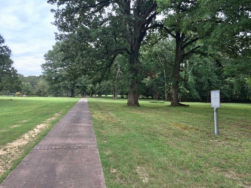
Near Old Post Road, 0.8 miles south of State Route 169.
When Napoleon I became Emperor of France in 1799, he envisioned the establishment of a vast "French Empire in America". He began in 1800 when he won control of Louisiana from Spain.
Constant threat of war with England soon forced him to . . . — — Map (db m108650) HM
Near Old Post Road, 0.8 miles south of State Route 169.
The land passed from France to the United States in 1803 with the Louisiana Purchase. Arkansas then became a territory on March 2, 1819: the Post of Arkansas was designated its capital.
The Territorial Secretary Robert Crittendon, acting in . . . — — Map (db m108651) HM
The United States and several European powers vied for control of the lower Mississippi Valley. Arkansas Post was the key to that control.
In 1541 Hernando de Soto explored the territory which is now Arkansas. Sieur de La Salle further . . . — — Map (db m108647) HM
Near Old Post Road, 0.7 miles south of State Route 169.
The Regent of France authorized a settlement at the Post of Arkansas in 1722. These early settlers were on good terms with the Quapaw Indians who "exhibited a great spirit of friendliness and hospitality toward the French". Cotton was introduced . . . — — Map (db m108648) HM
On Old Post Road at State Route 169, on the right when traveling south on Old Post Road.
Here on the Grand Prairie you tread on
soil laid down over the centuries as the
mighty Mississippi and Arkansas Rivers
brought down their precious cargoes of
silt from the northern uplands.
The footprints of many were pressed into
this . . . — — Map (db m108486) HM
Near Old Post Road, 0.7 miles south of State Route 169.
In 1763 the Post of Arkansas became
Spanish territory when, by the Treaty of
Paris, the French King ceded Louisiana
to Spain. For several years after the
transfer, French officers and soldiers
remained at Arkansas Post.
In 1771 the . . . — — Map (db m108551) HM
Near Old Post Road, 0.8 miles south of State Route 169.
Spanish Explorer Hernan de Soto passed this way in 1542. Nearly
130 years later Father Marquette, the French missionary and explorer,
reached the nearby mouth of the Arkansas. In 1682 Robert Cavelier,
Sieur de la Salle, claimed this territory for . . . — — Map (db m108407) HM
Near Old Post Road, 0.8 miles south of State Route 169.
Arkansas Post was not a single fort and trading center. From
1686 until 1863 there were no fewer than seven posts on the
Arkansas River between here and the Missişsippi. The flags
of five nations flew over them.
The 1686 post . . . — — Map (db m108464) HM
On State Highway 276, 0.2 miles east of Riley Lane (State Highway 276 Spur), on the right when traveling east.
Bayou Meto Cemetery was established in 1876 after Allen "Uncle Gip" Gibson donated one acre of land to the local community for use as a cemetery. Gibson, a former Union soldier, was an early settler of the Bayou Meto Community. A skilled . . . — — Map (db m178029) HM
On State Highway 276, 0.1 miles east of Riley Lane (Highway 276 Spur), on the left when traveling east.
Thirteen charter members founded Mount Zion Methodist Episcopal Church South in 1881 and constructed a small, wooden church building in the southwest corner of the Bayou Meto Cemetery. The structure contained handmade pews, oil lamps, and
a wood . . . — — Map (db m178026) HM
On Arkansas Route 153, on the right when traveling north.
Named for resident William Finley Crockett, son of frontiersman Davy Crockett, this community was once a flourishing river port during the second half of the 19th century and into the early years of the 20th century. Steamboats loaded with cotton, . . . — — Map (db m201389) HM
On Broadway Avenue at Main Street, on the right when traveling east on Broadway Avenue.
J. Deane and Son was a hardware store that
served this area beginning in 1890. During the
steamboat era, St. Charles was a thriving river
boat community and this was its largest retail
outlet.
Founded by Joe Deane, who arrived here . . . — — Map (db m108563) HM
On 321 South Main Street near East 4th Street, on the left when traveling north.
Rev. Adam Buerkle brought a
colony of German Lutherans to
this area in 1878. In 1880 he named the post office
Stuttgart in honor of his native city. Stuttgart was
platted in 1884 and incorporated in 1889. Col. Bob Crockett,
a grandson of Davy . . . — — Map (db m191876) HM
On South Main Street south of Fourth Street, on the right when traveling south.
The citzens at this time paused and reflected on those pioneers who with sweat and tears gave this community its heritage and traditions. This memorial recognizes the dedication and efforts of all those who made this centennial a year to remember . . . — — Map (db m167630) HM
On Arkansas Route 5 at Wolf Street on State Route 5.
In 1829, when Arkansas was a territory of the United States, Jacob Wolf
donated the land and built this structure as the first permanent courthouse for
Izard County. Great competition existed among frontier settlers to secure the "seat of justice . . . — — Map (db m170827) HM
Courthouse
Jacob Welt was serving as a legislator in the Arkansas Territorial General
Assembly in 1829 when he wrote the legislation to create the structure you see as the country's first permanent courthouse. In the legislation he noted . . . — — Map (db m171518) HM
Wolf Family Home
Even after the county seat moved, this house bustled with activity.
Arkansas became a state in 1836, and settlers followed the White River
hundreds of miles into the interior of north Arkansas. Thousands of these
settlers . . . — — Map (db m171528) HM
On Hudson Road (U.S. 62) south of Rose Street, on the right when traveling north.
800 AD • Trace of the Rock People
1808 • Osage Boundary
1815 • Lawrence County
1827-28 • Lovely County
1838 • Trail of Tears
1840 • Trott's Stand
1858 • Old Wire Road
1858-61 • Butterfield Stage Route
1861 • Troop Trails
1862 • . . . — — Map (db m62485) HM
On Lancashire Boulevard (State Highway 340) at Town Center, on the right when traveling east on Lancashire Boulevard.
So called because steps were dug into the hill so settlers could reach the top.
Once existed two churches, a school and a cemetery. Area named and cemetery started about 1867. — — Map (db m90572) HM
On North Main Street at East Central Avenue (State Highway 72), on the right when traveling north on North Main Street.
The Osage Nation first used the area now known as Bentonville for their hunting grounds. The Osage would leave their settlements to hunt in present day Benton County for months at a time before returning to their families. Settlers first . . . — — Map (db m237837) HM
On Jackson Place at McClure Avenue (County Road 923), on the left when traveling north on Jackson Place.
Started as Robinson's Cross Roads east of here on the historic Old Wire Road. It was on the Main Line of the Butterfield Stage Route. Its name changed to Bloomington in 1885, nicknamed “Mudtown.”
After completion of the railroad in 1881, city . . . — — Map (db m224828) HM
On Jackson Place at McClure Avenue (Route 923), on the left when traveling north on Jackson Place.
Mar. 20, 1839 Trail of Tears Mar. 8, 1847 Robinson's Crossroads First Post Office Feb. 5, 1858 Name changed to Bloomington Sept. 18, 1858 Butterfield Stage Stop to 1861 Dec. 9, 1862 Civil War Skirmishes Aug. 24, 1864 "Camp Mudtown" Mar. 9, 1881 . . . — — Map (db m33712) HM
On Jackson Place at McClure Avenue (Route 923), on the right when traveling north on Jackson Place.
This marker, set on the Butterfield Stagecoach Road, is placed near the spot where the trail crossed the east-west road between Huntsville and the Robinson settlement in western Benton County. John Robinson, a Revolutionary soldier, settled here . . . — — Map (db m68781) HM
On South Old Wire Road (County Road 83) 0.2 miles north of Dogwood Drive/Cross Hollow Road (County Road 1189), on the left when traveling north.
This post office was established in 1843. Nov. 29, 1861, Gen. Ben McCulloch moved his army into winter quarters here. Numerous, large, two-room, plank barracks were built in two rows facing each other, extending eastward more than a mile. Ten or . . . — — Map (db m68788) HM
On South Old Wire Road (County Road 83) 0.2 miles north of Dogwood Drive/Cross Hollows Road (County Road 1189), on the left when traveling north.
This site was donated to the Benton County Historical Society by Scarlett Biggs Wilson and Lara Wilson Rosenblum in honor of their parents/grandparents, Guy and Nell Biggs, early pioneers of the Cross Hollows area. Cross Hollows is recognized for . . . — — Map (db m68789) HM
On State Highway 12, 0.1 miles west of Van Winkle Place Road, on the left when traveling west.
Peter Van Winkle’s saw mill cut lumber for Confederate soldiers’ winter quarters at Cross Hollow and Oxford Bend in early 1862. Gen. Earl Van Dorn’s Confederates used the mill to grind corn after their March 1862 defeat at Pea Ridge, and wounded men . . . — — Map (db m90738) HM
On High Sky Inn Road (State Highway 303) 0.2 miles west of Bettis Hill Road, on the right when traveling north.
Sylvanus Blackburn came to the War Eagle in 1832. By 1838 he had a saw mill, a grist mill, and a house. Peter Van Winkle came about 1850. By 1860, this was a thriving crossroads. March 8, 1862, Generals Van Dorn and Price, retreating from the . . . — — Map (db m19492) HM
On North Main Street at West Rush Avenue, on the right when traveling south on North Main Street.
In memory of 140 men, women and children N.W. Arkansas emigrants to California. In 1857 under leadership of Alexander Fancher (Piney Alex) left from Caravan Spring 4 miles south of here around May 1st - Camped at Mountain Meadows, Utah in early . . . — — Map (db m143889) HM
On South Main Street (U.S. 62) just south of East Church Avenue, on the right when traveling north. Reported missing.
The first court house in Carroll County. Built about 1825, was constructed of logs and stood on the site of Carrollton. A second court house was built of brick, but burned in 1859. Another court house was built of brick on the same site after the . . . — — Map (db m170746) HM
On Main Street (State Highway 23) at Spring Street, on the right when traveling east on Main Street.
Professor KALKLOSCH’s Guidebook, published in 1880, states: “The first street of the town was surveyed down the gulch below the spring. A broad avenue connects this street with the famous EUREKA BASIN SPRING. It being the first street it . . . — — Map (db m79755) HM
On Spring Street west of Hillside Avenue, on the right when traveling west.
The buildings, the bluffs, the spring and The Boulevard all make this a special place in Eureka Springs which has kept a peaceful beauty of earlier times.
The front of the McLaughlin Block has changed little since it was built in 1900 to . . . — — Map (db m80138) HM
On Prospect Avenue at Linwood Avenue, on the left when traveling east on Prospect Avenue.
Resort home built 1899 by William Henry Reid of Chicago. Architect Theodore C. Link of St. Louis. Design reflects simplicity favored at end of Victorian era. Upper floors are wood with verandas on four sides. Lower floor is Beaver Limestone. In . . . — — Map (db m80118) HM
On Main Street (State Highway 23) at Spring Street, on the right when traveling east on Main Street.
Richard H. James and Charles S. Beck built the three story brick and limestone Beck and James Building in the year 1888 to house a clothing and apparel store.
F. H. and Avarilla James and their family resided in the upper rooms and C. S. Beck . . . — — Map (db m79738) HM
On Spring Street at Hillside Avenue, on the right when traveling west on Spring Street.
Crescent Spring was revered for its healing waters almost as much as the basin, the legendary Indian Healing Spring. Situated beside the Wagon Road on a hillside with a rocky outcropping described as "crescent" shaped, the spring was soon given . . . — — Map (db m80135) HM
On Spring Street, on the right when traveling south.
Eastview is situated adjacent to Harding Spring on a lot originally registered by Absalom M. Thomas after the town site survey of 1879. John E. and Bell Perrin purchased the lot and residence in October, 1881, then sold to David R. and Harriett . . . — — Map (db m80140) HM
On Spring Street at Pine Street, on the right when traveling north on Spring Street.
The neighborhood above the current First Baptist Church burned in the Great Fire of 1883, the first of four Great Fires which destroyed most of the town's early wooden structures. New commercial buildings were built of more fire-resistant . . . — — Map (db m131739) HM
On Spring Street, 0.2 miles east of Polk Street, on the right when traveling east.
The words "esto perpetua" emblazoned upon a stone above the entrance to Grotto Spring declare the prevailing belief that these healing waters would flow forth forever. Early townspeople discovered the spring under an overhanging rock ledge, a . . . — — Map (db m80121) HM
On Spring Street at Howell Avenue, on the right when traveling south on Spring Street.
Named for J. Emmett Harding, a photographer who began the tradition of making photographs of people in front of the spring as souvenirs. He built a small dwelling near the spring in the summer of 1879.
In 1879, the spring was accessed by a . . . — — Map (db m80151) HM
On Flint Street at Steele Street, on the left when traveling south on Flint Street.
The site of this spring was outside the area included in the 1879 survey. Known as East Mountain, this area was crowded with wood structures by 1885. The spring, which flowed from a small cave lined with projections of onyx stone, was already . . . — — Map (db m80152) HM
On Main Street (State Highway 23) at Flint Street, on the right when traveling north on Main Street.
"It being the first street in town... it was named Main Street. But owing to its low elevation and the law of gravitation, the water would find a level in the street, and as the immense travel created an abundance of mud, the street was nicknamed . . . — — Map (db m80153) HM
On Spring Street east of Pine Street, on the left when traveling east.
This spring derived its name from early townspeople who declared the water to have a pleasant, sweet taste. The spring was originally located in the deep ravine below the present site. A long wooden stairway led from the spring to the narrow . . . — — Map (db m80115) HM
On Spring Street at Pine Street, on the left when traveling east on Spring Street.
Sweet Spring Hotel
The Sweet Spring Hotel was established about 1887 at the corner of Pine Street and Spring, then known as Rice Street, with A.S. Capps as proprietor. The spacious three-story frame structure was painted white with dark . . . — — Map (db m80112) HM
On Main Street at Spring Street (State Highway 23), on the right when traveling north on Main Street.
Basin Bath House was established 1879 adjacent to Basin Spring by Dr. Alvah Jackson's son, Thomas. John S. Tibbs succeeded Jackson about 1880, operated bath house and Eureka Water Shipping Company. Building was destroyed by Great Fire of 1888, . . . — — Map (db m59969) HM
On Main Street (State Highway 23) north of Benton Street, on the left when traveling south.
These two large limestone public buildings anchor this part of downtown Eureka Springs. They span the deep ravine cut by Leatherwood Creek which flows in a tunnel beneath all the buildings on this entire part of Main Street.
[Photo 1.]
This . . . — — Map (db m59964) HM
On Spring Street north of Main Street (Arkansas Highway 23), on the left when traveling north.
1884 - Cutter's Guide
The Eureka Springs of Arkansas
The hotels and boarding houses of Eureka Springs are numerous. The Perry House is the only real first-class hotel in the city; and we say this with no disparagement of the . . . — — Map (db m79733) HM
On Spring Street, on the left when traveling north.
Eureka Springs claims an estimated fifty-six miles of stone walls. Skilled stonemasons constructed most of the walls between 1885 and 1910. The limestone used was sometimes quarried on site but the majority was transported to the town site by horse . . . — — Map (db m63299) HM
On Main Street (State Highway 23) 0.1 miles north of Magnetic Drive, on the left when traveling north.
First by horseback, wagons or on foot, invalids from all over this region flocked to Eureka Springs in 1879 to seek cures from the miraculous healing springs. But soon there were easier ways to arrive - stagecoaches, then trains. This laid a base . . . — — Map (db m80211) HM
On Grand Lake Loop (Arkansas Route 8) at Cariola Road when traveling south on Grand Lake Loop.
From the close of
the Civil War to
the beginning of the twentieth century, Cariola
Landing at Grand Lake was one of the largest
shipping points on the Mississippi River south
of Helena, Arkansas. Cotton from a large area
west and south of . . . — — Map (db m159402) HM
On East Lee Street, 0.5 miles south of South Main Street, on the right when traveling south.
Site of the Eudora settlement's first business district. After a ferry across Bayou Macon was established in 1846, Cariola Landing was accessible to Arkansas Communities to the west and Louisiana towns to the south. Merchants built stores along the . . . — — Map (db m158053) HM
On Gum Street, 0.5 miles south of South Archer Street (State Highway 159).
Site of Mount Carmel, the first organized community in the Eudora area. John Booth donated land for a Presbyterian Church and a seminary for girls. Rev. Benjamin Shaw was director and pastor. Booth and Shaw are buried in Mount Carmel Cemetery. The . . . — — Map (db m158466) HM
Near Main Street at North Lakeshore Drive (Arkansas Highway 144).
The county seat of Chicot County was located at Columbia in 1823, where it remained until 1855. The county took its name from Point Chicot, on the Mississippi. — — Map (db m89773) HM
On Highway 257 near Bluebird Lane, on the right when traveling south.
The town of Columbia was located on the Mississippi River about two miles east of this point. In 1833 the Chicot County seat was moved to Columbia from Villemont due to river bank erosion. Columbia became a thriving port and the location of a . . . — — Map (db m167545) HM
On South Lakeshore Drive at St. Marys Street (Arkansas Highway 144), on the right when traveling south on South Lakeshore Drive.
In 1895 Austin Corbin, a New York banker and land developer, working with immigration officials brought 100 families from north central Italy to grow cotton at Sunnyside, a plantation located between the Mississippi River and Lake Chicot. These . . . — — Map (db m89774) HM
Since Crowley's Ridge provided the only natural route for north-south travel across the lowlands of northeastern Arkansas, an Indian trail and later a military road crossed the river here. About 1840 Abraham Seitz established a ferry which was later . . . — — Map (db m4912) HM
On Arkansas Route 8 north of Banks Road, on the left when traveling north.
The New Edinburg Commercial Historic District,
located along the north and south sides of Highway 8,
was added to the National Register of Historic Places
on September 4, 2001 as a representative collection
of Craftsman style architecture . . . — — Map (db m170749) HM
On Arkansas Route 97 at Arkansas Route 8, on the left when traveling north on State Route 97.
So many horses and soldiers were killed that Salty Branch ran red with blood.
In 1864, Camden was a large town on the Ouachita River, as was Pine Bluff on the Arkansas River. Moro Bay, to the south, was the largest cotton shipping point . . . — — Map (db m121330) HM
On County Road 11E at County Road 25, on the right when traveling west on County Road 11E.
One of the very oldest settlements of this county. Here in 1840–1850 settled the Bakers, Barnetts, Booths, Couches, Deeses, Dixons, Garretts, McDonalds, McWilliams, and other pioneer families Near this point Harvey Crowley Couch, Arkansas . . . — — Map (db m121240) HM
On U.S. 371 at East Columbia Road (County Road 60), on the right when traveling north on U.S. 371.
One of the oldest settlements in Columbia County. Here Colonel John Dockery had his plantation and home. Here T.P. Dockery, who became a general in the War Between the States, was born and reared. The Caddo Indian Trail from Camden on the Ouachita . . . — — Map (db m121136) HM
Near Petit Jean Mountain Road, on the right when traveling west.
This cabin was built in 1845 by John Walker, the second white settler on Petit Jean Mt. In 1854 it became the home of Owen & Jane West, a young couple who reared a family of 9 children, 5 of whom were born in this cabin without medical aid. . . . — — Map (db m233677) HM
On East Railroad Avenue west of South Moose Street, on the right when traveling west.
Lewisburg A trading post and steamboat landing was founded near here in 1825 by Major William Lewis, his son Stephen D. Lewis and Dr. Nimrod Manifee. The location gave them land and river access. A town grew up around the trading post and . . . — — Map (db m237068) HM
William Cummings Stout
(1824-1886)
In 1849, William Cummings Stout
was the first Arkansan ordained as
a priest of the Episcopal Church.
In 1855, he and his wife purchased
5000 acres spanning both sides of
the Arkansas River beginning . . . — — Map (db m233667) HM
As you explore these unique structures around Petit Jean State Park,
you will find that nature and history are strongly connected here.
Rock House Cave - Explore this sandstone
bluff shelter and look for ancient Native
American . . . — — Map (db m233679) HM
Near North 3rd Street, 0.1 miles Knox Street, on the right when traveling south.
There is no doubt that other structures,
demolished at some point in the family's history,
stood on the Drennen-Scott property.
Like many wealthy 19th-century households, this one had privies, a well, smokehouse, carriage house, . . . — — Map (db m120515) HM
Near North 3rd Street, 0.1 miles south of Knox Street, on the right when traveling south.
From the front of his home, John Drennen could overlook the bustling port town of Van Buren, including the wharf originally known as Phillips Landing.
Until after the Civil War, the Arkansas River and the steamboats that plied its . . . — — Map (db m120427) HM
On Main Street at South 3rd Street, on the right when traveling east on Main Street.
The Butterfield stage route
between Saint Louis and San
Francisco passed through the
main street of Van Buren,
Arkansas and crossed the
river at this point.
— — Map (db m96457) HM
On Main Street at Fayetteville Road, on the right when traveling west on Main Street.
By a natural turn in the Arkansas River, Van Buren began at
the water's edge in 1818, straight down this hill. So, the first
muddy trail from the river came directly and in directly to this
spot - and became the hub of activity for Van Buren and . . . — — Map (db m243972) HM
Near North 3rd Street, 0.1 miles south of Knox Street, on the right when traveling south.
John Drennen made profitable choices during his diverse professional life as merchant, bank trustee, plantation owner, and Indian agent.
He linked his future to the fledgling town of Van Buren, and built his family home here, . . . — — Map (db m120426) HM
On Old Highway 64 (Business Highway 64) 0.1 miles east of Main Street (State Route 50), on the right when traveling east.
Named for Adolphus Fountain
Crawford
Born Aug. 15, 1848
Died Feb. 21, 1876
Confederate soldier of Arkansas,
he fought under Gen. Price. — — Map (db m116177) HM
On Dacus Road at Wheeler Road, on the left when traveling west on Dacus Road.
An old river town, once located on the banks of the Mississippi River, deriving its name from Indian mounds. Federal troops burned it January 15, 1863. — — Map (db m221342) HM
On State Highway 184 at U.S. 64 on State Highway 184.
Welcome to Northeast Arkansas Pick up your Discovery our guide in the part visitor for center.
From pre-history to today, people have come here for a variety of reasons. Settlers found a state rich in wildlife and wilderness. Ancient . . . — — Map (db m232112) HM
On State Highway 184, 0.2 miles U.S. 64, on the left when traveling north.
The Parkin
archeological site was
preserved better than
most because it was
reoccupied during most of the 20th century. The residents who lived on the ancient
village site.
in the 1900s came to
call their neighborhood
Sawdust Hill or . . . — — Map (db m231817) HM
Near State Highway 184, 0.6 miles north of U.S. 64, on the left when traveling north.
As the Northern Ohio Cooperage and Lumber
Company expanded, so did the need for housing and
services for its workers. Out of this came the Sawdust
Hill community. At its peak, over 60 structures,
including shotgun-style houses, a Baptist church, . . . — — Map (db m221309) HM
On Arkansas Route 9 north of County Road 409, on the right when traveling north.
Tulip was settled in 1838 by Moses Overton. Making it the oldest community in Dallas County. Prominent settlers were Tyre H. Brown, Gen. Nathaniel G. Smith, Col. Maurice Smith and Judge Willis L. Somervell. Tulip missed being the capitol of Arkansas . . . — — Map (db m121307) HM
On North 2nd Street just north of Oak Street, on the left when traveling north.
The first school in McGehee was started about 1903 in a one room frame building at this location, with Miss Puntney as teacher. In 1905, in this building Reverend J. L. Cannon organized the McGehee First Methodist Episcopal Church. There were ten . . . — — Map (db m229500) HM
Near South Main Street (State Highway 83) south of East Shelton Avenue, on the right when traveling south.
Drew County, named for Governor Thomas S. Drew, was organized in 1845 and Monticello was laid out in 1849 as the county seat. Many pioneer families whose sons and daughters became prominent in the affairs of State and Nation lived here. — — Map (db m85085) HM
Near Locust Avenue at Main Street, on the right when traveling south.
The first court house in Faulkner County was erected in 1873 on this site, the town of Conway then being known as Conway Station, on the Little Rock and Ft. Smith Railroad. The county was named for “Sandy” Faulkner of “Arkansas Traveler” fame. — — Map (db m229576) HM
Near U.S. 63 at Main Street (State Route 9), on the right when traveling north.
How has the spring helped the development of Mammoth Spring? The constant flow of water provided a reliable source of power as early as 1835, when a grist mill was located on the banks of the river. As the city flourished, the dam was . . . — — Map (db m192165) HM
Many small towns once existed in the area now covered by Lake Ouachita. Settlers first came to the upper Ouachita River valley in the decades prior to the Civil War to establish homes, farms and businesses, creating communities such as Cedar Glades . . . — — Map (db m108929) HM
On Spring Street just east of Post Office Court, on the right when traveling east.
Near this spot around the year 1790 stood the first hotel and bath house built in the Hot Springs Territory. To mark the site of the first permanent citizen, the host of this tavern, JOHN PERCIFUL, reputed to have been a revolutionary soldier. This . . . — — Map (db m102954) HM
On Whittington Ave. at Pine Street, on the right when traveling east on Whittington Ave..
Front of Obelisk
Born in Boston, Mass., came to Arkansas in 1826 to be printer for the Arkansas Gazette. In 1882 he moved to Hot Springs and in a two room log cabin established a general store, post office and lending library. He served as . . . — — Map (db m116351) HM
On Mote Street at Hollywood Street on Mote Street.
Presented by Arkansas Col. John Washington Chapter, National Society Colonial Dames, XVII Century, honoring War Veterans, Early Pioneers, 1998 — — Map (db m61770) HM WM
Near Central Avenue (Arkansas Route 7) south of Whittington Avenue, on the right when traveling south.
The first White man to settle
near the hot springs was
Emmanuel Prudhomme of
Louisiana, who came in 1807
for reasons of his health. He
bathed in the springs and lived
in the temporary primitive
cabins that had been built
prior to his arrival. — — Map (db m211097) HM
Near Central Avenue (Arkansas Route 7) south of Whittington Avenue, on the right when traveling south.
The arrival of Josiah and
Nancy Mellard in 1820 marked
the beginning of the development
of the village of Hot Springs
into a resort. They built a
double log cabin and operated
their quarters as a hotel. — — Map (db m211117) HM
The Caddo, Quapaw, and Choctaw tribes lived in or visited the area during the 1700s and 1800s. This edifice pays homage to their lasting influence. The owners named the bathhouse for the Quapaw Indians, and incorporated an Indian head design over . . . — — Map (db m61795) HM
On Conway Street east of Jay Street, on the right when traveling east.
In 1831 James Black, a silversmith, made for Col. James Bowie the original Bowie Knife. Black made the knife, but it was Bowie who made it famous. This shop was reconstructed in 1960 by the Pioneer Washington Restoration Foundation Inc. with funds . . . — — Map (db m245401) HM
On Franklin Street east of Arkansas Highway 278, on the left when traveling west.
The Washington Post Office is the oldest continuous postal facility in Arkansas, having been established as Hempstead Courthouse Post Office, Arkansas Territory, February 23, 1820. This building provided by the Pioneer Washington Foundation -- . . . — — Map (db m244819) HM
On Midway Road (County Road 15) south of Jim Bray Drive (County Highway 628), on the right when traveling north.
Military Road
The Military Road, following part of the route of the old Southwest Trail, passed through the heart of Hot Spring County and the Midway community. Now known as Midway Road, the primitive pathway served as a major thoroughfare . . . — — Map (db m178623) HM
On U.S. 278 at State Route 26, on the left when traveling north on U.S. 278.
Near this spot in 1837 Robert Messer built the first house in Center Point. A few years later John Russey opened the first store. Center Point acquired its name and post office in 1848, and became an incorporated town in 1859.
Held by the . . . — — Map (db m121163) HM
Near Sidney Street south of Virginia Drive, on the left when traveling south.
Col. Magness, 1796-1871, legendary wealthiest man of Independence County before the Civil War, emigrated from Tennessee with his father, Johnathan Magness, a North Carolinian, when Arkansas was a part of Missouri Territory. Col. Magness, a prominent . . . — — Map (db m221205) HM
On Walden Road north of White Drive (Arkansas Route 25), on the left when traveling north.
Down this road came the settlers who settled Arkansas and the southwest.
What once began as an Indian footpath became a major route of migration for settlers into the Arkansas Territory by 1819.
The trail bypassed the swamps of eastern . . . — — Map (db m221061) HM
On West Hopewell Road at State Route 122, on the left when traveling west on West Hopewell Road.
In 1835, the Hopewell Cumberland Presbyterian Church was established in a one-room log structure adjacent to the Hopewell cemetery. A community arose with many businesses including blacksmith shops, general stores, gristmill, cotton gin, barber . . . — — Map (db m206934) HM
On Walden Road north of White Drive (Arkansas Route 25), on the left when traveling north.
David Hogan brought his family to Walnut
Grove from North Carolina in 1830. He was
buried in 1840 in this cemetery. Three of
his children are buried here; Charlotte,
wife of J.N. Churchill, for whom the
town of Charlotte is named, lies . . . — — Map (db m221078) HM
On Arkansas Route 932 at Main Street (Arkansas Route 14), on the left when traveling north on State Route 932.
When the white man came into the White River
valley, Oil Trough Bottom was covered with a
dense canebrake inhabited by bear. Early
hunters rendered the bear oil and stored it
in troughs made from hollowed out tree trunks.
Use of these troughs . . . — — Map (db m221215) HM
Near Avenue Street at Adams, on the right when traveling east.
Thomas Todd Tunstall laid out the town of Jacksonport in the mid 1830s. He built a hotel and several businesses along the river front. By 1840, several buildings had been added. The town grew, and was incorporated on December 17, 1852.
In 1853 . . . — — Map (db m221243) HM
On Avenue Street, 0.1 miles west of Adams, on the left when traveling north.
In the late 1700s this area became a trade center due to its location on the White River near the mouth of the Black River. In 1833, Thomas Todd Tunstall, piloted one of the first steamboats to venture up the White River. Shortly thereafter he . . . — — Map (db m221246) HM
On Avenue Street west of Adams, on the right when traveling west.
Jacksonport's unique location at the meeting of the Black and White Rivers shaped its history and natural resources. Founded as a river port town in the mid-19th century, it thrived on the steamboat trade. This traffic made the town a center of . . . — — Map (db m221244) HM
On West Barraque Street at North Pine Street, on the right when traveling west on West Barraque Street.
This street was named for Antoine Barraque (1773-1858), native of France, soldier of Napoleon, and one of this area's earliest settlers. Founder of New Gascony in this county, he was a man of property and Indian sub-agent. Trusted and liked by the . . . — — Map (db m30577) HM
214 entries matched your criteria. The first 100 are listed above. Next 100 ⊳