A founder of Columbia, Trabue built original house (SW corner of this structure) ca. 1823. He served as trustee, sheriff, and justice of peace; operated grist mill, inn and retail store. Here Trabue wrote memoirs, 1827, of pioneer era, which . . . — — Map (db m83406) HM
Girlhood home of Jane Lampton (1803-1891). Wife of John Marshall Clemens. Mother of "Mark Twain." Granddaughter of Colonel William Casey, original Adair County settler. — — Map (db m83397) HM
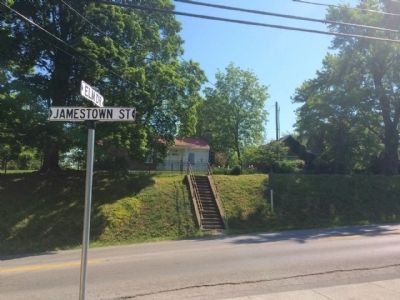
Allen County was formed in April 1815. Scottsville was named for Gen. Charles Scott, 4th governor of Ky. In 1816, location was chosen for county seat because of abundant water supply from this spring. County bought 100 acres, which were laid off in . . . — — Map (db m143071) HM
1860 – A Bustling County Seat Town
Imagine Scottsville in 1860. A fine two-story octagonal brick courthouse dominates the busy court square. The prosperous rural town of 403 residents boasts a public spring, at least one church, a . . . — — Map (db m152751) HM
Settled by Scott family ca. 1845. Developed from family farmstead to highly diversified & productive cattle, jack stock and mule ranch. In 1998, recognized by National Cattlemen's Beef Assoc. as one of the oldest cattle ranches in U.S. under . . . — — Map (db m216302) HM
Confederate Brigadier General, commanded famous “Orphan Brigade” in Civil War. In 1861 he conducted recruiting and training camp here. State legislature, 1850-54, 69-70. US Congress, 1870-73. Member of Kentucky Court of Appeals for 24 years, . . . — — Map (db m96727) HM
Taken from parts of Green and Warren counties. Glasgow, county seat, was founded in 1799. County received name from the “barrens” or prairies of this region.
Early explorers and settlers came through this area. In Civil War, first . . . — — Map (db m88132) HM
In 1855, John and Francis Marion Jones formed a partnership for selling goods at Myers Steam Mill on Beaver Creek in Barren County. A petition for a post office was granted in 1856 & name changed from Myers Mill to Coral Hill. Store was catalyst . . . — — Map (db m143082) HM
Preston H. Leslie, born Ky., 1819. Died Montana, 1907. Completed term of Gov. John Stevenson from Feb. to Sept., 1871, when elected 27th Governor of Kentucky. Known for his sound judgment of State affairs and meeting the needs of growing population . . . — — Map (db m87981) HM
Henry Skaggs and two companions trapping beaver, winter 1770-71, were probably first white men in this area. Named Long Hunters due to long period away from home in the East. Came through Cumberland Gap, 1769, in party led by James Knox. Skaggs’ . . . — — Map (db m87978) HM
Prized by frontiersmen, now rare collectors' items; they were made by three Settle generations in Barren County. Starting in 1800, William made flintlocks at Rocky Hill. A son, Felix, had shops in Glasgow, Roseville. Felix's sons, Simon and Willis, . . . — — Map (db m143078) HM
Formed from Montgomery County, 1811. Named for its many mineral springs. The birthplace of CSA Gen. John B. Hood and US Senator Richard H. Menefee. Owingsville named for Col. Thomas D. Owings. Organizer US 28th Inf. Reg., 1812. Associate in . . . — — Map (db m26286) HM
Bourbon Iron Works Jacob Myers from Richmond, Va. took up land grants here on Slate Creek, 1782. He built the first iron blast furnace in Ky., 1791. John Cockey Owings and Co. formed to operate furnace. Utensils and tools supplied settlers. . . . — — Map (db m110121) HM
This famous Revolutionary War hero, who rode 40 mi. to warn Jefferson, Patrick Henry and other legislators of British approach, June 3, 1781, is buried in Bath Co. Jack Jouett of Va. galloped all night from Cuckoo Tavern to Monticello to . . . — — Map (db m26285) HM
Owings House
Built 1811-14 for Colonel Thomas Dye Owings by Benjamin Latrobe, who redesigned the interior of the US Capitol after the British burned it, War of 1812. This house was a center of social life during early 1800's. Henry Clay, . . . — — Map (db m110150) HM
Rev. Hiram M. Frakes founded this Methodist Settlement in 1925. Begun in a cabin with 13 students, it became an institution for spiritual and educational development of mountain youth. Frakes guided and influenced the entire Middle Laurel Fork . . . — — Map (db m162490) HM
For travelers who had to walk, the Appalachian mountains seemed like an impenetrable wall, 600 miles long and 150 miles wide. Here at Cumberland Gap you could find both a good way in and a good way out of that rugged labyrinth of ridges, coves, . . . — — Map (db m35880) HM
For travelers who had to walk, the Appalachian mountains seemed like an impenetrable wall, 600 miles long and 150 miles wide. Here at Cumberland Gap you could find both a good way in and a good way out of that rugged labyrinth of ridges, coves, . . . — — Map (db m205056) HM
For travelers who had to walk, the Appalachian mountains seemed like an impenetrable wall, 600 miles long and 150 miles wide. Here at Cumberland Gap you could find both a good way in and a good way out of that rugged labyrinth of ridges, . . . — — Map (db m205084) HM
English colony founded in 1886 by Alexander Arthur. Project financed by English company, the American Association, because of timber and rich mineral deposits here. Almost 100,000 mountainous acres in Va., Tenn., and Ky. purchased for the . . . — — Map (db m33297) HM
Alexander Arthur, 1846-1912, an outstanding figure in history of Middlesboro. He came here in 1885 to prospect, discovering coal and iron ore deposits. President of American Association, formed to carry out his plans for a mining and manufacturing . . . — — Map (db m33298) HM
Built about 1800 in Yellow Creek Valley, the second brick house in the county, and the oldest one still standing. The bricks were made from clay by slave labor. Home of Rev. John Calvin Colson, "Patriarch of Yellow Creek Valley," preacher, teacher, . . . — — Map (db m181081) HM
We went four miles to a large Creek, which we called Cedar Creek,
being a Branch of Bear-Grass, and from thence Six miles to
Cave Gap, the land being Levil. On the North side of the Gap is a
large Spring, which falls, very fast, and just above . . . — — Map (db m210486) HM
Cumberland Gap, the break in the ridgeline you see ahead, is far more than just a pass through a long, rugged mountain barrier. For a generation of American pioneers this was the gateway from their old lives and limitations out to a frontier . . . — — Map (db m35899) HM
This area of the park was once home to dozens of people, with several homes and a school. Evidence of families who once lovingly cared for their homes and land is still visible; stone foundations and chimneys survive, daffodils and forsythia bloom . . . — — Map (db m207881) HM
Two hundred years ago, pioneers poured through Cumberland Gap on their way west to a better life. But not all the traffic on the Wilderness Road was westbound. By the 1820s, drovers pushed huge herds of hogs and smaller herds of cattle and sheep . . . — — Map (db m167001) HM
It will be 100 years or more before Cumberland Gap's restored Wilderness Road trail looks like it did in 1780–1810. The short segment of trail ahead is one of the few places where you can still see the original roadbed, unaltered by the . . . — — Map (db m241292) HM
One of the most important points on the Wilderness Road marked by Daniel Boone in 1775. Ford first used by Indians, then by early explorers and the Long Hunters. After Boone opened the way west, more than 100,000 settlers used the crossing as a . . . — — Map (db m35831) HM
Bell County, named for Joshua Fry Bell (1811-1870), was formed just after the Civil War in February of 1867 from portions of Harlan and Knox Counties. Pineville, the county seat, being so near the site where pioneers on the Wilderness Road crossed . . . — — Map (db m35875) HM
Following in Their Footsteps
The Wilderness Road was a 200-mil, overland route made famous by legendary frontiersman Daniel Boone. First mapped in 1750 by Dr. Thomas Walker, the route began as a series of braided trails, called traces, created by . . . — — Map (db m181125) HM
This cemetery was established by pioneers traveling along Boone's Wilderness Road during the late 1700's and early 1800's. These first settlers camped in the bottomland that is now Wasioto Golf Course while preparing to cross the Cumberland . . . — — Map (db m181156) HM
In June 1799, Boone County's first
court set Craig's Camp as county
seat. The next year, John H. Craig and Robert Johnson donated 74 acres at the Woolper Creek site for a town they called Wilmington. Court held here in a log courthouse in Jan. . . . — — Map (db m133144) HM
Boone County was established in 1799 and the County Court held its first meeting in June of that year, where The Court proceeded to fix on a place for the Seat of Justice on 74 acres offered by Robert Johnson and John H. Craig. Initially known as . . . — — Map (db m134232) HM
From its earliest days, Burlington was the hub of a community rooted in farming. Prior to World War II, the majority of people in Boone County lived and worked on farms and the livelihood of nearly everyone else was somehow connected to farming. By . . . — — Map (db m134233) HM
One of several log structures on North Jefferson Street, this c. 1860 single pen log house was once part of the Willis Graves estate. It is named after James Hogan, who owned it from 1881 to 1912. The house was rehabilitated as a craft shop in 1992. . . . — — Map (db m201101) HM
One of only a few
remaining early 19th century towns along the 981-
mile course of the Ohio River. The Rabbit Hash
National Registry encompasses 33 acres of
this linear rural/agricultural/commercial village,
characterized by its eclectic . . . — — Map (db m79231) HM
James and Martha Macomb Dinsmore
moved from La. to raise their three
daughters here. Completed in1842,
the main house served as the center
of a typical large, antebellum Boone
Co. farm. tenants and slaves raised
grains, grapes, sheep, and . . . — — Map (db m79304) HM
Formed by legislative act from a part of Campbell County. Names for Daniel Boone, renowned Kentucky pioneer-explorer.
Big Boone Lick, graveyard of the mammoth, was discovered in 1729 by Capt. M. de Longueil. In 1756, Mary Inglis was brought . . . — — Map (db m61867) HM
Hopeful Evangelical Lutheran
Church was founded on Epiphany
Day. 1806. by German-speaking
families from Madison County, Virginia.
Called “the Mother of Lutheranism
west of the Allegheny Mountains,”
it is the oldest Lutheran church . . . — — Map (db m136081) HM
John Uri Lloyd (1849-1936). Born in NY, came to Boone Co. KY in 1853. Pharmacist, chemist, inventor & electric herbal medicine pioneer. Wrote series of novels based on local folklore including Stringtown on the Pike in 1900. Founded . . . — — Map (db m201104) HM
Lewis Loder (1819-1905). Born in Pennsylvania, he moved to Petersburg in 1858 and lived in a c. 1840 house at Tanner & Front Sts. He served as justice of the peace and operated a tavern in his home for many years. Loder was hired as clerk & . . . — — Map (db m133205) HM
First settlement in Boone County. Rev. John Tanner built blockhouse, and town began on 2000 acres he and John Taylor owned. Shawnees captured Tanner’s 9-year-old son here, held him until grown. An ardent Baptist, Tanner preached in Carolinas, . . . — — Map (db m79310) HM
Big Bone Methodist Church was constructed in 1888
The original congregation, which was organized in 1887
and led by Reverend George Froh, helped in the construction.
As was the custom, a social order lodge shared the expense of . . . — — Map (db m79030) HM
In celebration & commemoration
of
the 250th anniversary of the daring escape of
Mary Draper Ingles
from her Shawnee captors here at
Big Bone Lick, Kentucky in the fall of 1755
Her direct descendants met here for a family reunion
to . . . — — Map (db m79073) HM
Reputed first white woman in Ky.
Shawnees captured her and two sons
in July 1755 at site Roanoke, Va.
Led to village at mouth of Scioto River,
separated from sons, taken to Big
Bone Lick. compelled to make salt
here; adopted by chief; given . . . — — Map (db m79071) HM
Piatt's Landing
Near here on the north bank of the
Ohio River at mile 510.5 was a
riverboat landing, ferry, and road
to the courthouse at Burlington.
The landing and large brick home
that once stood near, later called
Winnfield . . . — — Map (db m79142) HM
Edward Boone was killed by Indians here on the banks of Boone Creek on Oct. 4, 1780, while hunting with his brother Daniel. He was buried here the next day by Daniel and a party from Boone’s Station, near Athens, Ky, where Edward, Daniel and their . . . — — Map (db m172021) HM
Death site of Edward Boone, a brother of renowned Kentucky pioneer Daniel Boone. Edward was killed by Indians here Oct 1780 at age 40 while hunting with Daniel. Boone Creek named for Edward. Daniel and Edward wed sisters, Rebecca and Martha Bryan, . . . — — Map (db m171825) HM
Bourbon Whiskey
Named after Bourbon Co. because of quantity and quality of whiskey produced within its borders. Made from a fermented mash of at least 51% corn, with less wheat, rye, or barley, yeast and limestone water. Distilled at no more . . . — — Map (db m35597) HM
Built by Presbyterians, 1791. Here Barton W. Stone began his ministry, 1796. Famous revival attended by pioneers of many faiths, 1801. Springfield Presbytery dissolved and "Christian Church" launched, June 28, 1804. — — Map (db m9724) HM
Dedicated in honor of
Mary Desha
of Kentucky
one of the four founders of the
National Society, Daughters of the American Revolution
restoration commenced 1940 the Golden Jubilee Year, N.S.D.A.R.
by the
Kentucky Society, . . . — — Map (db m245039) HM
Near his home Isaac Ruddell built a gristmill in 1788 on the north side of Hinkson bridge, and a sawmill in 1795 to be operated by his son, Abram. A 720-spindle cotton mill erected 500 feet west by Thomas and Hugh Brent in 1828, burned 1836. Soon . . . — — Map (db m171782) HM
Originally a 1,400 acre land warrant, Townsend Springs was settled by John Townsend in 1775-1776. With Capt. John Hinkston Townsend traveled Ohio River exploring Shawnee territory. Named Townsend Creek in 1776. Townsend raised corn, sold to . . . — — Map (db m170052) HM
Settled by 1799 by members of the Poage family of Virginia. Known as Poage's Landing until named in 1854 for Henry Clay's Lexington estate, by the owners, Ky. Iron, Coal and Manufacturing Company. It engaged M. T. Hilton to lay out a town, then . . . — — Map (db m59244) HM
Ashland, the largest city in eastern Kentucky, is located on the banks of the Ohio River in Boyd County. This second class city, when first incorporated by act of legislature in 1856, was located in Greenup County. Boyd County was created four years . . . — — Map (db m228063) HM
For Linn Boyd. Born Tenn., 1800. Came to West Ky. in youth. Ky. Legislature, 1827-31. Congress, 1835-37, 1839-55, and Speaker 1851-55. Author of Resolution to annex Texas. The Ky. delegation proposed Boyd for Vice President at Democratic Convention, . . . — — Map (db m73754) HM
Early pioneer settlement erected before 1779. Developed by George Clark, brother-in-law of William Whitley, whose party came to Ky. about 1775. Located on Clark's Run Creek, named for George Clark, it was one of the first stations built in the . . . — — Map (db m105411) HM
For Judge John Boyle, 1774-1834. State representative, 1800; U.S. Congress, 1803-9; Kentucky Court of Appeals, Chief Justice, 1810-26; U.S. District Judge for Kentucky, 1826-34. The Judge "lived for his country," setting many important legal . . . — — Map (db m121555) HM
McDowell House And Apothecary Shop
The pioneering spirit of Dr. Ephraim McDowell-father of abdominal surgery and most prominent surgeon west of the Alleghenies in the early 19th century-is celebrated today at McDowell House.
On Christmas . . . — — Map (db m71041) HM
Obverse
Home of Ephraim McDowell, the “father of modern surgery.” Here on December 25, 1809, McDowell performed the first successful abdominal operation when he took a 22-pound ovarian cyst from Jane Todd Crawford of Green . . . — — Map (db m71047) HM
Stephen Albert Fisher, Rev. War soldier from Va., assigned in 1775 to active duty and wounded while serving with Colonel John Bowman's militia. Returned to Ky. in 1779 with wife Mary Magdalene Garr. He established garrison of military significance . . . — — Map (db m70981) HM
Obverse
John Gill Weisiger Memorial Park
The land embraced within this park, bounded by Main Street, First Street, Walnut Street and alleyway, was conveyed to the commonwealth of Kentucky as a gift by Miss Emma Weisiger, and . . . — — Map (db m71338) HM
Old Crow Inn
The oldest existing stone house in Kentucky, built 1784, is part of this building. The house has been enlarged and Doric pillars added. Land purchased from John Crow by James Wright, 1781. Next owner, Colonel Joshua Barbee, who . . . — — Map (db m105413) HM
Founded Danville, 1781. First Atty. Gen. of Ky. District, 1783. As a member of Commission went to Falls of Ohio to allot lands in Clark's grant to members of Ill. Regt. Daniel was killed by Indians, Aug. 1784, on way to visit brother at Bullitt's . . . — — Map (db m49743) HM
Isaac Shelby, 1st & 5th governor, came to Ky. as a surveyor in 1775. He claimed 1400 acres in 1776 by raising a crop of corn. In 1779 he received 1st land settlement & premption deed granted by Va. Land Commission. His home, Traveler's Rest, . . . — — Map (db m120115) HM
The area around this cave was the site of Perryville’s original settlement, Harbison’s Station. Named for its founder, James Harbison, the station was settled in the 1770s. Harbison and the group of Virginians traveling with him chose this location . . . — — Map (db m46419) HM
(obverse)
Karrick-Parks House
Bivouac for Confederate troops on Oct. 7, 1862, night before Battle of Perryville. Karricks ordered to vacate home the next day. Day after the battle they returned to survey damage, found little done. . . . — — Map (db m46396) HM
Established as Harberson's Fort before 1783 by James Harberson, Thomas Walker, Daniel Ewing and others at the crossroads of Danville-Louisville and Harrodsburg-Nashville routes. Town laid out by Edward Bullock and William Hall, 1815, named for . . . — — Map (db m46400) HM
The area that became Perryville was first settled between 1776 and 1780 by a group of Virginians led by James Harbison. The settlement became known as Harbison’s Station, and a stockade was built around a cave that exists today behind 403 South . . . — — Map (db m46415) HM
Formed from parts of Campbell and
Mason. Named for William Bracken,
hunter, fisherman, Indian fighter,
came here 1773. Birthplace of John
Gregg Fee, founder of Berea College,
1855. Birthplace and home of Dr.
Joshua Taylor Bradford, . . . — — Map (db m136282) HM
Captain Philip Buckner, an Englishman, was a Revolutionary War veteran. He came to Va., served adopted colony as issuing commissary, received extensive land grants, then settled here. In 1797, he donated this lot for Augusta Public Square as part of . . . — — Map (db m86656) HM
In summer of 1793 Indians crossed Ohio River, hid canoes at mouth of Holt’s Creek, site of Foster, and proceeded to Bourbon County to steal horses. Simon Kenton secured a small group to ambush them on their return. After lying concealed for four . . . — — Map (db m136268) HM
Samuel VanderMeer came here from New Jersey in 1923. “Uncle Sam” to generations of Ky. Youngsters, he became pastor of the Morris Fork Presbyterian Church in 1927, the year he married nurse Nola Pease. Missionaries, community builders. . . . — — Map (db m39151) HM
Abraham Lincoln, then a lad of 7, with other members of the Thomas Lincoln family crossed the Ohio River on a log raft ferry near here in 1816. The Lincolns were moving to Indiana. — — Map (db m119796) HM
An early station on the Wilderness Road between the Falls of the Ohio (Louisville) and
Harrodsburg, Brashear's Station was a haven for pioneer hunters and travelers. It was built at mouth of Floyd's Fork near bank of Salt River, 1779. Founded by . . . — — Map (db m174444) HM
Brooks' Spring
The spring here, first called Stewart's or Phillips' and then Brooks' Spring, was a well-known camping place in the early 1780s on the main route from the Falls of the Ohio & Beargrass Creek to Bullitt's Lick and Harrodsburg. . . . — — Map (db m174479) HM
For Alexander Scott Bullitt, a leader in the political formation of Kentucky. Member conventions, 1788, seeking statehood and, 1792, drafting first Ky. Constitution. President Ky. Senate, 1792-99, and second constitutional convention, 1799. Elected . . . — — Map (db m122013) HM
The Shepherdsville Pioneer Graveyard (the word "cemetery” was not commonly used until sometime later) was established circa 1799 and abandoned in 1909 following a flood. The Hebron Cemetery was opened in northern Bullitt County in the 1890s, . . . — — Map (db m174404) HM
Front
Settled ca. 1800 by Rev. War veterans Thos. Carson, John Helm, & Matthew Kuykendall who received land grants for their service. These founders of Butler County served as first county surveyor, presiding justice of . . . — — Map (db m123286) HM
Morgantown
The county seat of Butler Co., it was originally called Funkhouser Hill. It was renamed Morgan Town in Dec. 1810 to honor Revolutionary War officer Daniel Morgan and was incorporated in 1813. It began as a settlement of . . . — — Map (db m123448) HM
The town of Suffolk, originally called “Bluff,” established here by Logan Co. Court in 1803. Site recognized importance of Green River for future development of valley and State of Kentucky. The court appointed trustees: Reuben . . . — — Map (db m123460) HM
Town founded 1835 as a voting precinct. Established between Princeton and Salem stage stops, it was first called Midway; name changed to Fredonia two years later. In 1887, the Ohio Valley Railroad ran one-half mile west of town. Kelsey was . . . — — Map (db m123802) HM
For General John Caldwell.
Born Virginia; came Kentucky 1781.
Maj. Gen. in militia; Indian campaigns.
With George Rogers Clark, 1786.
Member Danville Conventions, 1787, 1788, which adopted petition “demanding admission into the . . . — — Map (db m79159) HM
Shandy Hall, two-story stone home built on Bluff above Big Spring, built by William Prince on his 200-acre survey made in 1798. Prince, a Rev. War veteran from S.C., began town on waters of Eddy Creek. In 1817, Princetown became county seat of . . . — — Map (db m123817) HM
Shandy Hall, two-story stone home built on Bluff above Big Spring, built by William Prince on his 200-acre survey made in 1798. Prince, a Rev. War veteran from S.C., began town on waters of Eddy Creek. In 1817, Princetown became county seat of . . . — — Map (db m123818) HM
A Revolutionary War patriot - He served as a captain in Colonel Benjamin Roxbury Spartan Regiment - S.C. Organized a group from 96th S.C. District migrated through Cumberland Gap. Settled on Red River in NW Tennessee. In 1798 he explored land on . . . — — Map (db m244271) HM
William Prince
1752-1810
Born in Virginia, his family moved to Spartanburg Co., S.C. in 1768. During the Revolutionary War, he served as captain in Col. Benjamin Roebuck’s S.C. Spartan regiment. After completing his military duty, he . . . — — Map (db m123867) HM
Two miles west was District seat of Jackson Purchase area 1818, now being Kentucky's eight and Tennessee's twenty westernmost counties. Settled in 1821 and U.S. Public Land Office opened. Calloway County Seat, 1822-1842. Then it was moved to . . . — — Map (db m169133) HM
For Col. Richard Callaway. Came to Ky. With Daniel Boone, 1776. One of the founders of Boonesboro, he instilled confidence in success among other settlers. In one year, 1777, appointed Col. Of Militia; Justice of the Peace; elected a representative . . . — — Map (db m151224) HM
Many salt wells located in this area, left over from the last Ice Age. Salt making was an early business in Grant's Lick. John Grant was one of the owners, and the entire area is named for him. Mary (Boone) Bryan — sister to Col. Daniel Boone — is . . . — — Map (db m175100) HM
Ca. 1793, salt water found here by
Samuel Bryan, a nephew of Daniel
Boone. John Grant, another Boone
nephew, and Charles Morgan helped
him drill well, which supplied salt
to interior of Ky. This territory
was owned by John Grant and named
for . . . — — Map (db m175099) HM
Born in Pa. in 1736, she was the
daughter of Squire & Sarah Morgan
Boone and younger sister of Daniel
Boone. Family moved to N.C. when
she was 14. There she met, and in
1755, married William Bryan. With
10 children, they migrated to Ky.
via . . . — — Map (db m175094) HM
Incorporated March 15, 1870, on part of original land grant to Gen. James Taylor, pioneer, for whose farm this city was named. A general in War of 1812, banker, and statesman, whose farm was an underground railroad station.
President of the first . . . — — Map (db m49115) HM
In 1865, with the Civil War ending, John Roebling was able to resume construction of his famous Suspension Bridge connecting Covington and Cincinnati. The top of the bridge pier on the Covington side immediately became a favorite place for . . . — — Map (db m174873) HM
688 entries matched your criteria. The first 100 are listed above. Next 100 ⊳