Ideally Situated Close to Commerce Square and the Brazos River, these two lots were near the center of town. Like many San Felipe lots, the property changed hands several times. First developed by the Calvit family, its last owner was Almyra . . . — — Map (db m206287) HM
Near Farm to Market 1458, 0.2 miles 2nd Street, on the left when traveling north.
Near this site stood
A Town Hall
Built about 1830
in which were held
the First and Second Conventions
of Texas, 1832 and 1833,
and the Consultation of 1835
the provisional government functioned
here until March 2, 1836, when . . . — — Map (db m43759) HM
San Felipe's First Townsfolk Arrived to find the "town" yet to be built. Many raised their houses, kitchens and stables with their own hands.
Austin also enlisted skilled housewrights (house builders), sawyers, teamsters and blacksmiths to . . . — — Map (db m206316) HM
On Farm to Market 1458, 0.2 miles north of 2nd Street, on the left when traveling north.
During the mid-1820's, When Stephen F. Austin was founding this town, the only roads in the area were wagon ruts or beaten trails marked by notched trees. Within a decade, however, the village of San Felipe, one of the first Anglo settlements in . . . — — Map (db m43718) HM
In the Town's Early Years, Empresario Stephen F. Austin filled many roles. Administrator of land grants and court judge, Austin also coordinated with Mexican government officials. He managed the growing town, and as colonel of the . . . — — Map (db m206275) HM
On Park Road 38, 0.1 miles east of Antonio Martinez Street, on the right when traveling west.
The first known person to occupy the land where the Hill House is located was Judge Robert M. "Three Legged Willie" Williamson. During his ownership, the community of San Felipe de Austin was burned to the ground by order of Moseley Baker, a . . . — — Map (db m202605) HM
Near Farm to Market 1458, 0.2 miles north of 2nd Street, on the left when traveling north.
Built by John Crutcher in 1847 on the Plaza de Commercio in San Felipe, this was the last store built in the town after its 1836 burning by military order. Purchased in 1867 by Dr. J.J. Josey, it was in continuous operation as a store until 1942. . . . — — Map (db m43760) HM
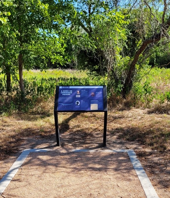
Jane Wilkins and her family were among the Colony's earliest immigrants and the first to
settle what is now the City of Houston. By 1827, Wilkins and her two daughters, Jane and Mary, had made a home in San Felipe. They also received a league . . . — — Map (db m206262) HM
On Farm to Market Road 1458, 0.2 miles north of Interstate 10, on the right when traveling north.
First Anglo-American capital of Texas. Came into being on July 26, 1828, as capital of the Austin Colony, by decree of the Mexican government. Father of Texas Stephen F. Austin had begun under the 1821 grant from Mexico the settlement of more than . . . — — Map (db m116924) HM
On Farm to Market 1458, 0.2 miles 2nd Street, on the left when traveling north. Reported missing.
Replica of
Stephen F. Austin's Cabin
This structure is a replica of the only Texas home of Stephen F. Austin, “Father of Texas.” The chimney contains bricks from original (1828) cabin. Other materials were made as . . . — — Map (db m156552) HM
On Farm to Market Road 1458, 0.2 miles north of 2nd Street, on the left when traveling north.
Stephen F. Austin • Father of Texas, November 3, 1793-December 27, 1836. He planted the first Anglo-American colony in Texas • "The Old Three Hundred"• In his several colonies he settled more than a thousand families. He was from 1823 until 1828 . . . — — Map (db m116925) HM
On Lux Road at Peschel Lane, on the right when traveling south on Lux Road.
Sealy's German immigrants were famous for their love of music. A group of men, some of them Sealy's pioneer settlers, had formed a singing society, called Liedertafel, by 1899. They met primarily in the home of Ferdinand Lux. Lux and Fritz Kinkler, . . . — — Map (db m71567) HM
On Main Street, 0.1 miles east of 2nd Street, on the left when traveling west.
In 1879 Gulf, Colorado and Santa Fe Railway Company agent George Sealy purchased 11,635 acres at this location from the township of San Felipe de Austin for the purpose of establishing a railroad depot. The village of Sealy soon developed around . . . — — Map (db m162576) HM
On 36th Division Memorial Highway (State Highway 36) 3 miles north of Farm to Market Road 1093, on the left when traveling north.
This land was purchased for the purpose of establishing a school, church, and cemetery by P.L. Habermacher, Miles J. Allen, and J.S. Dabney in 1903. The Hartsville school was a 2 room building that was used until 1939 when students were . . . — — Map (db m168498) HM
On 36th Division Memorial Highway (State Highway 36) at Johnston Road, on the right when traveling south on 36th Division Memorial Highway.
As a young man Martin Allen assisted his father, Benjamin, in surveying roads in their native state of Kentucky. He married Elizabeth Vice in 1804 and by 1810 they and their three children were living in Louisiana.
Martin joined the . . . — — Map (db m61299) HM
Near Cemetery Road, 0.3 miles north of 1st Street (Farm to Market Road 1093).
Also known as the Protestant Cemetery, this burial ground has served the Wallis Community and surrounding area since the 1890s. The earliest settlers in the area were William and Lydia Ann (English) Guyler, Kentucky natives who arrived here in . . . — — Map (db m168496) HM
Near Cemetery Road, 0.3 miles north of 1st Street (Farm to Market Road 1093).
Kentucky natives William Henry Guyler (1823-1897) and Lydia Ann English (1826-1920) were married in 1845 and journeyed to Texas in 1859. They purchased a homestead on the Milburn and Davis Land Grant in Austin County. William Guyler erected a log . . . — — Map (db m168489) HM
One of numerous natural salt lakes in the Texas Panhandle. Its waters, although brackish, have been welcome enough at various times to Indians, buffalo hunters, and thirsty cattle on hot, dry days. The lake, having a shoreline of over six and a . . . — — Map (db m153245) HM
On State Highway 214 at County Route 1033, on the right when traveling south on State Highway 214.
First town in Bailey County. Promoted in 1907 by land company of Stevens A. Coldren (d. 1924). He had a townsite surveyed and named it for Patrick J. Hurley (1883-1963), New Mexico political leader. Company built general store, hotel and livery . . . — — Map (db m73697) HM
Part of a land promotion scheme begun 1908. Advertised as future metropolis by shrewd dealers, who implied that good rains and bumper crops were typical of region. Naive buyers were treated to tours through town, where they saw shops, a lot reserved . . . — — Map (db m151348) HM
On South 1st Street (State Highway 214) south of West Avenue C, on the right when traveling south.
Bailey County was created August 21, 1876, and named for Peter James Bailey, a Kentucky lawyer killed at the Alamo during the Texas War for Independence.
This was thinly settled cattle country; Bailey was attached for judicial purposes to . . . — — Map (db m73670) HM
On 11th Street at Cedar Street, on the right when traveling east on 11th Street.
The origin of the name of Bandera Pass and its namesake city and county dates back to conflicts between the Spanish Army and native Lipan Apaches in the early 18th century. The history of the townsite began in the early 1840s, when Charles de Montel . . . — — Map (db m130359) HM
On State Highway 173, 1 mile north of Farm to Market Road 2828, on the left when traveling north.
The prominent feature known as Bandera Pass is a notable landmark in the topography and history of the region. The pass is a narrow natural cut through a chain of hills which run roughly east and west and divide the Guadalupe and Medina river . . . — — Map (db m157932) HM
On Main Street (State Highway 173/16) at Hackberry Street, on the right when traveling south on Main Street.
The tradition of the Texas cowboy originated from northern Mexico with the vaqueros, individuals mounted on horseback who herded livestock, mainly cattle, through the open prairie. These men became legends in Bandera County. The City of Bandera . . . — — Map (db m130352) HM
On Main Street (State Highway 16) at Hackberry Street, on the left when traveling north on Main Street.
The town of Bandera was named by Indians. In 1870, a young boy, Herman Lehman, was captured by the Apaches and later lived with the Comanches. At the age of 65 he told this story to Bandera historian J. Marvin Hunter: Lehman said the Comanches . . . — — Map (db m175888) HM
On Main Street (State Highway 173) north of Hackberry Street, on the right when traveling north.
(side 1)
Camp Montel C.S.A.
Site 25 mi. West on Hy. 470, 1 mi. South. Established 1862 as part of Red River-Rio Grande defense line. Named for Captain Charles DeMontel, surveyor and colonizer of Bandera, leader of county . . . — — Map (db m111200) HM
On 13th Street at Pecan Street, on the right when traveling north on 13th Street.
Built 1933 to house Western collection of J. Marvin Hunter, Sr. (1880-1957), noted historian, journalist, editor and author. Having lived throughout the west, he settled in Bandera as owner of "New Era", 1921-1934. In 1923 he founded . . . — — Map (db m162838) HM
On Main Street (State Highway 16), on the right when traveling west.
Entered the year-old town of Bandera in March, 1854. Leader was Lyman Wight, church elder who had separated from followers of Brigham Young and taken a colony of 250 to Texas in 1846.
Settling first in Austin, then Fredericksburg (where they . . . — — Map (db m130135) HM
On Main Street (State Highway 16) at Pecan Street, on the right when traveling south on Main Street.
This winding, 100-mile trail from San Antonio to Kerrville was, during the 19th century, a strategic patrol road traveled by Texas Rangers to protect the surrounding area from hostile Indian attacks.
During uneasy pioneer days roads such as . . . — — Map (db m117711) HM
On Polly's Cemetery Road at Old School Road, on the right when traveling west on Polly's Cemetery Road.
In the late 1850's, Jose Policarpio" Polly" Rodriguez (1829-1914), a noted US Army scout with 2nd Calvary, became one of the first settlers of Bandera County. His first purchase of 600 acres included this property. Ultimately, he acquired over 4,000 . . . — — Map (db m189491) HM
On Polly's Chapel Road, 0.1 miles north of Old School Road, on the left when traveling north.
Named for Policarpo Rodriguez (1829-1914), Texas Ranger, Army Scout and Guide; 1858 Privilege Creek settler. Converted here to Methodist faith, built with his own hands, in 1882, chapel of native stone, where he and others have preached. . . . — — Map (db m155675) HM
On Polly's Chapel Road, 0.1 miles north of Old School Road, on the left when traveling north.
An official Texas Historical Landmark
In 1880, the Rev. Jose Policarpio "Polly" Rodriguez (1829-1914) completed this chapel on his ranch. Plans began when he selected this gentle rise west of nearby Privilege Creek. Then, he faced the building . . . — — Map (db m189489) HM
This home was constructed in the 1870s by Georgia stonemason James Henry White for Charles F. Schmidtke (1839-1884). A native of Germany, Schmidtke was an early Bandera merchant, grist miller, and lumber mill operator. White's grandson J. Calvin . . . — — Map (db m163287) HM
On Bear Creek Road at Privilege Creek Road, on the right when traveling north on Bear Creek Road.
125 Years of Bandera history!
Polly Texas Pioneer Association, a local 501.c.3 non-profit, is proud to announce its acquisition of Polly's Schoolhouse. The schoolhouse was built in 1892 by J.P. "Polly" Rodriguez. The schoolhouse served as . . . — — Map (db m189492) HM
On Privilege Creek Road at Old School Road, on the left when traveling north on Privilege Creek Road.
Polly, Texas was founded by Jose Policarpio "Polly" Rodriguez (1829-1914) in 1858. Polly was a noted frontieraman, surveyor and US Army scout with the 2nd Calvary who became one of the first settlers of Bandera County. His purchase of acreage and . . . — — Map (db m189485) HM
On Farm to Market Road 462, 2 miles south of County Highway 211, on the left when traveling south.
During the mid-1800s the Texas Hill Country was the site of many hostile encounters, some deadly, between pioneer immigrants whose permanent settlements ran counter to area Native Americans accustomed to unrestrained hunting and gathering. One . . . — — Map (db m155608) HM
On Farm to Market Road 187, 0.3 miles north of West Sabinal Road, on the left when traveling north.
Founded 1883, named for Henry Taylor. He, Gid Thompson and other early settlers gave land and founded school. First trustees were D. Harper, H. Kennedy, H. Taylor. First one-room frame building had homemade desks and recitation benches. . . . — — Map (db m111332) HM
On Pine Street at Water Street, on the right when traveling east on Pine Street.
Erected in recognition of the distinguished service to Texas of Felipe Henrique Neri, Baron de Bastrop, 1770-1829.
Pioneer Red River empresario. Land Commissioner of Austin’s Colony, member of the Congress of Coahuila and Texas. Through his . . . — — Map (db m126756) HM
On Loop State Highway 150 at Park Road 1, on the right when traveling west on State Highway 150.
Long before white men arrived, this region was inhabited by Tonkawa and Comanche Indians. In 1691 the first Spanish explorers crossed this territory en route to east Texas. From their route, parts of “El Camino Real” (the King's . . . — — Map (db m126751) HM
On Park Road 1-A, 0.6 miles east of Loop Texas Highway 150 when traveling east.
Erected in recognition of the
distinguished service to Texas of
Felipe Entrique Neri,
Baron De Bastrop
1770 - 1829
Pioneer Red River empresario. Land commissioner of Austin's colony. Member of the Congress of Coahuila and Texas. In . . . — — Map (db m111113) HM
On Farm to Market Road 535, 0.1 miles east of Lehman Lane (County Highway 233), on the right when traveling east.
Beginning as a farming community, Rockne traces its roots to German settlers who came to the area in the 1840s. In November 1846, the Daniel and Mortiz Lehman families arrived at Indianola, Texas from Schlesien, Prussia. They soon settled in this . . . — — Map (db m118404) HM
On Farm to Market Road 20, 0.1 miles north of Humble Lane (County Highway 232), on the right when traveling north.
Early land grantee in this area. Of Dutch descent, he was born in Virginia. Came to Texas (then part of Mexico) in 1831 as a colonist of Stephen F. Austin, the "Father of Texas."
Received a Spanish league of land (4,444 acres) here. Active in . . . — — Map (db m118406) HM
On Park Road 1 at Loop State Highway 150, on the right when traveling east on Park Road 1.
Originated in 1820s. Crossed the present counties of Austin, Washington, Fayette, Lee, Bastrop; joined San Felipe, capital of Stephen F. Austin's colony, with Bastrop. Marked by James Gotier, a settler who (with several in his family) died in an . . . — — Map (db m126807) HM
On Walnut Street at Hill Street, on the right when traveling west on Walnut Street.
Thomas H. Mays was born in 1802 in Virginia and emigrated to Texas from Tennessee in 1830. In 1834, he became Bastrop's first municipal surveyor and platted the city's new streets. Two years later, he was wounded in the leg at the Battle of San . . . — — Map (db m65221) HM
On Farm to Market Road 969, 0.4 miles north of Farm to Market Road 61, on the left when traveling west.
According to local tradition this site was used by area slaves for gathering purposes. Silvie Story, William Hill, Martha Young, Paulie Johnson, Grant McBride, and Martha J. Hill organized this church in 1864 with the help of the Rev. Joshua Brice. . . . — — Map (db m82620) HM
On Farm to Market Road 969 at Wilbarger Bend (County Route 65), on the right when traveling west on Route 969.
Founded in 1827 by Josiah Pugh Wilbarger of Austin's Colony
Beginning of Wilbarger's Trace, blazed by his son James Harvey Wilbarger 1860 with slaves and ox-wagons carrying commerce to Corpus Christi and Matamoros, Mex. — — Map (db m82611) HM
Near Hyatt Lost Pines Road north of Texas Highway 71, on the right when traveling north.
The bluff stands 80 feet above the Colorado River at Wilbarger Bend. Josiah Wilbarger was an early settler whose family owned the land on the opposite side of the river during the 1800s. Josiah was one of a few Texans who were scalped and lived to . . . — — Map (db m79096) HM
On North Main Street (Farm to Market Road 1100) 0.1 miles west of East 11th Street, on the right when traveling west.
After Houston & Texas Central Railroad built through this area in 1871, town was platted (1872) and named for Robert M. Elgin (1825-1913), H.& T.C. Land Commissioner.
Brick and tile, for which Elgin is widely known, have been chief products . . . — — Map (db m205292) HM
On North Main Street, 0.1 miles north of West 2nd Street, on the left when traveling north.
Kentucky native I.B. Nofsinger (1864-1938) came to Texas at the age of 20 and taught school before returning to his home state to study medicine. He was a doctor in McDade (8 Mi. E) prior to moving his practice here. In 1906 he and his wife Mary . . . — — Map (db m205304) HM
On Farm to Market Road 969, 0.2 miles west of Upper Elgin River Road (County Route 127), on the right when traveling east.
Signer of the Texas
Declaration of Independence
Aide-de-camp to Gen. Houston at
San Jacinto
Commander of a regiment of Rangers
1836-37
Here his widow
Mrs. Elizabeth Coleman
and son, Albert V. Coleman
were killed by Indians
and . . . — — Map (db m82688) HM
On U.S. 290, 0.2 miles north of Duck Pond Road, on the right when traveling south.
Laid out 1871; named for Jas. McDade, Brenham lawyer. Became a thriving town, important freight center and early-day stage stop. School-Church was built 1872; vigilantes (organized 1883) lynched three men on Christmas Eve causing a shoot-out next . . . — — Map (db m205518) HM
In 1691 missionaries on the expedition of Don Domingo Teran De Los Rios sighted a lagoon which the Indians called Nenocadda. The lagoon, known today as Shipp's Lake, is on the southern edge of present Smithville. Frederick W. Grasmeyer operated a . . . — — Map (db m41902) HM
On Farm to Market Road 2571 at Young School House Road (County Road 280), on the right when traveling west on Road 2571.
Maryland native Stephen Scallorn (1787-1887) lived in Kentucky and Tennessee, where he practiced medicine and was active in the Primitive Baptist Church, before moving to Texas. He was attracted to the Republic by the favorable accounts of his . . . — — Map (db m160302) HM
On State Highway 114, 0.4 miles east of Hale Road, on the right when traveling west.
Platted in 1910 on the Gulf, Texas and Western Railroad, Westover developed into a small market center providing goods and services for area farmers and ranchers. J. W. Stevens offered part of his ranchland for the townsite, which was given the . . . — — Map (db m187151) HM
With the coming of the railroad to Beeville in the spring of 1886, Mississippi native William Oscar McCurdy (1866-1913) visited his aunt and uncle here. After spending several days, McCurdy, a printer and editor, decided to stay, becoming a . . . — — Map (db m205672) HM
On Corpus Christi Street, on the right when traveling east.
Long before Mexico granted land (1834) on Poesta Creek to the first settlers, Anne Burke and James Heffernan, savage Indians roamed this valley at will.
Their colony, although successful at first, soon met disaster. In 1836 James Heffernan, his . . . — — Map (db m202007) HM
On Business U.S. 181J at U.S. 181, on the right when traveling south on U.S. 181JBusiness .
From pack trails and wagon roads that marked this area at least 300 years, have developed such modern roads as U.S. Highway 181. The old trails of Indians, wild cattle and mustang horses formed highways for 17th, 18th and 19th century . . . — — Map (db m206886) HM
Block 1, Beeville original townsite, donated 1859 by Anne Burke. First owned by G.W. McClanahan, land was bought 1862 by county for "Public Burying Ground". In 1872, H.W. Wilson donated northeast strip, land was added on the northwest, and Court . . . — — Map (db m206891) HM
Built in 1890 by Will H. and Julia George of materials from early house on land inherited from her father, Maj. J.H. Wood (Texas Cattle Empire Builder) who came from New York to join Texas War for Independence. Remodeled in 1900, house is raised . . . — — Map (db m207402) HM
On U.S. 181, 0.4 miles south of South Bee Street, on the right when traveling south.
Settlement dates from about 1850. First town, 2 miles west, was called San Domingo for its location near junction of San Domingo and dry Medio Creeks. After railroad was built, 1886, citizens moved to Walton (new flag station) to be on line. Name . . . — — Map (db m121886) HM
On U.S. 181 south of Mineral Avenue, on the right when traveling south.
Oil capital of Bee County, Pettus was settled in the 1850's when John Freeman Pettus set up his sprawling ranch about 4 miles south of here.
The son of one of Stephen F. Austin's first 300 colonists, Pettus was an extensive cattle and horse . . . — — Map (db m211746) HM
On U.S. 181 north of Sullivan Street, on the right when traveling north.
Earliest known residents were Karankawa Indians who named creek. On this stream was one of the most famous ranches in early Texas, occupied in 1805 by Don Martin de Leon, who in 1824 founded Victoria.
In 1830's Irish colonists came by way of . . . — — Map (db m202006) HM
A few yards south passes Papalote Creek, crossed by the fierce Karankawa Indians who found kite-shaped pebbles and named it Papalote, which means,"kite-shaped" or "wing-shaped". Along its banks came the leaders of the Power and Hewetson colonists, . . . — — Map (db m202002) HM
On U.S. 181, 0.2 miles south of Farm to Market Road 1465, on the right when traveling south.
The Rev. Peter Unzicker led a group of Illinois settlers here in 1906. Buying 53.4 acres of land of the original Uranga Grant and later Chittim-Miller Ranch, he founded Tuleta, named for the daughter of J. M. Chittim. A rail depot and post office . . . — — Map (db m121884) HM
On W. Clark St., on the right when traveling west.
Settlers began moving to this area in the 1830s, when Texas was a Republic, but the town of Bartlett was not established until the 1870s. The founders were J. Edward Pietzsch and Capt. John T. Bartlett, for whom the community was named. In 1882 the . . . — — Map (db m29040) HM
On Donahoe Road at Post Oak Road, on the right when traveling north on Donahoe Road.
Colonists settled in the late 1840s along the fertile Donahoe Creek. Samuel Gibbs Leatherman (1799-1888) arrived in 1854 and opened the first mercantile store. He gave land for the cemetery and brought in the first doctor. In 1880 Leatherman donated . . . — — Map (db m29073) HM
Settlement began on Lampasas River, 1847. Created Jan. 22, organized Aug. 1, 1850. Named for Peter Hansbrough Bell (1812-1898), native of Virginia; veteran of Battle of San Jacinto; served in Somervell expedition to stop Mexico's Raids into Texas; . . . — — Map (db m218643) HM
On West Central Avenue at North Pearl Street, on the right when traveling west on West Central Avenue.
A native of Tennessee, William W. Reed came to Texas with his parents, Michael and Martha Reed, in 1833 and joined Robertson's colony in 1834. His land grant was situated near his parents' land on the south bank of the Little River. The family . . . — — Map (db m150627) HM
A native of South Carolina, Wilson Van Dyke served as a member of the Somervell Expedition, which was organized in 1842 to expel the Mexican Army from Texas. Under command of Col. W.S. Fisher, he crossed the Rio Grande and was captured. A survivor . . . — — Map (db m29382) HM
On West Travis Street at North Lexington Street, on the right when traveling east on West Travis Street.
Present-day Holland has its origins in three different settlements. Settlers first came here during the 1830s to farm the area’s fertile soil. A community named Mountain Home (0.5 mi SE) formed along Darrs Creek and included a school, church, . . . — — Map (db m75700) HM
On Conder Street at Sutton Drive, on the left when traveling south on Conder Street.
When the tracks of the Gulf, Colorado and Santa Fe Railroad were extended from Temple to Lampasas in the early 1880s, a switching station was installed near the midway point. The settlement that grew up around the site became the town of Killeen, . . . — — Map (db m133597) HM
On Wolfridge Road, 0.4 miles east of Maxdale Road (Farm to Market Road 2670), on the right when traveling east.
Established in the 1860s to serve the rural community of Pleasant Grove, this cemetery is one of the oldest in Bell County. Land for the graveyard was given by Frank N. McBryde, Sr., whose 1883 application for a post office for the community . . . — — Map (db m121241) HM
On State Highway 195, 0.2 miles north of Sharp Cemetery Road, on the right when traveling north.
Mancel T. McBryde (1821-1896), who brought his family here from Georgia in the early 1860s, began this family cemetery in 1885 upon the death of his wife, Jane W. Goar McBryde (1826-1885). A farmer and rancher, McBryde selected a site south of his . . . — — Map (db m121235) HM
Milton Wesley Damron (1825-1887), an early settler and Salado public servant, was born in Tennessee and came to Texas as part of the Mercer Colony. He arrived in the 1840s and shortly afterwards married Sarah Pennington. When original settlement . . . — — Map (db m29350) HM
On South Main Street (Farm to Market Road 2268) at College Hill Drive, on the right when traveling north on South Main Street.
Elijah Sterling Clack Robertson was born in Giles County, Tennessee, August 23, 1820. His father, Empresario S.C. Robertson, brought him to Texas to learn Spanish and to help him in his land office translating and copying land grants to Spanish. For . . . — — Map (db m212459) HM
On South Main Street (Farm to Market Road 2268) at College Hill Drive, on the right when traveling north on South Main Street.
To understand the settlement of Salado we begin with the time when empresarios, such as Stephen F. Austin and Sterling C. Robertson, obtained land grants from Mexico to colonize Texas. Empresarios contracted with Mexico to bring settlers to Texas in . . . — — Map (db m212460) HM
On Interstate 35 Frontage Road north of Main Street, on the right when traveling north.
Built 1872 by Josiah Fowler, a settler from Tennessee, Confederate veteran, co-editor of "Fowler's Arithmetic", and a college teacher. — — Map (db m29307) HM
New Hampshire native Hermon (Herman) Aiken worked in Illinois and Tennessee before moving to New Orleans. There, he served as a ship’s captain taking supplies to Galveston in support of the Texas Revolution. He lived in Texas by 1840. In 1846, . . . — — Map (db m29351) HM
This house was built 1856-1860 by Elijah Sterling Clack Robertson
1820-1879 Texas pioneer, patriot, soldier and jurist, and one of the founders of Salado College. — — Map (db m29312) HM
On N Main St close to Rock Creek Road, on the right when traveling north.
Home of Wellborn Barton 1821-1883; Pioneer physician of this region. For many years a trustee of Salado College, built 1866. (John Hendrickson, Contractor)
Old military road and Chisholm cattle trail passed here. — — Map (db m29255) HM
On Baines Street at Salado Oaks Drive, on the right when traveling north on Baines Street.
James Anderson and his wife, Elizabeth Caroline Barnard, natives of Buncombe County, North Carolina, married there in 1821 The couple had 15 children. Anderson was a farmer and in 1835 migrated to Missouri. He joined the Mercer Colony and migrated . . . — — Map (db m203268) HM
Near South Main Street (Farm to Market Road 2268) at Pace Park Road.
When Addie Barton (1858-1921) was seven years old, her parents, Dr. Welborn and Louisa Barton, moved to Salado so their children could attend Salado College. Upon graduation, Addie became a teacher. She felt called to become a missionary in 1883 . . . — — Map (db m29249) HM
On Van Bibber Road, 0.1 miles east of North Main Street, on the left when traveling east.
Rev. Denman was born in Gumlock Creek, Franklin Co., Georgia on May 8, 1803 and moved to Cherokee County, Texas with his first wife, Elizabeth Randle (1805-1861), in 1849. There he established a large plantation and ran a general store with the help . . . — — Map (db m203301) HM
Built by Col. E.S.C. Robertson and wife, Mary Elizabeth (Dickey).
Rare ante-bellum plantation complex, comprising home, servant quarters, land, family cemetery, stables. Still a working ranch.
The house, occupied by fifth generation of . . . — — Map (db m29310) HM
On South Main Street (County Route 2268) at Royal Street, on the right when traveling south on South Main Street.
Salado was officially establish in 1859 when Col. E.S.C Robertson donated land for a townsite and for a college. Col. Hermon Aiken drew a plat for the town, which developed along its main street. However, there had been activity here long before . . . — — Map (db m79922) HM
Alabama native James Ferguson (1824-1876) became a Methodist preacher in Arkansas before moving to Texas in 1847. As a circuit rider for the next 20 years, he served Methodists in numerous parts of central and southeast Texas. Ferguson wed native . . . — — Map (db m29373) HM
Near South Main Street (Farm to Market Road 2268) at College Hill Drive, on the right when traveling north.
Under the sheltering trees on this hill, Mary E. Robertson and Thomas S. Sutherland met and studied at Thomas Arnold High School graduating in 1906 and 1910, married in the Robertson Homeplace uniting two families whose ancestors settled in Texas . . . — — Map (db m212453) HM
On N. Main Street at Adams Avenue (Texas Highway 53), on the left when traveling north on N. Main Street.
Founded in 1881, on the Santa Fe line, Temple, like dozens of Texas towns, owed its beginning to the railroad and was, in fact, named for a Santa Fe official, B.M. Temple. On June 29, 1881, a gala town lot sale, with free barbecue, was held by . . . — — Map (db m89965) HM
On Sherwood Road at Gross Lane, on the right when traveling east on Sherwood Road.
This farming community was a growing settlement in July of 1867 when a group of Indians on horseback attacked Romanus Gross, age 51, and his 19-year-old son George on land belonging to the elder Gross' son-in-law, Michael Kauffmann. A party of men . . . — — Map (db m155710) HM
Near New Sulphur Springs Road east of Foster Road, on the left when traveling east.
Land for this schoolhouse was given to Bexar County in 1919 by Albert F. Boldt. During that year this two-room building was constructed by local resident Fritz Gembler. From 1919 until 1960 it served as an educational facility for the children of . . . — — Map (db m205699) HM
On Wilson Street at Road S-22, on the right when traveling east on Wilson Street.
In March, 1916, President Woodrow Wilson ordered General John J. Pershing to lead an expedition into Mexico to punish Pancho Villa, the Mexican revolutionary whose troops crossed the U.S.-Mexico border and attacked the town of Columbus, New . . . — — Map (db m85539) HM
On Old Bandera Road, 0.1 miles south of Floore Road, on the right when traveling north.
Arnold Gugger, son of Swiss-born Helotes Pioneers Anton and Marie Gugger, built this house and store circa 1881. Its site on the east bank of Helotes Creek was ideal for Gugger’s blacksmith shop, general store and saloon, and Arnold and wife . . . — — Map (db m163155) HM
On Old Bandera Road south of Floore Drive, on the right when traveling north.
According to archeologists, human occupation of the Helotes area dates to about 7000 years before present, when small bands of Nomadic Indians who migrated seasonally in search of food and game camped in this vicinity.
Early Texas Pioneer John . . . — — Map (db m46922) HM
On Scenic Loop Road at Marnoch Road on Scenic Loop Road.
Scottish surgeon Dr. George Frederick Marnoch (1802-1870) purchased more than 1500 acres at this site in the fall of 1858. In January 1859, Marnoch commissioned famed San Antonio architect and builder John M. Fries to construct this house near . . . — — Map (db m163145) HM
On Bandera Road (State Highway 16) at Grissom Road, on the left when traveling north on Bandera Road.
In 1940, Raymond Rimkus established a food and variety store on this site. Being the only store in the area. It became a meeting place for the community. Here the City of Leon Valley was founded in 1952 with Raymond Rimkus becoming the first . . . — — Map (db m171822) HM
On Forest Pine Street, 0.1 miles north of Evers Road, on the left when traveling north.
Claus (1817-1900) and Johanna (1818-1905) Evers and their children Christian (1847-1915) and Christina (1850-1914) came to Texas from Schleswig-Holstein, Germany in 1855. They moved here in 1874. This cemetery began on their farm in 1877, when a . . . — — Map (db m171800) HM
On Bandera Road (State Highway 16) 0.1 miles south of Grissom Road, on the right when traveling north.
This site was home to two important area families, as well as a stagecoach stop in the 1800s. Development here began in 1858 when Joseph Huebner and his family who arrived from Austria five years earlier, bought acreage surrounding what is now . . . — — Map (db m171819) HM
In December 1854, Polish settlers began arriving in eastern Bexar County from their homeland in Upper Silesia. The early community of fewer than 20 families was called Martinez. In 1857, residents built a mission log church on the land of Ludwig . . . — — Map (db m205628) HM
3536 entries matched your criteria. Entries 101 through 200 are listed above. ⊲ Previous 100 — Next 100 ⊳