After filtering for Virginia, 1637 entries match your criteria. Entries 101 through 200 are listed.⊲ Previous 100 — Next 100 ⊳
Settlements & Settlers Topic
By Devry Becker Jones (CC0), March 8, 2020
Potomac Town Hall and Firehouse Marker
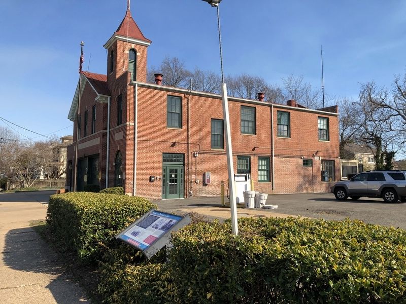
| 101 ► Virginia, Alexandria, Potomac West — Potomac Town Hall and Firehouse — Town of Potomac — 1908 - 1929 — |
| On East Windsor Avenue just east of Mt. Vernon Avenue, on the right when traveling east. | |||
| 102 ► Virginia, Alexandria, Potomac West — Potomac Yard History — Town of Potomac — 1908 - 1929 — |
| On Mount Vernon Avenue south of East Uhler Avenue, on the right when traveling north. | |||
| 103 ► Virginia, Alexandria, Potomac West — Rosemont — City of Alexandia, Est. 1749 — Alexandria Heritage Trail — |
| On Commonwealth Avenue at West Rosemont Avenue, on the right when traveling south on Commonwealth Avenue. | |||
| 104 ► Virginia, Alexandria, Potomac Yard — The Alexanders & Agriculture — City of Alexandria Est. 1749 — Potomac Yard — |
| On Potomac Avenue north of East Glebe Road, on the right when traveling north. | |||
| 105 ► Virginia, Alexandria, Potomac Yard — Virginia's First Highways — City of Alexandria Est. 1749 — Potomac Yard — |
| On Potomac Avenue north of East Glebe Road, on the right when traveling north. | |||
| 106 ► Virginia, Alexandria, Rosemont — Braddock Cannon — |
| On West Braddock Road at Russel Road, on the right when traveling west on West Braddock Road. | |||
| 107 ► Virginia, Alexandria, Seminary Hill — "The Fort" and "Seminary" Community — Civil War to Civil Rights — City of Alexandria, est. 1749 — |
| On West Braddock Road, 0.2 miles west of Marlboro Drive, on the right when traveling west. | |||
| 108 ► Virginia, Alexandria, Seminary Hill — Jackson Cemetery — City of Alexandria Est. 1749 — |
| Near West Braddock Road, 0.2 miles west of Marlboro Drive, on the right when traveling west. | |||
| 109 ► Virginia, Alexandria, Southwest Quadrant — Capt. James McGuire House — |
| On Prince Street east of South Fayette Street, on the left when traveling east. | |||
| 110 ► Virginia, Alexandria, Southwest Quadrant — James Harris House — |
| On Prince Street east of South Fayette Street, on the left when traveling east. | |||
| 111 ► Virginia, Alexandria, Southwest Quadrant — The West End — Alexandria Heritage Trail — |
| Near Jamieson Avenue at Daingerfield Road, on the right when traveling west. | |||
| 112 ► Virginia, Alexandria, Southwest Quadrant — William Clayborne Memorial — |
| On South Columbus Street north of Green Street, on the right when traveling north. | |||
| 113 ► Virginia, Alexandria, Taylor Run — A Chinquapin House — Alexandria Heritage Trail |
| On Chinquapin Drive, 0.2 miles south of King Street (Virginia Route 7), on the right when traveling north. Reported damaged. | |||
| 114 ► Virginia, Alexandria, Taylor Run — A Native American Village — Alexandria Heritage Trail — |
| Near Francis Hammond Parkway, 0.2 miles east of Key Drive, on the right when traveling east. | |||
| 115 ► Virginia, Alexandria, Taylor Run — Chinquapin Trek — Alexandria Heritage Trail — |
| On Chinquapin Drive, 0.1 miles south of King Street (Virginia Route 7), on the right when traveling north. | |||
| 116 ► Virginia, Alexandria, Taylor Run — The Bloxham Cemetery: Portal to the Past — Alexandria Heritage Trail — City of Alexandria, est. 1749 — |
| On Business Center Drive east of Witter Drive, on the left when traveling north. | |||
| 117 ► Virginia, Alexandria, Taylor Run — The Bloxham Family Cemetery — Alexandria Heritage Trail — City of Alexandria, est. 1749 — |
| On Business Center Drive south of Witter Drive, on the left when traveling north. | |||
| 118 ► Virginia, Alleghany County, Alleghany — Z-223 — Alleghany County Va. / West Virginia — |
| On Kanawha Trail (Virginia Route 311) 0.3 miles south of West Virginia Exit 183 (Interstate 64), on the left when traveling south. | |||
| 119 ► Virginia, Alleghany County, Clifton Forge — Robert Gallaspy Land Grant — May 12, 1770 and June 22, 1772 — |
| On Main Street (Business U.S. 60) at Jefferson Avenue, on the right when traveling east on Main Street. | |||
| 120 ► Virginia, Alleghany County, Covington — Z-286 — West Virginia / Alleghany County, Virginia — |
| On Interstate 64, 0.6 miles east of Jerry's Run Road (Virginia Route 198), on the right when traveling east. | |||
| 121 ► Virginia, Alleghany County, Falling Spring — The Road to the Kanawha — and Washington’s Route — Scenic Overlook — |
| On Hot Springs Road (U.S. 220) south of Falls Road (County Route 640), on the left when traveling north. | |||
| 122 ► Virginia, Amherst County, Amherst — Kearfortt-Wood House — |
| On South Main Street (Business U.S. 29) at Star Street, on the right when traveling south on South Main Street. | |||
| 123 ► Virginia, Amherst County, Amherst — The Reverend Robert Rose — 1704-1751 — |
| On Patrick Henry Highway (Virginia Route 151) 0.2 miles south of Fletchers Level Road (Virginia Route 610), on the right when traveling north. | |||
| 124 ► Virginia, Amherst County, Monroe — Water Gap — |
| Near Blue Ridge Parkway (at milepost 63.6), on the left when traveling north. | |||
| 125 ► Virginia, Appomattox County, Bent Creek — Diuguidsville — |
| On Richmond Highway (U.S. 60) at State Highway 26, on the right when traveling south on Richmond Highway. | |||
| 126 ► Virginia, Arlington County, Arlington, Alcova Heights — Alcova — |
| On South 8th Street west of South Glebe Road (Virginia Route 120), on the right when traveling west. | |||
| 127 ► Virginia, Arlington County, Arlington, Arlington Forest — Mary Carlin House — |
| On North Carlin Springs Road. | |||
| 128 ► Virginia, Arlington County, Arlington, Arlington View — Albert I. Cassell — 1895 - 1969 — |
| On South Quinn Street at 13th Street South, on the right when traveling north on South Quinn Street. | |||
| 129 ► Virginia, Arlington County, Arlington, Arlington View — George Washington Carver Cooperative Apartments — 1943 - 2015 — |
| On 13th Street South at South Quinn Street, on the right when traveling west on 13th Street South. | |||
| 130 ► Virginia, Arlington County, Arlington, Ashton Heights — Buckingham — |
| On North Glebe Road (Virginia Route 120) at North Quincy Street, on the right when traveling north on North Glebe Road. | |||
| 131 ► Virginia, Arlington County, Arlington, Barcroft — 29 — Barcroft — |
| On Columbia Pike (Virginia Route 244) at South Four Mile Run Drive, on the right when traveling west on Columbia Pike. | |||
| 132 ► Virginia, Arlington County, Arlington, Bluemont — Arlington County in 1921 / John M. Walton, Architect — |
| Near North Glebe Road (Virginia Route 120) just north of Fairfax Drive (Virginia Route 237), on the left when traveling north. | |||
| 133 ► Virginia, Arlington County, Arlington, Chain Bridge Forest — Pimmit Run and Chain Bridge — |
| On North Glebe Road (State Highway 120) at 41st Street, on the right when traveling south on North Glebe Road. | |||
| 134 ► Virginia, Arlington County, Arlington, Chain Bridge Forest — The Mouth of Pimmit Run — |
| On North Glebe Road (State Highway 120) at 41st Street, on the right when traveling north on North Glebe Road. | |||
| 135 ► Virginia, Arlington County, Arlington, Cherrydale — Cherrydale — |
| On Military Road, on the right when traveling south. | |||
| 136 ► Virginia, Arlington County, Arlington, Clarendon — Arlington Post Office — |
| On Washington Boulevard (Virginia Route 237) at North Hudson Street, on the right when traveling east on Washington Boulevard. | |||
| 137 ► Virginia, Arlington County, Arlington, Columbia Forest — Original Federal Boundary Stone, District of Columbia, Southwest 6 — Southwest No. 6 Boundary Marker — |
| On South Jefferson Street, 0.1 miles south of Columbia Pike (Virginia Route 244), in the median. | |||
| 138 ► Virginia, Arlington County, Arlington, Columbia Heights — Arlington Village — |
| On 13th Road South at South Edgewood Street, on the right when traveling east on 13th Road South. | |||
| 139 ► Virginia, Arlington County, Arlington, Columbia Heights — Selina Gray — 🔑 — |
| On 12th Street South at South Ross Street, on the right when traveling east on 12th Street South. | |||
| 140 ► Virginia, Arlington County, Arlington, Dominion Hills — Mace Park — |
| Near 10th Road North at Patrick Henry Drive, on the right when traveling west. | |||
| 141 ► Virginia, Arlington County, Arlington, Donaldson Run — Birchwood — |
| On 26th Street N at North Wakefield Street, on the right when traveling north on 26th Street N. | |||
| 142 ► Virginia, Arlington County, Arlington, Fort Myer — "Lest We Forget - We Stand on Your Shoulders" — |
| On Ord and Weitzel Drive. | |||
| 143 ► Virginia, Arlington County, Arlington, Fort Myer — A Place of Division and Reunification — Arlington House — George Washington Memorial Parkway, National Park Service, U.S. Department of the Interior — |
| On Sherman Drive north of Sheridan Drive, on the right when traveling north. | |||
| 144 ► Virginia, Arlington County, Arlington, Fort Myer — Evolving Vision — Arlington House, The Robert E. Lee Memorial — George Washington Memorial Parkway, National Park Service, U.S. Department of the Interior — |
| Near Sheridan Drive, 0.1 miles east of Humphreys Drive, on the right when traveling north. | |||
| 145 ► Virginia, Arlington County, Arlington, Fort Myer — The Path to Freedom — Arlington House, The Robert E. Lee Memorial — George Washington Memorial Parkway, National Park Service, U.S. Department of the Interior — |
| Near Sherman Drive at Sheridan Drive, on the right when traveling north. | |||
| 146 ► Virginia, Arlington County, Arlington, Fort Myer — Tree Ring Timeline — |
| On Sherman Drive north of Sheridan Drive, on the right when traveling south. | |||
| 147 ► Virginia, Arlington County, Arlington, Foxcroft Heights — Freedman’s Village — A New Home for African Americans — |
| On South Oak Street at Southgate Road, on the right when traveling north on South Oak Street. | |||
| 148 ► Virginia, Arlington County, Arlington, Foxcroft Heights — Freedman's Village — |
| On South Oak Street at Southgate Road, on the right when traveling north on South Oak Street. | |||
| 149 ► Virginia, Arlington County, Arlington, Glencarlyn — Moses Ball Grant — |
| On Carlin Springs Rd., on the right when traveling north. | |||
| 150 ► Virginia, Arlington County, Arlington, Glencarlyn — Washington's Survey Marker |
| Reported missing. | |||
| 151 ► Virginia, Arlington County, Arlington, Green Valley — FREED, 2021 — Walter Hood — Laser cut aluminum panel and metallic gold urethane topcoat. — |
| On Shirlington Road south of 24th Street South, on the left when traveling north. | |||
| 152 ► Virginia, Arlington County, Arlington, Green Valley — 2019 — |
| On South Nelson Street south of South Four Mile Run Drive, on the left when traveling south. | |||
| 153 ► Virginia, Arlington County, Arlington, Green Valley — Green Valley — |
| On South Four Mile Run east of South Nelson Street, on the left when traveling west. | |||
| 154 ► Virginia, Arlington County, Arlington, Green Valley — Late 1800's — |
| On South Four Mile Run Drive east of South Nelson Street, on the left when traveling west. | |||
| 155 ► Virginia, Arlington County, Arlington, Green Valley — Living and Learning — |
| Near South Kenmore Street north of 24th Street South, on the right when traveling south. | |||
| 156 ► Virginia, Arlington County, Arlington, Green Valley — Mid-Late 1800's — |
| On South Four Mile Run Drive east of South Nelson Street, on the left when traveling west. | |||
| 157 ► Virginia, Arlington County, Arlington, Green Valley — Nauck: A Neighborhood History — |
| On South Four Mile Run Drive at South Shirlington Road, in the median on South Four Mile Run Drive. | |||
| 158 ► Virginia, Arlington County, Arlington, Green Valley — Origins |
| On Shirlington Road south of 24th Street South, on the right when traveling south. Reported permanently removed. | |||
| 159 ► Virginia, Arlington County, Arlington, Green Valley — Origins of Green Valley — |
| Near South Kenmore STreet just north of 24th Street South, on the right when traveling south. | |||
| 160 ► Virginia, Arlington County, Arlington, High View Park — Hall's Hill Wall — |
| On 17th Road North west of North Culpeper Street, on the left when traveling west. | |||
| 161 ► Virginia, Arlington County, Arlington, Madison Manor — Brandymore Castle — |
| Near Custis Memorial Highway (Interstate 66), on the right when traveling east. | |||
| 162 ► Virginia, Arlington County, Arlington, North Highland — The Dawson-Bailey House — |
| On North Taft Street, on the left when traveling east. | |||
| 163 ► Virginia, Arlington County, Arlington, North Highland — The Dawson-Bailey Spring Site — |
| On North Scott Street north of 21st Road North, on the right when traveling north. | |||
| 164 ► Virginia, Arlington County, Arlington, North Rosslyn — Rosslyn — |
| On Langston Boulevard (U.S. 29) at North Fort Myer Drive, on the left when traveling east on Langston Boulevard. | |||
| 165 ► Virginia, Arlington County, Arlington, Potomac Overlook Regional Park — Native American Home Site — |
| Near Marcey Road, 0.3 miles north of Overlook Trail, on the right when traveling north. | |||
| 166 ► Virginia, Arlington County, Arlington, Potomac Overlook Regional Park — This is Potomac Overlook! — |
| On Marcey Road, 0.3 miles north of North Beechwood Place, on the right when traveling north. | |||
| 167 ► Virginia, Arlington County, Arlington, Potomac West — Four Mile Run and Flooding / The Restoration Project / I Live Here...Can You Find Me? / Public Art — |
| Near South Eads Street, 0.1 miles south of South Glebe Road (Virginia Route 120), on the right when traveling south. | |||
| 168 ► Virginia, Arlington County, Arlington, Ronald Reagan Washington National Airport — Abingdon — |
| 169 ► Virginia, Arlington County, Arlington, Ronald Reagan Washington National Airport — Abingdon Plantation — |
| 170 ► Virginia, Arlington County, Arlington, Ronald Reagan Washington National Airport — Abingdon Plantation Restoration — |
| 171 ► Virginia, Arlington County, Arlington, Ronald Reagan Washington National Airport — The Ages of Abingdon — Abingdon Plantation — |
| 172 ► Virginia, Arlington County, Arlington, Ronald Reagan Washington National Airport — The Alexander Family — Abingdon Plantation — |
| 173 ► Virginia, Arlington County, Arlington, Ronald Reagan Washington National Airport — The Custis Family — Abingdon Plantation — |
| 174 ► Virginia, Arlington County, Arlington, Ronald Reagan Washington National Airport — The Hunter Family — Abingdon Plantation — |
| 175 ► Virginia, Arlington County, Arlington, Rosslyn — Mount Vernon Trail — George Washington Memorial Parkway — National Park Service, U.S. Department of the Interior — |
| On Mount Vernon Trail, on the right when traveling south. | |||
| 176 ► Virginia, Arlington County, Arlington, Virginia Square — Old Ball Family Burial Ground — |
| On Washington Boulevard, on the right when traveling west. | |||
| 177 ► Virginia, Arlington County, Arlington, Woodmont — Maywood — |
| On North Lorcom Lane at North Edgewood Street, on the left when traveling west on North Lorcom Lane. | |||
| 178 ► Virginia, Augusta County, Lyndhurst — Crop Protection from Predators — |
| Near Blue Ridge Parkway (at milepost 6), 6 miles south of Howardsville Turnpike (Virginia Route 610), on the right when traveling south. | |||
| 179 ► Virginia, Augusta County, Lyndhurst — Everyday Hard Work - Year Round — |
| Near Blue Ridge Parkway (at milepost 6), 6 miles south of Howardsville Turnpike (Virginia Route 610), on the right when traveling south. | |||
| 180 ► Virginia, Augusta County, Lyndhurst — Mountain Farms: A Way of Life — |
| Near Blue Ridge Parkway (at milepost 6), 6 miles south of Howardsville Turnpike (Virginia Route 610), on the right when traveling south. | |||
| 181 ► Virginia, Augusta County, Lyndhurst — Stone Fences — |
| Near Blue Ridge Parkway (at milepost 8.8). | |||
| 182 ► Virginia, Augusta County, Lyndhurst — Subsistence and Survival — |
| Near Blue Ridge Parkway (at milepost 6), 6 miles south of Howardsville Turnpike (Virginia Route 610), on the right when traveling south. | |||
| 183 ► Virginia, Augusta County, Lyndhurst — The Mountain Economy — |
| Near Blue Ridge Parkway (at milepost 6), 6 miles south of Howardsville Turnpike (Virginia Route 610), on the right when traveling south. | |||
| 184 ► Virginia, Bath County, Hot Springs — Q-33 — Garth Newel — |
| On Sam Snead Highway (U.S. 220) at Garth Newel Lane, on the right when traveling north on Sam Snead Highway. | |||
| 185 ► Virginia, Bath County, Warm Springs — D-36 — Early Bath County Courthouses — |
| On U.S. 220. | |||
| 186 ► Virginia, Bath County, Williamsville — Settlement on Warm Springs Mountain — |
| On State Highway 39 at Homestead Mountain Drive, on the right when traveling west on State Highway 39. | |||
| 187 ► Virginia, Bath County, Williamsville — The Land and Natural Resources of Bath County — |
| On Ingalls Overlook Trail at Mountain Valley Road (Virginia Route 39), on the right when traveling north on Ingalls Overlook Trail. | |||
| 188 ► Virginia, Bedford County, Bedford — A Community at "the Mons" — Blue Ridge Parkway — |
| Near Blue Ridge Parkway (at milepost 85.6) at Peaks Road (Virginia Route 43). | |||
| 189 ► Virginia, Bedford County, Bedford — K-134 — Bedford — |
| On East Main Street (Business U.S. 460) at Court Street, on the right when traveling west on East Main Street. | |||
| 190 ► Virginia, Bedford County, Forest — Z-255 — Bedford County / Campbell County — |
| On Lynchburg Highway (U.S. 460) at County Route 649, on the right when traveling east on Lynchburg Highway. | |||
| 191 ► Virginia, Bedford County, Forest — What happened to Poplar Forest after Jefferson's death? |
| Near Bateman Bridge Road. Reported missing. | |||
| 192 ► Virginia, Bedford County, Forest — Why build the mounds? |
| Near Bateman Bridge Road. Reported missing. | |||
| 193 ► Virginia, Bedford County, Lynchburg — Plantation Worker Housing — |
| On Bateman Bridge Road. | |||
| 194 ► Virginia, Bedford County, Timberlake — K-135 — Callaway-Steptoe Cemetery — |
| On East Lynchburg-Salem Turnpike (U.S. 460) west of Ryland Drive, on the right when traveling west. | |||
| 195 ► Virginia, Botetourt County, Buchanan — A 58 — Buchanan — |
| On Main Street (U.S. 11) south of Washington Street, on the right when traveling south. | |||
| 196 ► Virginia, Botetourt County, Buchanan — A-91 — Looney's Ferry — |
| On Main Street (U.S. 11), on the right when traveling south. | |||
| 197 ► Virginia, Botetourt County, Cloverdale — A-81 — Old Carolina Road — |
| On Lee Hwy (U.S. 11) south of 2nd Avenue, on the right when traveling north. | |||
| 198 ► Virginia, Botetourt County, Fincastle — D-28 — Fincastle — |
| On Fincastle Road (U.S. 220) at West Main Street (Local Route T-630), on the right when traveling north on Fincastle Road. | |||
| 199 ► Virginia, Botetourt County, Nace — A-80 — Coming of the Railroad — |
| On Lee Highway (U.S. 11), on the right when traveling south. | |||
| 200 ► Virginia, Bristol — K-124 — Bristol Union Railway Station — |
| On Martin Luther King Jr. Boulevard (Virginia Route 113) north of State Street, on the right when traveling north. | |||
1637 entries matched your criteria. Entries 101 through 200 are listed above. ⊲ Previous 100 — Next 100 ⊳