After filtering for Indiana, 247 entries match your criteria. Entries 101 through 200 are listed.⊲ Previous 100 — The final 47 ⊳
Native Americans Topic
By William Fischer, Jr., December 28, 2009
Trinity United Methodist Church and Markers
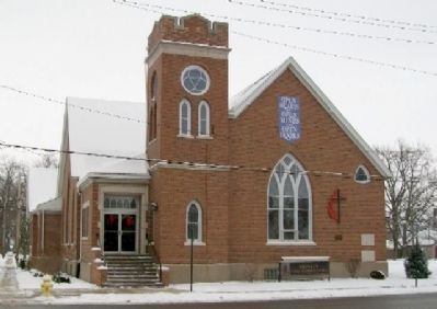
| 101 ► Indiana, Jasper County, Rensselaer — Trinity United Methodist Church — |
| 102 ► Indiana, Jennings County, North Vernon — 40.1966.1 — Grouseland Treaty Line — (August 21, 1805) — |
| 103 ► Indiana, Johnson County, Franklin — Nancy Kerlin Barnett — Born May 14, 1793 - Died Dec. 1, 1831 — |
| 104 ► Indiana, Knox County, Vincennes — Chief Tecumseh — 1768 - 1813 — |
| 105 ► Indiana, Knox County, Vincennes — Red Banks Trace — |
| 106 ► Indiana, Knox County, Vincennes — 42.2011.1 — Tecumseh and Harrison — |
| 107 ► Indiana, Knox County, Vincennes — Vincennes — |
| 108 ► Indiana, Knox County, Vincennes — 42.2006.1 — William Henry Harrison & Lewis & Clark Expedition — |
| 109 ► Indiana, Knox County, Vincennes, Vincennes Township — Tecumseh at Fort Knox II and Vincennes — |
| 110 ► Indiana, Kosciusko County, Syracuse — 43.1962.2 — Indian Hill — |
| 111 ► Indiana, Kosciusko County, Syracuse — Last Tract of Land Owned by Miami — |
| 112 ► Indiana, Kosciusko County, Syracuse — 43.1962.1 — Papakeechie's Reserve — |
| 113 ► Indiana, LaGrange County, Howe — Site of First LaGrange County Courthouse and Jail 1833 - 1843 — |
| 114 ► Indiana, Lagrange County, Shipshewana — Chief Shipshewana Memorial — |
| 115 ► Indiana, Lake County, Dyer — Sauk (Sak) Trail — |
| 116 ► Indiana, Lake County, Dyer — The Lincoln Highway — Ideal Section & Monument — |
| 117 ► Indiana, Lake County, Gary, Miller Beach — Jacques Marquette — Born 1637 - Died 1675 — |
| 118 ► Indiana, Lake County, Gary, Miller Beach — Southern Point of Lake Michigan — |
| 119 ► Indiana, Lake County, Lake Station — Potawatomi Trail — |
| 120 ► Indiana, Lake County, Merrillville — 45.1966.1 — Great Sauk (Sac) Trail — (east-west through this point) — Reported missing |
| 121 ► Indiana, LaPorte County, La Porte — American Revolutionary Bicentennial — 1776 - 1976 — |
| 122 ► Indiana, LaPorte County, La Porte — Indian Boundary Line — |
| 123 ► Indiana, LaPorte County, Michigan City — Battle of Trail Creek — Dec. 5, 1780 — |
| 124 ► Indiana, LaPorte County, Michigan City — Hoosier Slide — |
| 125 ► Indiana, LaPorte County, Rolling Prairie — Fort Wayne-Fort Dearborn Trail — |
| 126 ► Indiana, Lawrence County, Mitchell — Vincennes Tract Line — |
| 127 ► Indiana, Madison County, Anderson — Public Square — |
| 128 ► Indiana, Madison County, Anderson — The Great Mound — |
| 129 ► Indiana, Madison County, Anderson — The Moravian Mission — |
| 130 ► Indiana, Madison County, Chesterfield — American Indian Memorial/The Totem Pole/The Lighthouse — Camp Chesterfield — |
| 131 ► Indiana, Madison County, Chesterfield — Native American Memorial — [Mounds State Park] — |
| 132 ► Indiana, Madison County, Chesterfield — The Circle Mound — [Mounds State Park] — |
| 133 ► Indiana, Madison County, Chesterfield — The Mounds Dugout Canoe — [Mounds State Park] — |
| 134 ► Indiana, Madison County, Markleville — 48.1966.1 — Massacre of Indians — |
| 135 ► Indiana, Madison County, Orestes — Landmark Oak — |
| 136 ► Indiana, Madison County, Pendleton — History — Town of Pendleton — |
| 137 ► Indiana, Madison County, Pendleton — 48.2017.1 — Indians Murdered 1824 — |
| 138 ► Indiana, Madison County, Pendleton — Three White Men Were Hung Here — |
| 139 ► Indiana, Marion County, Indianapolis, Downtown — Allen County — Organized in 1835 — Named for John Allen — |
| 140 ► Indiana, Marion County, Indianapolis, Downtown — Blackford House — |
| 141 ► Indiana, Marion County, Indianapolis, Downtown — Crawford County — Organized in 1818 — Named for William Crawford — |
| 142 ► Indiana, Marion County, Indianapolis, Downtown — Delaware County — Organized in 1827 — Named for the Delaware Tribe — |
| 143 ► Indiana, Marion County, Indianapolis, Downtown — Hamilton County — Organized in 1823 — Named for Alexander Hamilton — |
| 144 ► Indiana, Marion County, Indianapolis, Downtown — Huntington County — Organized in 1834 — Named for Samuel Huntington — |
| 145 ► Indiana, Marion County, Indianapolis, Downtown — Madison County — Organized in 1823 — Named for James Madison — |
| 146 ► Indiana, Marion County, Indianapolis, Downtown — St. Joseph County — Organized in 1830 — Named for the St. Joseph River — |
| 147 ► Indiana, Marion County, Indianapolis, Downtown — Steuben County — Organized in 1837 — Named for Baron Friedreich Wilhelm von Steuben — |
| 148 ► Indiana, Marion County, Indianapolis, Downtown — Tippecanoe County — Organized in 1826 — Named for the Tippecanoe River — |
| 149 ► Indiana, Marion County, Indianapolis, Downtown — Vanderburgh County — Organized in 1818 — Named for Henry Vanderburgh — |
| 150 ► Indiana, Marion County, Indianapolis, Downtown — Wells County — Organized in 1837 — Named for William Wells — |
| 151 ► Indiana, Marion County, Indianapolis, Mile Square — William H. Harrison — |
| 152 ► Indiana, Marion County, Indianapolis, Near NW - Riverside — 49.1992.4 — Site of Golden Hill Totem Pole — |
| 153 ► Indiana, Marion County, Indianapolis, Wholesale District — Chief Tecumseh — |
| 154 ► Indiana, Marshall County, Culver, Union Township — Pioneer Camp / Nas-Wau-Kee and Maxinkuckee — Reported permanently removed |
| 155 ► Indiana, Marshall County, Plymouth — Chief Menominee — |
| 156 ► Indiana, Marshall County, Plymouth — Menominee Chapel — Potawatomi - Trail of Death — Reported missing |
| 157 ► Indiana, Marshall County, Plymouth — 50.1949.1 — Trail of Death — Reported missing |
| 158 ► Indiana, Marshall County, Tippecanoe — 50.2011.1 — Benack's Village — |
| 159 ► Indiana, Marshall County, Twin Lakes — Potawatomi Indian Village — |
| 160 ► Indiana, Miami County, Peru — 52.1992.1 — Burial Place of Francis Godfroy — |
| 161 ► Indiana, Miami County, Peru — Chief Francis Godfroy's Council Chambers — |
| 162 ► Indiana, Miami County, Peru — 52.1992.2 — House of Chief Richardville — |
| 163 ► Indiana, Miami County, Pioneer — Lost Sister Trail — |
| 164 ► Indiana, Montgomery County, Ladoga — 54.1981.1 — Chief Cornstalk’s Village — |
| 165 ► Indiana, Montgomery County, Waynetown — 54-2002-1 — William Bratton — Lewis and Clark Expedition Member — |
| 166 ► Indiana, Noble County, Indian Village — 57.1967.1 — Chief Papakeecha’s House — ← one quarter mile south — |
| 167 ► Indiana, Noble County, Indian Village — 57.1967.2 — Indian Oven — 80 Rods East → — |
| 168 ► Indiana, Orange County, French Lick — Site of The French Lick Fort — Reported permanently removed |
| 169 ► Indiana, Orange County, Orleans — Freeman Corner — |
| 170 ► Indiana, Orange County, Orleans — 59.1966.1 — Freeman's Corner — (250 feet east) — |
| 171 ► Indiana, Owen County, Gosport — The Ten O'Clock Line — |
| 172 ► Indiana, Parke County, Armiesburg — 61.2004.1 — Christmas (Noel) Dagenet — |
| 173 ► Indiana, Parke County, Bridgeton — 61.1968.2 — 10 O'Clock Line — Treaty with Potawatomi, Delaware, and Miami Indians — |
| 174 ► Indiana, Parke County, Marshall — 61.1968.4 — Turkey Run — |
| 175 ► Indiana, Parke County, Mecca — 61.1968.1 — 10 O'Clock Line — |
| 176 ► Indiana, Porter County, Hebron — Site of Huakiki — |
| 177 ► Indiana, Porter County, Hebron — Site of Huakiki — Location of "Huakiki" village — |
| 178 ► Indiana, Porter County, Valparaiso — Old Sac Trail — |
| 179 ► Indiana, Pulaski County, Winamac — The Teacher — |
| 180 ► Indiana, Putnam County, Greencastle — The Ancient Peoples Who Once Walked Here — |
| 181 ► Indiana, Putnam County, Reelsville — 67.1966.1 — 10 O'Clock Treaty Line — Treaty with Potawatomi, Delaware, and Miami Indians — |
| 182 ► Indiana, Randolph County, Ridgeville — Indian Boundary Line — |
| 183 ► Indiana, Randolph County, Winchester — Pre-County Settlement — |
| 184 ► Indiana, Scott County, Nabb — John Kimberlin Farm — |
| 185 ► Indiana, Scott County, Scottsburg — Pigeon Roost — |
| 186 ► Indiana, Scott County, Scottsburg — Pigeon Roost — |
| 187 ► Indiana, Shelby County, Shelbyville — 73.2011.1 — Whetzel Trace — After the War of 1812 — |
| 188 ► Indiana, St. Joseph County, South Bend — The Original People — |
| 189 ► Indiana, St. Joseph County, South Bend, Council Oak — Council Oak — |
| 190 ► Indiana, Steuben County, Angola, Pokagon State Park — Beginning in Ice: The Lakes of Pokagon — |
| 191 ► Indiana, Steuben County, Hamilton — Native Americans — |
| 192 ► Indiana, Steuben County, Ray — The Unknown Potawatomi — |
| 193 ► Indiana, Sullivan County, Fairbanks — 77.1989.4 — Fairbanks' Massacre — Sergeant Nathan Fairbanks — |
| 194 ► Indiana, Sullivan County, Garysville, Turman Township — Wea Indian Trail — Gen. Wm. H. Harrison Route — |
| 195 ► Indiana, Tippecanoe County, Battle Ground — Potawatomi ‘Trail of Death’ Route — |
| 196 ► Indiana, Tippecanoe County, Battle Ground — Prophet’s Rock — |
| 197 ► Indiana, Tippecanoe County, Battle Ground — Prophet’s Town — |
| 198 ► Indiana, Tippecanoe County, Lafayette — Trail of Death — September 13, 1838 — Lagrange on Wabash River — |
| 199 ► Indiana, Tippecanoe County, Lafayette — Trail of Death — September 12, 1838 — LaGrange - Logansport State Road — |
| 200 ► Indiana, Tippecanoe County, Shadeland — Scott's Expedition — Against the Wea — Reported missing |
247 entries matched your criteria. Entries 101 through 200 are listed above. ⊲ Previous 100 — The final 47 ⊳