On Ohio Route 93 at Ohio Route 36 on State Route 93.
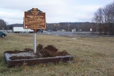
In the early 1770s, Chief White Eyes (Koquechagachton) of the Delaware tribe founded White Eyes Town approximately two miles southeast of this marker on a plain near present day West Lafayette. A friend of the Moravian leader David Zeisberger, White . . . — — Map (db m15175) HM
On Ohio Route 19, on the right when traveling west.
On the banks on the Olentangy River, at the
bend where the stream turns southwest, is the
legendary site of Seccaium. This 17th century
village was located on the portage to the
Sandusky River, and was recognized by
Indians as a neutral . . . — — Map (db m80440) HM
On Sandusky Avenue (Ohio Route 4) 0.2 miles north of Chatfield Center (Ohio Route 103), on the right when traveling north.
For centuries this area was used by Indian
tribes as a hunting ground. Vast swamp forests
of elm, ash, beech, pin oak, and maple lay on all
sides. To the east, a large cranberry bog was
covered by water most of the year. Indian
hunting camps . . . — — Map (db m119771) HM
Distinguished Indian chief
Brave in war ... valiant in peace
Algonquin Nation ... Osaukee Tribe
Bear Clan
Born Saukeenuk, IA, 1810
Died Cleveland, 1844
After the Black Hawk War where Joc-O-Sot received the wound that finally caused . . . — — Map (db m17900) HM
Side A
In 1826, when Cleveland's first cemetery closed, Cleveland village trustees paid Leonard Case Sr. one dollar for eight acres of land and dedicated it as the Erie Street Cemetery. Built on what became prime property, the cemetery . . . — — Map (db m102722) HM
On Canal Road at Stone Road, on the right when traveling south on Canal Road.
Beginning around 1000, American Indians in northeastern
Ohio developed a distinct culture known archeologically as
the Whittlesley Tradition. They started building walls around
their small villages. (See illustration below.) Their pottery . . . — — Map (db m140125) HM
On Canal Road at Stone Road, on the right when traveling south on Canal Road.
Directly across the Cuyahoga River from this spot is the South Park Village. Here, archeologists uncovered the remains of a four-acre, Native American settlement populated by people of the Whittlesey Tradition. The people of South Park lived in . . . — — Map (db m140124) HM
On Ohio Route 49, 0.7 miles south of Ohio Route 47, on the right when traveling south.
The army of
Maj. General Arthur St. Clair
camped on the ridge to the east
from Sunday evening, October 30th,
until the morning of November 2nd 1791,
awaiting the forwarding of flour,
tents and heavy baggage. The troops
had advanced . . . — — Map (db m20250) HM
Near Weavers-Fort Jefferson Road, 0.1 miles west of Ohio Route 121, on the left when traveling west.
Built by the Army of
General Arthur St. Clair
in October 1791
and used as a military post
during the campaigns against
the North-Western Indian tribes
MCMVII — — Map (db m19885) HM
On Ohio Route 121 at Weavers-Fort Jefferson Road (County Route 24), on the right when traveling south on State Route 121.
Site of
Fort Jefferson
The most advanced post
established by General St. Clair
on his campaign
against the Northwestern
Indian Tribes in 1791. — — Map (db m138773) HM
On Weavers-Fort Jefferson Road, 0.1 miles west of Ohio Route 121, on the left when traveling west.
Fort Jefferson. During the Indian Wars of 1790-1795, the United States built a chain of forts in the contested area of what is today western Ohio. These forts were built as a result of various tribes of the region attacking the encroaching . . . — — Map (db m20254) HM
On Weavers-Fort Jefferson Road, 0.1 miles west of Ohio Route 121, on the left when traveling west. Reported damaged.
Fort Jefferson was just a link in a chain of forts stretching north from Fort Washington (Cincinnati) to Fort Deposit (Waterville).
During the Indian War of 1790-1795, the United States felt it necessary to build forts in contested . . . — — Map (db m165698) HM
On Broadway Street (Ohio Route 118) at Main Street (Ohio Route 49), on the right when traveling north on Broadway Street.
One of America's best-known sport shooters and entertainers of the late 1800s, Annie Oakley was born Phoebe Ann Mosey (or Mozee) north of Versailles in Darke County in 1860. She achieved local fame for her shooting ability as a hunter while still in . . . — — Map (db m205096) HM
On South Broadway Street (Ohio Route 49) at West Main Street, on the right when traveling south on South Broadway Street.
Site of
Fort Greene-Ville
»»««
The largest pioneer fort
in Ohio, built in 1793, by
General Anthony Wayne.
Here, August 5, 1795, the
Treaty was signed by which
much of present Ohio was
opened to White . . . — — Map (db m19878) HM
On Main Street (Ohio Route 502) at Elm Street, on the right when traveling east on Main Street.
Signed near this location on
Aug. 3, 1795
Line Drawing of the Principal Figures
in the signing of the treaty
1. Anthony Wayne
2. Little Turtle • 3. William Wells
4. William Henry Harrison
5. William Clark • 6. Meriwether Lewis . . . — — Map (db m28801) HM
Side A: Tecumseh
One of the most influential Native Americans of the 19th century, Tecumseh was born in 1768 in the Pickaway settlements on the Mad River and raised by older siblings at Old Town. A prominent Shawnee war leader who vigorously . . . — — Map (db m28646) HM
On Main Street (Ohio Route 49) at Main Street (Ohio Route 121), on the right when traveling north on Main Street.
Following General Anthony Wayne's victory at Fallen Timbers, members of the western tribes assembled at Fort Greene Ville to settle on terms of peace. Representatives of the Wyandot, Delaware, Shawnee, Ottawas, Chippewa, Ottawa, Pattawatimi, . . . — — Map (db m244967) HM
On South Broadway Street (Ohio Route 49) at West Main Street, on the right when traveling south on South Broadway Street.
Placed
to Commemorate the
Treaty of Greeneville
Signed August 3, 1795 by
General Anthony Wayne
Representing the
United States Government
and the chiefs and agents of the
Allied Indian Tribes
of the
Territory Northwest
of the . . . — — Map (db m19883) HM
On Wilson Drive, 0.2 miles east of North Broadway Street (Ohio Route 118), on the right when traveling east.
Gen. William Henry Harrison, United States
Gov. Lewis Cass, Michigan Territory
A Bowery was built to conduct treaty negotiations
with eight Native American Indian Nations
Wyandot, Delaware, Shawanee, Ottawa,
Seneca, Miami, . . . — — Map (db m193031) HM WM
On Ohio Route 49, 2.2 miles north of Ohio Route 47, on the left when traveling north.
The army of
Major General Anthony Wayne
camped on the rising ground immediately
eastward on the night of July 28th, 1794 A.D.
After advancing twelve miles from headquarters
at Fort Greene Ville on the expedition against
the Indian tribes . . . — — Map (db m20252) HM
On South Clinton Street (Ohio Route 111) south of Sunday Street, on the right when traveling south. Reported missing.
Abatis and Camp
»»««
General Wayne’s Army in
1794 and General Winchester’s
Army in 1812 encamped on
this spot.
Here also was the western
end of Gen. Winchester’s Abatis. — — Map (db m136580) HM
Near Fort Street at Washington Street, on the right when traveling west.
Buffalo were recorded here in 1718 to the east across the river.
This entire area was an important Indian trade center from early times to c. 1830.
Trading posts were established here in the middle 1700's including George Ironside's and Peter . . . — — Map (db m28539) HM
On Fort Street at Washington Avenue, on the left when traveling east on Fort Street.
On August 9, 1794, General Anthony Wayne ordered Major Henry Burbeck to erect a garrison
at the confluence. Though it was constructed in only six days using crude implements and
materials that were on hand, it was the strongest fort built during . . . — — Map (db m160528) HM
On East River Drive (Ohio Route 424) west of Maywinn Road, on the right when traveling east.
[First Marker]
Coohcooche
Mineral Spring 1790
Birthplace of Ottawa
Chief Shabonee 1775
and
Lodge of Shawnee Chief
Blue Jacket 1792
Winchester Camp No 1
1812
[Second Marker]
Chief
Blue Jacket . . . — — Map (db m28354) HM
On East 2nd Street (Ohio Route 66) near Auglaize Street, on the right when traveling west.
Site Of
French Mission 1650
Jesuit Mission 1670
Moravian Christian Indians 1781
Great Indian Cornfields 1794
Cabin and Home of Delaware
Chief Whingy-Pooshies and
Boy Captive, John Brickell
1791 - 1794 - 1795
British . . . — — Map (db m165819) HM
On East River Drive (Ohio Route 424) 0.2 miles east of Clinton Street (Ohio Route 18), on the right when traveling east.
• This area was first seen by the Europeans c. 1650, and following the Indian Wars, the first white settlers arrived in the spring of 1815.
• Five prehistoric Indian mounds were found in this area.
• The three rivers, prior to paved roads, . . . — — Map (db m173057) HM
On Fort Street at Washington Avenue, on the right when traveling west on Fort Street.
Fort Defiance was erected upon this site by General Wayne August 9-17, 1794 and thus "The Grand Emporium of the hostile Indians of the west was gained without loss of blood."
From this point General Wayne advanced against the Indians and . . . — — Map (db m18751) HM
On Fort Street at Washington Avenue, on the right when traveling west on Fort Street.
Fort Defiance
The arrival of the Legion of the United States at this point on August 8, 1794 marked the end of General Anthony Wayne's difficult march, through swamps and forests, from Fort GreeneVille. On this site, in the center of the . . . — — Map (db m239102) HM
Here in 1794 General Anthony Wayne built Fort Defiance during the Indian Wars prior to the Battle of Fallen Timbers.
Fort Winchester was built south of here during the War of 1812.
Down river from here is Preston Island, former site of Indian . . . — — Map (db m28542) HM
On West 2nd Street at Washington Avenue, on the right when traveling east on West 2nd Street.
Built by General Wm. H. Harrison in Oct. 1812 and named for General Winchester.
For a time it was the only defensive work against the British and Indians in Northwestern Ohio. — — Map (db m18717) HM
On Fort Street at Washington Avenue, on the left when traveling east on Fort Street.
As Anthony Wayne marched up the Maumee River to Kekionga (Fort Wayne, Indiana), another
Native American stronghold, he placed Major Thomas Hunt in command of the garrison.
Major Thomas Cushing was second in command of the 200 to 300 remaining men. . . . — — Map (db m160532) HM
[Text on the south side of the Marker]:
Little Turtle (Me-she-kin-o-quah)
1752 - 1812
Little Turtle, a war chief of the Miami People, was born near
present-day Fort Wayne, Indiana. From 1790 to 1794, he lived in a . . . — — Map (db m52992) HM
On East River Drive (Ohio Route 424) 0.2 miles east of North Clinton Street (Ohio Route 66), on the right when traveling east.
Pontiac Birthplace
»»««
Here, in 1712, was born the
Great Indian chief who in-
cited Pontiac’s Conspiracy.
He federated the tribes and
with the aid of the French
threatened British suprem-
acy. Killed in Illinois . . . — — Map (db m28350) HM
On East River Road (Ohio Route 424) 0.1 miles east of North Clinton Street, on the right when traveling east.
Named for the Ottawa Indian chief said to have been born here c. 1712. Site of the largest recorded apple tree "French and Indian" c. 1680 to 1887. Here Oliver Spencer spent his Indian captivity 1792. Bark cabins and cultivated fields fields of the . . . — — Map (db m30297) HM
On Fort Street at Washington Avenue, on the left when traveling west on Fort Street.
Anthony Wayne defeated the Indian Confederation at the Battle of Fallen Timbers on August 20, 1794.
The retreating Indians were locked out of Fort Miamis by their British allies. Wayne noted the artillery
mounted at the British Fort. Upon . . . — — Map (db m160530) HM
Near Fort Street at Washington Street, on the right when traveling west.
"Spemica Lawba-Johnny Logan"
In September 1786, Captain Benjamin Logan of Kentucky captured a young Indian boy during a raid across the Ohio River on the Machachac tribe towns of the Shawnee nation. Upon returning to Kentucky, Captain Logan . . . — — Map (db m28338) HM
On Delaware Bend Road south of U.S. 24, on the left when traveling south.
[Front Side of Marker]: "Tale of Ensign James Liggett"
After American militia troops forcibly ended the 1812 siege of Fort Wayne, General James Winchester's Army of the Northwest marched down the north side of the Miami [Maumee] . . . — — Map (db m28336) HM
On East Lincoln Avenue near Blymer Street, on the left when traveling east.
In the late days of September, 1776, negotiators William Wilson and Joseph Nicholson left Fort Pitt which is today Pittsburgh. Their goal was to convince the tribes north and west of the Ohio not to join forces with the British. For support, the . . . — — Map (db m93221) HM
On Central Avenue (Ohio Route 37), on the right when traveling west.
(Side A):
Courthouse Hill
In the early years of Delaware, this area was known as Briar Hill. It is the highest elevation in the city. Situated facing south and approximately at the center of the existing Courthouse, was the site of the first . . . — — Map (db m18247) HM
On East Lincoln Avenue east of Blymer Street, on the left when traveling east.
Near this location was a large Mingo town of significance during the Revolutionary period of the 1770's. The chief was Te-caugh-ye-te-righ-to, known to the settlers as Pluggy. The village consisted of perhaps 300 inhabitants. Among them were . . . — — Map (db m93220) HM
On South Washington Street (Ohio Route 101) at Reed Court, on the right when traveling east on South Washington Street.
In 1810 Snow's grist mill
was built near here.
Unfailing water supply brought
people from great distances
to Cold Creek mills.
Snow's family was massacred
by Indians in 1813 — — Map (db m31746) HM
On Adams Avenue at U.S. 6 Eastbound, on the right when traveling west on Adams Avenue.
Huron and Erie County are rich in Native American history.
During the construction of the nearby Ohio Route 2 bypass
archaeologists in 1976-77 uncovered three Native villages and
burial sites.
The Anderson site, overlooking the Old Woman . . . — — Map (db m142364) HM
On Lake Shore Road at Addison Road, on the right when traveling east on Lake Shore Road.
Between three and four hundred years ago, Ohio pre-historic Indians, believed to be of the Erie tribe, pecked numerous inscriptions or pictographs on the top surface of this large native limestone rock. The figures, now nearly obliterated by the . . . — — Map (db m158974) HM
On North Main Street, on the left when traveling south.
The last mission of the Moravians in the Valley of the Huron in the Ohio Country was at the Indian Village of Pettquottink, now Milan. — — Map (db m90658) HM
On North Edison Drive, 0.1 miles north of Front Street, on the right when traveling north.
The ridge beginning at the Edison Birthplance and descending to the Village Creek 1/4 mile north of this spot was known, even in Edison's time, as the Hogback. Shown on an 1805 Morvaian map, the street on which you are standing was an . . . — — Map (db m236716) HM
On Venice Road (U.S. 6) at Fremont Avenue (U.S. 6), in the median on Venice Road.
Erected by the British near this junction in 1761; destroyed during Pontiac's Conspiracy of 1763. The fort was strategically located near Indian towns and trading posts on the Great Indian trail between Detroit and Pittsburgh. — — Map (db m20435) HM
On Huron Avenue (U.S. 6) at Wayne Street, on the right when traveling east on Huron Avenue.
An Indian camp formerly called Ogontz Place by Chief Ogontz of the Ottawa Tribe. Sandusky, founded 1817 by Hon. Zalmon Wildman, Judge Isaac Mills, George Hoadley. Incorporated 1824, Dr. George Anderson, Aaron C. Corbet, Cyrus W. Marsh, Alexander . . . — — Map (db m142010) HM
On Main Street (Ohio Route 60) north of Ohio Street, on the right when traveling north.
Vermillion. Founded 1808, incorporated 1837.
• Settled by Connecticut “Firelanders.”
• Name derived from red banks along river.
• Old Indian Fort, up river, famous for giving protection to Vermilion Tribe and roving bands. . . . — — Map (db m147774) HM
On Long Street (U.S. 33), on the left when traveling east.
Central Ohio was home to Native Americans as early as 10,000 years ago. While we don't know what they called themselves, archaeologists call a group of the earliest peoples, “Mound Builders”. Their society left nearly 200 burial and . . . — — Map (db m30023) HM
On Long Street (U.S. 33) at Neil Avenue, on the left when traveling east on Long Street.
Columbus was founded specifically for the purpose of being the state capital in 1812, and was selected primarily due to its location - near the center of the state. But a lack of transportation options restricted access to town. For nearly 20 . . . — — Map (db m30007) HM
On West Long Street (U.S. 33) west of Marconi Boulevard.
On this spot the first cabin
in Columbus
was built by its first inhabitant
John Brickell 1797
Born Stewarts Crossing, Penn. 1781.
Captured by a Delaware Indian 1791.
Adopted by chief of that tribe
Whingwy . . . — — Map (db m59319) HM
On Marconi Boulevard south of West Long Street (U.S. 33), on the right when traveling north.
Author's Note:
It is wise to remember the ancient people before us who greeted new things to this continent. How did they teach children to prepare for real change holding to virtue as they discovered the voyagers? The hero of this fantasy, . . . — — Map (db m204180) HM
On Martin Street south of West State Street, in the median.
Near this spot, June 21, 1813 was held a council between General William Henry Harrison and the Indians comprising Wyandots, Delawares, Shawnees and Senecas with Tarhe the Crane as spokesman resulting in permanent peace with the Indians of Ohio. — — Map (db m59300) HM
On High Street near Indian Springs Dr., on the right when traveling north.
The Treaty of Greeneville temporarily ended the Indian Wars and
opened the west to white settlers. Kihue (aka Bill Moose), a
Native American and member of the Wyandotte tribe, was born
in Ohio in 1837. By 1846 all but twelve Wyandotte families . . . — — Map (db m116830) HM
On Indianola Avenue (U.S. 23) at Cooke Road, on the right when traveling north on Indianola Avenue.
Dominion Land Company Mound
An Early Woodlands Period Structure
In the early 1800s, Prosper Wetmore wrote about his childhood
memories of native mounds in the ravine area of Northwestern
Clinton Township. At that time, he recalled two . . . — — Map (db m108853) HM
On McKinley Avenue, 0.5 miles south of Trabue Road, on the right when traveling south.
Campbell Memorial Park. James E. Campbell was governor of the State of Ohio from 1890-1892. From 1913-1924, he served as president of the Ohio Archaeological and Historical Society, which later became the Ohio Historical Society. His daughter . . . — — Map (db m36726) HM
On McKinley Avenue, 0.5 miles south of Trabue Road, on the right when traveling south.
One of the last remaining earthen mounds in this area of Ohio. Built by Native American people of the Adena Culture (800 BC-100 AD). The land was deeded to the Ohio Historical Society in 1928 by the Shrum Family. — — Map (db m36869) HM
On McKinley Avenue north of Quarry Lake Drive, on the left when traveling north.
The Shrum Mound. Preserved as a memorial to those first Ohioans whose bones rest in this ancient tomb.
James E. Campbell Memorial Park. Made a permanent park by Jessie Campbell Coons in memory of her father former Governor of Ohio . . . — — Map (db m200861) HM
Near Hard Road at Riverside Drive (Ohio Route 257).
Kościuszko Timeline
February 4, 1746.
Andrzej Tadeusz Bonawentura Kościuszko was born in the town of Mereczowszczyzna, near the present-day town of Kosava, Belarus.
1776 – 1783.
Kosciuszko arrived in . . . — — Map (db m170833) HM
On Rings Road at Frantz Road, on the left when traveling west on Rings Road.
Corn has been cultivated in Ohio for approximately 1800 years. It was
known to prehistoric Native American Hopewell peoples (A.D. 100-
500 ) and was grown in large quantities by the later Fort Ancient Indians
(A.D. 1000- 1550). Prehistoric and . . . — — Map (db m107940) HM
Near Riverside Drive (Ohio Route 257) just south of Hard Road, on the right when traveling south.
Leatherlips, the Dublin Arts Council’s first outdoor public sculpture, was dedicated to the City of Dublin on July 1, 1990. Designed by artist Ralph Helmick, Leatherlips is an eleven foot high limestone portrait of the . . . — — Map (db m115842) HM
Near Harrisburg Georgesville Road (County Highway 281).
On this terrace bench overlooking Big Darby Creek, people of the Fort Ancient Culture constructed a large circular village with a central plaza and constructed a low earthen mound on the plaza's edge to commemorate the burial location of . . . — — Map (db m141375) HM
On Autumn Wind Drive at Snowy Creek Drive, on the right when traveling west on Autumn Wind Drive.
Archaeological investigations in 2002 uncovered evidence of a Native American camp at this location. The recovered artifacts and features included charcoal that produced a radiocarbon date indicating a possible Early Woodland Period occupation . . . — — Map (db m176237) HM
On Alkire Road at Gardner Road (County Route 281), on the left when traveling west on Alkire Road.
Recognized for their biodiversity and high quality aquatic habitat, Big Darby Creek and Little Darby Creek were designated as state and national scenic rivers. These riparian ecosystems provide modern recreational opportunities while allowing a . . . — — Map (db m12514) HM
On Swickard Woods Boulevard, on the right when traveling east.
Side A:
Because three distinct survey methods were used to survey Plain Township lands and are still meaningful, the township can be thought of as a surveyor's museum. The township came into existence by a 1796 act of Congress in which the federal . . . — — Map (db m17377) HM
On Riverside Drive (U.S. 33), on the right when traveling north.
Last of the Wyandots. Born 1837 and whose death in 1937 marks the passing of the Indians from this territory.
Engraved by Zenker Brothers — — Map (db m17430) HM
On Tremont Road, 0.1 miles north of Northam Road, on the right when traveling north.
Early Inhabitants
Over 2,000 years ago, this land was occupied by
the Adena people, considered the area's first farmers and best known for building conical mounds for burial sites. Shrum Mound at Campbell Memorial
Park is the closest example . . . — — Map (db m221811) HM
On Riverside Drive (U.S. 33), on the right when traveling north.
A network of Native American trails, usually following waterways, traversed Ohio and often determined the routes of military roads and improved highways. U.S. Route 33 follows the route of the Scioto Trail from the confluence of the Scioto and . . . — — Map (db m17415) HM
On Plesenton Drive, 0.2 miles west of Olentangy River Road, on the left when traveling north.
Archaeologists believe that this prehistoric mound, part of a complex of earthworks, was used for rituals by the Hopewell people and was probably built between 100 BC and 400 AD. Note the painted post tops marking the Hopewell pole house footprint. . . . — — Map (db m168823) HM
On Chestnut Street west of Clark Street, on the left when traveling east.
This is a small to medium sized tree with a dense, oval to round form branching quite low. It is one of the first trees to leaf out in the spring. Indians named the fruit of this tree "buckeye" because it is dark brown with a large gray spot that . . . — — Map (db m235809) HM
Near County Road 15 south of Fairway Lane, on the right when traveling north.
This is a small to medium sized tree with a dense, oval to round form branching quite low. It is one of the first trees to leaf out in the spring. Indians named the fruit of this tree "buckeye" because it is dark brown with a large gray spot that . . . — — Map (db m228976) HM
On County Road 10-2, 0.3 miles north of County Road K, on the left when traveling north.
From around 1692 to 1992, a White Oak (Quercus alba) that became known
as the Council Oak, grew on this spot. At full maturity it stood 75 feet high and
measured 5 feet in diameter. From 1800 to 1840 many important meetings concerning
the . . . — — Map (db m170874) HM
On County Road 102, on the left when traveling north.
Council Oak Of the three things for which the site is historically important, only one survives - the famous Council Oak. Given the power of speech, the great tree could tell a stirring story of council meetings, torture of war prisoners, and . . . — — Map (db m100804) HM
This site(approximately 6 acres) contains 12 low mounds which each averaged 3 foot high and 35 feet wide. They contain adult, children, and animal remains and cremains, altars, and personal belongings of pre-historic mound building cultures from the . . . — — Map (db m101218) HM
In Grateful Remembrance
this public state park has been created
through the generosity of public- spirited
citizens of Greene county who donated the
land. The prehistoric Indian-mound known
as the “Williamson Mound” thus will . . . — — Map (db m118376) HM
On Ohio Route 343, 0.8 miles east of Swimming Pool Road, on the right when traveling east.
History- To the Shawnee Indians, Clifton Gorge was a refuge in time of trouble. To the pioneers, it was a barrier to travel. The nineteenth century industrialists valued its water power and filled it with mills. Today, as part of Ohio's . . . — — Map (db m214656) HM
On U.S. 68, 0.1 miles south of Brush Row Road, on the right when traveling south. Reported permanently removed.
In memory of
Col. Daniel Boone and 27 salt makers, taken prisoners at Blue Licks, KY., by the Shawnees, Feb. 7, 1778 and brought to Old Chillicothe.
Boone and eleven were adopted by the Shawnees. Ten were taken, over the Bullskin Trail, . . . — — Map (db m241942) HM
On U.S. 68, on the left when traveling south. Reported missing.
Here, between the site of the old Shawnee Council House and the hill to the south, Simon Kenton, in 1778, successfully ran an Indian Gantlet, 158 rods - almost one half mile - long. — — Map (db m14071) HM
On U.S. 68, 0.1 miles south of Brush Row Road, on the right when traveling south. Reported permanently removed.
The famous Shawnee Village destroyed four times by pioneer forces. It remained Ohio's leading Indian Town until 1807. On the rise to the west stood the bark Council House. — — Map (db m241945) HM
On U.S. 68, 0.1 miles south of Brush Row Road, on the right when traveling south. Reported permanently removed.
In Memoriam
Ten Kentucky soldiers were killed on this site (Old Chillicothe) May 29, 1779, in the first battle with the Shawnees in the Miami Valleys. The force of 261 men was defeated and pursued 30 mi. One Indian was killed.
Col. John . . . — — Map (db m241948) HM WM
On Ohio Route 725 at Main Street, on the left when traveling north on State Route 725.
Side A: An important route north from the Ohio River for Indians, frontiersmen, soldiers, and settlers. Pre-historic Indian mounds and village sites are throughout the valley. In 1788 the river was a boundary between two major survey districts, . . . — — Map (db m26223) HM
645 entries matched your criteria. Entries 101 through 200 are listed above. ⊲ Previous 100 — Next 100 ⊳