[Marker Front]:
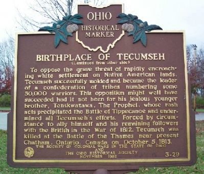
The great Native American Shawnee leader, Tecumseh, was born on the bank of a large spring at this site in 1768, at the very instant that a great meteor seared across the skies. The birth occurred while his parents, Shawnee . . . — — Map (db m14064) HM
Built by James Galloway about 1798 near Old Town. In this house Tecumseh, Chief of the Shawnees, lost a memorable campaign for the hand of Rebecca Galloway. — — Map (db m52922) HM
In the year 1792, Henry Tucker started clearing land and erecting a Station House on the old Indian Trace in what is now the village of Woodlawn. He had purchased the land from John Cleves Symmes for two dollars per acre. Fear of Indian Attack drove . . . — — Map (db m76291) HM
Southwest of Lytle was Fort Washington, built in 1789 and 1790 and named for President George Washington. The fort protected settlers in the new Ohio country from Indian attacks. It became the base headquarters for the Indian campaigns of Generals . . . — — Map (db m24891) HM
The Madisonville site is the largest and most thoroughly studied
village of the late Fort Ancient culture (AD 1450-1670). Artifacts
were so abundant here that local residents called this site the "pottery field.” Between 1879 and 1911, a . . . — — Map (db m133287) HM
General Hull's army arrived in this area at the beginning of the War of 1812. Two days after their arrival, the army continued on and left 13 men to complete the fort on the south bank of the Blanchard River. They named it in honor of their . . . — — Map (db m245411) HM
Indian Green. This area of western Hancock County is a part of the Maumee River Watershed known as "Indian Green." Wyandot Indians chose this area for hunting and ceremonial grounds along the Blanchard River in the 1700s because it was next to . . . — — Map (db m93378) HM
[Marker Front]:
Early in the War of 1812, Gen. Wm. Hull, commander of Ohio troops, ordered Col.. James Findlay to open a road from Ft. McArthur on the Scioto River to Blanchard’s Fork. Under Findlay, a stockade 50 yards square, with a . . . — — Map (db m21576) HM
The Great Black Swamp, which covered approximately 1,500 sq. mi. in Northwest Ohio and Northeastern Indiana, formed when the Wisconsin Glacier retreated about 20,000 years ago. It left a flattened surface covered with impermeable clay. Sand . . . — — Map (db m245414) HM
The Blanchard River was named after Jean-Jacques Blanchard, a French tailor, trapper and trader who worked with the Shawnees. Blanchard came to this area in 1770. He and his Shawnee wife lived with the tribe for over thirty years before Blanchard . . . — — Map (db m245413) HM
Fort Necessity. A short distance to the northeast a small stockade and blockhouse were built on June 22, 1812 by order of General William Hull for his nearly 2000 man army on its Detroit expedition during the War of 1812. Here mired in mud, . . . — — Map (db m242781) HM
County Road 265 follows an old Indian trail which connected the Wyandot villages at Upper Sandusky with the Shawnee Mac-o-chee towns to the southwest. Many wigwams were pitched near this Scioto River ford during the late 18th and early 19th . . . — — Map (db m245475) HM
Upon this site, in the late 18th and early 19th centuries, stood Chief Roundhead's Wyandot Indian village. This flourishing agricultural community later gave way to white settlement and Hardin County's first town was laid out here in 1832. . . . — — Map (db m21566) HM
Oldest community in
Hardin County
Founded in 1832 on the
site of the Indian village
led by Chili Stiahia
better known as Roundhead
an ally of the British in
the War of 1812
Roundhead Township was organized 1832
Until March 1833 . . . — — Map (db m22939) HM
This ridge road west from Cadiz through Deersville to the Tuscarawas Valley is known locally as the Moravian Trail. Originally an Indian path, it became an important trail for the frontiersmen. The men who participated in the Gnadenhutten Massacre, . . . — — Map (db m79828) HM
Girty's Island
»»««
Named for George Girty,
renegade brother of Simon Girty.
This was his hiding place
between various treach-
erous expeditions. — — Map (db m136576) HM
The "Old Indian Treaty Boundary Line” once ran through
this fertile piece of ground. Beginning in the 1800s, the land
was owned and cared for by the Laskey family. The Laskeys
are descendants of the Honorable George Laskey, who came
to this . . . — — Map (db m239667) HM
Prairie des Mascoutins
In 1742, a tribe of Kickapoo requested permission from Montreal's Governor to move to a Mascoutin village on both sides of the river here. French "Coureurs de Bois" traders named the wide floodplain "La Prairie des . . . — — Map (db m224475) HM
This Oak tree was planted in 1836 by the Ottawa Indians in honor of Martha A. Edwards Showman, the first white child born in Washington Township, Henry County, Ohio. — — Map (db m239670) HM
Architects of Monumental Earthworks. Fort Hill Earthwork was built 2000 years ago by
indigenous people who flourished in the temperate deciduous forest of Eastern North America. The exact ancestral
lineages and languages that united the . . . — — Map (db m214661) HM
Ash Cave, Ohio's largest stone recess, stretches 700 feet across and rises 90 feet high.
The rock shelter was created when ground water percolating through the sandstone eroded away the formation's weaker middle layer, undercutting the resistant . . . — — Map (db m130373) HM
This hard-surfaced trail meanders one-quarter mile along a stream which sculpted the sandstone gorge terminating at majestic Ash Cave. Early settlers named
this rock shelter for the huge mounds of campfire ashes that blanketed its floor, . . . — — Map (db m195121) HM
Modern roads often have their precedents in much older thoroughfares. Two ancient paths once converged near this point. As late as the 1700s, the Salt Trail guided Native Americans from the upper Scioto Valley plains past Cantwell Cliffs, Cedar . . . — — Map (db m218379) HM
Bouquet’s Trail, 1764. Unsatisfied by the treaty that ended the French and Indian War, Ottawa chief Pontiac led a confederacy of Native American tribes in attacks against the British frontier forts during 1763, a campaign known as . . . — — Map (db m13615) HM
Side A:
This area, known as Calmoutier, was an early French Catholic farming community founded in 1832 by Claude Druhot, who came from Calmoutier, Hte-Saône, France. Its first native, the four-month-old Claude Joseph Druhot, was baptized on 9 . . . — — Map (db m24492) HM
Peace-Loving Amish Pioneers Build Brotherly Native American Frontier Relations An unbarred log cabin door could mean vulnerability. But for one of the earliest pioneering families of the Ohio country the peace-loving Amish Jacob Mast . . . — — Map (db m240036) HM
Side A: James Cemetery
Major John James (1772-1854) established James Cemetery in 1828 on and around a Native American mound that is the only significant ancient mound remaining in the city of Jackson. The mound is about 70 feet in diameter . . . — — Map (db m24758) HM
Side A:
The Scioto Salts Licks, located in and around Jackson, is an area where naturally occurring salt water, known as brine, flowed to the surface as a salt-water spring. It is known that the spring existed since the Pleistocene Ice Age . . . — — Map (db m24767) HM
Side A: Trails
Plunging herds of buffalo seeking salt licks and grazing lands wore trails through the Ohio Country when it was an Indian no-man's land. Later, Indians found the same trails suitable for their needs. The tawny paths were . . . — — Map (db m24768) HM
On the flat surface of this rock is one of the finest examples of prehistoric Indian petroglyphs or craved writings in Ohio. These figures are carved on an exposed portion of the black Hand Sandstone bedrock which underlies much of east-central . . . — — Map (db m165764) HM
This shelter covers a small group of petroglyphs, or rock
carvings, cut into the flat sandstone surface by prehistoric
Indians. This group of petroglyphs includes about 40 figures
representing animals, humans, and other unidentified
images. . . . — — Map (db m166702) HM
This shelter covers a small group of petroglyphs,
or rock carvings, cut into the flat sandstone
surface by the ancestors of American Indians
around 1,000 years ago. The symbols engraved
here include about 40 figures representing
animals, humans . . . — — Map (db m166704) HM
We cannot know for certain the meaning of the symbols,
but it's possible they tell a story that was important to the
ancient people who once lived here. The most iconic image
on the panel is the human head with deer antlers and bird's
feet, . . . — — Map (db m166703) HM
One of the finest examples of ancient petroglyphs in Ohio
is engraved on the exposed rock protected by the shelter
house. Ancestors of American Indians carved these figures
onto this outcrop of the Sharon Sandstone bedrock.
This sandstone is . . . — — Map (db m166701) HM
Mount Pleasant's Beginnings
Many Quakers stood in fierce opposition to slavery. When Congress passed an ordinance prohibiting slavery northwest of the Ohio River in 1787, Quakers throughout the country began a migration to this . . . — — Map (db m196258) HM
From near this place in 1774, all the family of Logan was lured across the Ohio River and massacred by Whites thus sending Logan and Ohio Indian nations on a path of war for vengeance now known to history as Cresap's War.
"Who Shall Mourn" — — Map (db m44144) HM
Named for the Native Americans who first dwelled here along both sides of the Kokosing River, the Little Indian Fields is adjacent to the site of the first white settlement of Knox County. Early white inhabitants of this land were Andrew and . . . — — Map (db m18747) HM
Flint Ridge is a chain of long, narrow hills extending from a few miles east of Newark almost to Zanesville, a distance of more than twenty miles. The surface of these hills is underlain with an irregular layer of flint, which may be only a few . . . — — Map (db m12958) HM
For more than 10,000 years, Flint Ridge was one of the most important flint quarries in eastern North America. The flint formed at the bottom of a shallow ocean 300 million years ago. The softer rocks surrounding the flint have washed away, leaving . . . — — Map (db m12949) HM
This facility recognizes Gilbert W. Dilley (1902-1996), a life-long student of Ohio history; an avid collector of Ohio Indian artifacts; a long standing trustee, past president, and generous benefactor of the Ohio Historical Society; and a true . . . — — Map (db m12950) HM
On this bluff lies one of the two great animal effigy mounds built by Ohio's prehistoric people. Shown here, Alligator Mound is a giant earthen sculpture of some four-footed animal with a long, curving tail. Archaeologists believe the animal is . . . — — Map (db m17482) HM
Humans have lived in the region of Granville Township for thousands of years. Much of what we know of the Indigenous peoples is inferred from the stone tools and adornments left behind, discovered when land was plowed for farms and homes were . . . — — Map (db m206521) HM
In 1928, Emerson Greenman excavated Eagle Mound and discovered traces of a ceremonial longhouse with two walls projecting from the eastern end like wings. These walls may have been screens to hide certain activities from public view. Within the . . . — — Map (db m206095) HM
The Great Circle Was Built With Different Colored Soils
In 1992, Archaeologists excavated a trench through the Great Circle and discovered that it was built using different colored soils. The outer portion of the wall was built with dark . . . — — Map (db m206081) HM
The history of American Indians in Licking County goes back 14,000 years, and countless generations of native people spent full and varied lives in this area. Probably the best known are those whom archaeologists identify as the Hopewell, who . . . — — Map (db m199880) HM
The Great Circle Earthworks [,] one remnant of the largest complex of geometric earthen enclosures ever built. The Newark Earthworks, situated on a high terrace between the South Fork of the Licking River and Raccoon Creek, once covered more . . . — — Map (db m155729) HM
The Great Circle Earthworks one remnant of the largest complex of geometric earthen enclosures ever built. The Newark Earthworks, situated on a high terrace between the South Fork of the Licking River and Raccoon Creek, once covered more than . . . — — Map (db m206093) HM
The main axis of Newark’s Octagon Earthworks marks the northernmost rising of the Moon. The earthworks include additional alignments to all other key lunar rise and set points in a cycle that takes 18.6 years to complete. Yet, the Octagon is not an . . . — — Map (db m206069) HM
Earthen Avenues Connect the Earthworks to One Another and to the Surrounding Streams
This earthen wall is part of a set of converging walls that once channeled the movement of people from the Great Circle into an avenue enclosed by parallel . . . — — Map (db m206092) HM
The Great Circle was preserved as the main attraction of Licking County’s Fairgrounds between 1854 and 1933. In 1861, the site served as Camp John Sherman, the training camp for the 76th Ohio Volunteer Infantry Regiment. Seventeen years later, . . . — — Map (db m206076) HM
The Great Circle used to be called the “Old Fort,” because people thought the interior ditch served as a moat. For a moat to be useful in defense, however, it should be located outside rather than inside the walls. Cornelius Matthews recognized . . . — — Map (db m206074) HM
Much of the earth used to build the earthworks was dug from "borrow pits, such as this one in front of you. In some cases borrow pits were transformed into ponds and incorporated into the sacred architecture of the site. This borrow pit was a . . . — — Map (db m206056) HM
The history of American Indians in Licking County goes back 14,000 years, and countless generations of native people spent full and varied lives in this area. Probably the best known are those whom archaeologists identify as the Hopewell, who . . . — — Map (db m246433) HM
The extensive flint deposits at Flint Ridge and the quarrying by early residents influenced the local ecosystem, including how nonhuman inhabitants thrive here and how trees grow in the area. Mining activities at Flint Ridge ceased hundreds of . . . — — Map (db m246454) HM
At Flint Ridge, ancient American Indians quarried the flint from pits they laboriously dug by hand into the bedrock. Many of these pits are still visible along the park trails. Once the flint was exposed, it was struck with hammer stones to break . . . — — Map (db m246459) HM
From the Paleoindian Period of North American history, which began around 14,000 years ago, through the Early Woodland Period, which ended about 2,000 years ago, ancient American Indians came to Flint Ridge when they needed flint to make new . . . — — Map (db m246457) HM
During the Middle Woodland Period (2,000 to 1,500 years ago), Ohio's American Indian cultures began to quarry Flint Ridge flint on a more industrial scale. They still used the flint to make the tools needed for the tasks of daily living, but now . . . — — Map (db m246460) HM
The flint deposits at Flint Ridge are found in rocks of the geologic era known as the Pennsylvanian Period (299-320 million years ago). These deposits are the largest and purest occurrence of flint in the state. Technically called "Vanport flint," . . . — — Map (db m246463) HM
Flint is a sedimentary rock - it formed from sediment, material that settled millions of years ago to the bottom of the seas that covered what is now Ohio. Flint is a type of the common mineral quartz. It's one of the "microcrystalline" forms of . . . — — Map (db m246462) HM
The preserve is rich in natural as well as early Ohio history. The name, Blackhand, originated from a dark hand-shaped Indian petroglyph which was engraved on the face of a massive sandstone cliff along the north side of the river. The engraving was . . . — — Map (db m205963) HM
Flint Ridge Ancient Quarries, Nature Preserve and Museum give visitors a window into the lives of the pre-contact American Indians who quarried the flint here from 14,000 to around 400 years ago. The name "Flint Ridge” refers to the multi-colored . . . — — Map (db m205962) HM
Paths and trails wave their way through dense forests as the hooves of deer and bison left their mark in the earth in search of food and water. Eventually, these paths gave way to the soft patter of human feet) as they became used by local tribes . . . — — Map (db m206027) HM
Although the Newark Earthworks were an imposing site to the first settlers of this area, major portions were gradually destroyed by farming, the construction of roads, canals, railroads, and the development of the city. In the 1890s, the City of . . . — — Map (db m200102) HM
A Wonder of the World
These walls were once the center of an ancient civilization. The Octagon Earthworks, like a modern cathedral or county fairgrounds, were a focal point for the social and religious activities of the Hopewell people about . . . — — Map (db m17487) HM
The Newark Earthworks complex was built by the prehistoric Hopewell Indians who occupied central and southern Ohio between approximately 100 B.C. and A.D. 500. These people, supporting themselves by hunting, gathering wild plant foods, and growing . . . — — Map (db m200067) HM
A unique feature of the circle is the so-called crown work opposite the opening to the octagon. This oval mound is 170 feet long and approximately 8 feet higher than the adjoining portions of the circle. Since the mid-19th century, this mound has . . . — — Map (db m200139) HM
The Great Circle Earthworks was built by the Hopewell Culture around 2,000 years ago as a ceremonial site. The Newark Earthworks is a remnant of the largest system of geometric earthworks in the world, covering several square miles. This ancient . . . — — Map (db m205980) HM
The Newark Earthworks is truly one of the most magnificent prehistoric Indian sites in the eastern United States. Covering an area two miles square, it once was the largest earthworks complex in Ohio. The main components of the site are the large . . . — — Map (db m155655) HM
The Newark Earthworks, covering over 4 squire miles, is the largest geometric earthworks complex in the world. The site includes a combined circle and octagon, a square, and a second circle, all connected by earthen walls.
One pair of earthen . . . — — Map (db m200116) HM
The form of this mound is unique among all the known Hopewellian mounds. Some 19th century archaeologists thought that the builders had planned to extend a set of parallel walls from the circle, bu thene changed their minds and blocked off the stubs . . . — — Map (db m18101) HM
Within the octagon are 8 flat-topped mounds positioned just inside the openings between wall segments. Each one is 6 feet high, 75 to 90 feet long, and 40 to 60 feet wide. The function of these mounds has not been determined. However, they may have . . . — — Map (db m200126) HM
Ancient Architecture Now Lost
The two earthen walls before you are remnants of one of the wonders of the ancient world. They were part of the Newark Earthworks, the largest set of geometric enclosures ever built. Much like a modern cathedral . . . — — Map (db m17485) HM
Gunn's Tavern. 500 yards west →. About 1797, John Gunn, a land agent from Canada, came to the head of McKee's Creek to start a town. His two story log house, licensed as a tavern in 1805, became the county's first hotel. . . . — — Map (db m178532) HM
[North Side of Marker]
<— 500 Yards East —«
A British-Indian Outpost was established in 1778 by the Tory, Alexander McKee, for trade with the Shawnees.
It was destroyed by Logan's Army in 1786, re-built, and used as a . . . — — Map (db m35018) HM
Myeerah Trail A former Indian trail connected Blue Jacket's Town (site of Bellefontaine) and Zanestown (now Zanesfield). The highway was named by the County Commissioners in honor of Princess Myreerah, daughter of Chief Tarhe and wife of Isaac . . . — — Map (db m74503) HM
Pigeon Town
This town was established
after the destruction of
the Mackachack towns in
Dunmore’s War in 1774. It
was named for a wild pigeon roost near by. Col.
Logan’s army destroyed it
in 1786.
Shawnee Village Site
The Shawnee . . . — — Map (db m83765) HM
[North Side of Marker]
Named for a Wyandot Chief. Once home of Chief Tarhee. During American Revolution was headquarters of renegade Simon Girty who brought Simon Kenton here after saving his life in 1778. Hull camped here in 1812. . . . — — Map (db m34246) HM
[South Side of Marker]
The Maumee Rapids Treaty of Sept. 29, 1817 granted the Shawnee and Seneca Indians a reservation of 40,300 acres surrounding this point. Here they lived until removed to the West in 1832.
[North Side of . . . — — Map (db m85921) HM
Greenville Treaty Line
North of this line 640 acres of land was given to Nancy Stewart, daughter of Chief Blue Jacket, by Shawnee Chiefs in Council at Wapakoneta, May 22, 1813. Approved in treaty of 1817 by U.S. Government.
Nancy Stewart . . . — — Map (db m12198) HM
Seneca Council House Near this spot on the east bank of Muchinnippi Creek, stood a council house of the Seneca, 20 x 40 feet, without windows, floor or chimney. Later it became the Reservation Council House.
Indian Reservation . . . — — Map (db m74647) HM
Curry Blockhouse
Built by Hiriam Curry for
protection of the border
settlers, following surrender
of Gen. Hull in War of
1812. It stood on the north
bank of Stony Creek, opposite
the Indian village “Oldtown”.
Shawnee . . . — — Map (db m99540) HM
Entering Logan County over Greenville Treaty Line. Ohio lands east and south of this line were opened for U.S. settlement by Gen. Wayne's defeat of Indian tribes under Chief Blue Jacket at the Battle of Fallen Timbers, August 1794. . . . — — Map (db m185268) HM
The Indian Lake Region was inhabited by Native American Indian cultures long before white settlers. The Shawnee, Cherokee and Wyandot Tribes were the primary inhabitants, The Algonquin, Delaware and Ottawa tribes also had settlements nearby. Many of . . . — — Map (db m104209) HM
Nearby stood the Shawnee village of Mackachack or Mac-A-Cheek. This village was the first of the Shawnee towns to be attacked by Gen. Benjamin Logan's mounted Kentucky militia in the fall of 1786. In all the American forces destroyed eight Shawnee . . . — — Map (db m19811) HM
Here was fought the first of the major engagements of Logan’s 1786 campaign, in which eight Shawnee towns were destroyed and Chief Moluntha killed. Kenton here ran the gantlet in 1778. — — Map (db m136689) HM
"Shawnee Nation in Logan County"
From the 1770s until 1832, the Logan County area was the homeland to much of the Shawnee Nation. Ten villages known as the Upper Mad River towns included the homes of influential leaders Moluntha, Black . . . — — Map (db m34083) HM
Squaw Rock
Of
Indian Legend
Site
Shawnee Village Mac-A-Cheek
and
home
Chief Moluntha
Destroyed 1786
by Col. Logan Simon Kenton Gauntlet
1778 — — Map (db m76156) HM
In Memory
of
Gen. Simon Kenton
Born in Culpepper County, VA. in 1755
and died in 1836
Age 81 years
Left his native country in early youth, for a frontier life in the great northwest.
Captured by Indians in 1778, and brought to . . . — — Map (db m20072) HM
Gen. Simon Kenton
A soldier, a scout, a Guide.
History places him
among the strong and the brave.
Pathfinder for the
midwestern civilization.
Fate used him
as an instrument to open the door
of an empire state.
Historical . . . — — Map (db m23593) HM
645 entries matched your criteria. Entries 201 through 300 are listed above. ⊲ Previous 100 — Next 100 ⊳