1553 entries match your criteria. Entries 201 through 300 are listed.⊲ Previous 100 — Next 100 ⊳
Natural Resources Topic
By Craig Baker, June 27, 2020
Baltic Mine Marker
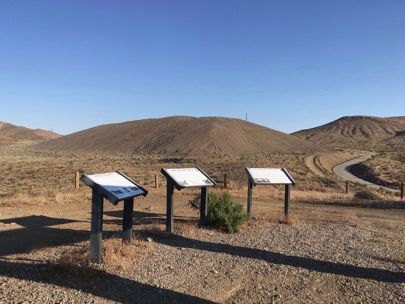
| 201 ► California, Kern County, Red Mountain — The Baltic Mine — |
| On Red Mountain Road, 0.8 miles west of U.S. 395, on the left when traveling west. | |||
| 202 ► California, Kern County, Red Mountain — The Baltic Mine Project |
| On Red Mountain Road, 0.8 miles west of U.S. 395, on the left when traveling west. Reported permanently removed. | |||
| 203 ► California, Kern County, Red Mountain — The Kelly Silver Mine — |
| On Red Mountain Road, 0.8 miles west of U.S. 395, on the left when traveling west. | |||
| 204 ► California, Kern County, Red Mountain — Yellow Aster Gold Mine — |
| Near Red Mountain Road, 0.8 miles west of U.S. 395, on the left when traveling west. | |||
| 205 ► California, Kern County, Taft — History of Taft — |
| Near Supply Row near East 6th Street, on the right when traveling west. | |||
| 206 ► California, Kern County, Taft — West Kern Oil Museum — |
| Near Wood Street, on the right when traveling east. | |||
| 207 ► California, Lake County, Clearlake Oaks — 428 — Sulphur Bank Mine — |
| On Sulphur Bank Drive at California Route 20, on the left when traveling south on Sulphur Bank Drive. | |||
| 208 ► California, Los Angeles County, Gorman — Castaic Powerplant — Built 1969 — |
| Near Vista Del Lago Road just west of Interstate 5. | |||
| 209 ► California, Los Angeles County, Inglewood, South Los Angeles — 363 — Centinela Springs — Aguaje de la Centinela — |
| Near Warren Lane, 0.3 miles east of Centinela Avenue. | |||
| 210 ► California, Los Angeles County, Lancaster — Los Angeles Aqueduct Construction — Through the Antelope Valley — |
| Near Avenue H west of California Route 14, on the right when traveling west. | |||
| 211 ► California, Los Angeles County, Los Angeles, El Sereno — Ascot Reservoir: 1910 - present — Ascot Park — |
| Near Multnomah Street, 0.3 miles east of Soto Street, on the left when traveling east. | |||
| 212 ► California, Los Angeles County, Los Angeles, Franklin Canyon — Upper Franklin Canyon Reservoir — Exact Center of Los Angeles — |
| On Franklin Canyon Drive, 0.7 miles south of Mulholland Drive. | |||
| 213 ► California, Los Angeles County, Los Angeles, Los Feliz — William Mulholland — 1855 - 1935 — |
| On Riverside Drive at Los Feliz Boulevard, on the right when traveling south on Riverside Drive. | |||
| 214 ► California, Los Angeles County, Los Angeles, Los Feliz — 162 — William Mulholland Memorial Fountain — |
| On Riverside Drive at Los Feliz Boulevard, on the right when traveling south on Riverside Drive. | |||
| 215 ► California, Los Angeles County, Los Angeles, Miracle Mile — 170 — Hancock Park — La Brea Pits — |
| On Wilshire Boulevard at Curson Avenue, on the right when traveling west on Wilshire Boulevard. | |||
| 216 ► California, Los Angeles County, Los Angeles, Mission Hills — Mission Dam — |
| On Rinaldi Street, 0.1 miles east of Indian Hills Road, on the left when traveling east. | |||
| 217 ► California, Los Angeles County, Los Angeles, Mission Hills — 150 — This Fountain — Brand Park — |
| Near San Fernando Mission Boulevard at Columbus Avenue, on the right when traveling west. | |||
| 218 ► California, Los Angeles County, Los Angeles, Playa del Rey — 490 — Gabrielino-Tongva People — People of the Land and Sea — |
| Near Culver Boulevard at Pershing Drive, on the right when traveling west. | |||
| 219 ► California, Los Angeles County, Los Angeles, Sherman Oaks — Melhorn Overlook — Mulholland Scenic Parkway — |
| On Mulholland Drive, 0.3 miles east of Benedict Canyon Drive, on the left when traveling east. | |||
| 220 ► California, Los Angeles County, Los Angeles, Silver Lake — 422 — Silver Lake & Ivanhoe Reservoirs — Built in 1906 — |
| On Tesla Avenue at West Silver Lake Drive, on the left when traveling west on Tesla Avenue. | |||
| 221 ► California, Los Angeles County, Los Angeles, Silver Lake — 422 — Silver Lake & Ivanhoe Reservoirs — |
| Near Tesla Avenue west of Armstrong Avenue, on the left when traveling west. | |||
| 222 ► California, Los Angeles County, Los Angeles, Sunland — How the Tongva Used Local Native Plants — |
| Near Oro Vista Avenue at Grove Street, on the left when traveling north. | |||
| 223 ► California, Los Angeles County, Los Angeles, Sunland — Sunland Welcome Nature Garden — Local Biodiversity — |
| On Sunland Boulevard at Fenwick Street, on the left when traveling east on Sunland Boulevard. | |||
| 224 ► California, Los Angeles County, Los Angeles, Sylmar — 653 — "The Cascades" |
| On Foothill Boulevard, 0.1 miles north of Balboa Boulevard, on the right when traveling north. Reported missing. | |||
| 225 ► California, Los Angeles County, Los Angeles, Sylmar — 50 — Mission Wells — |
| Near Havana Avenue at Bleeker Street. | |||
| 226 ► California, Los Angeles County, Los Angeles, Sylmar — 653 — The Cascades — |
| On Foothill Boulevard, 0.1 miles west of Balboa Boulevard, on the right when traveling west. | |||
| 227 ► California, Los Angeles County, Malibu, Eastern Malibu — Malibu Potteries — Adamson House — |
| On Pacific Coast Highway at Serra Road, on the left when traveling west on Pacific Coast Highway. | |||
| 228 ► California, Los Angeles County, Redondo Beach, South Redondo — 373 — Old Salt Lake — |
| On North Harbor Drive at Herondo Street, on the right when traveling north on North Harbor Drive. | |||
| 229 ► California, Los Angeles County, Santa Clarita, Newhall — Oak of the Golden Dream — |
| Near Placerita Canyon Road, 1.5 miles east of the Antelope Valley Freeway (California Route 14). | |||
| 230 ► California, Los Angeles County, Santa Clarita, Newhall — 168 — Oak of the Golden Dream — ← 2 Miles — |
| On Sierra Highway, 0.2 miles north of Placerita Canyon Road, on the right when traveling south. | |||
| 231 ► California, Los Angeles County, Santa Clarita, Newhall — 168 — Oak of the Golden Dream — ← 6 Miles — |
| On Lyons Avenue just east of Interstate 5, on the right when traveling east. | |||
| 232 ► California, Los Angeles County, Santa Clarita, Newhall — 168 — Oak of the Golden Dream — |
| Near Placerita Canyon Road, 1.5 miles east of the Antelope Valley Freeway (California Route 14). | |||
| 233 ► California, Los Angeles County, Santa Clarita, Newhall — Oil in Placerita Canyon — |
| Near Placerita Canyon Road, 1.5 miles east of the Antelope Valley Freeway (California Route 14), on the right when traveling east. | |||
| 234 ► California, Los Angeles County, Santa Clarita, Newhall — 172 — Pioneer Oil Refinery — ← 3 Miles — |
| On Lyons Avenue east of Interstate 5, on the right when traveling east. | |||
| 235 ► California, Los Angeles County, Santa Clarita, Newhall — 172 — Pioneer Oil Refinery — |
| Near Pine Street, 0.2 miles south of Newhall Avenue, on the left when traveling south. | |||
| 236 ► California, Los Angeles County, Santa Clarita, Newhall — Walker Ranch — |
| Near Placerita Canyon Road, 3.2 miles east of the Antelope Valley Freeway (California Route 14), on the right when traveling east. | |||
| 237 ► California, Los Angeles County, Santa Clarita, Newhall — White Oil Seep — Do You Smell That? — |
| Near Canyon Trail near Placerita Canyon Road. | |||
| 238 ► California, Los Angeles County, Santa Clarita, Stevenson Ranch — 516-2 — Mentryville — |
| Near Pico Canyon Road, 3 miles west of Interstate 5. | |||
| 239 ► California, Los Angeles County, Santa Clarita, Valencia — 168 — Oak of the Golden Dream — ← 9 Miles — |
| On The Old Road just north of Rye Canyon Road, on the right when traveling south. | |||
| 240 ► California, Los Angeles County, Signal Hill — 1 — Discovery of Oil on the Hill — Part of the “Memory Necklace” — A Series of Historical Panels Located in the Hilltop Loop Trail — |
| On Temple Avenue, on the right when traveling north. | |||
| 241 ► California, Mariposa County, Coulterville — Whistling Billy — |
| On State Highway 49 at Main Street on State Highway 49. | |||
| 242 ► California, Mariposa County, Mariposa — California State Mining and Mineral Museum — |
| Near Fairgrounds Road near California Highway 49, on the right when traveling east. | |||
| 243 ► California, Mariposa County, Mariposa — La Mineta 1850 - Princeton 1854 - Mount Bullion 1862 — |
| On Princeton Road at Highway 49 Frontage Road on Princeton Road. | |||
| 244 ► California, Mariposa County, Mariposa — The Ophir Mines |
| On Mount Ophir Road. Reported missing. | |||
| 245 ► California, Mariposa County, Yosemite National Park — Yosemite National Park — UNESCO World Heritage Site — |
| On Village Drive north of Northside Drive. | |||
| 246 ► California, Mendocino County, Ukiah — 980 — Ukiah Vichy Springs Resort — |
| On Vichy Springs Road, on the right when traveling east. | |||
| 247 ► California, Mono County, Benton — Montgomery City California — |
| On Highway 6, on the right when traveling north. | |||
| 248 ► California, Mono County, Coleville — Golden Gate Mine — |
| On Golden Gate Road near Three Flags Highway (California Highway 395). | |||
| 249 ► California, Mono County, June Lake — June Lake Mining District — |
| On North Shore Drive near Mount Vista Drive (Leonard Drive), on the right when traveling east. | |||
| 250 ► California, Mono County, Lee Vining — Bennettville — |
| Near Saddlebags Lake Road at Tioga Pass Road (California Highway 120), on the right when traveling east. | |||
| 251 ► California, Mono County, Lee Vining — Mono Mills — |
| On State Highway 120, 10 miles east of State Highway 395. | |||
| 252 ► California, Mono County, Lundy — Lundy — |
| On Lundy Lake Road, 7 miles west of U.S. 395, on the right when traveling west. | |||
| 253 ► California, Mono County, Mammoth Lakes — Mammoth City — |
| On Old Mammoth Road. | |||
| 254 ► California, Mono County, Mammoth Lakes — The Mammoth Consolidated Gold Mine — |
| On Lake Mary Loop Road. | |||
| 255 ► California, Monterey County, Aromas — A. R. Wilson Quarry — |
| On Quarry Road, 0.7 miles west of Carpenteria Road, on the right when traveling west. | |||
| 256 ► California, Monterey County, Marina — Welcome to Fort Ord Dunes State Park! — |
| On 8th Street. | |||
| 257 ► California, Monterey County, Monterey — Chestnut Tree — |
| Near Pacific Street, on the right when traveling south. | |||
| 258 ► California, Napa County, Calistoga — Old Faithful Steam Well — |
| On Tubbs Lane, 0.8 miles south of Hwy 29, on the right when traveling south. | |||
| 259 ► California, Napa County, Pope Valley — 2010-02 — Historic Aetna Mining District — |
| On Aetna Springs Road at Aetna Mine Road, on the right when traveling west on Aetna Springs Road. | |||
| 260 ► California, Nevada County, Grass Valley — 298 — Empire Mine — |
| Near Empire Street near California Route 174. | |||
| 261 ► California, Nevada County, Nevada City — English and New Salmon Mine Stamp Mill — |
| 262 ► California, Nevada County, Nevada City — Giant — |
| On North Bloomfield Road at Relief Hill Road, on the right when traveling east on North Bloomfield Road. | |||
| 263 ► California, Nevada County, Nevada City — Miners Foundry – Allans Machine Shop — Founded 1856 — |
| 264 ► California, Nevada County, North Columbia — Humbug Creek — |
| On North Bloomfield Road. | |||
| 265 ► California, Nevada County, Truckee — Boca Townsite — |
| Near Stampede Meadows Road, 0.3 miles Interstate 80. | |||
| 266 ► California, Nevada County, Truckee — Rocking Stone — |
| On High Street near Keiser Avenue. | |||
| 267 ► California, Nevada County, Washington — 628 - 629 — Alpha and Omega — |
| On State Highway 20, on the left when traveling east. | |||
| 268 ► California, Orange County, Brea — 918 — Olinda — |
| On Carbon Canyon Road at Santa Fe Road, on the right when traveling east on Carbon Canyon Road. | |||
| 269 ► California, Orange County, Brea — 50 — Olinda Oil Museum and Trail — Olinda Oil Well #1 — |
| On Santa Fe Road east of Railway Avenue. | |||
| 270 ► California, Orange County, Irvine, Northwood — The Evolution of the City — Irvine — |
| Near Jeffrey Road north of Roosevelt, on the right when traveling north. | |||
| 271 ► California, Orange County, La Habra — West Coyote Field, The La Habra Research Laboratory — |
| On West Imperial Highway (California Route 90) near Beach Boulevard, on the right when traveling east. | |||
| 272 ► California, Orange County, Yorba Linda — Section of the Cajon Canal — |
| Near Susanna Bryant Drive at Rancho Santa Ana Road, on the left when traveling south. | |||
| 273 ► California, Orange County, Yorba Linda — The Historic Cajon Canal — 1878 - 1968 — |
| Near La Palma Avenue near Gypsum Canyon Road. | |||
| 274 ► California, Placer County, Auburn — Gold Bug Stamp Mill — |
| Near Auburn-Folsom Road, 0.1 miles south of Lincoln Way. | |||
| 275 ► California, Placer County, Auburn — Marguerite Mine “Quartz Rock” — |
| Near Lincoln Way. | |||
| 276 ► California, Placer County, Auburn — Wise Power Plant — |
| On Ophir Road near Werner Road, on the right when traveling south. | |||
| 277 ► California, Placer County, Cisco Grove — 2 — Meadow Lake — |
| On Eagle Lakes Road near Interstate 80, on the right when traveling west. | |||
| 278 ► California, Placer County, Gold Hill — Hydraulic Mining — |
| On Interstate 80. | |||
| 279 ► California, Placer County, Newcastle — 463 — Town of Ophir — |
| On Lozanos Road at Bald Hill Road, on the right when traveling north on Lozanos Road. | |||
| 280 ► California, Placer County, Newcastle — 400 — Virginiatown — |
| On Virginiatown Road, 0.2 miles east of Fowler Road, on the left when traveling east. | |||
| 281 ► California, Placer County, Tahoe City — A Safe Harbor — |
| Near West Lake Boulevard (State Highway 89) west of State Highway 26. | |||
| 282 ► California, Plumas County, Belden — Pacific Crest Trail — |
| On Belden Town Road, on the right when traveling west. | |||
| 283 ► California, Plumas County, Blairsden — 196 — Jamison City, Eureka Mine and Mill, Johnstown — ← 6 Miles — |
| On California Route 70 at California Route 89, on the right when traveling west on State Route 70. | |||
| 284 ► California, Plumas County, Chester — Humbug Valley — |
| On Forest Service Road 26N26, on the right when traveling south. | |||
| 285 ► California, Plumas County, Chester — Soda Spring — |
| On Forest Service Road 26N26, on the right when traveling south. | |||
| 286 ► California, Plumas County, Cromberg — Vardanega Spring — |
| On Mt. Tomba Road, on the right when traveling south. | |||
| 287 ► California, Plumas County, Greenville — Engelmine — |
| On Diamond Mountain Road, 9.1 miles north of North Valley Road, on the right when traveling north. | |||
| 288 ► California, Plumas County, Greenville — Seneca — |
| On Seneca Road (at milepost 6). | |||
| 289 ► California, Plumas County, La Porte — Port Wine — |
| On Port Wine Ridge Road (County Route 690). | |||
| 290 ► California, Plumas County, Quincy — Spanish Creek Mines — |
| Near Bucks Lake Road (County Route 119) at Snake Lake Road, on the left when traveling east. | |||
| 291 ► California, Riverside County, Desert Center — Barren or Bountiful — Joshua Tree National Park — |
| On Cottonwood Springs Road. | |||
| 292 ► California, Riverside County, Desert Center — 41 — Eagle Mountain Iron |
| Near Ragsdale Road west of Desert Center Rice Road (County Route 177), on the right when traveling east. Reported missing. | |||
| 293 ► California, Sacramento County, Folsom — 569 — Mormon Island — |
| Near Folsom Point Road, 0.5 miles north of Natoma Street. | |||
| 294 ► California, Sacramento County, Rancho Cordova, Mather — Vernal Pool Grassland — Mather Vernal Pools — |
| On Eagles Nest Road, 2 miles south of Douglas Road. | |||
| 295 ► California, Sacramento County, Rancho Murieta — 468 — Gold Mining and Michigan Bar — |
| On Michigan Bar Road at Highway 16, on the left when traveling north on Michigan Bar Road. | |||
| 296 ► California, San Bernardino County, Baker — Salt Creek — A Desert and Riperian and Wetland Area — |
| On Death Valley Road, 1 mile south of Saratoga Springs Road. | |||
| 297 ► California, San Bernardino County, Baker — Salt Creek Hills — Area of Critical Environmental Concern — |
| Near California Route 127, 29 miles north of Baker, on the right when traveling north. | |||
| 298 ► California, San Bernardino County, Big Bear City — 5 Stamp Mill — Big Bear Valley Historical Museum — |
| Near Greenway Drive, 0.3 miles north of Big Bear Boulevard, on the right when traveling north. | |||
| 299 ► California, San Bernardino County, Big Bear City — 619 — Holcomb Valley — |
| Near Greenway Drive, 0.3 miles north of Big Bear Boulevard, on the right when traveling north. | |||
| 300 ► California, San Bernardino County, Big Bear Lake — 2 — Holcomb Valley |
| Near Holcomb Valley Road (Road 3N16) 0.5 miles east of Van Dusen Canyon Road (Road 3N09), on the right when traveling west. Reported missing. | |||
1553 entries matched your criteria. Entries 201 through 300 are listed above. ⊲ Previous 100 — Next 100 ⊳