Near North Bay Street (Florida Route 19) at Gottsche Avenue, on the right when traveling south.
Custom boat building was one of the early businesses in Eustis. Bassett Boats Works, founded in 1926, constructed some of the first outboard powered cabin cruisers and the first powered glass-bottom boats famous at Silver Springs. Pilings from this . . . — — Map (db m166237) HM
Near North Bay Street (Florida Route 19) at Gottsche Avenue, on the right when traveling south.
Lake Eustis was named for Colonel Abraham Eustis, First Commander of U.S. Army forces in Florida. The city of Eustis was briefly named Lake Eustis, but the word “Lake” was dropped in 1883 when the town was incorporated. The lake is about 12 square . . . — — Map (db m166238) HM
Near Northshore Drive, 0.1 miles west of North Bay Street (Florida Route 19) when traveling west.
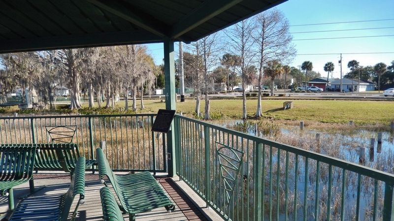
The lakefront was the hub of early Eustis. Businesses, Eustis Park, the railroad station, bathing beaches, marinas and public docks brought people to the waterfront. Boating activities of every sort from pleasure cruises to regattas were popular. . . . — — Map (db m166242) HM
Near Wolfs Head Road, 0.5 miles north of County Road 455.
Lake Apopka has been home to generations of people who settled in this area. Over the years, the Lake has thrived and fallen into decline. It is now in recovery and revival since the 1990s, and is central to the Green Mountain Scenic . . . — — Map (db m165283) HM
On North Donnelly Street north of East Fifth Avenue, on the left when traveling north.
John P. Donnelly, a native of Pittsburg, came to Mount Dora in 1879. In 1881, he married Annie McDonald Stone, a prominent landholder in the community. Successful in a number of real estate and business ventures, Donnelly built this imposing Queen . . . — — Map (db m72779) HM
On Park Avenue at 4th Street West, on the right when traveling north on Park Avenue.
On November 28th, 1905, the steamboat Mistletoe of Tampa with the engineer corps and a force of sixty laborers landed on the beach directly opposite this spot, and the initial work of surveying and constructing the Charlotte Harbor and Northern . . . — — Map (db m128324) HM
Near McGregor Boulevard south of Larchmont Avenue, on the right when traveling south.
“Beyond doubt you have the finest place in the country, and if you build a sea wall inside a few years this section will not be large enough to hold the tourists that will be scrambling to get here every winter. Yes, sir, by all means build . . . — — Map (db m90286) HM
Near McGregor Boulevard south of Larchmont Avenue, on the right when traveling south.
The pier was originally called “the wharf.” It was used as a working area to off-load boats carrying materials and contents for the homes and laboratory, beginning in November 1885. After the Estate buildings were complete, the pier’s . . . — — Map (db m90285) HM
Near Palm Beach Boulevard (State Road 80) 1.5 miles east of Interstate 75, on the right when traveling east.
Nature has been good to Lee County, one of the last frontiers to be settled in southwest Florida. Nestled between the Everglades and the Gulf of Mexico, the county includes a variety of interconnected ecosystems. Careful planning has preserved much . . . — — Map (db m105731) HM
Near McGregor Boulevard south of Larchmont Avenue, on the right when traveling south.
In 1914, Thomas Edison invited Henry Ford, wife Clara, and son Edsel to the Edison Florida estate. In 1916, the Fords purchased their Fort Myers estate, The Mangoes. The Ford family visited regularly with good friends and neighbors, Thomas and Mina . . . — — Map (db m89883) HM
Near Edwards Drive east of Hendry Street, on the right when traveling west.
The Caloosahatchee River was the main highway for travel and commerce for many years after the settlement of Fort Myers. Even before Fort Harvie was established in 1841 (later renamed Fort Myers, in 1850) and the first permanent settlers (led by . . . — — Map (db m183546) HM
Near Periwinkle Way, 1.7 miles east of Causeway Boulevard.
The first permanent English-speaking settlers on Sanibel Island arrived from New York in 1833 as part of a colony planned by land investors. Although that settlement was short-lived, the initial colonists petitioned the U.S. government for the . . . — — Map (db m80475) HM
Relatively easy access to the St. Marks River port of call enhanced San Luis' trading industry. Supplies could be unloaded at St. Marks River and, using small boats, could be brought to within 1.5 miles of the mission. Similarly, surplus goods . . . — — Map (db m239253) HM
On South Bronough Street, 0.1 miles south of West Pensacola Avenue, on the right when traveling south.
Duval County
In 1939, the citizens of Duval County purchased and donated the land used to establish Naval Air Station Jacksonville in 1940.
Naval Station Mayport and Cecil Field Naval Air Station were
similarly commissioned . . . — — Map (db m210751) HM WM
On South Bronough Street, 0.1 miles south of West Pensacola Avenue, on the right when traveling south.
Miami-Dade County
During WW II, Miami Dade County played an integral role in this
nation’s war effort.
The Army established three major schools on Miami Beach: the
Replacement Training Center, the Officer Candidate School . . . — — Map (db m210928) WM
On South Adams Street south of West Jefferson Street, on the right when traveling south.
The keel for Monitor No. 9 (BM-9) was laid down in January 1899 at the Crescent Shipyard in Elizabethport, New Jersey by the Lewis Nixon ship works company. She was launched on 30 November 1901 and commissioned the USS Florida on 18 June 1903. The . . . — — Map (db m131027) HM
On Seminole Drive at Santa Rosa Drive, on the left when traveling north on Seminole Drive.
(Front)
This earth work located on ground once part of the plantation of E.A. Houston, father of Captain Patrick Houston (later state adjutant general) who commanded the Confederate artillery at the Battle of Natural Bridge, is a silent . . . — — Map (db m79544) HM
Near NW 115th Street (Florida Route 320) 0.5 miles west of U.S. 98.
Rainfall, which is slightly acidic, dissolves limestone as it passes through the ground. As water travels underground toward the springs, it sometimes creates large cave passages through the porous limestone. On the surface, as this limestone breaks . . . — — Map (db m191209) HM
Near U.S. 27/98, on the right when traveling east.
The Fanning Springs Bridge was built by the State of Florida.
In 1934 it was officially named the Benjamin Chaires Bridge in honor of a prominent pioneer settler of Dixie County.
Located 29 miles north of the Gulf of Mexico, it held the . . . — — Map (db m17709) HM
Near Canal Road (Spillway Road), 0.8 miles south of Florida Route 40, on the left when traveling west.
Unintended Consequences In the 1960s, the U.S. Army Corps of Engineers cut through and plugged the Withlacoochee River to make way for the Cross Florida Barge Canal. Blocking the river entirely would have devastated downstream ecosystems. The . . . — — Map (db m167893) HM
Near West Riverwood Drive, 1.7 miles east of North Basswood Avenue, on the left when traveling east.
Bisecting a State, Bisecting a River Inglis Island sits at the center of the Withlacoochee River, Lake Rousseau, and the Cross Florida Barge Canal. From here you can see where the canal bisected the river. Look for an earth and concrete berm on . . . — — Map (db m167499) HM
Near Southeast 90th Avenue, 0.3 miles south of Florida Route 40, on the right when traveling south.
A Stairway to the Top of the Canal Lake Rousseau sits almost 30 feet above the western edge of the Cross Florida Barge Canal. How do you move a barge up 30 feet? You build a lock. Think of a lock like water stairs. A barge enters the lock . . . — — Map (db m167500) HM
Near West Riverwood Drive, 1.7 miles east of North Basswood Avenue, on the left when traveling east.
Changing the Face of Florida At the end of the 19th century, prospectors and entrepreneurs flocked to Dunnellon, 10 miles east of here. They came to mine phosphate, a valuable ingredient in fertilizer. In just five years, Dunnellon transformed . . . — — Map (db m167501) HM
On NE Drew Way, 0.2 miles east of U.S. 90, on the left when traveling east.
Drew Mansion Site
Located approximately one-half mile to the northwest is the site of the Drew Mansion, home of George F. Drew, governor of Florida during the difficult period of readjustment following Civil War Reconstruction, 1877-1881. . . . — — Map (db m19939) HM
Near Bay Boulevard at Pine Avenue, on the right when traveling west.
In 1911, with dreams of founding..."the place destined to be the greatest year-round resort in Florida," the Anna Maria Beach Company built the Anna Maria City Dock (later called Pier).
The dock, extending 776 feet into the waters of Tampa . . . — — Map (db m242279) HM
Near North Bay Boulevard, 0.3 miles north of Pine Avenue.
Less than a mile to the north lies Passage Key, marking the southerly entrance into Tampa Bay. Since Ponce de Leon explored this coast in 1513, this island has served to guide ships into the great bay beyond, called by early Spanish explorers . . . — — Map (db m72420) HM
On South Bay Boulevard at Pine Avenue, on the right when traveling west on South Bay Boulevard.
Built in 1911, the Anna Maria City Pier welcomed visitors and residents to the island city arriving by steamship. The 776-foot-long pier accommodated paddle wheelers such as the Favorite and the Mistletoe prior to the construction of . . . — — Map (db m72421) HM
On Morgan Johnson Road (57th Street East) south of 32nd Avenue East, on the right when traveling south.
Side 1
The Braden River is the largest tributary of the Manatee River and is 35 miles in length. It is named for Dr. Joseph Braden, a Tallahassee sugar planter who came here in 1842 and established a sugar plantation at the western . . . — — Map (db m146454) HM
On 4th Avenue East east of 12th Street East, on the right when traveling east.
The Curry Houses are two of the oldest homes in Bradenton still in the location where they were built. Their age and connection to the Curry family make them important markers of the community’s history. Reflections of Manatee is dedicated to . . . — — Map (db m218514) HM
Near Desoto Memorial Highway (75th Street NW), 0.2 miles north of 24th Avenue NW when traveling north.
Picture the past as you stand here. Indians once gathered oysters and clams along this shore and fished the river. On your left are remnants of a mound composed of shells they discarded after countless meals. Long after the Indians were gone road . . . — — Map (db m125368) HM
Near 63rd Street East, 0.1 miles west of Linger Lodge Road East.
In August 1944. the United States was engaged in a great struggle in the European and Pacific theaters of World War II. In contrast, standing on the banks of the Braden River were Manatee County residents Al "Jiggs" and Agnes Metcalf. looking over . . . — — Map (db m239216) HM
Near Braden Castle Drive at Plaza St E, on the left.
Originally constructed in
1929, it reaches out into the
Manatee River more than
600 feet to the
navigable channel.
Destroyed by weather events,
and then rebuilt in 1990,
1993 & 2002. It was
refurbished in 2017 by
many . . . — — Map (db m131205) HM
On 4th Avenue East east of 12th Street East, on the right when traveling east.
Battles were not fought around the Manatee settlement, but the Civil War brought stress and stain none-the-less. Men went away to war. Union blockades meant that women and children only had flour occasionally – when it was smuggled in – and . . . — — Map (db m218513) HM
In 1866, three brothers, John, Bartholomew, and Bill Fogarty, settled in Manatee County and established a ship building and coastal trading schooner base on the shore of the Manatee River. In the years before automobiles and railroads, Manatee . . . — — Map (db m43104) HM
Near Manatee Avenue East (State Road 64) at 14th Street East, on the right when traveling east.
named for the marine mammal Trichechus Latirostris, was the main avenue of transportation and communication since the first permanent settlement. All commerce, goods for the early stores, the U.S. Mail, passengers and settlers came into the county . . . — — Map (db m131463) HM
Restored on the original building site, the Wiggins Store was built by King Wiggins in 1903. The fact that it was one of the areas first brick buildings is significant because, prior to the arrival of the railroad, brick could only be brought in by . . . — — Map (db m43107) HM
On 17th Avenue NW at 99th Street NW, on the right when traveling west on 17th Avenue NW.
Sometimes, a piece of history is just too valuable to lose. When the Valentine House was in danger of loss due to development, the Preston family of Manatee County stepped in to make a generous donation of this house and a second structure to . . . — — Map (db m241299) HM
[Marker Front]:
At the close of the Seminole War in 1842, this frontier was opened to settlement. Major Robert Gamble and other sugar planters soon located along the rich Manatee River valley, and by 1845 a dozen plantations were producing . . . — — Map (db m15665) HM
On 6th Street West at 16th Avenue West, on the left when traveling west on 6th Street West.
Side 1
The Tresca home was established in 1946 at this location by Major Wm. Warren and Annie H. Tresca. They met in Oklahoma where Warren was recovering from serious injuries suffered while serving in France during WWII and Annie was serving in . . . — — Map (db m200403) HM
On Rye Wilderness Road, 1 mile east of North Rye Road, on the left when traveling east.
Side 1
Rye was once a thriving settlement along the Manatee River named after Erasmus Rye, who moved to the area in the mid-1840s from Hanover County, Virginia. In 1861, Erasmus married Mary Lucebia Williams, whose family owned the largest . . . — — Map (db m214570) HM
On Bayshore Drive, 0.2 miles west of U.S. 19, on the right when traveling west.
A Director of the Independent Line of Steamships circa 1890, his deep-water pier at this site loaded all area citrus/vegetable produce for Tampa markets. At the pier base on pilings stood his large store/office building. The upland 7.5 acres, the . . . — — Map (db m241302) HM
Near County Highway 484, 5.2 miles east of Williams Street (U.S. 41), on the right when traveling east.
Human Hands Changed the Land A mile east of here, you will encounter some rugged terrain. It's left over from a ship canal dug during the Great Depression. Some 8,000 men shoveled tons of sand and dirt onto mule-drawn carts and trucks, swatting . . . — — Map (db m167503) HM
Near State Road 200, 1.5 miles south of County Road 484, on the left when traveling south.
Welcome to the Summit Ross Prairie is a wetland surrounded by a high-and-dry ecosystem known as sandhills. The plants and animals here live on ancient sand dunes, leftovers from when the ocean was higher. This area's topography presented a . . . — — Map (db m167505) HM
Near Northeast 154th Street east of Northeast 152nd Court Road, on the left when traveling east.
History Hidden in the Trees Across the river, concealed by trees, lies a relic from a largely forgotten episode in Florida's history. The Eureka Lock and Dam were built in the 1960s but never used. They were part of the Cross Florida Barge . . . — — Map (db m167896) HM
Near Southeast 80th Street (County Road 328) at South Pine Avenue (U.S. 441), on the right when traveling east.
"The Island is flat and sandy with abundant wildlife. Numerous lakes and stands of trees also mark the landscape." Alvar Hunez Cabeza deVace Journal Entry, 1536 The geographic area that comprises the present-day Cross Florida Greenway has been . . . — — Map (db m166902) HM
Near Southeast 58th Avenue (Baseline Road) (Florida Route 35) 5 miles south of East Silver Springs Boulevard (Florida Route 40), on the left when traveling south.
From the Gulf — to Golf Imagine playing disc golf surrounded by bulldozers and workers digging! Just north of here, the Ocala Greenway Disc Golf Course sits within the remnants of the Atlantic-Gulf Ship Canal. By 1936, workers had . . . — — Map (db m167506) HM
Near Southeast 80th Street (County Road 328) at South Pine Avenue (U.S. 441), on the right when traveling east.
Roosevelt EraThe Cross Florida Canal got its start during the Great Depression years. President Franklin D. Roosevelt's efforts to revive the nation's ailing economy involved a wide array of projects and jobs funded by tax-payers. The . . . — — Map (db m237438) HM
Near Southeast 80th Street (County Road 328) at South Pine Avenue (U.S. 441), on the right when traveling east.
What Changed? For nearly 500 years, the idea for a Cross Florida Ship and Barge Canal had been kept alive. There were several driving forces. • Hiding Caribbean gold shipments from pirates until fleets of protected ships sailed to . . . — — Map (db m166910) HM
Near East Fort King Street, 0.1 miles East Silver Springs Boulevard.
Sunk by submarine while returning from Tinian Island after delivering critical parts of 1st atomic bomb due to radio silence orders. Crew was in water five days. Lost many men to shark attack.
July 30, 1945
Sponsored by: . . . — — Map (db m198270) HM WM
Near Southeast 80th Street (County Road 328) at South Pine Avenue (U.S. 441), on the right when traveling east.
"I am today ordering a halt to further construction of the Cross Florida Barge Canal to prevent serious environmental damage. "The Council on Environmental Quality has recommended to me that the project be halted, and I accept its advice. The . . . — — Map (db m166909) HM
Near East Fort King Street, 0.1 miles south of East Silver Springs Boulevard.
CSS Submarine Hunley
Commander
1st LT. George E. Dixon - 21st ALA Inf.
Crew
C.F. Carlson
Arnold Becker
James A. Wicks
Carl Simpkins
Frank Collins
Joseph Ridgeway
Miller
Commanded by Confederate . . . — — Map (db m199055) WM
Near Southeast 80th Street (County Road 328) at South Pine Avenue (U.S. 441), on the right when traveling east.
"In view of this unprecedented expression of opposition to continuing the Cross Florida Barge Canal by candidates for public office in Florida [petitions and resolutions] we respectfully call on you to implement a moratorium on construction of the . . . — — Map (db m166906) HM
Near E Fort King St, 0.1 miles south of E Silver Springs Blvd..
Army Chaplains,
Alexander D. Goode, Jewish
George L. Fox, Methodist
Clark V. Poling, Reformed
John P. Washington, Catholic.
Calmed the troops - gave their life jackets died praying together as troop ship Dorchester . . . — — Map (db m198256) WM
Near Southeast 80th Street (County Road 328) at South Pine Avenue (U.S. 441), on the right when traveling east.
"...Requesting the assistance and cooperation of every available federal agency in order to make possible, at an early date, commencement of construction on a ship canal across the peninsula." Message from Florida's Legislature to President . . . — — Map (db m166903) HM
Near Southeast 80th Street (County Road 328) at South Pine Avenue (U.S. 441), on the right when traveling east.
The Crusher Green life was a major factor between those who opposed the Cross Florida Canal and those who backed it. The sharpest point of contention was the Ocklawaha River basin, as well as the environmental catastrophe that evolved after . . . — — Map (db m166914) HM
Near Southeast 80th Street (County Road 328) at South Pine Avenue (U.S. 441), on the right when traveling east.
"Your majesty: In order to protect your interests [land and gold] in La Florida, we must discover or construct a passage across this peninsula." The Essence of an Historic Communication by Spanish Explorer Pedro Menendez Aviles to Spain's King . . . — — Map (db m166901) HM
Near East Fort King Street, 0.1 miles south of East Silver Springs Boulevard.
Merchant Marine founded by Act of Continental Congress 1775. Their job getting troops, munitions, equipment and supplies where needed and provide critical logistical support. June 12, 1775 the first sea engagement of the revolution was the beginning . . . — — Map (db m198741) HM WM
Near East Fort King Street, 0.1 miles south of East Silver Springs Boulevard.
Iwo Jima
February - March 1945 1
880 ship armada - 110,000 Marine landing force
28,851 USA Casualties 22,000 defenders perished
6,825 KIA
Marines, Navy, Air Force, Sea Bees, nurses,
and hospital ships participated . . . — — Map (db m198447) WM
Near East Fort King Street, 0.1 miles south of East Silver Springs Boulevard.
Captain John J. Dickison moved to Orange Lake (Marion County) and was a plantation owner. Served as 1st LT. in Marion Light Artillery. Later formed 2nd Florida Cavalry Co. H. commanding mostly less than 300 soldiers. Relied on guerrilla actions to . . . — — Map (db m199030) WM
On Florida Trail, 1.2 miles west of SW 16th Avenue, on the right when traveling west.
From Separation to Connection High above Interstate 75, this landbridge was the first of its kind in the country. The land it sits on was originally intended to be part of a massive canal across Florida. The canal would have split the state in . . . — — Map (db m166698) HM
On Florida Trail, 1.4 miles west of SW 16th Avenue, on the left when traveling west.
Transforming the Land — Twice! The land you're standing on was once part of a major engineering feat. Men and machines toiled to move about 13 million cubic yards of dirt. They were building the sea level Atlantic-Gulf Ship Canal. The men . . . — — Map (db m166699) HM
Near E Fort King St, 0.1 miles south of E Silver Springs Blvd..
Lewis & Clark Expedition
1803
President Thomas Jefferson picks Meriwether Lewis to
explore Louisiana Purchase and unknown spaces west
of the Mississippi River. Q
Lewis picks former army comrade William Clark to
share . . . — — Map (db m198633) HM
On Florida Trail, 1.4 miles west of SW 16th Avenue, on the left when traveling west.
Where Progress Meets Preservation Imagine a 200-mile channel across Florida, connecting the Gulf of Mexico with the Atlantic Ocean. The Cross Florida Barge Canal would have been like a moat, separating people and wildlife on either side. This . . . — — Map (db m166700) HM
Near County Road 314, 4 miles south of State Route 19, on the left when traveling west.
Imagine This Spot Underwater If the Cross Florida Barge Canal had been built in the 1960s as planned, Marshall Swamp would be 13 feet underwater. The swamp sat in the path of the Dosh Reservoir. Plans called for flooding 20 miles of the . . . — — Map (db m167900) HM
Near East Fort King Street, 0.1 miles south of E Silver Springs Blvd..
A special force for both WWI & WWII known
as Naval Armed Guard Service protected
Merchant Marine ships carrying materials
troops & supplies to all fronts from
attack by submarine & air.
WWII
Served on 6,236 ships . . . — — Map (db m198727) HM WM
Near East Fort King Street, 0.1 miles south of East Silver Springs Boulevard.
Normandy Invasion
June 6,1944 (D-Day), American, British,
Canadian & French stormed the beach
to liberate Europe from
Nazi Germany
WWII
Dedicated to: Horace W. & Lourine Hooker Badger Family Navy (LCI) - D-Day . . . — — Map (db m198530) WM
On Florida Trail, 4.5 miles south of Southeast 80th Street (County Road 328), on the left when traveling south.
Landfill Legacy Nearby is a landfill that was used during the construction of a massive canal across Florida. Engineers and workers operating huge machines dug about a third of the canal in the 1960s. The project was never completed, but its . . . — — Map (db m166776) HM
Near East Fort King Street, 0.1 miles south of East Silver Springs Boulevard.
USS Constitution
1798
Old Ironsides
This vessel was the 2nd war ship built by
the United States Government
Fought in many battles & engagements
Served as:
Training ship, War of Tripoli, War of 1812
Civil . . . — — Map (db m198332) HM WM
Near Southeast 80th Street (County Road 328) at South Pine Avenue (U.S. 441), on the right when traveling east.
"Incited by selfish interests and from a purely mercenary motive, an effort is now being made, through construction of a cross-state canal, to mar and at least, in part, destroy the region's beauty, fertility and health." Hillsborough County Board . . . — — Map (db m166905) HM
Near Southeast 80th Street (County Road 328) at South Pine Avenue (U.S. 441), on the right when traveling east.
History of Santos Founders and Families In 1882, John A. Cole and his family (black Americans) established Santos, naming it after a village in Brazil (South America) where they had gone to start a new life following the American Civil War. . . . — — Map (db m166911) HM
Near Southeast 80th Street (County Road 328) at South Pine Avenue (U.S. 441), on the right when traveling east.
"Even a shallow canal would pollute the aquifer because of the porosity of the underlying rock structure… barge traffic would jeopardize both surface and ground water with the threat of oil spills and leakage from vessels and the wash-off of . . . — — Map (db m166904) HM
Near Southwest 69th Court just north of Southwest 128th Street.
High and Dry in the Sandhill Look around — do you notice sandy soil and pine trees? This habitat is called sandhill. It grows on ancient sand dunes left behind when sea levels were higher. Sandhill is now exceptionally rare. It's ideal . . . — — Map (db m167504) HM
Near Southeast 80th Street (County Road 328) at South Pine Avenue (U.S. 441), on the right when traveling east.
"La Florida" Became Part of World Commerce [panel 1] 1507 • Explorer Ponce de Leon claims "La Florida" for Spain and recommends canal to King to protect gold carrying ships to Spain. 1763-1802 • Eastern Florida passes from Spain . . . — — Map (db m166900) HM
Near East Fort King Street, 0.1 miles E Silver Springs Blvd..
U.S.S. Monitor
vs
C.S.S. Virginia (Merrimack)
March 1862
Casualties
U.S.A…..1
C.S.A…10
Sponsored by: Friends and Visitors to the Park — — Map (db m198065) WM
Near East Fort King Street, 0.1 miles south of East Silver Springs Boulevard.
United States Merchant Marine
WWII
833 Large ships sank
31 lost with no trace
8,651 Mariners killed at sea
11,000 wounded
1,100 died from wounds ashore
604 men and women taken prisoner
60 died in prison camps . . . — — Map (db m198371) WM
Near East Fort King Street, 0.1 miles south of East Silver Springs Boulevard.
USS Juneau CL52
Cruiser
Sunk by Japanese in battle off Guadalcanal
resulting in the loss of all but 10 of crew
loss of 5 members Sullivan Family in the action.
George
Francis
Albert Sullivan
Joseph
Madison . . . — — Map (db m199048) WM
Near East Fort King Street, 0.1 miles south of East Silver Springs Boulevard.
World’s 1st Nuclear Powered Submarine
Jan. 17, 1955 underway on nuclear power
Aug. 3, 1958-crossed North Pole under the ice
Sponsored by Nautilus Alumni Association — — Map (db m200648) HM
Near East Silver Springs Boulevard (Florida Route 40) near NE 57th Avenue, on the right when traveling east.
Although set in the ocean, the classic 1958-1961 television series "Sea Hunt" starring Lloyd Bridges filmed many of its scenes at Silver Springs. The show inspired many people to take diving on as a hobby for themselves. Ivan Tors directed and . . . — — Map (db m225930) HM
Near East Silver Springs Boulevard (Florida Route 40) at NE 57th Avenue, on the right when traveling east.
Train rail tracks and rail beds can still be found throughout Silver Springs State Park. From the 1800's forward Horse and buggy transported goods to train or boat to travel from the center of the state to shipping areas like Palatka. Buggy, trains, . . . — — Map (db m225914) HM
Near Northeast 29th Place, 0.5 miles south of East Silver Springs Boulevard.
The first paddle-wheel steamboat to operate in northeast Florida was the Florida in 1834, running once a week from Savannah, Georgia to Picolata on the St. Johns River. After the Civil War, in late 1860s, travelers from northern states . . . — — Map (db m132199) HM
Three miles to the east on September 23, 1696, the British barkentine Reformation foundered off Jupiter Island. The 24 survivors included a party of Quakers bound from Jamaica to Pennsylvania. Leader of the Quakers was Jonathan Dickinson who . . . — — Map (db m14311) HM
On West High Point Road at East High Point Road, in the median on West High Point Road.
In 1889, Capt. Henry Seawall and his wife, Abbie, settled on the peninsula that bears their name. Previously, the Sewall family inherited a third of the 16,000-acre Miles-Hanson Grant, awarded by the king of Spain in 1823. Within the grant were the . . . — — Map (db m127508) HM
Near NW Dixie Highway north of SW Albany Avenue, on the right when traveling north.
Thee pilings are the remains of the Florida East Coast Railway freight dock, once a center of local commerce for many years. Fish and pineapples were shipped from Stuart by the boxcar load.
In 1918, when the first auto-bridge spanned the St. . . . — — Map (db m226363) HM
Near Southeast MacArthur Boulevard, 1.4 miles south of Southeast Ocean Boulevard (State Road A1A), on the left when traveling south.
The iron-hulled Italian bark Georges Valentine was built in 1869 at Liverpool, England. She was wrecked here in a storm on October 16, 1904, while bound from Pensacola to Buenos Aires with a load of lumber. Five members of her twelve-man crew . . . — — Map (db m112173) HM
On South Bayshore Drive north of Darwin Street, on the right when traveling north.
(Side 1)
This seaplane hangar was a part of the first permanent United States Coast Guard Air Station in the country. Built in 1932, the hangar served as a crucial center for Coast Guard aviation in Florida. Planes from Dinner Key carried . . . — — Map (db m150778) HM
On South Le Jeune Road (State Road 953) at Sunset Drive (State Road 986), on the right when traveling north on South Le Jeune Road.
When developer George Merrick (1886-1942) and the Coral Gables Corporation conceived the master plan for Coral Gables in the 1920s, the city's boundaries encompassed waterfront acreage allowing access to waterways. The original city boundaries went . . . — — Map (db m74931) HM
Near Southwest 328th Street, 2.8 miles east of Southwest 117th Avenue when traveling east.
A Sudden Squall drives a ship westward, off its southerly Gulf Stream route from Liverpool, England to New Orleans, Louisiana. In mere feet of water, a sea swell heaves the laden ship onto a massive coral reef. Sailors panic as the hull cracks . . . — — Map (db m245823) HM
Near Southwest 328th Street, 2.6 miles east of Southwest 117th Avenue when traveling east.
For 235 years, this iron cannon lay on the bottom of the sea only 13 miles from where you are standing. Archeologists removed the cannon from the shipwreck site of HMS Fowey in 1983. A British warship, HMS Fowey sank in 1748 after . . . — — Map (db m245789) HM
Near Southwest 328th Street, 2.8 miles Southwest 117th Avenue when traveling east.
In 1900, a bell buoy (like the one to the left) was installed in Biscayne Channel at the north end of Biscayne National Park near Key Biscayne. In clear, daytime weather, mariners could see the buoy that marked one of the primary entrances to . . . — — Map (db m245820) HM
Near Southwest 328th Street, 2.8 miles east of Southwest 117th Avenue (Colonial Road) when traveling east.
The Edge of Discovery (English)
Ponce de Leon is said to have named this place after the Bay of Biscay in his native Spain. A reef near the northern end of the park is dubbed “Fowey” after the British warship that wrecked . . . — — Map (db m131794) HM
Near Cape Florida Park Boulevard when traveling south.
Dade Heritage Trust’s Cape Florida Lighthouse Brick Program Dade Heritage Trust is the leading voice for historic preservation in Miami-Dade County. Founded as a nonprofit in 1972, Dade Heritage Trust works to preserve the architectural, . . . — — Map (db m134814) HM
Near South Crandon Boulevard at Cape Florida Park Boulevard, on the left when traveling south.
Stiltsville got its start in the 1930s, when "Crawfish" Eddie Walker set up a bait shop on the bay.
The area takes its name from the houses built on stilts above the water. By the 1950s and 1960s, it was a popular gathering place for . . . — — Map (db m79658) HM
Near South Crandon Boulevard at Cape Florida Park Boulevard, on the left when traveling south.
Key Biscayne is a barrier island located at the north end of the reef-strewn Florida Straits. One thousand years before Columbus sailed, the Tequesta inhabited the island. These coastal fishermen navigated dugout canoes between the . . . — — Map (db m79666) HM
Near Cape Florida Park Boulevard at South Crandon Boulevard, on the left when traveling south.
The Cape Florida Lighthouse stands today as a reminder of perseverance in the face of hardship.
The Cape Florida Lighthouse was built to alert ships as they sailed near the dangerous reefs of the Florida Keys.
Constructed in December . . . — — Map (db m79720) HM
On Cape Florida Park Boulevard south of Crandon Boulevard.
The original brick dwelling was completed in July 1825: a two story cottage with two rooms on each floor. The lower floor was dirt and the upper floor had only one small window on each end. The kitchen was attached to the back. The first . . . — — Map (db m80255) HM
612 entries matched your criteria. Entries 201 through 300 are listed above. ⊲ Previous 100 — Next 100 ⊳