The American Rivers Initiative gives special recognition to outstanding stretches of America’s rivers to further three objectives: natural resource and environmental protection, economic revitalization, and historic and cultural preservation. The . . . — — Map (db m171601) HM
Ferry service from Jacksonville and Arlington began in 1914 and was Sponsored by the Alderman Company. The service gave access to 1,100 acres of plantation land bought and subdivided by the company in 1913 and provided the impetus for growth and . . . — — Map (db m173403) HM
To the memory of all sailors who served aboard the Destroyer USS Frank E. Evans DD754 May we never forget the ship The crews who proudly sailed Her and those who paid the ultimate price while serving their country {Back} Some . . . — — Map (db m239889) HM WM
Approximately 15 miles up river from this point, the Union transport Maple Leaf was destroyed by a Confederate mine during the early morning hours of April 1, 1864. The Maple Leaf sank to the bottom of the St. Johns River after . . . — — Map (db m58347) HM
(side 1)
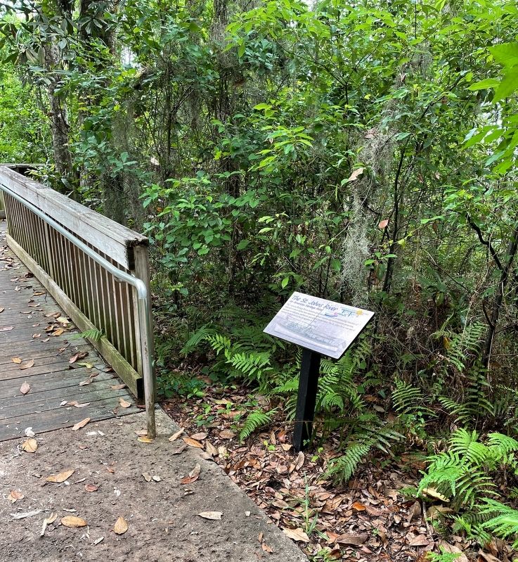
Discovered by Juan Bono Quexos, 1520 • First named Rio de Corrientes by Spain • Explored by Pedro Menendez • Called Riviere de Mai by France, 1562-4 • San Mateo, Salamototo and Picolata were among its other Spanish names • Its . . . — — Map (db m129642) HM
In 1912, following the drowning of a prominent citizen, Dr. Lyman Haskell and Clarence MacDonald established and trained Florida’s first U.S. Volunteer Life Saving Corps (VLSC) at this location to protect the lives of bathers on Jacksonville Beach . . . — — Map (db m93262) HM
On April 10, 1942, German submarine U-123 torpedoed the oil tanker SS Gulfamerica off the coast of Jacksonville Beach. The tanker exploded and eventually sank. Nineteen Americans lost their lives in the attack. This marker has been placed to . . . — — Map (db m181086) HM WM
This marker commemorates the attack on the USS Gulfamerica on April 10, 1942, during World War II (1941-1945) by a German U-boat just off the coast of Jacksonville Beach. The Gulfamerica, a merchant marine vessel, was on her maiden . . . — — Map (db m220170) HM
(Side 1)
U.S. Merchant Marine
In Peace and War – 1775
Dedicated September 14, 1999
Mayport Florida
In memory of the men and women
of all nations who loyally served
aboard United States merchant
ships . . . — — Map (db m137894) WM
Pensacola became a center for commercial fishing by the 1870s. The industry's primary export was red snapper (Lutjanus campechanus). Pensacola's fish houses, including E.E. Saunders & Co. on the Palafox Street wharf and the Warren Fish . . . — — Map (db m130815) HM
The Submarine Lifeguard League was officially formed in
early 1943. From then and until August 14, 1945, a total of
518 airmen were rescued from a watery grave or certain
capture by the enemy. Many rescues were accomplished
by the 87 submarines . . . — — Map (db m177644) HM WM
Pensacola's residents have endured more than 450 years of destructive hurricanes. The first historically recorded hurricane overwhelmed Don Tristán de Luna's 1559 colonization attempt, destroying most of the ships in his fleet. In 1752, another . . . — — Map (db m130814) HM
The success of the American Revolution spurred population growth and movement in the early 19th century. While many Americans moved west to claim new land, some looked south to Spanish West Florida. The flood of new settlers and increased pressure . . . — — Map (db m130794) HM
Pensacola Bay has been a valuable resource for populations from prehistoric to modern times. The relationship between these people and their environment is often reflected in archaeological sites submerged beneath local waters. In addition to many . . . — — Map (db m130819) HM
On March 9, 1781, Spanish General Bernardo de Galvez, with a fleet of some 30 ships, arrived opposite Pensacola Bay and within a day took Santa Rosa Island. On March 18, Galvez, in his ship Galveztown, sailed under the cannon of the Royal Navy . . . — — Map (db m72252) HM
If you flew over Pensacola Bay, you would see that it has many natural forms of protection. Sandy barrier islands defend the narrow entrance into the bay and rolling hills provide excellent vantage points to watch ships arrive. The many colonial . . . — — Map (db m130741) HM
A native of Maine, Ebenezer Dorr spent fourteen months as a prisoner of war in England during the War of 1812. He was captain of his own ship for many years, trading at ports around the world. In about 1827,
Dorr moved his family to Escambia County . . . — — Map (db m80050) HM
Side 1
Emanuel Point Shipwrecks
In August 1559, eleven ships under command of Don Tristan de Luna y Arellano sailed into Pensacola Bay, then called Ochuse, to establish a new colony for Spain. Intended to stake a claim on the . . . — — Map (db m102003) HM
As the Spanish Governor of Louisiana Territories, Bernardo de Gálvez was an important friend of American Colonists. When Spain became an ally of the American Revolutionaries in 1779, Bernardo de Gálvez led a multinational force of troops from New . . . — — Map (db m145510) HM
Although the American Civil War (1861-1865) hindered much of Pensacola's early industrial growth, the city rebounded quickly once the war ended. Entrepreneurs from the northern United States saw great value in the area's deep port and natural . . . — — Map (db m130716) HM
Archaeology has helped us learn a lot about life in prehistoric Pensacola.
Although little archaeological evidence exists from Pensacola's earliest
Paleoindian residents, sites from later periods reveal a strong reliance on the
marine landscape. . . . — — Map (db m177091) HM
Mooring anchors like this one were lowered into Pensacola Bay during the 1800s. A pair of buoyed mooring anchors connected by a long, heavy chain gave sailing ships a place to moor (tie up) while waiting to enter Pensacola's harbor to load or unload . . . — — Map (db m91136) HM
In 1559, Don Tristan de Luna y Arellano sailed from Vera Cruz to Pensacola Bay in La Florida, to establish as the first permanent colony. The bay, also known as Ochuse and Panzacola, was reached by this sea pathway on August 15, 1559. A hurricane in . . . — — Map (db m183420) HM
Construction began 1856, was lit 1859 and is still in use at the present time.
This lighthouse replaced the original lighthouse built 1824, the first lighthouse on the Gulf Coast. — — Map (db m50405) HM
Site of
Pensacola’s First Lighthouse
and
First on Florida’s Gulf Coast
Lighted: December 20, 1824-December 31, 1858
Architect: Winslow Lewis
Tower: Conical 30-foot Brick
Light: 10 Whale Oil Lamps in 7-foot Lantern
Keepers: Jeremiah . . . — — Map (db m102635) HM
During the mid-1800s, 16 wharves reached into Pensacola Bay, along a three-mile stretch of waterfront from Bayou Texar to Bayou Chico. A few years later, around 1900, railroad companies invested in Pensacola's port facilities, improving wharves and . . . — — Map (db m91137) HM
Early Spanish explorers quickly
recognized the importance of
Pensacola and its waterways.
Remnants of conquistador Pánfilo
de Narváez's expedition sighted
Pensacola Bay as early as 1528. In 1539
and 1540, Francisco de Maldonado
waited in the . . . — — Map (db m177087) HM
Military and naval conflict dominated the 18th century. France, Spain, and Great Britain were aggressors in nearly constant warfare that often extended into North America. Spain established a fledgling colony near what is now the Pensacola Naval Air . . . — — Map (db m130767) HM
Side 1:
This berth was once the home of the 255 foot Owasco class patrol gunboat, Sebago (WPG 42), which was commissioned in September 1945 as the United States’ most heavily armed war vessel per foot. The ship carried an initial . . . — — Map (db m110471) HM
Bartram wrote of the security and extent of intracoastal water ways from Virginia's Chesapeake Bay to the Mississippi, in 1774. — — Map (db m110475) HM
Middle Passage to Pensacola
Beginning in the early 1500s and continuing for more than three
centuries, about 12 million enslaved Africans were transported
across the Atlantic Ocean from Africa to the Americas. This
transportation, known . . . — — Map (db m177047) HM
Fort Pickens' brick walls and cast-iron guns had become obsolete by the end of the Civil War. Harbor defenses now called for steel guns in low-lying concrete batteries. Trueman's 3-inch, rapid-fire guns, mounted in 1905, guarded the inner channel . . . — — Map (db m80063) HM
On the brink of war with Spain after the USS "Maine" battleship was sunk in Havana Harbor, Cuba, in February 1898, the U.S. Army installed a minefield in the Pensacola Harbor entrance. Leaving a 1000-foot opening, the Corps of Engineers placed two . . . — — Map (db m80095) HM
If you had been here on November 22 and 23, 1861, you would have been in the midst of a fierce Civil War battle. Union troops at Fort Pickens bombarded Confederates who, in January, had occupied Fort McRee straight ahead across the bay and Fort . . . — — Map (db m80083) HM
The last step in producing sugar on my plantation involved getting it ready to ship north to market. Once the molasses drained from the hogsheads in the curing room, slaves transferred both the sugar and the molasses to this loading area between . . . — — Map (db m234835) HM
When the Bulow Plantation was active, these boat slips harbored both work and pleasure crafts. The slips have, fortunately, survived time because John Bulow reinforced the embankments with ale and wine bottles which were discarded from house . . . — — Map (db m191598) HM
Welcome to the
Intracoastal Waterway
One of the most popular features of Waterfront Park is the body of water that winds along the paved paths. This waterway is part of a massive marine highway, known as the Intracoastal Waterway. It is . . . — — Map (db m239834) HM
This hiking path is located on the Old Coast Guard Road, which was established during World War II. In the first half of 1942, German submarines sank more than 35 ships off Florida's coast prompting the military to establish a beach patrol. The . . . — — Map (db m208176) HM
This riverside cottage was the winter home of Owen D. and Louise P. Young. The Young’s primary residence was in Van Homesville, New York. After much consideration, the Youngs decided to build their Washington Oaks home on this raised bank along . . . — — Map (db m144590) HM
(side 1)
History records the first shipment of cotton to leave this Port, arrived New York, 1822.
Beginning 1836, forty-three, three-storied brick, Cotton Warehouses and Brokerages lined Apalachicola's water front. Their granite-columned . . . — — Map (db m101141) HM
The Crooked River Lighthouse, built in 1895, replaced three lighthouses on Dog Island that over the years were destroyed by storms. The lightstation grounds originally included a house for both the Keeper and the Assistant Keeper, and several . . . — — Map (db m117427) HM
In 1838 the steamship Irvington, carr[y]ing 200 bales of cotton on a downstream run, burned and sank four miles upstream from here. This 115 foot side-wheeler was constructed in 1836 in Marion, Indiana. These boilers and parts were dredged from the . . . — — Map (db m114622) HM
The 1795 Treaty of San Lorenzo defined the international border dividing Spanish Florida from the newly formed United States.
No one who signed the treaty had ever seen it, but the point of land formed by the confluence of the Chattahoochee and . . . — — Map (db m230733) HM
The wooden wrecks visible along the shoreline here are all that remain of once luxurious paddlewheel steamboats that plied the Apalachicola River from 1820s to the 1930s.
Marine archaeologists documented a large number of these vessels between . . . — — Map (db m230791) HM
The Apalachicola River flows 107 miles from its source at the Jim Woodruff Dam to its mouth at Apalachicola Bay.
A vital ecological and water resource, it has a long history as a waterway for commercial, military, and recreational use. It is . . . — — Map (db m231584) HM
The First Seminole War erupted when U.S. soldiers attacked the Lower Creek village of Fowltown near today's Bainbridge, Georgia, on November 21-23, 1817.
Native American and Maroon (escaped slave or Black Seminole) warriors retaliated by . . . — — Map (db m230902) HM
Victory Bridge is a monument to early 20th century engineering. Completed in 1922 at a cost of roughly $1 million, the bridge was built by Masters and Mullen Construction Company of Cleveland, Ohio.
Its name honors the Allied victory in World War . . . — — Map (db m230656) HM
About 3 miles up river from here the sunken remains of the "City of Hawkinsville" lie on the bottom of the Suwannee River at Old Town landing. The "City of Hawkinsville" was brought to the Suwannee River in 1900 as a vessel employed in the timber . . . — — Map (db m245245) HM
The Mariner's Compass pattern is one of the earliest quilt patterns. “Trenton's Compass Rose” is a variation that was designed by Stephanie Metts to highlight the City of Trenton's leadership in creating Florida's first quilt trail. The . . . — — Map (db m126489) HM
Shortly after Florida became a state in 1845, its leaders began to consider draining the swampy areas of south Florida to create prime farmland as an inducement to settlement. In 1850 Florida received title to all swamp and overflowed lands within . . . — — Map (db m16414) HM
(side 1)
Fort Place, or Richard's Fort, five miles south, erected in the early 1800's is considered as the forerunner of Wewahitchka. People lived in the area earlier. Wewahitchka (Indian name for water eyes), first permanent settlement in . . . — — Map (db m101420) HM
The Bishops had a great love for Florida and its beautiful rivers. Senator Bishop was a conservationist and farmer. While in the Florida senate he was a key figure in the establishment of the Ichetucknee Springs State Park. Virginia Bishop was a . . . — — Map (db m210075) HM
Sulphur deposits in the
limestone layers of the
aquifer system in the
northern stretches of the
Suwannee River cause
Florida's historic White Springs to
discharge mineral water" containing
hydrogen sulfide gas and sulfate. As a
result, . . . — — Map (db m146348) HM
These sulphur springs were thought to have medicinal properties and were considered sacred by the Indians. Warriors wounded in battle reputedly were not attacked when they came here to recuperate. Settlers moved into the vicinity in 1826 and the . . . — — Map (db m13675) HM
Designed and built in 1938 by inventor Edward Christopher Warren, former associate of famed inventor Nicola Tesla, to install in a 114 foot shuttle yacht “Navette,” originally commissioned by financier J. Pierpont “Jack” Morgan and built by . . . — — Map (db m239974) HM
(side 1)
Bayport in the Civil War
Bayport was a shallow-water gulf port town in the 1850s. The town was designated the Hernando County Seat and a port of delivery by Congress in 1854. Before the Civil War, the port shipped lumber cut . . . — — Map (db m110440) HM
In honor of The U.S.S. Highlands (APA 119) and Her Gallant Crew For service in the Pacific during WWII donated by The Citizens of Highlands County Dedicated October 5, 1993 — — Map (db m157289) WM
A remnant of U.S. forces separated from South Vietnam in April 1975 in what President Gerald Ford termed a “humiliating withdrawal." U.S military involvement in southeast Asia had officially said it wasn’t over yet. In what many consider to be . . . — — Map (db m194326) HM WM
The USS Cole bombing was a terrorist attack against the United States Navy guided-missile destroyer USS Cole (DDG-67) on 12 October 2000, while it was being refueled in Yemen’s Aden harbor. Seventeen American sailors were killed and 39 injured in . . . — — Map (db m194008) HM WM
In 1848, James Alderman settled near this site, a densely forested area, and cut down the steep banks of the Alafia River to make it easier for horses and wagons to ford it. The area became known as Alderman's Ford.
As the land to the south of . . . — — Map (db m111055) HM
Dedicated to the
memory of the
29 Sea Captains and
Mariners whose
vision and courage
chartered a course
of development
for Tampa Bay — — Map (db m26967) HM
Alfred Reuben Swann was born and raised in Tennessee. After wintering in Tampa, he foresaw a bright future for the community. In 1905, he began living in Tampa much of the year and became a major figure in the city's residential and commercial . . . — — Map (db m69882) HM
Site of Only Land Engagement at Tampa between Confederate & Union Forces, Oct. 17, 1863 A Federal detachment of 124 men from U. S. gunboat Tahoma & Steamer Adela after firing 2 blockade-runners moored upriver fell back under Confederate assault . . . — — Map (db m44740) HM
The Cuban missile crisis — known as the October crisis in Cuba and the Caribbean crisis (Russian: к ариский кризис, tr. Karibskiy krizis) in the USSR — was a . . . — — Map (db m193986) HM WM
This vessel named for Jose Gaspar a gentleman Lieutenant of the Royal Spanish Navy, who achieved great fame as a pirate headquartered on Florida's Gulf Coast.
As leader of a mutinous uprising, Lt. Gaspar seized command of the Spanish . . . — — Map (db m34860) HM
Navy Seabees
With willing hearts and skillful hands
the difficult we do at once,
the impossible takes a bit longer
Seabees can do
We Build We Fight — — Map (db m193709) WM
On 5 January 1968, Pueblo left Yokosuka, Japan, in transit to Sasebo, Japan, from where she left on 11 January 1968, headed northward through the Tsushima Strait into the Sea of Japan. She left with specific orders to intercept and conduct . . . — — Map (db m193251) HM
Here docked the Royal Yacht Britannia for the official visit to Harbour Island by Her Majesty Queen Elizabeth II and His Royal Highness The Duke of Edinburgh May 12, 1991 — — Map (db m33806) HM
The Tampa Tribune published a story in 1982 about Calvin “Poppa” Taylor, a treasure hunter of sorts, who claimed to have gotten inside information from a descendant of McKay who revealed where to look for sunken treasure. The story includes a photo . . . — — Map (db m193202) HM
U.S. Navy Submarines
paid heavily for
their success in
World War II.
A total of
374 officers and
3131 men are on
board these 52
U.S. Submarines
Still on “Patrol.”
We shall never forget that it was our submarines that help the . . . — — Map (db m207404) WM
The Barbary States were a collection of North African states, many of which practiced state-supported piracy in order to exact tribute from weaker Atlantic power Morocco was an independent kingdom, Algiers, Tunis, and Tripoli owed a loose . . . — — Map (db m194012) HM WM
The Battle of Fort Brooke was a minor engagement fought during the Civil War near Tampa, Florida.
Two Union Navy ships, the USS Tahoma and the USS Adella, bombarded the fort on October 16, 1863. As the conflict continued, the Battle of Ballast . . . — — Map (db m199144) WM
The Battle of Tampa, also known as the "Yankee Outrage at Tampa", was a minor engagement of the American Civil War fought June 30 - July 1, 1862, between the United States Navy and a Confederate artillery company charged with protecting the port of . . . — — Map (db m197409) HM WM
In 1907, Alfred Swann and Eugene Holtsinger constructed the original section of seawall and roadway extending from Swann Avenue to Rome Avenue. This initial section, which was called Bayshore Drive, served Suburb Beautiful, the first residential . . . — — Map (db m44647) HM
This stone from the invasion beach at Incheon was provided by the City of Incheon, South Korea as a tangible reminder of the sacrifices made by the United States military to protect the freedom of a sovereign country. — — Map (db m193434) WM
On October 18, 1863, a union task force of 85 soldiers found the “Scottish Chief” and “Kate Dale”, celebrated blockade runners, hidden in a remote anchorage in the Hillsborough River, near this site and set the ships afire. Owner-Skipper James . . . — — Map (db m33675) HM
The United States Invasion of Panama, code-named Operation Just Cause, was the invasion of Panama by the United States in December 1989. It occurred during the administration of U.S. President George H. W. Bush, and ten years after the . . . — — Map (db m194046) HM WM
Submarine Torpedo of WW II,
This Example is a Non-Explosive Dummy
643 lb. Torpex Explosive Charge in Warhead
Steam propulsion
Range: 4,500 yards at 46 knots
Designed 1930 in Service 1931 Through the mid-1970s
This type was the . . . — — Map (db m193414) HM
Naval, (Hydrogen Peroxide) Propulsion
973 lbs. Torpex Explosive Charge
Range: 13,700 yards at a speed of 46 knots
This type was in service from 1944 to 1975
This example is a non-explosive dummy.
Sign provided by . . . — — Map (db m193417) HM
The USS Liberty Incident was an attack on a United States Navy technical research ship, USS Liberty, by Israeli Air Force jet fighter aircraft and Israeli Navy motor torpedo boats, on 8 June 1967, during the Six-Day War. The combined air and sea . . . — — Map (db m193283) HM
At the nearby junction of Jackson Street and the Hillsborough River was the east bank docking site of the Tampa Ferry, the only means of crossing the river in pioneer days. The ferry was an open deck, flat barge, hand pulled by means of a steel . . . — — Map (db m216191) HM
On the morning of June 9, 1898, the 1st U.S. Volunteer Cavalry Regiment, “The Rough Riders,” disembarked from an empty coal train (approximately 1 mile east of here) joining 16,000 U.S. Army troops mobilizing in Port Tampa for the invasion of . . . — — Map (db m243964) HM
Near here in 1937, world-recognized evangelist Billy Graham would paddle his canoe across the river to the little island. There he would practice his sermons on the creatures of the river great and small, from alligators to birds. Dr. Graham, one . . . — — Map (db m101007) HM
The Mark VII SDV began experimental service in 1967, and conducted its first mission off the coast of North Vietnam in June, 1972. It is a four-man, wet, submersible vehicle. It’s acoustic and magnetic signature is minimized by the use of non . . . — — Map (db m186177) WM
Late in July, 1715, a hurricane destroyed a fleet of eleven or possibly twelve homeward bound merchant ships carrying cargoes of gold and silver coinage and other valuable items from the American colonies to Spain. About 1500 men, women, and . . . — — Map (db m14306) HM
In the early 20th century, the Indian River was a highway for settlers and tourists. There were few roads, and no bridges from the mainland to the barrier islands in the Indian River County area. In 1923, a road with bridges was opened, crossing the . . . — — Map (db m212943) HM
This point of land at the junction of the St. Sebastian River and the Indian River was once settled by aboriginal people, the Ais. Pottery shards and ancient shells can still be found along the shore.
In 1889, L.C. Moore built the . . . — — Map (db m93121) HM
Settled in the 1870's, Sebastian became an important trading and fishing center during the era of the river steamers. To improve commerce and fishing, pioneers in 1886 attempted unsuccessfully to link the ocean with the river via the Sebastian . . . — — Map (db m95073) HM
On 30 April 1894, the British Steamship Breconshire (formerly the Numidian), bound from New York to Tampa, stranded on the offshore limestone reef leaving its boiler visible above the waves. The 24-man crew was sheltered by the U.S. Life Saving . . . — — Map (db m186018) HM
The pattern of community development which occurred in Vero Beach provides insight into some important aspects of Florida's history. Although the coastal waters in the region attracted fishermen, settlement of this area did not occur until the . . . — — Map (db m82788) HM
On the night of May 5, 1942, eight miles off this coast, German submarine U-333 attacked the US tanker Java Arrow, killing two of her crew.
Coast Guard Auxiliary volunteers Kit Johnson, Ottie Roach, Harry McDonald, and Ward . . . — — Map (db m245936) HM
Two Dollar Bluff, prominently featured on the U.S. Geodetic Map of 1887, was considered a navigational aid for ships on the Indian River. Located on property owned by settler and citrus grower A.B. Michael, this bluff was an Ais Indian midden and . . . — — Map (db m212947) HM
Bascom School was built in 1927 on the Woodman of the World Campground. The classic 1920s era design embodies many characteristics of Florida's founding and early development period (1890-1929). The one-story school used locally made bricks and hewn . . . — — Map (db m208152) HM
Creek Town of the Spanish Era
Ekanachatte ("Red Ground") was an important Creek Indian town that stood here at Neal's Landing Park during the latter half of the 18th century and the first two decades of the 19th.
This site was known as . . . — — Map (db m201244) HM
Lafayette County was created December 23, 1856, from Madison County. The county was named in honor of the Marquis de Lafayette, the French citizen who rendered invaluable assistance to the Colonies during the Revolutionary War. The famed Suwannee . . . — — Map (db m17725) HM
A wide diversity of people have traversed this spot on the St. Johns River, starting with the ancient tribes and Timucuan and Mayacan Indians. The St. Johns River was named one of fourteen American Heritage Rivers because of its importance to the . . . — — Map (db m188477) HM
Located on the west bank of the St. Johns, Ft. Butler was built in 1838 during the Seminole Wars. It consisted of a crude log stockade and barracks for the garrison. The Fort was one of the military installations designed to protect the St. Johns . . . — — Map (db m31341) HM
612 entries matched your criteria. Entries 101 through 200 are listed above. ⊲ Previous 100 — Next 100 ⊳