3079 entries match your criteria. Entries 101 through 200 are listed.⊲ Previous 100 — Next 100 ⊳
Bridges & Viaducts Topic
By Joseph Alvarado, August 14, 2022
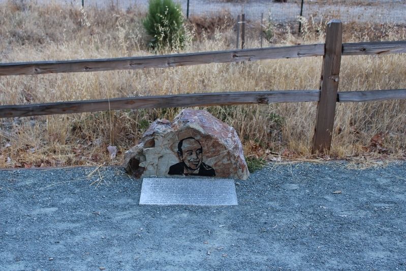
Supervisor Edward R. Campbell Foot Bridge Marker
| 101 ► California, Alameda County, Livermore — Supervisor Edward R. Campbell Foot Bridge — |
| 102 ► California, Alameda County, Oakland — Observation Pier — |
| Near Burma Road. | |||
| 103 ► California, Alameda County, Oakland — The Oakland - San Francisco Bay Bridge — |
| 104 ► California, Alameda County, Oakland, Fruitvale — Tidal Canal — |
| On Alameda Avenue north of Tidal Way, on the right when traveling south. | |||
| 105 ► California, Alameda County, Oakland, Oakmore — 40 — Leimert Bridge — |
| On Leimet Boulevard near Clemens Road, on the right when traveling west. | |||
| 106 ► California, Alameda County, Oakland, Oakmore Highlands — 40 — Leimert Bridge — |
| On Leimert Boulevard east of Park Boulevard, on the right when traveling east. | |||
| 107 ► California, Alameda County, Oakland, Produce and Waterfront — 26 — Oakland Portal — Oakland Waterfront Warehouse District |
| On Fourth Street at Harrison Street on Fourth Street. Reported permanently removed. | |||
| 108 ► California, Alameda County, Pleasanton, Verona — Once a Hilltop Castle — Another Hearst Legacy — |
| Near Verona Road west of Pleasanton Sunol Road. | |||
| 109 ► California, Amador County, Jackson — Massa (Tunnel) Adit — |
| Near North Main Street/Jackson Gate Road. | |||
| 110 ► California, Butte County, Chico — Gianella Bridge — |
| On Highway 32 at Gianella Road, on the right when traveling east on Highway 32. | |||
| 111 ► California, Butte County, Chico — Honey Run Covered Bridge / Gold Dredge |
| On Honey Run Road at Centerville Road, on the right when traveling north on Honey Run Road. Reported permanently removed. | |||
| 112 ► California, Butte County, Oroville — Bidwell Bar Bridge and Tollhouse — |
| On Bidwell Canyon Road. | |||
| 113 ► California, Butte County, Oroville — 314 — The Mother Orange Tree of Butte County — Bidwell Bar Bridge — |
| On Bidwell Canyon Road. | |||
| 114 ► California, Calaveras County, Copperopolis — Copperopolis Historical Plaza — |
| On Main Street, on the right when traveling north. | |||
| 115 ► California, Calaveras County, Copperopolis — 281 — O'Byrne Ferry — |
| On O'Byrne Ferry Road (State Highway 49), on the right when traveling south. | |||
| 116 ► California, Calaveras County, Dorrington — Sourgrass Bridge — 1999 — |
| On Boards Crossing Road/Forest Route 5NO2, 5 miles south of Ebbetts Pass Scenic Byway (California Highway 4), on the left when traveling south. | |||
| 117 ► California, Calaveras County, San Andreas — 258 — Fourth Crossing — |
| On State Highway 49, on the right when traveling south. | |||
| 118 ► California, Colusa County, Colusa — Center Section of the Former Colusa Bridge — Historical Landmark — |
| Near Levee Street near 10th Street. | |||
| 119 ► California, Contra Costa County, Crockett — Al Zampa Memorial Bridge — Crockett, California 2003 — |
| Near San Pablo Avenue, 0.1 miles west of Merchant Street. | |||
| 120 ► California, Contra Costa County, Orinda — San Pablo Creek Bridge — 1920 — |
| On Orinda Way at Camino Pablo, on the left when traveling north on Orinda Way. | |||
| 121 ► California, Contra Costa County, Walnut Creek — 101 — Botelho's Island & Creek Confluence — Liberty Bell Plaza — 1949 — |
| On Mt. Diablo Boulevard near Broadway Plaza, on the left when traveling east. | |||
| 122 ► California, Contra Costa County, Walnut Creek — 124 — Bridge over Walnut Creek — Duncan St. and Broadway — Late 1800s — |
| On Duncan Street near North Main Street, on the left when traveling east. | |||
| 123 ► California, El Dorado County, Coloma — Coloma Bridges — |
| On Mt Murphy Road at Coloma Road (California Route 49), on the right when traveling east on Mt Murphy Road. | |||
| 124 ► California, El Dorado County, Coloma — Mining Ditches — |
| On Marshall Parkway, on the left when traveling north. | |||
| 125 ► California, El Dorado County, Coloma — Pleasant Flat — |
| On Mt Murphy Road at Levee Trail, on the left when traveling east on Mt Murphy Road. | |||
| 126 ► California, El Dorado County, Kyburz — Riverton Bridge — |
| On U.S. 50 near Ice House Road, on the right when traveling west. | |||
| 127 ► California, Fresno County, Reedley — Wagon Bridge — 1885 - 1929 — |
| On Kings River Road, 0.1 miles south of Manning Avenue when traveling east. | |||
| 128 ► California, Glenn County, Orland — Simpson Bridge Memorial — |
| Near Route 206, 4 miles west of Newville Road (Route 200), on the right when traveling west. | |||
| 129 ► California, Humboldt County, Fernbridge — Fernbridge — |
| On California Route 211 at Depot Street, on the left when traveling south on State Route 211. | |||
| 130 ► California, Kings County, Laton — 270 — Kingston — |
| On Douglas Avenue, 0.3 miles west of 12¾ Avenue, on the right when traveling west. | |||
| 131 ► California, Los Angeles County, Bradbury — Mr. Bradbury’s Bridge — 1908 — |
| On Royal Oaks Drive North at Oaks Avenue, on the left when traveling west on Royal Oaks Drive North. | |||
| 132 ► California, Los Angeles County, Los Angeles, Boyle Heights — 905 — Sixth Street Viaduct — |
| On 6th Street, 0.1 miles west of Boyle Avenue, on the right when traveling west. | |||
| 133 ► California, Los Angeles County, Los Angeles, Cahuenga Pass — Barham Blvd Bridge — |
| On Barham Boulevard at U.S. 101, on the right when traveling south on Barham Boulevard. | |||
| 134 ► California, Los Angeles County, Los Angeles, Chinatown — 907 — Buena Vista Street Viaduct — North Broadway Bridge — |
| On Broadway at Elysian Park Drive, on the right when traveling east on Broadway. | |||
| 135 ► California, Los Angeles County, Los Angeles, Downtown Los Angeles — Macy Street Grade Separation — Cesar Chavez Avenue — |
| On Cesar E Chavez Avenue east of Alameda Street, on the right when traveling east. | |||
| 136 ► California, Los Angeles County, Los Angeles, Downtown Los Angeles — Sixth Street Viaduct — |
| On 6th Street, 0.5 miles east of Alameda Avenue, on the right when traveling east. | |||
| 137 ► California, Los Angeles County, Los Angeles, Downtown Los Angeles — Temple Street Grade Separation — |
| On Temple Street at Figueroa Street, on the right when traveling west on Temple Street. | |||
| 138 ► California, Los Angeles County, Los Angeles, El Sereno — Soto Street Bridge Removal — Intersection Improvement Project — |
| On Soto Street at Huntington Drive, on the right when traveling north on Soto Street. | |||
| 139 ► California, Los Angeles County, Los Angeles, Griffith Park — Riverside Drive - Zoo Drive Bridge — |
| On Riverside Drive north of Zoo Drive, on the right when traveling north. | |||
| 140 ► California, Los Angeles County, Los Angeles, Griffith Park — 910 — Riverside Drive Bridge — |
| On Riverside Drive north of Zoo Drive, on the right when traveling north. | |||
| 141 ► California, Los Angeles County, Los Angeles, Highland Park — 339 — Santa Fe Arroyo Seco Railroad Bridge — |
| Near California Route 110. | |||
| 142 ► California, Los Angeles County, Los Angeles, Lincoln Heights — Soto Street Tunnel — Pacific Electric Pasadena Short Line — |
| On Soto Street just north of Valley Boulevard, on the right when traveling south. | |||
| 143 ► California, Los Angeles County, Los Angeles, Northeast Los Angeles — North Atwater Bridge — |
| Near the Los Angeles River Bike Path near Chevy Chase Drive. | |||
| 144 ► California, Los Angeles County, Los Angeles, San Pedro — San Pedro Landmarks — |
| On Beacon Street at 9th Street, on the left when traveling south on Beacon Street. | |||
| 145 ► California, Los Angeles County, Los Angeles, Sherman Oaks — Mulholland Drive Bridge — |
| On Mulholland Drive at Skirball Center Drive, on the right when traveling west on Mulholland Drive. | |||
| 146 ► California, Los Angeles County, Los Angeles, Westlake — 1st Street Viaduct — Over Glendale Boulevard — |
| On Toluca Street just north of 2nd Street, on the right when traveling north. | |||
| 147 ► California, Los Angeles County, Pasadena — The Picture Bridge — Huntington Hotel — |
| Near Oak Knoll Avenue at Hillcrest Avenue, on the right when traveling south. | |||
| 148 ► California, Los Angeles County, Pasadena, North Arroyo — Pasadena Pioneers Bridge — |
| On Orange Grove Boulevard at West Colorado Boulevard, on the right when traveling south on Orange Grove Boulevard. | |||
| 149 ► California, Los Angeles County, Pasadena, Old Pasadena — Castle Green — Green Hotel — |
| On South Raymond Avenue just south of Green Street, on the right when traveling south. | |||
| 150 ► California, Los Angeles County, Pasadena, South Arroyo — Colorado Street Bridge — Historic Civil Engineering Landmark — |
| On Colorado Boulevard, 0.1 miles west of Orange Grove Boulevard, on the left when traveling west. | |||
| 151 ► California, Los Angeles County, Pasadena, South Arroyo — La Loma Bridge — John K. Van De Kamp Bridge — |
| On La Loma Road just east of Arroyo Boulevard. | |||
| 152 ► California, Los Angeles County, Santa Monica — Santa Monica Harbor and Breakwater — |
| Near Ocean Avenue at Colorado Avenue. | |||
| 153 ► California, Los Angeles County, South Pasadena — 3 — Oaklawn Bridge & Waiting Station — Route 66 Roadside Attraction — South Pasadena, California — |
| On Fair Oaks Avenue at Oaklawn Avenue, on the right when traveling south on Fair Oaks Avenue. | |||
| 154 ► California, Los Angeles County, Torrance, Old Torrance — Pacific Electric Railway — El Prado Bridge — |
| On Torrance Boulevard at Bow Avenue, on the right when traveling east on Torrance Boulevard. | |||
| 155 ► California, Marin County, Ross — Historic Dedication of the Lagunitas Road Bridge — Corte Madera Creek — Ross, California - March 20, 2011 — |
| Near Lagunitas Road at Sylvan Lane, on the right. | |||
| 156 ► California, Marin County, San Anselmo — Creek Park Bridge — Town of San Anselmo Public Path — |
| Near Sir Francis Drake Boulevard. | |||
| 157 ► California, Marin County, San Anselmo — Magnolia Avenue Bridge — Town of San Anselmo Public Path — |
| Near Sir Francis Drake Boulevard. | |||
| 158 ► California, Marin County, San Rafael — Richmond-San Rafael Bridge — |
| On Francisco Boulevard East at Main Street, on the right when traveling north on Francisco Boulevard East. | |||
| 159 ► California, Marin County, Sausalito — Strengthening an Icon — Golden Gate Bridge Seismic Retrofit — |
| Near Conzelman Road near U.S. 101, on the left when traveling west. | |||
| 160 ► California, Marin County, Sausalito — 974 — The Golden Gate Bridge |
| Near U.S. 101, on the right when traveling north. Reported damaged. | |||
| 161 ► California, Marin County, Tiburon — History of the Tiburon Trestle — |
| On Tiburon Boulevard, on the left when traveling north. | |||
| 162 ► California, Marin County, Tiburon — Shapero Bridge — |
| 163 ► California, Marin County, Tiburon — Welcome to Trestle Trail — A Tribute to Tiburon's Railroad History — |
| 164 ► California, Mariposa County, Coulterville — 6011 — Bagby — |
| Near State Highway 49, 10.2 miles south of State Highway 132, on the left when traveling south. | |||
| 165 ► California, Mariposa County, Mariposa — Bridgeport — |
| On Old Highway Road, on the right when traveling east. | |||
| 166 ► California, Mariposa County, Mariposa — William Sell Jr. Memorial Bridge — First Place Award Winner — |
| On California Highway 49 (State Highway 49). | |||
| 167 ► California, Merced County, Hilmar — Merced River Bridge — |
| On River Road at Kelley Road, on the right when traveling north on River Road. | |||
| 168 ► California, Merced County, Winton — The Montpelier-Oakdale Railroad — 1890 to 1942 — |
| On Oakdale Road south of Turlock Road, on the right when traveling south. | |||
| 169 ► California, Nevada County, Chicago Park — Old Bear River Bridge — |
| On Colfax Highway (California Route 174), on the left when traveling south on Colfax Highway. | |||
| 170 ► California, Nevada County, Nevada City — Pine Street Bridge — 1996 — |
| On South Pine Street south of Spring Street, on the left when traveling north. | |||
| 171 ► California, Nevada County, Nevada City — Purdon Bridge — 1895 — |
| On Purdon Road, on the right when traveling north. | |||
| 172 ► California, Nevada County, Norden — Donner Summit Bridge — |
| On Donner Pass Road, on the left when traveling east. | |||
| 173 ► California, Nevada County, Norden — 28 — Rainbow Bridge — |
| On Donner Pass Road, on the right when traveling east. | |||
| 174 ► California, Nevada County, Penn Valley — 390 — Bridgeport (Nyes Crossing) Covered Bridge — |
| Near Pleasant Valley Road. | |||
| 175 ► California, Nevada County, Penn Valley — Bridgeport Bridge — |
| Near Pleasant Valley Road. | |||
| 176 ► California, Nevada County, Penn Valley — Bridgeport Bridge — "Wood’s Crossing" — |
| Near Pleasant Valley Road. | |||
| 177 ► California, Nevada County, Penn Valley — 390 — Bridgeport Historic District — |
| On Pleasant Valley Road. | |||
| 178 ► California, Nevada County, Smartsville — The Yuba River Bridge at Parks Bar — 1913 - 1994 — |
| On Timbuctoo Road south of California Highway 20. | |||
| 179 ► California, Orange County, Las Flores — Oso Parkway Bridge — Historical Marker — |
| On Oso Parkway, on the right when traveling west. | |||
| 180 ► California, Orange County, Las Flores — Oso Parkway Bridge — Historical Marker — |
| On Oso Parkway, on the right when traveling east. | |||
| 181 ► California, Placer County, Auburn — 1051 — Mountain Quarries Railroad Bridge — |
| On Old Foresthill Road east of Golden Chain Highway (California Highway 49), on the right when traveling east. | |||
| 182 ► California, Placer County, Auburn — GPY 135-10 — Mountain Quarries Railroad Bridge — |
| On Old Foresthill Road east of Golden Chain Highway (California Highway 49), on the right when traveling east. | |||
| 183 ► California, Placer County, Lincoln — Colonel C. Lincoln Wilson — |
| On 5th Street west of E Street, on the right when traveling east. | |||
| 184 ► California, Placer County, Roseville — 2 — Reuben F. Nelson Footbridge — Roseville Historical Society Marker No. 2 — |
| Near Oak Street near Lincoln Street. | |||
| 185 ► California, Placer County, Tahoe City — Roads and Bridges — |
| On W Lake Blvd, on the right when traveling north. | |||
| 186 ► California, Riverside County, Riverside — 54 — Victoria Bridge — 1928 — |
| On Victoria Avenue just south of Woodbine Street. | |||
| 187 ► California, Sacramento County, Fair Oaks — "Jim’s Bridge" — |
| Near Pennsylvania Avenue near the north bank of the American River. | |||
| 188 ► California, Sacramento County, Folsom — Folsom Dam Improvements — Promoting Public Safety for the Sacramento Region — |
| Near East Natoma Street. | |||
| 189 ► California, Sacramento County, Sacramento, CSUS — The Guy West Bridge — |
| Near State University Drive East. | |||
| 190 ► California, Sacramento County, Sacramento, Old Sacramento — R Street Bridge — |
| On Front Street south of O Street, on the right when traveling north. | |||
| 191 ► California, Sacramento County, Sacramento, Old Sacramento — The Northern Electric Bridge — |
| Near Capital Mall. | |||
| 192 ► California, Sacramento County, Sacramento, Old Sacramento — The Tower Bridge — |
| Near Capital Mall. | |||
| 193 ► California, Sacramento County, Sacramento, Old Sacramento — Tower Bridge: Gateway to the Capital — |
| Near Capital Mall. | |||
| 194 ► California, San Bernardino County, Redlands — 17 — Mill Creek Zanja — Santa Fe and Southern Pacific Railroad Bridges — |
| Near Laramie Avenue at Lincoln Street, on the left when traveling east. | |||
| 195 ► California, San Bernardino County, Rialto — The Bridge To Progress — |
| On North Fillmore Avenue. | |||
| 196 ► California, San Diego County, Coronado — San Diego-Coronado Bay Bridge — |
| Near State Highway 75 when traveling east. | |||
| 197 ► California, San Diego County, San Diego — Balboa Park West Mesa — |
| On El Prado, on the right when traveling east. | |||
| 198 ► California, San Diego County, San Diego — Cabrillo Bridge — |
| On El Prado, on the right when traveling east. | |||
| 199 ► California, San Diego County, San Diego — 244 — Derby Dike — |
| On Presidio Drive at Taylor Street, on the right when traveling west on Presidio Drive. | |||
| 200 ► California, San Francisco City and County, San Francisco, Fisherman's Wharf — San Francisco's Most Popular Postcard. — |
| Near Pier 39 north of The Embarcadero. | |||
3079 entries matched your criteria. Entries 101 through 200 are listed above. ⊲ Previous 100 — Next 100 ⊳