Our Constitution names the President of the United States the Commander in Chief of all the Armed Forces. Presidents who have served in our military are displayed on the following plaques. Each has served either on Active Duty, in the National . . . — — Map (db m92382) HM WM
[Written on the initial marker, provided for context]
Our Constitution names the President of the United States the Commander in Chief of all the Armed Forces. Presidents who have served in our military are displayed on the following . . . — — Map (db m92400) HM WM
[Written on the initial marker, provided for context]
Our Constitution names the President of the United States the Commander in Chief of all the Armed Forces. Presidents who have served in our military are displayed on the following . . . — — Map (db m92423) HM WM
[Written on the initial marker, provided for context]
Our Constitution names the President of the United States the Commander in Chief of all the Armed Forces. Presidents who have served in our military are displayed on the following . . . — — Map (db m92424) HM WM
The first court house in Benton County, built of hewed logs was erected on this site (at Bentonville) in 1837, the year after the county was created. It was named for Thomas H Benton. — — Map (db m19880) HM
The earliest postal area was at Cross Hollows. Records show the Bloomington Post Office was changed to Lowell, March 9, 1881 with Paul F. Lewis, Postmaster. Insets show a 1900 Post Office building on North Jackson Street. The one next door to . . . — — Map (db m93274) HM
It was completed in 1903 and served as the Post Office from 1906 - 1965. The three story (plus basement) building was constructed at an original cost of $78,000 with a floor space in excess of 20,000 sq ft. It was constructed of hard-burned, dark . . . — — Map (db m141866) HM
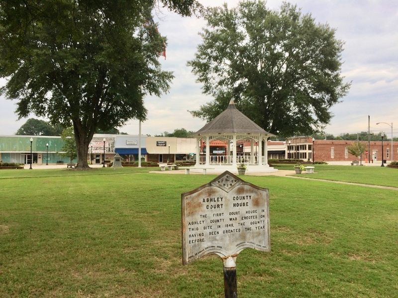
The first temporary court house in Bradley County was erected on this site in 1842, two years after the creation of the county, and continued in use until 1858, when a court house built of brick was erected. — — Map (db m121054) HM
Crescent Cottage
on the National Register of Historic Places
Built in 1881
Home of Powell Clayton,
the first governor of Arkansas
after the state was readmitted
to the Union following
the War Between the States
Owners
Ray & . . . — — Map (db m80139) HM
Festus Orestes Butt was born in 1875 in Illinois just before his family moved to Carroll County, Arkansas. He became a licensed attorney before he was of legal age. The Arkansas General Assembly set aside his "disability of minority", and he set up . . . — — Map (db m79735) HM
These two large limestone public buildings anchor this part of downtown Eureka Springs. They span the deep ravine cut by Leatherwood Creek which flows in a tunnel beneath all the buildings on this entire part of Main Street.
[Photo 1.]
This . . . — — Map (db m59964) HM
Eureka Springs was incorporated on Valentine's Day in 1880. At that time, the only courthouse was in the county seat of Berryville, some 12 miles to the east. This was a great distance at the time, the roads were bad, and the King's River had to be . . . — — Map (db m59962) HM
Until its removal to Heber Springs, the county seat of Cleburne County, the youngest of the 75 counties in Arkansas, was established at Sugar Loaf in 1883, the year the county was formed, and named for General Pat. Cleburne. — — Map (db m141602) HM
Third courthouse on this site. Bid for construction of a new courthouse was let in 1905 for $58,631. Designed by W.S. Hull and built of blond brick with stone detailing, it is considered an example of second renaissance revival architecture. . . . — — Map (db m121341) HM
Side 1
Conway County in the Civil War
Conway County men served in both the Union and Confederate armies in the Civil War. Co. I, 1st Arkansas Mounted Rifles, Co. B, Carroll’s Cavalry, Co. I, 36th Arkansas Infantry, . . . — — Map (db m96451) HM
The site of Jonesboro was laid off as the county seat of Craighead County in 1859, and there was erected soon afterwards the first court house in the county. — — Map (db m116609) HM
February 1, 1878 - December 22, 1950
Tennessee Native -Arkansas Daughter
A good southern wife in the traditional sense.
First:
Elected woman U. S. Senator
Woman to preside over the Senate
Woman chairman of a Senate committee . . . — — Map (db m227550) HM
The companies of soldiers that came out
of Van Buren were formed at this historic
landmark. It is also the site where some
infantry and Calvary units camped and
drilled. There were nine different
companies that were formed in . . . — — Map (db m96864) HM
From the front of his home, John Drennen could overlook the bustling port town of Van Buren, including the wharf originally known as Phillips Landing.
Until after the Civil War, the Arkansas River and the steamboats that plied its . . . — — Map (db m120427) HM
The county was named for Col. David C. Cross. First seat of justice, Cleburne 1865. Moved to Wittsburg 1865 where it remained until 1884 when it was removed to Vanndale and later in 1903 the county seat was established at Wynne, where it has since . . . — — Map (db m158125) HM
Watson became the county seat of Desha County after Napoleon was abandoned to the Mississippi River. Lewis W. Watson donated the land and built the courthouse near this site. The county seat was moved to Arkansas City in 1880. Watson remained the . . . — — Map (db m107757) HM
Ozark was designated as the county seat of Franklin County in 1837, and the first court house in the county was erected on this site in 1838. — — Map (db m120001) HM
In 1928 Senator Joe T. Robinson was
the Democratic party's candidate
for vice-president. He was
formerly (sic) notified at the
Arlington Hotel that he had been
chosen as Al Smith's running mate.
A huge crowd assembled downtown
to hear . . . — — Map (db m211196) HM
From 1832 to 1877, the Hot
Springs Reservation was under
federal ownership, but there was
no local supervision of the land
or the thermal waters. During
that period, several private
citizens attempted to gain title
to the springs, including . . . — — Map (db m211136) HM
In 1832 Congress passed a bill reserving four sections of land with the springs in the middle for future use by the United States government. This act supposedly eliminated the possibility of private ownership of land within a mile of the springs. — — Map (db m211046) HM
The first Lamar opened in 1888, the final year that Georgia-born Lucius Quintus Cincinnatus Lamar (1825-1891) — a former Confederate officer, overseas ambassador for the Confederacy, and U.S. Representative and Senator for Mississippi — served as . . . — — Map (db m211200) HM
Site of
The State Capitol of Arkansas
July 2-14-1862
When Federal troops
advanced on Little Rock,
Governor Henry Massie Rector
moved his staff and records here.
Erected by the Garland County Association
of the
Arkansas . . . — — Map (db m122573) HM
Early in 1862 Governor Henry
Rector feared that Federal
troops were planning an attempt
to seize Little Rock and decided
to move the capitol of the state
to Hot Springs. The movement of
the government to Hot Springs
was the highlight of the . . . — — Map (db m211077) HM
The temporary state capitol was set up in 1862 in a two-story home on the site of the park opposite the Arlington Hotel. Some state records were stored in a log kitchen which was separate from the house. The kitchen was later moved and sat adjacent . . . — — Map (db m211072) HM
March 12, 1999. On this day two Hope natives
visited the Hope Visitor Center and museum.
President William Jefferson Clinton, in town to
dedicate his restored birthplace house, was
escorted through the center by life-long friend
Thomas Franklin . . . — — Map (db m161917) HM
• Pay off the national debt • Repeal laws that
favors capital • Prevent aliens from owning land
• Abolish national banks • Government operations
on a cash basis • End agricultural futures
trading • Establish a graduate income tax •
Prohibit . . . — — Map (db m221190) HM
Col. Magness, 1796-1871, legendary wealthiest man of Independence County before the Civil War, emigrated from Tennessee with his father, Johnathan Magness, a North Carolinian, when Arkansas was a part of Missouri Territory. Col. Magness, a prominent . . . — — Map (db m221205) HM
Elisha Baxter (1827-1899), 10th Governor of Arkansas, was born in Rutherford County, North Carolina. He came to Batesville in 1852, opened a mercantile business and was elected mayor in 1853. Baxter served two terms as state representative . . . — — Map (db m221210) HM
The town of Batesville was selected as the county seat and the first county court house built in 1821, a year after the county was organized. — — Map (db m66720) HM
Near this spot stood the homes of
three governors
of the State of Arkansas
Thomas S. Drew (1844-1849)
Elisha Baxter (1873-1874)
William R. Miller (1877-1881) — — Map (db m221079) HM
The first court house in Jackson County, created in 1832, was located at Litchfield, where it remained until 1839, when it was moved to Elizabeth. In 1852 Augusta (now Woodruff County) was made the county seat and two years later it was moved to . . . — — Map (db m116624) HM
In 1912, Secretary of State Earle Hodges (1911-1917) and the Pine Bluff chapter of the Daughters of the American Revolution sponsored a competition to produce a design for Arkansas’s first state flag. Since 1819, Arkansans had lived, fought, played . . . — — Map (db m168987) HM
The first court house in Lafayette County erected in 1828, was built of logs on Chickaninny Prairie. In 1840 a new town site for the county seat was laid off at the place to which was given the name of Lewisville. — — Map (db m178710) HM
Three African American men represented Lafayette County in the state legislature after the Civil War. Monroe Hawkins, born a slave in North Carolina around 1832, was a minister and laborer. He was a delegate in the 1868 Constitutional Convention and . . . — — Map (db m121211) HM
You are facing the Powhatan Jail
Designed by John D. Edwards, this is a rare example
of a stone military blockhouse.
Lawrence County, is known as the "Mother of Counties". In 1815,
Lawrence County formed this northern region of . . . — — Map (db m242636) HM
Little River County was formed 1867 out of lands taken from Hempstead and Sevier Counties by Act 104 of the Arkansas Legislature approved March 7, 1867. The Act fixed the temporary county seat at the home of William M. Freeman, which was ½ mile . . . — — Map (db m121273) HM
Rocky Comfort, made the County Seat of Little River County in 1868, continued as such until 1880, when it was moved to Richmond and from there the Seat of Justice was moved to Ashdown. — — Map (db m121243) HM
The Arkansas Constitutional Convention of 1868 located the permanent county seat at Rocky Comfort, where it remained until 1880. The first term of court was held there August 4, 1868. A frame court house was erected with offices on the first floor . . . — — Map (db m121277) HM
Joseph Taylor Robinson Home - 204 NE Front St. Practiced law in Lonoke - 1893-1912 U.S. Congressman - 1902-1913. Governor of Arkansas - January - March 1913. U.S. Senator - 1913-1937. Lonoke was named for lone oak tree, surveyor's landmark for . . . — — Map (db m65710) HM
Senator Joseph Taylor Robinson, Arkansas' outstanding statesman was born six miles northwest of this place in 1872. He lived in Lonoke and practiced law; was elected to Congress and served ten years; moved to Little Rock in 1912; served as Governor . . . — — Map (db m65713) HM
A county government was organized in Madison County in 1836, in the barn of Evan S. Polk, a short distance northwest of the present town of Huntsville which was laid out as a town and made the permanent seat, of government in 1839. The county was . . . — — Map (db m141599) HM
Mark Twain referred to Osceola as "the famous and formidable Plum Point" in his book, Life on the Mississippi, as well as other writings. First established in 1837 as Plum Point, Osceola was incorporated in 1853. From this vantage point, one could . . . — — Map (db m36301) HM
The county seat of Mississippi County, created in 1833, was located at Osceola in 1836. Since about 1900 the county has maintained another court house at Blytheville for the northern district. The county was named for the great river which flows . . . — — Map (db m36489) HM
This Neoclassical Courthouse was built in 1912 on land donated by Judge W.J. Driver. Constructed of unusual brick, the building features a flat roof supporting a copper dome with large concrete terra cotta decorations and round polished inserts on . . . — — Map (db m36434) HM
Constructed in 1915, this building served as the post office on the Cotton Highway until 1936. County Judge S.L. Gladish made sure that the Post Office contained European tiles like those used in the then-new courthouse. The building later housed a . . . — — Map (db m36454) HM
In memory of the honorable William J. Driver.Former Circuit Judge and Congressman, a lifelong citizen of Osceola, Arkansas. Born March 2, 1873. Died October 1, 1948. As a member of the Rivers and Harbors and Flood Control Committees of the Congress . . . — — Map (db m36532) HM
The first court house in Monroe County, created in 1829, was erected about 1830 on a site on Joseph Jacob's farm, to which was given the name of Lawrenceville. There it remained until 1856, when the county seat was moved to Clarendon. — — Map (db m153390) HM
Jacob Trieber served as United States District Judge for the Eastern
District of Arkansas from 1901 to 1927. He was the first Jewish judge
ever to serve on the federal bench. Trieber was born in Prussia in
1853, immigrated with his parents to St. . . . — — Map (db m107824) HM
The First County Seat of Phillips county was ordered in the Act of 1820 which created the county, to be located in the Town of Monticello, which place has since been identified as the original name of the present Town of Helena. — — Map (db m51918) HM
African Americans Exercise Their Rights
In the decades following the Civil War, former slaves in
Arkansas saw African Americans elected to local, state and
national offices. Henderson B. Robinson was elected . . . — — Map (db m107892) HM
The first court house in Pike County, built of logs, was erected on the site of the town of Murfreesboro, which was laid out as a site for the county seat in 1833. — — Map (db m121284) HM
The first county seat of Poinsett County, created in 1838, was located at Bolivar, and there it remained until 1856, when it was moved to Harrisburg. — — Map (db m221251) HM
The first steamboat to ascend the Arkansas River, the Comet, arrived at Arkansas Post on March 31, 1820, and river travel was transformed.
Two years later people in the new town of Little Rock were jubilant over the arrival of the first . . . — — Map (db m142031) HM
The first court house in Prairie County erected in 1846, was located in the town of Brownsville, where it remained until 1873, when it was removed to Devalls Bluff, in 1875 the seat of justice was moved to Des Arc, where it has since remained. — — Map (db m172136) HM
The 32nd Governor of the State of Arkansas (Dem. 1941 - 34) was born near Jacksonville on October 15, 1890 in the community of Piedmont, spent his childhood here and attended Bayou Metro public School. Gov. Adkins was largely responsible for . . . — — Map (db m183524) HM
Constructed in 1899, the Choctaw Route Station served as a passenger depot for the Choctaw, Oklahoma and Gulf Railroad Company, before becoming the property of the Rock Island Railroad in 1902.
The station served as a major passenger terminal on . . . — — Map (db m121451) HM
This granite boulder was placed here June 15, 1936 to commemorate the one hundredth year of Arkansas’ Statehood. The boulder weighs nearly twenty tons. It was brought from Granite Mountain, five miles south of this point and placed by the authority . . . — — Map (db m157178) HM
The county government in Pulaski County
was organized May 24, 1819, at the house of
Samuel Mc Henry. The next year at the first
session of the General Assembly of Arkansas
Territory, the permanent seat of government
for Pulaski County was . . . — — Map (db m211313) HM
On this site stood the home of
Robert Crittenden
Lieutenant in the War of 1812
First Territorial Secretary of State
and Acting Governor of Arkansas
1819 – 1829 — — Map (db m211339) HM
The Johnson House was built about 1827 as the residence of Robert W. Johnson and his son and daughter-in-law, Mr. and Mrs. Benjamin S. Johnson. Robert W. Johnson had returned to Little Rock in 1876 after a long and distinguished career which . . . — — Map (db m211347) HM
On October 25, 1905, Theodore Roosevelt became only the second sitting president to visit our state. His visit was a key stop on a southern tour following the election of 1904 in which he was elected easily but failed to win any states of the former . . . — — Map (db m116375) HM
At about this site stood the law office
of
Augustus Hill Garland
Member of House and Senate of the
Confederate Congress
He prepared and won the case of ex parte Garland in
the U.S. Supreme Court, thus effecting the readmission . . . — — Map (db m102759) HM
This property has been
placed on the
National Register
of Historic Places
by the United States
Department of the Interior
Built in 1900 — — Map (db m211526) HM
deMun, a French aristocrat (Chevalier or Knight),
emigrated to the U.S. in the 1790s. A trained
draftsman, he became the right hand man of
Benjamin Latrobe, architect of the U.S. Capitol.
deMun oversaw the construction of the west wing . . . — — Map (db m170292) HM
The first court house in Randolph county, created in 1835, was erected in 1886, on the site of the town of Pocahontas, which was then known as Bettis' Bluff. — — Map (db m170293) HM
The Old Randolph County Courthouse has been placed on the National Register of Historic Places By the United States Department of the Interior April 24, 1973. — — Map (db m172011) HM
The county seat of Searcy County was created in 1838 and was first located at Lebanon, on Bear Creek, about five miles west of the present town of Marshall, to which place the seat of justice was moved in 1856. — — Map (db m141600) HM
The building in front of you is very much as it appeared in the 1890s. First built as a military barracks, it was later converted for use as a courthouse and jail. Over time its appearance changed to accommodate different needs of the people . . . — — Map (db m59026) HM
The permanent seat of justice in Sebastian County, created in 1851 was located on a site to which was given the name of Greenwood. In 1861 another court house was erected at Ft. Smith and since then the county has maintained two seats of justice. . . . — — Map (db m92349) HM
With the largest criminal jurisdiction of any federal court at the time, the Western District of Arkansas handled an extraordinary number of murder and rape cases. When a jury found defendants guilty in these capital cases, federal law mandated the . . . — — Map (db m59022) HM
In 1884, by an act of Congress, secured by
Congressman John H. Rogers, later United
States Judge of the Western District of
Arkansas, more than 200 acres of the
government reservation was donated to
the Fort Smith school district. — — Map (db m236843) HM
In 1829 the year after the creation of the County of Sevier, the permanent seat of justice for the county was located at Paraclifta on Cossatot River about five miles from the southern boundary of the county where it remained until 1871, when it was . . . — — Map (db m121280) HM
The first court house in Sharp County was erected at Evening Shade in 1868. About 1890 another court house was built at Hardy, in the Northern end of the county, and since then the county has maintained two seats of justice. — — Map (db m59179) HM
The first court house in Sharp County was erected at Evening Shade in 1868. About 1890 another court house was built at Hardy in the northern end of the county and since then the county has maintained two seats of justice. — — Map (db m65507) HM
This bell rang from the bell tower of the magnificent courthouse that graced this site for seventy-nine years before the present structure was built in 1976. The former courthouse was built in 1897 by Judge John S.R. Cowan of Hughes at a cost of . . . — — Map (db m172208) HM WM
This marks the site of the second court house built in Union County. Completed May 1st, 1848. The spot was originally a pond where ducks gathered in season. Emigrants in search of home sites frequently camped alongs its banks. It was filled in under . . . — — Map (db m121292) HM
Founded in 1843 by Scotch Presbyterians, it became an educational center with two academies ~ The Academy or Old Field School established in 1845, and Mount Holly Academy in 1848 under J.M. Hogg. More than 200 students attended these schools . . . — — Map (db m121268) HM
The first court house in Van Buren County was erected at Bloomington, on Little River, about eight miles below the present town of Clinton the county seat remained at Bloomington until 1844, when it was moved to Clinton. The county was named for . . . — — Map (db m141601) HM
Archibald Yell was Arkansas’s first congressman and its second governor. Likely born in Tennessee in the late 1790s, Yell received limited formal education but a sound instruction in law, which became his calling. Yell’s close friendship with . . . — — Map (db m234889) HM
The nation's 42nd president, William J. Clinton (1993-2001), and First Lady, Hillary Rodham Clinton, were faculty members of the University of Arkansas School of Law in the mid-1970s. Mr. Clinton started in 1973, teaching trade regulation, . . . — — Map (db m224737) HM
David Walker was born Feb. 19, 1806, near Elkton,
Ky. He moved to Arkansas in 1830, earning his
law license and settling in Fayetteville. Walker
was elected circuit prosecutor in 1832, then to
the Arkansas territorial legislature in 1835. . . . — — Map (db m224142) HM
The Fayetteville Square served as the location of the Washington County courthouse from 1837 to 1904, when a new courthouse was built facing Center Street on College Avenue. Title to the public square (Block 27) was conveyed to the United States of . . . — — Map (db m59879) HM
113 entries matched your criteria. The first 100 are listed above. The final 13 ⊳