1796 entries match your criteria. The first 100 are listed. ⊳
Natural Features Topic
By Sandra Hughes, December 7, 2011
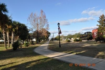
City of Foley Camellia Walk Marker
| 1 ► Alabama, Baldwin County, Foley — City of Foley Camellia Walk — |
| 2 ► Alabama, Baldwin County, Gulf Shores — Here ends the Alabama Scenic River Trail — |
| Near Fort Morgan Road (Alabama Route 180) 1.2 miles west of Dune Drive, on the right when traveling west. | |||
| 3 ► Alabama, Blount County, Oneonta — Champion Mines — |
| On 6th Street South (U.S. 231) at Champion Road, on the right on 6th Street South. | |||
| 4 ► Alabama, Clay County, Delta — Alabama's Highest Point — |
| 5 ► Alabama, Colbert County, Tuscumbia — Petrified Conifer Tree / Petrified Lycopod Tree Stump — |
| On S. Main Street. | |||
| 6 ► Alabama, Jackson County, Woodville — Cathedral Caverns — |
| Near Cave Road, 0.7 miles east of Cathederal Caverns Road, on the left when traveling east. | |||
| 7 ► Alabama, Jefferson County, Birmingham — Reading Red Mountain — |
| Near Richard Arrington Jr Boulevard, 0.2 miles north of 20th Avenue South, on the right when traveling south. | |||
| 8 ► Alabama, Jefferson County, Clay — The Cahaba Heart River of Alabama — |
| On Old Springville Road / County Road 30, on the left when traveling north. | |||
| 9 ► Alabama, Jefferson County, Pinson — Pinson, Alabama — |
| On Main Street east of Center Point Road (State Highway 75), on the left when traveling east. | |||
| 10 ► Alabama, Lauderdale County, Waterloo — Mud Glorious Mud — |
| On Lauderdale County 1 (County Route 1) 0.8 miles north of Lauderdale County 14 (County Route 14), on the left when traveling north. | |||
| 11 ► Alabama, Lauderdale County, Waterloo — Rock Spring — |
| Near Natchez Trace Parkway (at milepost 330.2), 1.4 miles north of County Road 2, on the right when traveling north. | |||
| 12 ► Alabama, Madison County, Huntsville — Burritt Museum — |
| On Monte Sano Boulevard Southeast at Burrit Drive Southeast, on the left when traveling north on Monte Sano Boulevard Southeast. | |||
| 13 ► Alabama, Madison County, Huntsville — Old Town Historic District — |
| On Holmes Avenue close to Lincoln St., NE. | |||
| 14 ► Alabama, Marengo County, Demopolis — White Bluff — |
| On West Monroe Street. | |||
| 15 ► Alabama, Marshall County, Guntersville — Section of Core — |
| On Paddle Wheel Drive (U.S. 431) at Taylor Street, on the right when traveling south on Paddle Wheel Drive. | |||
| 16 ► Alabama, Mobile County, Grand Bay — William Bartram Trail — Traced 1773-1777 — Deep South Region — |
| Near Interstate 10, 2 miles east of Franklin Creek Road. | |||
| 17 ► Alabama, Talladega County, Childersburg — DeSoto Caverns — |
| Near DeSoto Caverns Pkwy (State Highway 76). | |||
| 18 ► Alabama, Tuscaloosa County, Tuscaloosa — Burns’ Shoals — |
| Near Greensboro Avenue north of 2nd Street (Jack Warner Parkway). | |||
| 19 ► Alabama, Tuscaloosa County, Tuscaloosa — Marr’s Spring — |
| Near Marrs Spring Road south of Campus Drive East, on the left when traveling south. | |||
| 20 ► Alabama, Tuscaloosa County, Tuscaloosa — Why Are We Here? — City of Tuscaloosa — |
| Near 6th Street west of 21st Avenue, on the left when traveling west. | |||
| 21 ► Arizona, Apache County, Chambers — Badlands — |
| Near Park Road, on the right when traveling north. | |||
| 22 ► Arizona, Apache County, Chambers — Painted Desert / Finding Fossils |
| On Park Road, on the right when traveling west. Reported missing. | |||
| 23 ► Arizona, Apache County, Petrified Forest National Park — A Painted Park — Petrified Forest National Park — |
| On Petrified Forest Road, 1 mile north of U.S. Route 66 (Interstate 40), on the right when traveling north. | |||
| 24 ► Arizona, Apache County, Petrified Forest National Park — Over the Edge — Petrified Forest National Park — |
| Near Petrified Forest Road, 2 miles north of U.S. Route 66 (Interstate 40), on the right when traveling north. | |||
| 25 ► Arizona, Apache County, Window Rock — In Remembrance of Our Warriors / Navajo Warrior Memorial — |
| Near Parking Lot BIA 100 MP 0 (Route 100 Connector Road) 0.8 miles east of Route 12 N (Arizona Highway 263). | |||
| 26 ► Arizona, Cochise County, Bowie — 086-352 — Old Fort Bowie — Guardian of Apache Pass — |
| On I-10 Extension (Interstate 10), on the left when traveling east. | |||
| 27 ► Arizona, Coconino County, Flagstaff — Telephone Exchange — 1909 — |
| On North Leroux Street, on the right when traveling north. | |||
| 28 ► Arizona, Coconino County, Flagstaff — The Citadel / Natural Features — |
| On Loop Road, on the left when traveling north. | |||
| 29 ► Arizona, Coconino County, Grand Canyon National Park — Grandview, 1898 — |
| 30 ► Arizona, Coconino County, Sunset Crater Volcano National Monument — As Powerful as a Volcano — |
| 31 ► Arizona, Coconino County, Sunset Crater Volcano National Monument — Life and Landscape Transformed — |
| 32 ► Arizona, Coconino County, Sunset Crater Volcano National Monument — The Birth of a Mountain — |
| 33 ► Arizona, Mohave County, Fredonia — How Can 10 Million Gallons of Water a Year Suddenly Appear in a Stony Desert? — Pipe Spring National Monument — |
| Near North Pipe Spring Road, 0.3 miles north of Arizona Route 389, on the left when traveling north. | |||
| 34 ► Arizona, Mohave County, Fredonia — Remnants of a Frozen Sahara — Pipe Spring National Monument — |
| Near North Pipe Spring Road, 0.3 miles north of Arizona Route 389, on the left when traveling north. | |||
| 35 ► Arizona, Navajo County, Holbrook — A Gap in the Geologic Record — |
| On Petrified Forest Road, on the left when traveling east. | |||
| 36 ► Arizona, Navajo County, Holbrook — Desert Vistas — |
| Near Petrified Forest Road, on the left when traveling east. | |||
| 37 ► Arizona, Navajo County, Holbrook — From Wood to Stone — |
| On Petrified Forest Road, on the right when traveling north. | |||
| 38 ► Arizona, Navajo County, Holbrook — Jasper Forest — |
| Near Jasper Forest Road, on the left when traveling west. | |||
| 39 ► Arizona, Navajo County, Holbrook — Painted Desert Community Complex Historic District — |
| Near Interstate 40. | |||
| 40 ► Arizona, Navajo County, Holbrook — The Painted Desert — |
| Near Petrified Forest Road, on the left when traveling north. | |||
| 41 ► Arizona, Navajo County, Holbrook — Triassic Landscape — |
| Near Petrified Forest Road, on the right when traveling north. | |||
| 42 ► Arizona, Navajo County, Shonto — A Relict Forest — Navajo National Monument — |
| Near State Highway 564 at County Route 221. | |||
| 43 ► Arizona, Navajo County, Shonto — Upside-down Mountain — Navajo National Monument — |
| On Arizona Route 564. | |||
| 44 ► Arizona, Navajo County, Winslow — Sunset Crossing — |
| On East Second Street/Old Route 66 (Arizona Route 66), on the left when traveling east. | |||
| 45 ► Arizona, Pima County, Tucson, Menlo Park — Sentinel Peak — |
| On South Sentinel Peak Road, on the left when traveling north. | |||
| 46 ► Arizona, Pima County, Vail — Colossal Cave Mountain Park — |
| Near East Old Spanish Trail. | |||
| 47 ► Arizona, Yavapai County, Sedona — Wilson Mtn. Trail — National Recreational Trail — |
| Near Arizona Route 89A, on the left when traveling north. | |||
| 48 ► Arkansas, Arkansas County, Arkansas Post — The Post of Arkansas — |
| On Old Post Road at State Route 169, on the right when traveling south on Old Post Road. | |||
| 49 ► Arkansas, Carroll County, Eureka Springs — Calif Spring — South Main — |
| On Main Street (State Highway 23) at Armstrong, on the right when traveling south on Main Street. | |||
| 50 ► Arkansas, Clay County, St. Francis — Chalk Bluff — |
| Near County Road 347, on the right when traveling north. | |||
| 51 ► Arkansas, Crawford County, Van Buren — Log Town Hill — |
| On Fayetteville Road (State Highway 59) south of Hynes Street, on the right when traveling south. | |||
| 52 ► Arkansas, Garland County, Hot Springs — Hot Springs — |
| On Central Avenue (State Highway 7) just south of Fountain Street, on the right. | |||
| 53 ► Arkansas, Jefferson County, Pine Bluff — Bayou Bartholomew — |
| On South Main Street at South Olive Street (Business U.S. 63), on the right when traveling north on South Main Street. | |||
| 54 ► Arkansas, Phillips County, Helena — Battery A — |
| On Adams Street east of Beech Street, on the right when traveling west. | |||
| 55 ► Arkansas, Phillips County, Helena — Battery D — |
| On Military Road, 0.1 miles west of Prairie Street, on the left when traveling south. | |||
| 56 ► Arkansas, Pike County, Murfreesboro — B-26 — Pike County Diamond Mines — |
| On Courthouse Square at North Washington Avenue, on the left when traveling west on Courthouse Square. | |||
| 57 ► Arkansas, Pulaski County, Jacksonville — The Memphis to Little Rock Railroad — Samson Gray Helps Link the State Capital with the Mississippi — |
| Near East Trickey Lane at Military Road. | |||
| 58 ► Arkansas, Pulaski County, Little Rock — One Old Rock — La Petite Roche Historical Walk — |
| Near President Clinton Avenue. | |||
| 59 ► Arkansas, Pulaski County, Little Rock — Smaller Rock, Big Bridge — La Petite Roche Historical Walk — |
| Near President Clinton Avenue. | |||
| 60 ► Arkansas, Pulaski County, Little Rock — The Big Rock and the Little Rock — La Petite Roche Historical Walk — |
| Near President Clinton Avenue. | |||
| 61 ► Arkansas, Pulaski County, Little Rock — Witness to Removal — La Petite Roche Historical Walk — |
| Near President Clinton Avenue. | |||
| 62 ► Arkansas, Searcy County, Marshall — Devils Backbone Road Cut-Geology / Construction — |
| On U.S. 65 north of County Road 415, on the right when traveling south. | |||
| 63 ► California, Alameda County, Berkeley, Berkeley Hills — Indian Rock — Berkeley History — |
| On Indian Rock Avenue. | |||
| 64 ► California, Alameda County, Berkeley, Berkeley Hills — Thousand Oaks Neighborhood and Urns — Circa 1909-1910 — Mark Daniels, Landscape Engineer — |
| On San Fernando Avenue at Yosemite Road on San Fernando Avenue. | |||
| 65 ► California, Alameda County, Berkeley, North Berkeley — Live Oak Park — 1914 — Berkeley History |
| Near Shattuck Avenue near Berryman Street. Reported permanently removed. | |||
| 66 ► California, Alameda County, Fremont, Cameron Hills — Under the Canopy — |
| Near Via Orinda near Castillejo Way. | |||
| 67 ► California, Alameda County, Piedmont — Sulphur Springs Grotto — The Healing Powers of Mineral Springs — |
| Near Wildwood Avenue, on the right when traveling west. | |||
| 68 ► California, Alpine County, Kirkwood — Caples Lake — |
| On Carson Pass Highway (State Highway 88), on the right when traveling east. | |||
| 69 ► California, Alpine County, Kirkwood — Summer Retreat — |
| On California 88, on the right when traveling east. | |||
| 70 ► California, Alpine County, Markleeville — Grover Hot Springs — |
| Near Hot Springs Road. | |||
| 71 ► California, Amador County, Volcano — Volcano Masonic Cave — |
| Near Masonic Cave Road, 0.2 miles north of Pine Grove Volcano Road. | |||
| 72 ► California, Butte County, Oroville — Bald Rock Dome — |
| Near Bryant Ravine Road (Forest Road 21N35Y) 1.6 miles north of Lumpkin Road when traveling north. | |||
| 73 ► California, Calaveras County, Angels Camp — Stalactite/Stalagmite — |
| On South Main Street (California Route 49), on the left when traveling south. | |||
| 74 ► California, Calaveras County, Cave City — 956 — California Caverns at Cave City — California Historical Landmark No. 956 — |
| On Cave City Rdoad, 2 miles east of Michel Road, on the left when traveling east. | |||
| 75 ► California, Calaveras County, Murphys — Mercer Caverns — |
| Near Sheep Ranch Road. | |||
| 76 ► California, Contra Costa County, Clayton — History of Marsh Creek Springs — |
| Near Marsh Creek Road near Aspara Drive. | |||
| 77 ► California, Contra Costa County, Clayton — Old Marsh Creek Springs — |
| Near Marsh Creek Road near Aspara Drive, on the left when traveling west. | |||
| 78 ► California, Contra Costa County, El Cerrito — Cerrito Creek — |
| On San Pablo Avenue at Carlson Boulevard, on the left when traveling north on San Pablo Avenue. | |||
| 79 ► California, Contra Costa County, El Cerrito — Historic Cerrito Creek — |
| Near San Francisco Bay Trail / Cerrito Creek Trail. | |||
| 80 ► California, Contra Costa County, El Cerrito — The Little Hill — |
| On San Pablo Avenue at Fairmont Avenue, on the right when traveling north on San Pablo Avenue. | |||
| 81 ► California, Fresno County, Sanger — 25 — Kings River — |
| Near Pine Flat Road, 1.5 miles north of Elwood Road. | |||
| 82 ► California, Humboldt County, Fortuna — The Eel River Starts on Your Street — Eel River: Linking Human and Coastal Environments — |
| On Riverwalk Drive, 0.6 miles south of Redwood Highway (U.S. 101), on the right when traveling south. | |||
| 83 ► California, Humboldt County, Garberville — Richardson Grove Historic Lodge — |
| Near Redwood Highway (California Route 101) near County Route 271, on the right when traveling north. | |||
| 84 ► California, Inyo County, Death Valley National Park — Devil’s Cornfield — |
| On California Route 190, 6 miles east of Stovepipe Wells Village, on the left when traveling east. | |||
| 85 ► California, Inyo County, Death Valley National Park — Lake Manly — |
| On Badwater Road, 3.4 miles north of Jubilee Pass Road (California Route 178), on the left when traveling north. | |||
| 86 ► California, Inyo County, Death Valley National Park — Star Wars Canyon — Military Training — Rainbow Canyon — |
| On California Route 190, 37 miles east of U.S. 395, on the left when traveling east. | |||
| 87 ► California, Inyo County, Death Valley National Park — The Racetrack Playa — Death Valley National Park — |
| On Racetrack Valley Road, 26 miles south of Ubehebe Crater, on the left when traveling south. | |||
| 88 ► California, Inyo County, Death Valley National Park — Ubehebe Crater — Death Valley National Park — |
| On Ubehebe Crater Road, 2.8 miles west of Scotty’s Castle Road. | |||
| 89 ► California, Inyo County, Ridgecrest — Fossil Falls — |
| Near Fossil Falls Access Road, 0.5 miles south of Cinder Road. | |||
| 90 ► California, Kern County, Buttonwillow — Tule Elk State Reserve — A California State Park — |
| Near Station Road, 0.2 miles west of Morris Road, on the left when traveling west. | |||
| 91 ► California, Los Angeles County, Agoura Hills — Ladyface Mountain — |
| Near Ladyface Court, 0.1 miles south of Agoura Road. | |||
| 92 ► California, Los Angeles County, Arcadia — Cycads — Jurassic Period — 200 Million Years Ago — |
| Near Baldwin Avenue, 0.3 miles south of Colorado Boulevard, on the right when traveling south. | |||
| 93 ► California, Los Angeles County, Azusa — Crystal Lake |
| Near Crystal Lake Road. Reported missing. | |||
| 94 ► California, Los Angeles County, Compton — Eagle Tree — |
| Near Short Avenue at Poppy Avenue. | |||
| 95 ► California, Los Angeles County, Inglewood, South Los Angeles — 363 — Centinela Springs — Aguaje de la Centinela — |
| Near Warren Lane, 0.3 miles east of Centinela Avenue. | |||
| 96 ► California, Los Angeles County, La Verne — La Verne Heights Elementary School — |
| On Baseline Road, 0.1 miles east of Wheeler Avenue, on the right when traveling east. | |||
| 97 ► California, Los Angeles County, Lancaster — California Poppy Reserve — The Dream of a Poppy Park — |
| Near Lancaster Road at 150th Street West, on the right when traveling west. | |||
| 98 ► California, Los Angeles County, Long Beach, Waterfront — Evolution of a Skyline — Long Beach's history can be seen in its rooftops — |
| Near West Shoreline Drive, on the right when traveling south. | |||
| 99 ► California, Los Angeles County, Los Angeles, Chatsworth — Garden of the Gods — Iverson Movie Ranch — |
| Near Redmesa Road, 0.2 miles north of Santa Susana Pass Road, on the left when traveling north. | |||
| 100 ► California, Los Angeles County, Los Angeles, Encino — 24 — Encino Oak Tree — |
| On Louise Avenue just south of Ventura Boulevard, in the median. | |||
1796 entries matched your criteria. The first 100 are listed above. Next 100 ⊳