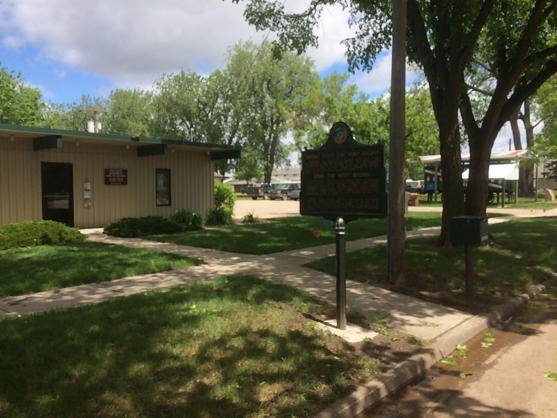
On 3rd Street Southwest west of Livestock Avenue, on the left when traveling east.
Where Does the West Begin?
Traditionally the American West has begun at the edge of the settled areas, always advancing with the sun. The Delaware River was the West of 1700; the Mississippi of 1820. Then the settlement of the Pacific . . . — — Map (db m179726) HM
On Commercial Avenue (U.S. 14) south of Cardinal Street, on the left when traveling south.
Wolsey: A Crossroad of the Heartland
Wolsey has been a crossroad of the heartland of South Dakota from its beginnings. In 1880 the Dakota Central Railway, a subsidiary of the Chicago & North Western, laid track following a wagon trail called . . . — — Map (db m123906) HM
On 471st Avenue at 220th Street, on the right when traveling north on 471st Avenue.
Home of roving Indians until 1862. The exploring party of Nicollet, scientist, and Fremont,
‘Pathfinder of the West,’ visited Oakwood Lakes July 1838, leaving the first reliable record.
The region East of the Big Sioux was ceded by the Santee . . . — — Map (db m181268) HM
Near 6th Street (U.S. 14) at 17th Avenue, on the right when traveling east.
Brookings: The county seat of Brookings County was platted October 3-4, 1879, when the Northwestern Railroad reached here. Some of the early store buildings were moved overland from Fountain and Medary, which soon became ghost towns. In November . . . — — Map (db m179949) HM
On 471st Avenue at 219th Street, on the right when traveling south on 471st Avenue.
Created 1862; Organized 1871; Convention 1877
The County, created on paper in 1862, was organized July 3, 1871 and by 1877, there were communities at Lake Hendricks, Oakwood, Lake Village and Medary, and all had delegates to the nominating . . . — — Map (db m179959) HM
Brookings County Courthouse
The Renaissance Revival-style courthouse was built in 1911 for $100,000 to replace the original 1885 two-story $7,000 wooden courthouse. Oscar Lee, an amateur artist from Volga, South Dakota, painted . . . — — Map (db m118947) HM
On 6th Street (U.S. 14) west of 17th Avenue, on the right when traveling east.
Marthin Christianson was a logger before moving west from Wisconsin to Dakota Territory in 1878. Thus, it was only fitting that this Norwegian immigrant would take advantage of the Timber Culture Act of 1873. Christianson was one of the first . . . — — Map (db m247711) HM
On 471st Avenue at 219th Street, on the right when traveling south on 471st Avenue.
The Dakota Land Company of St. Paul, hoping to make this site the capital of a proposed
Dakota Territory, started a town here, naming it for Samuel Medary, Governor of Minnesota
Territory. Towns were also begun at Flandreau and Sioux Falls, the . . . — — Map (db m179957) HM
On County Road 6, 0.5 miles west of 163rd Avenue, on the right when traveling west.
Oakwood, called Tetonkaha, Lakes, when visited in 1838 by Nicollet & Fremont, was site of a small Fort, N of Little Round Lake in 1857 and again occupied in 1863-64. The township was surveyed by Richard F. Pettigrew in September 1871 and James . . . — — Map (db m179799) HM
On 202nd Street, 1.2 miles west of 462nd Avenue, on the right when traveling west.
This log cabin stands on the original site where it was constructed in 1869 by Samuel "Ol Spot" Mortimer.
Mortimer, a shoemaker from New York, came to Dakota Territory after hearing stories of the rich fur trade in the Big Sioux Valley. In . . . — — Map (db m179782) HM
On Oakwood Shoreline Drive, 0.1 miles north of 204th Street (County Road 6), on the left when traveling north.
C. Z. Sutton came to the Oakwood Village in 1872 and in 1878 built a home on this site. It was dug into the hill so that the back and much of the sides were dirt. The front was field rock with mortar made himself by burning local limestone. The roof . . . — — Map (db m179935) HM
Near Oakwood Drive, 1.7 miles north of 204th Street (County Highway 6).
Each leaf on a green ash has 5 to 9 leaflets growing on 8 to 12 inch stems. During fall and winter months, clusters of seeds remain on female ash trees. Note the seed's shape. Indians were inspired to use ash wood for canoe paddles because of the . . . — — Map (db m237244) HM
Near Oakwood Drive, 1.7 miles north of 204th Street (County Highway 6).
The tall shrub near this post is a buckthorn. Dark green leaves, marked by prominent veins, cling to the branches long after a frost. Clusters of black, pea-sized berries appear in fall. The berries are a favorite of many birds because they cling to . . . — — Map (db m237238) HM
Near Oakwood Drive, 1.7 miles north of 204th Street (County Highway 6).
The cluster of oak trees at this rest spot are representative of the trees that gave Oakwood Lakes its name. In 1870, Samuel "Spot" Mortimer, sold oak trees from his land to other settlers for building their homes. Oak logs were prized for their . . . — — Map (db m237242) HM
Near Oakwood Drive, 1.7 miles north of 204th Street (County Highway 6).
The Oakwood Lakes chain was formed more than 10,000 years ago when melting glaciers filled depressions scooped from the earth's surface. The eight lakes, fertile lands and native woods attracted prehistoric Indians. Burial mounds in the park are . . . — — Map (db m237234) HM
On 220th Street east of 481st Avenue (State Route 13), on the left when traveling east.
You are about to enter
Brookings County
home of roving Indians until 1862. The exploring party of Nicollet, scientist, and Fremont, "Pathfinder of the West," visited Oakwood Lakes, July 1838, leaving the first reliable record.
The . . . — — Map (db m181265) HM
On Highway 14, 0.5 miles east of 487th Ave, on the right when traveling west.
All early maps (1838-1879) showed the Hole-in-The-Mountain or Mountain Pass where Coteau Perce creek drained SW from Lake Benton to the Big Sioux. It is 8 miles SE. Nicollet & Fremont, first explorers, visited the "Hole" on July 6, 1838 and . . . — — Map (db m177443) HM
On 219th Street, 1.1 miles east of Caspian Avenue, on the right when traveling west.
The Lake Campbell Lutheran Church was originally the Medary Norwegian Evangelical Lutheran Congregation, Brookings County, Dakota Territory. The congregation was organized June 13, 1870 at the John Thompson home in Sverdrup Township Minnehaha . . . — — Map (db m179962) HM
On 211th Street (U.S. 81) 1.1 miles west of Caspian Avenue, on the right when traveling west.
Oakwood Lakes, called by the Sioux, Te-tonka-ha, meaning the place of the Great Summer Lodge, lie in a scenic state park 7 miles N and 3 W. First visitors of record were Nicollet & Fremont. July 8, 1838.
During the Indian Disturbances of . . . — — Map (db m179802) HM
On 197th Street, 15 miles east of U.S. 29, on the right when traveling west.
Lake Hendricks Norwegian Colony of 1873
The first settlers at Lake Hendricks were 31 Norwegians, arriving July 14, 1873, with 11 covered wagons and 30 cattle. On May 14, 1873 they left Houston County, Minn., and Allamakee and Winneshiek . . . — — Map (db m179811) HM
On Unnamed Road, 0.7 miles north of 201st Street, on the right when traveling north.
Lake Hendricks State Park
This lake was named for Thomas A. Hendricks (1819-1885), Commissioner of the General Land Office, 1855-59, at which time the state boundary was surveyed and the lake named. Hendricks was a Member of Congress, 1851-55; . . . — — Map (db m184234) HM
On East Melgaard Road, 0.1 miles west of South Lloyd Street, on the right when traveling west.
Two German-language newspapers, Dakota Freie Press (DFP) and Neue Deutsche Presse (NDP), were located a short distance from here at 524 South Main St. Owner and editor, Friedrich Wilheim Sallet, emigrated from East Prussia and published DFP for . . . — — Map (db m90571) HM
Lyman Frank Baum was born May 15, 1856, in Chittenango, New York. He held a variety of jobs from actor to newspaper man to traveling salesman before settling in Aberdeen with his family in 1888.
Baum first opened a variety store called . . . — — Map (db m210350) HM
Located at the mouth of Elm River, Columbia has a notable history.
Here was the wintering place of Waneta "Cuthead Band"of Yanctonaise Sioux.
Here was the site of the scout's camp from which in 1866, Sam J. Brown
started his famous "ride in . . . — — Map (db m179946) HM
Near 101st Street, 0.2 miles west of 392nd Avenue, on the right when traveling west.
On June 22, 1883 Mrs. Matt (Valborg) Hanhela became the first Finnish settler here to die (in childbirth). She and her infant son were the first to be buried here. Their grave is unmarked and unknown.
Ten acres of land for this cemetery and for . . . — — Map (db m206651) HM
On 391st Avenue (County Road 14) at 104th Street (County Road 4), on the right when traveling north on 391st Avenue.
(south side)
Finnish Pioneer Settlers of Other Savo Area Twps. in Territory qf Dakota. 1882–1886
Names of Finnish pioneers. Ada Twp. 129 Range 61. Wm. Pöykkö N.W.14. Markku Rusko S.E.22. Michael . . . — — Map (db m206705) HM
A pioneer in Brown County, Philip Cain Gelling was born on the Isle of Man in 1849. He came to the Dakota Territory from Illinois in 1882 and homesteaded on this site. Philip married Elizabeth Johnson in 1887. From that union 8 children were . . . — — Map (db m169929) HM
On 391st Avenue (County Road 14) at 104th Street (County Road 3), on the right when traveling north on 391st Avenue.
This monument was created to forever make available the story of those Finnish people who early came to Brown and Dickey Counties, and settled there.
Erected by the Savo Finnish Historical Society under the direction of John G. Peterson, the . . . — — Map (db m206703) HM
On 391st Avenue (County Road 14) 0.7 miles north of 112th Street (State Highway 10), on the right when traveling north.
Site of the
Tveit Homestead
Claimed in October 1882 by Iver Lars Tveit
Iver brought his bride Marta here in 1883, then his parents Lars & Ragnhilde in 1885
These Tveits were born and raised here: Lewis, Belle, Hilda, . . . — — Map (db m206665) HM
On Rondell Avenue just east of 2nd Street, on the left when traveling east.
Oakwood post, established in 1835 by Major Joseph R. Brown for the American Fur Company, was an early trading post in Brown County. French explorers called it “place of the scrub oaks,” a landmark used by Indians and Whites alike. Pierre Le . . . — — Map (db m187060) HM
Madison Gregory was born in Huron County, Ohio in 1848. He married Ester Randall on December 26, 1870 in Kankakee County, Illinois. Three daughters were born to them in Kankakee County-Lillie Gregory Martin, Jennie Gregory, and Ethel Gregory . . . — — Map (db m125356) HM
"Grant Tooker, one of the early settlers, told of the first burial at Westport. In the late fall of 1883 a man named Albright died of consumption. He lived west of town. No one would volunteer to dig the grave, but when Grant's father offered to . . . — — Map (db m125357) HM
On North Main Street (State Highway 50) at Rodeo Avenue, on the left when traveling north on North Main Street.
Named for Selah Chamberlain, a Milwaukee RR official, the site was scene of an encounter between Jean Baptiste Trudeau and the Teton Sioux in 1794 and when Samuel H. Morrow surveyed the area, in November of 1868, he found a ranch on American Creek . . . — — Map (db m184645) HM
This Corps of Discovery II marker commemorates the bicentennial
of the Lewis and Clark expedition.
The geographic position of this marker has been established
using the satellite-based Global Positioning System.
This marker is part of the . . . — — Map (db m101382) HM
Near 5th Avenue (CanAm Highway) (U.S. 85) just north of Faulk Street, on the right when traveling north.
[marker on south side of cabin] This cabin, built in 1876 of logs split & transported by Spaulding from the Black Hills, was the first home on the Redwater & what became Butte County. An experienced scout, familiar with the . . . — — Map (db m234772) HM
Near 5th Avenue (U.S. 85/212) just north of Faulk Street, on the right when traveling north.
The Great Western Cattle Trail embodied the spirit, determination, and grit of the early cowboys and remains one of the most romantic and interesting times of our past. The entire trail extended from Matamoros, Mexico to Saskatchewan, Canada (Texas . . . — — Map (db m234800) HM
On 306th Avenue (U.S. 83) 0.3 miles north of 3rd Street, on the left when traveling north.
The Town of Mound City was started by Edward C. McIntosh, and his father, E.H. McIntosh on June 10, 1884. It was named “Mound City” because of the small hills just north of town, which they called “bachelor mounds.” The . . . — — Map (db m154474) HM
On 296th Ave at State Highway 10, on the right when traveling north on 296th Ave.
Side A The Flint store and post office was built on this site in 1895. It was named after Moses E. Flint, and early homesteader. Mr. Flint served as a teamster with General Custer on the 1876 campaign against the Sioux which ended with the . . . — — Map (db m112082) HM
On State Highway 10 at A Ave, on the left when traveling west on State Highway 10.
Lewis and Clark
The Lewis and Clark Expedition, officially the Corps of Discovery, was in what is now South Dakota from August 21 to October 14, 1804 and from August 21 to September 4, 1806.
While here they would make numerous . . . — — Map (db m187079) HM
On State Highway 1804 at 294th Ave, on the right when traveling west on State Highway 1804.
Old Pollock
In 1901 Pollock was founded as the end point of the Soo Line rail service from Wishek, ND. Soo Line officials requested the town be named Pollock in honor of R.Y. Pollock, a pioneer lay minister and respected citizen of the . . . — — Map (db m112084) HM
On B Avenue (State Highway 1804) at Park Street, on the right when traveling north on B Avenue.
Pollock, South Dakota Settlers The first settlers came to this area
about 1880. LaGrace, 9 miles
southwest, was the first town and
the County seat until 1888, when
It gradually disappeared.
The town of Pollock was founded
In 1901 at . . . — — Map (db m112086) HM
On 390th Avenue, 0.2 miles north of County Road 2, on the right when traveling north.
This monument commemorates the Yankton Sioux Treaty of 1858.
As increasing numbers of settlers came upriver, the Yankton Sioux had to decide whether to join other Sioux tribes in armed resistance or to co-exist with the immigrants. They . . . — — Map (db m217461) HM
On 390th Avenue, 0.2 miles north of County Road 2, on the right when traveling north.
In memory of the Yankton Chiefs, who made the Treaty of 1858.
Struck by the Ree ·
Black Bear ·
Medicine Cow ·
White Swan ·
Pretty Boy ·
Feather in the Ear ·
Crazy Bull ·
Frank Deloria
Sioux
Delegates who signed the . . . — — Map (db m217464) HM
On University Road, 0.5 miles south of 304th Street, on the right when traveling south.
Dalesburg School
The Dalesburg School was located one-half mile south of the village site on land donated by Andrew and Lina Berg in 1872. Classes were held in the Berg home until the schoolhouse was built in 1874. A second building was . . . — — Map (db m221138) HM
On Main Street south of State Route 50, on the right when traveling east.
Meckling, like so many small American towns, was built by progress, and it was progress that slowly took the town away. The town was named for railroad grading contractor Jonas S. Meckling, who helped to build the Dakota Southern Railway through the . . . — — Map (db m179346) HM
On Main Street south of State Route 50, on the left when traveling east.
Named for a grading contractor on the Dakota Southern Railway, built in 1872. George W. Gilbert became the first postmaster on 29 April 1873. Prior to that Lincoln Post Office, Charles M. Taylor, Postmaster, 27 July 1864 was nearby to the south. In . . . — — Map (db m179347) HM
On South Dakota Route 50, 3 miles west of Interstate 29, on the right when traveling west.
August Bruyer, his wife, Josephine (Simon) and their sons, John and Julius, were born in France, coming to America about the middle of the nineteenth century. By 1858, they had settled in Fairview Township, 4 miles east of what was to be Vermillion. . . . — — Map (db m179897) HM
On State Highway 19, 0.1 miles north of 312th Street, on the left when traveling north.
Change came slowly to Spirit Mound after 1804. For 55 years the area remained the land of the Yankton Sioux, with fur traders conducting business from posts on the Missouri. The tallgrass prairie continued to thrive as it had for thousands of years . . . — — Map (db m194632) HM
On West Main Street, 1 mile south of State Route 50, on the right when traveling east.
The confluence of the Missouri and Vermillion rivers provided an ideal location for camping, farming, and settling for generations. Yankton Sioux camped below the bluffs in the winter for protection from the harsh winds and moved to the bluffs in . . . — — Map (db m179288) HM
On Canby Street, 1.3 miles south of State Route 50, on the left when traveling west.
Early Vermillion settlers built their homes and businesses below the bluff. The town was susceptible to flooding from the Missouri River, which at that time ran next to the bluff.
The winter of 1880 started early and did not subside until an . . . — — Map (db m179289) HM
The Dexter Cemetery was started by the early pioneers located in this area in 1899 on land donated by John and Eliza Drake. This was followed by the organization of the United Brethren Church in Christ in 1902 under the supervision of Rev. W.F. . . . — — Map (db m101260) HM
On Main Street south of 2nd Street, on the right when traveling south.
Henry’s Centennial Tree, also known as “The Big Tree,” was planted the same year the town of Henry was established, by David & Lucenda Wiley, in from of their business, Lucenda’s Millinery Shop. The tree’s circumference was 30 ft. and its height . . . — — Map (db m213992) HM
On St. Peter St. NW at Hastings Ave. NW, on the left when traveling east on St. Peter St. NW.
District No. 5 School was the first rural public school in Codington County. At a meeting on June 30, 1879 at the Kranz Hotel, it was decided to build the school for $1,000 or less. The first term was from December 1879 to March 1880, taught by . . . — — Map (db m101265) HM
On East Kemp Avenue east of North Maple, on the right when traveling east.
Watertown was platted by the Winona & St. Peter Railroad. The uptown district, consisting of six square blocks, was divided into narrow lots intended mostly for commercial use running parallel to the railroad tracks. Important noncommercial . . . — — Map (db m120097) HM
On West Kemp Avenue, 0.1 miles west of Broadway St. S, on the left when traveling east.
Maurice A. Hockman, a prominent South Dakota architect, designed a large part of uptown. At least ten buildings are attributed to him and nine or more have Hockmanesque features. Characteristics of his style are prominent courses of brick . . . — — Map (db m131988) HM
On North Broadway Street, 0.1 miles north of 1st Avenue North, on the right when traveling north.
This depot, originally the Rock Island Lines New Passenger Station and Division Office Building, was erected as a joint venture of
the Rock Island, and the Minneapolis and St. Louis Railroads in
1912 for $50,000.00.
Over the years, it has . . . — — Map (db m90413) HM
Several newspapers kept the people of Watertown up to date until about 1900. By then the majority of them had ceased publication or merged with other papers. The Public Opinion was formed from the merger of the Courier-News, which began printing . . . — — Map (db m131989) HM
On 9th Ave. SW at 3rd St. SW, on the right when traveling west on 9th Ave. SW.
1835 Joseph LaFramboise had trade post at Two Woods Lake (Chanopa.
1838 Nicollet & Fremont , explorers, visited SE Codington County.
1840 Rev. Stephen Return Riggs enroute, Lac Qui Parle to Ft. Pierre, traversed the area.
1856 Capt. Alfred . . . — — Map (db m177449) HM
Although extensive trade networks were always part of the economies of the indigenous Tribes in North America, the trade in furs between Native peoples and European traders emerged as the major tribal industry on the Missouri River from the . . . — — Map (db m113318) HM
On Highway 12, 0.2 miles west of 222nd Ave, on the right when traveling west.
At this point the Bismarck-Deadwood Stage Trail passed in a line extending about 240 miles from northeast to southwest. In 1877, the Dakota Territorial Legislature commissioned the survey of the trail, which transported passengers and freight . . . — — Map (db m190174) HM
Near U.S. 16A east of Lower French Creek Road, on the right when traveling east.
Between 1874-1876, thousands of citizens illegally entered the Black Hills in search of gold. Every gold panner, newspaper article, and frontier story told of great wealth and encouraged the onslaught of the region.
The military made vain efforts . . . — — Map (db m121400) HM
Near U.S. 16A east of Lower French Creek Road, on the right when traveling east.
Cultural conflicts erupted across the western Great Plains during the 1860s. Expanding railroads and frontier posts located in traditional hunting grounds impacted the various tribes in the northern plains. Restrictions on westward settlement . . . — — Map (db m121397) HM
Near U.S. 16A east of Lower French Creek Road, on the right when traveling east.
An economic crash in 1873 affected the entire nation. The government, pressured to boost the economy, needed to explore new land. Open land for settlement and rich resources would create markets and new jobs.
George A. Custer and his . . . — — Map (db m121398) HM
On Lower French Creek Road, 0.2 miles south of Stockade Lake Drive (U.S. 16A), on the left when traveling south.
In Memory of
Anna Donna Tallent
Teacher and Author.
Born in New York State
April 12, 1827.
Died in Sturgis, S. Dakota
February 13, 1901.
The first white woman
to enter the Black Hills.
Arriving in Custer City
in December . . . — — Map (db m185226) HM
Charles Badger Clark was born on January 1, 1883, in
Albia, Iowa. His father was a Methodist minister, and
his mother was of Quaker faith. This family heritage
created close ties, and their home was a hub of activities.
Badger stated, "There was . . . — — Map (db m203440) HM
Site of the first public school building in the Black Hills. Built by Ed Walsh, James Doran, and George Gundlach. Logs were hand hewn from nearby trees and hauled to the site by oxen. First school was held in summer of 1882. Teacher was Mr. . . . — — Map (db m168895) HM
On Mount Rushmore Road (U.S. 16A) 0.3 miles east of State Highway 89, on the right when traveling east.
Historic Site
Miners Meet
The miners of the Black Hills
held their first meeting to
pass mining regulations at
this location in 1875
— — Map (db m119986) HM
Near U.S. 16A east of Lower French Creek Road, on the right when traveling east.
Spurred by rumors of gold, many prospector groups attempted to enter the Black Hills in the 1870s. Without regard to the Fort Laramie Treaty, they planned to enter the region and exploit the untapped wealth.
A group of 28 people headed west from . . . — — Map (db m121399) HM
On U.S. 385, 3.9 miles north of 7-11 Road (County Road 101), on the right when traveling north.
Wind Cave National Park harbors a fragment of an endangered ecosystem, a remnant of the native grasslands that once stretched from Indiana to the Rocky Mountains, from southern Canada to the Gulf of Mexico. In fewer than 100 years, the Great Plains . . . — — Map (db m234694) HM
On East 1st Avenue at Bartscher Road, on the right when traveling east on East 1st Avenue.
The site of the junction of two old trails—the "Jimtown" Trail first mail route of the James River Valley and the Fort Thompson Trail much used in the Black Hills Gold Rush.
Close to this junction was Firesteel the pioneer settlement and trading . . . — — Map (db m180135) HM
On South Gamble Street at East Hanson Avenue, on the right when traveling north on South Gamble Street.
Used for many years in White's mill on "Jim" River, 4 miles east of Mitchell, to grind flour for the homesteaders and farmers who hauled their wheat to the "grist" mill
In memory of my father
John R. White
and other pioneers of 1879 . . . — — Map (db m180133) HM
During the early 1880's, a small group of Swedish settlers left their homeland to come to Dakota Territory where they took up homesteads in this vicinity. On September 15, 1883, after holding services and meetings in their homes, they organized "The . . . — — Map (db m180277) HM
On 397th Avenue near 254th Street, on the right when traveling south.
Union No. 31 Country School
Education was a priority for the pioneers in this area even before South Dakota became a state. In 1899 settlers erected the Union No. 31 Country School 6 miles south & 1 mile east of Mt. Vernon to replace the small . . . — — Map (db m174086) HM
On 134th Street at 412th Avenue (County Highway 43), on the right when traveling west on 134th Street.
You are entering
Brown County
South Dakota
Colin Campbell had an early trade post on Elm River for Waneta's Cuthead Band of Yanctonaise Sioux. Leblanc's wintering post of 1835 was burnt and in 1836 he built a new one at the Talles Chenes . . . — — Map (db m206641) HM
On Railroad Avenue East just east of Main Street, on the left when traveling east.
Indians from the Lake Region now Northeastern South Dakota visited this area frequently in the early 1800's and white traders also traveled this way while buying furs. The government survey party of Horace J. Austin arrived June 21, 1879, and began . . . — — Map (db m197685) HM
On South Dakota Route 25 at 133rd Street, on the right when traveling south on State Route 25.
Pioneering was never easy. In Dakota, drought, and grasshoppers, blizzards, and prairie fires were all occupational hazards. In sparse timbered areas, the settlers lived in dugouts and sod houses, enduring the hardships common to all . . . — — Map (db m185035) HM
The prairie has been changing for millions of years. Grasses have grown, soil has built up, rocks have eroded, and hillsides have fallen. Rain has been followed by drought, until the rain has returned. Fire would turn the land black, but soon . . . — — Map (db m125352) HM
On U.S. 12, 0.2 miles W. 7th Street, on the right when traveling west.
Following the 1862 Minnesota Indian Uprising where nearly 600 men, women, and children were killed, the United States Army at Fort Wadsworth recruited friendly Indians as scouts to restrict the hostile Indians from white settlements. A half-breed, . . . — — Map (db m179955) HM
On U.S. 12, 0.2 miles W. 7th Street, on the right when traveling west.
Founded in 1881 and named for J.P. Webster who homesteaded the townsite. Railroad supply point for Fort Sisseton (Fort Wadsworth) frontier outpost established 20 miles north in 1864. Gateway to
Northeastern South Dakota Lake Region whose abundance . . . — — Map (db m179947) HM
Near Interstate 29 at milepost 160,, 3 miles 188th St..
Due east of these rest areas, the valley land looks much as it did before the pioneers came to this country. This area is part of the drainage of Hidewood Creek, located one-and one-half miles south of here. Hidewood's name comes from the prairie . . . — — Map (db m92068) HM
On U.S. I-29 at milepost 160,, 3 miles 188th Street.
Due east of these rest areas, the valley land looks much as it did before the pioneers came to this country. This area is part of the drainage of Hidewood Creek, located one-and one-half miles south of here. Hidewood's name comes from the prairie . . . — — Map (db m100894) HM
On South Dakota Route 20, 0.3 miles south of County Road 3, on the right when traveling south.
The town of Firesteel takes its name from nearby Firesteel Creek. First known as “Firesteel Station”, it started in May of 1910 with an influx of settlers drawn by rumors an entire section (square mile) to become a government townsite. Many who had . . . — — Map (db m161846) HM
On 276th Street (U.S. 281) 0.4 miles west of 392nd Avenue, on the right when traveling west.
A great town while it lasted, Grand View became Douglas County's third county seat when it won out over Huston, the second and Douglas City by 11 votes in 1882. Brownsdale the first, a phantom city, had been a brief but expensive luxury. Grand View . . . — — Map (db m180686) HM
On South Dakota Route 45 at 145th Street, on the right when traveling south on State Route 45.
On March 22, 1883 the 300 Members of a Welsh colony arrives by train at Aberdeen, South Dakota. Thirty families led by William E. Powell arrived here on the 29th and built the "Big Shanty or Shanty Mawr" on the Hugh Griffin claim on Section 9, 1 . . . — — Map (db m177873) HM
On U.S. 18, 0.5 miles west of Cemetery Road (County Highway 185), on the right when traveling west.
The Cheyenne to Deadwood Stage Line changed routes several times during its history.
In 1876 and 1877, the Cheyenne to Deadwood stagecoaches came through what would become present day Edgemont over what was known as Pollock’s Cutoff Route. The . . . — — Map (db m119900) HM
On Highway 18, 0.5 miles west of Cemetery Road (County Highway 185), on the right when traveling west.
In early 1890, the Burlington Railroad established Siding 7 three-quarters of a mile up the tracks north from here. The siding consisted of four short, fan-shaped tracks and a hand-operated turntable over an open pit used for servicing engines. . . . — — Map (db m119899) HM
On 2nd Avenue (South Dakota Route 471) north of G Street, on the right when traveling north.
(Side 1)
President Theodore Roosevelt (T. R.) stopped in Edgemont on April 25, 1903 as part of a
western states tour. Hundreds were on hand to welcome him.
An old friend, Seth Bullock of Deadwood, arrived with him.
They were then . . . — — Map (db m124008) HM
On North River Street (U.S. 385) 0.1 miles south of Main Street, on the right when traveling south.
Nobody suspected that this old jail existed until it was found within the walls of a frame house on 332 South Chicago Street, Hot Springs.
The old residence was being taken down for salvage. Although it’s earliest history is obscure, it was . . . — — Map (db m123995) HM
On Battle Mountain Avenue (U.S. 385) at Sherman Street, on the right when traveling north on Battle Mountain Avenue.
According to tradition, American Indians were stricken with an epidemic known as “fell disease” about the middle of the 16th century that threatened to obliterate the tribes. A messenger arrived from the Great West with news of a . . . — — Map (db m124081) HM
On Fall River Road (U.S. 385) near Hidden Nook Trail, on the right when traveling north.
Tribal tradition states that as long ago as the 16th century the Fall River Valley and canyon area were seldom without groups of tipis belonging to North American Plains Tribes. They knew the curative value of the warm springs located there and used . . . — — Map (db m184455) HM
424 entries matched your criteria. The first 100 are listed above. Next 100 ⊳