After filtering for South Dakota, 424 entries match your criteria. The first 100 are listed. ⊳
Settlements & Settlers Topic
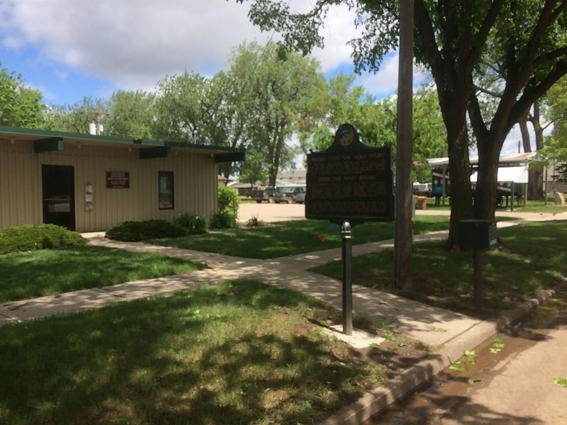
By Ruth VanSteenwyk, May 21, 2017
Where Does the West Begin?/ Here the West Begins Marker
| 1 ► South Dakota, Beadle County, Huron — 200 — Where Does the West Begin?/ Here the West Begins — |
| On 3rd Street Southwest west of Livestock Avenue, on the left when traveling east. | |||
| 2 ► South Dakota, Beadle County, Wolsey — 694 — Wolsey: A Crossroad of the Heartland / Wolsey Notables — |
| On Commercial Avenue (U.S. 14) south of Cardinal Street, on the left when traveling south. | |||
| 3 ► South Dakota, Bon Homme County, Springfield — Graves of Ogden Marsh and Addie L. Marsh — |
| On Walnut Avenue at 6th Street, on the right when traveling south on Walnut Avenue. | |||
| 4 ► South Dakota, Brookings County, Brookings — 553 — Brookings County — You are about to enter — |
| On 471st Avenue at 220th Street, on the right when traveling north on 471st Avenue. | |||
| 5 ► South Dakota, Brookings County, Brookings — 358 — Brookings/Hillcrest Park — |
| Near 6th Street (U.S. 14) at 17th Avenue, on the right when traveling east. | |||
| 6 ► South Dakota, Brookings County, Brookings — 285 — First Convention in Brookings County — |
| On 471st Avenue at 219th Street, on the right when traveling south on 471st Avenue. | |||
| 7 ► South Dakota, Brookings County, Brookings — Heart of Brookings — |
| On 4th St at 6th Ave. on 4th St. | |||
| 8 ► South Dakota, Brookings County, Brookings — Hillcrest Timber Claim — |
| On 6th Street (U.S. 14) west of 17th Avenue, on the right when traveling east. | |||
| 9 ► South Dakota, Brookings County, Brookings — 601 — Medary — |
| On 471st Avenue at 219th Street, on the right when traveling south on 471st Avenue. | |||
| 10 ► South Dakota, Brookings County, Brookings — 189 — Medary Townsite — 1857-58 1871-79 — |
| On 471st Avenue at 219th Street, on the right when traveling south on 471st Avenue. | |||
| 11 ► South Dakota, Brookings County, Bruce — 279 — Oakwood — 1877-1894 — |
| On County Road 6, 0.5 miles west of 163rd Avenue, on the right when traveling west. | |||
| 12 ► South Dakota, Brookings County, Bruce — 685 — 'Ol Spot Mortimer's Cabin — |
| On 202nd Street, 1.2 miles west of 462nd Avenue, on the right when traveling west. | |||
| 13 ► South Dakota, Brookings County, Bruce — Sutton Home Site — |
| On Oakwood Shoreline Drive, 0.1 miles north of 204th Street (County Road 6), on the left when traveling north. | |||
| 14 ► South Dakota, Brookings County, Bruce, Oakwood Township — 11 — Ash, Ponderosa Pine — Station 11 — Tetonkaha Trail — |
| Near Oakwood Drive, 1.7 miles north of 204th Street (County Highway 6). | |||
| 15 ► South Dakota, Brookings County, Bruce, Oakwood Township — 3 — Buckthorn, Catnip — Station 3 — Tetonkaha Trail — |
| Near Oakwood Drive, 1.7 miles north of 204th Street (County Highway 6). | |||
| 16 ► South Dakota, Brookings County, Bruce, Oakwood Township — 6 — Bur Oak — Station 6 — Tetonkaha Trail — |
| Near Oakwood Drive, 1.7 miles north of 204th Street (County Highway 6). | |||
| 17 ► South Dakota, Brookings County, Bruce, Oakwood Township — 1 — Cottonwood — Station 1 — Tetonkaha Trail — |
| Near Oakwood Drive, 1.7 miles north of 204th Street (County Highway 6). | |||
| 18 ► South Dakota, Brookings County, Elkton — 196 — Brookings County / Moody County — You are about to enter — |
| On 220th Street east of 481st Avenue (State Route 13), on the left when traveling east. | |||
| 19 ► South Dakota, Brookings County, Elkton — 123 — Hole-In-The-Mountain — |
| On Highway 14, 0.5 miles east of 487th Ave, on the right when traveling west. | |||
| 20 ► South Dakota, Brookings County, Volga — 595 — Lake Campbell Lutheran Church — |
| On 219th Street, 1.1 miles east of Caspian Avenue, on the right when traveling west. | |||
| 21 ► South Dakota, Brookings County, Volga — 122 — Oakwood Lakes Big Sioux River - Volga — |
| On 211th Street (U.S. 81) 1.1 miles west of Caspian Avenue, on the right when traveling west. | |||
| 22 ► South Dakota, Brookings County, White — 253 — Lake Hendricks Norwegian Colony of 1873 / Brookings County — |
| On 197th Street, 15 miles east of U.S. 29, on the right when traveling west. | |||
| 23 ► South Dakota, Brookings County, White — 330 — Lake Hendricks State Park / Brookings County — |
| On Unnamed Road, 0.7 miles north of 201st Street, on the right when traveling north. | |||
| 24 ► South Dakota, Brown County, Aberdeen — Andrew Melgaard — |
| 25 ► South Dakota, Brown County, Aberdeen — 508 — F.W. Sallet and the Dakota Freie Presse — |
| On East Melgaard Road, 0.1 miles west of South Lloyd Street, on the right when traveling west. | |||
| 26 ► South Dakota, Brown County, Aberdeen — L. Frank Baum, Author — The Wonderful Wizard of Oz — |
| On Yellow Brick Road. | |||
| 27 ► South Dakota, Brown County, Aberdeen — T. Clarkson Gage Homestead — |
| On 131st Street, 0.5 miles west of 385th Avenue, on the right when traveling west. | |||
| 28 ► South Dakota, Brown County, Columbia — 318 — Columbia — 1879 — |
| Near 396th Avenue. | |||
| 29 ► South Dakota, Brown County, Frederick — 616 — Colin Campbell Fur Post — |
| Near 382nd Avenue, 0.1 miles north of 111st Street, on the right when traveling north. | |||
| 30 ► South Dakota, Brown County, Frederick — In Memoriam — |
| Near 101st Street, 0.2 miles west of 392nd Avenue, on the right when traveling west. | |||
| 31 ► South Dakota, Brown County, Frederick — In Memory of the Finnish Pioneers — 1882 — 1955 — |
| On 391st Avenue (County Road 14) at 104th Street (County Road 4), on the right when traveling north on 391st Avenue. | |||
| 32 ► South Dakota, Brown County, Frederick — Philip Cain Gelling Homestead — |
| On 391st Avenue, 0.2 miles north of 111th Street. | |||
| 33 ► South Dakota, Brown County, Frederick — 319 — Savo Monument — |
| On 391st Avenue (County Road 14) at 104th Street (County Road 3), on the right when traveling north on 391st Avenue. | |||
| 34 ► South Dakota, Brown County, Frederick — Tveit Homestead — |
| On 391st Avenue (County Road 14) 0.7 miles north of 112th Street (State Highway 10), on the right when traveling north. | |||
| 35 ► South Dakota, Brown County, Mansfield — John Mansfield — |
| On N. 2nd St., 0.1 miles north of E. Main St., on the left when traveling north. | |||
| 36 ► South Dakota, Brown County, Stratford — Oakwood Post — |
| On Rondell Avenue just east of 2nd Street, on the left when traveling east. | |||
| 37 ► South Dakota, Brown County, Westport — Madison Gregory — 1848-1885 — |
| On 120th St.. | |||
| 38 ► South Dakota, Brown County, Westport — Pioneers with Unknown Grave sites in Westport Cemetery — Memorial to — |
| On 120th St. | |||
| 39 ► South Dakota, Brule County, Chamberlain — 169 — Chamberlain — 1880 — |
| On North Main Street (State Highway 50) at Rodeo Avenue, on the left when traveling north on North Main Street. | |||
| 40 ► South Dakota, Brule County, Chamberlain — Lewis and Clark Bicentennial 1804-2004 — |
| Near Interstate 90 at milepost 263. | |||
| 41 ► South Dakota, Butte County, Belle Fourche — "Buckskin Johnny" Spaulding Cabin — Historic Structure — |
| Near 5th Avenue (CanAm Highway) (U.S. 85) just north of Faulk Street, on the right when traveling north. | |||
| 42 ► South Dakota, Butte County, Belle Fourche — Lasting Legacy — |
| On 5th Avenue (U.S. 85) at National St. on 5th Avenue. | |||
| 43 ► South Dakota, Butte County, Belle Fourche — Minnesela, So. Dak. — 1882 - 1901 — |
| On Gaver Rd., 1 mile east of Helmer Rd., on the left when traveling east. | |||
| 44 ► South Dakota, Butte County, Belle Fourche — The Great Western Cattle Trail — |
| Near 5th Avenue (U.S. 85/212) just north of Faulk Street, on the right when traveling north. | |||
| 45 ► South Dakota, Campbell County, Mound City — Mound City, South Dakota — |
| On 306th Avenue (U.S. 83) 0.3 miles north of 3rd Street, on the left when traveling north. | |||
| 46 ► South Dakota, Campbell County, Pollock — 654 — Flint Store and Post Office — |
| On 296th Ave at State Highway 10, on the right when traveling north on 296th Ave. | |||
| 47 ► South Dakota, Campbell County, Pollock — Lewis and Clark/Pollock, South Dakota — |
| On State Highway 10 at A Ave, on the left when traveling west on State Highway 10. | |||
| 48 ► South Dakota, Campbell County, Pollock — 662 — Old Pollock / Lot Distribution in New Pollock / Lake Pocasse — |
| On State Highway 1804 at 294th Ave, on the right when traveling west on State Highway 1804. | |||
| 49 ► South Dakota, Campbell County, Pollock — Pollock, South Dakota Settlers / National Bicentennial Wagon Train — |
| On B Avenue (State Highway 1804) at Park Street, on the right when traveling north on B Avenue. | |||
| 50 ► South Dakota, Charles Mix County, Marty, Wahehe Township — Treaty of 1858 — Yankton Sioux Tribe — Missouri National Recreational River — |
| On 390th Avenue, 0.2 miles north of County Road 2, on the right when traveling north. | |||
| 51 ► South Dakota, Charles Mix County, Marty, Wahehe Township — 647 — Yankton Sioux Treaty of 1858 Monument — |
| On 390th Avenue, 0.2 miles north of County Road 2, on the right when traveling north. | |||
| 52 ► South Dakota, Clay County, Centerville, Garfield Township — Dalesburg School / Dalesburg Village — |
| On University Road, 0.5 miles south of 304th Street, on the right when traveling south. | |||
| 53 ► South Dakota, Clay County, Meckling — Meckling — |
| On Main Street south of State Route 50, on the right when traveling east. | |||
| 54 ► South Dakota, Clay County, Meckling — 414 — Meckling & Lincoln — |
| On Main Street south of State Route 50, on the left when traveling east. | |||
| 55 ► South Dakota, Clay County, Vermillion — 425 — Bruyer Church — |
| On South Dakota Route 50, 3 miles west of Interstate 29, on the right when traveling west. | |||
| 56 ► South Dakota, Clay County, Vermillion — From Lewis and Clark to the Future — |
| On State Highway 19, 0.1 miles north of 312th Street, on the left when traveling north. | |||
| 57 ► South Dakota, Clay County, Vermillion — Old Vermillion — |
| On West Main Street, 1 mile south of State Route 50, on the right when traveling east. | |||
| 58 ► South Dakota, Clay County, Vermillion — Old Vermillion — |
| On Canby Street, 1.3 miles south of State Route 50, on the left when traveling west. | |||
| 59 ► South Dakota, Codington County, Florence — Dexter Cemetery — |
| Near 156th St., 0.3 miles west of 446th Ave. | |||
| 60 ► South Dakota, Codington County, Henry — The Centennial Tree — Planted in 1882 — |
| On Main Street south of 2nd Street, on the right when traveling south. | |||
| 61 ► South Dakota, Codington County, Kranzburg — District No. 5 Public School — |
| On St. Peter St. NW at Hastings Ave. NW, on the left when traveling east on St. Peter St. NW. | |||
| 62 ► South Dakota, Codington County, Watertown — Commercial Historic District — |
| On East Kemp Avenue east of North Maple, on the right when traveling east. | |||
| 63 ► South Dakota, Codington County, Watertown — Maurice Hockman — |
| On West Kemp Avenue, 0.1 miles west of Broadway St. S, on the left when traveling east. | |||
| 64 ► South Dakota, Codington County, Watertown — 498 — Old M. & St. L. Depot Museum — |
| On North Broadway Street, 0.1 miles north of 1st Avenue North, on the right when traveling north. | |||
| 65 ► South Dakota, Codington County, Watertown — Public Opinion & City Hall — |
| On 3rd St NE at Kemp Ave E on 3rd St NE. | |||
| 66 ► South Dakota, Codington County, Watertown — 191 — Watertown — and Vicinity — |
| On 9th Ave. SW at 3rd St. SW, on the right when traveling west on 9th Ave. SW. | |||
| 67 ► South Dakota, Corson County, Mobridge — The Fur Trade — |
| On U.S. 12 at State Highway 1806 on U.S. 12. | |||
| 68 ► South Dakota, Corson County, Morristown — 699 — Bismarck-Deadwood Stage Trail — |
| On Highway 12, 0.2 miles west of 222nd Ave, on the right when traveling west. | |||
| 69 ► South Dakota, Custer County, Custer — A Legacy of Debate — Did the Gold Rush Forever Tarnish the Black Hills? — |
| Near U.S. 16A east of Lower French Creek Road, on the right when traveling east. | |||
| 70 ► South Dakota, Custer County, Custer — An Agreement Between Cultures — The Fort Laramie Treaty Created the Great Sioux Reservation — |
| Near U.S. 16A east of Lower French Creek Road, on the right when traveling east. | |||
| 71 ► South Dakota, Custer County, Custer — An Expedition of Mixed Outcomes — The Custer Expedition of 1874 Ignited Interest in the Black Hills — |
| Near U.S. 16A east of Lower French Creek Road, on the right when traveling east. | |||
| 72 ► South Dakota, Custer County, Custer — 588 — Anna Donna Tallent — |
| On Lower French Creek Road, 0.2 miles south of Stockade Lake Drive (U.S. 16A), on the left when traveling south. | |||
| 73 ► South Dakota, Custer County, Custer — Everyone has a Beginning — |
| Near Badger Hole north of Badger Clark Road. | |||
| 74 ► South Dakota, Custer County, Custer — Frontier Protection — |
| On North 7th Street north of Mount Rushmore Road (U.S. 16A), on the left when traveling north. | |||
| 75 ► South Dakota, Custer County, Custer — Glen Erin School — Historic Site — |
| On Lower French Creek Road. | |||
| 76 ► South Dakota, Custer County, Custer — 604 — Horace N. Ross — |
| On Mount Rushmore Road (U.S. 16A) east of South 4th Street, on the right when traveling east. | |||
| 77 ► South Dakota, Custer County, Custer — Miners Meet 1875 — |
| On Mount Rushmore Road (U.S. 16A) 0.3 miles east of State Highway 89, on the right when traveling east. | |||
| 78 ► South Dakota, Custer County, Custer — Prospectors in Search of Gold — The Gordon Party Prompted an Illegal Invasion of the Black Hills — |
| Near U.S. 16A east of Lower French Creek Road, on the right when traveling east. | |||
| 79 ► South Dakota, Custer County, Hot Springs — Vanishing Prairie — Wind Cave National Park — |
| On U.S. 385, 3.9 miles north of 7-11 Road (County Road 101), on the right when traveling north. | |||
| 80 ► South Dakota, Davison County, Mitchell — 573 — Junction of Jimtown & Fort Thompson Trails — |
| On East 1st Avenue at Bartscher Road, on the right when traveling east on East 1st Avenue. | |||
| 81 ► South Dakota, Davison County, Mitchell — 615 — Old Mill Stone — |
| On South Gamble Street at East Hanson Avenue, on the right when traveling north on South Gamble Street. | |||
| 82 ► South Dakota, Davison County, Mitchell — 451 — Original Site of New Home Lutheran Church — |
| Near 480th Avenue, 6.6 miles south of U.S. 90. | |||
| 83 ► South Dakota, Davison County, Mount Vernon — Union No. 31 Country School — |
| On 397th Avenue near 254th Street, on the right when traveling south. | |||
| 84 ► South Dakota, Day County, Andover — 283 — Brown County / Day County — |
| On 134th Street at 412th Avenue (County Highway 43), on the right when traveling west on 134th Street. | |||
| 85 ► South Dakota, Day County, Bristol — 276 — Bristol — 1881 — |
| On Railroad Avenue East just east of Main Street, on the left when traveling east. | |||
| 86 ► South Dakota, Day County, Roslyn — 431 — Pioneering in Dakota — Prairie Fires — |
| On South Dakota Route 25 at 133rd Street, on the right when traveling south on State Route 25. | |||
| 87 ► South Dakota, Day County, Waubay — Changes on the Land — |
| On Waubay Refuge Entrance Road. | |||
| 88 ► South Dakota, Day County, Webster — 376 — The Fight at Webster — |
| On U.S. 12, 0.2 miles W. 7th Street, on the right when traveling west. | |||
| 89 ► South Dakota, Day County, Webster — 326 — Webster — County Seat of Day County — |
| On U.S. 12, 0.2 miles W. 7th Street, on the right when traveling west. | |||
| 90 ► South Dakota, Deuel County, Clear Lake — Hidewood Creek — Rest Area — |
| Near Interstate 29 at milepost 160,, 3 miles 188th St.. | |||
| 91 ► South Dakota, Deuel County, Clear Lake — Hidewood Creek Rest Area — |
| On U.S. I-29 at milepost 160,, 3 miles 188th Street. | |||
| 92 ► South Dakota, Dewey County, Firesteel — 539 — Firesteel — |
| On South Dakota Route 20, 0.3 miles south of County Road 3, on the right when traveling south. | |||
| 93 ► South Dakota, Douglas County, Corsica — 333 — Grand View — 1882-1894 — |
| On 276th Street (U.S. 281) 0.4 miles west of 392nd Avenue, on the right when traveling west. | |||
| 94 ► South Dakota, Edmunds County, Ipswich — 427 — Welsh Colony at Powell — |
| On South Dakota Route 45 at 145th Street, on the right when traveling south on State Route 45. | |||
| 95 ► South Dakota, Fall River County, Edgemont — 705 — Cheyenne River Crossing — 1876-1877 Cheyenne to Deadwood Stage Trail — |
| On U.S. 18, 0.5 miles west of Cemetery Road (County Highway 185), on the right when traveling west. | |||
| 96 ► South Dakota, Fall River County, Edgemont — 505 — Siding 7 — |
| On Highway 18, 0.5 miles west of Cemetery Road (County Highway 185), on the right when traveling west. | |||
| 97 ► South Dakota, Fall River County, Edgemont — Teddy Roosevelts's Visit to Edgemont — |
| On 2nd Avenue (South Dakota Route 471) north of G Street, on the right when traveling north. | |||
| 98 ► South Dakota, Fall River County, Hot Springs — An Old Jail - 1888 — |
| On North River Street (U.S. 385) 0.1 miles south of Main Street, on the right when traveling south. | |||
| 99 ► South Dakota, Fall River County, Hot Springs — 509 — Battle Mountain — |
| On Battle Mountain Avenue (U.S. 385) at Sherman Street, on the right when traveling north on Battle Mountain Avenue. | |||
| 100 ► South Dakota, Fall River County, Hot Springs — 663 — Hot Springs, SD — |
| On Fall River Road (U.S. 385) near Hidden Nook Trail, on the right when traveling north. | |||
424 entries matched your criteria. The first 100 are listed above. Next 100 ⊳