On Oregon Trail Boulevard (Business U.S. 30) near Frontage Road, on the left when traveling north.
In October 1860 the Van Ornum Party, survivors of the Utter Disaster, reached Farewell Bend. Here they again encountered Indians.
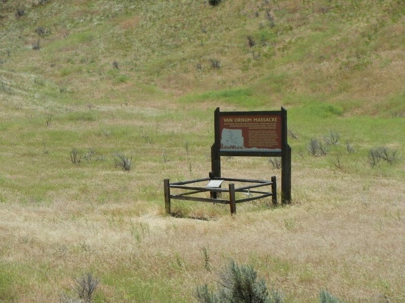
On September 9 & 10, in Idaho, the Elijah P. Utter wagon train suffered a two-day attack by Indians in . . . — — Map (db m107219) HM
On Oregon Trail Boulevard (Business U.S. 30) when traveling north.
By October 1860 the Van Ornum party reached Farewell Bend. They were survivors of the Elijah P. Utter wagon train that was attacked by Indians on September 9 and 10, just west of Castle Butte in Owyhee County, Idaho. The survivors had escaped the . . . — — Map (db m107220) HM
On Washinton Street East (Business U.S. 30) near 1st Street East.
By October 1860 the Van Ornum party reached Farewell Bend. They were survivors of the Elijah P. Utter wagon train that was attacked by Indians on September 9 and 10, just west of Castle Butte in Owyhee County, Idaho. The survivors had escaped the . . . — — Map (db m107292) HM
On SW Campus Way, 0.5 miles west of SW 35th Street, on the left when traveling west.
A Watershed
A watershed is an area of land from which water drains and flows into a river and its tributaries. Small watersheds, such as Oak Creek’s, become part of larger watersheds when their streams converge. Thus, Oak Creek‘s . . . — — Map (db m108389) HM
In Prehistoric Times
Fifteen thousand years ago, the mouth of the Tualatin River was located at Like Oswego. The river's course changed when the cataclysmic Missoula floods poured down the Columbia Basin and inundated the Willamette Valley. . . . — — Map (db m120526) HM
Ikanum are traditional stories. One such story from Victoria Howard of Grand Ronde is told about the area around Lake Oswego. The story tells of a particularly hostile winter, in which cold and starvation threatened the entire village of . . . — — Map (db m116145) HM
Near Washington Street near Abernethy Road, on the right when traveling north.
About four miles below Oregon City the Klackamass enters the Walhamettee: and, seated below the banks at its mouth, I saw a party of Indians of the Klackamass tribe, and I put ashore for the purpose of taking a sketch of them.
They were busy . . . — — Map (db m114759) HM
Near Washington Street near Abernethy Road, on the right when traveling north.
"Let us make a waterfall across the river." Meadowlark said to Coyote. So they made a rope by twisting young hazel shoots.
Holding one end of the rope, Meadowlark went on one side of the Willamette River; holding the other end, coyote went on the . . . — — Map (db m114060) HM
Near Washington Street near Abernethy Road, on the right when traveling north.
Coyote came to that place around Oregon City and found the people there very hungry. The river was full of salmon, but they had no way to spear them in the deep water. Coyote decided he would build a big waterfall, so that the salmon would come to . . . — — Map (db m114061) HM
Near Washington Street near Abernethy Road, on the right when traveling north.
It must have been long long ago that the earth shook. Then they would get their wooden pans and buckets, they would turn them upside down there, and they would sing and make a racket. They would say in their singing,
Put by the side of the . . . — — Map (db m114168) HM
Near Washington Street near Abernethy Road, on the right when traveling north.
Since time immemorial, Willamette Falls (Tumwater) has been an important fishing site for the Clowewalla (also known as the Willamette Tumwater) and Clackamas Chinook peoples. They controlled access to the falls through inter-tribal relationships . . . — — Map (db m114172) HM
Native Americans are understood to have used this large rock for grinding acorns, nuts, or grains, and preparing other foods. The several holes are evidence of long term use. This rock may have been close to Native American encampments located near . . . — — Map (db m114255) HM
On McLoughlin Boulevard (Oregon Route 99) near S. 2nd Street, on the right when traveling south.
Oregon City - once known as Willamette Falls - was early the site of an Indian salmon fishing village. The falls furnished the power for a lumber mill which began operation in 1842. A flour mill in 1844. A woolen mill in 1864 and the first paper . . . — — Map (db m113515) HM
Near Washington Street near Abernethy Road, on the right when traveling north.
The Clowewalla (also known as the Willamette Tumwater) and Clackamas Chinooks were relocated to the Grand Ronde Reservation under the Treaty with the Kalapuya, Etc. 1855 (also known as the Willamette Valley Treaty).
The Clowewalla joined other . . . — — Map (db m114063) HM
Near Washington Street near Abernethy Road, on the right when traveling north.
When she went shortly after to her American woman friend, she told her, "They are going to take you Indian people somewhere pretty soon now." She told her, "Do not leave anything. Take along all your things with you. Put your canoe . . . — — Map (db m114762) HM
Near Washington Street near Abernethy Road, on the right when traveling north.
When travelers arrived at the End of the Oregon Trail, they found Willamette Falls, a natural wonder that attracted both those early settlers and the Native Americans who settled here centuries earlier. For the traditional peoples, the main . . . — — Map (db m114034) HM
On Northbound Rest Area (Interstate 205), on the right when traveling north.
Was early the site of an Indian salmon fishing village. The falls furnished the power for a lumber mill which began operation in 1842, a flour mill in 1844, a woolen mill in 1864 and the first paper mill in the Pacific Northwest in 1867. The first . . . — — Map (db m113514) HM
The Corps of Discovery traveled thousands of miles and endured many hardships to reach the Pacific Ocean in mid-November 1895. The last sixteen miles down the Columbia River took ten days because of bad weather. The explorers huddled among the rocks . . . — — Map (db m113006) HM
[panel 1] Great Chief of the Chinook Nation, known to Lewis and Clark, honored and respected by the founding Astorians, the Northwesters and the Hundson's Bay fur traders. [panel 2] Symbolic memorial dedicated by Comcomly's . . . — — Map (db m113009) HM
Near East Columbia River Highway (U.S. 30) east of 11th Street, on the left when traveling east.
For thousands of years, Native Americans thrived on salmon fishing on the Columbia River. They traded dried fish with other native people all over the west. In the 1870s, later settlers also made commercial fishing a way of life. It remains a . . . — — Map (db m113239) HM
Near East Columbia River Highway (U.S. 30) east of 15th Street, on the left when traveling east.
Well after the end of the American Revolution, this vast river we call the Columbia and the entire Northwest Coast were still only vague lines on even the best European maps. But the region was home to native peoples whose ancestors had lived . . . — — Map (db m113236) HM
On Exchange Street at 15th Street, on the right when traveling west on Exchange Street.
Birthplace of
Ranald MacDonald
First Teacher of English in Japan
The son of the Hudson's Bay Co. manager of Fort George and Chinook Indian Chief Comcomly's daughter, MacDonald theorized that a racial link existed between Indians and . . . — — Map (db m113565) HM
"The Wife of Shabone our interpreter We find reconciles all the Indians, as to our friendly intentions A woman with a party of men is a token of peace." - Clark, October 13, 1805
"...your woman who accompanied you that long and . . . — — Map (db m113553) HM
In 1804-06, Captains Meriwether Lewis and William Clark led about 40 soldiers and boatmen on an epic journey. President Thomas Jefferson commissioned this "Corps of Discovery" to find a route to the Pacific Ocean through the newly acquired Louisiana . . . — — Map (db m114094) HM
Near Ecola State Park Road, on the right when traveling west.
Weary of boiled elk and dog meat, Captain William Clark and a dozen other explorers left their winter encampment at Fort Clatsop on January 6, 1806, in search of the whale beached on present day Cannon Beach. This trek was the farthest west that any . . . — — Map (db m113602) HM
On Oregon Coast Highway (U.S. 101) near Radar Road, on the right when traveling east.
On January 8, 1806 William Clark and perhaps fourteen of the famous expedition reached a Tillamook village of five cabins on a creek which Captain Clark named Ecola or Whale Creek. Three days earlier, two men sent out from Fort Clatsop to locate a . . . — — Map (db m113597) HM
On Columbia River Highway (U.S. 30) at SW Old Portland Road, on the left when traveling north on Columbia River Highway.
Panel 1
Once covered by an Ice Age ocean, then home to the Diersinno (Keeassino) Indian Tribe led by Chief Cassino, this area then became the meeting grounds for all the Northwest Indians who gathered each year to hold their . . . — — Map (db m113156) HM
On Columbia River Highway (U.S. 30) at SW Old Portland Road, on the left when traveling north on Columbia River Highway.
Lewis & Clark on the Columbia River
The Lewis and Clark Expedition made the first documented descent of the Columbia from the mouth of the Snake River to the Pacific.
This voyage strengthened the claim of the young United States to . . . — — Map (db m113157) HM
On Columbia River Highway (U.S. 30) at SW Old Portland Road, on the left when traveling north on Columbia River Highway.
Lewis & Clark and the Corps of Discovery
In 1803, the United States purchased the Louisiana Territory from France, expanding this country from the Mississippi River west to the Rocky Mountains and from the Gulf of Mexico north to . . . — — Map (db m113159) HM
On Yachts Landing at The Strand, on the left when traveling west on Yachts Landing.
The path before you represents the Corps of Discovery's journey on the Columbia River – from its confluence with the Snake to the Pacific Ocean.
Entering the Columbia in mid-October 1805, they travelled along the river from shore to shore . . . — — Map (db m113154) HM
On Yachts Landing west of The Strand, on the left when traveling west.
In 1804-06, Captains Meriwether Lewis and William Clark led 31 men and one dog on an epic journey.
President Thomas Jefferson commissioned this "Corps of Discovery" to find a route to the Pacific Ocean through the newly acquired Louisiana . . . — — Map (db m113155) HM
On Oregon Coast Highway (U.S. 101) north of Central Avenue, on the right when traveling north.
Working On Water
Koos No. 2 was the second of several tugboats with the Koos name to work for the Knutson Towboat Company.
Built in 1924 by Frank Lowe at his Marshfield shipyard, Koos No. 2 went to work with her . . . — — Map (db m114186) HM
On Oregon Coast Highway (U.S. 101) south of Central Avenue, on the right when traveling south.
(panel 1)
The Oregon Coast boasts forested headlands, towering dunes of sand, and sparkling lakes and rivers. From the Columbia River south to Bandon, the picturesque coastline is bordered to the east by the peaks of . . . — — Map (db m113658) HM
Near Harbor Drive west of Lower Harbor Road, on the right when traveling west.
The Chetco people are the earliest known inhabitants of the Brookings-Harbor area. The Athabaskan-speaking people of Chit-xu and eight other Chetco group villages originally lived along this river and on the adjacent coast between the Winchuck River . . . — — Map (db m176835) HM
Near Harbor Drive west of Lower Harbor Road, on the right when traveling west.
"From the numerous miners and settlers that are pressing into their country they are suffering many grievous wrongs that call for the immediate interference of the Government. Within the last six months four of their villages have . . . — — Map (db m176836) HM
On Oregon Coast Hwy (U.S. 101), on the right when traveling south. Reported missing.
During the early 1850s hundreds of miners and settlers poured into southwest Oregon and onto Indian lands staking claims and establishing farms. The clash of cultural attitudes toward the ownership and use of natural resources led to the Rogue River . . . — — Map (db m113293) HM
On Oregon Coast Highway (U.S. 101) at Jefferson Street, on the right when traveling east on Oregon Coast Highway.
The Tututní people lived along the Southern Oregon coast, including this site, and the lower Rogue River for thousands of years before first contact with explorers, miners, and settlers.
In 1792, George Vancouver was among the first outsiders to . . . — — Map (db m176841) HM
On Oregon Coast Highway (U.S. 101) at Jefferson Street, on the right when traveling east on Oregon Coast Highway.
Battle Rock City Park has been dedicated in memory of the ancient people (Dene Tsut Dah) and the pioneer founders of this townsite. In 1850, the U.S. Congress passed the Oregon Donation Land Act. This act allowed white settlers to file claims on . . . — — Map (db m176821) HM
On Southwest 5th Street at South East Canyon Street, on the right when traveling east on Southwest 5th Street.
(Seven panels dealing with topics related to the Applegate Trail are found at this kiosk.)
Applegate Trail
Southern Route to Oregon
In 1846, Jesse Applegate and fourteen others from near Dallas, Oregon, established . . . — — Map (db m112862) HM
This portion of the southwest Oregon is homeland to the Cow Creek Band of Umpqua Indians. They thrived here for thousands of years before contact with Euro-Americans. Living in plank-house villages, they followed a seasonal round of resource use. . . . — — Map (db m112859) HM
On Elkton-Sutherlin Highway (Oregon Route 138) south of Mehl Creek Road, on the right when traveling south.
On the west bank and upstream is the site of Fort Umpqua.
Established in 1836 by the Hudson’s Bay Company, the fort was a twelve foot high and ninety foot square stockade with bastions at diagonal corners.
The fort served as a dwelling for . . . — — Map (db m113337) HM
On Interstate 5, on the right when traveling south.
The story of the Cow Creek Band of Umpqua Tribe of Indians is a tale of perseverance and strong recovery in the face of great loss. Epidemics and hostilities with miners let to large population declines. The tribe entered into a treaty with the . . . — — Map (db m99222) HM
On Lower Smith River Road (County Road 48 at milepost 1), at Stables Road (County Road 498), on the left when traveling north on Lower Smith River Road.
Smith, Jackson & Sublette Beaver Trappers
-- In Memory of --
Thomas Daws · John Gaither · John Hanna · Abraham Laplant · Joseph Lapoint · Emmanuel Lazarus · Toussaint Marechal · Martin McCoy · Joseph Palmer · Peter Ranne · . . . — — Map (db m237193) HM
On Up Middle Fork Road (County Highway 20), on the right when traveling west.
There are five markers describing the areaMarker 1:
A history of human interaction with the land
From tribal use to ranching, gold mining, and ecological restoration, the land that is now the Oxbow Conservation Area . . . — — Map (db m107488) HM
Fort Harney, on the former Malheur Indian Reservation, was named for Gen. Wm. S. Harney, who took command of the Military Department of Oregon, Sept. 13, 1858. The fort was established Aug. 10, 1867, and became a permanent Military Post. By order of . . . — — Map (db m63026) HM
On Wa Pa Na Street, on the right when traveling south.
Although steel has been made for centuries, it wasn’t until the Bessemer process was introduced in the 1870s that it could be produced in quantity.
The Bridge of the Gods mural is the creation of Larry Kangas, of Beaverton, . . . — — Map (db m112267) HM
At 7533 feet, Mt. Ashland in the Siskiyou Mountains is the highest point in the headwaters of Ashland Creek. The coarse granitic soils on its steep slopes are highly erodible. Management of the watershed tries to minimize the disturbance to protect . . . — — Map (db m112522) HM
On Dead Indian Memorial Rd at Green Springs Highway (U.S. 66) on Dead Indian Memorial Rd. Reported permanently removed.
Long before the first Euro-American emigrants trekked westward, this road was a trail used by the Takelma and Shasta Peoples as a trade route. With the arrival of settlers and gold-seekers, the trail quickly became a wagon road called ‘Indian . . . — — Map (db m244111) HM
Named for its hundreds of fresh water springs, lush glades and meadows, the Greensprings has for millenia been a seasonal gathering place for Native Americans and later provided refuge for travelers. In 1846, Levi Scott and the Applegate brothers, . . . — — Map (db m113544) HM
On Mt Ashland Ski Rd, on the right when traveling north.
Side 1
Used for centuries by Shasta and other Native people, this low gap between the Rogue and Klamath watershed was crossed by Peter Skene Ogden, led by Shasta Guides, on February 9, 1827. With Ogden was a mounted group of Hudson’s Bay . . . — — Map (db m134504) HM
Pinus lambertiana
When settlers crossed on the Applegate Trail, sugar pine trees dominated this landscape. Native Americans had seasonal camps and purposefully managed the sugar pines, including using a hook-ladder to move up the tiered . . . — — Map (db m112589) HM
On Table Rock Rd, on the right when traveling north.
Honoring the courageous men, led by
General Joseph Lane
who on Sept. 10, 1853 met near this spot
and signed a treaty of peace
with the Rogue River Indians.
Col. John E.Ross, Capt. J. W. Nesmith, Capt. L. F. Mosher
Capt. A. J. Smith, . . . — — Map (db m112905) HM WM
Near Oregon Route 234, 1 mile north of 4th Avenue.
The Takelma, which means "People of the River," had a village here. According to legend, Ti'lomikh (Te lo meekh) is where Daldal, the Great Dragonfly, brought the Salmon Ceremony. Although the date of the first ceremony is unknown, the People of the . . . — — Map (db m99316) HM
On Upper River Road, 1 mile north of Oregon Route 99, on the left when traveling north.
The Takelma, which means "People of the River," had a village here. According to legend, Ti'lomikh (Te lo meekh) is where Daldal, the Great Dragonfly, brought the Salmon Ceremony. Although the date of the first ceremony is unknown, the People of the . . . — — Map (db m99319) HM
On Rogue-Umpqua Scenic Highway (Oregon Route 234), on the left when traveling west.
The world of the Takelma people could be viewed from Titanakh, Table Rocks. Of the two major groups of the Takelma, the Dagelma resided west from here, while the Latgawa extended to the east. These people gathered grass seed, acorns and camas; . . . — — Map (db m112581) HM
Near Interstate 5 at milepost 458, on the right when traveling north.
(Seven panels dealing with topics related to the Applegate Trail are found at this kiosk.)
The Applegate Trail
Southern Route to Oregon
In 1846, Jesse Applegate and fourteen others from near Dallas, Oregon, . . . — — Map (db m112656) HM
An ancient trail passed through here as part of an extensive Indian trade network linking peoples of the Northern Great Basin and Columbia Plateau to those living west of the Cascades. Obsidian, bear grass, and slaves were transported over these . . . — — Map (db m36498) HM
Near Interstate 5 at milepost 62 near Merlin Road, on the right when traveling south.
The Rogue Valley has been the traditional homelands of three distinct language- based tribal groups since ancient times: Takelma, Dakubetede/Taltushtuntude, and Shasta. Tribes shared similar cultural and societal practices, subsistence patterns, . . . — — Map (db m112806) HM
Near Interstate 5 at milepost 62 near Merlin Road, on the right when traveling north.
The utmost good faith shall always be observed towards the Indians; their lands and property shall never be taken from them without their consent; and, in their property, rights, and liberty, they shall never be invaded or disturbed, unless in . . . — — Map (db m112807) HM
Near Interstate 5 at milepost 62 near Merlin Road, on the right when traveling north.
The perilous last leg of the Oregon Trail down the Columbia River rapids took lives, including the sons of Jesse and Lindsay Applegate in 1843. The Applegate brothers and others vowed to look for an all-land route into Oregon from Fort Hall (in . . . — — Map (db m167270) HM
On Merlin-Galice Road, on the right when traveling west.
The smallest Indian Reservation ever created. Granted to "Indian Mary" by the U.S. Government in 1894. In recognition of gratitude to her father, Umpqua Joe, who gave the alarm which saved white settlers of this area from a planned massacre. . . . — — Map (db m112780) HM
On Haines Lane near Pleasant Valley Road, on the right when traveling south.
(There are two sides to this marker,)
White settlers and miners out numbers the Oregon Indians. The United States proposed treaties with the Oregon Indians moving off their lands onto reservations. Miners started a group of volunteers . . . — — Map (db m141196) HM
The Klamath Tribes consists of three groups of people: The Klamath, Modoc, and Yahooskin Band of Snake Indians. These three groups inhabited an area approximately 22,000,000 acres in northern California and Southern Oregon. The Klamath and Modoc . . . — — Map (db m112874) HM
On Volcanic Legacy Scenic Byway, aka Rim Drive near Pinnacles Road, on the right when traveling south.
Stories from the Klamath Indian tradition tell of the many battles here between Spirit chief Llao (of the below-world) and Skell (of the above-world). In one visit to the above-world, Llao fell in love with the chief's daughter. He promised . . . — — Map (db m157453) HM
Established for the promotion of peaceful relationships between the Indians and
the early settlers by the Oregon Volunteer Calvary in 1863. The post was abandoned
by the United States Army in 1890. Now preserved
as a
Klamath County Park
for . . . — — Map (db m100288) HM
Built in part with lumber from abandoned
post at Fort Klamath. First pastor - Rev.
J. H. Roork. First board - Lisa and Alec
Wilson, David Hill and Seldon Kirk. — — Map (db m100279) HM
At this narrow point where Lost River flows westerly toward Tule Lake, there is a conjunction of historical events. "Olene" in the Klamath (native American) language means "eddy place." For hundreds, perhaps thousands of years, this site was an . . . — — Map (db m112891) HM
On Klamath Avenue, on the right when traveling east.
Agriculture
The Klamath Reclamation project began in 1906 with the draining of marshlands, which had been remnants of a prehistoric lake, to supply irrigation water to farmers. The main canal, called the “A Canal,” was first . . . — — Map (db m153545) HM
On Lakeshore Drive, on the right when traveling west.
This is Oregon's largest body of water, about 90,000 acres. Indians inhabiting its shores ("People of the Lake") lived well on wild fowl, fish and wocus seeds. The first known white visitors (1825-26) were Hudson's Bay trappers under Tom McKay and . . . — — Map (db m112525) HM
Originally built as a milkhouse straddling willow creek, this structure was located on the Van Brimmer Ranch, west of Tulelake, California, 13 miles from the Modoc Stronghold, Lava Beds. During the Modoc Indian War of 1872-73, the cabin was . . . — — Map (db m100265) HM
On Malone Road, on the right when traveling south.
Capt. Jack’s winter camp was located approximately 1/4
mile east of here and was the site of the opening battle
of the Modoc War - Nov. 1872 — — Map (db m112936) HM
On Old Fort Rock Road (County Route 5-10) west of County Route 5-13, on the right when traveling east.
The history of the west is linked with the idea of finding a new home in a challenging land. We call it homesteading.
During the Pleistocene epoch, homesteaders in the Fort Rock Basin were mammoths, camels, horses, flamingos, and . . . — — Map (db m113604) HM
Fort Rock, towering above you to the north and west, is one of Oregon's most interesting geologic features.
Geologists believe it was formed near the end of the Ice Age some 10,000 to 12,000 years ago during a period of frequent volcanic . . . — — Map (db m113575) HM
On Oregon Route 31 south of Old Fort Rock Road, on the left when traveling south.
Fort Rock is the remnant of a maar volcano or tuff ring, formed when rising basaltic magma encountered water and exploded violently. The exploded debris – called tuff – fell back to earth around the volcanic vent to form this . . . — — Map (db m113585) HM
Ten thousand years ago, Fort Rock was prime real estate for cave-dwelling families. Food was plentiful and there was a great lake where you stand. Walk the trail of this giant "tuff ring" and you'll discover dynamic strands of nature woven . . . — — Map (db m113569) HM
Near the end of the last Ice Age, America's first people migrated into this lake-filled basin, finding a climate cooler than today's.
A warming trend increased evaporation and the lake shrank. Soon these people discovered caves carved by waves . . . — — Map (db m113571) HM
On Fremont Hwy (U.S. 395), on the right when traveling south.
Behind you to the east is a steep cliff called Abert Rim, made of many layers of hardened lava flows. This 30-mile-long, 2,500-foot-high, steep cliff is an example of a fault scarp, produced over millenia by great blocks of rock tilting and moving . . . — — Map (db m112536) HM
On Fremont Highway (Oregon Route 31) at Chewaucan Street, on the right when traveling north on Fremont Highway.
Paisley was once the site of a seasonal Native American settlement. Northern Paiute and Klamath Indians came to the Chewaucan Marsh and River to harvest local resources, most notably the wapato, Silgittaria cuneata, a plant with . . . — — Map (db m113765) HM
On Fremont Highway (Oregon Route 31) at Chewaucan Street, on the right when traveling north on Fremont Highway.
The 19th century brought significant changes to this region.
In 1843, Captain John C. Fremont explored and mapped this area.
By the 1870s, most of the region's Native American inhabitants were removed to distant reservations.
Homesteaders . . . — — Map (db m113773) HM
On McKenzie Highway (Oregon Route 242) west of Forest Road 260, on the right when traveling west.
In 1862 Felix Scott led a crew of 50 men who blazed a trail across the Cascade Mountains following an old Indian trail which skirted lava flows.
Scott hoped to use the new route to take supplies to gold fields in Idaho.
His trail was . . . — — Map (db m114245) HM
Near Cape Creek Road west of Oregon Coast Highway (U.S. 101) when traveling west.
This headland has attracted and challenged centuries of travelers.
For centuries, Siuslaw, Yachats and Alsea Tribes were drawn to the rich marine resources at Heceta Head.
As they hunted, fished, and traveled, they established . . . — — Map (db m113442) HM
On Oregon Coast Highway (U.S. 101) south of Southeast 54th Drive, on the right when traveling south.
During the 18th century, Native American villages occupied the mouths of nearly every stream along this coastline—including here at Siletz Bay.
References to great flooding and ground shaking events are recorded in the oral traditions of . . . — — Map (db m244254) HM
Near Southeast Marine Science Drive, on the right when traveling west.
In 1861 word about beds of a rare rock oyster on Yaquina Bay spread to San Francisco. Ships came for the oysters which were served at top restaurants on the west and east coasts. Local Indians, in particular women, were hired to harvest the oysters. . . . — — Map (db m177026) HM
Near Southeast Marine Science Drive, on the right when traveling west.
The South Beach of Yaquina Bay has changed each decade as regularly as the tides. The Yacona Indians set up summer camps here before the Coast Reservation was established in 1855. Lemuel Davis homesteaded a good chunk of the land when it was opened . . . — — Map (db m177023) HM
On SW Maple Street north of U.S. 101, on the right when traveling south.
(right column)
Local Stories to Share
The Alsea River and Alsea Bay take their name from the native word Alsi (meaning peace). The Native Americans who once lived here were removed by order of the US Government in the . . . — — Map (db m177061) HM
On King Street at Chief Albert Drive, on the left when traveling south on King Street.
The Coast Reservation was established in 1855. Four years later, the Alsea Sub-Agency opened, and the Coos and Lower Umpqua were forcibly marched from Fort Umpqua to the Yachats River, a dangerous journey resulting in many deaths and injuries. Here . . . — — Map (db m177090) HM
Near Oregon Coast Highway (U.S. 101) south of NFD 55, on the right when traveling north.
Before Columbus sailed to the Americas, this Sitka spruce began its life nourished by a nurse log. As it grew, it shared Cape Creek with the Indians who lived just one-half mile west at their large seasonal campsite by the ocean.
When the . . . — — Map (db m114265) HM
On Ocean View Drive south of West 2nd Street, on the left when traveling south.
(Note: marker is comprised of four panels)(top left panel)
The rugged shore of the Central and Northern Oregon Coast is backed by the Coast Range Mountains, remnants of a chain of volcanic islands that collided with the North . . . — — Map (db m177132) HM
On Danner Loop Road near Old Ion Highway, on the right when traveling north.
This plaque is dedicated as a memorial to Jean Baptiste "Pomp" Charbonneau, whose personal life experience elevated him to national recognition in American History. He began his "Road of Life" on an epic journey westward. The youngest person . . . — — Map (db m106879) HM
On Danner Loop Road near Old Ion Highway, on the right when traveling north.
This site marks the final resting place of the youngest member of the Lewis and Clark Expedition, born to Sacajawea and Toussaint Charbonneau at Fort Mandan (North Dakota) on February 11, 1805. Baptiste and his mother symbolized the peaceful nature . . . — — Map (db m106876) HM
On ION Highway (U.S. 95) at Old ION Highway, on the right when traveling west on ION Highway.
(left panel)
Sarah Winnemucca played a major role in shaping development of the American West, and especially what is known as the I.O.N. country: The Idaho, Oregon and Nevada state junction. During her lifetime, Sarah became well . . . — — Map (db m106883) HM
Near Vietnsm Veterans Memorial Highway (Interstate 84), on the right when traveling west.
(The Oregon Trail kiosk houses thirteen panels which deal with Native Americans, the Fur Trade, the Oregon Question, Oregon Fever, and trials of the Oregon Trail.)
Pathway to the "Garden of the World"
Excitement filled the . . . — — Map (db m107234) HM
On Lytle Boulevard, on the left when traveling north.
For thousands of years, the native peoples of the northern Great Basin met the challenge of living in this arid region. During the nineteenth century, contact with explorers and emigrants resulted in dramatic changes to the Indians’ traditional way . . . — — Map (db m107031) HM
Near Champoeg Road NorthEast near French Prairie Road NorthEast.
This area, once named tchampuick, the 'place of yampah' was the traditional homeland of the Tualatin Kalapuya tribe. Fur trappers first arrived here by canoe in 1811, and they found lush open prairies bordering the Willamette River. In 1830, . . . — — Map (db m114307) HM
On Manning Road near Dorion Lane NE, on the left when traveling north.
In Honor Of
Madame Marie Dorion
Courageous Pioneer
Devoted Ioway Mother
Early Oregon Settler
At this her final resting place
September 6, 1850 — — Map (db m114350) HM
139 entries matched your criteria. The first 100 are listed above. The final 39 ⊳