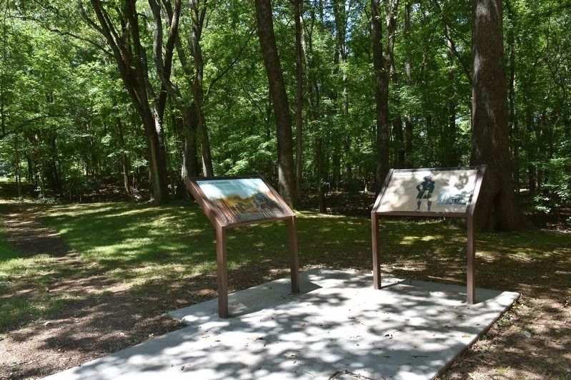
Near Natchez Trace Parkway (at milepost 327.3), 1.4 miles east of N Pike (County Route 21), on the left when traveling east.
During the early 1800s, a slave-owning planter class including George Colbert’s family, emerged among the Chickasaw.
George’s success stemmed from a variety of endeavors. He fought with the Americans against the Shawnee and Creeks, traveled to . . . — — Map (db m107261) HM
Near Natchez Trace Access Road (at milepost 327.3), 0.4 miles west of Natchez Trace Parkway, on the right when traveling west.
Here, near the bubbling waters of Buzzard Roost Spring, Levi Colbert (Itawamba Minko, “Bench Chief”) built one of the many inns—called stands—along the Natchez Trace.
But it was Colbert’s negotiating and language skills . . . — — Map (db m107265) HM
Near Natchez Trace Parkway (at milepost 327.3), 1.4 miles east of N Pike (County Route 21), on the left when traveling east.
George Colbert's stand sat atop the ridge before you. As one of many inns that dotted the Trace between Nashville and Natchez, it provided travelers with food and lodging.
With a Scottish father and Chickasaw mother, George Colbert used his . . . — — Map (db m107260) HM
On Mulberry Lane 0.4 miles east of Moody Lane, on the left when traveling east.
was moved by Benjamin Smith from Pontotoc, Miss. in 1825 to this site, known as Bennkhinnah, where it remained until 1837. Bennkhinnah Post Office, established at the Agency in 1829, was renamed Newport in 1837. In 1856 with D. C. Oates as . . . — — Map (db m156992) HM
Near Natchez Trace Parkway (at milepost 327.3), 1 mile north of N. Pike (County Road 21).
This monument is to memorialize Chickasaw Chief George Colbert who operated a river ferry, traveler’s stand, and had a home on this Natchez Trace site. Colbert Co. AL was named in his honor. — — Map (db m84706) HM
On Mhoontown Road 1.1 miles east of North Pike, on the right when traveling north.
Chickasaw Indian removal began in July 1837. This removal allowed white settlers to establish residence in Colbert County. One example of this is the Mhoon family who migrated from Halifax County, North Carolina in June 1837. They built their . . . — — Map (db m244515) HM
Near Natchez Trace Parkway (at milepost 327.3), 1.6 miles east of N Pike (County Route 21), on the left when traveling east.
In the early 1800s, ferries like the one George Colbert ran near here on the Tennessee River linked segments of the Natchez Trace. Ferries carried people across the river—for a fee. Post riders, Kaintucks, military troops, casual travelers, . . . — — Map (db m107258) HM
On Natchez Trace Access Road (at milepost 320.3), 0.4 miles north of Natchez Trace Parkway.
Inns, or stands, provided occasional shelter for travelers along the Natchez Trace. These stands offered flood to eat and food for thought: local news, information, and ideas. The ever-changing mix of diverse populations—whites, American . . . — — Map (db m107263) HM
Near Natchez Trace Parkway (at milepost 327.3), 1.3 miles east of N Pike (County Route 21), on the left when traveling east.
Frontier America once walked along the Natchez Trace.
The Chickasaw and Choctaw used the Trace for transportation and trade. After 1801, with tribal permission, post riders who rode the Trace connected isolated settlements in Mississippi and . . . — — Map (db m107257) HM
Near Reservation Road 1 mile east of Alabama Route 133, on the left when traveling east.
Natural and Cultural Preservation
TVA is fully committed to protecting our natural and cultural resources. And nowhere is that more evident than right here at Wilson Dam.
Here, the 25-acre Old First quarters Small Wild Area showcases the . . . — — Map (db m106189)
On N. Montgomery Avenue near W 3rd St and N. Montgomery Avenue.
Side A Prehistoric man arrived in this area bout 10,000 years ago.
Later Indian cultures left many stone artifacts and pottery vessels.
In the 1780s, a French trading post and Indian village were located near the mouth of Spring Creek. . . . — — Map (db m83389) HM
On S. Water Street, on the left when traveling south.
Side 1
Oka Kapassa (Ococoposa), meaning "Cold Water", was the Chickasaw name given to Spring Creek and to a trading post established near the Tennessee River about 1780. About 1817, Michael Dickerson and others were greeted at what by . . . — — Map (db m83393) HM
On South Main Street at West 6th Street, on the right when traveling south on South Main Street.
(Obverse):
The area around the Big Spring was inhabited by prehistoric Native Americans as early as 10,000 years ago. The first settlement was a French trading post and Indian village about 1780 on Cold Water Creek (Spring Creek) near the . . . — — Map (db m83396) HM
On South Main Street at Spring Park Road, on the left when traveling south on South Main Street.
Panel 1
Tuscumbia and much of the Shoals area played an integral part in the "Trail of Tears" with the Tennessee River route and the overland routes. In 1825, the U.S. Government formally adopted a removal policy, which was carried out . . . — — Map (db m83403) HM
On Spring Park Road, on the left when traveling west.
Big Spring (average daily flow 35,000,000 gallons) provided water for town founded on its banks.
Michael Dickson of Tennessee was first settler (about 1817). Town laid out in 1819 and incorporated as Ococoposo (Cold Water, 1820).
Name changed to . . . — — Map (db m83453) HM
On Red Rock Road 1.5 miles south of U.S. 72, on the left when traveling south.
Caney Creek Chickasaw School was opened here
Jan 15, 1827 with 35 students. The school was
authorized by the Chickasaw Council through the
influence of Chief Levi Colbert. The co-ed
boarding school was run by Cumberland Presbyterian . . . — — Map (db m310816) HM
On County Road 5 at County Road 20, on the right when traveling north on County Road 5.
Near Bermuda was the home of Jeremiah Austill, who won fame in the canoe fight on the Alabama River during the Creek Indian War. His first wife, Sarah, died of injuries from falling off a fence during an Indian raid. — — Map (db m81280) HM
On East Front Street at Depot Square, on the right when traveling west on East Front Street.
Evergreen, the county seat of Conecuh County, is located in the central part of the county on the Louisville & Nashville Railroad. Founded in 1819 by James Cosey, George Andrews and the Clough Brothers, Evergreen was originally known as "Cosey’s . . . — — Map (db m81287) HM
On Alabama Route 83 at Route 47, on the right when traveling north on Alabama Route 83.
Midway was one of the first settlements established in Conecuh County along the Post Road which later became the Old Federal Road. Long serving as a hub for Indian trails branching out to the north, northeast and northwest, the Midway town site once . . . — — Map (db m81277) HM
On 3rd Street (Alabama Route 55) north of 2nd Avenue, on the right when traveling north.
Andrew Jackson in Seminole War
with an army of 1200 camped here
in May 1818
enroute westward from Fort Gadsden
to subdue marauding Indians
abetted by Spaniards at Pensacola.
Jackson determined to seize Pensacola . . . — — Map (db m99237) HM
On South Daleville Avenue (Alabama Route 85) south of Jennifer Lynn Drive, on the right when traveling south.
Daleville, originally called Dale, was the county seat of Dale County from 1831-1841. William Harper was probate judge of Dale County, which was originally included in present-day Coffee County until 1841, present-day Geneva County until 1868, and . . . — — Map (db m41145) HM
On Unnamed road west of Myrtle Drive, in the median.
Sam Dale (1772-1841) - Indian trader / wagoner Scout and trader, he explored Alabama wilderness, was called Big Sam "Tholocco" by the Indians later led settlers from Georgia to lands in Tombigbee Alabama River basins.
Gen. Sam Dale Indian . . . — — Map (db m220901) HM
On State Road 22 at County Route 9, on the right when traveling west on State Road 22. Reported missing.
Site of Alabama's first permanent capital 1820-26. County seat Dallas County, 1820-66. Prison for Union soldiers during the War Between the States 1863-65. Indians were the first inhabitants over 4000 years ago. Their large fortified village could . . . — — Map (db m75779) HM
On Capitol Street at Cahaba Road, on the right when traveling east on Capitol Street. Reported permanently removed.
Waist-high grasses billowing in the
wind. Rolling prairie expanses. Most
people connect these images with the Midwest's Great Plains. But for
thousands of years, tallgrass
soils of Alabama's Black Belt. Along
prairie—25 miles across at its . . . — — Map (db m112692) HM
Two Ghost Towns?
Long before Cahawba was built as
Alabama's first state capital, there was
another village at this location. Just like
Cahawba, it thrived for about 50 years,
then disappeared.
About the year 1500 a group of . . . — — Map (db m112450) HM
On Capitol Street at Cahaba Road, on the right when traveling east on Capitol Street.
In 1818, Alabama's first governor
carved the capital city of Cahawba
out of the wilderness. In less than 50
years, Cahawba grew from a frontier
capital full of log cabins to one of
America's wealthiest communities,
with some of the . . . — — Map (db m112690) HM
In 1858, the railroad company graded away an Indian mound that stood here. A brick warehouse was built in its place. From 1863 - 1865 the Confederate government used this warehouse to hold captured Federal Soldiers. You are standing on a pile of . . . — — Map (db m22666) HM
On Vine Street at Capitol Avenue, on the right when traveling north on Vine Street.
Between AD 1500 and 1600, the
indigenous inhabitants of the area around
the confluence of the Cahaba and
Alabama Rivers built a flat-topped mound
measuring about ½ acre in size. The
mound was the central feature of a
semicircular village . . . — — Map (db m150834) HM
On Godfrey Avenue at Logan Street Southeast, on the right when traveling north on Godfrey Avenue.
Under the provisions of the Cherokee Removal Act of 1830, a log stockade was built, “Two hundred yards Northeast of Big Spring.” The spring supplied abundant water for the Cherokees, the soldiers and livestock. Fort Payne was used as . . . — — Map (db m36743) HM
Near 4th Street near Gault Avenue South ( Route 35) when traveling east.
In 1837 Federal Troops arrived in this area to select a fort location for the collection, holding and removal of the Cherokee. Part of a much larger compound, this site contained a cabin seized by the troops for use as part of the fort. Today a . . . — — Map (db m100286) HM
On Gault Avenue North (U.S. 11) east of 4th Street, on the right when traveling east. Reported missing.
The fort, consisting of a log house and large stockade, was built in 1838 by order of General Winfield Scott, commander of military forces responsible for the removal of Cherokee Indians.
Soldiers occupying the fort were commanded by Captain . . . — — Map (db m261858) HM
Near Little River Falls Overlook Trail 0.1 miles west of State Road 35.
Little River Canyon has been attracting humans for over 10,000 years. Ancestors of the American Indians came here to hunt, gather fruits and nuts, and create temporary settlements. In 1540 Hernando DeSoto and his army of Spanish soldiers passed . . . — — Map (db m196858) HM
On Gault Avenue North (U.S. 11) east of 4th Street, on the right when traveling east. Reported missing.
Born in Tennessee, Sequoyah moved to Wills Town (DeKalb County, Alabama) area of the Cherokee Nation in 1818.
Here, in 1821, he invented an 86 symbol alphabet providing the Cherokees with the only written Indian language in the United . . . — — Map (db m261859) HM
Near Gault Ave N, on the right when traveling east.
Panel 1
1819-1838
(partially broken)
?on - During the middle 1700s, the Cherokee
?south into present day Alabama and
?important village of Willstown. Sequoyah
?kee syllabary while living in the area. In
?e Nation officially . . . — — Map (db m224648) HM
On Glenn Boulevard SW (Alabama Route 35) at Airport Road West, on the right when traveling west on Glenn Boulevard SW. Reported missing.
The first detachment of 1,103 Cherokees to emigrate under their own officers, prior to leaving for the west held a final council at Rattlesnake Springs (near present-day Charleston, TN) and, by unanimous vote, declared their intentions to . . . — — Map (db m261860) HM
Near Little River Falls Overlook Trail 0.1 miles west of Route 35.
In 1838 U. S. soldiers and local militia rounded up over 1,100 men, women, and children in the Little River area during the forced removal of the Cherokee and Muscogee (Creek) Indians. Soldiers held some of them at Fort Likens and Fort Lovell east . . . — — Map (db m196860) HM
On Gault Avenue North (U.S. 11) east of 4th Street, on the right when traveling east. Reported missing.
The mission was established in 1823 by the American Board of Missions to further education and Christianity among the Cherokee Indians. Mission operated until the Indian removal in 1838.
Grave site of Reverend Ard Hoyt, first superintendent, . . . — — Map (db m261861) HM
Near Interstate 59 1 mile north of County Road 140, on the right when traveling south.
A Cherokee town founded 1770. Situated on Big Wills Creek, named for a half-breed chief, Red-Headed Will. A place of importance in the Cherokee Territory, it was the home of Sequoyah, inventor of the Cherokee Alphabet; John Ross, the last chief of . . . — — Map (db m213367) HM
On Railroad Avenue at Mountain Street, on the right when traveling west on Railroad Avenue.
Here stood
The giant Black Spanish Oak
Under which
Traditionally
Sequoyah
Taught his newly invented
Alphabet
Tree felled by a storm
1934 — — Map (db m28036) HM
On Monument Drive 0.1 miles west of Main Street ( Route 143), on the right when traveling west.
Side 1:
Clear, bubbling springs have enticed people to this vicinity for thousands of years. Native American hunting paths led to them and after the defeat of the Creek Indians by the United States in 1813, old trails became the Jackson and . . . — — Map (db m71177) HM
On Tukabatchee Road (State Highway 229) at Taylor Road, on the right when traveling south on Tukabatchee Road.
Tukabatchee
On this bend of the Tallapoosa River, stretching out before you, lay one of the ancient towns of the Muscogee Creek People, called Tukabatchee. Tukabatchee is one of the original four mother towns of the Creek . . . — — Map (db m92945) HM
Near West Fort Toulouse Road 0.3 miles west of Jackson Park Road, on the right when traveling west.
Here stood
Fort Toulouse
A defense against
the Indians
Built by
Bienville
1714
The Alabama Society
of Colonial Dames
preserves the memory
of faithful service
1912 — — Map (db m69567) HM
On Weoka Road (County Road 211) south of Grier Road, on the right when traveling south.
Here lived Lachlan Mc Gillivray, a Scotch trader among the Indians. His wife, Sehoy, was the daughter of the French Captain, Marchand and Sehoy of the Creek Tribe of the Wind. Here was born their son, General Alexander McGillivray, who went in 1790 . . . — — Map (db m242547) HM
Near West Fort Toulouse Road 0.6 miles west of Jackson Park Road.
This earthen mound and an adjacent
village were built by people of the
Mississippian culture who likely had
some relationship to the major mound
center at Moundville near present-day
Tuscaloosa. The Mississippian culture is
believed to have . . . — — Map (db m145084) HM
Near East Commerce Street at Court Street, on the right when traveling east.
The land area which now comprises the City of Wetumpka was inhabited by various Indian cultures prior to the inward migration of the white man at the turn of the 19th century. The largest Indian village near here was located on . . . — — Map (db m67936) HM
On Shoffner Street (County Road 22) at Weaver Street, on the right when traveling east on Shoffner Street.
Fort Crawford was established in 1816 by elements of the 7th U.S. Infantry under orders from Major General Andrew Jackson. Purpose was to monitor Spanish activities in West Florida and curtail hostile Creek Indian activities.
Named after . . . — — Map (db m84373) HM
On 5th Avenue Northeast (U.S. 431) at Cleveland Avenue, on the right when traveling south on 5th Avenue Northeast.
For thousands of years, two important Indian trade routes ran across what was to become Etowah County. The “High Town Path” ran from Charlestown, S.C. west to the Mississippi River, near Memphis, TN. The “Creek Path” begins . . . — — Map (db m39226) HM
White settlers in the hills of Virginia, Kentucky, Tennessee, North Carolina, and South Carolina pushed the Cherokee Indian tribes into North Alabama. The Cherokee in turn encroached upon Creek Territory. There were sporadic battles between the . . . — — Map (db m83738) HM
The surrounding area and this well was part of Turkey’s Town, once a capital of the proud Cherokee Nation. Chief Turkey was the principal chief during the late 1700’s.
On October 25, 1864, the Turkey Town Valley Expedition of the XV Corps Union . . . — — Map (db m83740) HM
On Tuscaloosa Street (U.S. 11) east of Springfield Avenue, on the right when traveling east.
Named for Revolutionary hero,
General Nathaniel Greene,
who drove British from Southeast.
Area explored by DeSoto, 1540.
Claimed as French Louisiana, 1699.
Ceded to England, 1763.
Ceded by Choctaw Nation, 1816.
Made a territorial . . . — — Map (db m37962) HM
On Main Street (U.S. 11) near Springfield Avenue, on the right when traveling west.
In 1838, Greene County citizens voted to change the town seat from Erie to Eutaw. The City of Eutaw, Alabama was incorporated as a town by an act of the State Legislature on January 2, 1841. Greene County had been named for General Nathaniel . . . — — Map (db m83752) HM
Near Mound State Parkway 1.5 miles west of Route 69.
Imagine a clan chief 800 years
ago standing exactly where
you are. It's possible he would
see something resembling this
artist's rendering. Larger
mounds, like this one, dotted
the plaza's perimeter, serving
as elevated platforms for . . . — — Map (db m144752) HM
Near River Bank Road 0.3 miles west of Mound Parkway, on the right when traveling west.
Before you is Mound V, a broad, low, rectangular platform that forms an apron to Mound B at your left. Until recently, scientists knew only that Mound V's function was somehow intimately tied to Mound B upon which the principal chief's house stood. . . . — — Map (db m144777) HM
On River Bank Road 0.5 miles north of Mound Parkway, on the left when traveling north.
At least 29 mounds were built and used as platforms for important structures at Moundville. Their rectangular arrangement, roughly aligned with the four directions around a central plaza, shows us that these people planned this site before they . . . — — Map (db m144811) HM
Near River Bank Road 0.3 miles west of Mound Parkway, on the right when traveling west.
The mound in front of you probably once served as a platform for the principal chief's house. The noble who lived there was an extremely important political and religious figure. It is likely that this chief claimed to have divine relationships with . . . — — Map (db m144808) HM
On Mound Parkway at State Highway 69, on the right when traveling west on Mound Parkway.
Site of a prehistoric Native American political and ceremonial center from about A. D. 1100-1500 that, at its height in the 13th century, was America’s largest community north of Mexico. Between 1,000 and 3,000 people lived in this town fortified . . . — — Map (db m30700) HM
On Mound Parkway 0.6 miles west of Route 69, on the right when traveling west.
I do not think in the Southern States there is a group of Mounds to compare to Moundville, in the arrangement and state of preservation of the mounds.
- Clarence B. Moore, amateur archaeologist, 1910
Spanning more than . . . — — Map (db m144745) HM
On Mound Parkway 0.6 miles west of Route 69, on the right when traveling north.
Welcome to Moundville Archaeological Park, the best preserved site of its kind in
North America. At its height, Moundville was the largest and most powerful political
and religious center in the Southeast. Nobles at Moundville ruled over thousands . . . — — Map (db m144759) HM
On River Bank Road 0.3 miles west of Mound Parkway, on the right when traveling west.
The mounds you see here were built in a very orderly arrangement over the course of about 100 years. Surrounding them was an immense wall constructed from tens of thousands of logs. How did the rulers harness the manpower and allegiance of the . . . — — Map (db m144774) HM
Near River Bank Road 0.3 miles west of Mound Parkway, on the right when traveling west.
The mounds you see here were built in a very orderly arrangement over the course of about 100 years. Surrounding them was an immense wall constructed from tens of thousands of logs. How did the rulers harness the manpower and allegiance of the . . . — — Map (db m144809) HM
Near River Bank Road 0.9 miles west of Mound Parkway.
Rival Mississippian chiefdoms constantly threatened one another. Warfare was a way of life for most men. By proving their valor militarily, warriors probably increased their overall status as they were promoted up through the ranks. One theory . . . — — Map (db m144815) HM
Near River Bank Road, on the right when traveling south.
The Civilian Conservation Corps was born during the turmoil of the Great Depression. Hundreds of thousands of young men were out of work, and wasteful exploitation of the environment had devoured millions of acres across America. In 1933, as part of . . . — — Map (db m144813) HM
On Henry County 194, on the left when traveling south.
The now dead town of Little Rock stood here, along a vital Native American trading route which joined northeast Henry County to the Gulf. A U.S. Post Office opened here on April 10, 1820. Amos Wheeler was the first postmaster,succeeded by Henry . . . — — Map (db m213979) HM
On Alabama Route 95 0.4 miles south of County Road 48, on the left when traveling south.
The Treaty of Fort Jackson on August 9, 1814 by Major General Andrew Jackson on behalf of the President of the United States of America and the Chiefs, Deputies and Warriors of the Creek Indian Nation, established a boundary line between the . . . — — Map (db m71836) HM
On County Road 97 0.2 miles north of County Road 93, on the right when traveling north.
The Treaty of Fort Jackson on August 9, 1814 by Major General Andrew Jackson on behalf of the President of the United States of America and the Chiefs, Deputies and Warriors of the Creek Indian Nation, established a boundary line between the . . . — — Map (db m71838) HM
On Alabama Route 10 0.4 miles north of County Road 91, on the left when traveling north. Reported damaged.
Site of the 1831 Irwin homeplace where over 50,000 acres of land was owned by Major General William Irwin (1794-1850). He was an Indian fighter, farmer, politician, statesman and considered one of the nation’s richest and most influential men. A . . . — — Map (db m242474) HM
On Hartford Road (Alabama Route 10) 0.6 miles east of County Road 46, on the left when traveling east.
The frontier village of Franklin was established here by Colonel Robert Irwin in 1814 on the site of the Indian town of Cheeska Talofa. It was the first colonial village in east Alabama. Fort Gaines, Georgia, was constructed in 1816 to protect the . . . — — Map (db m71844) HM
On Omussee Creek Road 0.5 miles north of Picnic Road, on the right when traveling north.
Near where you stand lies Omussee Creek Mound, the southernmost
platform mound along the Chattahoochee River, occupied
approximately 1300 to 1550 A.D. as part of an important
Native American settlement. This region of southeastern Alabama and . . . — — Map (db m115032) HM
On Omussee Creek Road 0.5 miles north of Picnic Road, on the right when traveling north.
We do not know the exact date that residents of the community of which Omussee Creek Mound was a part abandoned the mound, but by around 1550 it was definitely in decline. Many believe this may have been part of a broader, regional depopulation due . . . — — Map (db m115034) HM
On Omussee Creek Road 0.5 miles north of Picnic Road, on the right when traveling north.
The original builders of the Omussee Creek mound
had abandoned the site by around 1550, but the
area continued to be occupied by Native American
groups well into the early nineteenth century. As early as
the 1630s, Spanish missionaries from . . . — — Map (db m115037) HM
On East Main Street (Business U.S. 84) at Museum Avenue, on the right when traveling west on East Main Street.
Located near this marker is the Poplar Head Spring which served as a meeting place for Indian traders prior to the arrival of the white and black settlers. The Alibamu Indians of the Chattahoochee River basin met the Creeks of the Choctawahatchee . . . — — Map (db m41141) HM
On Bradley Avenue 0.5 miles east of Hoffman Avenue, on the left when traveling east.
May 23, 1838 the deadline for the Cherokee to move west to Oklahoma, Gen. Winfield Scott was sent in to AL, TN and GA to round up the Cherokee and place them in stockades near what is now Chattanooga, TN and Ft. Payne, AL. In June of 1838 about . . . — — Map (db m197505) HM
On U.S. 72 0.2 miles north of State Highway 2, on the right when traveling south.
In May 1838 soldiers, under the command of U.S. Army General Winfield Scott, began rounding up Cherokee Indians in this area who had refused to move to Indian Territory in Oklahoma. About 16,000 Cherokees were placed in stockades in . . . — — Map (db m18047) HM
When did it start?
Almost as soon as European colonists arrived in the 1600s, conflict arose with Indian tribes. For the next 300 years, numerous conflicts and wars took place throughout the present-day continental United States. . . . — — Map (db m268155) HM
Side A One of the Five Lower Towns established by the Chickamauga Cherokees in 1782 under the leadership of Dragging Canoe. Territorial Governor William Blount reported to the Secretary of War in 1792 that: “Crow Town lies on the north . . . — — Map (db m28473) HM
On Alabama Avenue north of 19th Street N, on the right when traveling north.
The Bessemer Site was the largest
indigenous mound site in what is now
Jefferson County, and it once dominated
a large territory in what became
north-central Alabama. Occupied from
about AD 1150 to 1250 during the early
Mississippian period, . . . — — Map (db m144908) HM
Near Valley View Drive west of Richard Arrington Jr Boulevard South.
Red Mountain, where you are standing, and Jones Valley, which stretches before you, were sites of human activity long before Birmingham's founding in 1871.
Native American presence
Recorded history and archaeological evidence indicate the . . . — — Map (db m83805) HM
On 1st Avenue North (U.S. 11), on the right when traveling north.
The Creek Indian Cession of 1814 opened this section of Alabama to settlement. At the time of statehood in 1819 many pioneer families had located here in what later became known as Jones Valley. By 1820 the area was called Ruhama Valley as a result . . . — — Map (db m26680) HM
On Lee Highway (U.S. 72) at Big Oak (County Route 107), on the right when traveling east on Lee Highway.
(side 1)
Center Star was spelled Centre Star into the 1900s. The name evolved from the US Postal Service, which served remote areas by "star routes." The Post Office here, which existed from 1850 to 1914 (except between 1902 and 1913), . . . — — Map (db m264510) HM
On Lee Highway (U.S. 72), on the right when traveling east.
About 1800 Doublehead located his village at this site, where his brother-in-law Tahlonteeskee had previously lived. Doublehead's log house was built along the same style of those of the white settlers. Chief Doublehead had previously led raids . . . — — Map (db m83942) HM
Near South Court Street at Canal Street, on the right when traveling south.
The Chickasaw lived in an area of Indian Territory bordered on the east by the Choctaw and on the west by the Comanche and other tribes. The United States government admitted that it could not protect the Chickasaw from the raiding by the . . . — — Map (db m212217) HM
On County Route 47 at Cox Creek Parkway on County Route 47.
Construction of this road, as ordered by General Andrew Jackson, began in May 1817 by troops of the U.S. Army for national defense purposes. Beginning near Nashville, Tennessee and continuing to Madison, Louisiana, it shortened the distance from . . . — — Map (db m80321) HM
On Church Street (County Road 30) at Church Road and Bailey Spring Road, on the right when traveling east on Church Street.
On December 16, 1819, two days after Alabama became a state, the Alabama state legislature authorized construction of the Byler Road. Captain John Byler supervised the construction of the road, built between 1820-1823. The Byler Road began here, . . . — — Map (db m305269) HM
Near South Court Street at Canal Street, on the right when traveling south.
Toward the end of the 19th Century, the U.S. government decided that Native Americans should integrate into American culture and give up tribal sovereignty.
The Dawes Allotment Act forced Native Americans to register on what became known as . . . — — Map (db m212215) HM
Near South Court Street at Canal Street, on the right when traveling south.
The Chickasaw are a strong people, unconquered in battle and unconquerable in spirit. They arrived in what is now Mississippi, Alabama, Tennessee and Kentucky from the west, and this area became their homeland. The Chickassaw built large villages, . . . — — Map (db m212214) HM
Through negotiation with President George
Washington, Chief Doublehead owned all
lands between Bluewater and Cypress Creeks.
The land became federal property after 1807,
allowing a corporation to purchase
5,515 acres to establish Florence. . . . — — Map (db m219328) HM
Near Natchez Trace Parkway (at milepost 328.7) west of County Route 2, on the left when traveling west.
The Trail of Tears led groups of Cherokee up the Tennessee River here. The Cherokee are one of southeastern tribes who were relocated to Oklahoma due to the US Indian removal policy in the 1830s.
During removal, most Cherokee went by land, but . . . — — Map (db m107267) HM
On South Court Street north of Canal Street, on the right when traveling south.
The Florence Indian Mound was the heart of a largely indigenous cultural center that existed along this section of the Tennessee River Valley centuries ago. A map was drawn by E. G. Squier and Edwin Davis in 1848 showed the mound as originally . . . — — Map (db m191412) HM
On Cloverdale Road (Alabama Route 157) north of Cox Creek Parkway ( Route 133).
Cavalry Commander under Andrew Jackson throughout War of 1812:
(Creek War, Pensacola, New Orleans).
Negotiated many treaties ceding Indian lands to U.S.
Made original surveys of Tennessee Valley. — — Map (db m304253) HM
On South Court Street. Reported permanently removed.
This is the highest domiciliary mound in the Tennessee Valley. It was probably built between 100 B.C. and 400 A.D. by a prehistoric people of the ancient Woodland Culture. Such mounds served as bases for ceremonial temples or chief's houses. This . . . — — Map (db m251806) HM
Side A This area near the mouth of Cypress Creek was inhabited by Archaic People as early as 8,000 B.C. Their main food consisted of freshwater mollusks from the river.
(These mussels were the origin of the name "Muscle Shoals.")
The . . . — — Map (db m84044) HM
Near South Court Street at Canal Street, on the right when traveling south.
The American government wanted the Chickasaw land to grow cotton. The Chickasaw began negotation with the United States government in 1786 and within 50 years their ancestral homeland and hunting grounds were cederd to the American government. As . . . — — Map (db m212216) HM
On Bennett Road (County Road 27) north of County Road 22, on the left when traveling north.
Known for its mineral springs and prominent grist mill, this estate was part of the large reserve set aside by the 1798 Tellico Treaty for Cherokee Indian Chief Doublehead. John Reuben Hough was an early settler of Major Donelson’s party and . . . — — Map (db m141954) HM
On South Court Street at Canal Street, on the right when traveling south on South Court Street.
The Florence Mound was built in layers, or stages, between ca. AD 0 to 400. At 43 Feet, it is the tallest earthwork in the Tennessee River Valley. An earthen wall nearly 12 feet in height encircled the mound.
There is no indication houses or other . . . — — Map (db m251805) HM
On South Court Street (U.S. 72) at West Bluff on South Court Street.
Dedicated to the world-renowned musicians, recording executives, writers, producers, and performers who made Florence and the Muscle Shoals area the “Hit Recording Capital of the World” in the 1960s and 1970s, and to those that continue that . . . — — Map (db m268605) HM
People have lived in northwest Alabama since the end of the Pleistocene, around 11,500 years ago. The earliest inhabitants were mobile hunter-gatherers who tracked game and foraged among local plants in the Tennessee Valley's developing forests. . . . — — Map (db m268974) HM
On Alabama Route 101 at Mill Creek Cir, on the right when traveling north on Alabama Route 101.
In 1816, the Chickasaws ceded land north of the Tennessee River to the
government and, in 1817, the Cherokees ceded Doublehead's Reserve.
These land acquisitions opened the area around modern-day Lexington
to early settlers. Lauderdale County . . . — — Map (db m309429) HM
Gabriel Butler “Ole Gabe” was born in the Carolinas in 1779, about the time of the Revolutionary War. His name is on records in Kentucky in the 1800s. He married his first wife, Sarah Whitesides, in Warren County, KY, on December 26, 1803. Gabe . . . — — Map (db m216372) HM
14724 entries matched your criteria. Entries 101 through 200 are listed above. ⊲ Previous 100 — Next 100 ⊳