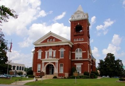
On West 3rd Street (U.S. 23) east of Oak Street, on the right when traveling west.
This County, created by Act of the Legislature December 24, 1825, is named for Capt. Sam Butts killed in the Indian War of 1814 at the Battle of Chalibbee. At Indian Springs, now a State Park, were signed the Treaties with the Creeks giving Georgia . . . — — Map (db m264205) HM
Near McDonough Road 0.2 miles east of Brookwood Avenue (U.S. 23).
Sylvan Grove Hospital site was originally part of a large colonial cotton plantation known as Sylvan Grove Plantation. This plantation was settled in 1817 by Williams Buttrill, Revolutionary soldier and aide to General George Washington. He was the . . . — — Map (db m103191) HM
On Bedell Avenue (Georgia Hwy 25) (U.S. 17) at East 4th Street, on the right when traveling north on Bedell Avenue (Georgia Hwy 25).
Formed from old Colonial parishes: St. Mary and St. Thomas. Camden one of eight original counties of Georgia created by the State Constitution of 1777. County named for Charles Pratt, Earl of Camden, Chief Justice and Lord Chancellor of England. . . . — — Map (db m168000) HM
On West Broad Street (State Highway 46) near Nort Kennedy Street, on the right when traveling west.
Candler County was created by an Act of the Georgia Legislature July 17, 1914, out of portions of Bulloch, Emanuel and Tattnall Counties, and named for Gov. Allen D. Candler (1834-1910). Gov. Candler is famed for the preservation of Colonial and . . . — — Map (db m18229) HM
On West McIntosh Circle 2 miles south of Georgia Route 5, on the right when traveling east.
Here at the home of Creek Chief Wm McIntosh, a treaty establishing a new boundary between the CHEROKEE and CREEK Indian Nations was drafted and signed. The north boundary was later used in the first survey of Carroll County in 1826-27. — — Map (db m12547) HM
On Okefenokee Parkway (Georgia Route 121) at the road to Traders Hill, on the right when traveling north on Okefenokee Parkway.
About 2 miles East, on this road, is the site of "Fort Alert, usually called Trader's Hill." Established in the 18th century, and defended by a stockade garrisoned by U.S. Troops, Trader's Hill was a refuge for settlers during the Indian Wars. At . . . — — Map (db m14472) HM
On Georgia Route 94 0.1 miles west of Route 185, on the left when traveling east.
Ellicott’s Mound, 5 miles north, at the head of the St. Marys River, was erected February 27, 1800, to mark the boundry between the United States and Spanish Florida, as set fourth in the Treaty of 1795 with Spain. Major Andrew Ellicott noted . . . — — Map (db m9186) HM
On Broad Street (Georgia Route 520) 0 miles east of Lafayette Road, on the left when traveling east.
Chattahoochee County, created by Act of February 13, 1854, was cut off from Muscogee and Marion Counties. It was named for the Chattahoochee River. Its courthouse, constructed in 1854, was built of select heart lumber from the Long Leaf Pine by . . . — — Map (db m38841) HM
On N Commerce Street (U.S. 27) at W Washington Street, on the right when traveling west on N Commerce Street.
Chattooga County was created by Act of Dec. 28, 1838 from Floyd and Walker Counties. It was named for the river which flows through the county, called Chattooga by the Cherokee Indians. Sequoyah (George Guess or Gist), inventor of the Cherokee . . . — — Map (db m16374) HM
On West Main Street (Georgia Route 205) at South Church Street, on the left when traveling east on West Main Street.
Created December 3, 1832, from Cherokee Indian Lands, and named in memory of the Cherokees. Early settlers tried to start silk production, but were not successful, and today there remains no trace of this except Canton, hopefully named for the . . . — — Map (db m21824) HM
On Washington Street S (Route 39) 0 miles north of Hartford Road ( Route 37), on the right when traveling north.
This County created by Act of the Legislature Feb. 16, 1854, is named for Henry Clay, famous statesman who died in 1852. Near Fort Gaines, the County Site, stood the actual Fort built in 1816 for defense in the Creek Indian Wars and named for Gen. . . . — — Map (db m47761) HM
On West Dame Avenue (U.S. 84) near Smith Street, on the right when traveling south.
Clinch County was created by an Act of the Legislature approved Feb. 14, 1850 out of lands formerly in Lowndes and Ware Counties and was named for General Duncan L. Clinch, a hero of the War of 1812 and the Indian wars. At the first election held . . . — — Map (db m23848) HM
On South Park Square NE east of West Park Square NE, on the left when traveling east.
Created December 3, 1832, and named for Judge Thomas W. Cobb, a former U.S. Senator, Marietta was named for his wife.
Fertile lands gave impetus to farming; ample water power encouraged industries. People from further south sought Marietta as . . . — — Map (db m1660) HM
On Memorial Place 0 miles south of Atlanta Road SE ( Route 3), on the right when traveling south.
Ulysses S. Grant was President of the U.S., and the South was still suffering from the effects of abusive Reconstruction when Smyrna was first incorporated August 23, 1872. One theory is that in the post-war era, citizens feared the town would . . . — — Map (db m17072) HM
On North Main Street (Georgia Route 33) at East Central Avenue, on the right when traveling north on North Main Street.
This County, created by Act of the Legislature February 25, 1856, is named for Hon. Walter T. Colquitt who had recently died. A famous lawyer and Methodist preacher, he served in Congress in 1839-40 and 1842-43, and in the Senate from 1843 to ‘48. . . . — — Map (db m40202) HM
On North Hutchinson Avenue (U.S. 41) 0 miles south of West 2nd Street, on the right when traveling south.
This County, created by Act of the Legislature July 30, 1918, is named for Gen. Philip Cook who fought in the States and Seminole Wars. He served in Congress from 1872 to '82, was Secretary of State for Georgia 1890-94 and 1898-1918. He served as . . . — — Map (db m40446) HM
On East Court Street (U.S. 29) at North Court Street, on the left when traveling north on East Court Street.
Coweta, an original county, was created by Acts of June 9, 1825 and Dec. 11, 1826 from Creek cessions of Jan. 24, 1826 and Mar. 31, 1826. It was named Coweta to perpetuate the fame of the head chief of the Coweta Towns, Gen. William McIntosh, . . . — — Map (db m10497) HM
On South 7th Street (U.S. 41) 0 miles north of 13th Avenue West, on the left when traveling north.
Crisp County was created by Act of Aug. 17, 1905 from Dooly County. It was named for Charles Frederick Crisp (1845-1896), Georgia lawyer, judge, Congressman, who was born in Sheffield, England, of actor parents touring the British Isles. Judge Crisp . . . — — Map (db m53210) HM
On Main Street (U.S. 11) at Court StreetAnoth, in the median on Main Street.
Often called the “State of Dade,” because, as legend has it, the county seceded from the Union ahead of Georgia, and only returned to the Union July 4, 1945.
Created December 25, 1837, and named for Major Francis Langhorne Dade, . . . — — Map (db m57731) HM
On Courthouse Circle 0 miles west of Eastman Dublin Highway ( Route 117), in the median.
This County created by Act of the Legislature Oct. 26, 1870, is named for William E. Dodge, a New York lumberman who owned large areas of the forest lands and who persuaded Congress to remove taxation from “the great staple of our state.” He built . . . — — Map (db m57197) HM
On 2nd Street at Cotton Avenue, on the right when traveling south on 2nd Street.
This County, created by Acts of the Legislature May 15 & Dec. 24, 1821, is named for Col. John Dooly of Revolutionary fame who was murdered in his home by Tories in 1780. The original County Site was at Berrien on the Flint River in 1823, the name . . . — — Map (db m53224) HM
On Pine Avenue at Champion Lane, on the right when traveling west on Pine Avenue.
This County, created by Act of the Legislature December 15, 1853, is named for Charles Dougherty of Athens, noted ante-bellum lawyer and jurist and strong advocate of states rights. In the Creek War in 1836 the Indians were driven out at the Battle . . . — — Map (db m40792) HM
On West Broad Street (U.S. 78) 0 miles west of Bowden Street, on the right when traveling east.
This county, created by Act of the Legislature October 17, 1870, is named for Stephen A. Douglas, the “Little Giant,” a Vermonter who was Congressman from Illinois 1843 to ‘47, Senator from ‘47 to ‘61, and Democratic candidate for President in 1860 . . . — — Map (db m30727) HM
On Court Square (Georgia Route 1) at South Main Street, on the left when traveling east on Court Square.
Early County, an original county, was created by Act of Dec. 15, 1818, from Creek Cession of Aug. 9, 1814. At first it contained Decatur, Seminole, Baker, Mitchell, Calhoun, Miller, Dougherty and parts of Clay, Grady, and Thomas Counties. It was . . . — — Map (db m165880) HM
On N. Pine Street near Rabun Street, on the left when traveling east.
This is one of the eight original Counties created by the Georgia Constitution in 1777 and is named for Lord Effingham who was an ardent supporter of Colonial Rights. By Act of Feb. 26, 1784, the first County Site was located at Tuckasee-King near . . . — — Map (db m7505) HM
On West Main Street south of Church Street, on the right when traveling south.
This County, created by Act of the Legislature Jan. 21, 1854, is named for Col. J. W. Fannin who was killed in the massacre at Goliad, Mar. 27, 1836. He had been captured with about 350 Georgia Volunteers under his command while fighting for the . . . — — Map (db m47137) HM
On Glynn Street South (Georgia Route 85) at East Lanier Avenue ( Route 54), on the right when traveling north on Glynn Street South.
This County, created by Acts of the Legislature May 15 and December 24, 1821, is named for the Marquis de LaFayette, famous French General who came to this country to fight under General George Washington in the Revolutionary War. After returning to . . . — — Map (db m42534) HM
On Fairburn Campbellton Road near Cochran Road SW, on the right.
Where, in June 1867 the widow of Captain T.C. Glover called a reunion of the survivors of Company A, 21st Georgia, C.S.A. who agreed to hold annual meetings. — — Map (db m21432) HM
On North Fulton Avenue at King Arnold Street, on the left when traveling north on North Fulton Avenue.
Hapeville is situated on the Central Railroad of Georgia, eight miles from Atlanta, upon a water-shed extending from Atlanta to Macon. When chartered on September 16, 1891, Hapeville was considered the most attractive suburban town around Atlanta . . . — — Map (db m10906) HM
On Sandy Springs Circle at Sandy Springs Place, on the right when traveling north on Sandy Springs Circle.
Sandy Springs, Georgia, the unincorporated community just north of Atlanta, began a 30-year campaign for incorporation when the City of Atlanta tried to annex the area in the 1970s. The Committee for Sandy Springs formed in 1975 to incorporate Sandy . . . — — Map (db m53430) HM
On East Main Street at Palmer Street, on the right when traveling east on East Main Street.
This County, created by Act of the Legislature Dec. 19, 1857, is named for Gen. Thomas Glascock who served in the War of 1812 and the Seminole War. He was a Speaker of the Georgia House of Representatives and a Member of Congress from 1835 to . . . — — Map (db m55549) HM
On G Street at Union Street, on the left when traveling east on G Street.
Glynn County, one of the eight original Counties of Georgia, was organized under the 1777 Constitution of the State of Georgia. It was named in honor of John Glynn, a member of the British House of Commons who defended the cause of the American . . . — — Map (db m12226) HM
On North Broad Street (Georgia Route 93) at 3rd Avenue NE, on the right when traveling north on North Broad Street.
This County, created by Act of the Legislature Aug. 17, 1905, is named for Henry W. Grady, nationally famous editor and “silver tongued orator” of the New South. Born in Athens, Ga., in 1850 and educated at the Universities of Georgia & Virginia, . . . — — Map (db m27123) HM
On North Main Street at Court Street, on the right when traveling north on North Main Street.
This County, created by Act of the Legislature Feb. 3, 1786, is named for Maj. Gen. Nathanael Greene, the strategist who ranked second only to Gen. Washington. Born in Rhode Island in 1742, he died at his Georgia plantation in 1786. Seven miles . . . — — Map (db m42718) HM
On North Clayton Street (Georgia Route 20) 0 miles West Crogan Street (U.S. 29), on the left when traveling north.
Button Gwinnett, for whom this county was named, was born in Gloucestershire, England, in 1735, the son of a Church of England minister. He worked in the store of his father-in-law in Dexter for two years, then as an importer and exporter for three . . . — — Map (db m84791) HM
Near South Perry Street (Georgia Route 20) at Luckie Street, on the left when traveling south.
The Georgia Legislature authorized the creation of Gwinnett County in 1818 and named it after Button Gwinnett. He was one of three Georgia signers of the Declaration of Independence but never lived in the county.
The first meetings, court . . . — — Map (db m197711) HM
On East Atlanta Street (U.S. 78) at Freeman Street, on the right when traveling east on East Atlanta Street.
Tallapoosa was a place of great ceremonial importance to the Indians. Here in 1826 settlers discovered “Charles Town,” an Indian Village named for one of their great warriors. Several Indian trails intersected here and the Choctaw, Creek . . . — — Map (db m11142) HM
On North Main Street (U.S. 27) at Broad Street, on the right when traveling north on North Main Street.
Chipley was incorporated on December 9, 1882, following the extension of the Columbus and Rome Railroad one mile north of the Village of Hood. Old Hood was the predecessor of Chipley. Chipley was named after Colonel W. D. Chipley, a partner in the . . . — — Map (db m59012) HM
On South Irwin Avenue (U.S. 129) at West 2nd Street, on the right when traveling south on South Irwin Avenue.
This County, created by Acts of the Legislature December 15, 1818 and December 21, 1819, is named for Gov. Jared Irwin who served from 1806 to ‘09. He helped revised the State Constitution in 1789 and ‘98 and was famed for his uncompromising . . . — — Map (db m40578) HM
On Green Street (Georgia Route 53) 0 miles south of Henry Street, on the left when traveling south.
In 1876 William H. Braselton, Sr. and his wife, Susan Hosch Braselton, established a 796-acre farm in western Jackson County. The Braseltons’ children, Henry, Green, John Oliver, Belle, and Lena , grew up working on the family farm, developing . . . — — Map (db m24176) HM
On Washington Street (Georgia Route 53) 0 miles north of Broad Street, on the left when traveling south.
The four Hosch brothers founded Hoschton in 1881 in the hope of influencing the proposed route of the Gainesville, Jefferson and Southern Railroad. In 1833 this depot was built on land donated by the brothers. The railroad transformed the town and . . . — — Map (db m18272) HM
On West Broad Street (U.S. 1) 0 miles east of Green Street, on the right when traveling east.
The notorious "Yazoo Fraud" act was passed and later repealed in the old State Capitol that stood here 1794-1807. The 1794 Georgia legislature sold
35,000,000 acres of land along the Yazoo River in what is now Alabama and Mississippi at 1½ cents . . . — — Map (db m58365) HM
On North Marcus Street (State Highway 15) at East Elm Street (U.S. 319), on the right when traveling north on North Marcus Street.
This County, created by Act of the Legislature Dec. 11, 1858, is named for Gov. Herschel V. Johnson. The County Site is named for John B. Wright, pioneer resident. Johnson, Governor from 1853 to `57, ran for the Vice Presidency in 1860 on the ticket . . . — — Map (db m88586) HM
On East Jackson Street (U.S. 80) at North Jefferson Street (Business U.S. 441), on the right when traveling west on East Jackson Street.
Laurens County was created by Act of Dec. 10, 1807 from Wilkinson County. Originally, it contained all of Pulaski and part of Johnson Counties. Among prominent residents of Laurens County were Gov. Geo. M. Troup and Gen. David Blackshear. It was . . . — — Map (db m49538) HM
On Leslie Highway (Georgia Route 195) at 4th Street East, on the right when traveling north on Leslie Highway.
Lee County was created by Acts of June 9, 1825 and Dec. 11, 1826 from Creek cessions of Jan. 24, 1826 and March 31, 1826. Originally, it contained all land in Randolph, Stewart, Quitman, Sumter, Terrell, Webster and part of Marion and Clay . . . — — Map (db m40125) HM
On North Ashley Street (U.S. 41) at West Central Avenue (U.S. 84), on the left when traveling north on North Ashley Street.
Lowndes County was created by an act of the Georgia Legislature December 23, 1825, from lands previously in Irwin County. It was named for William J. Lowndes, a South Carolina statesman. The first count officers commissioned May 29, 1826, were Henry . . . — — Map (db m40166) HM
On Clifton Bradley dr (Georgia Route 90) 0 miles east of Sumter Street (County Route 128), on the left when traveling east.
This County, created by Act of the Legislature Dec. 14, 1837, is named for Nathaniel Macon of North Carolina, President Pro-Tem of the U.S. Senate. The first County Site at Lanier was moved to Oglethorpe in 1854 to be on the railroad. Lanier became . . . — — Map (db m223517) HM
On McDuffie Avenue 0.2 miles west of Main Street (U.S. 78), on the left when traveling east.
McDuffie County was created by Act of Oct. 18, 1870 from Columbia and Warren Counties. It was named for George McDuffie (1788-1851). Born in Columbia (now Warren County, Ga.), he became a political leader in S.C. He was a Maj. Gen. of Militia, . . . — — Map (db m42688) HM
On South 1st Street (Georgia Route 45) 0 miles north of College Street, on the left when traveling north.
This County, created by Act of the Legislature February 26, 1856, is named for Judge Andrew J. Miller who died in 1856. A Commander of the Oglethorpe Infantry, he served in the legislature for more than twenty years and was several times President . . . — — Map (db m55508) HM
On McEachin Street (U.S. 221) near West Church Street, on the left when traveling south.
Montgomery County, created Dec. 19, 1793 out of Washington, originally contained all of Wheeler and Tattnall and parts of Treutlen, Toombs, Emanuel and Dodge Counties. It was named for Maj. Gen. Richard Montgomery (1736- 1775), "an early martyr to . . . — — Map (db m21842) HM
On South Main Street (U.S. 278) just east of East Washington Street, on the right when traveling east.
On the occasion of its Bicentennial, Morgan County placed this marker here to commemorate the community of
Madison
Named in honor of U.S. President James Madison, the town of Madison was established as the permanent seat of Morgan County . . . — — Map (db m16233) HM
On Old Post Road 0 miles west of Hill Street, on the right when traveling west.
The Georgia Legislature initially designated 100 acres (Parts of Land Lots No.36, No.35, & No.23) for Madison’s establishment. The Justices of the Inferior Court subdivided the land to create a “publick” square as well as lots for sale . . . — — Map (db m49234) HM
On Jailhouse Alley south of Main Street ( Road 42), on the right when traveling south.
Jailhouse Park
Jailhouse Park is so named because of its proximity to the town jail built c. 1875. The building was constructed on a 40 square foot plot of land owned by Dr. C.H. Richardson and purchased by the commissioners of the city of . . . — — Map (db m198010) HM
On West Church Street 0 miles west of Anderson Avenue, on the right when traveling east.
This County, created by Act of the Legislature July 18, 1924, is named for one of Georgia's leading crops, the Georgia Peach known throughout the nation and beyond. The famous Elberta Peach was developed in Georgia by Samuel B. Rumph and is grown . . . — — Map (db m53097) HM
On Georgia Route 53 at North Railroad Street, on the left when traveling east on Georgia Route 53.
The Georgia Marble Company began in 1884 as one of many small marble quarrying operations in the region. In 1905 Colonel Sam Tate became the company's president, continuing in that position until his death in 1938. Georgia Marble Company stone can . . . — — Map (db m15019) HM
On U.S. 84 near Gordon Street (State Road 15 /121), on the right when traveling west.
This County, created by Act of the Legislature December 18, 1857, is named for Franklin Pierce, New Hampshire Democrat and fourteenth President of the United States, 1853 to `57. He was a General in the Mexican War. Blackshear, incorporated . . . — — Map (db m24037) HM
On Main Street (U.S. 19) at Jackson Street, on the left when traveling south on Main Street.
Created by Act of Dec. 9, 1822, from Monroe County, Pike County originally contained part of Spalding, Upson and Lamar Counties. It was named for Zebulon Montgomery Pike (1779-1813), leader, in 1805, of an expedition to trace the Mississippi River . . . — — Map (db m59609) HM
On Prior Street 0 miles west of South Main Street ( Route 1), on the right when traveling west.
Created December 20, 1851 and named for President James Knox Polk. Cedartown is fittingly named for the trees which flourish in this beautiful valley. The city is a railroad center, has a thriving textile industry, and a large paper mill. . . . — — Map (db m35738) HM
On South Piedmont Avenue (Georgia Route 113) at Springdale Road, on the right when traveling south on South Piedmont Avenue.
County seat of Paulding when that county was created in 1832; inc. 1838. Named for Isaac Van Wert & John Paulding, two of the captors of Major Andre.
Polk County was organized in 1851 from parts of Floyd and Paulding; this placed Van Wert in Polk . . . — — Map (db m35778) HM
On Commerce Street (Georgia Route 26) 0 miles west of North Lumpkin Street, on the right when traveling east.
This County, created by Act of the Legislature December 13, 1808, is named for Count Casimir Pulaski, Polish hero of the Revolutionary War who died fighting in Georgia and is buried in Savannah. Court was to be held at the home of Isham Jordan until . . . — — Map (db m40329) HM
On Main Street 0 miles south of Harrison Street, on the right when traveling south.
This County, created by Act of the Legislature Dec. 10, 1858, is named for Gen. John A. Quitman, soldier in the Mexican War, Governor of Mississippi and ardent advocate of States Rights. The County Site is named for Georgetown, D.C. Among the first . . . — — Map (db m46586) HM
On Court Street (Business U.S. 27) at Pine Street, on the left when traveling north on Court Street.
Randolph County was created by Act of Dec. 20, 1828 from Lee County. Originally Randolph County included all of what is now Stewart and Quitman and part of Terrell and Clay Counties. It was named for “John Randolph of Roanoke” (1773-1833), Virginia . . . — — Map (db m238725) HM
On Greene Street near Monument St., on the right when traveling east.
Originally designated as the Parish of St. Paul by the Act creating it in 1758, the name was changed in 1777 to Richmond County in honor of the Duke of Richmond, who, as a member of Parliament, was a zealous supporter of the American cause, . . . — — Map (db m9706) HM
On North Main Street at Center Street, on the right when traveling north on North Main Street.
This County, created by Act of the Legislature October 18, 1870, is named for Rockdale Church, so called for the fine underlying granite strata. Conyers, the County Site, was incorporated in 1854 and named for a prominent physician. Smyrna Camp . . . — — Map (db m35930) HM
On Scarboro Highway (State Highway 17) at Rocky Ford Road, on the left when traveling north on Scarboro Highway.
Between 1765 and 1770 a group of settlers, mostly from North Carolina, settled and received grants for land in the vicinity of what is now Rockyford.
Among these first settlers were, Benjamin Lanier, Lemuel Lanier, Valentine Hollingsworth, . . . — — Map (db m13131) HM
On S. Wiley Street 0 miles south of 1st Street, on the right when traveling south.
According to a map "Plan of Donalson" dated April 1889, the town was laid out by John Earnest Donalson. On December 8, 1897, a charter, signed by Governor William Yates Atkinson, was granted incorporating the town of Donalsonville. Officers . . . — — Map (db m9858) HM
On South Knox Avenue at Court Street, on the left when traveling north on South Knox Avenue.
This County, created by Act of the Legislature July 8, 1920, is named for the Seminole Indians. Members of the Creek Confederacy, the Seminoles (meaning “separatist”) left the main body in Georgia and settled in Florida. After two bloody . . . — — Map (db m55645) HM
On 6th Street at East Bank Street, on the right when traveling south on 6th Street.
Spalding County was created by Act of Dec. 20, 1851 from Fayette, Henry and Pike Counties. It was named for Thomas Spalding (1774-1851), native of Frederica. One of the earliest cotton and sugar cane planters in Georgia, he was a legislator, state . . . — — Map (db m59619) HM
On East Doyle Street 0 miles east of North Alexander Street, on the right when traveling west.
This County, created by Act of the Legislature August 18, 1905, is named for Alexander Hamilton Stephens, Vice President of the Confederacy. A state legislator and Senator he was elected to Congress at 31, serving from 1843 to 1859. Elected to . . . — — Map (db m58733) HM
On Wall Street at Park Drive, on the right when traveling south on Wall Street.
First settled in 1827, Richland was named for the home district of several pioneer families from South Carolina. The community became a busy railroad junction when the Savannah. Americus and Montgomery, and the Columbus Southern rail lines met here . . . — — Map (db m10152) HM
Near West Brazell Street (U.S. 280) at Church Street, on the right when traveling west.
This County, created by Act of the Legislature Dec. 5, 1801, is named for Josiah Tattnall, Governor of Georgia at the time, who signed the Act. There being no town in the new County, the Act provided that all public business be transacted at the . . . — — Map (db m170739) HM
On Golden Isles Highway (U.S. 341/23) near Telfair Avenue, on the left when traveling east.
Telfair County was created by Act of Dec. 10, 1807 from Wilkinson County. Originally, it contained parts of Coffee and Dodge Counties. It was named for Gov. Edward Telfair (1735- 1807). Born in Scotland, he settled in Savannah in 1766, was a . . . — — Map (db m23638) HM
On 2nd Street East at Tift Avenue, on the left when traveling east on 2nd Street East.
This County, created by Act of the Legislature August 17, 1905, is officially named for Nelson Tift, well known businessman, legislator and Mayor of Albany. The organizers also had in mind his nephew Henry Harding Tift, who founded Tifton in 1872 . . . — — Map (db m39993) HM
Toombs County was created by Act of Aug. 18, 1905 from Emanuel, Montgomery and Tattnall. It was named for Gen. Robert Augustus Toombs 1810-1885), of Wilkes County, Congressman and Senator. One of the chief organizers of the Confederate government, . . . — — Map (db m18208) HM
On South 2nd Street (U.S. 221) near Court Street, on the right when traveling south.
Treutlen County was created by Act of Aug. 21, 1917 from Emanuel and Montgomery Counties. It was named for Gov. John Adam Treutlen (1726- 1782), "one of the foremost revolutionists." Elected Governor over Button Gwinnett in 1777, he was declared a . . . — — Map (db m23644) HM
On South Broad Street (Georgia Route 11) 0 miles south of East Washington Street, on the right when traveling north.
This City of Monroe, settled in 1818 and incorporated Nov. 30, 1821, was named for James Monroe, fifth President. Born in Virginia in 1758 he fought in the Continental Army. He served in the Virginia legislature, in Congress and the Senate, and as . . . — — Map (db m20718) HM
On Main Street (Business Route 278) at West Gibson Street, on the right when traveling east on Main Street.
This County, created by Act of the Legislature Dec. 19, 1793, is named for Gen. Joseph Warren, Massachusetts Revolutionary hero killed at the Battle of Bunker Hill. What is claimed to have been the first iron works and woolen mill in Georgia was . . . — — Map (db m49372) HM
On Pearl Avenue near Pine Street, on the right when traveling west.
This County, created by Act of the Legislature Aug. 14, 1912, is named for Gen. Joseph Wheeler, famous Confederate Cavalry leader and Major General of Cavalry in the Spanish War. He twice saved Augusta from Kilpatrick's Union Cavalry, at . . . — — Map (db m23634) HM
On Main Street (U.S. 129) at Kytle Street ( Route 115), in the median on Main Street.
When White County was formed in 1857, Mt. Yonah was selected as the County-seat. The majority of its residents wished to rename it Sheltonville for William H. Shelton, who sponsored the formation of the new county. Shelton asked that it be named . . . — — Map (db m43702) HM
On North Broad Street (U.S. 129) at Park Avenue, on the left when traveling south on North Broad Street.
This County was created by Act of the Legislature Dec. 22, 1857. Georgia Archives show that it was named for Capt. John Wilcox though some authorities believe it was named for his son Gen. Mark Wilcox, state legislator and one of the founders of the . . . — — Map (db m40104) HM
On East Liberty Street at Spring Street, on the right when traveling east on East Liberty Street.
Washington, Georgia
Incorporated January 23rd 1780
First incorporated city
in the United States
named for
our first president
Elevation 619 feet — — Map (db m200064) HM
On Kenneth W. Birdsong Highway (Georgia Route 57) at Bacon Street (Old U.S. 441), on the right when traveling east on Kenneth W. Birdsong Highway.
This County was created by Acts of the Legislature May 11, 1803 and Dec. 7, 1805. It is named for James Wilkinson, Revolutionary General, and formed from part of the lands acquired from the Creeks by the Treaty of Fort Wilkinson (on the Oconee) at . . . — — Map (db m41869) HM
On North Main Street (Georgia Route 33) at East Kelly Street, on the right when traveling south on North Main Street.
This County created by Act of the Legislature Dec. 20, 1853 is named for Maj. Gen. Wm. J. Worth of Mexican War fame under whose command served Maj. William A. Harris, a leader in the organization of the new County. Among the first County Officers . . . — — Map (db m40109) HM
Near Pe‘e Road south of Poipu Road, on the left when traveling south.
The bay before you—named Keoneloa (or ‘the long sand’)—is the site of one of the oldest known Hawaiian occupation on Kaua‘i, a temporary fishing camp, dating to A.D. 220–660.
The Hawaiians divided each island into . . . — — Map (db m12807) HM
On N Capitol Boulevard north of W Bannock Street, in the median.
President Abraham Lincoln created Idaho Territory, appointed its first officers and judges and addressed Congress about Idaho in 1863 and 1864. He considered Idaho issues in the White House on the afternoon that he was shot and invited the former . . . — — Map (db m126722) HM
On 24th Place near Princeton Avenue, on the right when traveling east.
For Celebration of the Bicentennial Commemoration of The United States of America
The Age of Great Comity
By Confucius
When the Great Way is implemented, the world-state is for the equality of all peoples. The sagacious and capable are . . . — — Map (db m266963) HM
[English text on the north-facing side of the base:]
Ping Tom Memorial Park was named in honor of the leading force behind its creation, Chinatown's most noted civic leader, Ping Tom. A lifelong resident of Chinatown, Ping Tom became president . . . — — Map (db m267230) HM
On North Narragansett Avenue 0.1 miles north of West Addison Street, on the left when traveling north.
In memory of
Henry Horner
1878 – 1940
Judge of the Probate Court of Cook County
1914 – 1933
Governor State of Illinois
1933 – 1940
He Had Clean Hands And A Pure Heart — — Map (db m246005) HM
This Illinois - Indiana state boundary marker is one of the oldest landmarks in the Chicagoland area. It was constructed in 1838 under the direction of the United States Surveyor General to commemorate the establishment of the common boundary . . . — — Map (db m237902) HM
On October 7, 1871, the Great Fire of Chicago started on the south side of the city and continued north. As the fire approached Old Town, the bells of St. Michael’s Church began to toll. The walls of church survived, but the interior was destroyed. . . . — — Map (db m47605) HM
From 1870 through the 1800s, Henry Piper, one of Old Town’s early entrepreneurs, operated a successful bakery in a narrow alley. Today, the building at Wells and North is known as Piper’s Alley. The existing house located at 1546 North Wells was . . . — — Map (db m47609) HM
On West Juneway Terrace at Heritage Avenue, on the left when traveling east on West Juneway Terrace.
Initiated, developed and managed by community residents, Triangle Park is open to everyone. We salute the labor and devotion of everyone who helped make this dream a reality.
The Triangle Park Corporation and its membership groups include: The . . . — — Map (db m267961) HM
On West Randolph Street west of La Salle Street, on the right when traveling west.
Chicago City Council, 1969-1976
Mayor of the City of Chicago, 1976-1979
Illinois First District Appellate Court, 1984-1990
Illinois Supreme Court, 1990-2000
Chief Justice, Illinois Supreme Court, 1994-1997 — — Map (db m265604) HM
Near Kean Avenue 0.2 miles south of 81st Street, on the right when traveling north.
[Lithuanian language text:]
Lietuvos Respublikos Prezidentas
Tautos Žadintojas Varpininkas
Laisvės Lietuvių Tautai!
[English translation:]
President of the Republic of Lithuania
The Bell Ringer of the Nation
Freedom for . . . — — Map (db m267210) HM