9533 entries match your criteria. Entries 201 through 300 are listed.⊲ Previous 100 — Next 100 ⊳
Roads & Vehicles Topic
By Bill Kirchner, October 20, 2013
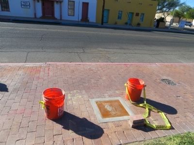
Cushing Street Marker
| 201 ► Arizona, Pima County, Tucson, Barrio Viejo — Cushing Street — |
| 202 ► Arizona, Pima County, Tucson, Butterfly Peak Natural Area — Honorable Frank Harris Hitchcock — |
| 203 ► Arizona, Pima County, Tucson, Downtown — Congress Street — Calle de la Alegria — |
| 204 ► Arizona, Pima County, Tucson, Downtown — Congress Street — Calle de la Alegria — |
| 205 ► Arizona, Pima County, Tucson, Downtown — Convent Street — |
| 206 ► Arizona, Pima County, Tucson, Downtown — Convent Street — Reported missing |
| 207 ► Arizona, Pima County, Tucson, Downtown — Convent Street — Reported missing |
| 208 ► Arizona, Pima County, Tucson, Downtown — Granada Avenue — |
| 209 ► Arizona, Pima County, Tucson, Downtown — Jackson Street — |
| 210 ► Arizona, Pima County, Tucson, Downtown — Main Avenue — Calle Real — El Camino Real — |
| 211 ► Arizona, Pima County, Tucson, Downtown — McCormick Street — |
| 212 ► Arizona, Pima County, Tucson, Downtown — Meyer Street — Callejon de las Flores — |
| 213 ► Arizona, Pima County, Tucson, Downtown — Ochoa Street — |
| 214 ► Arizona, Pima County, Tucson, Downtown — Pearl Street / Ott Street — Calle del Correo — |
| 215 ► Arizona, Pima County, Tucson, Downtown — Pennington Footbridge — |
| 216 ► Arizona, Pima County, Tucson, Downtown — Pennington Street — Calle de la Misión — Calle del Arroyo — |
| 217 ► Arizona, Pima County, Tucson, Downtown — Scott Avenue — |
| 218 ► Arizona, Pima County, Tucson, Downtown — Stone Avenue — |
| 219 ► Arizona, Pima County, Tucson, El Presidio — Alameda Street — Calle de las Milpas — Cemetery Street — |
| 220 ► Arizona, Pima County, Tucson, El Presidio — Alameda Street — Calle de las Milpas — Cemetery Street — |
| 221 ► Arizona, Pima County, Tucson, El Presidio — Council Street — Miltenberg Street — |
| 222 ► Arizona, Pima County, Tucson, El Presidio — Court Street — |
| 223 ► Arizona, Pima County, Tucson, El Presidio — Franklin Avenue — |
| 224 ► Arizona, Pima County, Tucson, El Presidio — Granada Avenue — |
| 225 ► Arizona, Pima County, Tucson, El Presidio — Main Avenue — Calle Real — El Camino Real — |
| 226 ► Arizona, Pima County, Tucson, El Presidio — Meyer Street — Callejón de las Flores — |
| 227 ► Arizona, Pima County, Tucson, El Presidio — Saint Mary’s Road — Seven Sisters Lane — |
| 228 ► Arizona, Pima County, Tucson, El Presidio — Stone Avenue — |
| 229 ► Arizona, Pima County, Tucson, Historic Fourth Avenue — Toole Avenue — |
| 230 ► Arizona, Pima County, Tucson, Pie Allen — Congress Street — Calle de la Alegria — |
| 231 ► Arizona, Pima County, Tucson, Sabino Canyon Recreation Area — Catalina Federal Honor Camp — Gordon Hirabayashi Recreation Site — |
| 232 ► Arizona, Pima County, Vail — Cienega Bridge — Built 1921 — |
| 233 ► Arizona, Pima County, Vail — Vail Sonoita Highway — Reported missing |
| 234 ► Arizona, Pinal County, Apache Junction — Apache Trail — State Route 88 — Arizona's First Historic Highway / Dedicated February 25, 1987 — |
| 235 ► Arizona, Pinal County, Apache Junction — Jacob Von Walzer — 1808 – 1891 — Lost Dutchman Gold Route — |
| 236 ► Arizona, Pinal County, Eloy — Stage Station and Homestead — |
| 237 ► Arizona, Yavapai County, Ash Fork — Ash Fork Maintenance Camp #1 — |
| 238 ► Arizona, Yavapai County, Bumble Bee — The Sunset Point Rest Area — Dedicated to the Engineering Achievement of — William Clayton LeFebvre, 1890-1964 — |
| 239 ► Arizona, Yavapai County, Camp Verde — "0" Mile Post General Crook Trail — |
| 240 ► Arizona, Yavapai County, Congress — In Memory of Charles Churchill Small — |
| 241 ► Arizona, Yavapai County, Lake Montezuma — Historic Bell Trail — |
| 242 ► Arizona, Yavapai County, Oak Creek — Beaver Head Stage Station — |
| 243 ► Arizona, Yavapai County, Peach Springs — Grand Canyon Caverns, Peach Springs, Arizona — Route 66 Roadside Attraction — |
| 244 ► Arizona, Yavapai County, Prescott — Pioneer Trail and Monument — |
| 245 ► Arizona, Yavapai county, Prescott — Simmons, Arizona — |
| 246 ► Arizona, Yavapai County, Rimrock — Chaves Historic Trail — |
| 247 ► Arizona, Yavapai County, Sedona — Early Uptown — Historic Sedona — |
| 248 ► Arizona, Yavapai County, Sedona — Roads — Historic Sedona — |
| 249 ► Arizona, Yavapai County, Seligman — Beale Wagon Road — Seligman, Arizona — |
| 250 ► Arizona, Yavapai County, Seligman — Delgadillo's Snow Cap, Seligman, Arizona — Route 66 Roadside Attraction — |
| 251 ► Arizona, Yuma County, Wellton — Red Top Wash Bridge — |
| 252 ► Arizona, Yuma County, Yuma — El Camino Del Diablo — (The Devil's Highway) — |
| 253 ► Arizona, Yuma County, Yuma — Juan Bautista de Anza National Historic Trail — |
| 254 ► Arizona, Yuma County, Yuma — The All-important Colorado River Crossing — Juan Bautista de Anza National Historic Trail — |
| 255 ► Arkansas, Baxter County, Mountain Home — Old Military Road — |
| 256 ► Arkansas, Benton County, Avoca — Sesquicentennial Trail of the Centuries — Benton County Arkansas Sesquicentennial Monument 1836 - 1986 — Arkansas Sesquicentennial 1836 - 1986 — |
| 257 ► Arkansas, Benton County, Bentonville — Benton County Hardware — |
| 258 ► Arkansas, Benton County, Garfield — Lifeline for Two Armies — Pea Ridge National Military Park — National Park Service, U.S. Department of the Interior — |
| 259 ► Arkansas, Benton County, Garfield — The Butterfield Overland Mail Route — |
| 260 ► Arkansas, Benton County, Lowell — 107 — Mudtown — |
| 261 ► Arkansas, Benton County, Lowell — Service Station and Garage — |
| 262 ► Arkansas, Benton County, Lowell — The Butterfield Stagecoach Road — Established 1858 — |
| 263 ► Arkansas, Benton County, Rogers — Cross Hollows — |
| 264 ► Arkansas, Benton County, Rogers — The Butterfield Overland Mail In Arkansas — |
| 265 ► Arkansas, Boone County, Harrison — Early Garage — |
| 266 ► Arkansas, Boone County, Harrison — Early Gas Station — |
| 267 ► Arkansas, Carroll County, Carrollton — "Old" Carrollton — |
| 268 ► Arkansas, Carroll County, Eureka Springs — "Mud" Street and "Underground Eureka" — |
| 269 ► Arkansas, Carroll County, Eureka Springs — Bank of Eureka Springs Community Room — |
| 270 ► Arkansas, Carroll County, Eureka Springs — Crescent Spring and Trail — |
| 271 ► Arkansas, Carroll County, Eureka Springs — Mud Street to Main Street — North Main — |
| 272 ► Arkansas, Carroll County, Eureka Springs — The Lay of the Land — |
| 273 ► Arkansas, Carroll County, Eureka Springs — The Railroad Depot — |
| 274 ► Arkansas, Clark County, Caddo Valley — 65 — Confederate Manufacturing / The Military Road — |
| 275 ► Arkansas, Clay County, St. Francis — Chalk Bluff Crossing and Town — |
| 276 ► Arkansas, Cleveland County, New Edinburg — E-27 — Cleveland County Battle of Mark's Mill — |
| 277 ► Arkansas, Cleveland County, New Edinburg — Shelby's Approach — |
| 278 ► Arkansas, Cleveland County, New Edinburg — The Battle Had Begun! — |
| 279 ► Arkansas, Columbia County, Lamartine — C-27 — Columbia County Lamartine Pioneer Settlement — |
| 280 ► Arkansas, Crawford County, Van Buren — The Butterfield Stage Route — |
| 281 ► Arkansas, Crittenden County, Marion — Military Road — |
| 282 ► Arkansas, Cross County, Wynne — The Trail of Tears along the Memphis to Little Rock Road — 1824-1840 — |
| 283 ► Arkansas, Franklin County, Ozark — Trail of Tears Memorial — |
| 284 ► Arkansas, Garland County, Hot Springs — Dead Chief Trail — |
| 285 ► Arkansas, Garland County, Hot Springs — Tufa Terrace Trail — |
| 286 ► Arkansas, Grant County, Leola — Red River Campaign — Battle of Jenkins' Ferry — |
| 287 ► Arkansas, Hot Spring County, Donaldson — 18 — Military Road / Settlement of Midway — |
| 288 ► Arkansas, Independence County, Cord — Southwest Trail — |
| 289 ► Arkansas, Lincoln County, Star City — F-7 — Lincoln County — Star City — |
| 290 ► Arkansas, Little River County, Alleene — Anderson Ferry — |
| 291 ► Arkansas, Lonoke County, Austin — Oakland Grove (Old Austin) — Short Cut to Indian Territory 1832-1838 — Trail of Tears Through Arkansas — |
| 292 ► Arkansas, Miller County, Doddridge — History of The Spring Bank Ferry — |
| 293 ► Arkansas, Miller County, Doddridge — The Spring Bank Ferry — |
| 294 ► Arkansas, Montgomery County, Caddo Gap — The Narrows on Caddo River — |
| 295 ► Arkansas, Pope County, Pottsville — 27 — Potts Inn / Butterfield's Overland Mail — |
| 296 ► Arkansas, Pope County, Russellville — Military Road Marker Stone — |
| 297 ► Arkansas, Pulaski County, Jacksonville — Memphis Military Road — |
| 298 ► Arkansas, Pulaski County, Jacksonville — The Memphis to Little Rock Railroad — Samson Gray Helps Link the State Capital with the Mississippi — |
| 299 ► Arkansas, Pulaski County, Little Rock — It is River City — La Petite Roche Historical Walk — |
| 300 ► Arkansas, Randolph County, Black Rock — Transportation — Davidsonville Historic State Park — |
9533 entries matched your criteria. Entries 201 through 300 are listed above. ⊲ Previous 100 — Next 100 ⊳