By Cosmos Mariner, August 27, 2016
Delphos Marker
| On North Main Street south of West 3rd Street, on the right when traveling south. |
| On Lincoln Highway (Ohio Route 66) just west of North Main Street (Ohio Route 66), on the left when traveling east. |
| On North Main Street (Route 66) just south of West 3rd Street (Ohio Route 697), on the left when traveling north. |
| On East 2nd Street east of N Main Street, on the left when traveling east. |
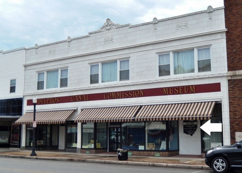
| On North Main Street at East 3rd Street, on the right when traveling north on North Main Street. |
| On North Main Street at East Third Street, on the right when traveling north on North Main Street. |
| On Lafayette Road, 0.1 miles north of Ada Road (Ohio Route 81), on the right when traveling north. |
| On Reservoir Road, 0.3 miles east of Metzger Road, on the right when traveling east. |
| Near Findlay Road (Ohio Route 81) 0.1 miles south of North McCullough Street, on the right when traveling east. |
| On North Broadway Street at East 3rd Street, on the left when traveling south on North Broadway Street. |
| On South Canal Street at West 1st Street, on the left when traveling south on South Canal Street. |
| On Ohio Route 66, 0.2 miles north of Deep Cut Road, on the right when traveling south. |
| On South Saint Marys Road (Ohio Route 66) 0.1 miles Deep Cut Road (County Road 226), on the right when traveling south. |
| On South Broadway Street (Ohio Route 66) north of Wurster Drive, on the right when traveling north. |
| On South Broadway Street (Ohio Route 66) at East 3rd Street, on the right when traveling south on South Broadway Street. |
| On South Broadway Street (Ohio Route 66) at East 3rd Street, on the right when traveling south on South Broadway Street. |
| On North Broadway Street (Ohio Route 66) at East 3rd Street, on the left when traveling north on North Broadway Street. |
| Near Miami-Erie Canal Walkway/Bike Path south of Zion Church Road, on the right when traveling south. |
| Near Miami-Erie Canal Walkway/Bike Path south of Zion Church Road, on the right when traveling south. |
| On Miami-Erie Canal Walkway/Bike Path south of Zion Church Road, on the right when traveling south. |
| On Main Street (U.S. 250) just south of Center Road, on the right when traveling south. |
| On Main Street (U.S. 250) just south of Center Street, on the right when traveling south. |
| On County Road 3006 north of Pleasant Hill Lake Trail, on the right when traveling north. |
| On Bridge Street (Ohio Route 531) west of Goodwill Drive, on the right when traveling west. |
| On Bridge Street (Ohio Route 531) west of Goodwill Drive, on the right when traveling east. |
| On Walnut Boulevard east of Hulbert Avenue, on the right when traveling east. |
| Near Main Avenue south of West 44th Street, on the left when traveling north. |
| On Walnut Boulevard east of Hulbert Avenue, on the right when traveling east. |
| On Walnut Boulevard east of Hulbert Avenue, on the left when traveling east. |
| On Bridge Street (Ohio Route 531) at Morton Drive, on the right when traveling west on Bridge Street. |
| Near Walnut Boulevard east of Hulbert Avenue, on the right when traveling east. Reported unreadable. |
| On Walnut Boulevard east of Hulbert Avenue, on the left when traveling east. |
| On State Road South (County Road 25) 0.3 miles north of Plymouth Ridge Road, on the right when traveling west. |
| On Harpersfield Road at State Road, on the left when traveling north on Harpersfield Road. |
| On Richland Avenue just south of South Shafer Street, on the right when traveling south. |
| On Fisher Road (County Road 17) 0.1 miles west of University Heights Drive, on the right when traveling west. |
| On Canal Street (U.S. 33) at Washington Street, on the left when traveling east on Canal Street. |
| On Ohio Route 66 at County Route 182, on the left when traveling south on State Route 66. |
| On Ohio Route 198, 0.2 miles south of Deep Cut Road (Local Highway 230), on the right when traveling north. |
| On West 4th Street west of North Frankfurt Street, on the right when traveling west. |
| On Main Street (Ohio Route 66) 0.1 miles south of Bensman Road (U.S. 40), on the right when traveling south. |
| On West 4th Street west of North Frankfort Street, on the right when traveling west. |
| On West 4th Street, on the right when traveling east. |
| On South Washington Street (Ohio Route 66) at East Front Street, on the right when traveling north on South Washington Street. |
| Near East Front Street, 0 miles west of Washington Street (Ohio Route 66). |
| On West Monroe Street (Ohio Route 247) at South Washington Street (Ohio Route 66), on the right when traveling east on West Monroe Street. |
| On West Monroe Street (Ohio Route 274) at South Washington Street (Ohio Route 66), on the right when traveling east on West Monroe Street. |
| On South Washington Street (Ohio Route 66) 0.1 miles south of West Monroe Street (Ohio Route 274), on the left when traveling north. |
| On West Monroe Street (Ohio Route 274) at South Washington Street (Route 66), on the right when traveling east on West Monroe Street. |
| On South Water Street, on the right when traveling south. |
| On Lock 2 Road (County Road 70) east of Quelhorst Road, on the right when traveling east. |
| On West Plum Street, on the right when traveling east. |
| On County Road 168 at St Marys River Road, on the left when traveling west on County Road 168. |
| On Miami and Erie Towpath. |
| Near East Spring Street (Route 29) near South Chestnut Street, on the right when traveling east. |
| On East High Street west of North Chestnut Street, on the right when traveling west. |
| Near East Spring Street (Ohio Route 29) west of South Chestnut Street, on the right when traveling east. |
| On North Spruce Street (Ohio Route 66) at Oil Street, on the right when traveling south on North Spruce Street. |
| Near Spring Street (Ohio Route 29) west of South Chestnut Street. |
| Near East Spring Street (Ohio Route 29/66) east of Miami and Erie Canal Trail, on the right when traveling east. |
| On Miami and Erie Towpath. |
| On Glynwood Road (County Road 160) east of Miami and Erie Canal Trail, on the right when traveling east. |
| On Schillinger Road, on the left when traveling east. |
| On Saint Marys Kossuth Road (Ohio Route 66) 1 mile south of Barber-Werner Rd.. |
| On Celina Road (Ohio Route 703) west of Royal Oak Drive, on the right when traveling east. |
| Near Ohio Route 364 near Parkway Drive. |
| On Buckland- Holden road (County Route 190) 0.8 miles west of St Rt 117, on the right when traveling west. |
| On Hardin county Road 15 (County Route 15) 1 mile north of St Rt 385 (Ohio Route 385), on the left when traveling north. |
| On Fair Street west of North Chestnut Street, on the right when traveling west. |
| On Negus Road (County Route 456), on the right when traveling west. |
| Near Railroad Avenue, 0.2 miles south of Mellott Street. |
| Near Mellot Street, 0.1 miles south of Main Street. |
| On North Front Street south of Sycamore Street, on the right when traveling south. |
| On North Front Street north of Main Street, on the left when traveling north. |
| Near Anderson State Road at Ohio Route 251, on the right when traveling east. |
| On Dixie Highway (Ohio Route 4) west of Holden Boulevard, on the right when traveling west. |
| On River Road at Lakeside Drive, on the right when traveling north on River Road. |
| On High Street (Ohio Route 129/177) west of Monument Street, on the right when traveling east. |
| On High Street (Ohio Route 129/177) west of Monument Street, on the right when traveling east. |
| On High Street (Ohio Route 129/177) west of Monument Street, on the right when traveling east. |
| On South Monument Avenue south of Main Street (Ohio Route 129), on the right when traveling south. |
| On South Front Street just north of Court Street, on the right when traveling west. |
| On High Street (Ohio Route 129/177) west of Monument Street, on the right when traveling east. |
| On High Street (Ohio Route 129/177) west of Monument Street, on the left when traveling east. |
| On High Street (Ohio Route 129/177) west of Monument Street, on the left when traveling east. |
| On Ross Avenue at B Street, on the right when traveling south on Ross Avenue. |
| On Central Avenue (Ohio Route 122) at N. Verity Parkway (Ohio Route 73), on the right when traveling west on Central Avenue. |
| On Central Avenue (Ohio Route 122) at N. Verity Parkway (Ohio Route 73), on the right when traveling west on Central Avenue. |
| On North Verity Parkway (Ohio Route 4) at Tytus Avenue, on the left when traveling north on North Verity Parkway. |
| On Central Avenue (Ohio Route 122) at N. Verity Parkway (Ohio Route 73), on the right when traveling west on Central Avenue. |
| On Central Avenue (Ohio Route 122) at N. Verity Parkway (Ohio Route 73), on the right when traveling west on Central Avenue. |
| On Verity Parkway (Ohio Route 4/73) at Main Street / Tytus Avenue, on the left when traveling north on Verity Parkway. |
| On Verity Parkway (Ohio Route 4/73) at Yankee Road, on the left when traveling south on Verity Parkway. |
| On Central Avenue (Ohio Route 122) at N. Verity Parkway (Ohio Route 73), on the right when traveling west on Central Avenue. |
| On Central Avenue (Ohio Route 122) at N. Verity Parkway (Ohio Route 73), on the right when traveling west on Central Avenue. |
| On Verity Parkway (Ohio Route 4 / 73) at Main Street, on the right when traveling north on Verity Parkway. |
| On Scio Road (Ohio Route 332) at Autumn Rd SW (County Road 19), on the left when traveling south on Scio Road. |
697 entries matched your criteria. The first 100 are listed above.
Next 100 ⊳