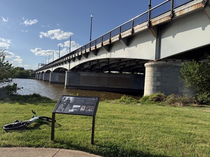
The John Philip Sousa Bridge links the communities of Fairlawn and Randle Highlands with neighborhoods on Capitol Hill. The bridge, completed in 1941, is the result of a multi-year lobbying campaign by the Southeast Council of Citizens . . . — — Map (db m297849) HM
In the early evening of November 22, 1963, a clutch of people stood forlornly on this bridge spanning Suitland Parkway. They awaited the procession carrying the body of slain President John F. Kennedy from Andrews Air Force Base to Bethesda . . . — — Map (db m130723) HM
One of the strongest bridge types, the arch bridge was used extensively by the Romans. The arch carries the weight of the roadway and vehicular traffic to supports at each end. — — Map (db m113615) HM
The cables connect structure supporting the roadway and traffic to the tower, stiffening or staying the bridge and enabling the tower to carry the required load. — — Map (db m113616) HM
Cantilever bridges carry heavy loads. The structure is built out symmetrically from each pier. The landward side is anchored and the other side may support an intermediate truss or be joined to the next cantilever. — — Map (db m112781) HM
Suspension bridges span the widest openings. Cables stretched over high towers conduct the weight of roadway and traffic to the anchorages at each end. — — Map (db m112737) HM
For the past six years, the NPS has been making temporary repairs to the bridge while planning a full rehabilitation. In February 2016, the Federal Highway Administration (FHWA) informed the NPS that despite these emergency repairs, without a . . . — — Map (db m140994) HM
On one side of Arlington Memorial Bridge stands the columned portico of Arlington House, the pre-Civil war home of Robert E. Lee. In that home, Lee made his decision to resign the US Army commission. He became the commanding general of Confederate . . . — — Map (db m142185) HM
In addition to being regarded as Washington's most beautiful bridge, Arlington Memorial Bridge was an engineering marvel when it opened. The bridge was originally designed by Joseph B. Strauss as a drawbridge, and has a large bascule span that . . . — — Map (db m150817) HM
Completed in 1932, Arlington Memorial Bridge was built in a neoclassical style and extended Pierre L'Enfant's (1754-1825) original plans for the District of Columbia. The bridge was designed by the prominent architectural firm of McKim, Mead and . . . — — Map (db m150819) HM
Built in 2004 as part of Mandarin Oriental, Washington D.C.'s development, this footbridge, connecting the hotel to Washington's Southwest Waterfront, was named and dedicated through a community-wide contest with The Washington Examiner in . . . — — Map (db m135434) HM
Originally constructed in 1809 as a mile-long wooden toll bridge connecting the District with Virginia, Long Bridge has seen many transformations and additions. In 1861, five days after the fall of Fort Sumpter, Robert E. Lee rode south on Long . . . — — Map (db m109421) HM
Originally constructed in 1809, the original wooden structure opened as a toll bridge that spanned the Potomac River, connecting the District of Columbia with Virginia—now carrying rail traffic as part of the 14th Street Bridge complex. — — Map (db m204405) HM
As an important link between the National Mall and Arlington National Cemetery, the bridge itself is a memorial to those who have given their lives for their country. As the ceremonial entrance to Arlington National Cemetery, numerous dignitaries, . . . — — Map (db m140991) HM
Arlington Memorial Bridge has served as a monument to the sacrifices and valor of our nation's military personnel since its dedication in 1932. Now that it is nearly 90 years old, the National Park Service and Federal Highway Administration are . . . — — Map (db m140993) HM
This old, concrete railway trestle is a remnant of the Florida Southern Railroad. Crews laid tracks here starting in 1882. The railroad played a major role in the founding and history of Gainesville. The Gainesville Hawthorne Trail now follows this . . . — — Map (db m126478) HM
Ernest Kouwen-Hoven, a land developer and promoter of Indialantic-by-the-Sea in 1918-19, realized that if the seaside town was to become a resort-residential community, a bridge must be built from the mainland to the peninsula. He contracted local . . . — — Map (db m110189) HM
The first wooden bridge from Eau Gallie to "Eau Gallie Beach" was started in 1924. The bridge was formally opened in February 1926. Soon after John R. Mathers began plans to build a bridge from the barrier island to the tip of Merritt Island. That . . . — — Map (db m75971) HM
Frank and Cleattie first came to Titusville in 1920 while traveling with the Hagenback-Wallace Circus. Frank was the Circus Band Director and Cleattie worked as a seamstress, making beautiful circus costumes. She also formed her own circus act with . . . — — Map (db m195982) HM
This pier was the western end of Walker Bridge, the first bridge linking Titusville to Merritt Island. Built in 1922, the hand-cranked, wooden drawbridge served the area until preparations for a modern causeway began in the late 1930s. Causeway . . . — — Map (db m100950) HM
The Covered Bridge was the first permanent structure built within the City by Coral Ridge Properties, developer of Coral Springs, in 1964. It withstood the eye of Hurricane Cleo that passed over it in August 1964 without sustaining any damage. The . . . — — Map (db m100391) HM
Lock No. 1, or Sewell Lock, was designed by world renowned engineers Major S. Sewell and Ben Johnson and built by the Furst-Clark Construction Company of Biltmore. It was part of the Everglades Drainage District and played a vital role in early . . . — — Map (db m100230) HM
During the 1920s Florida Land Boom, the present-day Nurmi Isles subdivision was dredged to create the four finger islands. Bridges providing access to each island were constructed, but no additional development occurred until Victor Nurmi purchased . . . — — Map (db m108909) HM
In the early 1980s, the eastern part of the City of Parkland (City) along Holmberg Road was known as Country Point. At that time, the Country Place residential community was under development on the north side of Holmberg Road and north of a . . . — — Map (db m244093) HM
Charlotte Harbor has provided food, industry, leisure, and transportation since pre-historic times. The first bridge connecting the towns of Charlotte Harbor and Punta Gorda opened in 1921, but was barely wide enough for two cars to pass.
In 1931, . . . — — Map (db m280927) HM
Near this point, the Bellamy Road crossed the Santa Fe River. The road was named for its builder, John Bellamy, a civil engineer. Approved by Congress in 1824 and completed in 1826, it was the first Federally funded road in Florida, connecting . . . — — Map (db m155320) HM
The McCoys Creek Improvement Project was a civic and transportation plan developed by Jacksonville City Engineer Joseph E. Craig in 1928. At the time, the McCoys Creek area was a breeding ground for mosquito-borne illnesses. Developed to reduce . . . — — Map (db m229765) HM
1900 • In the wake of the 1899 hurricane, downtown Carrabelle was moved to its present location. A Time of Prosperity Many larger buildings still standing today were constructed in the early 1900s. This was another boom time for . . . — — Map (db m299199) HM
The Georgia Florida & Alabama Railroad (GF&A), also known as the Gopher, Frog & Alligator, travelled from Carrabelle to Sopchoppy to Tallahassee during the early 1900s. This timber came from the trestle that went over a small creek crossing the . . . — — Map (db m276511) HM
Late in the 19th century the Godwin Bridge was built to span the river for both residential and commercial transportation (such as logging, cotton, and turpentine industries) to connect Hamilton and Columbia Counties. Floods swept the bridge away . . . — — Map (db m239390) HM
At the nearby junction of Jackson Street and the Hillsborough River was the east bank docking site of the Tampa Ferry, the only means of crossing the river in pioneer days. The ferry was an open deck, flat barge, hand pulled by means of a steel . . . — — Map (db m216191) HM
Fortune and Benjamin Taylor were brought to Florida from South Carolina in the 1850s. They were owned by the Howell family. At the end of the Civil War, the newly freed couple were among the first African Americans to legally marry. Freedom came to . . . — — Map (db m120259) HM
A parade of Model T automobiles crossed the first bridge to span the Indian River on Labor Day 1920. This made Vero the first community with a bridge to Orchid Island. Made of sabal palm pilings and rough-cut planking, it began on the mainland side . . . — — Map (db m136026) HM
The tee-beam bridge at this location carried traffic southbound on US-1 over the Florida East Coast Railway and Old Dixie Highway beginning in 1927. The tee-beam design, constructed from cast-in-place concrete beams and reinforced steel running . . . — — Map (db m95717) HM
Two Dollar Bluff, prominently featured on the U.S. Geodetic Map of 1887, was considered a navigational aid for ships on the Indian River. Located on property owned by settler and citrus grower A.B. Michael, this bluff was an Ais Indian midden and . . . — — Map (db m212947) HM
The Fanning Springs Bridge was built by the State of Florida.
In 1934 it was officially named the Benjamin Chaires Bridge in honor of a prominent pioneer settler of Dixie County.
Located 29 miles north of the Gulf of Mexico, it held the . . . — — Map (db m17709) HM
At this location over Wares Creek once stood one of the oldest concrete arch deck bridges in the State of Florida. Designed by noted local civil engineer Freeman H. Horton, the former 9th Avenue West bridge was constructed during World War II by the . . . — — Map (db m100899) HM
The original bridge over Longboat Pass was built in 1923 by Manatee County. It washed away in a high tide in 1932.
The foundations are still in place and mark where the pass used to be. The south foundation of the old bridge is on shore partially . . . — — Map (db m261041) HM
From Separation to Connection High above Interstate 75, this landbridge was the first of its kind in the country. The land it sits on was originally intended to be part of a massive canal across Florida. The canal would have split the state in . . . — — Map (db m166698) HM
Thee pilings are the remains of the Florida East Coast Railway freight dock, once a center of local commerce for many years. Fish and pineapples were shipped from Stuart by the boxcar load.
In 1918, when the first auto-bridge spanned the St. . . . — — Map (db m226363) HM
A rare example of a Hanover Skew bridge once crossed the Miami Canal at this location. The bridge, completed in 1952, was built to carry increasing automobile traffic to and from Miami International Airport, southwest of this location. In the early . . . — — Map (db m120652) HM
Considered one of the oldest natural landmarks in southeast Florida, the Miami River evolved over thousands of years from a tidal channel into a freshwater stream that carried water from the Everglades in the west to Biscayne Bay in the east. At the . . . — — Map (db m228998) HM
The South River Drive Historic District contains the oldest surviving Frame Vernacular boarding houses along the Miami River and illustrates the historic development of Miami beyond the downtown area and along the riverfront. Completed by 1915, . . . — — Map (db m229002) HM
The City of Miami Beach, the Consulate of France in Miami, and The Wolfsonian-FIU are pleased to dedicate this Bridge Tender House in honor of French-American entertainer Josephine Baker, a legendary Black artist and inspirational activist. Baker’s . . . — — Map (db m269012) HM
Until 1973, when it collapsed, the forty foot natural bridge of oolitic limestone that spanned Arch Creek was one of South Florida's earliest landmarks. Prehistoric Indians occupied this site hundreds of years before European exploration. In the . . . — — Map (db m77645) HM
The natural limestone that once spanned the Arch Creek served as a crossing place for prehistoric Tequesta Indians, Seminole War soldiers and early pioneers. It was a natural wonder of great beauty and a scenic gathering place from which eventually . . . — — Map (db m100667) HM
In 1918 Charles Deering constructed this bridge to cross Cutler Creek on the way to his retirement home. At the time this accessway was called "Old Cutler Road". Deering relocated it from its original location inside the natural areas of his . . . — — Map (db m79320) HM
Before 1951, Duck Key was an isolated island with minor salt production and cultivation of sea cotton. In 1951, Miami developer Bryan W. Newkirk Sr. and his business partners, Telfair Knight, Robert Eugene Otto, and his son, Bryan W. Newkirk Jr. . . . — — Map (db m310033) HM
The veterans of World War I were promised a bonus but due to the Great Depression of the early 1930s the government was without funds.
Roosevelt was president and formed the Florida Emergency Relief Administration to create jobs for those . . . — — Map (db m116064) HM
In April, 1926, Monroe County began construction of a road on the east end of Upper Matecumbe to connect with other islands. It eventually made it possible to drive to Key West by using a ferry.
The first car drove to Key West on Jan. 25 1928 . . . — — Map (db m83879) HM
Established in 1934, during the Great Depression, Camp Three housed 250 Bonus Army veterans until September 2, 1935 when one of the worst hurricanes ever recorded destroyed everything there. The eye of the hurricane passed over nearby Craig Key with . . . — — Map (db m83592) HM
The "Overseas Railroad" was a masterpiece of engineering, proclaimed the "eighth wonder of the world." In 1904 Henry M. Flagler, oil magnate, hotelier, and owner of the Florida East Coast Railway, coined the battle cry for his engineers, "Go to . . . — — Map (db m224640) HM
A swing span bridge once crossed Jewfish Creek just beyond this location. Early in the construction of Henry Flagler’s Overseas Railway from the Mainland to Key West, Jewfish Creek was identified as a critical site along the route. In 1905, . . . — — Map (db m150853) HM
From 1887 to 1904, Henry Flagler's railroad connected his many hotels seen here on the illuminated floor map. Railroad connection along the East Coast opened up the entire state to commerce, all the way to a once sleepy village now known as Miami. . . . — — Map (db m258555) HM
Flagler became the second richest man in America as creator and brains of the Standard Oil Company. His partner was John D. Rockefeller. Flagler went on to build Florida in a two decade span during which he created the Florida East Coast Railroad. . . . — — Map (db m222211) HM
Marathon began in 1908 as construction headquarters and chief shipping terminal for Henry M. Flagler's "Overseas Railway" to Key West. Through it passed thousands of workmen and immense quantities of material and supplies. At near by Knight's Key . . . — — Map (db m146247) HM
(side 1)
Knights Key Segment
Between 1905 and 1912. Henry Flagler extended his Florida East Coast (FEC) Railway to Key West. This massive engineering project, called the Overseas Railroad, required 23 bridges that utilized the most . . . — — Map (db m245787) HM
Oil magnate Henry M. Flagler first visited Florida in 1878. Realizing Florida’s potential for growth, he developed railroads and hotels which transformed the eastern seaboard. The Florida East Coast Railroad reached Miami in 1896 and soon was . . . — — Map (db m150462) HM
Rep. George Crady was born in Miami in 1931, the third of five children born to Syrian immigrants. He grew up in Jacksonville, graduated from Duke University, and served as a U.S. Marine helicopter pilot before relocating his family back to . . . — — Map (db m259695) HM
This fossil Gateway is composed of the
giant bones of a Brachiosaurus, one of the
largest creatures that ever walked the earth.
It stands fifty-two feet tall and more than
eighty feet long. A peaceful plant-eater,
the Brachiosaurus' enormous . . . — — Map (db m198209) HM
H. H. Dickson Azalea Park
Dickson Azalea Park began as a natural stream, later named Fern Creek, in a deep ravine surrounded by native ferns, palms, and oaks. It once was a watering hole for cattle herders driving their animals south. State . . . — — Map (db m93268) HM
During the late 1800s, Henry Morrison Flagler built numerous resort hotels and a railroad network, the Florida East Coast Railway, along the east coast of Florida. In 1894, Flagler constructed the Royal Poinciana Hotel in Palm Beach, which became . . . — — Map (db m157236) HM
The first bridge crossing the Withlacoochee River at this site was built in the 1850s by slaves belonging to James Lanier. Replaced several times during the following century, the bridge served lumber, turpentine and cattle operations along with . . . — — Map (db m213957) HM
For his lifetime of community service to residents of Pasco County as a Family Physician of 58 years, a Navy WWII Veteran and former City of New Port Richey Councilman, who in 1966 ensured that there would be continued access for emergency . . . — — Map (db m216420) HM
The Seminole Bridge was the original link to Clearwater Beach. Completed in 1917, the wooden bridge opened up access to the beach and paved the way for its first development. The bridge terminated where the Palm Pavilion stands today. It became . . . — — Map (db m3252) HM
Constructed as a toll bridge for auto and street car traffic by George S. Gandy, a pioneer West Coast developer, it was begun in 1922 and opened in 1924. The structure consisted of 3¼ miles of causeways and 2½ miles of bridge, and at its . . . — — Map (db m129358) HM
Speed from shore to shore
The Gandy Bridge, revolutionized travel between Tampa and St. Petersburg. The bridge shortened the distance between the two cities from 43 miles to 10 miles. The Reduction in mileage improved travel and boosted St. . . . — — Map (db m254670) HM
In Memoriam
On May 9, 1980, the freighter Summit Venture struck the southbound Sunshine Skyway Bridge during a sudden and violent storm. Six cars and a passenger bus fell 150 feet into the bay. Thirty-five persons were lost.
Duane P. . . . — — Map (db m243696) HM
The first bridge on this site was built along with the original Fort Meade
in the mid-1800s. The crossing was in constant need of repair and
reconstruction to serve military and civilians along the Peace River.
The county began construction of . . . — — Map (db m290362) HM
The natural ravine was developed into Ravine Gardens in the 1930s by the City of Palatka and the Federal Government. The suspension bridges and amphitheater built at that time have been placed on the National Register of Historic Places. . . . — — Map (db m130074) HM
Palatka Memorial Bridge
Visualized in 1921 at an estimated cost of $375,000, the Memorial Bridge spanning the St. John’s River was completed six years later. The bridge was considered at that time to represent the highest type of modern . . . — — Map (db m78142) HM
The Marquis Bayou Bridge, named for George Marquis, the owner of a local saw mill that operated in the mid-1800s, opened in 1937. A Santa Rosa County delegation that included future Florida Governor Millard Caldwell helped to make the bridge a . . . — — Map (db m98374) HM
Cedar Point/Sunset Park
Cedar Point, a hook of land on Sarasota Bay, was platted in 1899 and recorded as an addition to the Town of Sarasota in 1900. Split into north and south sections by North Gulf Stream Avenue, Cedar Point was home to . . . — — Map (db m97107) HM
Crossing the St. Johns River at Lake Jesup impacted both travelers and the environment over the years. Prior to 1900, people and goods were almost exclusively transported on the St. Johns by steamboat, with several large wharves around Lake Jesup . . . — — Map (db m93041) HM
The Lake Monroe Bridge was the first electrically operated swing bridge in Florida. In 1932-33 the State used federal assistance to build this bridge, which replaced a wooden toll bridge that was manually operated. The construction of the bridge . . . — — Map (db m45490) HM
This is the top of the turning mechanism which was positioned just below the floor of the old Osteen Bridge (1926-1977). This bridge crossed the St. Johns River on Highway 415, east of Sanford. The position of the mechanism cannot be entirely . . . — — Map (db m179063) HM
Named in honor of the St. Augustine and North Beach civic leaders, Francis E. and Mary Borum Usina. Just as the bridge spans the North River to connect the St. Augustine mainland with Vilano and North Beach, so too the Usinas were strong links . . . — — Map (db m47557) HM
The monumental and graceful lions that guard both sides of the Bridge of Lions are modeled from the historic Medici Lions that once adorned the Villa Medici in Rome and are now displayed in the Loggia dei Lanzi in Florence, Italy. The first pair . . . — — Map (db m220177) HM
An early coquina stone and wood span from which Bridge Street takes its name once extended westward across the now-filled Maria Sanchez Creek from an area under the Star General Store. Here archaeologists found the eastern footers of the bridge . . . — — Map (db m285518) HM
(Panel 1)
(Captions)
Kris’s Building - South Beach St. - 1940’s photo courtesy of Halifax Historical Museum
Memorial Riverfront Park - 1950’s photo courtesy of Halifax Historical Museum
. . . — — Map (db m217310) HM
(Panel 1)
(Captions)
Sign on the Halifax River, Mainland Side - 1930’s photo courtesy of Halifax Historical Museum
Halifax Journal - South Beach St. - 1890’s photo courtesy of Halifax Historical . . . — — Map (db m217306) HM
You are standing at the historic terminus of Broad St. Through this iron gable - which represents an original wooden covered bridge to Cook & Brother Factory - you can view historic Downtown Athens. — — Map (db m195756) HM
Can't Get There from Here
The Trail Creek trestle, fondly known as the "Murmur Trestle" was part of the former Georgia Railroad line that connected Athens to Augusta via Union Point, Crawford, and Winterville. The line was first chartered in . . . — — Map (db m296411) HM
The iron truss bridge across the Oconee River was constructed in 1899. It was restored in 2011-2012 with generous support from Robert E. and Sylvia Mathis Gibson, the Athens Area Junior Board of the Watson-Brown Foundation, and members of the . . . — — Map (db m249150) HM
Run -off water from the upper piedmont forms the Oconee (a Native American word meaning "river").
Below the Appalachian Mountains of North Georgia, the Oconee River headwaters begin in the rolling hill country of Hall and Gwinnett Counties . . . — — Map (db m207633) HM
Built around 1885, a wooden covered bridge connected the mill community of Potterytown to the Check Factory textile mill.
On this site the mill bridge brought East Broad Street to the front door of the mill. By 1909, this bridge was replaced . . . — — Map (db m207642) HM
On this site in 1882, the original Hurricane Shoals Covered Bridge was completed, spanning some 127 feet at the cost of a mere $1,433. Vandals burned the old bridge in 1972, spoiling a community landmark and transportation corridor that had been in . . . — — Map (db m109855) HM
The covered structure over the Etowah here, was burned by Jackson's [CS] Cav. May 21, 1864, the day after Johnston´s [CS] passage of the river at State R.R. Bridge. May 23rd, the 2 pontoon bridges intended for the passage of Schofield's 23d . . . — — Map (db m13840) HM
In 1886 the county contracted with Washington W. King, son of freed slave and noted bridge builder Horace King, and Jonathan H. Burke for the construction of this 138-foot bridge. It was adjacent to a mill owned by Daniel Lowry, of which the . . . — — Map (db m8478) HM
During the Civil War, Gillam's bridge at this location played a pivotal role in the advance of Union troops south toward Atlanta. After the Civil War and the destruction of the bridge, a ferry operated at this site transporting people and goods . . . — — Map (db m171179) HM
In 1864, this covered structure spanned the Etowah River on the plantation of Andrew F. Woolley, 0.5 mi. S. Next to the river was the Rome - Kingston R.R. discontinued, 1943. May 19, McPherson's Army of the Tenn. (15th & 16th Corps) [US] arched . . . — — Map (db m13925) HM
Railroad Overpass In 1833, the Central Railroad & Banking Company of Georgia was established and within ten years the railroad company constructed a main line between Macon and Savannah, a distance of 160 miles. In 1843, the rail line was . . . — — Map (db m244488) HM
This land is part of the former Ivanhoe Plantation property of the Whitehead family. The plantations home was located near the northeast corner of the Quaker road and the Walker Bridge road (Story Mill Road). A diary kept by 26-year-old Catharine . . . — — Map (db m103374) HM
In Nov. 1864. movements of Kilpatrick's cavalry division (USA) of Gen. Sherman's army which had left Atlanta on the 15th on its destructive March to the Sea, indicated an advance on Augusta via Waynesboro. To protect this crossing of Brier Creek, . . . — — Map (db m281645) HM
Swinging Bridge was constructed near the end of 1800's, probably by the city of Ringgold. It provided the farmers and school children that lived on the south side of the creek a safe crossing into Ringgold. There was a ford for use by wagons below . . . — — Map (db m82884) HM
The Georgia Central Rail Road and Canal Company began construction of a rail line from Savannah to Macon in the late 1830s. The company built a large embankment to carry the line across the Musgrove Creek floodplain to a wooden bridge over the . . . — — Map (db m222222) HM
Although the Savannah River provided an avenue to the sea, it also presented a barrier to overland travel and transportation. Rochester Ferry, later named Screven's Ferry, was established in 1762 and connected Savannah with a roadway in South . . . — — Map (db m19450) HM
Side 1:
The second covered bridge across the Chattahoochee River, connecting Clay County, Georgia and Henry County. Alabama was constructed between 1867-69. Bonner and Walden, a New York construction company, were the original contractors . . . — — Map (db m254009) HM
3933 entries matched your criteria. Entries 401 through 500 are listed above. ⊲ Previous 100 — Next 100 ⊳