808 entries match your criteria. The first 100 are listed. Next 100 ⊳
Native Sons/Daughters of the Golden West Historical Markers
The NSGW was formed by Albert Maver Winn in 1875 to preserve the California historic buildings and sites of the Gold Rush and prior. The only requirement to be a member is to have been born in California. The sister organization, NDGW, followed soon thereafter.
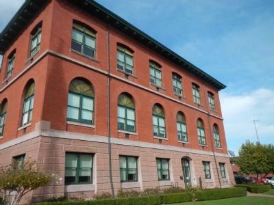
This city hall is one of oldest operating city hall buildings in the State of California. It was constructed in 1895 in the Romanesque style and has been in continual use as a city hall since its completion.
Original construction:
Building . . . — — Map (db m62216) HM
Alameda Lodge No. 1015 of the Benevolent and Protective Order of Elks was formed by 25 Alameda residents who were members of Oakland Lodge No. 171. The Lodge was instituted on March 17, 1906 and it received its charter from the Grand Lodge on July . . . — — Map (db m79864) HM
[Center and Main Marker:]
This plaque marks the terminus of the First Transcontinental Passenger train that started in New York City and terminated at Alameda Point Pier on September 6, 1869. Erected by the U.S. Naval Air . . . — — Map (db m150959) HM
Donated to the city of Alameda in 1920 by Park Avenue resident Isabella Derby Clark, this concrete bench was designed by Myrtle Maillot. Mrs. Clark was a proponent of animal welfare. The inscription "In memory of my dumb friends" is a reference to . . . — — Map (db m101553) HM
Organization of the First Presbyterian Church of Alameda began in 1864. By 1865, the church had 12 charter members. Traveling ministers delivered Sunday sermons until 1867 when Reverend Nash was installed as the first pastor.
The first sanctuary . . . — — Map (db m62217) HM
The Meyers House was erected in 1897. This Colonial Revival style home was designed by and built for prominent East Bay architect Henry H. Meyers. It served as the family residence from 1897 to 1993.
Meyers designed the Posey Tunnel Portals, . . . — — Map (db m79862) HM
On April 1, 1942, sixteen B-25 bombers were hoisted to the flight deck of the carrier Hornet and parked there, while moored at Pier No. 3 at U.S. Naval Station in Alameda. The B-25 detachment consisted of seventy officers and one hundred thirty . . . — — Map (db m29431) HM
This home built in 1854 for John Nelson Webster and Caroline Webster is Alameda’s oldest house. The house is a primary example of Gothic Revival architecture by renowned architect Andrew Jackson Downing. The house was prefabricated in New York, . . . — — Map (db m78903) HM
[Marker #1]
In Memory of Those Who
Made the
Supreme Sacrifice
in the World War
C T Vinther • J T Gimbel • A H Ohman
Berkeley Parlor No 210 Native Sons of the Golden West
[Marker #2]
This Tree . . . — — Map (db m221928) HM
This site was part of the original Don Castro Land Grant. In 1866 pioneer settler Josiah Grover Brickell made a land grant of this site for “educational purposes only” and paid the teacher’s salary, who taught children by day, in a one . . . — — Map (db m100557) HM
This tablet dedicated
May 30, 1947 as part of ceremonies
commemorating the one hundred
and fiftieth anniversary of the
founding of Mission San Jose by
Father Fermin Lasuen, June 11, 1797. — — Map (db m162158) HM
At the Ohlone Indian village of Oroysom, Padre Fermín Francisco de Lasuén founded this fourteenth of twenty-one Franciscan missions June 11, 1797. Taught by Padre Narciso Durán, the Ohlone Orchestra and Choir became famous. By 1830 almost 2,000 . . . — — Map (db m100551) HM
According to legend, in 1790, a young Spanish couple looking for food and lodging arrived at Don Guillermo Castro’s hacienda. After eating, the couple was directed to a lone tree, atop a nearby hill, so they could enjoy the view of the area. Later . . . — — Map (db m176285) HM
Original site of corrals of Don Guillermo Castro and part of 26,722 acre grant of Rancho San Lorenzo made by Governor Michaeltorena, 1842. Rancho adobe stood on present site of City Hall. Castro’s wife was Marie Luisa Peralta, daughter of grantee . . . — — Map (db m41629) HM
Here, in 1883, James Concannon founded the Concannon Vineyard. The quality it achieved in sacramental and commercial wines helped establish Livermore Valley as one of America’s select wine growing districts. Grape cuttings from this vineyard were . . . — — Map (db m100553) HM
Born in England 1799 – Died Rancho Las Positas 1858. Arrived in Monterey 1822. Married Josefa Higuera y Puentes 1830. Settled on Rancho Las Positas 1835.
“Next to the Mission Fathers, he was the first man to engage himself in the culture of . . . — — Map (db m199846) HM
Current site constructed 1923
Alameda County, California
For the purpose of providing
a continuation of essential
education and learning
Angelita Parlor No. 32, N.D.G.W, Livermore, California
Donner Parlor No. 193, N.D.G.W., Byron, . . . — — Map (db m92924) HM
Joaquin Miller, “Poet of the Sierras,” resided on these acres, named by him “The Hights,” from 1886 to 1913. In this building known as The Abbey, he wrote “Columbus” and other poems. The surrounding trees were planted by him and he personally . . . — — Map (db m100546) HM
In Memoriam
of the boys of this district
who made the supreme sacrifice
Dedicated Sunday July 10th 1921
by Claremont Parlor No. 240 N.S.G.W.
and affiliated organizations
This plate donated by H.T. Burns — — Map (db m136739) WM
Built by George Johnston pioneer landowner and
sheepherder in 1896 on portion of Rancho El Valle
De San Jose granted by Governor Alvarado to Pico
Bernal and Sunol in 1839 later owned by Juana
Higuera Bernal a 19th century architectural . . . — — Map (db m193945) HM
John W. Kottinger one of pioneer founders and first Justice of the Peace of Pleasanton constructed this adobe brick barn about 1852. So built that part of it could house prisoners brought to justice in his court. Thus serving as Pleasanton’s first . . . — — Map (db m24592) HM
This grandstand is located on a portion of the historic Rancho El Valle de San Jose, granted to Pico, Sunol and Bernal by Mexico in 1839 forming part of Mission San Jose lands. Early settlers trained and raced horses here over 100 years ago. — — Map (db m65971) HM
In 1864, five years before the first railroad arrived in Pleasanton, John W. Kottinger demonstrated his faith in Pleasanton”s future by building the communities first hotel, The Farmer’s Hotel.
The building was purchased by Henry in 1891 and . . . — — Map (db m24607) HM
On August 21, 1909, the cornerstone (containing the lists of the Grand Officers and past Masters of Eden Lodge, documents relating to the new temple, copies of local newspapers, old coins and a Bible that had been carried by John Hamilton through . . . — — Map (db m54746) HM
Courthouse of Alameda County on this site early months of 1855. Moved here officially on March 10, 1856 by act of Legislature February 8, 1856. Site donated for county purposes by Jose Joaquin Estudillo. Courthouse move to Oakland 1873. — — Map (db m26411) HM
The first court house where Alameda County government began, June 6, 1853. Officials met in two-story wooden building erected by Henry C. Smith and A. M. Church as merchandise store. Seat of government moved to San Leandro in 1856 following vote of . . . — — Map (db m28910) HM
On this spot, which marks the summit of the Kit Carson Pass, stood what was known as the Kit Carson Tree on which the famous scout Kit Carson inscribed his name in 1844 when he guided the then Captain John C. Fremont, head of a government exploring . . . — — Map (db m100568) HM
This building was designed by Frederic J. DeLongchamp, a designer and engineer of mining, born in Reno, Nevada, on June 2, 1882 and educated in Nevada. He designed 500 buildings, libraries, hotels, and post offices in the counties of the State of . . . — — Map (db m635) HM
The construction of this historical complex was initiated in 1964, "Alpine County's Centennial Year", by the Historical Society of Alpine County. With concerted effort and fortitude it was completed and duly dedicated as a historical landmark on . . . — — Map (db m3088) HM
John A. “Snowshoe” Thompson (1827-1876) Native of Norway who carried mail across the Sierra Nevada on skis, assisting the needful for twenty years, dwelt and died on this site.
Dedicated on June 30, 1990
Native Sons of the Golden . . . — — Map (db m21301) HM
This building was designed by Frederic J. DeLongchamps, a designer and engineer of mining, born in Reno, Nevada, on June 2, 1882, and educated in Nevada. He designed 500 buildings, including schools, courthouses, commercial structures, and . . . — — Map (db m3089) HM
Historic Woodfords Station, the Eastern Sierra gateway to the goldfields of California, way station of the famed Pony Express, and entrance to Carson Pass on the Emigrant Trail to the Sacramento Valley. Beginning in 1849 with the building of the . . . — — Map (db m195369) HM
Present two story brick structure was completed in 1879. Designed as a mercantile store, then converted to hotel and boarding house to accommodate local miners and travelers. Remained in operation until 1927. Walls at the base are twelve bricks . . . — — Map (db m9005) HM
Rich placer mining, 1850’s. Origin of town’s name: Lack of water in nearby creek to wash gold. Many Chinese laborers in fields & mines. East gateway to New Chicago, New Philadelphia, Amador City; Quartz mines: Fremont-Gover & Treasure (1867), Bunker . . . — — Map (db m74124) HM
Hiram C. Farnham built this home for his bride, Eunice Haynes. It overlooked the creek and steam powered sawmill that he built with James McLeod in 1853 to serve the new rich gold strike in Fiddletown. The boomtown was served by six stagecoaches a . . . — — Map (db m41369) HM
Buena Vista's store and house situated in Jackson Valley, was built by John Fitzsimmons, then sold to Sam Cook, then to James Norris and afterwards to Jacob and Verona Strohm. Once situated in Lancha Plana it was moved by the Chinese who discovered . . . — — Map (db m10189) HM
General merchandise store built by Daniel Stewart in 1856. First brick building erected in Ione Valley from nearby Muletown brick. Ione, once known as "Bed-Bug" and "Freeze-Out” was an important supply center on the main road to the Mother Lode and . . . — — Map (db m100587) HM
Built in the 1860’s of Ione Brick by Brewers Raab and Huttner. Served as a Brewery for Over 30 Years. In 1907 C.C. Prouty Moved His Creamery to this Site. A Soda Works and Ice Plant Were Installed in 1910. Various Businesses Have Occupied the . . . — — Map (db m15825) HM
Originally built as the three story commercial hotel in 1864, razed by fire and re-built as a one story building in 1930. Remodeled in 1966 by the City of Ione as its City Hall.
Mayor
David S. Mason III
Councilmen
Jack Gasawawy • . . . — — Map (db m2373) HM
The first high school in Amador County was erected on this spot in 1903 by the Ione Academy, a private corporation. The original two-story frame structure, built at a cost of $2,287, housed the school until 1939. As a result of the steady growth in . . . — — Map (db m94743) HM
This building, built in the year of 1854, was originally a hardware store on the ground floor and a dance hall on the upper floor.
Ione Parlor No. 33, N.S.G.W. bought the building in the year 1884 and has continuously owned it and met here . . . — — Map (db m2380) HM
In 1876 Ione’s Annual Picnic moved from Shakeley Hill to this location. The 100 acre park is part of an 1840 land grant and was leased to the city by the Howard Estate May 11, 1967. The park during it’s early years hosted many of the important horse . . . — — Map (db m42400) HM
Looking North from this monument lies 5.22 acres which was originally deeded to Ky Kee, Hop Wah Chung, Quong On Long and Chang Hang Co. in 1883. Known as Chinatown, the community was comprised of stores, homes and a Joss House. At the peak of . . . — — Map (db m42397) HM
Quincy, located approximately 1 1/2 miles east of here off Mule Creek, was one of the cities within the boundaries of Rancho Arroyo, or the grant, that suddenly appeared in the early 1850's.
Don Andreas Pico purchased the grant from Teodosio . . . — — Map (db m94747) HM
Property settled by J. P. Martin in 1848. Home built circa 1852. Purchased in 1882 by William Scully, who arrived from Ireland in 1854. The Scully family has owned and operated the ranch for five generations. Present owners are Robert and Etta . . . — — Map (db m42398) HM
Two German orphaned immigrant brothers come to the United States of America. One of them, John Hermann Deutschke finds his way to California and marries Maria Agnes Winter who was widowed on the journey west. In 1862, he purchases the first of . . . — — Map (db m176165) HM
Built circa 1863, this imposing residence with its classical columns, two-storied gallery, French window and fan transom, is an important local representative of the Greek Revival tradition in America. The house, constructed of locally fired brick, . . . — — Map (db m94748) HM
On the hill to your right stand the remains of the Argonaut Mine gallus (headframe), beneath which 47 miners were lost when a fire broke out deep in the main shaft on August 27, 1922. At that time the Argonaut was one of the deepest gold mines in . . . — — Map (db m94781) HM
Constructed by Italian stone mason in 1857. Served pioneer settlers and miners as post office and general store later later known as Ginocchio's. — — Map (db m100579) HM
This building was constructed circa 1860 as the Constitution Saloon, making it one of the oldest, permanent buildings in Jackson. First owned by William A. Phoenix, the first sheriff of Amador County, the brick and stone structure survived the . . . — — Map (db m176164) HM
Excelsior Parlor #31 was organized near this site on June 28, 1884. The building was the site of See & Marshall’s Circus lot in 1851, the Fireman’s Hall from 1850 through 1862 and Mat Ryan’s Saloon until purchased by the Native Sons of the Golden . . . — — Map (db m71556) HM
In 1848, was a village of huts and tents called
"Bottileas”
by the Mexicans from the bottles strewn about by those who tarried here.
In 1849, it was named
Jackson
for Colonel Jackson an early day resident.
In 1853, Amador . . . — — Map (db m72060) HM
This trusty bell served Jackson
faithfully for over 70 years.
Located in tower near courthouse.
Warning of fire or other peril.
Dedicated July 8, 1989 by
Amador County Historical Society
and
Excelsior . . . — — Map (db m19750) HM
In the late 1850’s, Andrew Kennedy discovered gold in an outcropping of quartz. The mine produced over $34.2 million in gold, making it one of the richest gold mines in the world. With a depth of 5,912 feet, it was the deepest mine in North America . . . — — Map (db m19797) HM
The Order or Native Daughters
of the Golden West
was organized on these premises
The site of the
Pioneer Hall
on September 1, 1886.
This tablet is placed
In memory of
the founding of the order
by
Ursula Parlor No. 1, . . . — — Map (db m28039) HM
Voters on July 17, 1854, selected Jackson as the county seat of the new County of Amador, born that June 14 after a spirited election. Fulfilling their promise, the Jackson town trustees, at no county expense, financed construction of the first . . . — — Map (db m27910) HM
St. Sava Serbian Orthodox Church was erected in 1894. It is the first Serbian Orthodox church built in the U.S. Rev. Sebastian Dabovich, first Priest in this parish. Born in S.F. & reared in nearby Plymouth. Inspired his people in the early 1890’s & . . . — — Map (db m11514) HM
Under This Tablet Is
The Court House Well
Dug in 1851, 52 feet in depth
For generations it was a main
source of domestic water
for the community.
“Gone is the ancient equipment
but still the living water flows.” . . . — — Map (db m27908) HM
The Foothill Station became the first University of California qualifying outlying station funded jointly by federal, state and local county sources in March 1888. The station was developed under the patronage of Senator A. Caminetti of Jackson. . . . — — Map (db m72065) HM
First structure on site built in 1851. Bar portion of building erected in 1856 as drug store. Wells Fargo Express Agency moved to store briefly in 1887. Two story section built in 1858, used as a general store. Easterly one story section built in . . . — — Map (db m27857) HM
Michael (“Mike”) Tovey, Wells Fargo Messenger was killed and DeWitt Clinton Radcliff, stage driver injured on this spot, June 15, 1893, by a lone bandit who attempted to hold up the regular six-horse stage on the old Ione - Jackson Stage . . . — — Map (db m41555) HM
Established as Foster’s Trading Post in 1855, this building was constructed in 1862 when this area was known as Spring Valley. It later became Smith’s Hotel which boasted a “carpeted parlor for the ladies.” The building and the 640-acre homestead . . . — — Map (db m175870) HM
Copper mines patented 1873:
Peak Outputs: Early 1860’s, 1895-1917, 1943-1947,
Township organized 1854.
A Methodist center for many years
U.S. Postoffice: 1862-1905 — — Map (db m11361) HM
This bell called the children of Shenandoah Valley to school. The school district was first named Williams after the family with the most children, then changed to Shenandoah in 1916. In 1952 with the creation of the Oro Madre School District . . . — — Map (db m10350) HM
Amador County, carved from Calaveras and El Dorado, was organized July 3, 1854, at the crossroads of Sutter Hill.
Act of Legislature, May 11, 1854, set June 17, 1854, as election date for people to vote on such a division, and appointed five . . . — — Map (db m11222) HM
In Memory of General John A. Sutter, benefactor of the Great State of California, who mined here and gave Sutter Creek its name and under whose regime gold was discovered.
Also to those pioneer mothers, fathers and miners of the Mother Lode, . . . — — Map (db m13407) HM
Typical of old country stores at the turn of the century. Opened in 1898. Over its counter and from its shed, the Monteverde Family offered for sale all manner and description of merchandise. The emporium served as a meeting place for housewives, . . . — — Map (db m8975) HM
Knight Foundry was established in 1873 to supply heavy equipment and repair facilities to the gold mines and timber industry of the Mother Lode. Samuel N. Knight developed a high speed, cast iron water wheel which was a forerunner of the Pelton . . . — — Map (db m100590) HM
The front building built in 1860. The opera house was built on back in 1892 by John and Michael Levaggi, early pioneers and stone masons from Italy. Bricks used were kilned east of Sutter Creek and hauled to the site by twelve mule team. Amapola . . . — — Map (db m29814) HM
Sutter Creek, California
Left Panel:
Like many communities in the Sierra Foothills, Sutter Creek grew out of the great gold rush of 1849. Thousands of men of every nationality arrived seeking fortunes through toil, sweat, and luck. . . . — — Map (db m106380) HM
In 1851 first building to be erected on south part of site, was Hanford and Downs General Store. That stores Liberty flag pole, marked center of incorporated town, 1854. In 1865, most of building destroyed by fire. Purchased in 1875 by Giovanni B. . . . — — Map (db m10744) HM
The Old Eureka Mine was first opened in 1852 and comprised the Amador, Maxwell, Alpha, and Railroad claims. At various times it was known as the Hayward, Eureka, Hetty Green, Badger and Wolverine, and Amador Consolidated mines.
One ore shoot . . . — — Map (db m240055) HM
One of Sutter Creek’s legends is that John Sutter founded this city in 1846 when he established a sawmill on the creek. But modern researchers have discovered he actually sent men into the Sierra foothills at least by 1844 to a place about four or . . . — — Map (db m176322) HM
On September 4, 1854 Sutter Creek was declared by Judge Marion Gordon an incorporated town. Sutter Creek's limits were one mile square. The center was "The Liberty Flag Pole", atop Main Street (Little Humbug Hill) where the Native Sons Hall stands . . . — — Map (db m94113) HM
In 1861 under leadership of Rev. I.B. Fish this church was built . Trustees incorporated the church as the Methodist Episcopal Church in 1862. Between 1863 and 1867 the Ladies Aid Society gave $1,300 for the back room addition. The steeple was added . . . — — Map (db m13684) HM
Within the bell
The following is inscribed
"Hung by G. Chisholm, Dan Ramazzotti
Oct. 18, 1907
Director – F. N. Soracco, F. Warner
E. Deacon – Sutter Creek Fire Co.
Cast by A. Fulton’s Son and Company
Pittsburg, PA.
Ordered by . . . — — Map (db m94750) HM
The Berry Creek Cemetery, sometimes referred to as the Lake Madrone Cemetery by local residents, served as a community graveyard for many years. The earliest known date of death for a person interred here is 1875. The cemetery fell into disrepair in . . . — — Map (db m61683) HM
Main Marker:
Burials here date back to the early 1860’s but it was 1900 before the first cemetery association purchased the land from Theodore Willrich and started keeping records. In 1958 a few residents re-formed the organization which . . . — — Map (db m29709) HM
Erected in 1894 by C.H. Hintz this building was used continuously for school purposes until 1966 when due to unification, pupils were bussed into Chico. The first teacher was Miss Ada Woods. Cost of building was $600.Purchased by Centerville . . . — — Map (db m29692) HM
Honey Run Bridge
Erected
1894
By George Miller
Gold Dredge
The first bucket line gold dredge to operate below the covered bridge used this tumbler – 1898. — — Map (db m29682) HM
This marker symbolizes the discovery of the first large gold nugget in California. It was found across this canyon in Willard Gulch April 12, 1859. Weight 54 pounds. — — Map (db m29663) HM
Erected by Argonaut Parlor No. 8 Native Sons of the Golden West and Butte County Board of Supervisors, to designate the site of the second county seat of Butte County - Bidwell's Bar 1853 – 1856.
Site of the Court House was 120 yds. west of this . . . — — Map (db m100598) HM
In memory of
James D. Braselton
his wife
Anna C. Braselton
and their family
The erection of this historical monument
marking the site of their home here at
Garden Ranch built in 1887 and the
Braselton Room in the Oroville . . . — — Map (db m69789) HM
To Commemorate completion of 4th Railroad in California – Marysville to Oroville, by California Northern Railroad, later the Southern Pacific Co. 1st passenger train February 9 – 1864. Also marks site of Middletown 1854 – 1856. — — Map (db m190381) HM
This tablet commemorates
the establishment
of the
First Banking Institution
in
Ophir
now
Oroville
which was located on this site
and occupied by
McWilliams & Tymeson -
G.A. Emery - Geo. Faulkner & Co. 1855-1865 . . . — — Map (db m25694) HM
In 1911, Lawrence Gardella, an Oroville native and successful dredge operator, built this commercial structure to replace the historic Gem Saloon as part of Oroville’s prohibition movement, which was one of the finest in its day. The first floor . . . — — Map (db m219769) HM
In 1888, James C. Gray purchased Brock and Tabor Hardware at 1950 Montgomery Street. That purchase included the lot you are standing on now. In 1898 Gray built a 50‘ by 100‘ building to house Ophir Hardware. The original building was a single story, . . . — — Map (db m176229) HM
Construction of the Oroville Inn commenced in 1929 and was halted due to the Great Depression. Two hundred local residents, in an impressive display of community, came together to complete the Inn which opened June 1, 1930. They became shareholders . . . — — Map (db m176288) HM
In 1864 the Strang family moved to Oregon City. The institution date of the Oregon City Cemetery is unknown, the oldest grave is believed to be August 16, 1878. William H. Strang granted to the inhabitants of Oregon City and vicinity this piece of . . . — — Map (db m61706) HM
This cemetery was established in 1850 during the Gold Rush days to serve the Chinese communities of Lava Beds, Bagdad, Bidwell Bar and Ophir City (now Oroville). The last burial here was in 1944. — — Map (db m61494) HM
A memorial to those whose burial places in
Bidwell Bar Cemetery
Enterprise Cemetery
And six family plots
were moved to make way for the rising waters of
Oroville Reservoir — — Map (db m69793) HM
808 entries matched your criteria. The first 100 are listed above. Next 100 ⊳