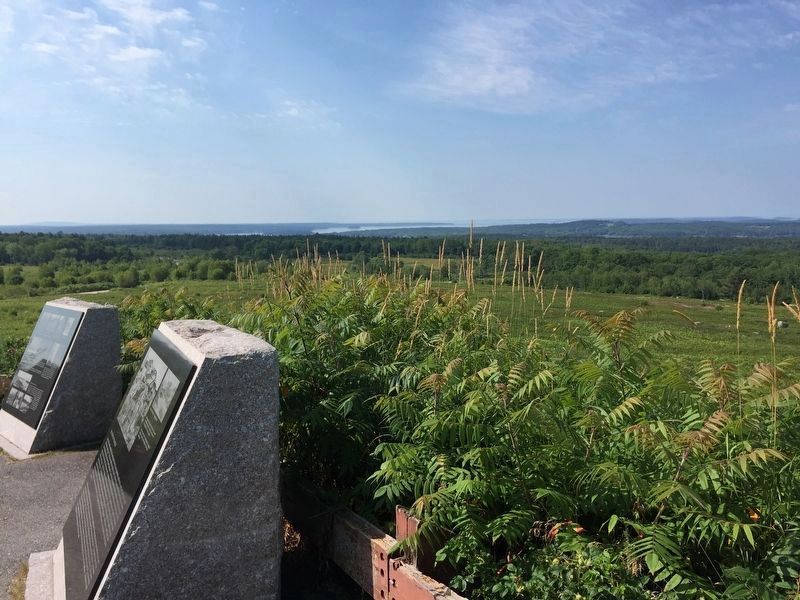
On Catapillar Hill Road (Maine Route 15) at Browns Avenue, on the right when traveling south on Catapillar Hill Road.
Photo captions starting center left at main illustration and going clockwise:
Penobscot Expedition
On July 28, 1779, in what is known as the Penobscot Expedition, American forces led by the Marines stormed the western bluffs of the . . . — — Map (db m145059) HM
Near Main Street (Maine Route 15) at Steamboat Wharf Lane, on the right when traveling east.
To take advantage of electricity supplied from the Wyman Dam in Bingham construction began on the Bucksport Mill in 1928 on the site of a former tannery along the banks of the Penobscot River. In its early days, the mill produced newsprint that was . . . — — Map (db m148398) HM
Many of Bucksport’s leading citizens made a living from maritime trade - building vessels, as owners and captains, and outfitting vessels.
Founder Jonathan Buck built Bucksport's first commercial sailing vessel, the sloop Hannah in . . . — — Map (db m258708) HM
On Main Street (Maine Route 15) when traveling west.
Bucksport’s First Library, the Buckstown Social Library, was established in 1806:
The librarian was Reverend Mighill Blood, the first pastor of the Congregational Church.
For the first 60 years or so, the library did not have a permanent . . . — — Map (db m257768) HM
Near Main Street at McDonald Street, on the right when traveling north.
This is the site where the Prospect to Bucksport Ferry operated from 1807 until 1931 when the Waldo/Hancock Bridge opened to the public for traffic. The ferry was an important transportation link between Waldo County and Hancock County transporting . . . — — Map (db m260187) HM
On Main Street (Maine Route 15) west of Elm Street, on the right when traveling west.
Bucksport’s Alexis B. “Lex” Luce and brothers William and Dustin Farnum played prominent roles in early 20th century American theater on stage and screen. Bucksport residents watched the local stars in movies at the Alamo Theatre.
Built in . . . — — Map (db m257765) HM
Welcome to Bucksport’s Museum in the Streets Historic Walking Tour
This place where the Penobscot River meets Penobscot Bay has been the homeland of the Penobscot people and their Wabanaki relations for thousands of years. Penobscot . . . — — Map (db m249541) HM
On Elm Street at Franklin Street, on the left when traveling south on Elm Street.
Churches have been the centers of community life in New England for hundreds of years.
The Congregational Church was established in 1803, and erected its first meeting house in 1813. The current Greek Revival style building was dedicated in . . . — — Map (db m258745) HM
Near Main Street (Maine Route 15) east of Elm Street.
Fishing was an important part of Bucksport's economy for more than a century. In 1855. Bucksport had 20 vessels in the offshore cod fishery, bringing in more than 2 million pounds of fish that year.
The building behind you was the home of . . . — — Map (db m258739) HM
Sheepskin Tanneries were an important part of Bucksport's economy in the 19th and early 20th centuries. They took advantage of local water power, and the forests nearby that supplied the hemlock bark essential to the tanning process.
The . . . — — Map (db m258691) HM
On McDonald Street at Franklin Street, on the right when traveling north on McDonald Street.
Perched atop Oak Hill, East Maine Conference Seminary (EMCS) took advantage of Bucksport's busy port to attract students from across the region. Founded by a group of Methodists from eastern Maine and beyond, the school welcomed its first . . . — — Map (db m258743) HM
Construction of Fort Knox began in 1844 and was halted while still unfinished 25 years and $1 million later. The Fort has never seen any military action. The largest of 133 total cannons fired a 315 pound shell 4,680 yards. The granite was quarried . . . — — Map (db m55114) HM
Colonel Jonathan Buck arrived in what is now Bucksport in 1762 aboard his sloop Sally with a group of men from Haverhill, Mass. They were here to survey land that had been granted to them by the Massachusetts colonial court. The first . . . — — Map (db m258704) HM
On Main Street (Maine Route 15) west of Mechanic Street, on the right when traveling west.
Every town has that special house that captures the imagination. Linwood Cottage, built in 1855 for local jeweler and clockmaker James Emery, is a melding of architectural styles, including Gothic, Greek Revival, and Italianate, Emery's . . . — — Map (db m258742) HM
On Main Street (Maine Route 15) at 1st Street, on the left when traveling north on Main Street.
A Good Sign
The sign post behind you symbolizes Bucksport's special place in the world, a town that many would proudly boast as unlike any other in the universe! People from all 4 corners of the
globe find their way here, some to visit, . . . — — Map (db m183890) HM
On Main Street (Maine Route 15) at 1st Street, on the left when traveling north on Main Street.
To the Top of the World
The beginnings of an historic journey to the
North Pole took place across the bay at the
McKay and Dix Shipyard on Verona Island
when the keel for a 185-foot, 650 ton wooden
sail-steamer named the . . . — — Map (db m183886) HM
Near Main Street (Maine Route 15) at School Street.
Just upriver from here, a point of land pushes out into the river. Today it is called Salmon Point, once the site of the Seaboard paper mill and now home to a land-based salmon farm. To the Penobscot people, this place is elanapayi-kwasaweyik . . . — — Map (db m258696) HM
The Penobscot River is a vital resource. In the 1700's it spawned numerous riverside communities, while the 1800's saw Bangor become the "lumber capital of the world", and Bucksport an international port renowned for shipbuilding. Crafted along . . . — — Map (db m55115) HM
On Main Street (Maine Route 15) east of Elm Street, on the right when traveling west.
Small businesses have been anchors in Bucksport for generations, and are equally important in shaping the future of the town.
This Federal-style house, built circa 1824, belonged to Phineas Heywood, a harness maker whose store was located across . . . — — Map (db m258687) HM
This marker commemorates the
men and women who achieved
American independence.
These Patriots, believing in the
noble cause of liberty, fought
valiantly to found a new nation.
1775-1783
Presented by
The Town of Bucksport, Maine
and . . . — — Map (db m285114) WM
On Main Street (Maine Route 15) at 1st Street, on the right when traveling north on Main Street.
A Past of Ports
The Penobscot River has played an important role in the history and development of the Town of Bucksport. This site where you are standing was once occupied by a commercial wharf, one of many along Bucksport's waterfront in . . . — — Map (db m183844) HM
Near Bucksport Waterfront Walkway 0.1 miles east of Steamboat Wharf Lane, on the right when traveling east.
"Panawap'skewtekw,” meaning "River of rocks spreading out” is the original, indigenous name for the Penobscot River. According to an ancient Penobscot legend, the river was created when Guards-Water, a giant frog monster . . . — — Map (db m183889) HM
Near Main Street (Maine Route 15) at Mill Street, on the right when traveling east.
At this site and adjacent to Mill Stream is the location of the first sawmill built in 1764 by Jonathan Buck. The mill provided boards, staves, shingles and clapboards needed by the settlers as well as for sale in Boston and more distant ports. The . . . — — Map (db m148399) HM
On U.S. 1 at Hinks Street, on the left when traveling east on U.S. 1.
This monument was erected
in memory of Colonel Jonathan Buck,
founder of Bucksport, who died on March 13, 1798
The memorial, built of Blue Hill granite, was erected
by his descendents nearly sixty years after his death.
Sometime after its . . . — — Map (db m145041) HM
Near Main Street (Maine Route 15) at McDonald Street.
Built in 1929-1930, the Maine Seaboard Paper Company mill shifted Bucksport from a largely maritime economy to a mill town. Built on the site of the former Blodgett tannery, the mill took advantage of electricity from the newly built Wyman Dam on . . . — — Map (db m258693) HM
The military history of our nation came to Bucksport quite dramatically over the centuries. The young settlement was occupied by the British during the War of 1812 and gained its most prominent view, Fort Knox, in the 1840s, built to protect . . . — — Map (db m233480) HM
On Main Street (Maine Route 15) at Central Street, on the right when traveling west on Main Street.
Once the largest hotel in eastern Maine, the Robinson House was built as a private home in 1783, and converted to a tavern and lodging in 1820. The hotel hosted a number of famous Americans in the 19th century, including five presidents: . . . — — Map (db m257812) HM
In 1763 Jonathan Buck settled the area, which was subesequently burned during the Revolutionary War. First incorporated as "Buckstown", the name was changed to "Bucksport" in 1817. In the 1800's Bucksport thrived as an international port. Later . . . — — Map (db m55112) HM
On Main Street (Maine Route 15) at 1st Street, on the left when traveling north on Main Street.
Battle on the River
In 1779, the early settlers of Bucksport witnessed a devastating military defeat for the Americans during the Revolutionary War. A fleet of 44 warships and support vessels from the Continental Navy Fleet set out on a . . . — — Map (db m183880) HM
Near Main Street (Maine Route 15) at Central Street, on the right when traveling east.
This unique suspension bridge opened in 1931. The total span 2040 feet (about 7 football fields) at a height of 135 feet. Each 206 foot tower rests on a concrete pier, that required six days of continuously pouring concrete to build. Final cost for . . . — — Map (db m148396) HM
On Battle Avenue (Maine Route 166) near Pleasant Street, on the right when traveling south.
This Fortress, originally known by its garrison as FORT PENOBSCOT and named by Admiral Sir George Collier in his reports FORT CASTINE received its present designation from its builder, British general Francis McLean upon its completion in December . . . — — Map (db m77148) HM
On Battle Avenue (Maine Route 166) near Pleasant Street, on the right when traveling south.
This fort, originally known by its garrison as “Fort Penobscot” and named by Admiral Sir George Collier in his reports “Fort Castine” received its present designation from its builder, British general Francis McLean upon its . . . — — Map (db m77147) HM
Built in 1780 by Colonel Campbell, named in honor of his regiment, H.B.M. 74th - “The Argyle Highlanders,” following a southerly direction to the shore.
Upon the explosion of the Tory refugees - September-October, 1784, a . . . — — Map (db m77152) HM
On Main Street near Atlantic Avenue, on the right when traveling north.
In honor of the
Brave Men of
Camden
who gave their lives
in defence of their
country during the
Great Rebellion
1861 - 65
[Roll of Honored Dead] — — Map (db m54674) WM
“All I could see from where I stood
Was three long mountains and a wood;
I turned and looked another way,
And saw three islands in a bay.
So with my eyes I traced the line
Of the horizon, thin and fine,
Straight . . . — — Map (db m35439) HM
In grateful recognition of the service rendered by the men and women of Camden in the World War 1914 — 1918 the Mount Battie Association has erected this tower for an enduring memorial — — Map (db m35419) WM
On Main Street at Atlantic Avenue, on the right when traveling north on Main Street.
The men who volunteered their services
to the Cause of Liberty
in the War with Spain that a nation might
enjoy peace and prosperity
The Birthright of All Men
Honor Roll of Members Past and Present
Charles P. Freeman • Ralph L. . . . — — Map (db m54676) WM
On Elm Street (U.S. 1) at Union Street, on the right when traveling east on Elm Street.
A native of Camden, on duty at the Pensacola Navy Yard, January 12, 1861, was ordered to haul down the American flag in token surrender. He indignantly refused. Honoring his sturdy loyalty the Town of Camden erects this boulder to his memory, and . . . — — Map (db m105319) HM
On Hawthorn Point Road near Pleasant Point Road, on the right when traveling south.
Dedicated in honor of those
men and women of the
Lower St. Georges and Cushing,
who defended this
plantation, town and country
here and abroad
[Dedicated] August 13, 1989 — — Map (db m54640) WM
On Church Street east of Rt. 105, on the left when traveling east.
In Memory of the Boys of Hope who served in World War I, and II, Korea and Vietnam giving supreme sacrifice
H. Vinal Hardy WW II
Eugene C. Dunbar WW II
John R. Goderre Vietnam — — Map (db m46435) HM
Land purchased from heirs of
Nathaniel Merryman
by the United States of America
November 22, 1824
Contractors - Jeremiah Berry
Robert Foster, Ballard Green
Beacon Installed - Winslow Lewis
1st Lightkeeper - Isaac Stearns
First . . . — — Map (db m52323) HM
How Did Owl's Head Get Its Name?
For centuries, people have wondered how Owl's Head received its name. According to Native American legend, the head of an owl can be identified in this rocky cliff that the Indians called . . . — — Map (db m52332) HM
On Main Street at Shore Drive, in the median on Main Street.
To the men and women
of Owl's Head
who served their country
1776 - 1976
To honor the men buried
in the town who bore arms
in the Revolution
Samuel Bartlett · Benjamin Cooper
Thomas Hix · Job Ingraham
Job Perry 2d · Joseph Perry . . . — — Map (db m52322) WM
Near Lighthouse Road 0.4 miles north of Dodge Point Lane, on the right when traveling north.
(panel 1)
Welcome to Owls Head Light Station
“Owl's Head ushers at once upon a scene almost too beautiful to profane with speech when we are looking at it; impossible to find language to do it justice when memory would . . . — — Map (db m116036) HM
On Park Street (U.S. 1) at Main Street, on the right when traveling east on Park Street.
Dedicated to Rockland Patrolman
John D. Chapman
Law Enforcement Officer
Killed in the Line of Duty
at this location on February 16, 1938 — — Map (db m55395) HM
On Park Street (U.S. 1) at Main Street, on the right when traveling east on Park Street.
To the memory of those men who claiming Rockland
by birth or by adoption as their home
served in the Army & Navy of the United States
War of 1861-1865
Here stood for many years the home of
Edwin Libby Post No. 16
Grand Army of the . . . — — Map (db m55394) WM
On Park Drive near Main Street (U.S. 1), on the right when traveling east.
This historic Coast Guard Bell from Portland Head Light is being loaned to the City of Rockland (a Coast Guard City) for their outstanding support of the men and women of the United States Coast Guard — — Map (db m55370) HM
Construction of this 4,300-foot long breakwater began in April 1881. Eighteen years, $750,000 and over 732,277 tons of granite later, it was completed on November 24, 1899. The lighthouse dates from 1902 and was placed on the National Register of . . . — — Map (db m55361) HM
On Main Street (Maine Route 73) near Myrtle Street, on the right when traveling north.
[Historical Excerpt Transcribed]
General Information
The Rockland Harbor Trail is easy to follow. Allow you and your imagination enjoy the Harbor sights along the way. The trail is approximately 5.5. mile[s] from beginning to end, . . . — — Map (db m52340) HM
[Historical Excerpt Transcribed]
General Information
The Rockland Harbor Trail is easy to follow. Allow you and your imagination enjoy the Harbor sights along the way. The trail is approximately 5.5. mile[s] from beginning to end, . . . — — Map (db m55360) HM
On Main Street (U.S. 1), on the right when traveling north.
[Historical Excerpt Transcribed]
General Information
The Rockland Harbor Trail is easy to follow. Allow you and your imagination enjoy the Harbor sights along the way. The trail is approximately 5.5. mile[s] from beginning to end, . . . — — Map (db m55393) HM
On Park Drive near Police Plaza, on the left when traveling east.
As blues has spread from Mississippi to the far corners of the country and the world, the state of Maine has assumed an active role in the presentation and promotion of the music to appreciative local audiences ever since Mississippi born blues . . . — — Map (db m77146) HM
On Union Street (U.S. 1) near Beech Street, on the right when traveling south.
Walter H. Piston, a noted American composer, author and music educator, was born in Rockland, Maine on January 20, 1894. His long and distinguished career earned him many awards and honors, including two Pulitzer Prizes in Music in 1948 and 1961. . . . — — Map (db m52321) HM
On Union Street (U.S. 1) near Beech Street, on the right when traveling south.
We, the citizens
of this community,
enshrine forever the glorious
memory of our boys and girls,
living and dead
who served their country
in World Wars I and II
Erected Nov. 11, 1948 — — Map (db m52320) WM
André was born on Robinson’s Rock in Penobscot Bay on May 16, 1961. Abandoned at birth, he was found, befriended, raised and trained by Harry Goodridge of Rockport, Maine. André is honorary harbor master of Rockport Harbor and is a celebrity of more . . . — — Map (db m124338) HM
Near Samoset Road at Jameson Point Road, on the left when traveling south.
Standing here at the park named after Sis Reed, a native of the city and Rockland's unofficial flower lady, you are also on Jameson Point where Robert Jameson lived in a log cabin during the mid-1800's. A man with an unyielding disposition, he was . . . — — Map (db m259616) HM
During the 19th Century, Rockport was a major supplier of lime to East Coast markets. These kilns converted limestone rock supplied by 15 local quarries into lime used to make mortar & finish plaster. The burned lime was packed into wooden casks . . . — — Map (db m124348) HM
On Commercial Street (U.S. 1) south of Powerhouse Hill Lane, on the left when traveling north. Reported damaged.
Revolution and a lookout was maintained on the summit of Pine Hill. 200 men were stationed in barracks located on the William Gregory farm one half mile back from the fort. A company of Penobscot Indians was part of the force. Men retreating from . . . — — Map (db m246230) HM
On Main Street (U.S. 1) at Robbins Lane, on the right when traveling east on Main Street.
The Maine State Prison stood in Thomaston from 1824 until it was razed in 2002. The original building was a wood structure for the guards and warden; the cells were exposed to the elements and below ground level. Prisoners were literally . . . — — Map (db m259597) HM
On Main Street (U.S. 1) near Knox Street, on the right when traveling east.
A Case of Modern Technology
Before the famous fire of June 1915, the south side of Main Street housed a telegraph building to the west of Watts Hall. For some unknown reason, the telephone office was separate. Perhaps the telegraph office handled . . . — — Map (db m259499) HM
On Main Street (U.S. 1) at Robinson Street, on the right when traveling north on Main Street.
A Favorite Widow
Captain Edward Robinson owned the large house to the west of the Academy. The side porch was removed in the mid-1980s. He was a ship builder who began his career at sea at age ten. Master of a small vessel at . . . — — Map (db m259466) HM
On Main Street (U.S. 1) near Robinson Street, on the right when traveling north.
A Remarkable Sea Story
The Greek revival cape, built by William Keith in 1830, is on the National Register of Historic Places. Several doctors have lived in the house and a few kept their offices on the ground level of the house.
A fire once . . . — — Map (db m259470) HM
On Main Street (U.S. 1) at Knox Street, on the right when traveling east on Main Street.
A Town Landmark
Captain Samuel Watts built and donated Watts Hall to the people of Thomaston. In June of 1915, a terrible fire broke out in the livery stable behind the building causing the entire block to burn to the ground. Perhaps the greatest . . . — — Map (db m259501) HM
On Main Street (U.S. 1) at Wadsworth Street, on the right when traveling east on Main Street.
A Unique Pumper and Old Fire Houses
Following a disastrous fire that leveled the Watts Block in 1915, the Board of Selectmen and townspeople voted to purchase new modern equipment for the fire department. The apparatus was a gasoline powered . . . — — Map (db m259610) HM
On Knox Street near Fluker Street, on the left when traveling south.
An Overlock House
James Overlock was one of the most prolific builders of houses in Thomaston between 1840 and 1855. His homes had a very distinctive Italianate appearance. Many have well sheltered side entrances, a practical way of keeping heat . . . — — Map (db m259472) HM
On Water Street near Public Landing, on the right when traveling east.
Burning Lime
"Lime burning" is a misnomer. The process of "burning" (actually heating) limestone releases the water molecule from limestone. A major industry in Thomaston, limestone was quarried, broken into small pieces and heated by very hot . . . — — Map (db m259491) HM
On Water Street south of Public Landing, on the right when traveling east.
Commemorating Captain George Waymouth's landing here - June 12, 1605.
Erected by the Thomaston Clergy and the Bicentennial Committee for 1977
"That we, the menne of England, have marked this spot for home and if they dare uproot itte God turn . . . — — Map (db m259476) HM
On Main Street (U.S. 1) near School Street, on the right when traveling east.
Days of Old
Open trolley cars were the best way to travel on warm summer days. The R,T&C line running from 1892 to 1931 started in Warren, went right down Main Street, into Rockland and ended in Camden. The tracks were laid on the dirt road. . . . — — Map (db m259420) HM
On High Street (Maine Route 131) at Main Street (U.S. 1), on the left when traveling south on High Street.
To honor Henry Knox’s military achievements, a permanent encampment site will be created with stockades and cannons for museum use for re-enactments and demonstrations. The site will be located behind Montpelier with the encampment and tent . . . — — Map (db m105564) HM
On Main Street (U.S. 1) at Pine Street, on the right when traveling east on Main Street.
U.S. Senator John Ruggles' nickname was well deserved. He was instrumental in establishing the office and was holder of U.S. Pat. No. 1, a design for an innovative railroad wheel. His stately home, in the Federal Style, is one of the . . . — — Map (db m259423) HM
Near Wadsworth Street 0.1 miles south of Main Street (U.S. 101).
Originally built in Thomaston in 1824 to house maximum security prisoners, the Maine State Prison underwent many changes in its 178 year history.
The prison was initially constructed with underground cells. Prisoners were lowered each night . . . — — Map (db m175898) HM
Near High Street (Maine Route 131) at Main Street (U.S. 1), on the left when traveling south.
In 1795, Major-General Henry Knox retired from public life and built a magnificent estate in Thomaston. His wife, Lucy Fluker Knox, named it Montpelier. A reconstruction of the original house, now a museum, can be seen at the . . . — — Map (db m105548) HM
On Erin Street at Erin Court, on the right when traveling north on Erin Street.
Former bookseller, Henry Knox, became a respected military strategist, artillery expert, and friend of George Washington, serving with him in most campaigns during the Revolutionary War. He is best known for hauling 60 tons of cannon from Ft. . . . — — Map (db m259615) HM
On High Street (Maine Route 131) at Main Street (U.S. 1), on the left when traveling south on High Street.
In keeping with its mission to “honor the life and times of Henry Knox and the heritage of Montpelier,” the Knox Museum is working to implement a landscape program for its campus, developed in collaboration with Richardson & Associates . . . — — Map (db m105568) HM
On Knox Street at Main Street (U.S. 1), on the right when traveling north on Knox Street.
June 7, 1915
A wagon loaded with brooms made by prison inmates makes its way down Knox Street to the Thomaston Railroad Station for shipping. Behind the wagon is the rubble of Watts Hall, collapsed from the recent fire that brought down the . . . — — Map (db m259613) HM
On Main Street (U.S. 1) at Elm Street, on the right when traveling north on Main Street.
Main Street
The view down Main Street was taken in 1871. Eventually, the elm trees grew until they formed a bower over the entire length of Main Street. Unfortunately, the trees had to be removed in the 1970s when they suffered from Dutch elm . . . — — Map (db m259462) HM
Near Wadsworth Street 0.1 miles south of Main Street (U.S. 1).
Destroyed by fire September 15, 1928
New prison dedicated September 11, 1924
Percival Proctor Baxter
Governor 1921 – 1924
Henry H. Hastings, Bethel • Frank H. Hargraves, Buxton
Charles S. Highborn, Augusta
Prison Commissioners . . . — — Map (db m175799) HM
Near Wadsworth Street south of William King Street, on the right when traveling south.
In the decades following 1923 many improvements and additions were made including a new Commissary, Segregation Unit, Chapel, Gymnasium, and Deputy Warden's Office.
In 1992 the Segregation Unit closed and a new "Super Max' facility opened in the . . . — — Map (db m259589) HM
Near Knox Street near Thatcher Street, on the right when traveling north.
The home of General Henry Knox first Secretary of War stood of the brow of this hill overlooking the bay from 1793 to 1871
The brick building now used for the Railroad Station is the original of one of the nine buildings that formed a semi . . . — — Map (db m259469) HM
On City Avenue / Main Street (Maine Route 131) at Georges Street, on the right when traveling east on City Avenue / Main Street.
Near the Old Prison
The Georges Hotel stood at the intersection of Main and Georges Street where there now is an empty lot. It burned to the ground leaving the three chimneys standing. On a very windy day several years after the . . . — — Map (db m54671) HM
On Main Street (U.S. 1) near Gilchrest Street, on the right when traveling north.
One of the oldest houses in town, built in 1795, this outstanding building started its life as a tavern. The Federal portico was added when a section of the house was rebuilt after a fire. Various stories are told about this house but . . . — — Map (db m259460) HM
On Main Street (U.S. 1) at Dwight Street, on the right when traveling north on Main Street.
One Minister Two Achievements
Built in 1847, Thomaston Academy, pictured before the two wings were added, originally housed students in both elementary and advanced studies. The older "scholars" studied Greek, Latin, navigation, oil painting and . . . — — Map (db m259463) HM
On Water Street near Public Landing, on the right when traveling east.
Sails to Catch the Wind
Sail makers are in demand wherever sailing vessels are made. The Dunn & Elliot Sail Loft, in the exterior photograph, and the Washburn Brothers Sail Loft were two of the best. The sail makers at Dunn & Elliot stopped work . . . — — Map (db m259485) HM
Near Main Street (U.S. 1) near Ship Street, on the right when traveling east.
The first record of shipbuilding in Thomaston dates back to 1787. The gently sloping banks of the St. George River provide access to the channel out to sea and create ideal conditions for ship-launching.
Early waterfront businesses were located . . . — — Map (db m259593) HM
On High Street (Maine Route 131) at Main Street (U.S. 1), on the left when traveling south on High Street.
Two-tiered terraces will flank either side of the main entrance to Montpelier, giving a greater presence to the mansion. The walkway up to the front door will also be extended, and serve (as) a guide to visitors toward the new overlook. The . . . — — Map (db m105567) HM
On Knox Street at Main Street (U.S. 1), in the median on Knox Street.
This flagpole was erected as a memorial to the Builders, the Captains and the Seamen of Thomaston Ships by those who take pride in their accomplishments — — Map (db m55529) HM
On High Street (Maine Route 131) at Main Street (U.S. 1), on the right when traveling south on High Street.
Construction of The First Parish Meeting House began in 1795, and was completed in 1797, with Henry Knox’s help. Members of the parish, the Knox family was involved in church activities at the meeting house, which was located next to the site . . . — — Map (db m105557) HM
On High Street (Maine Route 131) at Main Street (U.S. 1), on the left when traveling south on High Street.
Knox’s letters and financial papers specifically note the presence of an oval-shaped garden, a key feature to the landscape plan. The garden will contain plants such as rosebushes, lilacs and bleeding hearts, and will have brick walkways, an . . . — — Map (db m105572) HM
On Main Street (U.S. 1) near School Street, on the right when traveling east.
The Ranlett-Gould House
The two matching formal rooms in the front of this house built in 1849 have wallpaper copied from a castle in England and made in Alsace-Lorraine. This wallpaper was also used in the Walsh house on Knox Street. Men came . . . — — Map (db m259421) HM
On High Street (Maine Route 131) at Main Street (U.S. 1), on the left when traveling south on High Street.
American Patriot Paul Revere is best known for his midnight ride on April 18, 1775, warning colonists of the advancing British forces. Although generations of people know Revere as an American hero, others know him as a noted silver and . . . — — Map (db m105554) HM
On Water Street near Public Landing, on the right when traveling east.
Looking west is a bridge spanning the St. Georges River. The original was a toll road of wood with nothing to keep a horse or a person from falling over the side into the water. Some say that north of the bridge the first Indian trading post was . . . — — Map (db m259490) HM
200 entries matched your criteria. The first 100 are listed above. Next 100 ⊳