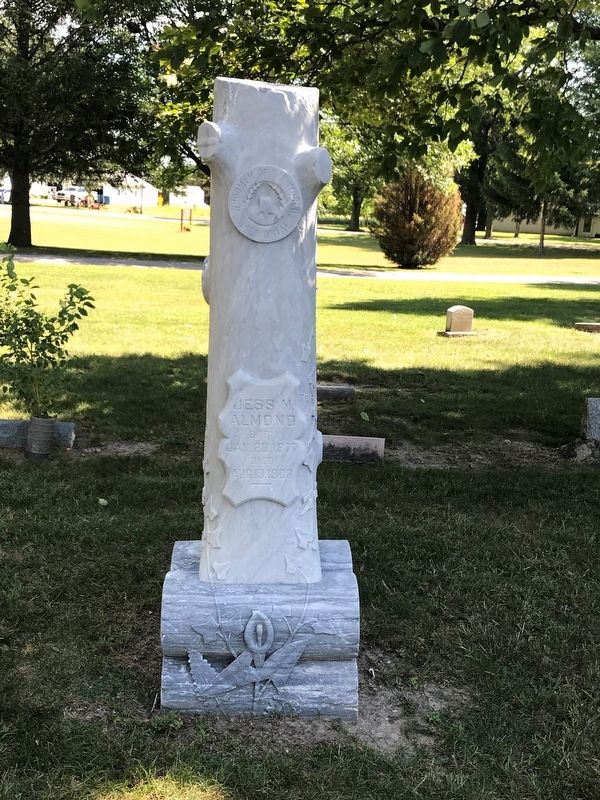
On 11 Mile Road at West North Union Road, on the left when traveling north on 11 Mile Road.
In 1868 the Williams Township Board of Health authorized a township burial ground and voted to purchase land for that purpose. In 1871 the board purchased five acres previously designated for school purposes from the state of Michigan for twenty . . . — — Map (db m163589) HM
When Bay City's sawmills opened in 1885, mill owners notified workers that wages would be 12 to 25 percent lower than in 1884. On July 6, 1885, Bay City millhands began to walk off the job. Their slogan, "Ten Hours or No Sawdust," represented their . . . — — Map (db m162453) HM
On Washington Avenue at 9th Street, on the right when traveling south on Washington Avenue.
Aaliyah was born in Brooklyn, New York, in 1979 but moved with her family to Detroit when she was very young. She first gained recognition at the age of ten when she appeared on Star Search. After signing with Jive and Blackground Records, she . . . — — Map (db m255458) HM
On Washington Avenue (State Highway 84) north of 10th Street, on the right when traveling south.
Abraham Lincoln Dedicated to the Grand Army of the Republic and The Women Who Served Daughters of Union Veterans of Civil War 1861-1865
Lincoln’s Address Delivered at the dedication of the cemetery at Gettysburg, November 19, 1863.
. . . — — Map (db m131778) HM WM
On North Madison Avenue at 6th Street, on the right when traveling north on North Madison Avenue.
This scene depicts artist W.E. Wright's vision of Bay City in 1882 as seen looking south from the Third Street Bridge. Mr. Wright depicts a busy port town with vessels of all size and function from tugs and barges to schooners and large . . . — — Map (db m255478) HM
On Center Avenue (State Highway 25) at North Jackson Street, on the right when traveling east on Center Avenue.
After being housed in various buildings since 1869, the east-side branch library found a permanent home thanks to the Carnegie Corporation, local leaders William Clements, James E. Davidson, and Charles R. Wells, and the government and citizens of . . . — — Map (db m198353) HM
On Center Avenue at North Madison Avenue, on the right when traveling west on Center Avenue.
In memory of Bay County Veterans who died in war that we may live in peace
Civil
Adams, Hiram • Armstrong, Thomas • Baldwin, Martin M. • Bartlett, Irwin C. • Beach, John W. • Beebe, Franklin H. • Birney, Fitzhugh • Blodgett, Jerome • . . . — — Map (db m257049) WM
On South River Road (State Highway 13) 3.5 miles north of Interstate 75, on the left when traveling north.
One of the first attempts in America to produce beet sugar was made in Michigan at White Pigeon late in the 1830's. The venture did not succeed though the future governor John Barry went to Europe seeking to learn its production methods. In 1888 Dr. . . . — — Map (db m180634) HM
On Center Avenue at Adams Street, on the right when traveling west on Center Avenue.
Bob Segar's first national success came after the Bob Seger System signed with Capitol Records and "Ramblin' Gamblin' Man" became a hit single in 1968. It took eight more years of hard work, but Seger finally established himself as a major rock . . . — — Map (db m255475) HM
On Center Avenue (State Highway 25) at North Madison Avenue (State Highway 25), on the right when traveling east on Center Avenue.
Center Avenue presents one of the most spectacular displays of late nineteenth and early twentieth century residential architecture in Michigan. Between 1870 and 1940 Bay City's prominent citizens favored Center Avenue as "the" place to live. Early . . . — — Map (db m33961) HM
On Center Avenue (Michigan Route 25) at Livingston Street, on the right when traveling west on Center Avenue.
Center Avenue presents one of the most spectacular displays of late nineteenth and early twentieth century residential architecture in Michigan. Between 1870 and 1940 Bay City´s prominent citizens favored Center Avenue as "the" place to live. Early . . . — — Map (db m161001) HM
On Center Avenue (State Highway 25) at North Grant Street, on the right when traveling east on Center Avenue.
Charles came to Bay City in 1864 from Ithaca, NY, to work for sawmill owners Henry Sage and John McGraw, eventually buying the Bay City Dredging Co. His home's architecture is Shavian Manorial, a Queen Anne/Tudor Revival style named after the . . . — — Map (db m33909) HM
Near Adams Street at 4th Street, on the right when traveling north.
Before the advent of the World Wide Web, indeed even before the advent of telephones and automobiles, it was the railroad that kept us connected. Communities to communities. Businesses to customers. People to one another. Americans to their . . . — — Map (db m131789) HM
On McGillivary Road at Marquette Avenue, on the right when traveling south on McGillivary Road.
Fan-fare produced noise that could confuse earlier types of passive acoustic homing torpedoes. When towed behind the ship and energized, fan-fare could make a torpedo its noise target rather than the Edison. — — Map (db m256579) HM
On Center Avenue (State Highway 25) at North Jackson Street, on the right when traveling west on Center Avenue.
Side 1
In 1848, James G. Birney and his wife led Bay City's earliest Presbyterian services in a schoolhouse. Birney, an elder in the church, twice ran unsuccessfully for president on the antislavery ticket. The Reverend Lucius Root organized . . . — — Map (db m33696) HM
On Center Avenue (State Highway 25) at Livingston Street, on the right when traveling west on Center Avenue.
The introduction of chicory into Bay County, at the beginning of the twentieth century brought a ___ industry into the area and provided the farmers with a profitable cash crop. Chicory was a popular beverage in Europe at the time. The chicory root, . . . — — Map (db m180656) HM
On Westside Saginaw Road (State Highway 84) at Ziegler Road, on the right when traveling north on Westside Saginaw Road.
Frankenlust
One of four colonies in Michigan settled by people from Franconia, Germany, Frankenlust was founded by Pastor Ferdinand Sievers and fourteen immigrants who established Saint Paul Evangelical Lutheran Church in June 1848. On July . . . — — Map (db m138097) HM
On North Monroe Street north of Center Avenue (State Highway 25), on the right when traveling north.
George began as a laborer in his father James' lumber business, eventually managing what became Shearer Brothers when his brother James B. joined the firm. The lumber, real estate and insurance company operated out of the Shearer Brothers Block . . . — — Map (db m131779) HM
On Center Avenue west of North Jefferson Street, on the right when traveling west.
A tribute to Gold Star Families and Relatives who sacrificed a Loved One for our Freedom.
Family - Patriot - Homeland - Sacrifice
Michigan Gold Star Families Memorial Monument
The monument is in tribute to and honors Michigan families . . . — — Map (db m255470) WM
On McGillivary Road at Marquette Avenue, on the right when traveling south on McGillivary Road.
The Bay County Independence Park Boat Launch Facility is located upon a former industrial area that has been impacted by petroleum and other chemicals, and is listed by the Michigan Department of Environmental Quality as a site of environmental . . . — — Map (db m256588) HM
On Center Avenue at North Jefferson Street, on the right when traveling west on Center Avenue.
This 9-inch Dahlgren Cannon is a true replica of those in place at Battery Park from the early 1900s to 1942. The originals were part of the arsenal aboard the USS Hartford, the flagship of Rear Admiral David G. Farragut. During the Civil . . . — — Map (db m182351) HM
On South River Road (State Highway 13) 0.8 miles south of McGraw Street, on the right when traveling south.
(Side 1)
In 1926 the Bay City Chamber of Commerce recognized the economic benefits that could be derived from a local airport. That year the chamber decided to build one and dedicate it to Bay City men killed during World War I. The . . . — — Map (db m180636) HM
On Washington Avenue north of 7th Street (State Highway 25), on the left when traveling north.
This plaque is issued by the Historical Society of Michigan in recognition of Keit’s Florist founded in 1856 for more than 100 years of continuous operation in service to the people of Michigan and for contributing to the economic growth and . . . — — Map (db m131787) HM
On Washington Avenue at 9th Street, on the right when traveling south on Washington Avenue.
Madonna became known as the 'Queen of Pop' after moving to New York, signing with Sire Records, and releasing a string of hit singles, albums, and music videos. Her works, which incorporate social, political, sexual, and religious themes, have . . . — — Map (db m255457) HM
On McGillivary Road at Marquette Avenue, on the right when traveling south on McGillivary Road.
The Mark 46 torpedo is the backbone of the United States Navy's lightweight anti-submarine warfare torpedo inventory and is the NATO standard. These aerial torpedoes are designed to attack high-performance submarines. In 1989, an improvement program . . . — — Map (db m256583) HM
On 9th Street at Saginaw Street, on the right when traveling east on 9th Street.
A medicine wheel is an ancient symbol respected by Native American people of North and South America to teach the interconnectedness of life. In the Native American tradition, a medicine wheel is a circle divided into four sections, each . . . — — Map (db m275561) HM
On East Midland Street at Litchfield Street, on the left when traveling east on East Midland Street.
The Midland Street Commercial District comprises fifty buildings in a four-block area that was the business hub of West Bay City. Prior to 1830 the area was occupied by Sauk and Chippewa Indians. In response to depleted eastern timberlands resulting . . . — — Map (db m163221) HM
On McGillivary Road at Marquette Avenue, on the right when traveling south on McGillivary Road.
The ships motor whaleboat can be launched rapidly when the ship is moving slowly ahead (forward) or stopped. Two of the many uses of the ship's boat was to rescue a downed aviator or men swept overboard, and transport of the crew ashore. (liberty) . . . — — Map (db m256585) HM
On Center Avenue at Saginaw Street, on the right when traveling east on Center Avenue.
Spend some time wandering around Bay City and you'll notice a few names appearing time and time again...on buildings, streets and parks. Some identify the person responsible without a hint of their accomplishments. Others reflect the early . . . — — Map (db m182354) HM
On North Euclid Avenue (Michigan Route 247) at Hidden Road, on the right when traveling north on North Euclid Avenue.
Established in 1847, the Ogaukawning Indian Mission, the first church in present-day Bay County, served Chippewa Indians at the nearby Kawkawlin settlement. First ministered by Methodist missionaries, it soon came under Indian trusteeship and still . . . — — Map (db m182297) HM
On Broadway Street (State Highway 13) at 35th Street, on the right when traveling south on Broadway Street.
This boulder is erected
to the memory of
O-Ge-Ma Ke-Ga-To
Chief Speaker of the Chippewas
Born about 1794,; elected chief, 1815;
spoke at treaty, 1819; spoke before
Congress, 1837; died, 1840
First buried on property now known . . . — — Map (db m180642) HM
On Adams Street south of 3rd Street, on the right when traveling north.
Rotary International is a worldwide association of business professionals and community leaders dedicated to service above self and guided by the principles of truth, fairness, charity, and compassion.
Paul Percy Harris (1868-1947) founded the . . . — — Map (db m255480) HM
On Washington Avenue at 9th Street, on the right when traveling south on Washington Avenue.
In service of our country
Army
Bernard Frasik Dec 17 -1915 • Angus White Dec 20 • Carl Alman Jun 17-1916 • Edward Deska Jun 17 • David Lonie Sep 16 • Ray Meeks Jun 4-1917 • Edward Secor Jun 26 • Otto Wuerthner Dec 12 • Stanley Powlak . . . — — Map (db m255460) WM
On East Midland Street south of South Wenona Street, on the right when traveling east.
Henry W. Sage (1814-1897) founded the village of Wenona (later West Bay City) in 1863. A merchant and philanthropist, he was also a founder of the Sage, McGraw and Company sawmill. In 1881 he donated property, building funds and $10,000 for books to . . . — — Map (db m163167) HM
On State Park Drive near North Euclid Avenue (State Route 247).
This bay derives its name from the Sauk Indians who once dwelt by its shores. Adrien Jolliet, on his voyage down Lake Huron’s western shore in 1669, first made it known to the white man. In the late 1800's an immense lumber industry flourished in . . . — — Map (db m182360) HM
On Washington Street at 10th Street, on the right when traveling south on Washington Street.
Sara Brooks Clark received her B.F.A. from Illinois Wesleyan University in Bloomington, Illinois in the Spring of 1989. In 1991, she earned an M.F.A. in ceramics from Ohio University. Clark has been working as the studio art technician and as an . . . — — Map (db m255462) HM
On McGillivary Road at Marquette Avenue, on the right when traveling south on McGillivary Road.
The Signal Bridge was a platform high in the superstructure of a ship. All visual signaling (flag hoist, semaphore, and flashing light) would take place from this point. Signal flags were flown from the mast in letters or codes that were put . . . — — Map (db m256581) HM
On 3rd Street west of North Sherman Street, on the right when traveling west.
St. Joseph was the first Catholic parish in the Saginaw Valley when it was founded in 1850-51 by missionary Joseph Kindekens. Dedicated on March 19, 1911, this building is the third to serve St. Joseph. During the late nineteenth century St. Joseph . . . — — Map (db m162342) HM
On Kosciuszko Avenue west of South Farragut Street, on the right when traveling west.
St. Stanislaus Kostka Roman Catholic Church
In the second half of the nineteenth century, Polish refugees who escaped Prussian domination settled in Bay City. In 1874 they formed a society under the patronage of Saint Stanislaus Kostka of . . . — — Map (db m161004) HM
On Center Avenue at Adams Street, on the right when traveling west on Center Avenue.
Fascinated by music, his vocal and instrumental talents were brought to the attention of Berry Gordy Jr. who signed him to Motown in 1962 and renamed him Little Stevie Wonder. His first #1 single, "Fingertips Pt. 2," was released in 1963, and he . . . — — Map (db m255477) HM
On South Catherine Street at East Thomas Street (State Route 25), on the left when traveling south on South Catherine Street.
During the 1870s, Swedish immigrants arrived in Bay County. By 1880 many Swedes had settled in West Bay City. In October of that year, fifty people organized the Swedish Evangelical Lutheran Sion Church, affiliated with the Augustana Synod. A year . . . — — Map (db m163096) HM
On Center Avenue at Adams Street, on the right when traveling east on Center Avenue.
Historic photographs show two traffic control shacks located on Center Avenue east and west of the railroad tracks that ran down what is now Jefferson Avenue. These hexagon-shaped buildings housed guardsmen when trains left or arrived at the F & PM . . . — — Map (db m182352) HM
On Center Avenue (State Highway 25) at North Grant Street, on the right when traveling west on Center Avenue.
Trinity Church
Trinity Church grew from a small group of settlers served by Episcopal missionaries beginning around 1842. Church records credit William and Ann Fitzhugh with founding the church. On March 4, 1854, fourteen people, led by the . . . — — Map (db m33912) HM
On Center Avenue at North Jefferson Street, on the right when traveling east on Center Avenue.
This 13-inch mortar cannon is a true replica of those in place at Battery Park from the early 1900s to 1942.
The originals were thought to be part of the Confederate arsenal at Fort Sumter, which is recognized as the official beginning of the . . . — — Map (db m182353) HM
On McGillivary Road at Marquette Avenue, on the right when traveling south on McGillivary Road.
To the memory of all sailors who served aboard the destroyer
USS Frank E. Evans DD 754
The Fighter
USS Frank E. Evans DD 754
May we never forget the ship the crews who proudly sailed her and those who paid the ultimate price while . . . — — Map (db m256578) HM WM
On Washington Avenue at 9th Street, on the right when traveling south on Washington Avenue.
Barbara Walworth is a lifelong resident of Michigan, currently living in Saginaw. She has enjoyed her roles as wife, mother, nurse, horsewoman, animal lover, and traveler. She had never painted until a friend asked her to attend a watercolor . . . — — Map (db m255456) HM
On Center Avenue (Michigan Route 25) near McLellan Street, on the right when traveling west.
Fremont and Matilda lived here until the 1915 bankruptcy of Chesbrough Brothers, a lumbering and milling firm started by Fremont's father, Alonzo. Built in the Romanesque Revival style popularized by Henry Hobson Richardson, it was designed by . . . — — Map (db m277229) HM
On Center Avenue at North McLellan Street, on the right when traveling west on Center Avenue.
Henry worked with his father James and brother William at Industrial Works, designers of a rail-mounted shovel and crane employed at the Chicago Columbian Exposition and the Panama Canal. His house is unusual in Bay City because it is
one of the . . . — — Map (db m277227) HM
On Center Avenue (Michigan Route 25) west of Park Avenue, on the right when traveling west.
This 2.5-story colonial revival house features a side-gable roof with segmental arch dormers; a symmetrical front façade with central oriel windows above the entry, 6/1 double-hung sash windows, and
single story wings on each side. A graceful . . . — — Map (db m277200) HM
On Amelith Road 0.2 miles west of Kraenzlein Road, on the right when traveling east.
St. John Evangelical Lutheran German missionary Pastor Ferdinand Sievers organized St. John Church in June 1852 to serve a colony of German migrants, some fleeing the turmoil that followed the European revolutions of 1848. Initially, the church . . . — — Map (db m180379) HM
On Washington Avenue at 9th Street, on the right when traveling south on Washington Avenue.
Steven Parkhurst is an artist working out of his Flat Frog Studio in Midland, Michigan. He works in oil painting and digital manipulation of iPhone photography. He has taught ceramics, beginning drawing, and advanced critique at the Midland . . . — — Map (db m255461) HM
On Weadock Highway 0.6 miles north of Woodside Avenue, on the left when traveling north.
In 1894 William Jennison, a yachtsman for fifty years, founded the Bay City Boating and Fishing Club. The first clubhouse, located on the Saginaw River, was moved across the ice to this site around 1902. A larger, stylish building was soon erected. . . . — — Map (db m163334) HM
On Woodside Avenue east of Scheurmann Street, on the left when traveling east.
The first successful beet sugar factory in Michigan was built in 1898 by the Michigan Sugar Company on Woodside Avenue in Essexville. A year later the Bay City Sugar Company built a competing factory across the street. The two plants merged in 1903 . . . — — Map (db m163255) HM
On Main Street near High Street, on the right when traveling north.
On May 18, 1927, a dynamite blast rocked the Bath Consolidated School, shattering one wing of the building and resulting in the deaths of thirty-nine children and teachers; dozens more were injured. An inquest concluded that dynamite had been . . . — — Map (db m196788) HM
This Memorial Is Dedicated
To All Veterans Who Gave
Their Lives And To Those Who
Proudly Served Our Great
Nation During The Many Wars
And Conflicts. — — Map (db m210794) WM
On Main Street near High Street, on the right when traveling north.
In 1873 there was built on this site a two story school constructed of
brick and wood. It was erected approximately 100 feet east of this
sign. The school consisted of 10 grades; a giant step toward higher
education in the Bath area.
In . . . — — Map (db m210790) HM
On East Madison Street at North Franklin Street, on the right when traveling west on East Madison Street.
This small frame house
was likely built in the 1850's
by Phillip Peck. George W.
Anderson, for whom DeWitt's
Grand Army of the Republic
Post is dedicated, lived here
prior to the Civil War
in which he lost his life. — — Map (db m239641) HM
On South Bridge Street at West Dill Drive, on the right when traveling south on South Bridge Street.
Constructed in the 1850's
for Joab and Olivia Baker.
Mr. Baker was one of the
first attorneys in Clinton
County. This house was
greatly remodeled in
the early 1900's by Levi
and Mabel Sibley. — — Map (db m239709) HM
On North Bridge Street south of Brunswick Drive, on the right when traveling north.
Originally the private burial grounds for the Scott family, this Cemetery was made public by the Scotts in 1841. As one of the oldest burial grounds in the country, it is the resting place of many veterans from the War of 1812, Civil war and the . . . — — Map (db m239640) HM
On North Scott Street at West Jefferson Street, on the right when traveling south on North Scott Street.
Jerome and Estella Dills built
this large frame house about 1905
as a retirement home. It's
built in a style widely popular in
DeWitt at that time due the
many farmers retiring and settling
in the small village of DeWitt
during the first . . . — — Map (db m233934) HM
On East Madison Street at North Franklin Street, on the right when traveling east on East Madison Street.
This Greek Revival style
house was constructed in
1855 by DeWitt merchant
Horatio Hunter. It originally
stood at 121 East Jefferson
Street. This portion of the
original house was moved
to this site by the
Shafley family in 1927. — — Map (db m233595) HM
On West Main Street at North Logan Street, on the right when traveling west on West Main Street.
This Greek revival style
house was built in the early
1850's by Riley J. Woodruff.
Mr. Woodruff was an early
DeWitt settler and cabinetmaker.
It was later owned by
Milton F. White, a general
merchant in DeWitt. — — Map (db m233966) HM
On West Washington Street near South Logan Street, on the right when traveling east.
Herbert (Bert) Moon
retiree of REO, built this
house in 1913. It was one of
the first bungalow style
homes to be built in DeWitt.
Its low streamline appearance
was a sharp contrast to the
tall narrow house previously
popular in DeWitt. — — Map (db m239645) HM
On 911 West Main Street near Westbrook Drive, on the right when traveling east.
riginally an Indian Path, this
road connected DeWitt with
the Capitol at Detroit and
Grand Haven on Lake Michigan.
It was opened as a military road
by the government in the late
1830's and at that time provided
settlers with the only access . . . — — Map (db m239677) HM
On Schavey Road near West Howe Road, on the right when traveling north.
German Immigrant
Theodore Schavey who came
to America in 1854, built this
two story brick house in 1883.
This house is the high style
Italianate and features
bracketed eaves and a two
story five sided bay window. — — Map (db m239646) HM
On West Main Street near Wilson Street, on the right when traveling east.
David and Nancy Scott built
this home in the 1860's. The
house rests on the only
known uniform cobblestone
foundation that survives in
the DeWitt area. A sawmill
once stood behind the house
during the late 1800's. — — Map (db m239642) HM
On Schavey Road at Larkwood Drive, on the right when traveling south on Schavey Road.
Charles Scott built this upright and
wing farm home in the mid-1840's
after living in a log cabin on the
river bank. This house is by far
one of the finest and best preserved
examples of Greek revival style
architecture in Clinton County.
The . . . — — Map (db m239676) HM
On West Main Street at North Scott Street, on the right when traveling west on West Main Street.
Dr. Richard Simmons had
this one and a half story
frame house built in the late
1890's. It featured detailed
oak woodwork on the
interior. Dr. Simmons'
office was located in the
building now housing the
Family Barber shop. — — Map (db m233937) HM
On East Washington Street near South Franklin Street, on the right when traveling east.
Site of the First Jail and Sheriff's
residence in Clinton County. The
cells were located in the basement. Built by Wm. Utley for the
County in 1837 for $1078. The jail
was discontinued in 1857 when
the County Seat was moved to St.
Johns. — — Map (db m239708) HM
On North Scott Street near West Jefferson Street, on the right when traveling south.
Built in the early 1850s, this
saltbox home was originally
located at 206 W. Main. Dr.
George Topping purchased it in
1856 and used it as an office and
drugstore. It was moved to its
present location about 1913. — — Map (db m233936) HM
On West Main Street at Wilson Street, on the right when traveling west on West Main Street.
This large two story house
was built about 1910 by
Knight and Harriet Van Fleet.
Mr. Van Fleet and other
members of his family were
noted quality builders early in
the twentieth century. — — Map (db m233967) HM
On South Logan Street at West Washington Street, on the right when traveling south on South Logan Street.
James Whitney is believed
to have built this upright
and wing home in the
early 1870's. It originally
stood at 403 W. Main and
was moved to its present
location in 1912 or 1913
by Earl Scott. — — Map (db m239644) HM
On West Main Street at North Logan Street, on the right when traveling west on West Main Street.
This two story brick house was
built in the 1870's by Addison
Woodruff to replace an earlier
home that sat on the site. Mr.
Woodruff was an early DeWitt
merchant. This house is
believed to have been the first
brick house built in
the Village . . . — — Map (db m233965) HM
On West Main Street near South Logan Street, on the right when traveling east.
This large two story house was built about 1910 for
Clayton and Clara Woodruff.
Mr. Woodruff and his
brother Mark Woodruff were
co-founders of Woodruff
Brothers Bank located in DeWitt. — — Map (db m239643) HM
On South Grange Road 0.2 miles south of West Howe Road, on the right when traveling north.
Joshua Simmons II, Revolutionary War veteran, is buried in this cemetery. He was born on a Massachusetts farm in the early 1760's. In 1778 he volunteered to fight the British and served with various units in Massachusetts for about two years. In . . . — — Map (db m215373) HM
On West 1st Street, on the right when traveling west.
America's First "Batman" Clement Sohn "There are pioneer souls that blaze their paths where highways never ran" Sam Walter Foss — — Map (db m289527) HM
Near Interstate 96 at milepost 87, 1.5 miles east of Wright Road ( Route 100).
Ahead lies Lansing, capital of Michigan. In 1835, when the state was organized, Detroit was the capital, as it had been when Michigan was a territory. The capital, after much debate, was moved to its present, more centally located site in 1847. The . . . — — Map (db m94905) HM
On State Park Drive 1.5 miles north of East Price Road, on the right.
Sleepy Hollow has three picnic areas with shelters, 1/8 mile of swim beach and a 181 site modern campground. The 11 miles of hiking trails and six miles of bridle trails pass through forested and open land. The park offers examples of "forest . . . — — Map (db m119568) HM
On Wood Road at East Clark Road, on the right when traveling north on Wood Road.
Purchasing one hundred sixty acres of farmland from the government, Elihu Gunnison, first settled this site, originally known as Gunnison, in 1835. This settlement, which its inhabitants often called “four corners,” had a general store owned and . . . — — Map (db m196655) HM
On West Cirlce Drive, on the right when traveling west.
Side 1
Philip Orin Parmelee, noted early aviator, lived a tragically brief but venturesome life. Born in 1887 in Matherton, Michigan, Parmelee grew up in nearby St. Johns, Clinton County, where he developed a keen interest in . . . — — Map (db m233545) HM
On West Main Street east of Poplar Street, on the right when traveling east.
Memorial to Early Pioneers
James and Bethia Youdan, the first white settlers north of the Maple River, came down the river in a canoe with all their worldly goods. They landed and built a log cabin near the Indian camp. The Indians were . . . — — Map (db m308119) HM
On North Main Street north of Williams Street, on the right when traveling north.
In 1996, the Ovid Historical Society with the financial aid of the Downtown Development Association purchased a carriage that had been manufactured at the Ovid Carriage Works, later known as the Scofield Buggy Company in Ovid. The members of the . . . — — Map (db m119805) HM
On East Williams Street east of North Main Street, on the left when traveling east.
Built in 1869-70 for George D. and Carrie Sowers, this house is an excellent example of Italianate architecture. Sowers, the first of several prominent local businessmen to live here, owned a planing mill located across the street with his partner, . . . — — Map (db m119389) HM
On North Main Street, on the right when traveling north.
Village of Ovid
In 1836, inhabitants of Ovid, Seneca Falls County, New York, began to settle this fertile farm area. Among them were Samuel Barker, who built his log cabin in "Section 6;" Jabez Denison, noted for his prowess in killing . . . — — Map (db m119352) HM
On East Front Street, on the right when traveling north.
Anthony (2002-2016) was the youngest of 11 children and
his family restored many Ovid buildings. He spoke
Spanish, made 6 missionary trips to Central America and was
the joyful greeter at Henry and Ida's Gospel Barn in Ovid.
Building occupants . . . — — Map (db m216355) HM
On South Main Street, on the right when traveling north.
Home to the horse-drawn carriage industry, a video store,
church, tavern, recreation center, hardware store, dancehall
and medical office where Emily Kelley (1988-2013)
was the first infant patient.
In her lifetime Emily helped restore 4 Ovid . . . — — Map (db m216356) HM
On South Main Street, on the right when traveling north.
In recognition of
Old Kent Bank
successor to State Savings Bank of Ovid
founded in 1897
for more than 100 years of
continuous operation in service
to the people of Michigan
and for contributing to the
economic growth and vitality
of our . . . — — Map (db m216357) HM
On East State Street (State Highway 21) just west of North Clinton Avenue, on the left when traveling west.
Here on this 18th day of July, A. D. 1956, the people of St. Johns, Michigan, dedicate this tree and monument to the courage and sacrifice of our forebears, who founded this city 100 years ago. ————————————— Beneath this monument is buried a metal . . . — — Map (db m213099) HM
On East State Street (State Highway 21) at Maple Avenue, on the left when traveling west on East State Street.
Blue Star Mothers Chapter 88 wish to pay tribute to all from Clinton County who served in Korea and Vietnam when our country needed them ————————————— To those who gave their lives we will never forget the sacrifice you made bless you as you rest . . . — — Map (db m213100) WM
On Maple Street north of West Cass Street, on the left when traveling north.
Lured by the railroad, John W. Paine (1821-1870) moved from the nearby Rochester Colony to St. Johns. In 1860 he built the town's first brick store and this house. The office was later added to this site. Dr. Samuel Gillam (1845-1908) remodeled . . . — — Map (db m215902) HM
On North Clinton Avenue, on the left when traveling north.
In lasting memory of
the Clinton County
men and women
who serve in the
armed forces,
past, present
and future
Civil War
James Abbottu •
George Albert •
Edwin Ammerman •
George Anderson •
Ira Armstrong •
Abijah Arnett • . . . — — Map (db m217876) WM