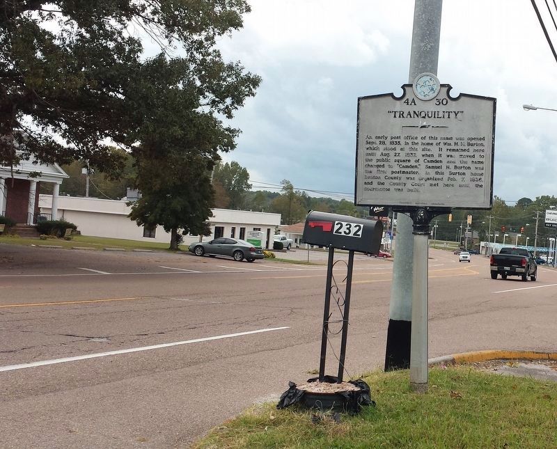
On Main Street at Westview Avenue, on the right when traveling west on Main Street.
An early post office of this name was opened Sept. 28, 1835, in the home of William H.H. Burton, which stood at this site. It remained here until Aug. 27, 1837, when it was moved to the public square of Camden and the name changed to "Camden." . . . — — Map (db m109047) HM
Born 1779, South Carolina, died 1860, Benton County Tenn. Citizen soldier, War of 1812, member of Benton County's first quarterly court February 1836. Patriot for whom Benton County was named. Presented to the Citizens of Benton.
(Base monument) . . . — — Map (db m74482) HM
On Birdsong Marina Road 0.5 miles east of Birdsong Road (Tennessee Route 191). Reported damaged.
During the Civil War, several engagements occurred along the strategically important Tennessee River within about five miles of here. In each one, cavalrymen engaged naval forces.
On April 26, 1863 near the mouth of the Duck River east of here, . . . — — Map (db m74512) HM
On North Church Avenue at East Lake Stret, on the left when traveling north on North Church Avenue.
8½ miles east, at Johnsonville Landing, Forrest's Cavalry Corps, after blocking river approaches from both directions with captured Federal vessels and gunfire, destroyed the Federal base at Johnsonville. Losses were 4 gunboats, 14 steamboats, 17 . . . — — Map (db m237476) HM
Near West Main Street (Business U.S. 70) west of Cole Avenue, on the left when traveling west.
U.D.C. Marker to eight Irish CSA soldiers
probably worked on railroad
1860-1861
Erected by
Captain Nathaniel A. Wesson
United Daughters of the Confederacy
1992 — — Map (db m109049) WM
Mary Cordelia Beasley-Hudson, a life-long resident of Benton County, was an advocate for women's suffrage. The Tennessee General Assembly approved an amendment to the state constitution to allow women's suffrage on April 15, 1919. Seven days later . . . — — Map (db m81359) HM
Near Mount Carmel Road (County Route 1766) 0.1 miles north of Firetower Road, on the right when traveling west.
On March 5, 1963, at 30 years of age, country singer Virginia Patterson Hensley, better known as Patsy Cline, along with her manager, Randy Hughes, and fellow Grand Ole Opry stars, Hawkshaw Hawkins and Cowboy Copas, were killed in a plane crash in . . . — — Map (db m184907) HM
Mildred Jolly Lashlee was the first woman elected to the Tennessee Senate for a full “regular” term. Elected in November 1944, she represented the 26th Senatorial District. Before her election she was appointed to complete the term of . . . — — Map (db m109048) HM
Born June 2, 1863, in a log cabin, about ½ mile N., he studied law at Charlotte, later began practice at Camden. Attorney General of the 13th Judicial District, 1908-12, he was the last Tennessee governor to be elected by a convention. . . . — — Map (db m74481) HM
Near Pilot Knob Road (Tennessee Route 191) 0.2 miles east of Cherry Ridge Road.
Some of the lesser known battles and incidents of wars have afforded drama and have portrayed characteristics of the participants far beyond those of usual recorded history. Such was the Battle of Johnsonville, fought between Maj. Gen. N. B. . . . — — Map (db m146444) HM
Near Eva Beach Drive 0.2 miles east of Lucas Road, on the right when traveling east.
In 1862 and 1863, Confederate cavalry raids along the Louisville & Nashville Railroad often shut down operations and slowed the flow of supplies into Nashville. The Union army built a supply depot at Johnsonville to help alleviate the disruptions. . . . — — Map (db m171324) HM
Near Pilot Knob Road (Tennessee Route 191) 0.5 miles north of Happy Hollow Road, on the left when traveling north.
The logs for this cabin were taken from a barn owned by Mr. James Sykes of Eva. The barn was used by scouts for General Nathan Bedford Forrest during a reconnaissance of the Pilot Knob area on November 4, 1864. The lower story of the Syke's home . . . — — Map (db m171323) HM
Near Eva Beach Drive 0.2 miles east of Lucas Road, on the right when traveling east.
"The river, a small rivercraft landing, its proximity to the N. B. Forrest State Park, and the Methodist assembly ground…make it attractive to visitors."
- Tennessee County History Series
The town of Eva began its . . . — — Map (db m183537) HM
Near Pilot Knob Road (Tennessee Route 191) 0.2 miles east of Cherry Ridge Road.
Below the hill to your front and concealed by thick brush, Confederate troops under the command of Maj. Gen. Nathan Bedford Forrest constructed five artillery positions to deploy guns against the Union supply depot at Johnsonville. On November 3, . . . — — Map (db m146438) HM
Near Pilot Knob Road (Tennessee Route 191) 0.2 miles east of Cherry Ridge Road.
By the fall of 1864, the Civil War was not going well for the Confederacy. The Union invasion of the Deep South continued to ravage both the military and civilian population of the war-torn region. In an attempt to halt the advance, Confederate Lt. . . . — — Map (db m146440) HM
Near Pilot Knob Road (Tennessee Route 191) 0.2 miles east of Cherry Ridge Road.
(side 1)
Commemorating the capture
of Federal gunboats
by Forrest's cavalry in the
Johnsonville Expedition
November 4, 1864.
(side 2)
"Faith is the duty of the hour."
N.B. Forrest, Major-General
to . . . — — Map (db m146443) WM
Near Eva Beach Drive 0.2 miles east of Lucas Road.
"In those days, that was how you got over there; there was no highway”
-Ken Ingram
The track leading to the Tennessee River
Railroad Bridge once started here. The
nearby depot served as the debarkation
point for . . . — — Map (db m183534) HM
Near Interstate 40 at milepost 130, on the right when traveling east.
Take Exit 133, State Route 191, and drive north to visit two state parks associated with the struggle to control the Tennessee River during the Civil War.
In 1861, the Confederates built Fort Donelson on the Cumberland River and Fort Henry . . . — — Map (db m96639) HM
On Interstate 40W at milepost 131, 1.9 miles west of Birdsong Road ( Route 191), on the right when traveling west.
Late in 1862, the Union army Gen. Ulysses S. Grant threatened Vicksburg, Mississippi. Confederate Gen. Braxton Bragg ordered Gen. Nathan Bedford Forrest to sever Grant's West Tennessee supply line, which extended from Columbus, Kentucky, via the . . . — — Map (db m118580) HM
On Atwood Highway (U.S. 79) at Cades Atwood Road, on the right when traveling south on Atwood Highway.
Carroll County
Established 1822: Named in honor of
William Carroll
An officer in the War of 1812;
governor of Tennessee, 1821-27
and 1829-35; Served as governor
longer than any other man.
Gibson County
Established . . . — — Map (db m52132) HM
On Main Street, Atwood Highway (Tennessee Route 76 / 77) at Cades Atwood Road, on the left when traveling east on Main Street, Atwood Highway.
Established 1823; Named in honor of
Colonel John Gibson
who served with distinction under
General Andrew Jackson in the
Natchez Expedition, 1812 - 13,
and in the Creek Wars. — — Map (db m52134) HM
On Atwod Highway (U.S. 79) at Jax Road, on the right when traveling east on Atwod Highway.
Governor Browning was born in Carroll County. After graduating from Cumberland Law School in 1915, he began practicing in Huntingdon. He commanded Battery D, 114th Field Artillery in France in World War I. In 1922 he was elected to Congress and . . . — — Map (db m51404) HM
On Lexington Clarksburg Road (Tennessee Route 22) at Route 424 when traveling south on Lexington Clarksburg Road.
(preface)
Gen. Nathan Bedford Forrest led his cavalry brigade on a raid through West Tennessee, Dec 15, 1862-Jan 3, 1863, destroying railroads and severing Gen. Ulysses S. Grant’s supply line between Columbus, Kentucky, and Vicksburg, . . . — — Map (db m174179) HM
On State Highway 22 at Roan Creek Church Road, on the right when traveling south on State Highway 22.
In July 1825, William and Mary Billingsley Holmes and daughter, Polly Holmes, Christopher and Elizabeth Wood Gist, and Levi McWhirter and wife met in the grove of large oaks directly to the west and organized a Bible school. This was the beginning . . . — — Map (db m156580) HM
On Broad Street (U.S. 70) at Wall Street, on the right when traveling west on Broad Street.
Alexis de Tocqueville (1805-1859), author of the classic Democracy in America, and Gustave de Beaumont (1802-1866) spent four frigid days and nights, December 12-16, 1831 at Sandy Bridge, now Hollow Rock. The postmaster, Zephaniah Harris, and . . . — — Map (db m52647) HM
On West Broad Street (U.S. 70) at Bayless Street, on the left when traveling east on West Broad Street.
Founded in 1822, this Primitive Baptist Church has been in constant use. It holds an annual foot-washing ceremony the first Sunday in May, which is attended by communicants and witnesses from many parts of this and neighboring states. — — Map (db m52585) HM
On Court Square at Lexington Street ( Route 22), on the left when traveling east on Court Square.
When the Civil War began, Carroll County residents were divided about equally between Union and Confederate sympathies and furnished a similar number of soldiers for each army. The well-to-do cotton growers residing in the prime land in the western . . . — — Map (db m179657) HM
On East Main Street at Northwood Dr, on the left when traveling east on East Main Street.
Alvin Hawkins
1821-1905
Born in 1821 in Bath County, Kentucky, Alvin Hawkins moved to Carroll County when he was seven years old. After attending McLemoresville Academy and Bethel College he tried his hand as a farmer, blacksmith, and teacher . . . — — Map (db m264334) HM
On East Main Street (Business U.S. 70) at Browning Avenue, on the left when traveling east on East Main Street.
Dedicated to
those who
gave their lives
Mexican War 1846-1848
Company B, Carroll County Guards
Tennessee Volunteers
John A. Barham • J. B. H. Bigham • W. E. Bledsoe • Samuel W. Bridges • Clark S. Butler • Gilmore S. Butler • Thomas . . . — — Map (db m179661) WM
Near East Main Street (Business U.S. 70) at Browning Avenue, on the right when traveling west.
Thomas Park was established in 1906 by the Civic Improvement Club, a women's group whose primary objective was the beautification of their hometown. The Club took on the task of making the area on East Main Street around the train depot more . . . — — Map (db m179631) HM
On Court Square at Lexington Street on Court Square.
Governor
Gordon Browning
Served
1937 to 1939 and
1949 to 1953
Governor
Alvin Hawkins
Served
1881 to 1888
The 200th year of this Nation
1776-1976 — — Map (db m273134) HM
On Lexington Street (Business Tennessee Route 22) at Noles Lane, on the right when traveling south on Lexington Street.
Born in Maury Co., he was an officer of volunteers in the Mexican War. A lifelong staunch Unionist, he was a delegate to the Constitutional Union Party convention of 1860, later an officer in the Federal Army. A delegate to the Republican convention . . . — — Map (db m52608) HM
On East Main Street at Northwood Dr, on the left when traveling east on East Main Street.
The Town of Huntingdon greatly appreciates the participation and assistance of the Walt Montgomery Family who acquired the cabin from its original home in Berton County. The cabin containing Chestnut logs, dates back to the early 1800's and was . . . — — Map (db m264335) HM
On Court Square (Business U.S. 70) at Church Street when traveling south on Court Square.
This site was a portion of the property that was home for Hotel Olive built in 1889 and later burned in 1930. E.H. & Lida Mai Edwards built the service station on the property in 1935 that remained a functioning service station for the downtown area . . . — — Map (db m179644) HM
On East Main Street (Business U.S. 70) at Buena Vista Road, on the right when traveling east on East Main Street.
Lived and is buried about 3½ miles southeast. On December 9, 1822, he made a trail through the woods to the new county seat, carrying a crosscut saw. Arrived at Huntingdon, he sawed a door in the new log courthouse and thus, as Chairman of the . . . — — Map (db m52609) HM
On East Main Street (U.S. 70) at Oakhill Drive, on the right when traveling east on East Main Street.
Established in 1822, this cemetery contains the remains of soldiers from every major American war since the establishment of the state. Among those buried here are two from the War of 1812, three from the Mexican War, and thirty-eight from the Civil . . . — — Map (db m51407) HM
On Tennessee Route 22 at Lexington Street (Business Route 22), on the right when traveling north on Tennessee Route 22.
Built about 1818 in the area to the east. Here also were held barbecues, barn dances, prize fights and cockfights. Here, according to court records, David Crockett “participated in an affray,” while attending the races. He was fined six . . . — — Map (db m52584) HM
On East Main Street (Business U.S. 70) at Northwood Drive, on the right when traveling west on East Main Street.
Although many West Tennessee residents favored secession, Unionism was strong in many areas, particularly in the counties near the Tennessee River. Two of the most notable Unionists lived on the south and north sides of Huntingdon.
Isaac R. . . . — — Map (db m179626) HM
On Cherry Avenue at College Drive, on the right when traveling west on Cherry Avenue.
Founded as Bethel Seminary at McLemoresville in 1842 by the West Tennessee Synod, Cumberland Presbyterian Church, with Rev. Ruben Burrow principal. Incorporated in 1847, it became Bethel College in 1850 and moved here in 1872. It was presented to . . . — — Map (db m52842) HM
On Highland Drive (U.S. 76) at State Route 22, on the left when traveling north on Highland Drive.
About 3 miles SE, the lake was discovered in 1785 by Henry Rutherford, who surveyed the majority of west Tennessee. It was orginally named Boyd's Lake, for the Rev. Adam Boyd, chaplin [sic] of the North Carolina Regiment in the Revolution, who later . . . — — Map (db m81368) HM
On North Main Street at Cedar Street, on the left when traveling north on North Main Street.
Shortly after the Battle of Shiloh on April 6-7, 1862, information reached the Confederate army near Corinth in northern Mississippi that a large store of Union supplies worth $3,000,000 was located at Paducah, Kentucky. On April 29, Confederate . . . — — Map (db m271959) HM
On Highland Drive (U.S. 76) 0.2 miles south of Oak Manor Road & Hamilton Street, on the right when traveling north.
Moving to McKenzie, Forrest's Brigade captured the 100 - man garrison. Here they spent Christmas Eve, while working parties completed destruction of 4 miles of trestles and bridge between the forks of the Obion River. Other parties completed . . . — — Map (db m52174) HM
On North Carroll Street 0.3 miles north of East Smith Avenue, on the left when traveling north.
Albert Gallatin Harris purchased this farm in 1829 and built the present house in 1857. After camping on the land during the Civil War, Union troops ransacked the farm, killing or stealing all the livestock. They did not burn the house because the . . . — — Map (db m74514) HM
On Cedar Street (Tennessee Route 124) at Broadway Street, on the left when traveling west on Cedar Street.
James Monroe McKenzie, entrepreneur and philanthropist, was born in February 12, 1818. In 1860 he donated land for the depot and freight office where the Nashville and Northwestern Railroad crossed the Memphis and Ohio Railroad, resulting in the . . . — — Map (db m81369) HM
On North Main Street at Cedar Street ( Route 124), on the right when traveling south on North Main Street.
(preface)
Gen. Nathan Bedford Forrest led his cavalry brigade on a raid through West Tennessee, Dec. 15, 1862-Jan. 3, 1863, destroying railroads and severing Gen. Ulysses S. Grant's supply line between Columbus, Kentucky, and Vicksburg, . . . — — Map (db m74532) HM
On Broadway Street at Lee Ave, on the left when traveling south on Broadway Street.
The Arcade saloon
was located on the corner of
Broadway and Lee Street
and operated from 1870-1885.
The proprietor of the establishment was
J.H. Coleman
who touted himself as a "saloonist."
Coleman advertised that a patron could buy
the . . . — — Map (db m271956) HM
On Cedar Street at Broadway St, on the right when traveling west on Cedar Street.
From the late 1800's until the Hamilton Building
was constructed in 1929, Dennings' Tin Shop, a livery
stable, and Lee Stroup's Saloon operated on this site.
Originally, the building was in two sections.
On the west side was Bobo's Dry Goods . . . — — Map (db m271957) HM
On Broadway Street at Lee Ave, on the right when traveling south on Broadway Street.
During the 1880's before this building was
constructed in 1898, the site was home to a shoe maker,
photo gallery and dry goods store.
Operating on the bottom floor of the building from
1899-1947 was J.P. Cannon & Sons Drug Store.
The original . . . — — Map (db m271953) HM
On Highland Drive (U.S. 79) 0.1 miles south of Route 22, on the left when traveling north.
Originally founded in 1923 as the black "County Training School" at Smyrna, Tennessee. It was moved to McKenzie in 1927, and named "Webb High School" in honor of John L. Webb. With over 1900 alumni, this school, under the leadership of J. L. Seets . . . — — Map (db m52177) HM
On West College Street at Oak Street, on the right when traveling south on West College Street.
Near this site, in 1842, Bethel
College had its beginning as Bethel
Seminary, founded by the West
Tennessee Synod of the Cumberland
Presbyterian Church. The college
continued here in McLemoresville
until 1872, when it was moved to
McKenzie. . . . — — Map (db m194269) HM
On Main Street (Alternate U.S. 70) 0.1 miles east of McLemoresville Road, on the right when traveling east.
The home of R.E.C. Dougherty stood on the foundations of the house to the north. Here, as Chairman, he held the first meeting of the Carroll County Court, March 11, 1822. Members were, Daniel Barcroft, John Bone, Banks W. Burrow, Edward Gwin, John . . . — — Map (db m51405) HM
On Main Street (State Highway 77) at College Street (State Highway 105), on the right when traveling south on Main Street.
Forrest's Brigade, re-armed, and re-equipped with material and horses captured from the Federal storehouses which they had plundered, passed through here enroute to Lexington and their re-crossing of the Tennessee River at Clifton. — — Map (db m51406) HM
On West College Street (Tennessee Route 105) at Church Street, on the right when traveling east on West College Street.
McLemoresville was settled in early 1800. In 1820 missionaries Rev. Benjamin Peeples and Rev. Lewis Garrett met at the Public Land Office to divide their territory. By 1859 a church was organized. From 1886 when the northern Methodist Episcopal . . . — — Map (db m194273) HM
On Adams Street 0.5 miles west of Route 105, on the right when traveling west.
Formerly enslaved, the Reverend Levi Price and his wife Lizzie Price were members of the original church. The Reverend Levi Price served as the first pastor of Reedy Creek Missionary Baptist Church, the only African American Church in the area. On . . . — — Map (db m130428) HM
On Main Street (U.S. 70) at McLemoresville Road on Main Street.
This 1800's log structure was donated to the
Town of McLemoresville by the Newman Walpole
family of Brownsville, TN in 2007, for use as an
historic site, visitor center and museum annex.
Restoration and furnishings were made possible
by the . . . — — Map (db m273136) HM
On Tennessee Route 190 at milepost 4, 0.3 miles south of Hinkledale Road, on the right when traveling north.
First used as Post No. 2 by the 1785 surveyors, a town was later established on November 14, 1823, at John Christmas McLemore's Bluff, on the South Fork of the
Obion River. Goods were shipped down the river until 1854. Buckeye Point, 1 mile east, . . . — — Map (db m52130) HM
On Broad Street (U.S. 76) at Oak Grove Road (Old McKenzie Road), on the right when traveling south on Broad Street.
On the old McKenzie Road one mile north stands the historic home of Major Jack Hillsman, Civil War veteran, son of pioneer Reddick Hillsman from North Carolina who helped organize Carroll County in 1821. The two-story house, completed in 1869, was . . . — — Map (db m52192) HM
On Whitthorne Road at Road 104, on the right when traveling north on Whitthorne Road.
Constructed in 1941, Milan Army Ammunition Plant Housing Area, better known as Area Q, served as base housing for assigned military personnel as well as selected supervisors and employees of the plant from 1941 to 2004. Styled in the classical . . . — — Map (db m265761) HM
On East Main Street (Tennessee Route 365) at North Cason Avenue, on the right when traveling west on East Main Street.
Listed on the National Register of Historical Places. Built in 1913 after fire destroyed the previous Court House. Portions of the Buford Pusser movie, "Walking Tall" were filmed in and around this Court House and Chester County. — — Map (db m168746) HM
Dedicated to the honor and glory of those Chester Countians who gave their lives in the service of their country. World War I Monty Allen · Joshua Buckingham · Earl Cooper · Hampton Cooper · Curry C. Cupples · Charlie Davis · H. Dolphus . . . — — Map (db m155292) WM
On Cabin Lane 0.2 miles south of Lake Levee Road, on the left when traveling east.
Between the Battle of Shiloh in April 1, 1862 until the end of the war, Confederate and Federal forces contested the control of key transportation lines near here. Union General Jeremiah S. Sullivan strove to drive Confederate cavalry under Gens. . . . — — Map (db m200462) HM
On East Main Street at White Avenue ( Route 365), on the right when traveling east on East Main Street.
Attacking this place at dawn, the Confederate cavalry battalion of Maj. N.N. Cox killed one Federal soldier, captured three officers and 33 enlisted men of "B" Co., 49th Illinois Infantry, and dispersed the rest. They burned the railroad station and . . . — — Map (db m84787) HM
On East Main Street (Tennessee Route 365) at South Washington Avenue, on the right when traveling east on East Main Street.
The first artist to successfully and consistently blend country and pop music into a new hybrid, Eddy Arnold was a pioneer of what became known as "the Nashville Sound." He introduced country music to a broad audience, registering 37 pop hits and . . . — — Map (db m174337) HM
On East Main Street (Tennessee Route 365) at North Cason Avenue, on the left when traveling east on East Main Street.
The three-year fight in present-day Chester County for control of the Mobile & Ohio Railroad often touched the lives of Henderson's residents. Henderson's Station, as it was called, served as a Confederate recruiting center for the 51st and 52nd . . . — — Map (db m155291) HM
On East Main Street, on the right when traveling east.
The campus includes the sites of predecessors Henderson Male and Female Institute (1869-1885), West Tennessee Christian College (1885-1897), Georgie Robertson Christian College (1897-1907), and National Teachers Normal and Business College . . . — — Map (db m84788) HM
On Front Street south of West Main Street ( Route 365), on the right when traveling south.
At the time of the Civil War, Henderson was a stop on the Mobile and Ohio Railroad line. First called Dayton and later renamed Henderson Station, the village consisted of houses and stores in a line facing the tracks. After the fall of Fort Donelson . . . — — Map (db m148486) HM
On Front Street south of West Main Street ( Route 365), on the right when traveling south.
The town of Henderson was begun on this street in 1860. First known as Dayton, the town's name was changed to Henderson Station during the Civil War. In 1860, Polk Bray opened the first store. Confederates led by A.B. Crook captured the railroad . . . — — Map (db m148495) HM
Near East Main Street west of North Cason Avenue, on the right when traveling west.
Perhaps the most tragic event in Chester County history occurred Friday, March 21, 1952.
At approximately 11 p.m., a tornado struck the town of Henderson. By the time the twister left the community, 22 persons lay dead, and another died later . . . — — Map (db m168749) HM
On Lake Levee Rd, on the right when traveling south.
Originally built in the Roby Community in 1876 by A.B. Fields and his wife Clearandie Stanfill Fields Ownership was passed down to their daughter Lessie Fields Woods and then to her daughter Ruby Nell Woods Brewer.
During the Bi-Centennial . . . — — Map (db m216012) HM
On State Highway 100 at State Route 22, on the right when traveling east on State Highway 100.
The Jacks Creek community was settled in the 1820s in Henderson (now Chester) County. It furnished men to the 13th Infantry, 18th Newsome's and 21st Wilson's Calvary units, C.S.A., and was the site of a skirmish 1 mi. N on Sept. 12, 1863, and an . . . — — Map (db m84789) HM
On Tennessee Route 200, on the right when traveling south.
Born 1798 in Mifflin County, Pennsylvania. Colonel John Purdy came to Tennessee in 1819. During the 1820s he served as Surveyor-General of the Ninth Surveyor’s District, with his office-home in Mifflin, which he named in honor of his Pennsylvania . . . — — Map (db m218360) HM
On North Bells Street (Tennessee Route 88) at West Main Street, on the right when traveling north on North Bells Street.
In 1861, this place was called Cageville, a small hamlet at an important West Tennessee crossroads. The residents here and at nearby Bells (then called Bells Depot) largely supported the Confederacy. In April 1861, 170 volunteers formed what would . . . — — Map (db m156331) HM
On North Bells Street (Tennessee Route 88) at North Court Street, on the right when traveling north on North Bells Street.
Crockett County
Post 4846
in commemoration of the
service of Crockett
Countians living and dead
in all of our countries
wars. We dedicate this
memorial to them.
Navy-Marines-Army
Air Force-Coast Guard
Dedicated to . . . — — Map (db m221850) WM
On S Bells Street at S Court Street, on the right when traveling north on S Bells Street.
All Gave Some - These Gave All
World War I
Thomas Arms •
John A. Barnett •
James W. Cole •
Jess Cummings •
Eldee Eaves •
Levie Edwards •
Robert C. Foster •
Joe Dean King •
Oren C. Kolwyck •
Henry Mathis •
Alford L. Nearn •
Roy B. . . . — — Map (db m274951) WM
On East Church Street (State Highway 221) just east of North Johnson Street.
In the second floor of the original Methodist Episcopal Church here, the first county court met. March 12, 1872, with Isaac Johnson Chairman, and Commissioners W.N. Beasley, John F. Sinclair, J.F. Robertson, David A. James, Asa Dean, Frank F. Wood, . . . — — Map (db m156333) HM
On Bells Street (Tennessee Route 88) at South Court Street, on the right when traveling north on Bells Street.
Robert H. "Bob" White was born in Crockett County 10 miles west of this site. He served 15 years as Tennessee's first official State Historian. He had previously served as a college teacher and a consultant to many departments of state government as . . . — — Map (db m52977) HM
On Cherryville Road at College Street ( Route 88), on the right when traveling west on Cherryville Road.
3½ miles west, this town, first called Harris' Bluff, later Harrisburg, was the first to be incorporated (Oct. 18, 1821) in west Tennessee. In 1833, the electors for the surrounding four counties delivered their returns here. Industries included a . . . — — Map (db m274905) HM
On Salem Road 0.7 miles south of Route 152, on the left when traveling north.
With 1874 land grants, Needham Moore, D.H. James, and James Alexander Cox, all descendants of Moses Cox, for whom Coxville was named, the original — trustees established the Cox's Chapel Church of Christ and Cemetery. All three are interred here . . . — — Map (db m265762) HM
Coming to this region from his native Maryland in 1867, David Brandenburg established here the first large-scale strawberry-growing operation in Tennessee. The industry has now become an important factor in the produce economy of the mid-South. — — Map (db m53032) HM
On College Street west of East End Street, on the right when traveling west.
The Maury City Masonic Lodge #368. Chartered January 1,1911 by the Grand Lodge of the State of Tennessee Free and Accepted Masons. made its home in the third floor of the old Crockett High School building which once stood on these grounds until its . . . — — Map (db m207478) HM
On Tennessee Route 88 at Dr Conyers Road, on the right when traveling east on Tennessee Route 88.
One mile due north is the grave of this veteran of the Revolutionary War who enlisted in 1776, wintered at Valley Forge, served in numerous battles, afterwards fought Indians, and was honorably discharged at Pittsburgh. He moved to what is now . . . — — Map (db m56291) HM
On Tennessee Route 114 at Dunbar Road, on the left when traveling north on Tennessee Route 114.
(side 1)
Dunbar Store, originally called Hermitage, was the center of early settlement here. It served as a store, bar, stagecoach stop, and rest stop for travelers going west. After the Civil War, the bar was no longer profitable. The . . . — — Map (db m142747) HM
On State Hwy 114 W at State Hwy 202, on the left when traveling west on State Hwy 114 W.
For the men and women who make up the United States Military, We, the people of Bath Springs, Tennessee, guided by our Heavenly Father, God Almighty, dedicate this tribute as a reminder that our nation’s freedom has come at a price borne by only a . . . — — Map (db m300013) WM
On East Main Street (Tennessee Route 100) at South Pleasant Street, on the right when traveling east on East Main Street.
13 miles southeast, this furnace was built, 1848. Iron was mined from nearby hematite deposits and processed here until 1876. The region is also known as “The Coalings”, because of extensive charcoal production here during iron mining . . . — — Map (db m63127) HM
On Pleasant Street at West Market Street, on the left when traveling north on Pleasant Street.
The Capt. Nathaniel A. Wesson Chapter of the United Daughters of the Confederacy
Dedicates this monument to the memory of our Confederate ancestors who fought so valiantly during the War Between the States
1861 - 1865
In Memoriam . . . — — Map (db m148473) WM
On East Main STreet (Tennessee Route 100) at Pleasant Street, on the right when traveling west on East Main STreet.
James Lemuel Jones, 46th General Assembly, 1889 - 1891 •
William Riley Tuten, 51st General Assembly, 1899 - 1901 •
James Tate Rogers, 57th General Assembly, 1911 - 1912, serving at time of death (1-18-19) •
James Kirk Vise, 71st General . . . — — Map (db m272943) HM
On Lewis Street just east of Crawder Street, on the right when traveling west.
Members and friends of the DCTS-CHS Alumni Association dedicate this monument to the memory of the faculty and students who attended this great institution.
The Faculty
Mr. David C. Crowder, Founder and Principal
Mr. . . . — — Map (db m152592) HM
On West Main Street (State Highway 100) just east of North White Oak Street, on the right when traveling west.
Dedicated to
the everlasting memory
of those from
Decatur County
who gave their lives
in the service
World War I
Leonard Barber • James C. Moore • Wilsie Brashear • Clarence Nichols • David A. Harrington • James J. Nichols • . . . — — Map (db m148480) WM
On Pleasant Street at West Market Street, on the left when traveling north on Pleasant Street.
The Peter Houston Chapter
of the
Daughters of the American Revolution
place this marker
on the event of the
American Revolution Bicentennial
in honor of their
Revolutionary Ancestors
Samuel Houston · Joshua Dodson · Wm. C. . . . — — Map (db m148468) WM
On East Main Street (Route 100) east of South South Street, on the right when traveling east.
Site of Decatur Co. School Gymnasium
Dedicated Oct. 15, 2013
Built with hand chiseled blocks from county's limestone quaries using Works Progress Administration "WPA" Labor
This structure burned on January 22, 1956 This memorial is . . . — — Map (db m178640) HM
Near South Tennessee Avenue (U.S. 641) at West 8th Street, on the right when traveling north.
In 1861 West Tennessee overwhelmingly supported secession. Many residents with strong attachments to the Union however, lived in several counties along the Tennessee River. despite enormous pressure from their neighbors to support the Confederacy, a . . . — — Map (db m143707) HM
1951 entries matched your criteria. The first 100 are listed above. Next 100 ⊳