116 entries match your criteria. The first 100 are listed. The final 16 ⊳
Network to Freedom Historical Markers
The Network to Freedom commemorates the stories of the men and women who risked everything for freedom and those who helped them. This series includes markers highlighting the freedom seekers, conductors, station masters, and others as well as locations and events on the Underground Railroad which are not necessarily certified as part of the Network to Freedom and not part of other specific Underground Railroad marker series.
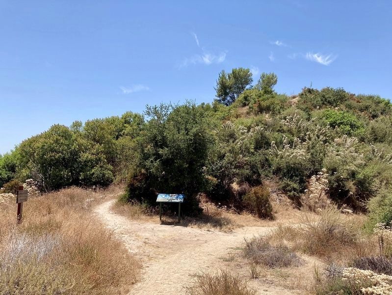
Owen Brown is buried at the top of
this hill, "Little Round Top," named for
the heroic stand by Union troops
at the Battle of Gettysburg. He and his
brother Jason lived nearby on land
they homesteaded in the 1880s. He
was the last survivor . . . — — Map (db m251866) HM
The Georgian Architecture of Poplar Hall, John Dickinson's Delaware home, suited his orderly mind and refined tastes. Built by his parents, Samuel Dickinson and Mary Cadwalader in 1740, enlarged in the 1750s, the house dominated a 5,000 acre . . . — — Map (db m284904) HM
"The Rocks," a natural landing on the Christina River, was critical to Wilmington's Underground Railroad network. Captain James Watson Fountain outfitted a schooner to secretly carry freedom-seekers north from North Carolina and Virginia. Black . . . — — Map (db m226518) HM
On Calvert Street Northwest at 20th Street Northwest, on the right when traveling west on Calvert Street Northwest.
The African American and Quaker cemeteries here were almost lost to time. Both closed in 1890 due to development. Parts of the land were sold to the National Zoo and National Park Service. Developers bought the rest and tried . . . — — Map (db m236780) HM
On Calvert Street Northwest at 20th Street Northwest, on the right when traveling west on Calvert Street Northwest.
Today's Walter Pierce Park was once the site of two cemeteries—the Friends (Quaker) Burying Ground, in use from 1807 to 1890, and Mt. Pleasant Plains Cemetery, where more than 8,400 African Americans were buried between 1870 and 1890. . . . — — Map (db m236776) HM
On Calvert Street Northwest at 20th Street Northwest, on the right when traveling west on Calvert Street Northwest.
Mt. Pleasant Plains Cemetery was the final resting place for some of the passengers and conductors of the largest Underground Railroad operation in history: the escape on the sailing ship Pearl. In April 1848, after months of planning, . . . — — Map (db m236777) HM
On Calvert Street Northwest at 20th Street Northwest, on the right when traveling west on Calvert Street Northwest.
The Civil War changed Washington, as Union troops poured into the city to secure it, and thousands of refugees from slavery arrived here seeking freedom. More than 40 African American soldiers and sailors were later buried at Mt. . . . — — Map (db m236779) HM
On Columbia Road Northwest north of Kalorama Road Northwest, on the left when traveling north.
The Courage of Hortense Prout
In 1861, at the start of the Civil War, 20-year-old Hortense Prout fled from slavery at John Little's manor house, which once stood on the lawn in front of you. She ran two miles east to an encampment . . . — — Map (db m305876) HM
On 6th Street Northwest at Indiana Avenue Northwest, on the right when traveling south on 6th Street Northwest.
To your right at the end of Indiana Avenue is Washington's first City Hall/Courthouse. Across Sixth Street is the H. Carl Moultrie I Courthouse, a successor to the original courthouse. The Old City Hall/Courthouse opened in 1822, with . . . — — Map (db m56124) HM
Near E Street Southeast just east of Potomac Avenue Southeast, on the right when traveling east.
Historic Congressional Cemetery is the final resting place of four significant contributors to the Underground Railroad.
William Boyd •
John Dean •
David A. Hall •
Hannibal Hamlin — — Map (db m141883) HM
Near Cape Florida Park Boulevard at South Crandon Boulevard, on the left when traveling south.
In the early 1820's, enslaved Africans, runaways, and "Black Seminoles" seeking freedom from slave catchers and plantation masters, secretly worked their way down to CAPE FLORIDA. They met with bold captains of sloops from the British Bahamas who . . . — — Map (db m79723) HM
Near 134th Place at St. Lawrence Avenue, on the right when traveling east.
Although Illinois was established as a "free" state in 1818, federal laws that had been enacted since 1793 permitted the recapture and return of runaway enslaved people within U.S. territory. Beginning in the 1830s, freedom seekers were . . . — — Map (db m261062) HM
On 134th Place at St. Lawrence Avenue, on the right when traveling east on 134th Place.
From the 1830s until the Civil War, many enslaved African descendants in the South escaped to Chicago on their way to freedom in Canada. Black and white abolitionists in the region were part of the networks of assistance known as the Underground . . . — — Map (db m261050) HM
On 134th Place at St. Lawrence Avenue, on the right when traveling east on 134th Place.
Prior to the Civil War, an estimated 3,000 to 4,500 African descendants traveled to the Chicago region to escape slavery in the South. Responding to their journeys, Black and White abolitionists in Chicago and across the region formed . . . — — Map (db m261052) HM
On Grace Street near Parkside Avenue, on the left when traveling south.
Built in 1839 and lived in by the Peck family until 1996, the Peck Homestead is significant locally, for the state of Illinois, and nationally as the home of Sheldon Peck, a radical abolitionist, keeper of a documented URR station and prolific . . . — — Map (db m255670) HM
On West Center Street east of Church Street, on the left when traveling east.
Before the abolition of slavery, a movement was established throughout the United States to help enslaved African Americans escape north into free states and Canada. Known as the "Underground Railroad," this network was comprised of communities, . . . — — Map (db m297045) HM
On County Road 2 at 306th Lane/Broad Street (County Road 2159E), on the right when traveling east on County Road 2.
Frank McWorter and his family worked all of their lives to gain freedom and abolish slavery. McWorter purchased freedom for his wife in 1817 and himself in 1819. He traded his saltpeter operation in 1829 so that son Young Frank could return a . . . — — Map (db m302485) HM
On County Road 2 at 306th Lane/Broad Street (County Road 2159E), on the right when traveling east on County Road 2.
The National Park Service has determined that the New Philadelphia town site has made a significant contribution to the understanding of the Underground Railroad in American history and therefore meets the requirements for inclusion in
The . . . — — Map (db m302493) HM
On East Main Street (State Road 111) at East 3rd Street, on the right when traveling east on East Main Street.
This church was built by the 2nd Presbyterian congregation and in 1889 sold to the 2nd Baptist Church. It is one of the outstanding church buildings in Indiana. The clock was a landmark for river pilots. The organ, a museum piece, was built in . . . — — Map (db m207038) HM
On Boyd Road (County Road N700W) 0.3 miles north of State Road 250, on the right when traveling north.
(Side One)
The Tibbets provided assistance to fugitive slaves here in their home (now part of National Park Service, Network to Freedom); John piloted them to the next safe haven. Both were members of Neil’s Creek Anti-Slavery Society . . . — — Map (db m74045) HM
Near Fuller Road west of South 19th Street, on the right when traveling west.
Pioneers for Emancipation
The man who built this house was James Cunningham Jordan (1813–1891). He and his wife Melinda were the earliest settlers in Walnut Township, Iowa (now West Des Moines). When he was thirty-three Mr. Jordan built a . . . — — Map (db m236559) HM
This is the final resting place of Josiah Bushnell Grinnell; Congregational minister, co-founder of the town that bears his name, member of the U.S. House of Representatives, and passionate abolitionist. As an active participant in the . . . — — Map (db m314934) HM
On Esplanade Street at Shawnee Street, on the right when traveling north on Esplanade Street.
In 1859, Charles Fisher (aka Peter and Charley Fisher), an African American barber, was
kidnapped from his place of employment at the Planters Hotel. Fisher's choice to work at the
Planters Hotel was an interesting one as it was "a recognized . . . — — Map (db m286947) HM
Near Danville Road Loop 2 0.4 miles south of Fitch Road.
Defending Camp Nelson
Designed to hold the middle of Camp Nelson's northern line, Fort Jackson is 280 feet deep and 300 feet wide with breastworks ten feet high. It is a lunette — a four-sided, unenclosed fort. It is one of . . . — — Map (db m171681) HM
From 2016 to 2018, the Oldham County History Center Compus was updated with renovations completed on the Rob Morris Educational Building and the J.C. Barnett Library and Archives. This work was done by inmates from Roederer Correctional Complex with . . . — — Map (db m223384) HM
Near North 2nd Avenue north of West Main Street, on the left when traveling north.
Town lots for LaGrange were laid out by 1827 and the population of the town in 1830 was listed as 27. By 1850 there were 400 residents as the railroad attracted new businesses. The older frame buildings on the campus reflect the typical architecture . . . — — Map (db m223385) HM
On North 2nd Avenue at West Jefferson Street (Kentucky Route 146), on the left when traveling north on North 2nd Avenue.
Road Warrior Sculpture — This sculpture represents Oldham County native and WWII veteran, Dr. E. Bruce Heilman (1926-2019). When Bruce Heilman turned 86 he circled the lower 48 states on his Marine issue Harley, traveling 9,200 miles to bring . . . — — Map (db m223387) HM
Near West Jefferson Street (Kentucky Route 146) west of North 2nd Avenue, on the left when traveling west.
Rob Morris Educational Building – The Rob Morris Educational Building was constructed in 1880 as a Presbyterian church with land donated by Amanda Mount. Amanda's son, John, married Ruth Electa Morris, daughter of Rob and Charlotte Morris. Dr. . . . — — Map (db m223390) HM
Near Louisiana Route 119 1 mile north of Highway 1, on the right when traveling north.
Although written documentation is scarce, Magnolia Plantation
is associated with an escape by enslaved Africans during an
1804 Insurrection from Rivière aux Cannes (Cane River), where
at least 30 enslaved people, including six men, one woman . . . — — Map (db m227818) HM
Near Louisiana 119 (at milepost 119), 1 mile north of Highway 1, on the right when traveling north.
Magnolia Plantation is associated with an 1863 freedom seeker
named Arnold who escaped with two others named Anderson and
Alfred from adjacent plantations. Arnold belonged to Ambroise
LeCompte (or LeComte), and Anderson and Alfred belonged . . . — — Map (db m227821) HM
Near Louisiana 494 (State Highway 494) near State Highway 119.
As the Civil War descended into the Red River valley in 1863, the presence of U.S. soldiers located in nearby Alexandria
began to disrupt plantation life and watchmen were posted each night. On June 20, 1863, Oakland Overseer, J. T. McNeely
wrote . . . — — Map (db m242183) HM
In 1760, Mount Clare was built as the summer home of Charles Carroll, Barrister. Mount Clare was the center of Georgia, Charles Carroll’s 800-acre Patapsco River Plantation. The estate supported grain fields and grist mills along the Gwynn’s Falls, . . . — — Map (db m61209) HM
On Harbor Bridge Walk at Pier 4, on the right when traveling east on Harbor Bridge Walk.
A bubbling stream to hide their tracks. A boat upriver toward hope. Chesapeake waterways were vital to the Underground Railroad, a secret network of routes used to escape slavery. The same waters that carried captured Africans into ports for sale . . . — — Map (db m234755) HM
On Harbor Bridge Walk at Pier 4, on the right when traveling east on Harbor Bridge Walk.
On October 21, 1856, two young women wove through the crowded pier to your right, heading for a steamboat. Harriet Tubman was on a mission to help an enslaved person named Tilly escape. Their dangerous journey began and became known as one of . . . — — Map (db m234754) HM
On South Poppleton Street just south of West Pratt Street, on the left when traveling east.
The Underground Railroad was a network of American abolitionists who aided and sheltered 100,000 African Americans seeking freedom from enslavement in the South. These Freedom Seekers often journeyed north by land, and many crossed into the free . . . — — Map (db m243532) HM
Gilpin’s Point was one of the busiest wharves along the Choptank River in Caroline County where steamboats and sailing vessels transported people, timber, agricultural products, and seafood. It sat just upriver from Dr. Anthony C. Thompson’s . . . — — Map (db m79311) HM
Common in the mid-19th century, this cabin is a rare survivor today. James H. and Mary Ann Webb built this one-room house in the 1850s, using materials found in the surrounding landscape. Hand-hewn log walls rest on a foundation of ballast stones . . . — — Map (db m79305) HM
On Church Street, on the right when traveling west.
In the decades before the Civil War, African Americans in the Cecilton area gathered quietly to worship in the woods outside town. The congregation, founded by Uncle Perry Hinson and known as "Friendship" was a powerful source of strength and . . . — — Map (db m297342) HM
On Cayots Corner Road, on the right when traveling east.
In late summer 1777, at least four enslaved men from Cecil County seized a rare opportunity for freedom. As British troops encamped near St. Augustine Parish during the Revolutionary War, these four men fled to the royal forces, who promised . . . — — Map (db m297019) HM
On Roundhouse Drive north of Broad Street, on the right when traveling north.
The Susquehanna River at Perryville was a critical and perilous obstacle for freedom seekers on the Underground Railroad. With no bridge, railroad travelers from Baltimore to Philadelphia were forced to disembark at Havre de Grace, cross the . . . — — Map (db m304317) HM
On Greenbrier Road 1 mile west of Bestpitch Ferry Road, on the left when traveling west.
The Call of Freedom
In the mid-19th century, 8,000 African Americans lived in Dorchester County. Roughly half were slaves; most of the rest worked as free laborers. Enslaved blacks, free blacks, and abolitionist whites worked together to . . . — — Map (db m3959) HM
On High Street at Spring Street, on the right when traveling north on High Street.
The Call of Freedom
Dorchester County occupies a central place in the story of the Underground Railroad, the secret network of "stations" and "conductors" that sheltered and shepherded hundreds of enslave African Americans to freedom in the . . . — — Map (db m3964) HM
On Taylors Island Road (SR16) at Maryland Route 335 on Taylors Island Road (SR16).
The Call of Freedom Dorchester County occupies a central place in the story of the Underground Railroad, the secret network of “stations” and “conductors” assisting hundreds of enslaved African Americans to reach . . . — — Map (db m78804) HM
Near Golden Hill Road south of Key Wallace Drive, on the right when traveling south.
Discover the extraordinary life and legacy of Harriet Tubman in the landscape of her childhood and early adult life.
Harriet Ross Tubman, an American legendary human rights advocate and suffragist, was born in enslaved in Dorchester . . . — — Map (db m114438) HM
Near Dwight D. Eisenhower Highway (Interstate 70) south of Baltimore National Pike (U.S. 40), on the right when traveling east.
Crisscrossed By Transportation Routes, Home To America's Earliest Industries, And Meeting Place For National Leaders, Maryland's Appalachian Region Has Been Pivotal In The Growth Of The Country
Throughout its history, the nation has . . . — — Map (db m116529) HM
Near Dwight D. Eisenhower Highway (Interstate 70) 2 miles west of Maryland Route 17, on the right when traveling west.
Crisscrossed By Transportation Routes, Home To America's Earliest Industries, And Meeting Place For National Leaders, Maryland's Appalachian Region Has Been Pivotal In The Growth Of The Country
Throughout its history, the nation has . . . — — Map (db m196233) HM
The 1843 Howard County Courthouse, Located on Court Avenue in the Historic District of Ellicott City, Maryland, was the location for judicial proceedings related to legal cases involving those charged with encouraging enslaved persons to run away. . . . — — Map (db m111703) HM
Near Court Place, on the left when traveling south.
The Howard County Jail, located at 1 Emory Street, in the Historic District of Ellicott City, Maryland, was the location where freedom seekers and those charged with encouraging enslaved persons to run away or rise up against their masters or . . . — — Map (db m111721) HM
Near Main Street (Maryland Route 144) at Ellicott Mills Drive. Reported missing.
The first Howard County Courthouse, located in the historic district of Ellicott City Maryland, was a pre-existing structure rented by the Howard District Commissioners from George Ellicott in 1840 to house judicial proceedings of the new Howard . . . — — Map (db m111783) HM
On Georgia Avenue (at milepost 97) at Blair Road, on the right when traveling north on Georgia Avenue.
On August 8, 1850 a hired carriage was forcibly stopped in the middle of Brookeville Pike (Georgia Avenue) near this spot by a Sheriff's posse from Washington, D.C. and a shoot-out ensued. The carriage was driven by William Chaplin, who was . . . — — Map (db m109230) HM
Seeking Freedom
"Billy", who went by William Whitington, and "Clem", also known as Clem Hill, escaped together on June 21, 1815, as shown in the ad printed in the Washington, D.C. newspaper, Daily National Intelligencer on June 26, . . . — — Map (db m69277) HM
On Point Lookout Road (Maryland Route 5) 1.6 miles south of 3rd Way, on the right when traveling south.
During the Civil War, thousands of enslaved African-Americans escaped from captivity in the South to liberty in the North. The grounds before you once sheltered these freedom-seekers, know at that time as “Contraband”.
Conditions in the . . . — — Map (db m104760) HM
On Washington Square (Massachusetts Route 1A) just south of Oliver Street, on the right when traveling south.
Salem Common was originally a nine-acre parcel of swampy land used for grazing livestock and training the local militia. In 1637, the first regiment of the Massachusetts Bay Colony militia to muster (train) was the East Regiment. This volunteer . . . — — Map (db m311661) HM
On State Street (State Highway 60) at Water Street, on the right when traveling east on State Street.
In 1847, black and white residents of Vandalia and Cassopolis stood up and stopped 13 slave catchers from taking 9 kidnapped slaves back to Kentucky. They showed great courage and determination in stopping what they saw as a grave injustice. . . . — — Map (db m201653) HM
Mary Meachum believed slavery was wrong, and she did something about it!
Did you know you are standing at the first site in Missouri to be added to the National Park Service's Underground Railroad Network to Freedom? At this site along the . . . — — Map (db m140413) HM
On North 14th Street north of 3rd Avenue, on the left when traveling north.
In 1858, Alexander Majors and his family moved from Kansas City, Missouri to Nebraska City where he purchased several blocks in the Prairie City Addition. Here he established the new headquarters of the Russell, Majors, and Waddell Freighting . . . — — Map (db m251936) HM
On Central Avenue west of South 5th Street, on the right when traveling west.
In 1854, Stephen F. Nuckolls settled with his wife, Lucinda, and family in Nebraska Territory from Atchison County, Missouri. He built the first brick house in Nebraska City, at this corner of 5th & Main (Central Avenue). Nuckolls, who became a . . . — — Map (db m251880) HM
On Stone Street at West 16th Street, on the right when traveling south on Stone Street.
The Dorrington House and Barn were
built on this site by abolitionists David and Ann Dorrington upon their arrival in 1857. David, who acquired the contract to transport mail between Falls City and Topeka, Kansas, used mail wagons to
move freedom . . . — — Map (db m254882) HM
Near Pine Street just south of East 4th Street, on the left when traveling south.
Here at the home of Silas Shearman pioneer settler and ardent abolitionist was the principal Jamestown “station” of the Underground Railroad where in the late fifties escaping slaves from the south were sheltered and assisted on their way to . . . — — Map (db m177999) HM
[Locator map of Woodlawn Cemetery]
20. Elizabeth Adams, (Leer Green) - Sec. P. (free ground)
4. John Arnot, Sr. - Sec. H (vault) • • • 3. Olivia Lewis Langdon - Sec. G Lot 37
12. Harwood Badger - Sec. D. Lot 73 • • • 21. Anderson Murphy - . . . — — Map (db m154366) HM
On Robert Rich Way 0.1 miles south of Ferry Street Bridge, on the right when traveling south.
[left panel] Black Rock Harbor. The Village of Black Rock received its name from a large rock outcropping that jutted into the river about a half mile south of this site. The original ferry crossing was located at the rock and a small village grew . . . — — Map (db m97956) HM
On Robert Rich Way 0.1 miles south of Ferry Street Bridge, on the right when traveling south.
[left panel] Broderick Park Welcome to Broderick Park, a waterfront park of the City of Buffalo! Broderick Park is significant as the site of the Black Rock Ferry, a historic crossing point between the United States and Canada for over 120 years. . . . — — Map (db m97957) HM
On Robert Rich Way 0.1 miles south of Ferry Street Bridge, on the right when traveling south.
Freedom Seekers faced daunting odds and demonstrated remarkable courage. Most started their journeys with little knowledge of what lay before them, and many sought help from free blacks and sympathetic whites once they reached the north. . . . — — Map (db m97931) HM
On Robert Rich Way at West Ferry Bascule Bridge when traveling west on Robert Rich Way.
Black Rock developed dramatically in the 19th century due to the Erie Canal and its competing railroads. Mills, factories, and an array of manufacturing plants were constructed along the waterfront with immigrant neighborhoods and commerical areas . . . — — Map (db m98194) HM
On Robert Rich Way at West Ferry Bascule Bridge when traveling west on Robert Rich Way.
The Black Rock Ferry was an important crossing to Canada throughout the 19th century until it ceased operations in 1949. The ferry wharf was located on a long, narrow stone pier constructed to protect Black Rock Harbor from the Niagara River. . . . — — Map (db m98196) HM
On Sutton Drive south of West Water Street (U.S. 17), on the right when traveling south.
Recognized since 2008 as part of the National Underground Railroad Network to Freedom the Roanoke River was an important passageway for Antebellum freedom seekers — — Map (db m276365) HM
On South Broad Street at East Water Street on South Broad Street. Reported permanently removed.
Now one of Edenton's most tranquil locations, during the antebellum period Edenton harbor was the town's industrial center with wharves, shipyards, and maritime activity.
North Carolina's small, ill-protected harbors prevented development of . . . — — Map (db m34770) HM
On Dock Street south of West Water Street, on the left when traveling south.
Now one of Edenton's most tranquil locations, during the antebellum period Edenton harbor was the town's industrial center with wharves, shipyards, and maritime activity. North Carolina's small ill-protected harbors prevented development of major . . . — — Map (db m276357) HM
[obverse:]First Light of Freedom Former slaves give thanks by the creek’s edge
at the sight of the island - “If you can cross the creek to Roanoke Island, you will find ‘safe haven’.” [rendering of Edwin Forbes' "The . . . — — Map (db m46990) HM
On King Street north of Fishing Club Road, on the right when traveling north.
Follow this ¼ mile trail to the Roanoke River and meet the men, women, and children who risked their lives to flee slavery.
“…the thought of being again made a slave, and of suffering the horrible punishment of a runaway, restrained me. I lay . . . — — Map (db m221541) HM
On South Water Street at Orange Street, on the right when traveling south on South Water Street.
In the years before the abolition of slavery, the Underground Railroad was neither “underground” nor was it a “railroad”. The Underground Railroad was comprised of a secret cooperative network of clandestine routes and safe houses that aided . . . — — Map (db m263346) HM
On South Water Street at Orange Street, on the right when traveling south on South Water Street.
In 2005, this site was named “Orange Street Landing on Cape Fear” when it was officially accepted into the National Underground Railroad Network to Freedom. As part of the National Park Service, this programs marks historic sites, facilities and . . . — — Map (db m263344) HM
On South Water Street at Orange Street, on the right when traveling south on South Water Street.
William Benjamin Gould (1837-1923) was born on November 18, 1837. His father, Alexander Gould, was a white man born in England, and his mother, Elizabeth Moore, was an enslaved woman from Wilmington, North Carolina. Gould's owner was Nicholas Nixon, . . . — — Map (db m263345) HM
Near South Water Street at East Ehringhaus Street, on the left when traveling south.
The Pasquotank River was noted in 35 runaway slave ads between 1791 to 1840, indicating that slaves (“freedom seekers”) escaped on board boats (“vessels”) traveling north to free territory or south to the West Indies, confirming that . . . — — Map (db m56811) HM
On West Water Street at Monroe Street, on the right when traveling west on West Water Street.
Plymouth Landing
In the late 17th century, two traders built a trading post on the Roanoke River in what is now downtown Plymouth. By 1738, the site was called Brickhouse Plantation on maps. A shipyard was built there in 1771, and a settlement . . . — — Map (db m276297) HM
On West Water Street at Monroe Street, on the right when traveling west on West Water Street.
Dedicated to the bravery of the enslaved people who came to the Plymouth waterfront seeking their freedom; and to their allies, enslaved and free, who, at great risk, helped the freedom seekers to find their way to a better life.
Plymouth . . . — — Map (db m276303) HM
On West Water Street at Monroe Street, on the right when traveling west on West Water Street.
In its edition of August 27, 1851, the Plymouth Villager made a backhanded confirmation of the presence of abolitionists in Washington County, North Carolina. "A coat of tar and feathers is in waiting for the gentleman who will come about . . . — — Map (db m276306) HM
On North Front Street at Locust Street on North Front Street.
John P. Parker (1827–1900). Born into slavery. Bought his freedom at the age of 18. Underground Railroad Conductor. He helped hundreds of freedom seekers. Mentor to Colonel Charles Young.
There is quiet symbolism built into this 1 . . . — — Map (db m135477) HM
On Western Avenue just east of Washington Street, on the left when traveling east.
The original section of the church was built in 1842, the same year the congregation avowed “not to fellowship with those who sustained or countenanced” the institution of slavery. — — Map (db m182099) HM
On Front Street just north of Main Street, on the left when traveling north.
Dr. Rogers was the first president of the Clermont County Anti-Slavery Society and a financial supporter of James G. Birney, publisher of The Philanthropist newspaper. He practiced medicine for over 60 years and is most noted for the delivery . . . — — Map (db m182096) HM
On Front Street at Walnut Street, on the right when traveling east on Front Street.
In 1862 slave catchers paraded a captured LeRoy Lee in
manacles down Front Street toward the ferry. A crowd of
New Richmond citizens confronted the armed captors
demanding the release of Lee. Seeing they were greatly
outnumbered, the slave . . . — — Map (db m99706) HM
On Basore Road NE 0.1 miles south of Cincinnati Zanesville Road NE (U.S. 22), on the right when traveling south.
In this cemetery are the remains of at least
7 enslaved people who died on their quest
for freedom. While traveling on the
Underground Railroad, they would have been
assisted in Rushville by Dr. Simon Hyde and
Rev. William . . . — — Map (db m137582) HM
On Ohio Route 109 just south of County Road F, on the right when traveling south.
The Kings, a family of staunch Presbyterians, were active in the Underground
Railroad. From 1838 to the end of the Civil War, here, at the John King Farm,
a network of extended families operated an Underground Railroad Station.
Following the . . . — — Map (db m227746) HM
On Lawrence Street at 5th Street, on the left when traveling east on Lawrence Street.
John Campbell (1818-1891), founder of Ironton, was an ironmaster and president of the Ohio Iron & Coal Company, a Presbyterian, and an abolitionist. This house and barn, which he built in 1850, became a stop on the Underground Railroad for . . . — — Map (db m59375) HM
On Woodlawn Avenue at Jefferson Street, on the right when traveling south on Woodlawn Avenue.
has been placed on the
National Register
of
Historic Places
by the United States
Department of the Interior
National Underground
Network to Freedom — — Map (db m316372) HM
Near Hickory Street east of Baumer Street, on the right when traveling east.
"For you don't have us yet."
On February 12, 1837, two slaves, brothers "Patrick" and "Abraham" escaped from the Fruit Hill farm of Col. John Sherrard in Bath, Va. They were pursued by slave catchers into Pennsylvania. Having been . . . — — Map (db m311834) HM
On West Market Street just west of North Walnut Street (Pennsylvania Route 217), on the right when traveling west.
On April 1, 1858, Blairsville Mayor Chester C. Davis was summoned to quell a mob of angry Blairsville citizens. The mob, a mixture of black and white men, had surrounded three slave catchers who were attempting to kidnap a former slave named . . . — — Map (db m211498) HM
116 entries matched your criteria. The first 100 are listed above. The final 16 ⊳