188 entries match your criteria. The first 100 are listed. ⊳
ASCE Civil Engineering Landmarks Historical Markers
More than 200 markers sponsored by the American Society of Civil Engineers recognizing historically significant local, national, and international civil engineering projects, structures, and sites.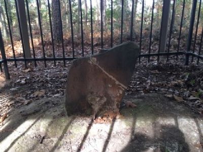
By Mark Hilton, December 4, 2013
Ellicott's Stone
1 ► Alabama, Mobile County, Le Moyne — Ellicott's Stone — Erected April 9th, 1799 —  |
| On U.S. 43 at milepost 19, 0.1 miles south of Lofton Road, on the right when traveling north. | |||
| 2 ► Alaska, Fairbanks North Star Borough, Fairbanks, Downtown — Alaska Highway/La route de l'Alaska Marker — International Historic Civil Engineering Landmark — Monument historique international du génie civil — |
| On 1st Avenue at Cushman Street, on the left when traveling east on 1st Avenue. | |||
| 3 ► Alaska, Juneau Borough, Juneau, Downtown Juneau — Alaska Governor's Mansion — |
| On Calhoun Avenue at Indian, on the left when traveling north on Calhoun Avenue. | |||
| 4 ► Alaska, Southeast Fairbanks Census Area, Delta Junction — Delta Junction, Alaska — Northern Terminus of the "Alcan" Highway — |
| On Alaska Highway (at milepost 1,422) at Richardson Highway, on the left when traveling north on Alaska Highway. | |||
| 5 ► Arizona, Cochise County, San Simon — The San Simon Rest Area - Percy Jones, Jr. — |
| Near Interstate 10 at milepost 388. | |||
| 6 ► Arizona, Cochise County, San Simon — The San Simon Rest Area - Percy Jones, Jr. — |
| Near Interstate 10 (Interstate 10). | |||
| 7 ► Arizona, Coconino County, Grand Canyon National Park — Kaibab Trail Suspension Bridge — National Historic Civil Engineering Landmark — Black Bridge — |
| On Rim Trail north of Yavapai Point, on the right when traveling west. | |||
| 8 ► Arizona, Coconino County, Marble Canyon — Navajo Bridge — |
| Near U.S. 89A at milepost 538. | |||
| 9 ► Arizona, Coconino County, Page — Colorado River Storage Project / Glen Canyon Dam — Reclamation: Managing Water in the West — |
| Near U.S. 89. | |||
| 10 ► Arizona, Maricopa County, Mesa — Prehistoric Irrigation in the Salt River Valley — |
| Near North Horne Avenue 0.4 miles south of East McKellips Road. | |||
| 11 ► Arizona, Yavapai County, Bumble Bee — The Sunset Point Rest Area — Dedicated to the Engineering Achievement of — William Clayton LeFebvre, 1890-1964 — |
| Near Interstate 17. | |||
| 12 ► California, Alameda County, San Leandro — Chabot Dam — |
| Near Estudillo Avenue. | |||
| 13 ► California, Alameda County, Sunol — Alameda Creek Water System — Sunol Water Temple Restoration — |
| Near Paloma Way. | |||
| 14 ► California, Humboldt County, Fernbridge — Fernbridge — Eel River Bridge — |
| On California Route 211 at Depot Street, on the left when traveling south on California Route 211. | |||
| 15 ► California, Kern County, Lebec — Interstate Highway 5 — |
| Near Interstate 5, 0.8 miles north of Frazier Mountain Park Road. | |||
| 16 ► California, Kern County, Tehachapi — Tehachapi Pass Railroad Line — Constructed 1874 – 1876 — Commemorated October 1998 — |
| On Woodford-Tehachapi Road, 3.2 mi E of Keene exit, on the left when traveling east. | |||
| 17 ► California, Los Angeles County, Angeles National Forest — The “Ridge Route” — California Historic Civil Engineering Landmark — Constructed 1914-1915 — |
| Near Vista Del Lago Road at Interstate 5. | |||
| 18 ► California, Los Angeles County, Los Angeles, Downtown Los Angeles — Los Angeles City Hall — Local Historic Civil Engineering Landmark — |
| Near Main Street north of 1st Street. | |||
| 19 ► California, Los Angeles County, Los Angeles, Granada Hills — Los Angeles Aqueduct Filtration Plant — |
| Near Sepulveda Boulevard 0.5 miles north of Roxford Street. | |||
| 20 ► California, Los Angeles County, Los Angeles, Sylmar — 653 — "The Cascades" — |
| On Foothill Boulevard 0.1 miles north of Balboa Boulevard, on the right when traveling north. | |||
| 21 ► California, Los Angeles County, Los Angeles, Sylmar — 653 — The Cascades — |
| On Foothill Boulevard 0.1 miles west of Balboa Boulevard, on the right when traveling west. | |||
| 22 ► California, Los Angeles County, Pasadena, South Arroyo — Colorado Street Bridge — Historic Civil Engineering Landmark — |
| On Colorado Boulevard 0.1 miles west of Orange Grove Boulevard, on the left when traveling west. | |||
| 23 ► California, Los Angeles County, Torrance, Old Torrance — Pacific Electric Railway — El Prado Bridge — |
| On Torrance Boulevard at Bow Avenue, on the right when traveling east on Torrance Boulevard. | |||
| 24 ► California, Marin County, Sausalito — 974 — The Golden Gate Bridge |
| Near U.S. 101, on the right when traveling north. Reported damaged. | |||
| 25 ► California, Mono County, Lee Vining — The Tioga Pass Road — Constructed 1883 & 1910 - Commemorated 2002 — |
| On Tioga Pass Road (State Highway 120), on the right when traveling east. | |||
| 26 ► California, Nevada County, Penn Valley — 390 — Bridgeport Historic District — |
| Near Pleasant Valley Road 7.5 miles north of Route 20, on the left when traveling north. | |||
| 27 ► California, Orange County, San Juan Capistrano — 54 — Mission San Juan Capistrano — |
| On Ortega Highway at Camino Capistrano, on the left when traveling east on Ortega Highway. | |||
| 28 ► California, Orange County, Tustin — Marine Corps Air Station Tustin — Blimp Hangars — |
| On Park Avenue at Victory Road, on the right when traveling south on Park Avenue. | |||
| 29 ► California, Orange County, Yorba Linda — 40 — Irrigation in Orange County — |
| Near Santa Ana Canyon Road. | |||
| 30 ► California, Sacramento County, Sacramento, Old Sacramento — Sacramento Water Works — Historic Civil Engineering Landmark — |
| On I street at Front Street, on the right when traveling west on I street. | |||
| 31 ► California, San Bernardino County, Mentone — Henry Harbinson Sinclair — 1858-1914 — |
| On Mill Creek Road (California Route 38) 1 mile east of Bryant Street, on the right when traveling east. | |||
| 32 ► California, San Diego County, San Diego, Balboa Park — Cabrillo Bridge — |
| On El Prado east of Balboa Drive, on the right when traveling east. | |||
| 33 ► California, San Francisco City and County, San Francisco, Golden Gate Park — Alvord Lake Bridge — National Historic Civil Engineering Landmark — Built 1889 — |
| Near Haight Street west of Stanyan Street. | |||
| 34 ► California, San Francisco City and County, San Francisco, Nob Hill — San Francisco Cable Car System — Ferries & Cliff House Railway Company — Cable Car Museum — |
| Near Mason Street at Washington Street, on the left when traveling north. | |||
| 35 ► California, San Francisco City and County, San Francisco, Presidio of San Francisco — The Golden Gate Bridge — Vision, Genius and Expert Care — |
| Near Lincoln Boulevard west of Chrissy Field Avenue. | |||
| 36 ► California, San Mateo County, Burlingame — 100th Anniversary of the Crystal Springs Dam — |
| On Skyline Boulevard west of Crystal Springs Road when traveling south. | |||
| 37 ► California, San Mateo County, Pescadero — 930 — Pigeon Point Lighthouse — |
| Near Pigeon Point Road near Highway 1. | |||
| 38 ► California, Santa Barbara County, Santa Barbara — Cold Spring Arch Bridge — Historic Civil Engineering Landmark — ASCE — |
| On Stagecoach Road near San Marcos Pass Road ( Route 154). | |||
| 39 ► California, Santa Barbara County, Santa Barbara — Santa Barbara Mission Early Water Supply — Historic Civil Engineering Landmark — |
| Near Los Olivos Street north of Alameda Padre Serra, on the right when traveling north. | |||
| 40 ► California, Yuba County, Camptonville — Lester Allen Pelton — |
| On Cleveland Avenue, on the right when traveling west. | |||
| 41 ► Colorado, La Plata County, Durango — Durango - Silverton Narrow Gauge Railroad — |
| On Main Avenue at 5th Street, on the right when traveling south on Main Avenue. | |||
| 42 ► Colorado, Montezuma County, Cortez — Prehistoric Mesa Verde Reservoirs — |
| Near State Highway 10. | |||
| 43 ► Colorado, Montezuma County, Mesa Verde National Park — Far View Reservoir — |
| Near State Highway 10 1.3 miles south of Wetherill Mesa Road. | |||
| 44 ► Florida, Collier County, Naples — Bay City Walking Dredge — National Historic Mechanical Engineering Landmark — 1924 — |
| Near Tamiami Trail East (U.S. 41) south of San Marco Road (County Route 92), on the right when traveling south. | |||
| 45 ► Florida, Columbia County, High Springs — Bellamy Road — Florida Historic Civil Engineering Landmark — |
| Near Oleno Park Road near U.S. 441. | |||
| 46 ► Florida, St. Johns County, St. Augustine, Historic District — Castillo de San Marcos — National Historic Civil Engineering Landmark — |
| On South Castillo Drive (State Road A1A) (Business U.S. 1) at Cuna Street, on the right when traveling north on South Castillo Drive (State Road A1A). | |||
| 47 ► Georgia, Chatham County, Savannah, North Historic District — Savannah Historic District — |
| On West Bryan Street near Bull Street, on the left when traveling west. | |||
| 48 ► Idaho, Boise County, Robie Creek — Arrowrock Dam — National Historic Civil Engineering Landmark — |
| On Arrowrock Road. | |||
| 49 ► Idaho, Kootenai County, Coeur d'Alene — The Mullan Road — Mullan Road Historical Site — |
| On Forest Road N 3098 near Interstate 90. | |||
| 50 ► Illinois, Cook County, Chicago, River North — Metropolitan Water Reclamation District of Greater Chicago's Wastewater System — Civil Engineering Monument of the Millennium — |
| On East Erie Street east of Rush Street. | |||
| 51 ► Illinois, Cook County, Chicago, River North — Sidestream Elevated Pool Aeration Project — |
| On East Erie Street east of Rush Street. | |||
| 52 ► Illinois, Cook County, Chicago, River North — The Metropolitan Sanitary District of Greater Chicago — |
| On East Erie Street east of Rush Street. | |||
| 53 ► Illinois, Cook County, Chicago, The Loop District — Monument of the Millennium — Wastewater System — |
| On North Breakwater Access. | |||
| 54 ► Indiana, Franklin County, Metamora — Duck Creek Aqueduct — |
| On Pennington Rd 0.2 miles east of Columbia St, on the left when traveling east. | |||
| 55 ► Indiana, Franklin County, Metamora — The Duck Creek Aqueduct — A Bridge for Water — |
| On Main Street 0.1 miles east of Basin Street, on the left when traveling east. | |||
| 56 ► Indiana, Marion County, Indianapolis, Mile Square — Historic National Road / Make History, Drive It — The Road That Built The Nation — |
| On West Washington Street at Senate Avenue, on the right when traveling west on West Washington Street. | |||
| 57 ► Kentucky, Kenton County, Covington — John A. Roebling Bridge — |
| On Court Avenue (Kentucky Route 17) 0.1 miles north of East 3rd Street, on the right when traveling north. | |||
| 58 ► Kentucky, Livingston County, Grand Rivers — Kentucky Dam — National Historic Civil Engineering Landmark — Tennessee Valley Authority — |
| On Kentucky Dam Road. | |||
| 59 ► Louisiana, Caddo Parish, Shreveport, Allendale-Lakeside — McNeill St. Pump Station — Historic Site — Shreveport — |
| On North Common Street 0.5 miles north of Caddo Street. | |||
| 60 ► Louisiana, Jefferson Parish, Elmwood — Huey P. Long Bridge, Louisiana — National Historic Civil Engineering Landmark — |
| On River Road (State Road 611-1) north of St. George Street, on the right when traveling north. | |||
| 61 ► Louisiana, Plaquemines Parish, Buras — Eads Jetties — |
| On Herbert Harvey Drive 0.5 miles south of Levee Road, on the left when traveling south. | |||
| 62 ► Louisiana, St. Charles Parish, Destrehan — Hale Boggs Bridge — |
| On River Road (State Highway 48) south of South Destrehan Avenue, on the left when traveling south. | |||
| 63 ► Louisiana, St. Charles Parish, Luling — Hale Boggs Bridge — |
| On River Road (State Highway 18) north of Fre'Re Street, on the left when traveling north. | |||
| 64 ► Louisiana, St. Charles Parish, Norco — Bonnet Carré Spillway — National Historic Civil Engineering Landmark — |
| Near River Road 0.3 miles north of Eighth Street, on the left when traveling north. | |||
| 65 ► Louisiana, St. Tammany Parish, Mandeville — Lake Pontchartrain Causeway Bridge — National Historic Civil Engineering Landmark — |
| On North Causeway Boulevard, on the right when traveling south. | |||
| 66 ► Maine, Cumberland County, Cape Elizabeth — Portland Head Light — National Historic Civil Engineering Landmark — |
| On Shore Road, on the right when traveling north. | |||
| 67 ► Maine, Cumberland County, Cape Elizabeth — Portland Head Light — National Historic Civil Engineering Landmark — |
| Near Captain Strout Circle. | |||
| 68 ► Maine, Cumberland County, Harpswell — Bailey Island Bridge — |
| On Harpswell Island Road (Maine Route 24) on Harpswell Island Road. | |||
| 69 ► Maine, Cumberland County, Naples — Songo Lock — |
| On Sebago Lake State Park Road 1.9 miles east of U.S. 302, on the left when traveling north. | |||
| 70 ► Maine, Cumberland County, Portland, East End — Portland Observatory, Portland, Maine — Built 1807 — National Historic Civil Engineering Landmark — |
| On Congress Street just north of Kellogg Street, on the right when traveling north. | |||
| 71 ► Maine, Penobscot County, Bangor — Bangor Water District Thomas Hill Standpipe — |
| On Thomas Hill Road 0.1 miles south of Ohio St., on the right when traveling south. | |||
| 72 ► Maryland, Baltimore County, Relay — The Thomas Viaduct — |
| Near Railroad Avenue near Viaduct Avenue. | |||
| 73 ► Maryland, Howard County, Savage — Bollman Iron Truss Bridge — 1869 — |
| On Foundry Street near Gorman Road, on the left when traveling north. | |||
| 74 ► Maryland, Montgomery County, Cabin John — Building The Cabin John Bridge — |
| On MacArthur Boulevard, on the right when traveling east. | |||
| 75 ► Maryland, Montgomery County, Dickerson — Springing Over the Monocacy / The Enduring Aqueduct / Preservation Through Partnerships — Chesapeake and Ohio Canal National Historical Park — National Park Service, U.S. Department of the Interior — |
| On Mouth of Monocacy Road 1.3 miles west of Dickerson Road (Maryland Route 28), on the right when traveling west. | |||
| 76 ► Maryland, Prince George's County, Fort Washington — Woodrow Wilson Memorial Bridge — |
| Near the Woodrow Wilson Bridge Trail (U.S. I-95) 0.8 miles west of Oxon Hill Road (State Route 414). | |||
| 77 ► Massachusetts, Franklin County, Conway — Bardwells Ferry Bridge — |
| On Bardwells Ferry Road 0.2 miles north of Wholey Road when traveling north. | |||
| 78 ► Massachusetts, Franklin County, Gill, Riverside — 278 — Riverside Village Historic District — Town of Gill, Massachusetts — |
| On Riverview Drive just south of Pine Street, on the right when traveling south. | |||
| 79 ► Massachusetts, Norfolk County, Canton — Canton Viaduct — |
| On Neponset Street north of Walpole Street, on the right when traveling north. | |||
| 80 ► Massachusetts, Norfolk County, Quincy — The Granite Railway — |
| On Granite Rail Court, on the right when traveling east. | |||
| 81 ► Massachusetts, Plymouth County, Brockton — Brockton Railroad Viaducts and Bridges — Massachusetts Historic Civil Engineering Landmark — |
| On Centre Street (Massachusetts Route 123) west of Commercial Street, on the right when traveling west. | |||
| 82 ► Massachusetts, Suffolk County, Boston, Charlestown — Dry Dock 1 — Boston Nat’l Hist Pk — Charlestown Navy Yard — |
| Near 3rd Street, on the right when traveling south. | |||
| 83 ► Michigan, Allegan County, Allegan — S549A — The Second Street Bridge — |
| On State Street (2nd Street) south of Brady Street, on the left when traveling south. | |||
| 84 ► Michigan, Mackinac County, St. Ignace, Moran Township — Mackinac Bridge, Michigan — National Historic Civil Engineering Landmark — |
| Near Boulevard Drive. | |||
| 85 ► Minnesota, Hennepin County, Minneapolis, Downtown East — Stone Arch Bridge - Great Northern Railway — National Historic Civil Engineering Landmark — |
| Near West River Parkway. | |||
| 86 ► Minnesota, Hennepin County, Minneapolis, Downtown West — Stone Arch Bridge — |
| Near West River Parkway west of Portland Avenue South. | |||
| 87 ► Minnesota, Hennepin County, Minneapolis, Saint Anthony Main — The Stone Arch Bridge — Saint Anthony Falls Heritage Trail — |
| Near 6th Avenue Southeast. | |||
| 88 ► Missouri, St. Louis, Downtown — The Eads Bridge — National Historic Civil Engineering Landmark — |
| On North 1st Street north of Washington Avenue, on the right when traveling north. | |||
| 89 ► Missouri, St. Louis, Downtown — The Gateway Arch — Jefferson National Expansion Memorial — |
| On North Leonor K. Sullivan Boulevard. | |||
| 90 ► Missouri, St. Louis, Downtown West — Union Station — |
| On Market Street, on the right when traveling east. | |||
| 91 ► Missouri, St. Louis, Forest Park — River Des Peres Sewage and Drainage Works — |
| On Clayton Avenue 0.4 miles west of South Kingshighway, on the right when traveling west. | |||
| 92 ► Missouri, St. Louis County, Kirkwood — Remembering the Achievements of James P. Kirkwood — March 27, 1807 - April 22, 1877 — Co-Founder (1852) and Second President (1867-1868) of the American Society of Civil Engineers — |
| Near West Argonne Drive 0.1 miles west of South Kirkwood Road (U.S. 61/67), on the right when traveling east. | |||
| 93 ► Montana, Chouteau County, Fort Benton — Mullan Wagon Road — |
| On Front Street near 17th Street, on the right when traveling north. | |||
| 94 ► Nebraska, Douglas County, Omaha, Riverview — Union Pacific Railroad — The First Transcontinental Railroad — National Historic Civil Engineering Landmark — |
| Near Bancroft Street 0.2 miles east of Bancroft Plaza. | |||
| 95 ► Nebraska, Keith County, Ogallala — Central Nebraska Project — |
| On Scenic State Highway 61 6.1 miles north of North Spruce Street, on the left when traveling north. | |||
| 96 ► Nevada, Clark County, Boulder City — Civil Engineering Monument of the Millennium — Hoover Dam — |
| On U.S. 93, on the right when traveling west. | |||
| 97 ► Nevada, Clark County, Boulder City — Hoover Dam — |
| On U.S. 93, on the right when traveling west. | |||
| 98 ► Nevada, Storey County, Virginia City — 14 — Virginia & Gold Hill Water Company — Comstock Historical Marker No. 14 — 130 South B St., Virginia, City, NV — |
| On South B Street north of Taylor Street, on the right when traveling south. | |||
| 99 ► New Hampshire, Hillsborough County, Hillsborough — 203 — Stone Arch Bridges — |
| On West Main Street (New Hampshire Route 149) at U.S. 202, on the right when traveling east on West Main Street. | |||
| 100 ► New Hampshire, Sullivan County, Cornish — 158 — Cornish-Windsor Bridge — |
| On Chase Road (SR 12A) at Bridge Street on Chase Road (SR 12A). | |||
188 entries matched your criteria. The first 100 are listed above. The final 88 ⊳