116 entries match your criteria. The first 100 are listed. ⊳
Network to Freedom Historical Markers
The Network to Freedom commemorates the stories of the men and women who risked everything for freedom and those who helped them. This series includes markers highlighting the freedom seekers, conductors, station masters, and others as well as locations and events on the Underground Railroad which are not necessarily certified as part of the Network to Freedom and not part of other specific Underground Railroad marker series.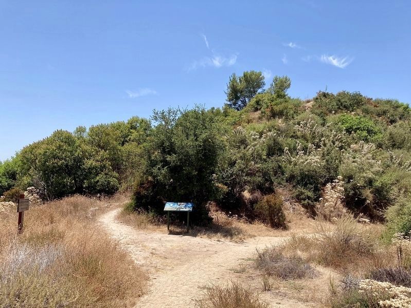
By Craig Baker, July 22, 2024
Owen Brown Marker
1 ► California, Los Angeles County, Altadena — Owen Brown — An Abolitionist Comes West —  |
| Near El Prieto Road Trail. | |||
| 2 ► Delaware, Kent County, Dover, East Dover Hundred — The Dickinsons in Delaware — Welcome to the John Dickinson Plantation — First State National Historical Park, National Park Service, U.S. Department of the Interior — |
| Near Kitts Hummock Road. | |||
| 3 ► Delaware, New Castle County, Wilmington — "The Rocks" and the Underground Railroad — The Delaware Underground Railroad — |
| On East 7th Street. | |||
| 4 ► District of Columbia, Washington, Northwest Washington, Adams Morgan — Rediscovery and Remembrance — Hallowed Ground — Rock Creek Park, National Park Service, U.S. Department of the Interior — |
| On Calvert Street Northwest at 20th Street Northwest, on the right when traveling west on Calvert Street Northwest. | |||
| 5 ► District of Columbia, Washington, Northwest Washington, Adams Morgan — Resilience and Resistance — Hallowed Ground — Rock Creek Park, National Park Service, U.S. Department of the Interior — |
| On Calvert Street Northwest at 20th Street Northwest, on the right when traveling west on Calvert Street Northwest. | |||
| 6 ► District of Columbia, Washington, Northwest Washington, Adams Morgan — Seeking Freedom — Hallowed Ground — Rock Creek Park, National Park Service, U.S. Department of the Interior — |
| On Calvert Street Northwest at 20th Street Northwest, on the right when traveling west on Calvert Street Northwest. | |||
| 7 ► District of Columbia, Washington, Northwest Washington, Adams Morgan — Soldiers, Sailors, and Refugees of War — Hallowed Ground — Rock Creek Park, National Park Service, U.S. Department of the Interior — |
| On Calvert Street Northwest at 20th Street Northwest, on the right when traveling west on Calvert Street Northwest. | |||
| 8 ► District of Columbia, Washington, Northwest Washington, Kalorama Triangle — The Courage of Hortense Prout / La valentía de Hortense Prout — National Underground Railroad Network to Freedom — |
| On Columbia Road Northwest north of Kalorama Road Northwest, on the left when traveling north. | |||
| 9 ► District of Columbia, Washington, Northwest Washington, Penn Quarter — e.2 — Ending Slavery in Washington — Civil War to Civil Rights — Downtown Heritage Trail — |
| On 6th Street Northwest at Indiana Avenue Northwest, on the right when traveling south on 6th Street Northwest. | |||
| 10 ► District of Columbia, Washington, Southeast Washington, Barney Circle — National Underground Railroad Network to Freedom — |
| Near E Street Southeast just east of Potomac Avenue Southeast, on the right when traveling east. | |||
| 11 ► Florida, Manatee County, Palma Sola — Back to Angola — De Soto National Memorial — |
| Near 75th Street Northwest. | |||
| 12 ► Florida, Miami-Dade County, Key Biscayne — Escaping to Freedom in the Bahamas — |
| Near Cape Florida Park Boulevard at South Crandon Boulevard, on the left when traveling south. | |||
| 13 ► Illinois, Cook County, Chicago, Golden Gate — Activists in the Anti-Slavery Movement — |
| Near 134th Place at St. Lawrence Avenue, on the right when traveling east. | |||
| 14 ► Illinois, Cook County, Chicago, Golden Gate — Freedom Seekers and the Underground Railroad: Ton Farm Site — |
| On 134th Place at St. Lawrence Avenue, on the right when traveling east on 134th Place. | |||
| 15 ► Illinois, Cook County, Chicago, Golden Gate — Pathways to Freedom: The Underground Railroad in Chicago — |
| On 134th Place at St. Lawrence Avenue, on the right when traveling east on 134th Place. | |||
| 16 ► Illinois, DuPage County, Lombard — Sheldon Peck Homestead and Underground Railroad Site — |
| On Grace Street near Parkside Avenue, on the left when traveling south. | |||
| 17 ► Illinois, Kendall County, Yorkville — Bristol Churches and the Underground Railroad — |
| On West Center Street east of Church Street, on the left when traveling east. | |||
| 18 ► Illinois, Morgan County, Jacksonville — Benjamin Henderson — |
| Near Myrtle Street. | |||
| 19 ► Illinois, Morgan County, Jacksonville — Elihu Wolcott — |
| Near South Lincoln Avenue. | |||
| 20 ► Illinois, Morgan County, Jacksonville — Henry Irving — |
| Near Massey View Road. | |||
| 21 ► Illinois, Morgan County, Jacksonville — Julia Wolcott Carter — |
| Near South Lincoln Avenue. | |||
| 22 ► Illinois, Morgan County, Jacksonville — William C. Verry — Died March 10, 1877 — |
| Near Massey View Road. | |||
| 23 ► Illinois, Morgan County, Jacksonville — William Chauncey Carter — |
| Near South Lincoln Avenue. | |||
| 24 ► Illinois, Pike County, Barry, Hadley Township — New Philadelphia and the Underground Railroad — |
| On County Road 2 at 306th Lane/Broad Street (County Road 2159E), on the right when traveling east on County Road 2. | |||
| 25 ► Illinois, Pike County, Barry, Hadley Township — New Philadelphia Town Site — |
| On County Road 2 at 306th Lane/Broad Street (County Road 2159E), on the right when traveling east on County Road 2. | |||
| 26 ► Indiana, Floyd County, New Albany — The Town Clock Church — |
| On East Main Street (State Road 111) at East 3rd Street, on the right when traveling east on East Main Street. | |||
| 27 ► Indiana, Jefferson County, Madison — 39.2006.2 — John H. and Sarah Tibbets — |
| On Boyd Road (County Road N700W) 0.3 miles north of State Road 250, on the right when traveling north. | |||
| 28 ► Iowa, Polk County, West Des Moines — Welcome to the Jordan House — |
| Near Fuller Road west of South 19th Street, on the right when traveling west. | |||
| 29 ► Iowa, Poweshiek County, Grinnell — Josiah Bushnell Grinnell — |
| Near 1st Avenue West. | |||
| 30 ► Kansas, Leavenworth County, Leavenworth — Planters Hotel — National Underground Railroad Network to Freedom Site — |
| On Esplanade Street at Shawnee Street, on the right when traveling north on Esplanade Street. | |||
| 31 ► Kentucky, Jessamine County, Nicholasville — Fort Jackson — |
| Near Danville Road Loop 2 0.4 miles south of Fitch Road. | |||
| 32 ► Kentucky, Oldham County, La Grange — Oldham County History Center — |
| Near North 2nd Avenue at West Main Street. | |||
| 33 ► Kentucky, Oldham County, La Grange — Oldham County History Center — |
| Near North 2nd Avenue north of West Main Street, on the left when traveling north. | |||
| 34 ► Kentucky, Oldham County, La Grange — Oldham County History Center — |
| On North 2nd Avenue at West Jefferson Street (Kentucky Route 146), on the left when traveling north on North 2nd Avenue. | |||
| 35 ► Kentucky, Oldham County, La Grange — Oldham County History Center — |
| Near West Jefferson Street (Kentucky Route 146) west of North 2nd Avenue, on the left when traveling west. | |||
| 36 ► Louisiana, Natchitoches Parish, Derry — Escaped! Freedom Seekers in 1804 — |
| Near Louisiana Route 119 1 mile north of Highway 1, on the right when traveling north. | |||
| 37 ► Louisiana, Natchitoches Parish, Derry — Escaped! Freedom Seekers in 1863 — |
| Near Louisiana 119 (at milepost 119), 1 mile north of Highway 1, on the right when traveling north. | |||
| 38 ► Louisiana, Natchitoches Parish, Natchez — Escaped! Freedom Seekers in 1863-1864 — |
| Near Louisiana 494 (State Highway 494) near State Highway 119. | |||
| 39 ► Maryland, Baltimore, Carroll Park — Mount Clare — Freedom Seekers at Georgia Plantation — National Underground Railroad-Network to Freedom — |
| On Washington Blvd.. | |||
| 40 ► Maryland, Baltimore, Inner Harbor — Pathways to Freedom — |
| On Harbor Bridge Walk at Pier 4, on the right when traveling east on Harbor Bridge Walk. | |||
| 41 ► Maryland, Baltimore, Inner Harbor — Tilly's Escape — |
| On Harbor Bridge Walk at Pier 4, on the right when traveling east on Harbor Bridge Walk. | |||
| 42 ► Maryland, Baltimore, Pigtown — The Underground Railroad — The Historic National Road, America's First Federally Funded Highway — |
| On South Poppleton Street just south of West Pratt Street, on the left when traveling east. | |||
| 43 ► Maryland, Caroline County, Harmony — “Sailing Away to Freedom” — Gilpin Point — Harriet Tubman Underground Railroad Byway — |
| On Holly Park Drive. | |||
| 44 ► Maryland, Caroline County, Preston — 28 — Webb Cabin — Living Free — Harriet Tubman Underground Railroad Byway — |
| On Grove Road. | |||
| 45 ► Maryland, Cecil County, Cecilton — Union Bethel African Methodist Episcopal Church — A Sanctuary of Faith & Freedom — |
| On Church Street, on the right when traveling west. | |||
| 46 ► Maryland, Cecil County, Chesapeake City — St. Augustine Parish — Revolutionary Paths to Freedom — |
| On Cayots Corner Road, on the right when traveling east. | |||
| 47 ► Maryland, Cecil County, Perryville — Perryville Railroad Ferry & Station — A Dangerous Crossing to Freedom — |
| On Roundhouse Drive north of Broad Street, on the right when traveling north. | |||
| 48 ► Maryland, Dorchester County, Bucktown — Finding Freedom — |
| On Greenbrier Road 1 mile west of Bestpitch Ferry Road, on the left when traveling west. | |||
| 49 ► Maryland, Dorchester County, Cambridge — Finding Freedom — |
| On High Street at Spring Street, on the right when traveling north on High Street. | |||
| 50 ► Maryland, Dorchester County, Church Creek — Finding Freedom — National Underground Railroad Network to Freedom — |
| On Taylors Island Road (SR16) at Maryland Route 335 on Taylors Island Road (SR16). | |||
| 51 ► Maryland, Dorchester County, Church Creek — The Harriet Tubman Underground Railroad Visitor Center — |
| Near Golden Hill Road south of Key Wallace Drive, on the right when traveling south. | |||
| 52 ► Maryland, Frederick County, Myersville — Explore Maryland as the Crucible of the Nation — |
| Near Dwight D. Eisenhower Highway (Interstate 70) south of Baltimore National Pike (U.S. 40), on the right when traveling east. | |||
| 53 ► Maryland, Frederick County, Myersville — Explore Maryland as the Crucible of the Nation — |
| Near Dwight D. Eisenhower Highway (Interstate 70) 2 miles west of Maryland Route 17, on the right when traveling west. | |||
| 54 ► Maryland, Howard County, Ellicott City — Howard County Courthouse, 1843 — National Park Service Underground Railroad — Network to Freedom — |
| Near Court Avenue. | |||
| 55 ► Maryland, Howard County, Ellicott City — Howard County Jail, 1851 — National Park Service Underground Railroad — Network to Freedom — |
| Near Court Place, on the left when traveling south. | |||
| 56 ► Maryland, Howard County, Ellicott City — Old Court House, 1840: — National Park Service Underground Railroad — Network to Freedom |
| Near Main Street (Maryland Route 144) at Ellicott Mills Drive. Reported missing. | |||
| 57 ► Maryland, Montgomery County, Silver Spring, Downtown Silver Spring — William L. Chaplin Arrested! — |
| On Georgia Avenue (at milepost 97) at Blair Road, on the right when traveling north on Georgia Avenue. | |||
| 58 ► Maryland, Prince George's County, Lake Arbor — Seeking Freedom — |
| On Water Port Court. | |||
| 59 ► Maryland, St. Mary's County, Scotland — "Contraband" Camp — Point Lookout State Park — Maryland Park Service — |
| On Point Lookout Road (Maryland Route 5) 1.6 miles south of 3rd Way, on the right when traveling south. | |||
| 60 ► Massachusetts, Essex County, Salem — Salem Common — Salem — |
| On Washington Square (Massachusetts Route 1A) just south of Oliver Street, on the right when traveling south. | |||
| 61 ► Michigan, Cass County, Vandalia — The Kentucky Raid — |
| On State Street (State Highway 60) at Water Street, on the right when traveling east on State Street. | |||
| 62 ► Missouri, St. Louis, Near North Riverfront — Mary Meachum Freedom Crossing — Moving Along and Across a Great River |
| Near East Grand Avenue. Reported missing. | |||
| 63 ► Nebraska, Otoe County, Nebraska City — Alexander Majors Residence — Network to Freedom-Site of Escape — Nebraska Underground Railroad Tour — |
| On North 14th Street north of 3rd Avenue, on the left when traveling north. | |||
| 64 ► Nebraska, Otoe County, Nebraska City — Stephen F. Nuckolls Residence — Network to Freedom-Site of Escape — Nebraska Underground Railroad Tour — |
| On Central Avenue west of South 5th Street, on the right when traveling west. | |||
| 65 ► Nebraska, Richardson County, Falls City — The Dorrington House — National Underground Railroad Network to Freedom — |
| On Stone Street at West 16th Street, on the right when traveling south on Stone Street. | |||
| 66 ► New York, Chautauqua County, Jamestown — The Underground Railroad — |
| Near Pine Street just south of East 4th Street, on the left when traveling south. | |||
| 67 ► New York, Chemung County, Elmira — John W. Jones — |
| On Davis Street just south of Woodlawn Avenue, on the right when traveling north. | |||
| 68 ► New York, Chemung County, Elmira — Underground Railroad Participants — |
| Near Woodlawn Avenue at Davis Street. | |||
| 69 ► New York, Erie County, Buffalo, Unity Island — Black Rock Harbor / From Plantation to Promised Land — National Underground Railroad Network to Freedom — |
| On Robert Rich Way 0.1 miles south of Ferry Street Bridge, on the right when traveling south. | |||
| 70 ► New York, Erie County, Buffalo, Unity Island — Broderick Park / Distinctive River Ecosystems — National Underground Railroad Network to Freedom — |
| On Robert Rich Way 0.1 miles south of Ferry Street Bridge, on the right when traveling south. | |||
| 71 ► New York, Erie County, Buffalo, Unity Island — Harrowing Journey — National Underground Railroad Network to Freedom — |
| On Robert Rich Way 0.1 miles south of Ferry Street Bridge, on the right when traveling south. | |||
| 72 ► New York, Erie County, Buffalo, Unity Island — Industrial Powerhouse — National Underground Railroad Network to Freedom — |
| On Robert Rich Way at West Ferry Bascule Bridge when traveling west on Robert Rich Way. | |||
| 73 ► New York, Erie County, Buffalo, Unity Island — International Crossing — National Underground Railroad Network to Freedom — |
| On Robert Rich Way at West Ferry Bascule Bridge when traveling west on Robert Rich Way. | |||
| 74 ► North Carolina, Bertie County, Windsor — Roanoke River Underground Railroad Trail — |
| On Sutton Drive south of West Water Street (U.S. 17), on the right when traveling south. | |||
| 75 ► North Carolina, Chowan County, Edenton — Escape Via Maritime Underground Railroad |
| On South Broad Street at East Water Street on South Broad Street. Reported permanently removed. | |||
| 76 ► North Carolina, Chowan County, Edenton — Maritime Underground Railroad — Escape by Sea — |
| On Dock Street south of West Water Street, on the left when traveling south. | |||
| 77 ► North Carolina, Dare County, Manteo — First Light of Freedom — The Freedmen’s Colony of Roanoke Island — National Underground Railroad - Network To Freedom — |
| Near National Park Drive 3 miles U.S. 64. | |||
| 78 ► North Carolina, Halifax County, Halifax — Escape! — The Roanoke River, Halifax, and the Maritime Underground Railroad. — |
| On King Street north of Fishing Club Road, on the right when traveling north. | |||
| 79 ► North Carolina, New Hanover County, Wilmington, Riverfront — Underground Railroad Activity in Wilmington, N.C. — Orange Street Landing on Cape Fear — |
| On South Water Street at Orange Street, on the right when traveling south on South Water Street. | |||
| 80 ► North Carolina, New Hanover County, Wilmington, Riverfront — What is the National Underground Railroad Network to Freedom? — Orange Street Landing on Cape Fear — |
| On South Water Street at Orange Street, on the right when traveling south on South Water Street. | |||
| 81 ► North Carolina, New Hanover County, Wilmington, Riverfront — William Benjamin Gould: A Brief Biography — Orange Street Landing on Cape Fear — |
| On South Water Street at Orange Street, on the right when traveling south on South Water Street. | |||
| 82 ► North Carolina, Pasquotank County, Elizabeth City — 2004 — Pasquotank River — |
| Near South Water Street at East Ehringhaus Street, on the left when traveling south. | |||
| 83 ► North Carolina, Washington County, Plymouth — Plymouth was at the Center of the Underground Railroad in North Carolina — |
| On West Water Street at Monroe Street, on the right when traveling west on West Water Street. | |||
| 84 ► North Carolina, Washington County, Plymouth — Plymouth Water Street Landing Park — |
| On West Water Street at Monroe Street, on the right when traveling west on West Water Street. | |||
| 85 ► North Carolina, Washington County, Plymouth — Why Plymouth? — Willing Citizens, Opportunity, Transportation — |
| On West Water Street at Monroe Street, on the right when traveling west on West Water Street. | |||
| 86 ► Ohio, Brown County, Ripley — John P. Parker Memorial Park — |
| On North Front Street at Locust Street on North Front Street. | |||
| 87 ► Ohio, Clermont County, New Richmond — 1st Regular Baptist Church — Underground Railroad Site — Clermont Freedom Trail — |
| On Western Avenue just east of Washington Street, on the left when traveling east. | |||
| 88 ► Ohio, Clermont County, New Richmond — Dr. John G. Rogers Home & Office — Underground Railroad Site — Clermont Freedom Trail — |
| On Front Street just north of Main Street, on the left when traveling north. | |||
| 89 ► Ohio, Clermont County, New Richmond — New Richmond Waterfront — Underground Railroad Site — Clermont Freedom Trail — |
| On Front Street at Walnut Street, on the right when traveling east on Front Street. | |||
| 90 ► Ohio, Clermont County, Williamsburg — 30 — Charles B. Huber Farm — Clermont County, Ohio Freedom Trail — National Underground Railroad Network to Freedom — |
| On West Main Street (Ohio Route 276) east of Tollgate Road, on the right when traveling east. | |||
| 91 ► Ohio, Clermont County, Williamsburg — 27 — Charles B. Huber Home Site — Clermont County, Ohio Freedom Trail — National Underground Railroad Network to Freedom — |
| On Gay Street east of North 2nd Street, on the left when traveling east. | |||
| 92 ► Ohio, Clermont County, Williamsburg — 28 — Dr. L.T. Pease Home Site — Clermont County, Ohio Freedom Trail — National Underground Railroad Network to Freedom — |
| On Gay Street at North 2nd Street, on the left when traveling east on Gay Street. | |||
| 93 ► Ohio, Clermont County, Williamsburg — 26 — Marcus Sims - Huber Tannery Location — Clermont County, Ohio Freedom Trail — National Underground Railroad Network to Freedom — |
| On South Second Street south of West Main Street ( Route 133), on the right when traveling south. | |||
| 94 ► Ohio, Clermont County, Williamsburg — 29 — Williamsburg Township Cemetery — Clermont County, Ohio Freedom Trail — National Underground Railroad Network to Freedom — |
| On Gay Street east of North High Street, on the right when traveling west. | |||
| 95 ► Ohio, Fairfield County, Rushville — Formerly Enslaved People — |
| On Basore Road NE 0.1 miles south of Cincinnati Zanesville Road NE (U.S. 22), on the right when traveling south. | |||
| 96 ► Ohio, Fulton County, Delta — John King and King Family Cemetery — |
| On Ohio Route 109 just south of County Road F, on the right when traveling south. | |||
| 97 ► Ohio, Lawrence County, Ironton — 5-44 — John Campbell Memorial Home — |
| On Lawrence Street at 5th Street, on the left when traveling east on Lawrence Street. | |||
| 98 ► Ohio, Muskingum County, Zanesville — Putnam Presbyterian Church — Circa 1835 — |
| On Woodlawn Avenue at Jefferson Street, on the right when traveling south on Woodlawn Avenue. | |||
| 99 ► Pennsylvania, Cambria County, Johnstown — Escape of Freedom Seekers Patrick and Abraham — |
| Near Hickory Street east of Baumer Street, on the right when traveling east. | |||
| 100 ► Pennsylvania, Indiana County, Blairsville — Chester C. Davis and the Kidnapping of 1858 — The Blairsville Area Underground Railroad — |
| On West Market Street just west of North Walnut Street (Pennsylvania Route 217), on the right when traveling west. | |||
116 entries matched your criteria. The first 100 are listed above. The final 16 ⊳