808 entries match your criteria. The first 100 are listed. ⊳
Native Sons/Daughters of the Golden West Historical Markers
The NSGW was formed by Albert Maver Winn in 1875 to preserve the California historic buildings and sites of the Gold Rush and prior. The only requirement to be a member is to have been born in California. The sister organization, NDGW, followed soon thereafter.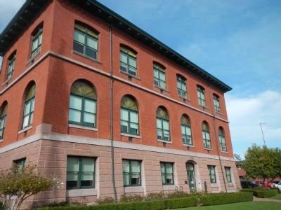
By Barry Swackhamer, December 8, 2012
Alameda City Hall Marker
| 1 ► California, Alameda County, Alameda — Alameda City Hall — |
| On Oak Street near Santa Clara Avenue. | |||
| 2 ► California, Alameda County, Alameda — Alameda Lodge No. 1015 — |
| On Santa Clara Avenue near Oak Street, on the right when traveling west. | |||
| 3 ► California, Alameda County, Alameda — 440 — Alameda Terminus of the 1st Transcontinental Railroad — |
| On West Mall Square, on the right when traveling north. | |||
| 4 ► California, Alameda County, Alameda — GPY-140-02 — Clark Memorial Bench — My Dumb Friends Bench — |
| On Park Avenue. | |||
| 5 ► California, Alameda County, Alameda — First Presbyterian Church — |
| On Santa Clara Avenue at Chestnut Street on Santa Clara Avenue. | |||
| 6 ► California, Alameda County, Alameda — 26 — Meyers House — |
| On Alameda Avenue near Chestnut Street, on the right when traveling west. | |||
| 7 ► California, Alameda County, Alameda — 1029 — The Jimmy Doolittle Pier – Alameda Naval Air Station — Pier No. 3 — USS Hornet — |
| Near Hornet Avenue at Ferry Point. | |||
| 8 ► California, Alameda County, Alameda — Webster House — |
| On Versailles Avenue, on the left when traveling south. | |||
| 9 ► California, Alameda County, Berkeley, Central Berkeley — Berkeley Veterans Memorial Grove — |
| On Martin Luther King Jr. Way at Allston Way, on the right when traveling south on Martin Luther King Jr. Way. | |||
| 10 ► California, Alameda County, Castro Valley — 776 — Site of First Public School in Castro Valley — |
| On Redwood Road near James Avenue, on the right when traveling north. | |||
| 11 ► California, Alameda County, Emeryville — Oakland Ball Park — |
| On Park Avenue, on the right when traveling west. | |||
| 12 ► California, Alameda County, Fremont, Mission San Jose — Founding of Mission San Jose — |
| On Mission Boulevard at Washington Boulevard, on the right when traveling north on Mission Boulevard. | |||
| 13 ► California, Alameda County, Fremont, Mission San Jose — 334 — Mission San José — |
| On Mission Boulevard at Washington Boulevard, on the right when traveling north on Mission Boulevard. | |||
| 14 ► California, Alameda County, Hayward — 141-09 — Lone Tree Cemetery — |
| On Fairview Avenue at Crolls Place, on the right when traveling south on Fairview Avenue. | |||
| 15 ► California, Alameda County, Hayward — NSGW Hall - Eden Parlor No. 113 — Former Site — |
| On Main Street, on the right when traveling north. | |||
| 16 ► California, Alameda County, Hayward — Rancho San Lorenzo — |
| On Mission Boulevard (State Highway 185) south of C Street. | |||
| 17 ► California, Alameda County, Livermore — 641 — Concannon Vineyard — |
| Near Tesla Road. | |||
| 18 ► California, Alameda County, Livermore — 241 — Robert Livermore — First Settler of Livermore Valley — |
| On Portola Avenue, on the right when traveling east. | |||
| 19 ► California, Alameda County, Mountain House — Mountain House School — Established 1893 — |
| On Mountain House Road, 0.5 miles south of Keho Road, on the right when traveling south. | |||
| 20 ► California, Alameda County, Oakland, Joaquin Miller Park — 107 — Joaquin Miller — "Poet of the Sierras” — |
| Near Joaquin Miller Road at Sanborn Road, on the left when traveling east. | |||
| 21 ► California, Alameda County, Oakland, Paradise Park — In Memoriam (NSGW WWI Memorial) — |
| On San Pablo Avenue at 63rd Street, on the right when traveling north on San Pablo Avenue. | |||
| 22 ► California, Alameda County, Pleasanton — Johnston Building — |
| On Main Street at Rose Street, on the right when traveling south on Main Street. | |||
| 23 ► California, Alameda County, Pleasanton — Kottinger’s Barn — |
| Near Ray Street, on the right when traveling south. | |||
| 24 ► California, Alameda County, Pleasanton — Rancho El Valle de San Jose — |
| Near Fairgrounds Road, 0.2 miles Pleasanton Avenue, on the right when traveling north. | |||
| 25 ► California, Alameda County, Pleasanton — The Pleasanton Hotel — |
| On Main Street, on the right when traveling west. | |||
| 26 ► California, Alameda County, San Leandro, Old San Leandro — Masonic Temple — |
| On East 14th Street at Joaquin Avenue, on the right when traveling south on East 14th Street. | |||
| 27 ► California, Alameda County, San Leandro, Old San Leandro — San Leandro Courthouse Site — |
| On Davis Street at Clarke Street (California Highway 61/112), on the right when traveling east on Davis Street. | |||
| 28 ► California, Alameda County, Union City — 503 — First County Courthouse — |
| On Union City Boulevard near Cambridge Way, on the right when traveling west. | |||
| 29 ► California, Alpine County, Kirkwood — 315 — Kit Carson — |
| Near Carson Pass Scenic Byway (State Highway 88), on the right. | |||
| 30 ► California, Alpine County, Markleeville — Alpine County Courthouse — |
| On Alpine State Highway (California Route 89) at Water Street, on the right when traveling north on Alpine State Highway. | |||
| 31 ► California, Alpine County, Markleeville — Alpine County Historical Complex — |
| Near School Street. | |||
| 32 ► California, Alpine County, Markleeville — Snowshoe Thompson Home — |
| On Diamond Valley Road, 3 miles east of California Highway 89, on the right when traveling west. | |||
| 33 ► California, Alpine County, Markleeville — Webster School — |
| On Montgomery Street at Laramie Street, on the left when traveling west on Montgomery Street. | |||
| 34 ► California, Alpine County, Woodfords — 805 — Woodfords Station — |
| On Old Pony Express Way (California Route 88) east of California Route 89, on the left when traveling east. | |||
| 35 ► California, Amador County, Amador City — Imperial Hotel — |
| On Main Street (Old State Highway 49) at Water Street, on the left when traveling south on Main Street. | |||
| 36 ► California, Amador County, Drytown — Drytown — |
| On Hanford Street (State Highway 49), on the right when traveling south. | |||
| 37 ► California, Amador County, Fiddletown — H. C. Farnham House 1855 — |
| On Jibboom Street near Ostrom Road, on the left when traveling east. | |||
| 38 ► California, Amador County, Ione — Buena Vista Store — |
| On Buena Vista Road at Jackson Valley Road on Buena Vista Road. | |||
| 39 ► California, Amador County, Ione — 788 — Daniel Stewart Co. Store — |
| On East Main Street, on the right when traveling west. | |||
| 40 ► California, Amador County, Ione — Ione Brewery — |
| On Preston Avenue (California Route 104) at Welch Lane, on the right when traveling north on Preston Avenue. | |||
| 41 ► California, Amador County, Ione — Ione City Hall — |
| On East Main Street at North Church Street, on the left when traveling west on East Main Street. | |||
| 42 ► California, Amador County, Ione — Ione High School — |
| Near South Mills Street, on the left when traveling south. | |||
| 43 ► California, Amador County, Ione — Ione Parlor No. 33, N.S.G.W. — |
| On East Main Street, on the left when traveling west. | |||
| 44 ► California, Amador County, Ione — Ione's Annual Picnic — |
| Near West Plymouth Highway at California Highway 124. | |||
| 45 ► California, Amador County, Ione — Ione's Chinatown — |
| On East Main Street at Eldorado Street, on the right when traveling west on East Main Street. | |||
| 46 ► California, Amador County, Ione — Quincy - Ione's Sister City — |
| Near Michigan Bar Road (California Route 104) 1.5 miles East Plymouth Highway (California Route 124). | |||
| 47 ► California, Amador County, Ione — Scully Ranch — |
| Near Five Mile Drive - Old Stockton Rd. (name changes) near West Marlette St.. | |||
| 48 ► California, Amador County, Ione — Steam Flour Mill — |
| On West Jackson Street near South Sacramento Street, on the right when traveling west. | |||
| 49 ► California, Amador County, Ione — 137-10 — The Dutschke Ranch — |
| Near Dutschke Road. | |||
| 50 ► California, Amador County, Ione — The Heirloom — |
| Near Shakeley Lane. | |||
| 51 ► California, Amador County, Jackson — Argonaut Mine — |
| On State Highway 49 (California Route 49), on the right when traveling south. | |||
| 52 ► California, Amador County, Jackson — 39 — Butte Store — |
| On State Highway 49 at milepost 1.4,, 2.5 miles south of State Route 88, on the left when traveling south. | |||
| 53 ► California, Amador County, Jackson — 141-16 — Constitution Saloon — |
| On Summit Street at Court Street, on the left when traveling south on Summit Street. | |||
| 54 ► California, Amador County, Jackson — 2010-08 — Excelsior Parlor 31 — Native Sons of the Golden West — |
| On Court Street east of North Main Street, on the right when traveling east. | |||
| 55 ► California, Amador County, Jackson — Hangman's Tree — |
| On Main Street. | |||
| 56 ► California, Amador County, Jackson — Jackson — |
| Near State Highway 49. | |||
| 57 ► California, Amador County, Jackson — Jackson Fire Bell — |
| On Broadway Street, on the left when traveling south. | |||
| 58 ► California, Amador County, Jackson — Kennedy Mining and Milling Company — 1860 - 1942 — |
| Near Kennedy Mine Road. | |||
| 59 ► California, Amador County, Jackson — Law Office — |
| On Court Street at Summit Street, on the left when traveling east on Court Street. | |||
| 60 ► California, Amador County, Jackson — 34 — Pioneer Hall — |
| On Main Street near Court Street, on the right when traveling south. | |||
| 61 ► California, Amador County, Jackson — Sesquicentennial Court House Site — |
| Near Summit Street near Court Street, on the right when traveling north. | |||
| 62 ► California, Amador County, Jackson — St. Sava Serbian Orthodox Church — |
| 63 ► California, Amador County, Jackson — The Court House Well — |
| On Summit Street near Court Street, on the right when traveling north. | |||
| 64 ► California, Amador County, Jackson — University of California Foothill Field Station — 1888 – 1903 — |
| Near State Highway 49, on the right when traveling south. | |||
| 65 ► California, Amador County, Jackson — Wells Fargo Building — |
| On Main Street at Water Street, on the right when traveling north on Main Street. | |||
| 66 ► California, Amador County, Martell — To The Memory of Mike Tovey — Wells Fargo Messenger — |
| On State Highway 88/104, 1.6 miles west of Ridge Road (State Highway 104), on the left when traveling west. | |||
| 67 ► California, Amador County, Pioneer — 141-17 — Ham's Station — |
| On Amador/Nevada Highway (State Highway 88) 0.6 miles Panther Creek Road, on the right when traveling east. | |||
| 68 ► California, Amador County, Plymouth — Forest Home — 1850's — Stage and Freight Stopover — |
| On Jackson Road (State Highway 16) 0.2 miles west of Forest Home Road, on the left when traveling east. | |||
| 69 ► California, Amador County, Plymouth — Shenandoah School — 1879 — |
| Near Shenandoah School Road. | |||
| 70 ► California, Amador County, Sutter Creek — 1854 · Amador County · 1954 — |
| On Sutter Hill Road at Eureka Road, on the right when traveling west on Sutter Hill Road. | |||
| 71 ► California, Amador County, Sutter Creek — Brignoli Building — 1858 — |
| On Main Street (Old Highway 49) south of Randolph Street, on the right when traveling south. | |||
| 72 ► California, Amador County, Sutter Creek — 322 — General John A. Sutter — Sutter Creek — |
| On Main Street (State Highway 49), on the right when traveling north. | |||
| 73 ► California, Amador County, Sutter Creek — J. Monteverde General Store Museum — |
| On Randolph Street at Boston Alley, on the left when traveling east on Randolph Street. | |||
| 74 ► California, Amador County, Sutter Creek — 1007 — Knight Foundry — |
| On Eureka Street, on the left when traveling east. | |||
| 75 ► California, Amador County, Sutter Creek — Levaggi Opera House — |
| On Main Street (Old Highway 49) south of Keyes Street. | |||
| 76 ► California, Amador County, Sutter Creek — Miners' Bend Park — A Historic Gold Mining Park — |
| On Old Route 49 (Main Street), on the left when traveling south. | |||
| 77 ► California, Amador County, Sutter Creek — Native Sons Hall — |
| On Main Street, on the right when traveling north. | |||
| 78 ► California, Amador County, Sutter Creek — 147-7 — Old Eureka Mine — Established 1852 — |
| On Old Route 49, 0.8 miles north of Golden Chain Highway (California Route 49), on the right. | |||
| 79 ► California, Amador County, Sutter Creek — 8 — Pine Woods — |
| On Church Street, on the left when traveling east. | |||
| 80 ► California, Amador County, Sutter Creek — Sutter Creek — |
| On Main Street (Old California Route 49), on the right when traveling north. | |||
| 81 ► California, Amador County, Sutter Creek — Sutter Creek Grammar School — 1871 — |
| Near Broad Street near Gopher Flat Road. | |||
| 82 ► California, Amador County, Sutter Creek — Sutter Creek United Methodist Church — |
| On Main Street (Old Highway 49) near Church Street, on the right when traveling north. | |||
| 83 ► California, Amador County, Sutter Creek — Sutter Creek’s First Fire Bell — |
| On Hanford Street (State Highway 49), on the right when traveling south. | |||
| 84 ► California, Butte County, Berry Creek — Lake Madrone Cemetery — |
| Near Oroville-Quincy Highway (Route 162). | |||
| 85 ► California, Butte County, Centerville — Centerville Cemetery — |
| On Centerville Road south of Pasa Way, on the right when traveling south. | |||
| 86 ► California, Butte County, Centerville — Centerville School — |
| On Centerville Road north of North Humbug Road, on the right when traveling north. | |||
| 87 ► California, Butte County, Chico — General John and Annie K. Bidwell Gravesite — |
| Near Mangrove Avenue near 881 Mangrove Avenue. | |||
| 88 ► California, Butte County, Chico — Honey Run Covered Bridge / Gold Dredge |
| On Honey Run Road at Centerville Road, on the right when traveling north on Honey Run Road. Reported permanently removed. | |||
| 89 ► California, Butte County, Magalia — 771 — The Dogtown Nugget — |
| On Old Skyway Road, 0.3 miles north of Pentz-Magalia Road, on the right when traveling east. | |||
| 90 ► California, Butte County, Oroville — 330 — Bidwell's Bar — 1853 – 1856 — |
| On Bidwell Canyon Road. | |||
| 91 ► California, Butte County, Oroville — Braselton Home Site — |
| On Foothill Boulevard near Oro-Bangor Highway/Foothill Boulevard, on the left when traveling north. | |||
| 92 ► California, Butte County, Oroville — Butte County Court House at Oroville — |
| Near Bird Street, on the right when traveling east. | |||
| 93 ► California, Butte County, Oroville — Completion of 4th Railroad in California — Middletown — |
| On Myers Street (Business California Route 70) at Kitrick Avenue, on the right when traveling south on Myers Street. | |||
| 94 ► California, Butte County, Oroville — First Banking Institution in Ophir — |
| On Myers Street at Mongomery Street, on the right when traveling north on Myers Street. | |||
| 95 ► California, Butte County, Oroville — 141-03 — Gardella-Reece Building — |
| On Huntoon Street at Miner's Alley, on the left when traveling north on Huntoon Street. | |||
| 96 ► California, Butte County, Oroville — Gray Nurse Hardware — |
| On Huntoon Street at Miner's Alley on Huntoon Street. | |||
| 97 ► California, Butte County, Oroville — 139-08 — Historic Oroville Inn — |
| On Bird Street near Downer Street, on the right when traveling west. | |||
| 98 ► California, Butte County, Oroville — Oregon City Cemetery — |
| On Oregon Gulch Road. | |||
| 99 ► California, Butte County, Oroville — Oroville Chinese Cemetery — 1850 -1944 — |
| On Feather River Boulevard at Gold Dredge, on the right when traveling south on Feather River Boulevard. | |||
| 100 ► California, Butte County, Oroville — Pioneer Cemetery — |
| On Thompson Flat Cemetery Road. | |||
808 entries matched your criteria. The first 100 are listed above. Next 100 ⊳