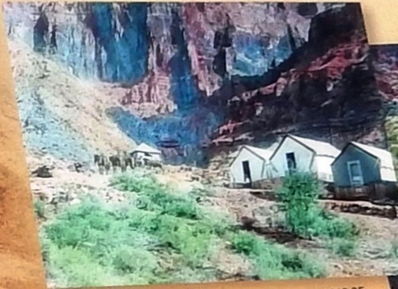
On the inner plateau, Hermit Camp has been built.... A skilled Chef is in charge of the dining room, where excellent meals are provided. It is camping out ‘deluxe.’ —1916 Hermit Camp postcard Deep in the canyon are faint signs of . . . — — Map (db m156994) HM
Today, most visitors will travel the Hermit Road by shuttle, but in 1912 when the road first opened, you would have traveled by horse or buggy. The Santa Fe Railway and U.S. Forest Service built the buggy road so early visitors had a choice in . . . — — Map (db m157166) HM
Established in 1904 by the Kolb Brothers as a photographic studio and operated by Emery Kolb until his death in 1976. Kolb is now operated as a book store and information center by the Grand Canyon Association, a non-profit organization. Proceeds . . . — — Map (db m39546) HM
Hopi House opened on January 1, 1905, the first Grand Canyon work of architect Mary Colter. To complement El Tovar, their new hotel, the Fred Harvey Company commissioned Colter to design a building to display and sell Indian arts and crafts. Colter . . . — — Map (db m39478) HM
Designed as living quarters for Hopi artisans and as a place to sell Hopi crafts and souvenirs, this building represents the efforts of the Fred Harvey Company to revive Southwest Indian arts and crafts. Designed by Mary Jane Colter, the building . . . — — Map (db m39509) HM
Albright's contributions to the National Park Service can hardly be overstated. While working with the agency's first director, Stephen Mather, in the early years of the National Park Service, Horace Albright played a decisive role in guiding the . . . — — Map (db m39600) HM
On a clear day you can easily see Mount Trumbull just
above the western horizon, 62 miles (99 km) away.
Most days, haze makes spotting this distant landmark
difficult. Sadly, most of this haze is human-caused. It can
be a plume from a local . . . — — Map (db m196818) HM
Constructed in 1928, the Kaibab Trail Suspension Bridge was the only crossing of the Colorado River in a distance of 754 miles from Moab, Utah to Needles, California. Built in a remove location with incredibly difficult access through rugged . . . — — Map (db m173929) HM
The Kolb Brothers: daring, persistent, Grand Canyon legends. Their studio stands before you.
Ellsworth Kolb arrived here in 1901, Emery in 1902. First located in a tent, their photo business grew with Grand Canyon tourism. They eventually . . . — — Map (db m39549) HM
If a horseshoe can bring luck, why not a horseshoe-shaped mesa? Some 2,500 feet (760 m) below you sits Horseshoe Mesa. There, in 1890, Pete Berry and fellow miners discovered copper and began digging the Last Chance Mine. The ore was rich (15 to 30 . . . — — Map (db m250566) HM
Welcome to Grand Canyon and Desert View, where sun and sky, canyon and river gorge, tiered plateaus, and historic architecture blend into sweeping panoramas.
Constructed in 1932, the 70-foot tall Desert View Watchtower provides visitors from . . . — — Map (db m250584) HM
The Fred Harvey Company built Lookout Studio in 1914, in part to compete with the Kolb Brothers Studio located slightly west along the rim. Called "The Lookout," Fred Harvey's studio offered telescopic views, photographs, and books about the . . . — — Map (db m39544) HM
In 1890 prospector Pete Berry staked the Last Chance copper claim 3,000 feet below you on Horseshoe Mesa. The Last Chance Mine began a 17-year flurry of activity here at Grandview Point.
For a while the Last Chance Mine thrived. The ore was . . . — — Map (db m39662) HM
Responding to mounting political and public pressure, Congress authorized a ten-year program in 1955 to regenerate and modernize the national parks dubbed "Mission 66" for the target date of 1966, the National Park Service's 50th anniversary. The . . . — — Map (db m39587) HM
The mule barn and the nearby livery stable were two of the most important buildings in the original Grand Canyon Village. In the early 1900's, when all travel within the village was by horse-drawn carriage, these huge barns were the center of all . . . — — Map (db m39585) HM
Behind you is the Bright Angel mule corral, where each morning mules greet riders and another adventure begins. Mules have carried people into Grand Canyon since sightseeers first visited here in the 1890s. For many people - including those who . . . — — Map (db m205170) HM
Something unexpected once stood on the rim in front of you. A steel headframe towered over a mineshaft that dropped 1,500 feet (460 m) to one of the richest uranium mines in the United States. From 1956 to 1969, miners extracted ton after ton of . . . — — Map (db m108885) HM
Now known as Phantom Ranch, this area along the Bright
Angel delta first gained attention as a tourist camp under the
name Rust's Camp. In 1902, David Rust began the planting
of fruit trees and cottonwoods and the
building of a camp for . . . — — Map (db m310656) HM
"Won't you be one of the 25,000 visitors at the Grand Canyon of Arizona this summer? It is the world's scenic wonder - nothing like it."
Santa Fe Railroad brochure, 1914.
The Santa Fe train whistle that was heard here on September 17, . . . — — Map (db m39569) HM
Can you spot the Colorado River? It looks tiny, surrounded by the
vast Grand Canyon, but do not be deceived. Its racing, muddy waters
carved the one-mile (1.6 km) depth of Grand Canyon, Standing
on the canyon's edge you may feel distant and . . . — — Map (db m196819) HM
Build a structure that provides the widest possible view of Grand Canyon yet harmonizes with its setting: this was architect Mary Colter's goal when the Fred Harvey Company hired her in 1930 to design a gift shop and rest area here at Desert View. . . . — — Map (db m39616) HM
Trans-Canyon Telephone Line,
built in 1935 by CCC workers,
maintained by Mountain Bell,
has been placed on the
National Register of
Historic Places
by the United States
Department of the Interior. — — Map (db m78832) HM
From Navajo Point, your view includes Grand Canyon and extends across the surrounding plateaus into modern-day Indian Country. Several tribes still live in and around the canyon, honoring their ancient connection to this place. Grand Canyon is . . . — — Map (db m250581) HM
Cohonina and ancestral Pueblo (Kayenta Anasazi) people lived in this area in prehistoric time. The ancestral Puebloans built Tusayan about AD 1185. A visit to the museum and a short walk through the remains of the village will furnish a glimpse of . . . — — Map (db m39631) HM
Allow about 30 minutes to tour Tusayan Ruin. The 0.1 mile loop trail through the main ruin is paved and wheelchair-accessible; the side loop to a prehistoric farming site is not. Signs along the way explain the site's features. An interpretive . . . — — Map (db m39633) HM
John G. Verkamp rented a tent from the Bright Angel Hotel in 1898 and began selling curios and Indian crafts for Babbitt Brothers' Trading Company. After several slow weeks he closed and sold his stock to the hotel. But he sensed Grand Canyon's . . . — — Map (db m39571) HM
Mary Colter's Desert View Watchtower creates an illusion of age. Concealed within the tower is an entirely different reality. Workers built a concrete and steel reinforced superstructure and then applied a veneer of native stone. The weathered . . . — — Map (db m169439) HM
Originally this building stood at Red Horse, 25 miles south of the Grand Canyon, where it was possibly used as one of the stage stops between the Grand Canyon and Flagstaff. In 1902, Ralph Cameron had it moved to its present site, where, with the . . . — — Map (db m236357) HM
Completed in 1935, Bright Angel Lodge was designed and built under the direction of Mary Colter, Fred Harvey company's celebrated Southwest architect. Colter's penchant for rustic designs and her attention to detail led to the creation of this . . . — — Map (db m250419) HM
This cabin is the only remaining building from the early pioneer settlement era of Grand Canyon Village. Built on this site in 1895 by William Owen "Buckey" O'Neill, the two-room office and bunkhouse - complete with v-notched logs, rough mortar . . . — — Map (db m250421) HM
The Grand Canyon National Park Superintendent's Residence is a National Park Service Rustic style building. It was designed in 1921 by Daniel Ray Hull, Chief Landscape Engineer for the National Park Service Branch of Plans and Designs, as the park's . . . — — Map (db m250416) HM
California condors are the largest flying birds in North America. Their wingspans of nearly 10 feet (3.5 m) make condors easy to spot gliding above Grand Canyon today. Yet, in the 1920s, these birds disappeared from Grand Canyon skies. Condors were . . . — — Map (db m250417) HM
The Santa Fe is going to build the most expensive hotel … at the Grand Canyon … the idea of the architect is to bring the building into harmony with the wonderful scenery of the canyon rather than to put a blot upon its beauty by the . . . — — Map (db m195830) HM
A rich architectural history awaits as you explore Grand Canyon Village. Eclectic in nature, the village is a mix of early pioneer, Santa Fe Railroad, and National Park Service structures. Entrepreneurial-pioneers started building here in the early . . . — — Map (db m95934) HM
A rich architectural history awaits as you explore Grand Canyon Village. Eclectic in nature, the village is a mix of early pioneer, Santa Fe Railroad, and National Park Service structures. Entrepreneurial-pioneers started building here in the early . . . — — Map (db m250414) HM
This steel lookout tower, erected in 1936, is 80 feet
tall. It replaced an earlier wooden lookout tower and platform. The two-room bungalow style cabin, also built in
1908, serves as the lookout's residence.
As guardians of our . . . — — Map (db m310681) HM
Hopi House opened to the public in 1905. In an era when most architects were men, it was Mary Elizabeth Jane Colter's first building. The 36-year-old Colter enlisted the help of local Hopi craftsmen to build Hopi House, using locally quarried . . . — — Map (db m236334) HM
Hull Cabin Historic District, built circa 1890, has been placed on the
National Register
of Historic Places
by the United States
Department of the Interior. — — Map (db m310705) HM
This boat is an exact replica of the boat used by John Wesley Powell in his historic voyage through the Grand Canyon.
In 1869, Powell and his intrepid crew managed to survive the rapids in the Grand Canyon of the Colorado by lining and . . . — — Map (db m285526) HM
Your visit and rest here is part of a long tradition started in 1914 with the opening of Hermits Rest. After an 8-mile (13 km) buggy ride, you would be greeted by the resident caretaker and offered a refreshing drink to clear the dust from your . . . — — Map (db m108881) HM
Mary Colter's attention to detail is reflected in every element of the Desert View Watchtower.
Each rock and painted wall is intended to convey meaning. Colter used ornamental details, seemingly haphazardly, to create an added charm of the . . . — — Map (db m285542) HM
Near here in late summer of 1540, soldiers from the Spanish expedition of Francisco Vasquez de Coronado became the first Europeans to see Grand Canyon.
After journeying for six months, Coronado's army arrived at the Hopi mesas, east of . . . — — Map (db m125895) HM
He laid the foundation of the National Park Service, defining and establishing the policies under which its areas shall be developed and conserved unimpaired for future generations. There will never come an end to the good that he has done. — — Map (db m169438) HM
Constructed of locally quarried Kaibab limestone, Lookout Studio appears as if it grew out of the canyon wall. In 1914, Fred Harvey company took a bold step to compete against Kolb Studio (just west of here). They asked Mary Colter to design a . . . — — Map (db m250420) HM
Catastrophe can happen even in spectacular beauty. When technological achievements and human actions fail, disasters may happen.
On June 30, 1956, a United Airlines DC-7 and a TWA Super Constellation maneuvered around towering cumulus clouds on . . . — — Map (db m124533) HM
Throughout their longstanding friendship, Congressman Morris K. Udall and Senator John S. McCain set an example of bipartisan comity, collegiality, and leadership.
Though members of different political parties, these two great leaders and . . . — — Map (db m292135) HM
Inspired by Grand Canyon's burgeoning tourism trade, in 1898, John Verkamp established a small tent shop on the South Rim, selling American Indian arts and crafts. Profits proved meager, so John sold his inventory to the Bright Angel Hotel and . . . — — Map (db m250413) HM
John D. Lee and wife Emma established this ranch to support their lives as river ferry operators. While living here, they shuttled wagon trains and travelers across
the Colorado River on makeshift ferry boats and skiffs.
The crossing became a . . . — — Map (db m289828) HM
Isolated from society, settlers here had to provide for themselves. Growing their own food proved to be a constant struggle as unreliable irrigation plagued the
desert fields. Lonely Dell families endured and grew lush gardens, orchards, and fields . . . — — Map (db m289827) HM
Text from: Historical Markers with The Arizona Department of Transportation right of way. Prepared by: Roadside Development Section April 1, 1997
Fatigued by a thirty mile ride, the padres picked their way down the rocky north slope . . . — — Map (db m39917) HM
In desperate search for a crossing of the Colorado River before the wild storms of winter might further weaken their starving bodies, Fathers Dominguez and Escalante led their expedition past this point on October 26, 1776.
Five days were spent . . . — — Map (db m94896) HM
John Deering (Bih Bitoodnii Nez) born 1870 of the Deer Water Clan, his wife Susie Deering, born in 1878, of the Maii Deeshgiizhinii Clan, and their nine children, pioneered the areas of the Gap, Copper Mine, Cedar Ridge, Bitter Spring, Page, Marble . . . — — Map (db m189730) HM
In memoriam to ironworker Lafe McDaniel
October 3, 1887 to June 12, 1928
The only individual to die during the construction of the Navajo Bridge, Lafe McDaniel, a well like and highly experienced Kansas City ironworker, fell from near . . . — — Map (db m206713) HM
From 1872 to 1929
principal route of travel
across the Colorado River
to Utah Settlements
First crossing made at the mouth of Paria Creek in 1864 by Jacob Hamblin. Regular ferry established by John Doyle Lee in 1872. Purchased by . . . — — Map (db m41998) HM
Because of long, deep canyons, Lees Ferry was the best crossing point along 500 miles (800 km) of the Colorado River.
In 1873, Mormon Church members opened a wagon road from Kanab, Utah, and built a ferryboat here. John D. Lee was the first . . . — — Map (db m41999) HM
Northern gateway to Arizona for 54 years - from 1873 to 1927 - is located six miles upstream from this bridge.
This monument erected to the founder
John Doyle Lee
who, with superhuman effort and in the face of almost insurmountable . . . — — Map (db m94892) HM
John D. Lee settled here in Dec. 1872 and established ferry service thirteen months later. After her husband's death, Warren M. Johnson ran the oar-driven ferry for Emma Lee, 1875 to 1879, when the Church of Jesus Christ of Latter-Day Saints . . . — — Map (db m41997) HM
Lewis Nez, born 1900 of the To’di’chi’i’nii (Bitter Water) Clan. He married twice, first to Fannie and second to Bessie Betoney. He had ten children. He was employed by the Cedar Ridge Trading Post. He was responsible for hauling supplies, U.S. . . . — — Map (db m189731) HM
For more than 100 years, Lonely Dell Ranch has meant different
things to those who traveled here. To pioneers and missionaries, it was
an isolated settlement offering small comfort during a long journey
further south. To the families who lived . . . — — Map (db m289772) HM
A tourist lodge and trading post have operated near this site since 1929. Without them, travel through this isolated region would have been far more difficult. Marble Canyon Lodge was already in operation when the historic Navajo Bridge was . . . — — Map (db m94893) HM
Charles H. Spencer's second gold mining site
Spencer used an amalgamator reliant on mercury to pull gold
from clay. Tests recovered a little gold, but also some other metal,
exhausting the mercury supply. Years later the mystery . . . — — Map (db m291039) HM
Navajo Bridge
has been placed on the
National Register
of Historic Places
By the United States
Department of the Interior
August 31, 1981 — — Map (db m94885) HM
There are three markers on this end of the Navajo Bridge.(Marker on left:)
National Historical Civil
Engineering Landmark
American
Society of
Engineers
1852
Designated by the American Society of Civil Engineers . . . — — Map (db m94887) HM
This Erection Toggle Screw was used in the construction of the historic Navajo Bridge to maintain bridge vertical elevations and as a means of lowering bridge sections in place. — — Map (db m38469) HM
The Paria Canyon-Vermilion Cliff Wilderness was added to the National Wilderness Preservation System on August 28, 1984. This 112,000-acre jewel of the desert Southwest truly reperesents the meaning of wilderness. The majority of the wildreness area . . . — — Map (db m289824) HM
Welcome to Vermilion Cliffs National Monument, an isolated and spectacular landscape. Tucked away in north-central Arizona, this Monument is a wonderland of geologic formations and rugged terrain that supports a rich array of desert wildlife and . . . — — Map (db m94911) HM
Early in the twentieth century, wealthy ladies and gentlemen yearning for a peek at the fabled Grand Canyon found few urban comforts along its northern rim. While visitors on the South Rim relaxed in the luxurious accommodations of the cliff-hugging . . . — — Map (db m163551) HM
When Grand Canyon became a national park in 1919, the North Rim was scarcely developed. While the South Rim had grand hotels and many visitor programs and services, the hard-to-reach North Rim had only rustic tent cabins for 40 guests. The National . . . — — Map (db m163289) HM
Under the supervision of the Utah Parks Company and architect Gilbert Stanley Underwood, work crews labored to build a lodge that harmonized with its surroundings. Advertisements for this "Hotel in the Wilderness" boasted that it "seems to have . . . — — Map (db m163552) HM
A fire consumed the main lodge building at the height of the Great Depression. The September 1, 1932, fire claimed no lives but left only stones. For four years the ruins of the Grand Canyon Lodge stood undisturbed, silhouetted eerily against a . . . — — Map (db m163553) HM
Take a moment to stretch your legs on this 200-yard (200 m) one-way trail along the edge of Greenland Lake. The trail ends at a small log cabin built in the 1890s to store salt for cattle, which grazed nearby and drank from this rare waterhole. . . . — — Map (db m258215) HM
From the North Rim, the Colorado river and the Unkar Delta below seem distant, yet ancestral Puebloan farmers 1,00 to 800 years ago made the journey from river to rim on a routine basis, spending summers on the rim and most of the remainder of the . . . — — Map (db m258222) HM
[Caption]: In the spring of 1902....we began to seek a route across to the north side. But at that time there was no trail across from rim to rim, nor was there a bridge over the Colorado. - . . . — — Map (db m258224) HM
"This is one of the wonders of the world! People will come from all quarters of the globe and will pay great sums of money to gaze on what we behold." - Edwin Dilworth "Dee" Woolley
A visionary entrepreneur, "Uncle Dee" . . . — — Map (db m258210) HM
Built more than 900 years before the Grand Canyon Lodge, the foundations of this small, two-room dwelling provide a glimpse of the kinds of lodging used by ancestral Puebloan farmers of the North Rim. These native farmers built field houses like . . . — — Map (db m163577) HM
Forest seems to be on the march here, invading this meadow at a rate of one foot per year, but the Outlet Fire in spring 2000 may have slowed the forest's advance. Before the fire burned this area, forest was encroaching on better-drained, dryer . . . — — Map (db m258213) HM
Dwellings for ferry customers and operators
Only a ruin remains of the small stone cabin available to
travelers staying overnight. The ruin with two stone fireplaces
was home to Ferryman Frank Johnson, son of a previous
ferryman. . . . — — Map (db m291064) HM
Every Lonely Dell family struggled to water their fields through various dams, tunnels, and hand-dug ditches. The Paria River's muddy flows and unpredictable floods caused problems, but ferryman Warren Johnson worked tirelessly to grow crops and . . . — — Map (db m289944) HM
Flagstone walls and a roof made from earth, this partially dugout building was common on most pioneer farms and ranches. Before modern electric appliances, the cellar acted as a refrigerator to keep vegetables from freezing in the winter, butter and . . . — — Map (db m289948) HM
Warren Johnson, who took over operations after the Lees, built this cabin for his second wife Samantha and their young children. Samantha lived here only a year until the large family home was completed next door. When she moved out, farm hands . . . — — Map (db m289946) HM
Ferryman Warren Johnson built a two story house for his families using proceeds from the ferry. They tore down Emma Lee's cabin to make room for the new home, removing the last Lee Family structure at Lonely Dell.
In 1897, new lead ferryman . . . — — Map (db m289947) HM
Jerry Johnson, son of former ferryman Warren Johnson and wife Samantha, built this cabin as part of a polygamist haven. With the completion of Navajo Bridge in 1929, travelers bypassed Lees Ferry and the ranch grew quiet. Johnson and his family . . . — — Map (db m289945) HM
Leo and Hazel Weaver had big plans for their newly purchased ranch as they flipped old cabins into rentals for guests. They hired Hopi stonemason Poli Hugavi to build this house which acted as the main lodge. The rustic Paradise Canyon Ranch was . . . — — Map (db m289949) HM
Headquarters of Charles H. Spencer's gold mining company
Built 1911
First of Spencer's eight stone buildings
Failing to recover gold, Spencer abandoned his
mining outpost around 1912. Cowboys, miners, and
travelers occasionally camped . . . — — Map (db m289950) HM
This fountain is dedicated to the memory of our fellow employees who died October 8, 1997 in a plane crash near Montrose, Colorado.
Their names encircle the fountain just as the accomplishments of their careers and lives encircle us. . . . — — Map (db m40325) HM
Colorado River Storage Project
In recognition of the vision of the Colorado River Storage Project Act of 1956 and the significant contributions the act has made to the development of the Upper Colorado River Basin states, this plaque . . . — — Map (db m40350) HM
Concrete Bucket
This is one of several concrete buckets that poured the concrete in Glen Canyon Dam. Each bucket held 24 tons (22 metric tons) of concrete and it took over 400,000 buckets to complete the dam. The first pour of concrete . . . — — Map (db m40342) HM
Work began in 1956. Four years were needed to prepare the site including the blasting of two river bypass tunnels and spillway tunnels, the erection of two huge cofferdams, the construction of a highway bridge just downstream from the dam site (a . . . — — Map (db m254684) HM
Within sight of this place the Franciscan priests Dominguez and Escalante and their ten companions experienced two of the most difficult challenges among many along the 1,800 miles of their epic journey from the Spanish presidio at Santa Fe, New . . . — — Map (db m40324) HM
The imprints were made by a one ton, twenty foot long, meat-eating dinosaur. The slab of sandstone came from a nearby side canyon.
When Dilophosaurus tracked through the silt 170 million years ago, this was a different landscape. Shallow streams . . . — — Map (db m40326) HM
A slightly larger, but reasonable replica of the 16 ft. pine rowboat in which Major John Wesley Powell first explored the canyons of the Colorado River in 1869. This craft was constructed by Walt Disney Productions and used in the river running . . . — — Map (db m40323) HM
Glen Canyon Bridge
Majestic Glen Canyon Bridge, 865 feet (264 meters) downriver from the dam, was the highest steel-arch bridge in the United States when completed.
The roadway is 700 feet (213 meters) above the surface of . . . — — Map (db m101903) HM
Glen Canyon Dam, Colorado River Storage Project, dedicated by the First Lady, Mrs. Lyndon B. Johnson, September 22, 1966.
United States Department of the Interior, Stewart L. Udall, Secretary.
Bureau of Reclamation, Floyd E. Dominy, . . . — — Map (db m40370) HM
Throughout the 1800 and 1900s, Lees Ferry was backdrop to a mix of Westward expansion dreams and failed schemes. Because of its stragic location along the Colorado River, unlikely groups overlapped on these shores. Miners, traders, US government . . . — — Map (db m291037) HM
Glen Canyon Dam and other dams along the Colorado River provide critical water and power resources for millions of Americans in the Southwest. Recreation at the reservoirs is enjoyed by visitors from around the world.
Turbine Runner
This . . . — — Map (db m40344) HM
The eight small "buildings" on the upstream face of the dam contain equipment to operate the penstock gates. Each penstock is 15 feet (4.6 meters) in diameter and carries water to one of the turbine generators in the powerplant. — — Map (db m40349) HM