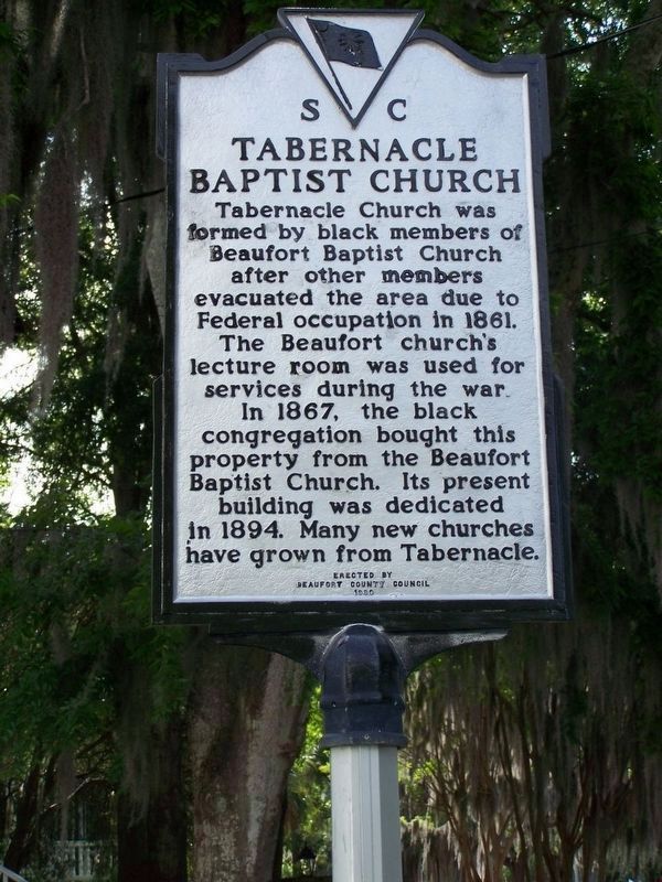
Tabernacle Baptist Church. Tabernacle Church was formed by black members of Beaufort Baptist Church after other members evacuated the area because of Federal occupation in 1861. The church's lecture room was used for services during the war. In . . . — — Map (db m20144) HM
Established as a mission of the Euhaw Baptist
Church in 1795, Henry Holcombe, pastor.
With Joseph B. Cook as pastor, the church
was chartered as a Baptist church by the
State of South Carolina on January 27,1804.
At the beginning of the Civil . . . — — Map (db m26102) HM
This lot and surrounding corners of the intersection were platted for civic use in Beaufort’s 1711 town plan. A municipal market stood here while the arsenal, a courthouse and jail stood at the other corners. — — Map (db m227292) HM
Significant as one of the tallest known surviving tabby structures, the house was built by a prominent merchant. Altered in the 20th century by removal of the first floor, it remains architecturally important. — — Map (db m135408) HM
This structure housed a cobbler before the Levins operated businesses in it, including a print shop which produced printed materials for Parris Island using modern early 20th century equipment. — — Map (db m135456) HM
About the Bench
The Reconstruction period, the era immediately following the Civil War and emancipation, teaches us when it comes to justice and equality—what may seem impossible is indeed possible. And it all began right here, in our South . . . — — Map (db m301222) HM
John Mark Verdier
1759-1826
Builder of this house
1795-1800
General Lafayette spoke to the people
of Beaufort from this portico
March 18, 1825 — — Map (db m19644) HM
This church, established in 1833, was the first Methodist church in Beaufort and was founded as a mission to slaves and free blacks here and on the neighboring Sea Islands. The congregation had both black and white members but many more black . . . — — Map (db m133501) HM
Possibly the earliest home on Bay Street, this structure housed the Freedmen's Bank to help freedmen save money during Reconstruction. By the 20th century, its first floor had been altered as a storefront. — — Map (db m301226) HM
On March 18, 1825, General Lafayette was welcomed with a procession & passing through an arch, he was addressed by Mayor William Elliott. — — Map (db m301225) HM
Built as a grocery with residence upstairs, the Roberts Building stands on the site of a mid-19th century home destroyed in the Great Fire of 1907. Prior to this structure, a lumber yard and a small store stood here. — — Map (db m301233) HM
A late 19th century building boom brought an influx of Jewish merchants to new commercial structures like this one on the ruins of the ca. 1810 Fripp House. Remains of tabby outbuildings stand in the rear. — — Map (db m301232) HM
Contributing to the building boom after The Great Fire of 1907, the Levin Building housed the Levin law offices and that of Sheriff J. E. McTeer who, 1924-1963, used voodoo in keeping the law in Beaufort County. — — Map (db m301229) HM
In Oct. 1943, the U.S. Army opened a prisoner-of-war (POW) camp near here on Pigeon Point Road. It was one of more than twenty POW camps built in S.C. during World War II to hold Axis prisoners. Around 250 Italian soldiers arrived here from Camp . . . — — Map (db m301189) HM
Beaufort Colored School opened at this site in 1867. The school was housed in a two-story frame residence acquired by thirteen free-born and previously enslaved Black men who served as the property's trustees. It was first staffed by northern . . . — — Map (db m301217) HM
Built in 1917-18, this was one of fourteen libraries constructed in S.C. with funding from the Carnegie Corporation. It was built at the urging of the Clover Club, a local women's literary group who in 1902 began a small subscription library. The . . . — — Map (db m223614) HM
Methodism in Beaufort Co. dates to the 1730s when denomination founder Rev. John Wesley visited the area. Methodist preachers in antebellum Beaufort worked primarily among local enslaved people. In c. 1882, white residents formed a union church . . . — — Map (db m301221) HM
This site was the starting point of the Great Fire of 1907, one of the worst disasters in the history of Beaufort. On Jan. 19, a fire started around 1:30 p.m. in F.W. Scheper's barn south of here and move into a large store at this corner. The . . . — — Map (db m219671) HM
This house was commissioned by Edgar Fripp (1806-1860) and completed c. 1853. Based upon architect Samuel Sloan's designs, it was built in the Italianate style, with a prominent central cupola, and served as the "town home" for Fripp and his . . . — — Map (db m240915) HM
1749 established First headmaster
1786 Beaufort Society-St Helena Society chartered by the state to foster educational endeavor
1795 St Helena-Beaufort Societies combined Resolved to "build a stately pile to the muses to be . . . — — Map (db m301190) HM
Originally known as May River, and later as Kirk's Bluff, Bluffton was settled as a resort town where planters could escape the hot, malarial summers of lowcountry plantations. The streets were laid out in the 1830s and much of the early . . . — — Map (db m219594) HM
The Methodist Society, organized in Bluffton,
built the first church and parsonage on
Boundry Street in 1853. During the Civil War,
two confederate soldiers saved the
church from being burned. In 1875 the church
sold the building to the . . . — — Map (db m39840) HM
Settled in 1825, as a summer resort of rice and cotton planters, this town was incorporated in 1852. Here in 1844 was launched the protest against the Federal tariff known as the "Bluffton Movement". — — Map (db m219148) HM
Built in 1853, this was originally Bluffton Methodist Episcopal church. Organized by whites, the church's 216 members in 1861 included 181 African Americas, who were likely enslaved to its white congregants. The church caught fire during the . . . — — Map (db m218551) HM
Cyrus Garvin. Little is known of Cyrus Garvin's early life. He was likely born into slavery, possibly on a plantation of the Baynard family. Garvin is notable for having amassed considerable status and property after emancipation. In 1868 he . . . — — Map (db m218662) HM
This congregation organized around the time of the Civil War to serve formerly enslaved African Americans living in the Bluffton area. It was originally known as First African Baptist Church and was later renamed First Zion. It was founded by . . . — — Map (db m269753) HM
(Plaque 1)
Dedicated to
The Memory and Honor
Of All Veterans
Servicemen and Servicewoman
Who Have Given Their
Full Measure of Devotation
In the Armed Forces
Defending This Nation
[ Emblems: Army • Navy • Marine Corps • Air Force . . . — — Map (db m18236) WM
This is the site of two schools that served the black community of southern Beaufort County for most of the twentieth century. Bluffton Graded School, a small frame building constructed about
1900, was followed in 1954 by an elementary and high . . . — — Map (db m5853) HM
This sanctuary, built 1824 as St. Luke's
Episcopal Church, housed an active
Episcopal congregation until just before
the Civil War. It was sold to the
trustees of St. Luke's Methodist
Church in 1875 and served that
congregation since. St. . . . — — Map (db m19645) HM
The name Barrel Landing (also spelled Barrell) comes from a nearby docking and landing area on the Okatie River initially used by early settlers of the Okatie community in the period following the Revolutionary War. Farmers and tradesmen used the . . . — — Map (db m15320) HM
Bluffton, an antebellum planters' summer village, was virtually abandoned by its seasonal and year-round inhabitants when Federal forces captured Beaufort and Port Royal in November 1861. Confederate forces used it as an outpost to watch Port . . . — — Map (db m219149) HM
Bluffton is a beautiful Southern town that is the heart of the lowcountry.
Bluffton began in the early 1800's and was originally known as "Kirk's Bluff." It wasn't there until the early 1840's that the name of the town was changed to . . . — — Map (db m301236) HM
The Bluffton community has an authentic historic district, celebrates the May River and respects the Bluffton character.
Once a summer retreat for wealthy planters, Bluffton has truly come into its own as a well-established . . . — — Map (db m301238) HM
(side 1)
Archeological evidence suggests human activity on Daufuskie Island as early as 12,000 B.C., with seasonal habitation tied to the harvesting of coastal resources. Early European inhabitants also realized the importance of the . . . — — Map (db m244700) HM
Phillip Martinangele, born in Italy, immigrated to this country and settled in St. Helena’s Parish. He married Mary Foster in 1743, but had died by 1762 when his widow bought 500 acres
on Daufuskie Island. Their son Phillip, a captain in the . . . — — Map (db m244107) HM
( Front text )
On the night of August 27, 1893, a
huge "tropical cyclone," the largest
and most powerful storm to hit S.C.
until Hurricane Hugo in 1989, made
landfall just E of Savannah, Ga.
With gusts as high as 120 mph and a
storm . . . — — Map (db m8782) HM
Near the old halfway house, in the vicinity of Grays Hill, on February 3, 1779, a force of South Carolina Militia, Continentals, and volunteers, including men from Beaufort, under General William Moultrie, defeated the British in their attempt to . . . — — Map (db m14738) HM
The Mystique is constructed almost entirely of teak and mahogany. At one time, crafts such as these were used by wealthy landowners to transport guests from their private yachts to lavish seaside retreats along the Northeast Coast all the way to the . . . — — Map (db m282576) HM
After the occupation of Hilton Head,
a civilian town grew up to serve the
needs of the large Union base and
its garrison here. The town boasted
a hotel, a theater, 2 newspapers, and
numerous stores, centering along a
street, officially . . . — — Map (db m16550) HM
Early A.M.E. Missionaries to South Carolina, Rev. James H.A. Johnson and Rev. James A. Handy, arrived at Hilton Head on the Steamship Arago at 3:18 p.m. Friday, May 12, 1865.
Rev. James Lynch, also an A.M.E. Missionary, shared entertainment . . . — — Map (db m104498) HM
A decisive battle in the Civil War took place here on Nov. 7, 1861, when 18 Union warships with about 55 supporting craft led by Adm. S.E. DuPont bombarded for 4½ hours the Confederate forces in Fort Walker on this shore and Fort Beauregard on . . . — — Map (db m16504) HM
The first black troops in the Union Army enlisted on Hilton Head Island in May 1862. Initially, men who escaped plantations and slavery were reluctant to join the army. They did not want to leave their families and new financial opportunities and . . . — — Map (db m105295) HM
This statue is based on the
photograph of Charles E. Fraser
as it appeared in a 1962 edition
of the Saturday Evening Post
on “People on the Way Up”.
This celebrated image
caused a media sensation that
awarded the Sea Pines . . . — — Map (db m212437) HM
In 1957, at the age of 27, Fraser completed his six-year research program and began building the eight square mile Sea Pines Plantation community. It was the island's first large-scale planned community and the site of its first golf course and . . . — — Map (db m282577) HM
Before the Island's first bridge, Charlie Simmons, Sr., became known as "Mr. Transportation" amoung the local community, which was made up of descendants of freed slaves following the Civil War.
Until the late 1920's sailboats were the primary . . . — — Map (db m41054) HM
(Front)
This one-room frame school, built ca. 1937, was the first separate school building constructed for African-American students on Hilton Head Island. It replaced an earlier Cherry Hill School, which had held its classes in personage of St. . . . — — Map (db m104496) HM
Oldest Baptist church on Hilton Head Island
Organized August 17, 1862
in the town of Mitchelville
with 120 members
Building was moved to present location
later and rebuilt in 1966
Rededicated October 30, 1988
Rev. C.W. Aiken, Pastor . . . — — Map (db m104497) HM
This church, organized in 1862, was first located in the town of Mitchelville, a freedman’s village established on Hilton Head by the United States Army. Rev. Abraham Murchinson, its first pastor, was a former slave. The congregation numbered . . . — — Map (db m104580) HM
Fish Hall Plantation This plantation was part of a 1717 Proprietary landgrant of 500 acres to Col. John Barnwell. Later owners included members of the Green, Ellis, and Pope families. Nearby tabby ruins are remains of fire places of slave . . . — — Map (db m6625) HM
(Front ) This Civil War fort, named for Gen. Joshua Blackwood Howell (1806-1864), was built by the U.S.
Army to defend Hilton Head Island and the nearby freedmen’s village of Mitchelville from potential Confederate
raids or . . . — — Map (db m49841) HM
An excellent example of the defensive earthworks common to the civil War era, Fort Howell was constructed by Union Forces occupying Hilton Head Island and was one of the final fortifications to be built during the war. The men of the 32nd U.S. . . . — — Map (db m6801) HM
Completed in 1862, this large earth fort
was designed to defend the great Union
blockade base on Hilton Head against
Confederate land attack. Named after
the first Union commander here, Gen.
Thomas W. Sherman, the fort consists
of two miles of . . . — — Map (db m15949) HM
Hastily built in 1861 to protect the S.C. coast
against Union attack, Fort Walker, commanded
by Col. William C. Heyward, bore the brunt
of the Union attack on November 7, 1861,
when after 4½ hours, with only 3 guns left
serviceable and . . . — — Map (db m16519) HM
Fort Howell is typical of the earthen forts constructed during the Civil War by both Confederates and Union Armies. The change from earlier brick and stone masonry forts was the result of advances in weaponry that occurred as the Civil War . . . — — Map (db m131833) HM
General Joshua Blackwood Howell 1806-1864
Fort Howell is named for General Joshua Blackwood Howell of Pennsylvania, who commanded the Hilton Head District, Department of the South, United States Army, from February through April, 1864. . . . — — Map (db m131835) HM
A prominent landmark for mariners
since the voyages of the early
Spanish explorers, this headland
was known to the English as
Hilton Head after the voyage
in 1663 of Captain William Hilton
which led to their first
permanent settlement in . . . — — Map (db m16231) HM
This marker has been erected as a lasting tribute to the following men who envisioned Hilton Head Island as a place where man could commune with Nature and the Forest and all things that dwell therein.
These men determined that no . . . — — Map (db m104507)
Dedicated to all veterans who have served their country honorably,
and have helped preserve the freedoms that we enjoy in this great country.
From A Grateful Nation — — Map (db m7015) HM
(Left column)
¤ 15,000 to 4,000 Years Ago: The
rising sea level flooded the deep basin
now known as Port Royal Sound.
¤ 1531: Spanish explorers Francisco
Gordillo and Pedro de Quexos sailed
into Port Royal . . . — — Map (db m63445) HM
native of Ireland, soldier in the Revolution, planter
on this island, a founder of the Episcopal Church on Hilton Head, the ancestor of the Stoneys of South Carolina. Also of his grandson, John Safford Stoney, eldest son of John and Elizabeth . . . — — Map (db m119649) HM
Interest in the freedom seekers of Mitchelville and the surrounding areas led to an outpouring of assistance from Northern missionaries and abolitionists. They organized and sent aid and teachers. Newspaper reporters came to document conditions . . . — — Map (db m105263) HM
The Maps and Pictures below identify the approximate locations of roads and buildings that were in Mitchelville circa 1862-1868.The Town of Mitchelville had praise houses, stores, schools and numerous homes. Unfortunately no physical remains of . . . — — Map (db m105156) HM
In 1862, after Hilton Head's fall to Union
forces in 1861, this town, planned for the
area's former slaves and named for General
Ormsby M. Mitchel, began. — — Map (db m6783) HM
(front)
The congregation of Queen Chapel can trace its roots to May 1865 when A.M.E. missionaries Rev. R.H. Cain, Rev. James H.A. Johnson and James A. Handy arrived on Hilton Head Island. They visited the Freedman’s town of Mitchelville . . . — — Map (db m104583) HM
Reuniting with family was one of the first concerns of African slaves who escaped to Hilton Head Island. Slavery split up families. Owners could sell family members for profit or punishment. On Hilton Head Island, and places where freedom seekers . . . — — Map (db m105209) HM
Religion in Mitchelville
Before Mitchelville was established, African slaves on the island congregated at impromptu religious services under trees. The churches built in Mitchelville were the center of religious, social, political, and . . . — — Map (db m105172) HM
In December 1781, returning from a patrol with the Patriot Militia, Charles Devant was mortally wounded from ambush near here by Captain Martinangel's Royal Militia from Daufuskie Island. He managed to ride
his horse to his nearby plantation, Two . . . — — Map (db m33789) HM
This church, founded in 1886 by former members of First African Baptist Church, is one of the oldest surviving institutions remaining from the town of Mitchelville, a freedmen’s village established here by the United States Army in 1862. The present . . . — — Map (db m44098) HM
Hilton Head Steamgun was the last of 13
produced - 8 land based and 5 ship borne. The 50 foot long, 15-inch diameter barrel propelled a 7 foot long, dynamite loaded projectile up to 3 .25 miles. Two steam engines powered an electric generator . . . — — Map (db m16604) HM
The Battle of Port Royal
On November 7, 1861, at the Battle of Port Royal Union forces attacked Confederates at Fort Walker on Hilton Head island and Fort Beauregard at Bay Point.The Union deployed the largest amphibious fleet ever assembled . . . — — Map (db m105290) HM
During the civil War, Union forces defeated the Confederates on Hilton Head Island at the Battle of
Port Royal on November 7, 1861. Cannon fire from that battle heralded a dawn of freedom for millions of African slaves throughout the South. . . . — — Map (db m105121) HM
In the spring and summer of 1864, Union officers of the Department of the South on Hilton Head Island became concerned about retaining sufficient troops and equipment to defend Hilton Head, as units were being transferred to participate in campaigns . . . — — Map (db m131823) HM WM
The Troops that Built Fort Howell
Construction of Fort Howell was begun by the 32nd U.S. Colored Infantry and completed by the 144th New York Infantry. The 500-man 32nd Colored Infantry was organized at Camp William Penn, Philadelphia, . . . — — Map (db m131839) HM
To honor the memory of two gallant gentleman
of South Carolina. Thomas Fenwick Drayton;
Brigadier-General, C.S.A. and his brother
Commodore Percival Drayton, U.S.N., Captain
of U.S.S. Hartford, and later the first Chief
of Naval Operations. . . . — — Map (db m16499) HM
This house, built in 1930, is typical in materials and methods of construction of those built on the S.C. Sea Islands from the end of the Civil War to the mid-20th century. It was built on land bought after 1865 by William Simmons (ca. . . . — — Map (db m56892) HM
Working for Wages
African slaves who escaped their plantations and worked for the Union military earned between six and eighteen dollars a month as carpenters, blacksmiths, drivers, boatmen, and laborers. Others worked as cooks and servants . . . — — Map (db m105254) HM
(plaque 1)
Welcome to
The Shelter Cove Harbor Community
Home Of The World’s Largest Figurative Sundial
Dedicated August 18, 1983
The sculpture weighs more than a ton, is a twice life sized statue
of Neptune, cast in bronze at . . . — — Map (db m104698)
A Chapel of St. Luke's Parish,
established May 23, 1767, built of
wood shortly after 1786 under the
direction of Captain John Stoney
and Isaac Fripp, was consecrated
in 1833. Members of the Barksdale,
Baynard, Chaplin, Davant, Fripp,
Kirk, . . . — — Map (db m119648) HM
The Harbour Town Yacht Basin was originally designed to be round, but after discovering this magnificent, centuries-old oak, the shape was reconfigured to save the specimen tree.
It has become one of the focal points of The Sea Pines Resort. . . . — — Map (db m282574) HM
The Hunting Island Lighthouse guided
mariners along the stretch of the South
Carolina coast for many years. The first
lighthouse, constructed of brick and
completed in 1859, was demolished by
Confederate troops during the early days
of the . . . — — Map (db m105048) HM
People Have Always Gathered Here...
We know from ancient shell middens found on these bluffs that Native American hunter-gatherers inhabited this
site as early as 1564. Like today's residents and visitors, they appreciated . . . — — Map (db m20319) HM
The ruins that lie before you are the remains of Marion and Richard T. Wilson Jr.'s winter and spring home. The four-story mansion occupied what is now the Wilson Village Green and took approximately five years to construct. Once completed in 1914, . . . — — Map (db m20367) HM
En respetuoso recuerdo de los Españoles que entre 1566 y 1587 dejaron aqui huella de su paso para gloria de España, y en agradecimiento a los Americanos benemeritos que hoy, con su trabaios rinden culto a su memoriay a la historia comun de España y . . . — — Map (db m20988) HM
General Robert H. Barrow enlisted in the Marine Corps in 1942, and was assigned as an assistant drill instructor at Marine Corps Recruit Depot, San Diago, before being commissioned as a second lieutenant in 1943. He served during World War II in . . . — — Map (db m20862) HM
On the morning of November 7, 1861, Du Pont's flagship, the Wabash led the fleet into action. As the Union vessels near the sound Confederate batteries at Forts Walker and Beauregard opened fire. Du Pont, having sent ships to test the enemy's . . . — — Map (db m20380) HM
In memory of Capt. Bror G. Brodstrom U.S.M.C. Associated with recruit training from 1918 to 1921. His influence was reflected in the high standard of men furnished in peace and war. — — Map (db m103790) WM
A year after the abandonment of Santa Elena in 1575, Spain, reestablished its colony on Parris Island. Fearing renewed Indian attacks upon their return, the Spanish brought with them a prefabricated fort, ready to assemble. After six days of . . . — — Map (db m20936) HM
The concrete pillars and the shallow depression here represent the outline and moat of a fortication excavated by the Marine Corps in 1923. The archaeological dig was supervised by Major George Osterhout who believed this was the site of the French . . . — — Map (db m21039) HM
Designated for use with the Japanese Cavalry, the Model 95 Field Gun is a horse-drawn gun with split trails, hydropneumatic recoil mechanism and horizontal sliding wedge type breech mechanism. The 75mm gun weighs 2440 pounds and fires a fourteen . . . — — Map (db m29867) HM WM
Here stood Charlesfort, built 1562 by Jean Ribault for Admiral Coligny. A Refuge for Hugunenots and to the glory of France.
Erected 1925 by the Government of the United States of America to mark the first stronghold of France on this . . . — — Map (db m21687) HM
The ruins in the woods before you are all that remain of the Parris Island lighthouse keeper's home. Established in 1878, by 1881 there were two navigational beacons in operation here.
The keeper tended both at night. At the rear beacon this . . . — — Map (db m21726) HM
Less than three decades after Columbus had discovered America, on Aug. 18, 1521 ( St. Helena's Day ), Spanish seafarers from Santo Domingo sighted this magnificent harbor, named its Eastern headland the Punta de Santa Elena, from which the area . . . — — Map (db m21253) HM
Native Americans on Parris Island
People have been living on Parris Island for over 4,000 years. Today, the prehistoric sequence is divided into four major
periods. Each is defined by the lifeways of the time.
Because these people . . . — — Map (db m20601) HM
In 1878, two lighthouses and a keeper's home were built on Parris Island. Standing 45 feet high, the front range light was on the marsh flats. The much taller rear beacon was further inland. Together, the two served as navigational points for ships . . . — — Map (db m21267) HM
In 1878, the United States built two lighthouses and a lighthouse keeper's home on Parris Island. The 45-foot tall Front Light was located on the southeastern tip of the island. Seen from the boardwalk, this area is the forested promontory to the . . . — — Map (db m21542) HM
Taming the Wilderness
1715 - 1750
In 1715, Alexander Parris aquired what would come to be known as Parris Island. By 1722, Parris gave almost half the island to his daughter Jane and her husband John Delabare. Both families established . . . — — Map (db m21410) HM
1422 entries matched your criteria. Entries 101 through 200 are listed above. ⊲ Previous 100 — Next 100 ⊳