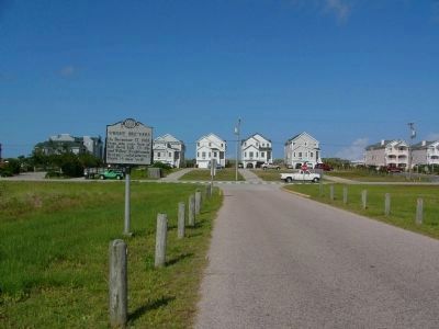
On Prospect Avenue near Virginia Dare Trail (North Carolina Highway 12), on the right when traveling west. Reported permanently removed.
On December 17, 1903, from site near foot of Kill Devil Hill, Orville and Wilbur Wright made first successful powered flight ⅕ mile west. — — Map (db m190804) HM
On North Croatan Highway (U.S. 158), on the left when traveling north.
On December 17, 1903, from site near foot of Kill Devil Hill, Orville and Wilbur Wright made first successful powered flight 1/5 mile west. — — Map (db m190805) HM
Near Croatan Highway (U.S. 158) at Prospect Avenue.
Wilbur Wright Orville Wright
In commemoration of the conquest of the air by the brothers Wilbur and Orville Wright. Conceived by Genius. Achieved by dauntless resolution and unconquerable faith. — — Map (db m10380) HM
Near North Croatan Highway (U.S. 158) at Prospect Avenue, on the left when traveling south.
Wright Brothers
National Memorial Visitor Center
Has been designated a
— — — — — —
National History Landmark
— — — — — —
This building possesses national significance as one of the original and most . . . — — Map (db m258390) HM
Near Carolista Drive 0.3 miles west of South Croatan Highway (U.S. 158).
The steady winds and gently sloping dunes of soft sand on North Carolina's Outer Banks have been attracting soaring pilots since the early 20th century. The Wright brothers flew many pioneering glider flights at Kitty Hawk between 1900 and 1903 with . . . — — Map (db m156116) HM
On Lunar Drive near N. Croatan Highwy (U.S. 158), on the right when traveling south.
[Marker Front]:
Dedicated on November 8, 2003
In celebration of the soaring of the human spirit
Created by artists
Glen Eure, Hanna Jubran, Jodi Hollnagel Jubran
Architect - Benjamin B. Cahoon
and presented as . . . — — Map (db m10126) HM
Near North Croatan Highway (U.S. 158) at Ocean Boulevard (North Carolina Highway 12), on the right when traveling south.
945 lb. Atlantic Blue Marlin
6th largest on record when caught on
July 28, 1983 aboard the
Carolinian
Oregon Inlet, NC
Captain Tony Tillett, Mate Bull Tolson
Angler Zak Garcia, age 14
of Southern Shores, NC
Time of . . . — — Map (db m76650) HM
On Moore Shore Road 0.1 miles W. Kitty Hawk Road, on the right when traveling south.
On this spot Sept. 17, 1900 Wilbur Wright began the assembly of the Wright Brothers' first experimental glider which led to man's conquest of the air.
1928
Sept. 17, 1987
This is a reproduction of the Wright Brother's Memorial Marker . . . — — Map (db m9625) HM
On U.S. 264 at U.S. 64, on the right when traveling north on U.S. 264.
Algonquian village at the time of Roanoke voyages. Home of leader, Wingina, slain by colonist, 1586. Abandoned in 1587, it was in this vicinity. — — Map (db m256820) WM
On U.S. 64 0.5 miles east of Old Ferry Dock Road, on the left when traveling east.
(panel 1)
Welcome to Manns Harbor
Purple Martin Bridge Roost
The Outer Banks of North Carolina are famous for beautiful beaches and other natural attractions, including a fascinating roost of purple martins here at William B. . . . — — Map (db m57094) HM
Near Airport Road at Old County Road, on the right when traveling south.
President Roosevelt and his security detail may have been momentarily flustered when they arrived at Fort Raleigh on August 18, 1937, to find 15,000 people at the cramped 16th century site. Still Roosevelt spoke animatedly about 'dreams as old as . . . — — Map (db m251901) HM
Near Fort Raleigh Road 0.3 miles north of U.S. 64.
In the 1860s - more than two and a half centuries after the disappearance of the 1587 settlers, a new colony was taking shape on Roanoke Island, one that was home to refugees fleeing the bondage of slavery. The island south and west of here became a . . . — — Map (db m233626) HM
Near Fort Raleigh Road 0.3 miles north of U.S. 64.
Despite dissolving only five years after the first individuals arrived, the Roanoke Freedmen's Colony was one of the first steps in a long struggle for racial equality in the United States. Community members fought for their freedom through . . . — — Map (db m233628) HM
Near Airport Road at Old County Road, on the right when traveling south.
Captain Will Colonna's shipyard launched many vessels that could each other continents, but only one that shuttled between different worlds. Moored most of the year near Norfolk, Va. Colonna's footing retreat—a two-story house with wraparound . . . — — Map (db m251914) HM
Near Airport Road at Old County Road, on the right when traveling south.
Edna Ferber was on a mission. After bats disrupted the premiere of her play Minick, its producer wryly suggested chartering a showboat. Inspired, she researched the vanishing vessels and found the James Adams Floating Theatre, which had given . . . — — Map (db m251903) HM
This marker is placed in grateful recognition of the gifts of food, friendship, and assistance with which the native inhabitants greeted the first Europeans to Roanoke Island in 1584.
Presented by
North Carolina Society
National . . . — — Map (db m206285) HM
On North Virginia Dare Avenue (U.S. 64/264) at Russel Twiford Road, on the right when traveling west on North Virginia Dare Avenue.
Agent of the American Colonization Society in Liberia, founded the A. M. E. Zion Churches in Albemarle area. His first church, 1865, near here. — — Map (db m9462) HM
On Queen Elizabeth Avenue at Fernando Street on Queen Elizabeth Avenue.
On this day, Hurricane Irene caused water from the Shallowbag Bay to rise to this level at this location.
For more information, contact:
National Weather Service Morehead City, NC
www.weather.gov/mhx
National Hurricane . . . — — Map (db m226120) HM
On Mills Landing Road (State Highway 345), on the left when traveling south.
At 3 P.M. February 7, 1862, Union forces under Gen. Ambrose Burnside landed at Ashby Harbor (A). By midnight 7,500 Federals were ashore. A Confederate force of 400 men and 3 field-pieces was sent to resist the Federal landing. The Confederates were . . . — — Map (db m11386) HM
On Freedman's Colony Road near U.S. 64/264, on the right when traveling west. Reported permanently removed.
and they made their lives
bitter with hard bondage
Exodus 1:14
For the millions of immigrants to this land, America has not been so much a destination as a promise: a promise of equality, a promise of . . . — — Map (db m9670) HM
Near Visitors Center Circle near Virginia Dare Memorial Bridge (Bypass U.S. 64), on the left when traveling west.
This marker recognizes the final resting place of Spencer Bowser, the patriarch of a prominent African American family in North Carolina. Also buried here are several other members of the Bowser family, including J.P. Bowser, Lloyd B. Bowser, Q.B. . . . — — Map (db m57026) HM
Near Visitors Center Circle near Virginia Dare Memorial Bridge (Bypass U.S. 64), on the left when traveling west.
Much of coastal North Carolina fell to Union forces in 1862. For the duration of the Civil War Northern troops kept a sizable presence in the area. The peculiar geography of the Outer Banks and the sounds region, a damper to antebellum trade, proved . . . — — Map (db m56925) HM
On Airport Road (County Route 1116) at Old County Road, on the right when traveling east on Airport Road.
Coastal Patrol Base, first in N.C., opened ½ mi. S.E., in 1942. Civilian pilots supported military and patrolled for German U-boats. — — Map (db m76772) HM
Near National Park Drive at Pear Pad Road, on the right when traveling west.
This Live Oak Tree
is given in loving memory of
Cora Mae Basnight
mother of Senator Marc Basnight,
President Pro Tempore of the
1997-1998 North Carolina Senate
Cora Mae performed the
role of “Agona” in
“The Lost . . . — — Map (db m257429) HM
On Sir Walter Raliegh Street at Queen Elizabeth Avenue, on the left when traveling east on Sir Walter Raliegh Street.
In honor of all who served
World War I
1917 – 1918
Dennis S. Twiford
World War II
1941 – 1945
Thomas C. Fearing
M. Blackwell Creef
Lawson H. Barnett
Charles F. Midgett, Jr.
Norman W. Payne
James D. . . . — — Map (db m79797) WM
On Freedman's Colony Road near U.S. 64/264, on the right when traveling west. Reported permanently removed.
Thus saith the Lord,
Let my people go.
Exodus 8:1
The bloodbath called the Civil War had begun and would cost the lives of over 600,000 Americans. As the Union armies advanced south, refugee . . . — — Map (db m9669) HM
On Fort Raleigh Road north of National Park Drive, on the left when traveling north.
The Garden Club of North Carolina created the Elizabethan Gardens in 1951 as a memorial to the Lost Colony. Designed by Innocenti and Webel, two of America's foremost architects, the garden features a wide variety of plants and antique statuary. . . . — — Map (db m276278) HM
Near Fort Raleigh Road 0.4 miles north of U.S. 64, on the left when traveling north.
European expeditions in the late 1500s commonly constructed small defensive structures. Soldiers built these earthworks by digging ditches and the forming walls from the removed soil. Ralph Lane, a fortifications export, led the 1585 English . . . — — Map (db m237880) HM
Near Fort Raleigh Road north of National Park Road when traveling north.
A furnace burned hot as metallurgist Joachim Gans and scientist Thomas Hariot conducted tests on local minerals and plants. Sent by Sir Walter Raleigh in 1585 as part of a larger expedition, these scientists built a workshop on this spot to gain an . . . — — Map (db m237881) HM
Near U.S. 64 at Fort Raliegh Road, on the right when traveling west.
Explored in 1584. Site of first English settlements in new world, 1585-1587. Birthplace of Virginia Dare, first child born of English parents in America. — — Map (db m11343) HM
[obverse:]First Light of Freedom Former slaves give thanks by the creek’s edge
at the sight of the island - “If you can cross the creek to Roanoke Island, you will find ‘safe haven’.” [rendering of Edwin Forbes' "The . . . — — Map (db m46990) HM
Near National Park Drive 0.1 miles east of Roanoke Voyages Corridor (U.S. 64), on the left when traveling east.
Beauty blooms, mysteries unfold, and the past speaks at Fort Raleigh National Historic Site
Within these wooded grounds are the stories of generations of families and their struggles to colonize a new world. Here, in 1587, the . . . — — Map (db m257677) HM
Near Airport Road near Old County Road, on the right when traveling south.
The numbers were shameful: for 99 years, the rescue of nine people on the schooner E.S. Newman by seven brave men from the all-black Pea Island Station during a six-hour struggle against Hurricane Five had received zero official . . . — — Map (db m251915) HM
Near Sir Walter Raleigh Street at Biddeford Street, on the left when traveling west.
Successful Rescues used Surfboats
Along the North Carolina coast thousands of successful rescues were carried out by Surfmen in the U.S. Lifesaving Service. One of the main pieces of equipment used during these rescues was the surf boat. . . . — — Map (db m257226) HM
Near Marshall C Collins Drive at U.S. 64, on the left when traveling west. Reported damaged.
In 2001, three of Marshall and Gussie Collins' children, Herbert, Zach, Naomi, and one grandson, Frank Hester, formed a Partnership to combine the property that was left by Marshall C. Collins. The Marshall C. Collins Family Partnership allowed . . . — — Map (db m276276) HM
Near National Park Drive near Pear Pad Road, on the right when traveling west.
During the Great Depression and the buildup to World War II, playwright Paul Green brought the legend of the Roanoke Voyages to life, introducing mainstream America to the stories of the first attempted English settlement of North America.
The . . . — — Map (db m257330) HM
On U.S. 64 at Fort Raleigh Road, on the right when traveling west on U.S. 64.
Scientist; Jewish native of Prague. Led metallurgy experiments, 1585-86, at the first Roanoke colony near here. Part of Lane's English expedition. — — Map (db m190824) HM
Near National Park Drive at Pear Pad Road, on the right when traveling west.
Without cooperation and guidance from the local Algonquian, Thomas Hariot would have discovered little and may have lost his life.
Fortunately, the Algonquian were willing to help him find his way. Friendship and respect grew between Hariot and . . . — — Map (db m257347) HM
Near Queen Elizabeth Avenue at Fernando Street, on the left when traveling south.
The US Weather Bureau once used Coastal Warning Display towers such as this one to fly signal flags to warn mariners of wind shifts or approaching storms.
On November 10, 1904, the Weather Bureau established the Manteo Weather Station . . . — — Map (db m79795) HM
On U.S. 64 north of Virginia Dare Memorial Bridge (Bypass U.S. 64), on the left when traveling north. Reported damaged.
For more than 400 years, the Mother Vineyard Scuppernong (part of the Muscadine species) grape vine on Roanoke Island, North Carolina has been – and still is – producing drops of succulent-bronze-colored fruits.
In 1584, English explorers . . . — — Map (db m276271) HM
On U.S. 64/264 near Freedman's Colony Road, on the right when traveling west.
During late January, 1862, a Federal land-sea expedition assembled at Hatteras Inlet to take Roanoke Island and capture control of the North Carolina Sound region. This force was under the joint command of General Ambrose Burnside and navy . . . — — Map (db m4828) HM
Near Fort Raleigh Road 0.4 miles north of U.S. 64, on the left when traveling north.
Archeological evidence indicates this was the site of an English earthwork from Sir Walter Raleigh's 1585 expedition.
Centuries of erosion had reduced the earthwork to a gentle dip and ridge in the forest floor. In 1947 and 1948, archeologists . . . — — Map (db m190822) HM
Near Visitor Center Circle near Virginia Dare Memorial Bridge (Bypass U.S. 64), on the left when traveling west.
(panel 1)
Welcome to Red Wolf Country
Northeastern North Carolina is Famous for the Outer Banks with its beautiful beaches, but the region has plenty of other natural attractions. Just a short drive inland, you’ll find many more . . . — — Map (db m57095) HM
Near Airport Road 0.1 miles east of Old County Road, on the right when traveling east.
Richard Etheridge was a 19-year-old slave in the fall of 1861, when thousands of Confederate soldiers came to fortify Roanoke Island. Their defeat that winter began an influx of black refugees, slave and free. The U.S. Army evacuated some . . . — — Map (db m257099) HM
Near Airport Road 0.1 miles east of Old County Road, on the right when traveling east.
In 1874, the U.S. Treasury Department
extended its network of lifesaving stations to North Carolina. Employment was open to qualified men regardless of color, but it was seasonal. Pay was low. Risks were high. When the small crews were not . . . — — Map (db m257241) HM
On Airport Road 0.1 miles east of Old County Road, on the right when traveling east.
The U.S. Supreme Court's 1896 decision in Plessy v. Ferguson accepted the separate-but equal pretense used to justify racial segregation by the states. Two years later, white supremacists regained control of the North Carolina . . . — — Map (db m257468) HM
Near Airport Road 0.1 miles east of Old County Road, on the right when traveling east.
As the last man assigned to Pea Island, Herbert Collins, locked the empty station on March 18, 1947, doors began to open elsewhere. Exactly four weeks later, Jackie Robinson crossed the Major League Baseball "color line." In 1954, the U.S. . . . — — Map (db m257507) HM
Near National Park Drive 0.1 miles east of Roanoke Voyages Corridor (U.S. 64), on the left when traveling east.
In Honor of the
Roanoke Island Historical Association
The eight men in this May 1931 picture are shown selecting the site for the Waterside Theatre, where they planned to produce a pageant commemorating the 350th anniversary of the first . . . — — Map (db m257630) HM
"In the years to come, as islanders mingle with visitors along the Manteo waterfront, let us remember that on this spot, where so many vessels have been built and launched, dreams still light the way. For how else can you explain how a lighthouse . . . — — Map (db m47013) HM
Near National Park Drive near Pear Pad Road, on the right when traveling west.
When Thomas Hariot and Joachim Gans arrived on Roanoke Island in 1585, they were responsible for studying the nature of the new world. Working in separate spaces of an open-air workshop, the two conducted various pharmaceutical and metallurgical . . . — — Map (db m257340) HM
Recreating History
The Spirit of Roanoke Island, completed in 2000 by volunteers of the North Carolina Maritime Museum on Roanoke Island, is a fine example of the shad boat. A traditional work boat built of juniper (Atlantic white . . . — — Map (db m47026) HM
Near Marshall C Collins Dr 0.2 miles west of Roanoke Voyages Corridor (U.S. 64), on the left when traveling west.
The Collins Trail is named after Marshall and Gussie Collins, a remarkable African American couple who owned a home and farmland near this trail that surrounds the Dare County
Governmental Center.
Marshall farmed, fished, crabbed, and . . . — — Map (db m257453) HM
On National Park Drive west of Pear Pad Road, on the right when traveling west.
Down the centuries, English women have built gardens to the Glory of God, the beauty of the countryside and the comfort of their souls.
The women of the Garden Club of North Carolina, Inc. have planted this garden in memory of the valiant . . . — — Map (db m276284) HM
On National Park Drive west of Pear Pad Road, on the right when traveling west.
History, mystery and fantasy are combined in these special gardens created by the Garden Club of North Carolina in 1951 as a living memorial to the first English Colonists who came to explore the New World in 1584-1587 and to settle on Roanoke . . . — — Map (db m276282) HM
On National Park Drive west of Pear Pad Road, on the left when traveling west.
The Freedmen's Colony was present on Roanoke Island from 1862 - 1867. During its peak, it was home to over 3,500 men, women, and children, all of whom came to the island in search of freedom and a better life. The story of the colony is filled with . . . — — Map (db m276285) HM
Near Sir Walter Raleigh Street at Biddeford Street, on the left when traveling west.
The Legacy of Pea Island
1880 to 1947 — 67 Years and Beyond
At Pea Island, Richard Etheridge and his crew were equals to their white counterparts. They were part of a national organization run by the federal government, receiving equal . . . — — Map (db m257554) HM
Near Sir Walter Raleigh Street at Biddeford Street, on the left when traveling west.
Early Life
January 16, 1842 — Richard Etheridge was born a slave.
He was the property of John B. Etheridge, a wealthy commercial fishermen and landowner.
Although a slave, Richard lived in the Etheridge's house and was raised as . . . — — Map (db m257607) HM
Near Fort Raleigh Road north of National Park Drive, on the left when traveling north.
The year was 1587, twenty years before Jamestown. Here on Roanoke Island a great moment in history occurred when 116 men, women, and children planted the roots of English society on the shore at Fort Raleigh. The colonists' hopes for a better . . . — — Map (db m276277) HM
Near Airport Road at Old County Road, on the right when traveling south.
How can you build an inexpensive lighthouse in turbulent water with a muddy bottom? Screw it.
Croatan Sound needed navigational aids. The shore-based light for Roanoke Marshes, at the lower end of the sound, wasn't effective, the lightship at . . . — — Map (db m251911) HM
On this site, in July – August, 1585 (O.S.), colonists, sent out from England by Sir Walter Raleigh, built a fort, called by them
“The New Fort in Virginia”
These colonists were the first settlers of the English race in America. They . . . — — Map (db m9460) HM
On Freedman's Colony Road near U.S. 64/264, on the right when traveling west. Reported permanently removed.
I have caused thee to see it
with thine eyes,
but thou shalt not go over thither.
Deuteronomy 34:4
The Proclamation of Emancipation gave the military authority to enlist “Such persons of suitable condition…into the . . . — — Map (db m9671) HM
Near Sir Walter Raleigh Street at Biddeford Street, on the left when traveling west.
Graveyard of the Atlantic
Where the cold water Labrador Current meets the warm water Gulf Stream Current with, "awesome displays of savage fury, seafaring men call it the Graveyard of the Atlantic.” — David Stick, 1953
Thousands . . . — — Map (db m257521) HM
Near Queen Elizabeth Avenue near Budleigh Street, on the left when traveling south.
From Plymouth, England, on 27 April 1584 Walter Raleigh sent Philip Amadas and Arthur Barlowe to North America to explore and prepare for English Colonization. On 13 July they claimed land in the name of Queen Elizabeth. Called Virginia in her . . . — — Map (db m225138) HM
Near Fort Raleigh Road 0.4 miles north of U.S. 64, on the left when traveling north.
In the late 1500s, Roanoke Island and London had very little in common. Imagine what it was like for Thomas Hariot when he first set foot on this strange new land.
New people, new plants, new animals—everything was truly "new". Is this land . . . — — Map (db m190823) HM
On Queen Elizabeth Avenue at Budleigh Street, on the right when traveling north on Queen Elizabeth Avenue.
First born of the English in America near by this place.
Born the eighteenth and baptized the Twentieth of August 1587 and then vanished with those colonists — — Map (db m190959) HM
On Queen Elizabeth Avenue at Budleigh Street, on the right when traveling north on Queen Elizabeth Avenue.
Whose friend and guide was the Indian Manteo christened and called Lord of Roanok and Pasamonguepeuk August 13, 1587 in reward of his faithful services — — Map (db m190960) HM
Located south of Oregon Inlet, Lifesaving Station Pea Island was the only unit in the history of the Coast Guard manned by all Black crews. This marker is dedicated to the crews of Pea Island who risked their lives and endured so that others might . . . — — Map (db m48610) HM
Near Airport Road at Old County Road, on the right when traveling south.
George Washington Creef didn't just pinch pennies. He used them in place of copper washers costing more than 1 cent apiece. His approach to other technical problems was comparably elegant. Neighbors fishing for shad and other species needed . . . — — Map (db m282212) HM
On National Park Drive west of Pear Pad Road, on the right when traveling west.
Roanoke Island has been the scene of historical dramas for more than four centuries. Algonquians, Europeans, and African Americans have all played their parts here.
First here were the Carolina Algonquian, who farmed the land and fished the . . . — — Map (db m276279) HM
Near U.S. 64 at Buzzy Lane, on the left when traveling north.
“Everything on the Banks seems to be devoid of paint – dwellings, barns and windmills, of which there are a greater number than I supposed were in existence in the whole country.”
Charles Johnson, Hawkins Zouaves, 1862
Roanoke Island, and . . . — — Map (db m190958) HM
Near Bodie Island Lighthouse Rd 1 mile west of North Carolina Route 12, on the left when traveling west.
By the mid-1800s out-of-state sportsmen, searching for a rustic hunting experience, found Bodie Island where thousands of geese, swans, and ducks congregate in the spring and fall. Exceptional waterfowl made this a hunter's paradise. Bodie Island . . . — — Map (db m251897) HM
Near West Carolista Drive west of South Croatoan Highway (U.S. 158), on the left when traveling south.
With its mountains of soft sand and consistent wind, the Outer Banks are an excellent place to experiment with flight. The Wright Brothers discovered this in the dunes of Kill Devil Hills just north of there. Here at Jockey's Ridge, a place . . . — — Map (db m276269) HM
Near West Carolista Drive west of South Croatoan Highway (U.S. 158), on the right when traveling south.
Jockey's Ridge became a North Carolina State Park in 1975 after local residents and visitors resisted the move to develop the dune. The name, Jockey's Ridge, is a mystery as to its origin. Perhaps it came from the practice of the early "bankers" who . . . — — Map (db m276268) HM
Near Bodie Island Lighthouse Road 1 mile west of State Highway 12, on the right when traveling north.
Joining the night-watch of the chief light-keeper, I also joined in the good man's enthusiasm for his wonderful "fixed white light", the bright beams of which poured out upon the surrounding waters a flood of brilliancy, gladdening hearts far out . . . — — Map (db m190961) HM
Near Bodie Island Lighthouse Road 0.9 miles east of North Carolina Highway 12.
Bodie Island Light Station
has been placed on the
National Register of Historic Places
by the United States
Department of the Interior — — Map (db m47028) HM
Near Bodie Island Lighthouse Road 1 mile east of State Highway 12, on the left when traveling south. Reported missing.
Nearby dangerous shifting nearshore sandbars caused hundreds of shipwrecks. Congress commissioned a lighthouse to be built to aid mariners in navigating this "Graveyard of the Atlantic".
Standing before you is the third lighthouse built in this . . . — — Map (db m176001) HM
Near Bodie Island Lighthouse Road 1 mile east of State Highway 12, on the left when traveling south.
The waters beyond this shore conceal a deadly secret: dozens of shifting sandbars that can imperil passing ships and wreak havoc on coastal commerce. Recognizing the problem in 1790, Secretary of the Treasury Alexander Hamilton began lobbying for . . . — — Map (db m252053) HM
On South Croatan Highway (U.S. 158) at Carolista Drive, on the right when traveling south on South Croatan Highway.
Environmental activist. Stopped destruction of Jackey’s Ridge sand dune in 1973. Fundraised and lobbied to preserve as a N.C. State Park, 1975. — — Map (db m256497) HM
Near South Croatian Highway (U.S. 158) 0.2 miles north of East Soundside Road, on the left when traveling south.
(Panel 1)
Francis & Gertrude Rogallo
Inventors of the Flexible Wing
(caption) Francis & Gertrude Rogallo invent the flexible wing
1948 • 1949 February
(Panel 2)
Francis Rogallo was born in . . . — — Map (db m254029) HM
On South Old Oregon Inlet Road 0.4 miles west of North Carolina Route 12.
Formed by a hurricane in 1846, Oregon Inlet connects the Atlantic Ocean with Pamlico Sound and a maze of inland waterways. Forming a 3,000-square mile estuary, these waters offer crucial habitat for commercially important fish, shrimp, and . . . — — Map (db m256870) HM
Near Oregon Inlet Road (State Highway 12) at State Highway 12 when traveling south.
NC State Record
805.5 lbs.
Caught March 12, 2011,
aboard the "Sea Breeze"
40 mi. SE of Oregon Inlet
Angler: Corey Schultz
Capt: Ned Ashby
Mate: George Cecil
Mounted by: Gray Taxidermy — — Map (db m76735) HM
Near West Carolista Drive 0.3 miles west of South Croatan Highway (U.S. 158), on the right when traveling west.
Sand Dune Access
The sand dunes of Jockey's Ridge showcase an unparalleled view of sound to sea. The largest active sand dune system on the East Coast is a place to see the local landmarks in the distance. A legend is told of spectators . . . — — Map (db m258309) HM
Near Cape Hatteras National Park Road (North Carolina Route 12) 0.2 miles south of South Croatan Highway (U.S. 158), on the right when traveling south.
These migrating barrier islands are land's answer to the dynamic Atlantic Ocean. Here, at the confluence of two global ocean currents, strong winds, storms, nearshore currents, and tides continually shift the shoreline, while overall sea level is on . . . — — Map (db m257287) HM
Near South Croatan Highway near Nags Head Town Hall, on the right when traveling north.
History Behind the Mystery
The Nags Head Wreck was brought to Nags Head Town Hall in 1978 after reoccurring disappearances due to coastal storms. The wreck was first found on shore in 1975, but after time it was buried by sand until 1977. . . . — — Map (db m257017) HM
On State Highway 12 at Myrna Peters Road, on the left when traveling south on State Highway 12.
A German submarine sank the British tanker "Mirlo" off coast nearby, Aug. 16, 1918. Coast Guard, led by J. A. Midgett, saved most of the crew. — — Map (db m11394) HM
On State Highway 12 4 miles south of Lifeboat Station Road, on the left when traveling south.
Panel 1
Welcome & Enjoy
Your National Wildlife Refuge
Pea Island
Established in 1938, Pea Island NWR included over 5,800 acres of typical barrier island habitat that has been carefully managed to better provide for the needs . . . — — Map (db m76739) HM