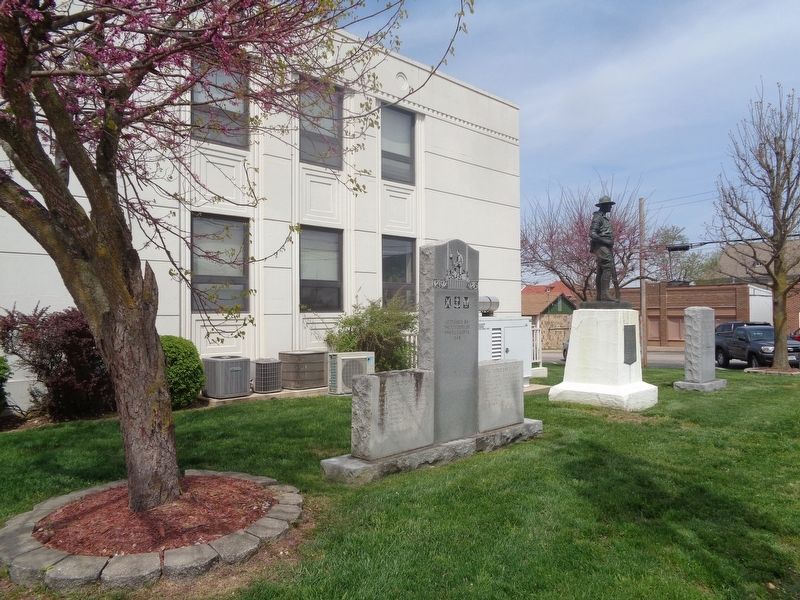
On Main Street south of 4th Street, on the right when traveling south.
(left column:)
Harold E. Asher • John R. Birmingham • Max A. Bonham • Otto J. Brandel • Melbern C. Branson • George B. Chambers • Joseph L. Dambach • Frank E. Hagenhoff • William J. Harrison • James R. Hickey • Richard A. Honey • William . . . — — Map (db m172939) WM
On West 9th Street just east of North Pine Street, on the right when traveling east.
"The USO had a substantial operation in Rolla during World War Two, serving thousands of soldiers on leave looking for recreation and an opportunity to get away from military life at Fort "Lost-in-the-Woods". The need for appropriate, and . . . — — Map (db m186162) HM
On North Pine Street at West 8th Street, on the right when traveling north on North Pine Street.
"The block of Eight Street from the railroad depot to Pine Street led to the business district. The strong of saloons on Eight Street between the railroad tracks and Pine Street was known as "Whiskey Row" during it rowdy days. The Baltimore Hotel is . . . — — Map (db m139738) HM
On North Rolla Street just south of West 10th Street (Missouri Highway BB), on the right when traveling south.
"The USO had a substantial operation in Rolla during World War Two, serving thousands of soldiers on leave looking for recreation and an opportunity to get away from military life at Fort "Lost-in-the-Woods". The need for appropriate, and . . . — — Map (db m139756) HM
On Bardsley Road south of Arkansas Avenue, on the right when traveling south.
This passenger car was built in 1883 by the Barney & Smith Car Company from Dayton, Ohio. The Barney & Smith Company built premier railroad passenger cars from 1848 to about 1894 and electric trolley cars for the next 20 years. The company had . . . — — Map (db m157186) HM
On North Pine Street at West 7th Street, on the left when traveling north on North Pine Street.
"The Campbell Building, on the southwestern corner of Seventh and Pine streets, was the centerpiece of Joseph Campbell's economic prominence at the turn of the century. The building housed the Rolla State Bank (Campbell was founder) and, until 1915, . . . — — Map (db m139742) HM
On West 6th Street at North Main Street, on the right when traveling east on West 6th Street.
"After losing the Rolla Building, the public school occupied a former army commissary office at Ninth and Elm streets until it was destroyed in the Great Fire. Central School, shown here until construction and with a basketball game in progress, . . . — — Map (db m139752) HM
In 1953, communities began asking Frisco Railroad [sic - Railway] to make the old Frisco steam locomotives available as historic attractions for cities located along the old Frisco line. Dr. Clair V. Mann, secretary/historian of the Phelps County . . . — — Map (db m157163) HM
On West 3rd Street just west of North Rolla Street, on the left when traveling west.
Fort Wyman and the Defense of the Railroad
Fort Wyman was the first of two artillery field fortifications built by the Union army at Rolla, signifying the importance of the railroad terminus to the northern was effort in Missouri.
The . . . — — Map (db m139747) HM
On Bardsley Road south of Arkansas Avenue, on the right when traveling south.
Steam locomotive 1501 was once part of a proud stable of thirty such engines on the Frisco Railway system. Built in 1923, the handsome modern machine was the pride of the fleet until dieselization of the system in the late 1940s. The 1501 was part . . . — — Map (db m157161) HM
On North Pine Street at West 8th Street, on the right when traveling north on North Pine Street.
"The quartermaster depot building at the northwest corner of Eighth and Pine streets was among many others in Rolla built by the Union army for its supply apparatus. Sold after the war as government surplus, the quartermaster building became the . . . — — Map (db m139737) HM
On West 8th Street just west of Park Street, on the right when traveling east.
Site of hand-hewn log structure built in 1855 as contractors office for southwest branch of Pacific Railroad Later served as home of Edmund Ward Bishop — Founder of Rolla During Civil War was used as officers quarters As the Eagle Hotel it was . . . — — Map (db m186159) HM
On North Pine Street at West 8th Street, on the left when traveling north on North Pine Street.
"Beyond the woman entering the National Bank is the southeastern corner of Eighth and Pine streets and the Central Drug Store, circa 1885. The Hotel Edwin Long replaced the drug store in 1931. Contractor M.E. Gillioz rushed the Hotel Edwin Long . . . — — Map (db m139741) HM
On Bishop Avenue (U.S. 63) 0.1 miles south of Vichy Road (County Highway 232), on the left when traveling south.
The ancients observed that when the full moon rose nearly diametrically opposite the sun at sunset, a lunar eclipse was very probable later in the evening. England's Stonehenge has a group of 56 post holes, known as Aubrey Holes, arranged in a . . . — — Map (db m157238) HM
On Kingshighway (Business Interstate 44) 0.1 miles west of U.S. 63, on the right when traveling west. Reported damaged.
"The Missouri Trachoma Hospital was one of two hospitals in the United States devoted for the treatment of this eye disease. The building was equipped with 70 beds and was completed in 1939 at a cost of $137,000. The grounds were donated by the . . . — — Map (db m139762) HM
On West 8th Street just east of North Pine Street, on the left when traveling east.
"Cyrus H. Frost, David W. Malcolm, Joseph Campbell, Edmund Ward Bishop, A.S. Long, and others organized the National Bank of Rolla in 1871. The offices were in the Malcolm Building, on the north side of Eighth Street (now part of the parking lot . . . — — Map (db m139753) HM
On North Rolla Street at West 4th Street, on the right when traveling south on North Rolla Street.
The exact date of construction of the Main Street bridge is unknown. Based on old Rolla Express newspaper ads, it was in existence by 1862. Available records point to a less than reliable past. During its first fifty years, the bridge was . . . — — Map (db m139743) HM
On North Olive Street at East 7th Street, on the right when traveling north on North Olive Street. Reported damaged.
"The Pennington-Gilbert Shoe Company factory opened east of the tracks in 1926 between Seventh and Eighth streets. The city provided the site after a vigorous campaign to bring the industry to Rolla that included sales of lots in the Frisco Addition . . . — — Map (db m139759) HM
On West 3rd Street just west of North Rolla Street, on the left when traveling west.
Phelps County Courthouse
1860-1994
has been placed on the
National Register
of Historic Places
by the United States
Department of the Interior — — Map (db m139745) HM
On West 3rd Street 0.1 miles west of North Rolla Street, on the left when traveling west.
Dedicated to all who served honorably
to preserve, protect, and defend our
nation principles of democracy
liberty and justice
~ Lest we forget ~ — — Map (db m139749) WM
On West 8th Street just east of North Pine Street, on the left when traveling east. Reported damaged.
"The automobile age in Rolla began about 1905." "The city began paving streets with brick in 1908, filling rutted paths and deep holes on Eighth and Pine streets...". "Local support for better roads coincided with national and regional . . . — — Map (db m139754) HM
On North Pine Street just north of West 10th Street (Missouri Highway BB), on the left when traveling north. Reported damaged.
"The highway helped sustain Rolla during hard times and war, but also brought increased traffic and stoplights, and, finally, new road construction. In just over a decade, traffic through town became heavy enough that the main stem of Route 66 was . . . — — Map (db m139757) HM
On Bardsley Road south of Arkansas Avenue, on the right when traveling south.
The Pandemic of 2020
In January of 2020, a coronavirus made it from China to the United States and by mid-March had spread across the entire world. Named COVID-19, it was considered so deadly that the government forced many businesses to . . . — — Map (db m157177) HM
On Kingshighway at Fairgrounds Road, on the right when traveling west on Kingshighway.
Side A:
This Ozark plateau town, 1120 feet above sea level, was a "Child of the railroad." On a natural passageway to southwest Missouri, midway between St. Louis and Springfield, this site was chosen by the Southwestern Branch of the . . . — — Map (db m55637) HM
On North Elm Street just south of West 8th Street, on the left when traveling south.
"Joseph Campbell established Rolla Mills across from the depot on the east side of the tracks between Seventh and Eighth streets in 1871. It was an important commercial enterprise for both townspeople and rural residents of the county, and was . . . — — Map (db m139758) HM
On Bishop Avenue (U.S. 63) south of Vichy Road (County Highway 232), on the left when traveling south.
Dr. Joseph Senne, Dr. David Summers and Chancellor Joseph Marchello, set out in 1982 to develop a model of Stonehenge on the Missouri S&T campus. Senne, an avid astronomer, helped design and made the astronomical calculations for the replica. He . . . — — Map (db m157230) HM
On North Pine Street at West 8th Street, on the right when traveling north on North Pine Street.
"The Rollamo Theater opened on west Eighth Street in June 1931. Lantern slides had been shown in the Shaw Opera House and downtown "air-domes", and silent movies in the Lyric Theater on Pine Street, but the Rollamo Theater was the first modern movie . . . — — Map (db m139740) HM
On North Pine Street at West 8th Street, on the right when traveling north on North Pine Street.
"The Schuman Brothers erected a new building on the southwestern corner of Eighth and Pine streets in 1902. Briefly the home of the Central Drug Store, it was better known later as Scott's Drugs. For nearly seventy-five years, townspeople and . . . — — Map (db m139736) HM
On Bishop Avenue (U.S. 63) 0.1 miles south of Vichy Road (County Highway 232), on the left when traveling south.
Each day as its rays pass through the hole in the analemma plate below the lintel of the south trilithon, the sun casts a spot surrounded by a shadow on either the horizontal or vertical face of the two stones north of the trilithon.
During the . . . — — Map (db m157279) HM
On Kingshighway (Business Interstate 44) west of North Walker Avenue, on the right when traveling east.
On March 15, 1931, Saint Patrick's Day, the city turned out to celebrate the completion of Route 66 in the area. In attendance was Cyrus Avery, president of the U.S. Highway 66 Association, and Governor Henry S. Caulfield. The celebration . . . — — Map (db m274692) HM
On Bishop Avenue (U.S. 63) 0.1 miles north of University Drive (State Highway E), on the right when traveling north.
Polaris, the North Star, is framed by the Polaris window. Polaris, a star of the second magnitude, stands alone and forms the tail of the constellation Ursa Minor. It marks the approximate position of the north celestial pole.
On clear nights, . . . — — Map (db m157241) HM
On Kingshighway (Business Interstate 44) 0.1 miles west of U.S. 63, on the right when traveling west.
John Webber established the first homestead in what is now in the city of Rolla on this site in about 1845. The one and one-half story, single-room log cabin he constructed stood just north of this plaque. The concrete marker that covers Webber's . . . — — Map (db m139760) HM
On Bishop Avenue (U.S. 63) 0.1 miles south of Vichy Road (County Highway 232), on the left when traveling south.
Located on Salisbury Plain, 75 miles southwest of London, Stonehenge was built in three phases, beginning in 2800 B.C. by Neolithic people and culminating around 1800 B.C. during the Broze Age. Stonehenge evolved into primarily a 100-foot circle . . . — — Map (db m157228) HM
These lintels were cast in the Maramec Iron Works circa 1866. After completion, the lintels were transported by wagon to "Dunmoor" the home of William James, 1870-79, and used on the west side to support the structure above the windows. The . . . — — Map (db m157878) HM
Near Pershing at Old U.S. 66, on the left when traveling east.
Four score and seven years ago our fathers brought forth, on this continent, a new nation, conceived in liberty, and dedicated to the proposition that all men are created equal.
Now we are engaged in a great civil war, testing . . . — — Map (db m246534) HM
Powered by an undershot water wheel, 10 feet in diameter, the sandcasted Anchony-Chaffery Hammer was used to convert blooms into anchonies and finished wrought iron mercantile bars. The hammer weighing approximately 500 pounds, was raised about two . . . — — Map (db m157879) HM
The Bloomery Forge Trip Hammer was powered by an undershot water wheel twelve feet in diameter. Lifted by wipers attached to the water wheel shaft, the hammer beat slag and impurities from pig iron. After pounding the iron into blooms it was sent . . . — — Map (db m157919) HM
Near North Jefferson Street (State Highway 8) just north of West Marcella Street, on the right when traveling north.
1866 - Built as a residence for the William James Family
1896 - Converted by the Women's Relief Corps and Opened as the Federal Soldiers Home
1897 - Operation of Home transferred to the State of Missouri — — Map (db m139767) HM
Rebuilt in 1856, the Maramec "Cold Blast" Furnace provided area settlers with all necessary farm, industrial, and household iron equipment. During the Civil War, Maramec Iron Works supplied the Union Army with cannonballs and iron plate to be used . . . — — Map (db m157920) HM
George Evans spent some three years at the Maramec Iron Works. On March 14, 1848, he and his brother started construction of the grist mill. George also built the boarding house and other residences throughout the area. [H]e married Emily Treece . . . — — Map (db m157943) HM
Samuel Hyer and his wife, the former Elizabeth Mitchell, lived on this site. They had eight children, three sons and five daughters. Samuel was a leading iron worker at Maramec. The Hyer's daughter, Martha, became one of the earliest teachers at . . . — — Map (db m157965) HM
This peaceful site became the final resting place for over two hundred fifty Maramec Village residents who shared the joys and fears of wilderness life.
Hardships constantly plagued the pioneers. Many lost their lives prematurely to the . . . — — Map (db m157929) HM
Here stood the historic Maramec Iron Works, completed in 1829. Fueled by charcoal from the surrounding forest, powered by the nearby Maramec Spring. By the middle of the century this former tribal land of the Shawnees was one of Phelps County's . . . — — Map (db m157926) HM
On Maramec Spring Drive, on the right when traveling west.
In 1937, the first commissioners of the Department of Conservation decided that trout anglers should "pay their own way" since trout are not native to Missouri and are expensive to produce. Money from the sale of daily tags and trout permits . . . — — Map (db m157971) HM
On Maramec Spring Drive, on the right when traveling west.
The Missouri Department of Conservation stocks rainbow trout and brown trout in suitable areas. Rainbow trout are native to mountain streams on the Pacific slope of North America, whereas brown trout are native to Europe. About 2 million . . . — — Map (db m157968) HM
You are now entering one of Missouri's first trans-link roads. It is typical of many frontier wagon roads in the early 1800's that linked one small community to another. Stringtown Road served two purposes. This stretch of road form[ed] the . . . — — Map (db m157939) HM
Stuttering Tom Lenox was a mule skinner. His job consisted of driving teams of mules and also caring for the animals. The mules were used for pulling wagons loaded with iron ore and charcoal to the works. His favorites were Belle and Nellie, . . . — — Map (db m157941) HM
The suspension railroad drop bucket was one of several vehicles used to deliver raw material to the iron furnace trunnel head. To produce pig iron, the cold blast furnace was charged 100 times a day with 640 pounds of iron ore, 18 bushels of . . . — — Map (db m157897) HM
On State Highway B at North Jefferson Street (State Highway 68), on the right when traveling east on State Highway B. Reported unreadable.
[Captions on arrows out from the center of the wood:]
1860 City of St. James Established. Our Tree Sprouts.
1865 Civil War Ends!
1875 Maramec River forges [unreadable]
1880 [unreadable] is Born in St. James. . . . — — Map (db m139735) HM
The two-wheeled charcoal barrow, filled from stockpiles in the adjoining Bridge House was used to deliver charcoal to the Iron Furnace trunnel head. Each cart, being constructed of 1/16 inch thick cast iron plates, stood about four feet high and . . . — — Map (db m157832) HM
On North Jefferson Street (State Highway 8) 0.1 miles north of Aida Street, on the right when traveling north.
Dedicated to all who
served in Vietnam
★ ★ ★ 1956 - 1975 ★ ★ ★
All Gave Some ★ ★ ★ Some Gave All
[Reverse:]
In remembrance of
"The Moving Wall"
which was here . . . — — Map (db m139766) WM
Donated by Minnie Witzke
in honor
of her husband
Richard P. Witzke
Born - January 30, 1906
Deceased - August 2, 1981
A true village blacksmith . . . — — Map (db m157892) HM
The "dog trot" cabin consisted of two cabins joined together by a breezeway. Much of the wood for fuel was kept here during rainy weather. A home of this type could provide living quarters for two families.
This was the home of Davis Westlake and . . . — — Map (db m157963) HM
On South Springfield Avenue (State Highway 83) just north of Jefferson Street, on the right when traveling south.
Bolivar in Polk County, 108 miles from the Tipton Terminus, was a relay and meal station.
The Franklin Hotel, no longer standing, provided accommodations. — — Map (db m266492) HM
On East College Street at South Springfield Avenue (State Route 83), on the left when traveling east on East College Street.
In central southwest Missouri, where the Western Prairie and the Ozark Plateau meet, Polk County was organized 1835, and named for Congressman, later U. S. President James K. Polk. The county lies in the 1808 Osage Indian cession and was roamed by . . . — — Map (db m251152) HM
On Broadway (Missouri Route 32) west of Barker Avenue, on the left when traveling west.
Dedicated in grateful tribute to the men and women of Polk County who served and to those listed here who gave their lives in our country's wars.
Let us remember their service and keep faith.
[Roll of Honored Dead from]
World War I • . . . — — Map (db m62569) WM
On Broadway (Missouri Route 32) at Main Avenue, on the right when traveling east on Broadway.
Died In Active Service
John W. Allred • Emmett Barham • John M. Black • Lawrence V. Boaz • Joseph E. Bush • Willie Cates • Roma O. Drumwright • Ulysses J. Durham • Walter N. Durkee • Homer C. Forcey • David F. Gentry • Arthur Goodrich • . . . — — Map (db m62548) WM
On Broadway (Missouri Route 32) at Main Avenue, on the right when traveling east on Broadway.
In honor and memory of
those who served in defense
of their country during all
wars and conflicts so that
all might enjoy freedom
Dedicated May 27, 1996 — — Map (db m62547) WM
On Highway F (Farm to Market Road F) 0.6 miles south of E 530th Rd (Route 530), on the right when traveling north.
The James H.M. Smith Relay Station in Polk County, 119 1/2 miles from the Tipton Terminus stood 2 miles north of Brighton. Molloy Station in Brighton was a was a stop for a time after the Telegraph line reached there Dec., 1859. — — Map (db m259447) HM
On Old U.S. Route 66 (State Highway 17) north of Risky Road, on the left when traveling north.
In Honor of All Veterans
Past and Present
[Armed Services Emblems]
In Honor of Francis J. Lynch VFW Post 3168
Dedicated May 31, 2004 — — Map (db m158058) WM
On Commercial Street (State Highway 17/133) at 10th Street, on the right when traveling north on Commercial Street.
Planted "Earth Day" April 22, 1999
Dedicated during
"National Gardening Week"
June 9, 1999
under the direction of the
Crocker Green Thumb Garden Club.
Kindergarten children from the Crocker school
named the tree during the planting . . . — — Map (db m158115) HM
On Teardrop Road east of Tealhouse Drive, on the right when traveling east.
Established in 1870 and named after a bad bend in the Big Piney River, this "devil of an elbow" was made famous by historic Route 66. — — Map (db m170623) HM
On Iowa Avenue just north of West 12th Street, on the right when traveling north.
The 75th Infantry Division was activated at Fort Leonard Wood, Missouri on 15 April 1943. After taking part in the Third Army maneuvers in Louisiana, the 75th moved to Camp Breckinridge, Kentucky in the Spring of 1944. The Division departed for . . . — — Map (db m163840) HM WM
On Iowa Avenue just south of West 11th Street, on the right when traveling north.
The 70th Infantry Division was activated on Infantry Day, 15 June
1943 at Camp Adair, Oregon. The Division was called "The
Trailblazers" to honor the centennial of the Oregon Trail. The
Division moved to Fort Leonard Wood, Missouri in the summer . . . — — Map (db m163839) HM WM
On J.H. Williamson Drive at Business Interstate 44, on the right when traveling north on J.H. Williamson Drive.
The AlPac was located at 18652 Historic Route 66, 3 miles east of Pacific, MO, on the way to Allenton. The property was aptly named Al-Pac Motel & Café due to its location between the communities to the east and west. Owned and operated by Fred . . . — — Map (db m311718) HM
On J.H. Williamson Drive at Business Interstate 44, on the right when traveling north on J.H. Williamson Drive.
The Alura Motel, later known as the Lin-Air Motel, was located at 4665 N. Lindbergh Blvd. in St. Louis. It was built by Paul Lammers in the late 1940s, and he owned and operated it until 1960. At that time, he built the Sands Motel across the . . . — — Map (db m311732) HM
On J.H. Williamson Drive at Business Interstate 44, on the right when traveling north on J.H. Williamson Drive.
D & G Package Store is a liquor store that was first opened by Herman and Jodie Paulette. They also owned and ran Jodie's Café, which was a separate building located to the left of the liquor store. The original D & G sign was a part of the . . . — — Map (db m311713) HM
On W.H. Williamson Drive at Business Interstate 44, on the right when traveling north on W.H. Williamson Drive.
George Marcellus Reed (1855-1938), a man of many talents, served Pulaski County in numerous ways. Beginning in his 20s, he taught at schools in Hancock, Dixon, and Waynesville over a period of 30 years while also giving violin lessons. In 1882, . . . — — Map (db m311735) HM
On J.H. Williamson Drive at Business Interstate 44, on the right when traveling north on J.H. Williamson Drive.
In November 2013, an opportunity for development arose during the "The Road Ahead" Strategic Roundtable hosted by the World Monument Fund in Anaheim, CA. Jim Thole, a guest speaker from the Neon Heritage Preservation Committee of the Route 66 . . . — — Map (db m311740) HM
On J.H. Williamson Drive at Business Interstate 44, on the right when traveling north on J.H. Williamson Drive.
Oaks Court Modern Cabins were located along the east side of Route 66 in St. Robert, just a quarter mile west of the Neon Park. A few of the cabins remain and have been remodeled over the years. The sign was originally located on the roof of what . . . — — Map (db m311739) HM
On J.H. Williamson Drive at Business Interstate 44, on the right when traveling north on J.H. Williamson Drive.
Known as the "Motel Beautiful" in its heyday, the Motel St. Louis was truly worthy of a sign befitting its nickname. Charming travelers beginning in the 1940s, the motel was located at 5028 N. Lindbergh Blvd., one of many streets that made up . . . — — Map (db m311708) HM
On St. Robert Boulevard 0.8 miles east of Old Route 66 (Business Interstate 44), on the right when traveling east.
Fort Leonard Wood
[Major General Leonard Wood]
[Drill Instructor and Recruit]
[The Spirit of Pulaski County P-51]
[Armed Service Service Caps]
[Fallen Soldier Memorial] — — Map (db m157293) WM
On J.H. Williamson Drive at Business Interstate 44, on the right when traveling north on J.H. Williamson Drive.
Route 66, also known as America's Mother Road, has been a popular route for travelers from all over the world since its inception in 1926.
It was the primary route for essential travel between the Midwest and the West for American . . . — — Map (db m311733) HM
On J.H. Williamson Drive at Business Interstate 44, on the right when traveling north on J.H. Williamson Drive.
The Stanley Cour-Tel, located at 4675 N. Lindbergh Blvd. in St. Louis, was constructed in 1950 by Stanley and Olivia Williams. It was situated next to the Alura Motel, which was later known as the Lin-Air Motel. The restored sign of the Lin-Air . . . — — Map (db m311711) HM
On J.H. Williamson Drive at Business Interstate 44, on the right when traveling north on J.H. Williamson Drive.
In 1933, Bonnie and Clyde travelled along Route 66 through Missouri while they were on the run. They used this route to move around, conceal themselves, and commit various crimes. The couple hid out in the Carthage/Joplin, MO area for 12 days . . . — — Map (db m311720) HM
"Traveled 12 miles to Waynesville on Roberdeou Creek, a branch of the Gasconade—clear and present day..."
Dr. W. I. Morrow's diary, March 5, 1839
During the Trail of Tears, the only way Cherokee could cross the creek . . . — — Map (db m158042) HM
On Superior Road south of Old U.S. Route 66 (Business Interstate 44), on the right when traveling south.
"...halted at Waynesville, MO o'c P.M. encamped and issued corn and fodder, beef and cornmeal. Weather extremely cold."
B. B. Cannon's diary, December 9, 1837
If you had been here the afternoon of December 9, 1837, you . . . — — Map (db m158038) HM
On Superior Road south of Old U.S. Route 66 (Business Interstate 44), on the right when traveling south.
How did you get here today? There's a good chance that you traveled along a route used by travelers for centuries. Nearby I-44 and the historic Route 66 follow paths used by American Indians for trade and travel more than 500 years ago.
In the . . . — — Map (db m158009) HM
On Superior Road south of Old U.S. Route 66 (Business Interstate 44), on the right when traveling south.
"This morning word came that a Cherokee woman was dying. I hastened to her tent...She was put in the wagon which carried her family when the detachment started, but soon expired."
Rev. Daniel S. Butrick diary, March 11, . . . — — Map (db m158035) HM
On Superior Road south of Old U.S. Route 66 (Business Interstate 44), on the right when traveling south.
Welcome to Waynesville's lush Laughlin Park, along the banks of the historic Roubidoux Creek. Along with its beauty and recreational opportunities, this place also played a part in one of the most tragic periods in American history, the Trail of . . . — — Map (db m158041) HM
On Olive Street at Roubidoux Drive, on the left when traveling north on Olive Street.
Husband, Father, Grandfather,
Founding Member of the Kickapoo Trace Muzzleloaders,
Mountainman, Sportsman, Civic Leader, Educator,
and to all others, a Friend. You will be missed by all.
Until next time Ozark Mountainman,
Keep Your . . . — — Map (db m158044) HM
On Lynn Street at North Street, on the right when traveling north on Lynn Street.
Built of logs in pioneer days, used as a stage coach stop and a tavern of rest for weary travelers westward bound. In 1862 the building was comandeered by the Union Forces and used as a hospital for the duration of the Civil War. After the war . . . — — Map (db m21618) HM
On Historic Route 66 at Benton Street, on the right when traveling west on Historic Route 66.
Here in Missouri's central Ozarks, Pulaski County was organized 1833, and named for Revolutionary War general, Polish Count Casimir Pulaski. Once roamed by Indians and French trappers, the county is part of land ceded by the Osage . . . — — Map (db m55638) HM
On Route 66 (Business Interstate 44) at Benton Street, on the right when traveling west on Route 66.
Located on the downtown Square was the Rigsby House and, next door, the building that was formerly Rigsby Standard Oil Station.
Claude and Eva Rigsby bought this house, which stands on lots 6 and 7 in block 4 of the original town of . . . — — Map (db m157295) HM
On Roubidoux Drive west of Olive Street, on the right when traveling west.
On December 9, 1837, United States Army Conductor, B.B. Cannon and 330 Cherokee Treaty Party "Volunteers" camped near this site. Ten additional detachments, led by Cherokees themselves, passed through here on the Northern Route of the "Trail of . . . — — Map (db m158046) HM
On North Street at State Highway 17, on the right when traveling west on North Street.
The Talbot House is one of Waynesville's oldest homes. The home was constructed by Rev. Albert Washington Davis in 1885. After his death in 1888, his widow opened the family home to travelers as the "Pulaski House".
Dr. C.A. Talbot . . . — — Map (db m184887) HM