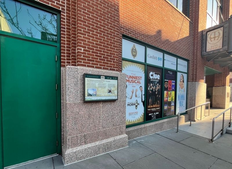
Maryland toll roads helped revolutionize American travel. The Baltimore and Frederick-Town Turnpike began with a tollgate, placed near this corner in 1807. For a few cents, you could head west on a "smooth" road that was the ancestor of today's . . . — — Map (db m243468) HM
The lofty, triple-arched Baltimore Street Bridge was built here in 1932 to provide better access across the Gwynns Falls Valley to the city's rapidly developing west side. Earlier, the Frederick Turnpike crossed farther south on a relatively . . . — — Map (db m6351) HM
As the Baltimore and Frederick-Town Turnpike twisted and turned westward, it passed one of the centers of early city industry. A three mile long millrace on the Gwynns Falls provided power for over twenty mills that sawed wood, ground flour, wove . . . — — Map (db m167307) HM
Maryland toll roads helped revolutionize American travel. The Baltimore and Frederick-Town Turnpike began with a tollgate, placed near this corner in 1807. For a few cents, you could head west on a “smooth” road that was the ancestor of today’s . . . — — Map (db m5700) HM
Moving Goods Since 1729, Baltimore has owed its existence to its deepwater port. The city looks east to the Chesapeake Bay and ports around the world. It also looks west with access to markets in America’s heartland. It began with local farmers . . . — — Map (db m282051) HM
Before Irvington existed, eastbound travelers encountered the last hill on the Baltimore and Frederick-Town Turnpike. The turnpike was part of the system of roads that connected to the National Road in Cumberland in 1806. During the 1800s, this . . . — — Map (db m114592) HM
For several decades in the early 1800s, thousands of Conestoga Wagons, “ships of inland commerce,” ruled the National Road. With their sloping bodies, wheels taller than a man and six-horse teams skillfully maneuvered with a single “jerk line,” . . . — — Map (db m5705) HM
The National Road was the first American highway funded by Congress. Construction began in 1811 for a 620-mile route starting at Cumberland, Maryland, and, by 1841, extending to Vandalia, IL. Designed for stagecoaches and Conestoga wagons taking . . . — — Map (db m243533) HM
The Underground Railroad was a network of American abolitionists who aided and sheltered 100,000 African Americans seeking freedom from enslavement in the South. These Freedom Seekers often journeyed north by land, and many crossed into the free . . . — — Map (db m243532) HM
This 6-miles-to-Baltimore marker was welcomed by thousands on horseback, in stagecoaches and wagons, who traveled this Frederick Turnpike. Some headed west to settle in the Ohio Valley, along with merchants selling their wares, while millers with . . . — — Map (db m39347) HM
A gift from Charles Carroll of Carrollton, Castle Thunder, the home of Richard and Mary Carroll Caton, stood on this site from 1787 to 1906.
The 7-mile Frederick Turnpike stone marker of 1804 was moved here from its original position 3/10 . . . — — Map (db m4910) HM
This 1877 “Plan of Catonsville” lays outs all the possibilities of an energetic and emerging suburb of Baltimore, only eight miles, or a one-day carriage ride, to the east. The centerpiece of the town is the Frederick Turnpike, part of the road . . . — — Map (db m5500) HM
The reign of stagecoaches and Conestoga Wagons on the Baltimore and Frederick-Town Turnpike only lasted seventy years. Omnibuses, attached to teams of four horses, began rolling out from Baltimore to Catonsville in 1862.
The Catonsville Short . . . — — Map (db m5536) HM
The Ellicott brothers constructed what became the first leg of the Baltimore and Frederick-Town Turnpike to get their flour to market in Baltimore. By 1787, they cut a new road east through the forests to shorten the trip to the city. This route . . . — — Map (db m128248) HM
Mount Airy was first settled along what is now Ridgeville Boulevard. With the construction of the Old National Pike (Route 40) in the 1730s, Ridgeville became a rest stop and overnight lodging for travelers on the road. In 1831 the Baltimore and . . . — — Map (db m199372) HM
In 1839, the Baltimore and Ohio Railroad extended its line through Mount Airy Cut, and a village soon developed here. During the Civil War, Co. K, 14th New Jersey Infantry, guarded the railroad and National Road at Mount Airy. Pine Grove Chapel, . . . — — Map (db m201590) HM
Here at Milestone 31, about 130 feet southeast of its original location, the Baltimore and Frederick-Town Turnpike created two towns as it moved west. Both Parrsville and Ridgeville are now a part of Mount Airy. Parrsville, to the east, was . . . — — Map (db m4933) HM
Here at Milestone 31, about 130 feet southeast of its original location, the Baltimore and Frederick-Town Turnpike created two towns as it moved west. Both Parrsville and Ridgeville are now a part of Mount Airy. Parrsville, to the east, was . . . — — Map (db m251978) HM
The National Road has borne witness to many notorious comings and goings. The quiet atmosphere you’ll find at Hagan’s Tavern today is quite different from the raucous bawdiness of yesteryear. This tavern was a “place where the old bloats of the . . . — — Map (db m167094) HM
The National Road has borne witness to many notorious comings and goings. The quiet atmosphere you'll find at Hagan's Tavern today is quite different from the raucous bawdiness of yesteryear. This tavern was a "place where the old bloats of the . . . — — Map (db m252611) HM
The Square Corner, at the intersection of Patrick and Market Streets, has long been the commercial and financial heart of Frederick. It is here that the National Road meets several important north-south roads that lead to Pennsylvania, Virginia, . . . — — Map (db m2748) HM
The Square Corner, at the intersection of Patrick and Market Streets, has long been the commercial and financial heart of Frederick. It is here that the National Road meets several important north-south roads that lead to Pennsylvania, Virginia . . . — — Map (db m249955) HM
The Square Corner, at the intersection of Patrick and Market Streets, has long been the commercial and financial heart of Frederick. It is here that the National Road meets several important north-south roads that lead to Pennsylvania, Virginia . . . — — Map (db m305549) HM
This part of downtown Frederick has long been a place of lodging and hospitality for travelers along the National Road. Kimball's Inn, Talbott's Tavern, the City Hotel and the Francis Scott Key Hotel have occupied this site for over two hundred . . . — — Map (db m104243) HM
This part of downtown Frederick has long been a place of lodging and hospitality for travelers along the National Road. Kimball's Inn, Talbott's Tavern, the City Hotel and the Francis SCott Key Hotel have occupied this site for over two hundred . . . — — Map (db m243565) HM
This part of downtown Frederick has long been a place of lodging and hospitality for travelers along the National Road. Kimball's Inn, Talbott's Tavern, the City Hotel and the Francis Scott Key Hotel have occupied this site for over two hundred . . . — — Map (db m305576) HM
Frederick Town was founded in 1745 when Daniel Dulany the Elder carved out an eastern portion of his 7,000 acre parcel patented as "Tasker's Chance." The town was then laid out in an orderly grid with Patrick Street designated as the east-west . . . — — Map (db m2805) HM
Frederick Town was founded in 1745 when Daniel Dulany the Elder carved out an eastern portion of his 7,000 acre parcel patented as "Tasker's Chance." The town was then laid out in an orderly grid with Patrick Street designated as the east-west . . . — — Map (db m249965) HM
Frederick Town was founded in 1745 when Daniel Dulany the Elder carved out an eastern portion of his 7,000 acre parcel patented as "Tasker's Chance." The town was then laid out in an orderly grid with Patrick Street designated as the east-west . . . — — Map (db m305577) HM
In 1826, Jacob Engelbrecht moved to the house across the street near Carroll Creek. He began reporting on the National Road cavalcade that was going by his front door. His priceless diary recorded everything he saw. Travelers he observed included: . . . — — Map (db m2706) HM
In 1826, Jacob Engelbrecht moved to the house across the street near Carroll Creek. He began reporting on the National Road cavalcade that was going by his front door. His priceless diary recorded everything he saw. Travelers he observed . . . — — Map (db m249946) HM
In 1826, Jacob Engelbrecht moved to the house across the street near Carroll Creek. He began reporting on the National Road cavalcade that was going by his front door. His priceless diary recorded everything he saw. Travelers he observed . . . — — Map (db m313510) HM
In 1800, travelers expected to ford rivers or use ferries that were slow and often risky in bad weather. The Baltimore and Frederick-Town Turnpike Company, building the first leg of the National Road in 1805, set out to revolutionize American . . . — — Map (db m2321) HM
In 1800, travelers expected to ford rivers or use ferries that were slow and often risky in bad weather. The Baltimore and Frederick-Town Turnpike Company, building the first leg of the National Road in 1805, set out to revolutionize American . . . — — Map (db m243580) HM
The stone demijohn and memorial plaque, placed by the Sons of the American Revolution, were originally located on a bridge crossing the Monocacy River about 2 miles east of this site. The stone bridge of four arches and two 65-foot spans was . . . — — Map (db m136898) HM
The man Americans honor as the author of "The Star-Spangled Banner" began his life and career in Frederick County, Maryland. Here he first learned the American values that guided his life.
Key was a child of the American Revolution, and saw . . . — — Map (db m198000) HM
As the Civil War approached, the citizens of Middletown read about the coming conflict in the town newspaper, The Valley Register. Some attended patriotic rallies, while others found it safer to conceal their allegiances. Soldiers from many . . . — — Map (db m143918) HM
Eight thousand Confederates under Gen. Lafayette McLaws marched by this church on September 10-11, 1862, heading south to Harper’s Ferry. Since no Federals were in the area, McLaws expected no encounters with the enemy. Unknown to him, however, . . . — — Map (db m166869) HM
Eight thousand Confederates under Gen. Lafayette McLaws marched by this church on September 10-11, 1862, heading south to Harpers Ferry. Since no Federals were in the area, McLaws expected no encounters with the enemy. Unknown to him, Union Gen. . . . — — Map (db m252643) HM
Noted for the tall white spire of the Zion Lutheran Church, Middletown has been framed by its picturesque valley for over two centuries. German Protestants, fleeing persecution in Europe, founded the community before the American Revolution. . . . — — Map (db m415) HM
When Gen. Robert E. Lee and part of the Army of Northern Virginia passes through Middletown on September 10–11, 1862, they encountered a chilly reception. The inhabitants of this single-street hamlet on the National Road loved the Union, and the . . . — — Map (db m21911) HM
After Confederate Gen. Robert E. Lee's stunning victory at Chancellorsville in May 1863, he led the Army of Northern Virginia west to the Shenandoah Valley, then north through central Maryland and across the Mason-Dixon Line into . . . — — Map (db m203059) HM
This view of downtown Middletown was taken from the towering steeple of the Zion Lutheran Church across the street behind you. This remarkable image highlights the historic National Road—dirt at the time—running eastward toward Frederick, and (to . . . — — Map (db m219995) HM
After Confederate Gen. Robert E. Lee's smashing victory over Union Gen. John Pope at the Second Battle of Manassas, Lee decided to invade Maryland to reap the fall harvest, gain Confederate recruits, earn foreign recognition of the . . . — — Map (db m252634) HM
Noted for the tall white spire of the Zion Lutheran Church, Middletown has been framed by its picturesque valley for over two centuries. German Protestants, fleeing persecution in Europe, founded the community before the American Revolution. . . . — — Map (db m252639) HM
Noted for the tall white spire of the Zion Lutheran Church, Middletown has been framed by its picturesque valley for over two centuries. German Protestants, fleeing persecution in Europe, founded the community before the American Revolution. . . . — — Map (db m313507) HM
The stucco house in front of you, now privately-owned, may be Middletown's oldest surviving residence. Its original walls made of Chestnut logs in the mid-1700s were replaced with stone walls in the early 1800s. Because a blacksmith had . . . — — Map (db m252657) HM
Crisscrossed By Transportation Routes, Home To America's Earliest Industries, And Meeting Place For National Leaders, Maryland's Appalachian Region Has Been Pivotal In The Growth Of The Country
Throughout its history, the nation has . . . — — Map (db m116529) HM
Crisscrossed By Transportation Routes, Home To America's Earliest Industries, And Meeting Place For National Leaders, Maryland's Appalachian Region Has Been Pivotal In The Growth Of The Country
Throughout its history, the nation has . . . — — Map (db m196233) HM
The Historic National Road — "The Road that Built the Nation" — parallels Interstate 70, connecting western settlements across the Appalachian Mountains with eastern ports since 1806. — — Map (db m116490) HM
The Historic National Road — "The Road that Built the Nation" — parallels Interstate 70, connecting western settlements across the Appalachian Mountains with eastern ports since 1806. — — Map (db m196232) HM
Looking more like an ancient tombstone, the stone marker at the bottom of the hill before you, tucked inside the guardrail, was once used to denote mileage to Baltimore along the Baltimore and Frederick-Town Turnpike, also known as the old National . . . — — Map (db m5404) HM
Looking more like an ancient tombstone, the stone marker at the bottom of the hill before you, tucked inside the guardrail, was once used to denote mileage to Baltimore along the Baltimore and Frederick-Town Turnpike, also known as the old . . . — — Map (db m252608) HM
As Fredericktown was born in 1745, German farmers were already hauling their grain to the port of Baltimore. By the 1780s, new communities were springing up along
busy wagon routes. Two speculators, Nicholas Hall and William Plummer, competed to . . . — — Map (db m167304) HM
As Fredericktown was born in 1745, German farmers were already hauling their grain to the port of Baltimore. By the 1780s, new communities were springing up along busy wagon routes. Two speculators, Nicholas Hall and William Plummer, competed to . . . — — Map (db m243567) HM
As early as 1750, Robert Turner bought land here on the top of South Mountain. The date of construction is unknown, but by 1790 a full-fledged inn was in operation at “Turner’s Gap.” Since then, the building has been in almost continuous use as . . . — — Map (db m1600) HM
As early as 1750, Robert Turner bought land here on the top of South Mountain. The date of construction is unknown, but by 1790 a full-fledged inn was in operation at “Turner’s Gap.” Since then, the building has been in almost continuous use as . . . — — Map (db m243581) HM
The land occupied by Wilderness Voyageurs was once the site of the livery stable for the Riverside Hotel. The house pictured above was the home of Captain Elijah Monroe Friend, grandson of Gabriel Friend, son of John Friend the first white . . . — — Map (db m153156) HM
As they climbed into the mountains west of Frostburg, travelers entered the longest straightaway on the National Road between Cumberland and Wheeling, West Virginia. They marveled at this long ribbon of road and christened it the "Long Stretch." . . . — — Map (db m134376) HM
Castleman's River Bridge
(Formerly "Little Youghiogeny")
Erected 1813 by David Shriver, Jr., Sup't of the "Cumberland Road" (The National Road). This 80 foot span was the largest stone arch in America at the time. It was continuously . . . — — Map (db m100) HM
The Casselman Inn. You are standing in front of the Casselman Inn, which was opened in 1842 by Solomon Sterner. This establishment has also been known as Sterner House, Drovers' Inn, Farmers' Hotel and Dorsey Hotel. There was a large outdoor . . . — — Map (db m360) HM
Nemacolin’s Path
In 1753, when freight was carried primarily by packhorses, the Ohio Company enlisted the Delaware Indian Nemacolin to mark and improve a freight route through this area.
Braddock’s Road
Braddock’s Road was built . . . — — Map (db m310836) HM
When the National Road came through here in 1815, this settlement was a half mile away along the old Braddock Road. This “New Grantsville” developed just west of the Casselman Bridge, completed a few years earlier. About a dozen buildings were . . . — — Map (db m477) HM
When the National Road came through here in 1815, this settlement was a half mile away along the old Braddock Road. This "New Grantsville" developed just west of the Casselman Bridge, completed a few years earlier. About a dozen buildings were . . . — — Map (db m310808) HM
Transportation
Transportation features include Garrett County's Indian Trails, the National Road, and the Casselman Bridge. It also includes railroads and waterways, which all contributed to the cultural landscapes and settlement patterns . . . — — Map (db m168096) HM
Transportation
Transportation features include Garrett County's Indian Trails, the National Road, and the Casselman Bridge. It also includes railroads and waterways, which all contributed to the cultural landscapes and settlement patterns . . . — — Map (db m223083) HM
Transportation
Transportation features include Garrett County's Indian Trails, the National Road, and the Casselman Bridge. It also includes railroads and waterways, which all contributed to the cultural landscapes and settlement patterns . . . — — Map (db m310831) HM
You have reached the highest point on the National Road. Here, in the far western mountains of Maryland is the backbone of eastern America. In 1817, the National Road construction crew took on the challenge of crossing this tough terrain by . . . — — Map (db m5409) HM
You have reached the highest point on the National Road. Here, in the far western mountains of Maryland is the backbone of eastern America. In 1817, the National Road construction crew took on the challenge of crossing this tough terrain by . . . — — Map (db m236979) HM
This was the site of a blacksmith ship for shoeing horses and servicing stagecoaches, freighters and Conestogas on the National Road. Up to fourteen coaches per day, each way, passed here during the peak season. Traffic was often so heavy that the . . . — — Map (db m137552) HM
This humble log cabin is a rare survivor of a common dwelling built by early settlers on the Allegheny frontier. Built after 1813 as a two-story log building, its large size has led some to believe it was once used as a tavern, giving respite to . . . — — Map (db m4921) HM
This humble log cabin is a rare survivor of a common dwelling built by early settlers on the Allegheny frontier. Built after 1813 as a two-story log building, its large size has led some to believe it was once used as a tavern, giving respite to . . . — — Map (db m243583) HM
In 1806 Congress authorized and funded the construction of a National Road from Cumberland, MD to the Ohio River at Wheeling, WV. This National Road, also known as the National Pike or Cumberland Road, was our nation's first highway and truly the . . . — — Map (db m84794) HM
Here America's first interstate highway enters Pennsylvania. The National Road started in Cumberland, connected to a series of privately funded turnpikes from Baltimore, and eventually wound its way through four states to Illinois.
Looking . . . — — Map (db m309705) HM
In 1785 Daniel Grant of Baltimore acquired an 1100 acre tract of land called "Cornucopia." The town of Grantsville is located in the center of this tract, named in honor of Daniel Grant. Garrett was established as a separate county in 1872, . . . — — Map (db m310833) HM
Granstville's Main Street, designated today as Alt. Route 40, was once part of the National Road, the country's first federally funded highway. Visit our Town Park to learn more about the history of the National Road.
Traffic on the National . . . — — Map (db m177981) HM
Granstville's Main Street, designated today as Alt. Route 40, was once part of the National Road, the country's first federally funded highway. Visit our Town Park to learn more about the history of the National Road.
Traffic on the National . . . — — Map (db m310834) HM
Built in 1820 in Grantsville, Md. as a stagecoach stop on the Old National Pike. Food, drink, sleeping accommodations and tickets were for sale here.
Reconstructed at Penn Alps in 1967. — — Map (db m137554) HM
“. . . so many happy people, restless in the midst of abundance.” —Alexis de Tocqueville, 1840.
Americans are an adventurous people. From
past to present, they have used feet, horses,
wagons, stagecoaches, canals, . . . — — Map (db m2171) HM
Methodist churches were a source of inspiration for the budding African-American community as people moved westward along the Baltimore and Frederick-Town Turnpike, part of the National Road system. Both enslaved and free African-Americans . . . — — Map (db m188490) HM
You are standing at Mile Marker 14, a historic stone marker located at the intersection of US Route 40 and MD 144, formerly known as the Pine Orchard hamlet. Although it has worn away over time, hand-chiseled letters read 14 M To B, meaning 14 . . . — — Map (db m179225) HM
Ellicott City’s Main Street is the National Pike, part of the road system that moved Americans west. Only two decades after the road was constructed, a new transportation rival appeared. In 1831, America’s first railroad, the Baltimore & Ohio, . . . — — Map (db m720) HM
Ellicott City’s Main Street is the National Pike, part of the road system that moved Americans west. Only two decades after the road was constructed, a new transportation rival appeared. In 1831, America’s first railroad, the Baltimore & Ohio, . . . — — Map (db m243568) HM
This marker stands on a part of the right of way of the historic and fabled National, or Cumberland Road. Commencing in 1806 it was built in segments by city, state, federal, and private means and was the first great commercial and travel link from . . . — — Map (db m131) HM
Caleb Pancoast built his family home here around 1805. Once the Frederick Turnpike came through in 1808, he platted out a town with ¼-acre lots. Connecting Baltimore and Frederick, the turnpike ushered in a new era of westward expansion. . . . — — Map (db m251954) HM
200 ► Maryland, Howard County, Lisbon — New Lisbon — Servicing Travelers on the National Pike — The Historic National Road - The Road That Built The Nation — Reported permanently removed
“New Lisbon” was established by Quaker Caleb Pancoast in 1802, who saw both need and opportunity to service travelers along the length of the National Pike. He also welcomed all religious denominations into his home, and allowed it to be used as a . . . — — Map (db m5744) HM
355 entries matched your criteria. Entries 101 through 200 are listed above. ⊲ Previous 100 — Next 100 ⊳