Welcome to the National Road
The National Road crosses six states from Baltimore, Maryland, to East St. Louis,
Illinois. The Road fulfilled the dreams of George Washington and Thomas
Jefferson to build an all-weather route across the . . . — — Map (db m209537) HM
Belmont County. On September 7, 1801, Belmont County became the ninth county in what became the State of Ohio. On April 1, 1803, the state’s first General Assembly appointed a commission to determine if it was necessary to move the county . . . — — Map (db m214486) HM
Built in 1836, the Buena Vista Tavern operated as an inn from 1849 to
1856, when it became a private residence. In 1930, it returned to
public life as a tourist camp with cabins or cottages located behind the
old inn. The Buena Vista Tavern is . . . — — Map (db m86729) HM
Since 1826, the Esplanade has been the traditional center of Springfield and Clark County. The National Road passed within one block of “Market Square” as it was then called. Three city halls, several hotels, train stations, and numerous . . . — — Map (db m13316) HM
Known as the main street of America, the National Road was authorized by Congress in 1806. The National Road began in Cumberland, Maryland in 1811 extending an earlier route from Baltimore. Construction in Ohio began in 1825 and reached Springfield . . . — — Map (db m175828) HM
In 1912, Congress appropriated funds for a new highway, the National Old Trails Road, or Ocean-to-Ocean Highway. The route crossed 12 states from Maryland to California following much of the National Road and the Santa Fe Trail. To celebrate the . . . — — Map (db m45529) HM
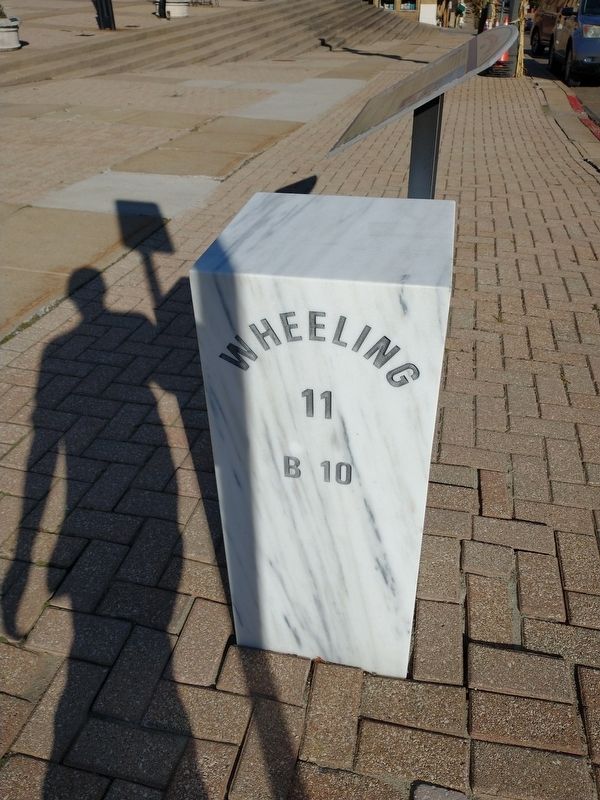
The Act of Congress in 1806, which authorized the construction of the National Road, required that mile markers be placed at regular intervals. These reference points reassured travelers that they were following the correct route. They also . . . — — Map (db m175105) HM
Pennsylvania House
David Snively built the Federal-style Pennsylvania House in 1839 along the newly constructed National Road. This tavern and inn was an important stopover for livestock drovers and pioneers traveling by foot, on horseback, or . . . — — Map (db m241911) HM
A short distance west of the Springfield City limits at the top of Sugar Grove Hill ended the continuous metaled or paved portion of the National Road. The National Road was, outside of the navigable rivers and harbors, the first great internal . . . — — Map (db m216946) HM
The National Road
To George Washington, Thomas Jefferson and others, a road to the Ohio Country was essential for the United States’ development. An overland route was the way west for settlers and goods, as well as a means to transport . . . — — Map (db m15785) HM
The Broad Street bridge is a significant part of the history of Columbus and the National Road. Until 1816, the only ways to cross the Scioto River were to ford the river during low water or to use the ferry. From 1816 to 1834 a series of wooden . . . — — Map (db m96392) HM
On the west bank of the Scioto River stands the former Central High School, now the core building of the Center of Science and Industry (COSI). The Plan of the City of Columbus, released in 1908, was developed to create a vision for the city in line . . . — — Map (db m96393) HM
"Fireproof" was an important word to the Columbus business community. Between 1889 and 1893, five downtown Columbus theaters were constructed and destroyed by fire. These fires also claimed the Seneca, Deshler, and Vendome hotels and resulted . . . — — Map (db m203909) HM
Eastmoor, one of nine (9) Columbus neighborhoods on the National Road, was built on part of the land established by Congress in 1798 as the “Refugee Lands” and given to British Canadians who supported the American colonists during the . . . — — Map (db m135243) HM
Camp Chase was named in honor of Salmon P. Chase, former governor of Ohio and Secretary of the Treasury in President Abraham Lincoln’s Cabinet.
In July 1861, a small prison was erected at Camp Chase to handle the influx of political prisoners . . . — — Map (db m135244) HM
Side A:
After the Revolutionary War, our first President, George Washington, advocated the construction of a road linking cities in the United States from east to west. In 1806, President Thomas Jefferson signed legislation authorizing the . . . — — Map (db m34082) HM
At the turn of the 20th century, three Columbus fire stations were on the National Road, including Station 11 which was built here at 1000 East Main. Construction began in August 1896 and was completed in February 1897 at a cost of $12,863. The cost . . . — — Map (db m226471) HM
The Underground Railroad (UGRR) was neither underground nor a railroad, but a system of loosely connected safe havens where those escaping the brutal conditions of slavery were sheltered, fed, clothed, nursed, concealed, disguised, and instructed . . . — — Map (db m189451) HM
The Act of Congress in 1806 which authorized the construction of the National Road required that mile markers be placed at regular intervals. These reference points reassured travelers that they were following the correct route. They also . . . — — Map (db m97517) HM
The eastern portion of Franklin County began to be settled about 1812 when Ohio was still a vast forested wilderness. Transportation moved at a snail’s pace over old Indian trails and natural waterways. 1n 1818 the National Road reached the Ohio . . . — — Map (db m96296) HM
The National Road was built through central Ohio in the 1830’s.
Robert Brotherton of White Hall, England, purchased 156 acres
of land between Alum Creek and Big Walnut Creek in April 1838.
This rural property became the site of “Ye Olde . . . — — Map (db m96331) HM
Old National Road
Built about 1828
Where the road crossed a creek at an angle, a stone arch bridge was built as right angles to the stream flow. "S" shaped walls were then built to guide traffic around the job from the direction of travel . . . — — Map (db m284) HM
Cambridge was platted in 1806 and became Guernsey County seat just four years later. The
town flourished with the construction of the National Road, and by 1834 Cambridge was served
daily by four stagecoach lines. Manufacturing boomed after the . . . — — Map (db m98595) HM
Named for the peacocks that once lived on a neighboring farm, this narrow brick road was on the National Roads original alignment when it was built through Guernsey County in 1828. Peacock road is typical of the steep grades and sharp curves that . . . — — Map (db m98596) HM
The Act of Congress in 1806 which authorized the construction of the National Road required that mile markers be placed at regular intervals. These reference points reassured travelers that they were following the correct route. They also indicated . . . — — Map (db m98507) HM
The history of this bridge is tied to Zane’s Trace, the original road through
the region. In 1803, the trace crossed Peters Creek, a few hundred yards
to the north, using logs to bridge the stream. In 1828, when the National
Road was built . . . — — Map (db m98505) HM
Old Washington was platted along Zane’s Trace in 1805 by the brothers George and Henry Beymer. Within two years twelve log dwellings had been built, making it the oldest settlement in Guernsey County. Originally known as New Washington, the official . . . — — Map (db m99047) HM
Where the road crossed a creek at an angle, a stone arch bridge was built as right angles to the stream flow. "S" shaped walls were then built to guide traffic around the job from the direction of travel across the bridge and back onto the road . . . — — Map (db m286) HM
Etna Township was formed from Harrison and Lima Townships in 1833. The village of Etna lies in the middle of the township from which it derives its name. Etna was laid out by Lyman Turrill, formerly from Vermont, in 1832 with lots selling for $3.00 . . . — — Map (db m97467) HM
Where the Water Met the Road
While the citizens of St. Clairsville, in eastern Ohio, celebrated the groundbreaking for the National Road on July 4, 1825, construction began on the Ohio & Erie Canal on the same day at Licking Summit (now . . . — — Map (db m97542) HM
Located at the crossing of the Ohio and Erie Canal and the National Road, Hebron was a favored commercial and agricultural center for Licking County in the nineteenth century. Only four miles north of the city Governor DeWitt Clinton of New York . . . — — Map (db m13878) HM
The village of Hebron lost its first mill to a fire in 1881. By the mid 1880’s, a new mill took its place and continued operation into the 1990’s, making it the longest running business in Hebron. by 1891, the Hebron Mill converted from water power . . . — — Map (db m97543) HM
The Hebron Milling Company building was built in 1880 where the National Trail (Route 40) and the Ohio Canal crossed in the village of Hebron. The building sat on the edge of the “turning basin” in the village, where canal boats docked to load or . . . — — Map (db m13879) HM
As a small “pike” town on the National Road, Kirkersville experienced the evolution of transportation from the days of horse and wagon to the automobile. It was the advent of the interurban that not only brought another mode of transit . . . — — Map (db m97514) HM
The Act of Congress in 1806 which authorized the construction of the National Road required that mile markers be placed at regular intervals. These reference points reassured travelers that they were following the correct route. They also indicated . . . — — Map (db m97516) HM
The din of wagon wheels and horses hooves on the macadam pavement of the National Road heralded a new era of American history. For families living in towns like Hebron, Brownsville, or Jacksontown, the National Road was an important part of the . . . — — Map (db m206028) HM
Old National Road, built 1825, rebuilt 1914 through the efforts of James M. Cox, Governor of Ohio. Columbus 39 ms. Cumberland 720 ms. — — Map (db m274) HM
For nearly fifty years prior to 1914, almost no maintenance had been carried out on “the pike”, the National Road. By the early 20th century, bicyclists, automobile owners, postal service, and the trucking industry were demanding better . . . — — Map (db m98521) HM
The Red Brick Tavern is a classic roadside inn and tavern from the heyday of the National Road.
Constructed between 1836 and 1837, it was in operation when the road was completed in front of the building. Brick used in the building was made from . . . — — Map (db m96415) HM
In 1837, when the National Road was completed through Madison County, the village of Lafayette was platted by William Minter, and this building was a tavern that served travelers. The Red Brick Tavern, which was built after the Anderson House, was . . . — — Map (db m96968) HM
In 1831, Congress passed a bill appropriating money for the extension of the Cumberland Road through Ohio, Indiana and Illinois. In 1836-37 this great National Road was completed through Madison County.
At the beginning of the 19th Century, hardly . . . — — Map (db m96977) HM
You are now traveling U.S. 40, the Old National Road, used in the westward expansion of our country. In 1837 notice was given that this section of the road would be constructed. A toll house was located at the east edge of Brandt. — — Map (db m28345) HM
Originally known as “Phone Town”, this community along the National Road was once a major telecommunications center in America. In 1893, the American Telephone and Telegraph Company (AT&T) selected this site as the location for a . . . — — Map (db m96437) HM
Harrisburg, Ohio, was platted three years after the National Road reached Randolph Township. The name of the town and that of its post office, Iamton, were changed to Englewood in 1899. Located at the intersection of Dayton-Covington Pike and the . . . — — Map (db m96499) HM
In the early 19th century, the small community of Tadmor found itself in a most enviable position- it was strategically located at the intersection of the National Road, the Great Miami River, the Miami and Erie Canal, and the Dayton and Michigan . . . — — Map (db m135245) HM
Transportation has played a significant role in Vandalia since the community’s beginnings as a part of Butler Township. In April 1811, a construction contract was awarded for the first 10-mile section of National Road beginning at Cumberland, . . . — — Map (db m96487) HM
The Village of Tadmor
The Village of Tadmor is significant as being the location of one of the most important centers of transportation in early Ohio history. As early as 1809, keelboats were poled up river from Dayton to load and unload . . . — — Map (db m224957) HM
Judge David Findley and his sons worked farms which extended from the site of Interstate 70 to the John Glenn High School. Here, on Findley Creek, the Judge erected log houses and built a carding and fulling mill and a tobacco warehouse.
. . . — — Map (db m279) HM
John Glenn, Jr. is a retired U.S. Marine Corps pilot, astronaut, and U.S. Senator. He was born in Cambridge, Ohio, on July 18, 1921, and moved to New Concord when he was two. On February 20, 1962, Glenn flew on the Friendship 7 space mission, . . . — — Map (db m98607) HM
In 1827, construction of the National Road began through Muskingum County, and the Scotch-Irish settlement that became New Concord was laid out on March 24, 1828 by Judge David Findley. Judge Findley, born in Belfast, Ireland in 1762, and his six . . . — — Map (db m98608) HM
Coaches, Conestoga wagons, herds of livestock, pioneers on foot or horseback, peddlers, soldiers, beggers - these and many others have crossed this bridge on the National Road since 1830. Escaping slaves sought shelter beneath it. Like many others . . . — — Map (db m13350) HM
Side A Fulfilling President George Washington's desire to “open wide the gates of the West,” in 1796 Congress authorized the Zane brothers of Fort Henry (at present day Wheeling) to clear a path through the dense woods of Appalachian . . . — — Map (db m13351) HM
First Traffic Fatality in Ohio
As he traveled the National Road on August 20, 1835, the last diary entry by Christopher C. Baldwin, librarian for the American Antiquarian Society in Worcester, Massachusetts, was, “Start by stage on the . . . — — Map (db m13348) HM
The Act of Congress in 1806 which authorized the construction of the National Road required that mile markers be placed at regular intervals. These reference points reassured travelers that they were following the correct route. They also indicated . . . — — Map (db m205519) HM
As motorized transportation developed, motels of all sizes became a fixture along the National Road. Automobile travel in the early 1900s was often an adventure. Overnight accommodations, in the form of hotels, were concentrated in urban centers, . . . — — Map (db m98694) HM
Welcome to the National Road
The National road crosses six states from Baltimore, Maryland to East St. Louis,
Illinois. The road fulfilled the dreams of George Washington and Thomas
Jefferson to build an all-weather route across the . . . — — Map (db m93721) HM
Built in 1836 for Ralph Hardesty at a cost of $500, the original stone portion of this house measures 40 by 22 feet. Little is known of Mr. Hardesty except that he was listed in the 1850 Census, when he was 43 years of age. The two-story house, . . . — — Map (db m205872) HM
One of the most beautiful and interesting of the old stopping places is the Headley Inn which provided lodging and refreshment for the westward tide of immigration for 30 years. The Headley Inn dreamed half a century away over rooms stored with . . . — — Map (db m98983) HM
Nelson Talbot Gant was freed from slavery by the last will and testament of his owner, John Nixon, September of 1845 in Loudoun County, Virginia. However, Gant’s wife, Maria, was a slave to Jane Russell of Leesburg, Virginia. According to Virginia . . . — — Map (db m43963) HM
Edward Edison Smith was born in Harrisburg, Pennsylvania and arrived in Muskingum
County about the same time as his neighbor, Uzal Headley. Smith was a farmer who built
a log house near this site and, after the National Road reached Zanesville in . . . — — Map (db m98982) HM
1880 - William Green opens the first tavern in what is now Zanesville.
1801 - Zanesville receives its name from a government official. (Formerly known as Westbourne).
1810-1812 - Zanesville is the capital of Ohio.
1817 - . . . — — Map (db m224039) HM
On November 16, 1814, the Muskingum Messenger reported,
“Muskingum and Licking Bridge, This grand and important work
is now possible. Great credit is due to Mr. Rufus Scott, the architect.
Now the south and north sides of Licking . . . — — Map (db m99037) HM
World famous part of the Old National Road.
Maintained by Muskingum County. Marker by Ohio Society of Professional Engineers. Approved by the Ohio Historical Society. — — Map (db m9555) HM
World famous part of the Old National Road.
Maintained by Muskingum County. Marker by Ohio Society of Professional Engineers. Approved by the Ohio Historical Society. — — Map (db m9559) HM
World famous part of the Old National Road.
Maintained by Muskingum County Marker by Ohio Society of Professional Engineers Approved by the Ohio Historical Society — — Map (db m8518) HM
Zanesville, the county seat of Muskingum County, was
named for Colonel Ebenezer Zane. In 1796 Congress
commissioned Colonel Zane to build a road from
Wheeling, Virginia (later West Virginia) to Limestone,
Kentucky (present Maysville, Kentucky). . . . — — Map (db m194090) HM
Construction of the National Road was approaching Preble County in 1830, and the coming of the Road spurred the economic interests of local residents. John Mumma, the county surveyor, decided to purchase 158 acres of farmland for $7,900. He platted . . . — — Map (db m96502) HM
The National Road crosses six states from Baltimore, Maryland to East st. Louis, Illinois. the road fulfilled the dreams of George Washington and Thomas Jefferson to build an all-weather route acros the Allegheny Mountains to connect the Eastern . . . — — Map (db m96508) HM
The National Road crosses six states from Baltimore, Maryland, to East St. Louis, Illinois. The road fulfilled the dreams of George Washington and Thomas Jefferson to build an all-weather route across the Allegheny Mountains to connect the . . . — — Map (db m139834) HM
ASM International has designated Brownsville - Route 40 Bridge an historical landmark. This bridge, designed by and built under the supervision of Capt. Richard Delafield in 1839 to improve the "National Road", is the first cast iron bridge to be . . . — — Map (db m252) HM
An integral part of the National Road, this was the first metal arch bridge in the United States, built 1836-39. Replacing several earlier bridges on this site, including an 1809 Finley suspension bridge, this 80-foot span was built of cast iron by . . . — — Map (db m251) HM
George Washington's only surrender took place here on July 3, 1754. After an eight to nine hour battle on a rainy day, he capitulated to a sizable force of French soldiers and their Indian allies, led by Jumonville's older brother de Villiers. . . . — — Map (db m152675) HM
This tavern once bustled with activity. Judge Nathaniel Ewing of Uniontown built it about 1830, then sold in in 1840 to James Sampey, who ran the tavern with his family. Mount Washington Tavern was a stage stop for the Good Intent Stage Line, one of . . . — — Map (db m347) HM
Our first national road; fathered by Albert Gallatin. Begun in 1811 at Cumberland, Md.; completed to Wheeling in 1818. Toll road under State control, 1835-1905. Rebuilt, it is present U.S. Route 40. — — Map (db m340) HM
This "National Road" connected east and west in the 1800s. George Washington proposed a route to join the western frontier to the eastern seaboard in the late 1700s. His idea was later promoted by Albert Gallatin, Secretary of the Treasury under . . . — — Map (db m342) HM
Portions of this trail system pass through the Great Meadows where George Washington and his troops fought a large French and Indian force on July 3, 1754.
The Braddock Road Trace is the remnant of the road built by Washington in 1754 and . . . — — Map (db m152678) HM
Our first national road; fathered by Albert Gallatin. Begun in 1811 at Cumberland, Md.; completed to Wheeling in 1818. Toll road under State control, 1835-1905. Rebuilt, it is present U.S. Route 40. — — Map (db m256) HM
From the creation of the National Road in 1806 until the advent of the railroads in the 1850s, thousands of travellers crossed Chestnut Ridge between the East and Midwest. Founded in 1791, Hopwood was a major resting stop for traffic in both . . . — — Map (db m41796) HM
Formed September 26, 1783 from Westmoreland County. Named for the Marquis de Lafayette. Among the French and Indian War sites here is Fort Necessity. The county seat, Uniontown, was incorporated 1796. On the National Road, eventually US Route 40. — — Map (db m181951) HM
Erected by Pennsylvania, 1835, to collect tolls on the old National Road. Administered by The Pennsylvania Historical and Museum Commission — — Map (db m257) HM
After receiving reports from the Lewis and Clark Expedition in the summer of 1803, President Thomas Jefferson realized that in order for the United States to reach its full potential, it must expand westward and be facilitated by the central . . . — — Map (db m207710) HM
One of the six original toll houses on the Cumberland or National Road. It was built by the State after the road was turned over to it by the United States in 1835. The road was completed through this section in 1817-1818. — — Map (db m41798) HM
Founded by Henry Beeson, who built a blockhouse on site of the county jail in 1774. Uniontown gained importance with the building of the National Road after 1811. — — Map (db m41799) HM
One of the six original toll houses on the Cumberland or National Road is on the hill opposite. Built after the road was turned over to the State in 1835 by the U.S. Restored and preserved by the D.A.R. — — Map (db m350) HM
Our first national road; fathered by Albert Gallatin. Begun in 1811 at Cumberland, Md.; completed to Wheeling in 1818. Toll road under State control, 1835-1905. Rebuilt, it is present U.S. Route 40. — — Map (db m353) HM
(South Face) N.S.D.A.R. Memorial to the Pioneer Mothers of the Covered Wagon Days.
(East Face) On this historic spot, the hunting ground of the friendly Indian Nemacolin, this monument is erected and dedicated to the memory of our pioneer . . . — — Map (db m501) HM
Claysville has the distinction of being one of the original “pike towns” along the National Road. In 1817, an early settler and land owner, John
Purviance, learned that the new National Road, that was being constructed between Cumberland, Maryland . . . — — Map (db m9372) HM
This stone bridge was part of the National, or Cumberland Road. Originated in 1805, it was completed to Wheeling in 1818. Over it passed countless wagons and stages uniting the East and the growing West. — — Map (db m806) HM
This tavern, in continuous operation since 1794 when it was opened by Stephen Hill, is one of the oldest on the National Road. It was a popular stop for stage coaches and waggoners. — — Map (db m202264) HM
Our first national road; fathered by Albert Gallatin. Begun in 1811 at Cumberland, Md.; completed to Wheeling in 1818. Toll road under State control, 1835-1905. Rebuilt, it is present U.S. Route 40. — — Map (db m816) HM
Laid out in 1781 by John and William Hoge. Site of Indian Catfish Camp. Boro charter, 1810; city, 1823. National Road center and rich in historic buildings and associations. Named for George Washington. — — Map (db m815) HM
Laid out in 1781 by John and William Hoge. Site of Indian Catfish Camp. Boro charter, 1810; city, 1823. National Road center and rich in historic buildings and associations. Named for George Washington. — — Map (db m258) HM
On site of Fort Shepherd is this mansion, built in 1798 by Moses Shepherd and known as Shepherd Hall. Among its guests were Lafayette, James K. Polk, Andrew Jackson, and Henry Clay. Clay's support brought National Pike here. — — Map (db m750) HM
Built in 1817 by Moses Shepherd, a prominent Ohio Countian, as part of the National Road. Constructed of uncoursed limestone, but covered by concrete in 1958, it is the oldest extant three span elliptical arch bridge in the state. Also known as . . . — — Map (db m64226) HM
(South Face)
N.S.D.A.R. Memorial
to the
Pioneer Mothers
of the
Covered Wagon Days.
(East Face)
To the pioneer mothers of our mountain state, whose courage, optimism, live and sacrifice made possible the National Highway that united east . . . — — Map (db m498) HM
The statue before you was created as a tribute to the pioneer women who braved the uncertainties of the great journey west. The Madonna memorials were a project of the Daughters of the American Revolution and were dedicated between 1926 and 1929. . . . — — Map (db m500) HM