582 entries match your criteria. Entries 201 through 300 are listed.⊲ Previous 100 — Next 100 ⊳
Historical Markers and War Memorials
in Northeast Oklahoma—Green Country
By Mark Hilton, March 20, 2024
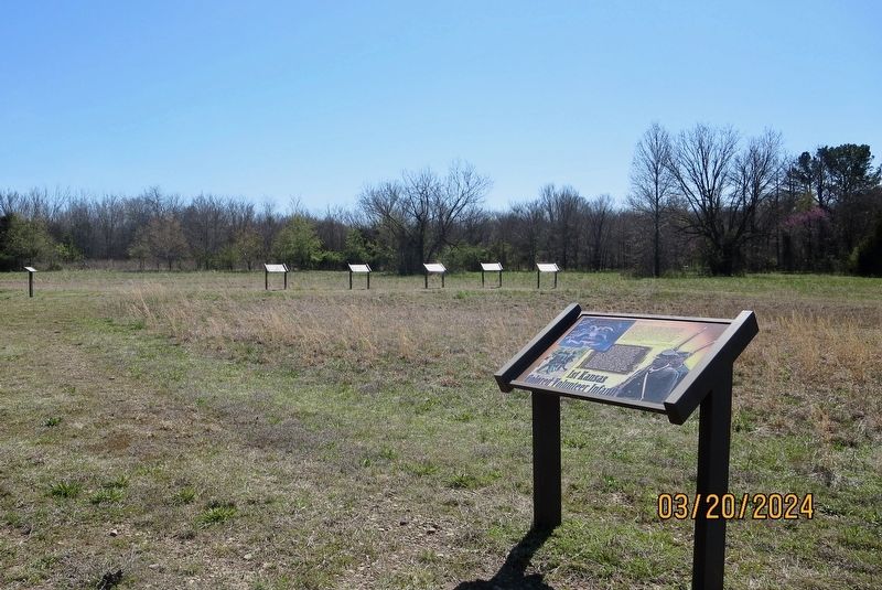
1st Kansas Colored Volunteer Infantry Marker
201 ► Oklahoma, Muskogee County, Oktaha — 1st Kansas Colored Volunteer Infantry — Honey Springs Battlefield — Interpretive Trail One · Federal Bivouac —  |
| Near Honey Springs Battlefield Road 2.5 miles north of East 1020 Road, on the right when traveling north. | |||
| 202 ► Oklahoma, Muskogee County, Oktaha — 29th Texas Cavalry & 20th Texas Cavalry — Honey Springs Battlefield — Interpretive Trail Three · Confederate Line — |
| Near Honey Springs Battlefield Road 1.9 miles north of East 1020 Road, on the right when traveling north. | |||
| 203 ► Oklahoma, Muskogee County, Oktaha — 2nd Colorado Infantry — Honey Springs Battlefield — Interpretive Trail One · Federal Bivouac — |
| Near Honey Springs Battlefield Road 2.5 miles north of East 1020 Road, on the right when traveling north. | |||
| 204 ► Oklahoma, Muskogee County, Oktaha — 2nd Indian Home Guard — Honey Springs Battlefield — Interpretive Trail One · Federal Bivouac — |
| Near Honey Springs Battlefield Road 2.4 miles north of East 1020 Road, on the right when traveling north. | |||
| 205 ► Oklahoma, Muskogee County, Oktaha — 3rd Indian Home Guard — Honey Springs Battlefield — Interpretive Trail One · Federal Bivouac — |
| Near Honey Springs Battlefield Road 2.4 miles north of East 1020 Road, on the right when traveling north. | |||
| 206 ► Oklahoma, Muskogee County, Oktaha — 3rd Wisconsin Cavalry — Honey Springs Battlefield — Interpretive Trail One · Federal Bivouac — |
| Near Honey Springs Battlefield Road 2.4 miles north of East 1020 Road, on the right when traveling north. | |||
| 207 ► Oklahoma, Muskogee County, Oktaha — 5th Texas Partisan Rangers and Lee's Light Battery — Honey Springs Battlefield — Interpretive Trail Three · Confederate Line — |
| Near Honey Springs Battlefield Road 1.8 miles north of East 1020 Road, on the right when traveling north. | |||
| 208 ► Oklahoma, Muskogee County, Oktaha — 6th Kansas Cavalry — Honey Springs Battlefield — Interpretive Trail One · Federal Bivouac — |
| Near Honey Springs Battlefield Road 2.5 miles north of East 1020 Road, on the right when traveling north. | |||
| 209 ► Oklahoma, Muskogee County, Oktaha — Battle for the Bridge — Honey Springs Battlefield — Interpretive Trail Four · Battle at the Bridge — |
| On Honey Springs Battlefield Road 1.3 miles north of East 1020 Road, on the right when traveling north. | |||
| 210 ► Oklahoma, Muskogee County, Oktaha — Breaking the Confederate Line — Honey Springs Battlefield — Interpretive Trail Two · Federal Artillery Line — |
| Near Honey Springs Battlefield Road 2.4 miles north of East 1020 Road, on the right when traveling north. | |||
| 211 ► Oklahoma, Muskogee County, Oktaha — Breaking the Line, Hand-to-Hand Combat — Honey Springs Battlefield — Interpretive Trail Three · Confederate Line — |
| Near Honey Springs Battlefield Road 1.9 miles north of East 1020 Road, on the right when traveling north. | |||
| 212 ► Oklahoma, Muskogee County, Oktaha — Defending the Bridge · and other Fighting along Elk Creek — Honey Springs Battlefield — Interpretive Trail Four · Battle at the Bridge — |
| Near Honey Springs Battlefield Road 1.5 miles north of East 1020 Road, on the right when traveling north. | |||
| 213 ► Oklahoma, Muskogee County, Oktaha — Farming and Communities · along the Texas Road — Honey Springs Battlefield — Interpretive Trail Four · Battle at the Bridge — |
| Near Honey Springs Battlefield Road 1.5 miles north of East 1020 Road, on the right when traveling north. | |||
| 214 ► Oklahoma, Muskogee County, Oktaha — Hopkin's Battery of Kansas Artillery — Honey Springs Battlefield — Interpretive Trail One · Federal Bivouac — |
| Near Honey Springs Battlefield Road 2.5 miles north of East 1020 Road, on the right when traveling north. | |||
| 215 ► Oklahoma, Muskogee County, Oktaha — How We Know What We Know — Letters, Diaries, & On-The-Spot Reporting Honey Springs Battlefield — Interpretive Trail Four · Battle at the Bridge — |
| Near Honey Springs Battlefield Road 1.4 miles north of East 1020 Road, on the right when traveling north. | |||
| 216 ► Oklahoma, Muskogee County, Oktaha — How We Know What We Know · Archeological Surveys & Interviews — Honey Springs Battlefield — Interpretive Trail Four · Battle at the Bridge — |
| Near Honey Springs Battlefield Road 1.4 miles north of East 1020 Road, on the right when traveling north. | |||
| 217 ► Oklahoma, Muskogee County, Oktaha — How We Know What We Know · Official Reports — Honey Springs Battlefield — Interpretive Trail Four · Battle at the Bridge — |
| Near Honey Springs Battlefield Road 1.5 miles north of East 1020 Road, on the right when traveling north. | |||
| 218 ► Oklahoma, Muskogee County, Oktaha — Prelude to Battle — Honey Springs Battlefield — Interpretive Trail One · Federal Bivouac — |
| On Honey Springs Battlefield Road 2.3 miles north of East 1020 Road, on the right when traveling north. | |||
| 219 ► Oklahoma, Muskogee County, Oktaha — Primitive Trail to Elk Creek Overlook — Honey Springs Battlefield — Interpretive Trail Three · Confederate Line — |
| Near Honey Springs Battlefield Road 1.8 miles north of East 1020 Road, on the right when traveling north. | |||
| 220 ► Oklahoma, Muskogee County, Oktaha — Short Trail to the Creek — Honey Springs Battlefield — Interpretive Trail One · Federal Bivouac — |
| Near Honey Springs Battlefield Road 2.4 miles East 1020 Road, on the right when traveling north. | |||
| 221 ► Oklahoma, Muskogee County, Oktaha — Smith's Battery of Kansas Artillery — Honey Springs Battlefield — Interpretive Trail One · Federal Bivouac — |
| Near Honey Springs Battlefield Road 2.4 miles north of East 1020 Road, on the right when traveling north. | |||
| 222 ► Oklahoma, Muskogee County, Oktaha — The Army of the Frontier — Honey Springs Battlefield — Interpretive Trail One · Federal Bivouac — |
| On Honey Springs Battlefield Road 2.3 miles north of East 1020 Road, on the right when traveling north. | |||
| 223 ► Oklahoma, Muskogee County, Oktaha — The Artillery — Honey Springs Battlefield — Interpretive Trail Two · Federal Artillery Line — |
| Near Honey Springs Battlefield Road 2.3 miles East 1020 Road when traveling north. | |||
| 224 ► Oklahoma, Muskogee County, Oktaha — The Battle Begins — Honey Springs Battlefield — Interpretive Trail Two · Federal Artillery Line — |
| On Honey Springs Battlefield Road 2.3 miles East 1020 Road, on the right when traveling north. | |||
| 225 ► Oklahoma, Muskogee County, Oktaha — The Cavalry — Honey Springs Battlefield — Interpretive Trail Two · Federal Artillery Line — |
| Near Honey Springs Battlefield Road 2.3 miles north of East 1020 Road, on the right when traveling north. | |||
| 226 ► Oklahoma, Muskogee County, Oktaha — The Confederate Center — Honey Springs Battlefield — Interpretive Trail Three · Confederate Line — |
| Near Honey Springs Battlefield Road 1.8 miles north of East 1020 Road, on the right when traveling north. | |||
| 227 ► Oklahoma, Muskogee County, Oktaha — The Confederate Right — Honey Springs Battlefield — Interpretive Trail Three · Confederate Line — |
| Near Honey Springs Battlefield Road 1.9 miles East 1020 Road, on the right when traveling north. | |||
| 228 ► Oklahoma, Muskogee County, Oktaha — The Federal Left · The Phillips' Brigade — Honey Springs Battlefield — Interpretive Trail Two · Federal Artillery Line — |
| Near Honey Springs Battlefield Road 2.4 miles north of East 1020 Road, on the right when traveling north. | |||
| 229 ► Oklahoma, Muskogee County, Oktaha — The Federal Right · Judson's Brigade — Honey Springs Battlefield — Interpretive Trail Two · Federal Artillery Line — |
| Near Honey Springs Battlefield Road 2.2 miles north of East 1020 Road, on the right when traveling north. | |||
| 230 ► Oklahoma, Muskogee County, Oktaha — The March from Fort Gibson — Honey Springs Battlefield — Interpretive Trail One · Federal Bivouac — |
| On Honey Springs Battlefield Road 2.3 miles north of East 1020 Road, on the right when traveling north. | |||
| 231 ► Oklahoma, Muskogee County, Oktaha — The Texas Road — Honey Springs Battlefield — Interpretive Trail Three · Confederate Line — |
| Near Honey Springs Battlefield Road 1.9 miles north of East 1020 Road, on the right when traveling north. | |||
| 232 ► Oklahoma, Muskogee County, Oktaha — The Toll Bridge and Fords · Crossing Elk Creek — Honey Springs Battlefield — Interpretive Trail Four · Battle at the Bridge — |
| Near Honey Springs Battlefield Road 1.4 miles north of East 1020 Road, on the right when traveling north. | |||
| 233 ► Oklahoma, Muskogee County, Oktaha — Waiting for History — Honey Springs Battlefield — Interpretive Trail Three · Confederate Line — |
| On Honey Springs Battlefield Road 1.8 miles north of East 1020 Road, on the right when traveling north. | |||
| 234 ► Oklahoma, Muskogee County, Sand Hill — Battle of Greenleaf Prairie — |
| On Oklahoma Route 10 1 mile north of East 63rd Street, on the left when traveling north. | |||
| 235 ► Oklahoma, Muskogee County, Webbers Falls — 75-1995 — Webbers Falls — |
| On OK Route 100 (U.S. 64) 0.2 miles east of 5th Street, on the right when traveling east. | |||
| 236 ► Oklahoma, Nowata County, New Alluwe — Al-lu-we — |
| On State Highway 28 south of County Highway E0270, on the right when traveling south. | |||
| 237 ► Oklahoma, Okmulgee County, Beggs — State Armory — |
| On West Main Street just west of North Broadway Street (Alternate U.S. 75), on the right when traveling west. | |||
| 238 ► Oklahoma, Okmulgee County, Henryetta — Henryetta War Memorial — The Spirit of the American Doughboy — |
| On West Main Street at North 6th Street, on the right when traveling west on West Main Street. | |||
| 239 ► Oklahoma, Okmulgee County, Okmulgee — 2nd Lt. Kenneth Strang Memorial — |
| On US Highway 75 (U.S. 75) 0.5 miles south of US75 and Loop Highway (Loop U.S. 75), on the right when traveling north. | |||
| 240 ► Oklahoma, Okmulgee County, Okmulgee — Creek Capitol — |
| On West 6th Street (State Highway 56) at South Morton Avenue, on the right when traveling east on West 6th Street. | |||
| 241 ► Oklahoma, Okmulgee County, Okmulgee — Creek Council House Capitol Of The Muscogee Nation — Erected - 1876 — |
| On West 6th Street (Oklahoma Route 56) at Grand, on the right when traveling east on West 6th Street. | |||
| 242 ► Oklahoma, Okmulgee County, Okmulgee — Ernest Childers — February 1, 1918 - March 17, 2005 — |
| On State Highway 56 east of U.S. 75, on the right when traveling east. | |||
| 243 ► Oklahoma, Okmulgee County, Okmulgee — First Bank of Okmulgee — |
| On Grand Avenue at West 6th Street, on the right when traveling south on Grand Avenue. | |||
| 244 ► Oklahoma, Okmulgee County, Okmulgee — Forced to Capitulate by Command or Shot out of the Sky: — |
| On State Highway 56 east of U.S. 75, on the right when traveling east. | |||
| 245 ► Oklahoma, Okmulgee County, Okmulgee — Landmark for All Generations — “Okmulgee Colored Hospital” — |
| On North Wood Drive (U.S. 75) at East 3rd Street, on the right when traveling south on North Wood Drive. | |||
| 246 ► Oklahoma, Okmulgee County, Okmulgee — Nuyaka Mission — |
| On Oklahoma Route 56 0.5 miles west of Nuyaka Road, on the right when traveling west. | |||
| 247 ► Oklahoma, Okmulgee County, Okmulgee — Okmulgee County Veterans Memorial — |
| On South Okmulgee Avenue at West 7th Street, on the right when traveling north on South Okmulgee Avenue. | |||
| 248 ► Oklahoma, Okmulgee County, Okmulgee — Samuel Checote — Grave 1.9 miles N.W. — |
| On West 6th Street (State Highway 56), on the left when traveling west. | |||
| 249 ► Oklahoma, Okmulgee County, Okmulgee — Trail of Tears — |
| On West 6th Street west of Grand, on the left when traveling west. | |||
| 250 ► Oklahoma, Osage County, Barnsdall — 166 — James Bigheart — |
| On State Highway 11 0.1 miles west of State Highway 123, on the right when traveling west. | |||
| 251 ► Oklahoma, Osage County, Barnsdall — Patriarch Petrochemical Plant of the Southwest — |
| On West Main Street east of 7th Street, on the right when traveling west. | |||
| 252 ► Oklahoma, Osage County, Barnsdall — Veterans Memorial — |
| On West Main Street (State Highway 11) at 6th Street, on the left when traveling west on West Main Street. | |||
| 253 ► Oklahoma, Osage County, Bartlesville — Phillips Bell — |
| On Woolaroc Ranch Road 1.5 miles north of State Highway 123. | |||
| 254 ► Oklahoma, Osage County, Fairfax — All Veterans Memorial — |
| On West Elm Avenue west of North Main Street, in the median. | |||
| 255 ► Oklahoma, Osage County, Hominy — "New Territory" — |
| On Main Street west of Katy Avenue, on the left when traveling west. | |||
| 256 ► Oklahoma, Osage County, Hominy — Marland Filling Station — |
| On Main Street at Wood Avenue, on the right when traveling east on Main Street. | |||
| 257 ► Oklahoma, Osage County, Pawhuska — "Change of Seasons" — by T.D. Kelsey — |
| Near County Road 4201. | |||
| 258 ► Oklahoma, Osage County, Pawhuska — "Million Dollar Elm" — |
| On Grandview Avenue north of 7th Street, on the left when traveling north. | |||
| 259 ► Oklahoma, Osage County, Pawhuska — "Osage in the Enemy Camp" — |
| On Kihekah Avenue south of 6th Street, on the right when traveling south. | |||
| 260 ► Oklahoma, Osage County, Pawhuska — An Answer To Prayer — |
| On Kihekah Avenue north of 7th Street, on the left when traveling north. | |||
| 261 ► Oklahoma, Osage County, Pawhuska — Blacksmith Home — |
| On West Main Street (U.S. 60) east of Matthews Avenue, on the right when traveling east. | |||
| 262 ► Oklahoma, Osage County, Pawhuska — Deep Ford — (Pawhuska) — |
| On Lynn Ave at East Main Street (U.S. 60), on the left when traveling south on Lynn Ave. | |||
| 263 ► Oklahoma, Osage County, Pawhuska — First Boy Scout Troop in America — Pawhuska, Oklahoma — |
| On Lynn Avenue at 7th Street, on the right when traveling north on Lynn Avenue. | |||
| 264 ► Oklahoma, Osage County, Pawhuska — Forest of Irons — |
| On Bartlesville Road (U.S. 60) at County Road 2809, on the right when traveling east on Bartlesville Road. | |||
| 265 ► Oklahoma, Osage County, Pawhuska — Friendship Between the Osage and the Occitan of Montauban — |
| On Grandview Avenue 0.3 miles north of Main Street (U.S. 60), on the left when traveling north. | |||
| 266 ► Oklahoma, Osage County, Pawhuska — Oil in the Osage Indian Nation and the "Million Dollar Elm" — |
| On Grandview Avenue 0.3 miles north of Main Street (U.S. 60), on the left when traveling north. | |||
| 267 ► Oklahoma, Osage County, Pawhuska — Osage Buffalo Hunting Trails — |
| On Lynn Ave at East Main Street (U.S. 60), on the left when traveling south on Lynn Ave. | |||
| 268 ► Oklahoma, Osage County, Pawhuska — Osage County Ranching — |
| On Bartlesville Road (U.S. 60) at County Road 2809, on the right when traveling east on Bartlesville Road. | |||
| 269 ► Oklahoma, Osage County, Pawhuska — Outlaws — |
| On Bartlesville Road (U.S. 60) at County Road 2809 on Bartlesville Road. | |||
| 270 ► Oklahoma, Osage County, Pawhuska — Pawhuska — A Picture Window of our Heritage, The Cowboy, The Indian, The Rich Oil History!! — |
| On East Main Street (U.S. 60) at Lynn Avenue, on the left when traveling west on East Main Street. | |||
| 271 ► Oklahoma, Osage County, Pawhuska — Pawhuska — "The Rich Oil History of the Osage" — |
| On East Main Srteet (U.S. 60) at Lynn Avenue, on the left when traveling west on East Main Srteet. | |||
| 272 ► Oklahoma, Osage County, Pawhuska — Pawhuska — "The Osage Tribe of Indians" — |
| On East Main Street (U.S. 60) at Lynn Avenue (U.S. 60), on the left when traveling west on East Main Street. | |||
| 273 ► Oklahoma, Osage County, Pawhuska — Restoring the Whiting Apartments — |
| On Kihekah Avenue north of 7th Street, on the left when traveling north. | |||
| 274 ► Oklahoma, Osage County, Pawhuska — Site of the First Osage Agency Building — 1873 - 1932 — |
| On Main Street (State Highway 11) at Osage Avenue, on the left when traveling west on Main Street. | |||
| 275 ► Oklahoma, Osage County, Pawhuska — St. Louis School — For Osage Indian Girls — 1887 – 1949 — |
| On West Main Street (U.S. 60) at Farrell Avenue, on the right when traveling west on West Main Street. | |||
| 276 ► Oklahoma, Osage County, Pawhuska — The Battle of Wooster Mound — |
| On State Highway 11/99 0.2 miles north of East Evergreen Street, on the right when traveling north. | |||
| 277 ► Oklahoma, Osage County, Pawhuska — The Swinging Bridge — |
| On Kihekah Avenue at E 2nd Street, on the right when traveling south on Kihekah Avenue. | |||
| 278 ► Oklahoma, Osage County, Pawhuska — The Tallgrass Prairie Preserve — |
| On County Route 4201 at County Route 4220, on the right when traveling north on County Route 4201. | |||
| 279 ► Oklahoma, Osage County, Pawhuska — Vernon Whiting — "Town Builder and a Good Citizen" — |
| On Kihekah Avenue at 7th Street, on the left when traveling north on Kihekah Avenue. | |||
| 280 ► Oklahoma, Osage County, Pawhuska — Veterans Memorial — |
| On Lynn Avenue south of U.S. 60, on the right when traveling south. | |||
| 281 ► Oklahoma, Osage County, Skiatook — 167 — Battle of Chustenahlah — |
| On W.C. Rogers Boulevard (State Highway 20). | |||
| 282 ► Oklahoma, Osage County, Skiatook — 175 — Hillside Mission — |
| On North Garrison Avenue 0 miles south of East 186th St. North (East 0410 Rd), on the left when traveling south. | |||
| 283 ► Oklahoma, Ottawa County, Afton — Eagle (D-X) Service Station, Afton, Oklahoma — Route 66 Roadside Attraction — |
| On 1st Street (U.S. 60) at Locust Avenue, on the left when traveling south on 1st Street. | |||
| 284 ► Oklahoma, Ottawa County, Afton — Sidewalk Highway — U.S. 66 - Will Rogers Highway — Chicago to Los Angeles — |
| On South 520 Road at E 220 Road, on the left when traveling south on South 520 Road. | |||
| 285 ► Oklahoma, Ottawa County, Commerce — Boyhood Home of Mickey Mantle — (Where Mickey Learned To Play The Game) — 319 South Quincy Street — |
| On C Street east of South Quincy Street, on the right when traveling west. | |||
| 286 ► Oklahoma, Ottawa County, Commerce — Mickey Charles Mantle — "The Commerce Comet" — Dr. Nick A. Calcagno, Artist — |
| On Mickey Mantle Boulevard (U.S. 69), on the right when traveling south. | |||
| 287 ► Oklahoma, Ottawa County, Miami — American Indian War Veterans — |
| Near North Eight Tribes Trail. | |||
| 288 ► Oklahoma, Ottawa County, Miami — Bill Hudson Hastings — |
| Near North Main Street (Old U.S. 66) north of 1st Ave NW. | |||
| 289 ► Oklahoma, Ottawa County, Miami — Carol Littleton — |
| Near North Main Street (Old U.S. 66) north of 1st Ave NW. | |||
| 290 ► Oklahoma, Ottawa County, Miami — Charles Banks Wilson — |
| On Main Street (Route 66) (U.S. 69) south of 2nd Avenue NW, on the right when traveling south. | |||
| 291 ► Oklahoma, Ottawa County, Miami — Charles Wayne "Tinker" Owens — |
| Near North Main Street (Old U.S. 66) north of 1st Ave NW. | |||
| 292 ► Oklahoma, Ottawa County, Miami — Coleman Theatre — |
| On Main Street (Route 66) at 1st Avenue, on the left when traveling north on Main Street (Route 66). | |||
| 293 ► Oklahoma, Ottawa County, Miami — Coleman Theatre, Miami, Oklahoma — Route 66 Roadside Attraction |
| On North Main Street (Old U.S. 66) north of 1st Avenue NW, on the right when traveling south. Reported missing. | |||
| 294 ► Oklahoma, Ottawa County, Miami — David Froman — |
| On Main Street (Route 66) (U.S. 69) south of 2nd Avenue NW, on the right when traveling south. | |||
| 295 ► Oklahoma, Ottawa County, Miami — David Osborne — |
| Near North Main Street (Old U.S. 66) north of 1st Ave NW. | |||
| 296 ► Oklahoma, Ottawa County, Miami — Dobson Home — |
| On A Street Southwest at 1st Avenue Southwest, on the right when traveling south on A Street Southwest. | |||
| 297 ► Oklahoma, Ottawa County, Miami — Dr. Nick Calcagno — |
| Near North Main Street (Old U.S. 66) north of 1st Avenue NW. | |||
| 298 ► Oklahoma, Ottawa County, Miami — Gateway Sign — |
| On Main Street (Route 66) (U.S. 69) north of 3rd Avenue (State Highway 10), on the right when traveling north. | |||
| 299 ► Oklahoma, Ottawa County, Miami — Hadley Building — |
| On Main Street (Route 66) (U.S. 69) at Central Avenue, on the left when traveling north on Main Street (Route 66). | |||
| 300 ► Oklahoma, Ottawa County, Miami — Historic Route 66 Ribbon Road - Sidewalk Highway — Oklahoma Historic Route 66 — |
| On U.S. 59/69 at 140th Road, on the left when traveling south on U.S. 59/69. | |||
582 entries matched your criteria. Entries 201 through 300 are listed above. ⊲ Previous 100 — Next 100 ⊳