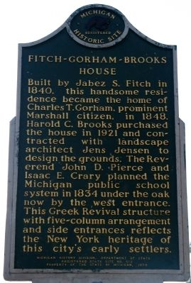
On West Prospect Street, on the right when traveling west.
Harold C. Brooks
Harold Craig Brooks (1885-1978) was Marshall's mayor from 1925 to 1931, patron, and philanthropist. His interest in city beautification set a standard for preservation and adaptive use as early as 1921. He owned and . . . — — Map (db m225783) HM
On North Kalamazoo Avenue, on the right when traveling south.
Abner Pratt settled in Marshall in 1839 and in the 1850s became Chief Justice of the State Supreme Court. In 1857-59 he was United States Consul to the Sandwich (Hawaiian) Islands. Returning home, he built this house in 1860 to recreate the island . . . — — Map (db m28384) HM
On South Marshall Street at River Street, on the right when traveling south on South Marshall Street.
Horace Perrin. Horace J. Perrin (1819-1880) was a prominent businessman and industrialist. Born in New York State, Perrin settled in Marshall in 1846 and founded a general store in the city’s growing downtown. An accomplished financier, he . . . — — Map (db m177173) HM
On Michigan Avenue (Business Interstate 94), on the right when traveling east.
Howard F. Young (1889-1934), a native of Allegan, designed this Marshall post office building in 1932. Young studied engineering at the University of Michigan and was involved in construction work in Albany, New York, Detroit and Kalamazoo. His . . . — — Map (db m28390) HM
On East Green Street, on the right when traveling east.
Isaac E. Crary and John D. Pierce
When attorney Isaac E. Crary came to Marshall in 1832 from Connecticut, he became fast friends with another transplanted easterner, the Reverend John D. Pierce. Interested in government and education, . . . — — Map (db m225763) HM
On North Kalamazoo Avenue north of U.S. 94, on the right when traveling north.
Michigan's first congressman lived here from the early 1840s until his death in 1854. Located on lots one and two, original plat, lower village, the house was a wedding gift from his father-in-law, Judge Abner Pratt. Arriving here in 1831, Crary . . . — — Map (db m226057) HM
On West Michigan Avenue (Alternate Interstate 94) at South Jefferson Street, on the right when traveling east on West Michigan Avenue.
In recognition of
J. H. Cronin Co. Inc.
Founded in 1850 For more than 100 years of
continuous operation in service
to the people of Michigan
and for contributing to the
economic growth and vitality
of our state. — — Map (db m248599) HM
On Michigan Avenue (Business Interstate 94) at North Eagle Street, on the right when traveling west on Michigan Avenue.
James A. Miner, born in Marshall in 1842, began studying law in Clinton, Iowa, in 1860. Completing his studies in Marshall, he was admitted to the Calhoun County bar in 1863. There he was circuit court commissioner (1866-1870) and prosecuting . . . — — Map (db m28393) HM
On North Madison Street 0.1 miles south of Forest Street, on the right when traveling south.
Jeremiah Cronin Jr. House This picturesque residence was erected in 1872 for Marshall merchant Jeremiah Cronin, Jr., and his wife, Susan. Local contractor Frederick N. Church constructed this house, as well as Cronin’s 1869 Michigan Avenue . . . — — Map (db m177247) HM
On West Mansion Street, on the right when traveling west.
On this foundation stood the log house of the Reverend John D. Pierce. Born in New Hampshire, Pierce moved to Marshall in 1831, where he founded the Congregational church. In 1834 he and Isaac Crary designed Michigan's school system, and from 1836 . . . — — Map (db m28394) HM
On Montgomery Street at Warren Street, on the left when traveling east on Montgomery Street.
In 1831 Sidney and George Ketchum located here on Rice Creek. This first settlement in Marshall consisted of a water-powered sawmill and log cabins. Until the twentieth century this was an important industrial area, containing at various times a . . . — — Map (db m177154) HM
Lieutenant George A. Woodruff (1840-1863) graduated early from West Point because of the start of the Civil War. Young Woodruff served valiantly with the Army of the Potomac. At Gettysburg he was mortally wounded while defending the center of the . . . — — Map (db m28395) HM
On Verona Road at 14 Mile Road, on the right when traveling west on Verona Road.
Lockwood Family New York State native Isaac Lockwood (1800-1873) came to Marshall in 1831. By 1858 he owned 480 acres of land. He and his wife, Elvira, had eight children. Their sons Peter, Augustus, and Henry were also farmers and like Isaac, . . . — — Map (db m177250) HM
On Michigan Avenue (Business Interstate 94), on the right when traveling east.
Founded in 1831 by Sidney Ketchum and settles from New York and New England, the town was named in honor of Chief Justice John Marshall. Townsmen Isaac Crary and the Rev. John Pierce planned in 1834 the innovative Michigan public school system. . . . — — Map (db m28450) HM
On West Prospect Street, on the right when traveling west.
This house, built for local attorney Henry W. Taylor and long owned by the Schuyler family, was also home to Mary "Mazie" Miller (1871-1941) and her husband, Craig. An outspoken suffragette and Republican political activist, Miller was an early . . . — — Map (db m28451) HM
On Michigan Avenue at South Parkview, on the right when traveling east on Michigan Avenue.
Erected by Andrew Mann in 1835, this structure is reported to be the first brick building in Calhoun County. National House was also known as Mann’s Hotel. It served travelers passing through Marshall and hosted political and community gatherings. . . . — — Map (db m177183) HM
On South Marshall Avenue at East Green Street, on the right when traveling north on South Marshall Avenue.
Oliver C. Comstock Jr. (1806-1895) built this Gothic Revival house between 1849 and 1856. Comstock, born in Fairfield, New York, migrated to the Marshall area in 1836. He left a well-established medical practice in Trumansburg, New York, to start . . . — — Map (db m177178) HM
On West Michigan Avenue 0.1 miles east of South Eagle Street, on the right when traveling east.
More than fifty medicine companies have operated out of Marshall. Thirty-seven of these emerged from 1895 to 1905, the heyday of over-the-counter remedies known as “patent medicines.” Before the Pure Food and Drug Act of 1906, some unregulated . . . — — Map (db m177242) HM
On West Mansion Street at North Eagle Street, on the right when traveling west on West Mansion Street.
The city of Marshall was platted in 1830 by Sidney Ketchum, a land speculator from Clinton County, New York. In 1832 townsfolk erected their first public building, a modest frame schoolhouse, on land donated by Isaac E. Crary, who became one of the . . . — — Map (db m177246) HM
On West Hanover Street at South Linden Street, on the right when traveling east on West Hanover Street.
In April 1863 a meeting held here at the home of Jared C. Thompson led directly to the organization of the Brotherhood of the Footboard. Under the leadership of Marshall’s William D. Robinson, founder and first Grand Chief Engineer, 54 locals were . . . — — Map (db m177181) HM
On West Mansion Street at North Eagle Street, on the left when traveling west on West Mansion Street.
Samuel W. Hill, legendary figure of the northland, surveyed the Great Lakes’ harbors in 1840-44 and worked with Dr. Douglass Houghton on the first geological survey of the Upper Peninsula in 1845. He was later involved with the sale of land and the . . . — — Map (db m177245) HM
On Homer Road at Willow Street, on the left when traveling east on Homer Road.
In 1928 the Samuel Coleman family settled in Marshall and became one of only two African American families living in Marshall. The city’s black population had dwindled from 109 in 1870 to 9 in 1920, in part because more work was available in nearby . . . — — Map (db m177177) HM
On West Hanover Street 0.1 miles west of South Sycamore Street, on the right when traveling east.
German immigrant Jacob Schellenberger built this structure as both a home and tavern. A stone cutter by trade, Schellenberger obtained sandstone from along the nearby Kalamazoo River for the building which he completed around 1840. Because of its . . . — — Map (db m177180) HM
On South Eagle Street at West Green Street, on the right when traveling north on South Eagle Street.
A hotel or inn has occupied this site since 1870. Here stood The Exchange which became the Johnson House in 1892. The Painter family erected the present brick building in 1895 then known as The Royal. Albert W. Schuler, Sr. purchased the hotel in . . . — — Map (db m177238) HM
On Exchange Street at East Green Street, on the right when traveling south on Exchange Street.
Sidney Ketchum (1797-1862) Sidney Ketchum, a land surveyor, was born in Clinton County, New York. Seeking a new home and hoping to found a town, Ketchum explored central lower Michigan in 1830. Later that year he obtained government grants for . . . — — Map (db m177175) HM
On Sixteen Mile Road 0.5 miles south of N-Drive North, on the right when traveling north.
Granville and Catherine Stow, natives of New York State, built this house between 1836 and 1844. In 1861 Matthew Hasbrouck bought the house. Also from New York, Hasbrouck descended from the French Huguenots, who sought refuge in North America from . . . — — Map (db m177251) HM
On 15 1/2 Mile Road at N-Drive North, on the right when traveling south on 15 1/2 Mile Road.
In 1836 the Hawkins family was among the first to settle Convis Township. Asahel Hawkins, who had emigrated from Vermont, began with eighty acres of government land and steadily increased his holdings until they reached 240 acres. After his death in . . . — — Map (db m177252) HM
On Michigan Avenue 0.1 miles west of North Grand Street, on the right when traveling east.
The Interurban The Jackson and Battle Creek Traction Company began interurban service to Marshall in 1903. Its electric trains were powered by overhead lines in towns and by a sometimes deadly third rail in the countryside. Often just a single . . . — — Map (db m177219) HM
On West Michigan Avenue at South Park Avenue, on the right when traveling east on West Michigan Avenue.
Built by William Prindle in 1857, this landmark served as a livery stable for over sixty years. It also saw brief use as a stagecoach stop for the lines connecting Coldwater with Lansing. By 1928 it had become an unsightly gas station. Purchased . . . — — Map (db m177239) HM
On Michigan Avenue at North Grand Street, on the right when traveling west on Michigan Avenue.
In December 1848, James Pratt, editor of the Marshall Statesman, invited readers to join him on a gold-seeking expedition. More than fifty Michigan men pooled their resources and formed the “Wolverine Rangers.” Pratt traveled to Independence, . . . — — Map (db m177217) HM
On North Madison Street at East Michigan Avenue, on the right when traveling south on North Madison Street.
Thomas J. O’Brien (1842-1933), a graduate of Marshall High School and the University of Michigan Law School, practiced law here in the First National Bank of Marshall Building from 1865 to 1876. He was appointed minister to Denmark in 1905 by . . . — — Map (db m177243) HM
On East Mansion Street at North Jefferson Street, on the right when traveling west on East Mansion Street.
Trinity Episcopal Church Trinity parish was organized in 1836. Early services were held in a log schoolhouse. The Rev. Samuel Buel assumed duties as the first pastor in 1838. This native Marshall sandstone building, with its Victorian interior, . . . — — Map (db m177244) HM
On West Michigan Avenue 0.1 miles east of South Eagle Street, on the right when traveling east.
Frank A. Stuart and Harold C. Brooks ran successful medical businesses. Stuart’s company, founded around 1892, incorporated as the F. A. Stuart Company in 1898. Its most popular product was “Stuart’s Dyspepsia Tablets.” In 1880, Charles E. Brooks . . . — — Map (db m177240) HM
On 603 North Kalamazoo Avenue 0.1 miles north of Hobalt Road, on the right when traveling south.
For thirty-three years this was the home of William Wallace Cook, prolific writer of dime novels. Heroes such as Frank Merriwell, Nick Carter, and Buffalo Bill were his speciality. Employed by Street and Smith serial publishers, Cook’s problems in . . . — — Map (db m177248) HM
On North Shore Drive at U Drive North on North Shore Drive.
The 1883 Duck Lake School is unique in that its construction and operation were privately funded. Stephen Munroe (1813 - 1890), a local physician and logging magnate, had the school erected as a convenience for children of his extended family and . . . — — Map (db m216424) HM
On East North Street at North Main Street, on the right when traveling west on East North Street.
This Queen Anne house was built in 1898 for Tekonsha businessman Harvey N. Randall (1859-1917) and his wife, dressmaker Adell Warboys Randall (1863-1943). Randall prospered as a produce, livestock, and hardware merchant. By 1905 he established the . . . — — Map (db m223761) HM
On North Broadway Street (State Highway 62) at East State Street (State Highway 60), on the right when traveling north on North Broadway Street.
Completed in 1899, this wooden frame building with limestone veneer is the third courthouse to serve Cass County. The Territorial Government of Michigan established the county in 1829 and named it after then Governor Lewis Cass. Two years later . . . — — Map (db m64729) HM
On Chain Lake Street 0.6 miles east of Carver Road, on the right when traveling east.
In the 1830s southern runaway slaves bound for freedom in Canada came into Michigan near Cassopolis. In 1840, Cass County's Quaker community, which provided a haven for the fugitives, became an integral part of the Underground Railroad. Many free . . . — — Map (db m64712) HM
On Marcellus Highway 0.2 miles east of Decatur Rd, on the right when traveling east.
Designed by Christian Haefner in the 1860s, this house belonged to George Newton, a state legislator. The cupola, projecting eaves, and symmetrically grouped windows distinguish its architecture. This building is located in the 580 acre densely . . . — — Map (db m64730) HM
On Main Street (Michigan Route 62) at North Lowe Street, on the left when traveling west on Main Street.
Criffield-Whiteley House
Businessman and farmer Charles M. Criffield (1867-1929) and his wife, Cora, (1865-1945) built this Queen Anne-style house in 1897. Fred Corber managed the construction. In 1920 the Criffields sold the house . . . — — Map (db m183901) HM
On Middle Crossing Road at Garrett Road, on the right when traveling west on Middle Crossing Road.
Circuit-riding ministers established a Methodist class in Silver Creek Township in 1843. Five families attended the earliest meetings, held in the home of Leroy L. Curtis, the first class leader. In 1844 the Reverend David Whitlock was appointed . . . — — Map (db m64737) HM
On School Street at Sink Road, on the right when traveling west on School Street.
Indian Lake Cemetery has been in use since the 1840s and contains the remains of many of the earliest settlers of Silver Creek Township. Many of the community’s first funerals were held in a log schoolhouse immediately to the south of here. In 1852 . . . — — Map (db m202752) HM
On Leach Road 0.2 miles north of Topash Street, on the right when traveling north.
Chief Leopold Pokagon and his tribe of Potawatomi Indians built a log church here in 1838 and deeded the forty acres of land on which it stood to the Catholic Bishop of Detroit. Pokagon, who came to Silver Creek Township from his village outside of . . . — — Map (db m64735) HM
On Courtland Street 0.1 miles west of Center Street, on the right when traveling west.
St. Paul's Church. Under the leadership of Justus Gage (1805-1875), this structure was built as a Universalist church. Completed at a cost of $3,000, it is Dowagiac's oldest public building. At the time of completion, it was the town's only . . . — — Map (db m64731) HM
Near U.S. 12 at Kessington Road, on the right when traveling east.
This late-Victorian schoolhouse was built in 1874-75. Constructed at a cost of $3,000, it is made of locally manufactured yellow and red brick. The 1882 Cass County History described it as "the best rural schoolhouse in the State." Its two . . . — — Map (db m64644) HM
Near Redfield Rd 0.4 miles west of Brush Road, on the right when traveling west.
The first Methodist church in Milton Township was organized in 1839. The following year, this church was built and named Smith's Chapel to honor Canon Smith, who had contributed generously to the construction of the church. Smith, a native of . . . — — Map (db m64740) HM
On Lake Street at Church Street, on the right when traveling north on Lake Street.
In 1831, Luther Humphrey of the American Home Missionary Society organized the Presbyterian Church of Edwardsburg. He described the village as "a few log cabins...standing amongst the bushes and brush." Members worshipped in homes until the chapel . . . — — Map (db m122217) HM
On Born Street at Patterson Hill Road, on the right when traveling west on Born Street.
In 1835, George Poe (1779-1851) emigrated from Crawford County, Ohio, and settled on land deeded to him by the U.S. government. Within two years he acquired 520 acres of land in Newberg Township. Many members of the Poe family settled in this . . . — — Map (db m64546) HM
On Vermont Street at Kansas Street, on the left when traveling south on Vermont Street.
Methodist Episcopal Church
Circuit-riding Methodist ministers held religious services in Pokagon Township during the 1830s and 1840s. A class was organized in Sumnerville in 1840. In 1876 the Methodists purchased this building, which had . . . — — Map (db m64747) HM
On Pokagon Highway at Wood Road, on the right when traveling west on Pokagon Highway.
(Obverse Side)
Sumnerville Mounds
Between the first and fourth centuries A.D. Hopewell Indians built nine burial mounds near here. The six remaining earthen mounds reflect the Hopewellian culture, which flourished in the Eastern . . . — — Map (db m64742) HM
On State Street (State Highway 60) at Water Street, on the right when traveling east on State Street.
Vandalia, prior to the Civil War, was the junction of two important "lines" of the "Underground Railroad." Slaves fleeing through Indiana and Illinois came to Cass County, where Quakers and others gave them shelter. Fugitives seeking a refuge in . . . — — Map (db m201617) HM
(Side A)
Big Rock Point
Big Rock Point is named for a large boulder used as a landmark by Native Americans. At least as early as the mid-nineteenth century Odawa (Ottawa) Indians used Big Rock, which they called Kitcheossening, as a . . . — — Map (db m97483) HM
On Green Sky Hill 0.2 miles east of Old U.S. 31, on the right when traveling south.
Here in the 1840's the Chippewa Indian missionary, Peter Greensky, established a Protestant mission in an area where legend says Indian chiefs once held their councils. New trees have been planted in an arrangement similar to that of the trees that . . . — — Map (db m215921) HM
Near M-66 0.8 miles north of Lord Road, on the right when traveling north.
Elm Pointe is an eleven-acre estate developed c. 1926 by John J. and Eva Porter. the house, designed by Grand Rapids architect J. Alexander McColl, was constructed of lumber milled by the East Jordan Lumber Company. An unusual, contemporary . . . — — Map (db m215776) HM
On Boyne City-Charlevoix Road (County Road 56) east of Lake Street, on the left when traveling east.
Named for pioneer settler Samuel Horton, this village was founded as a lumbering community in 1876, complete with sawmill, shanty boys, boarding house, company store, blacksmith shop, and draft horses. The store and many early buildings still . . . — — Map (db m98027) HM
This building was erected in 1850 by
James Strang and his followers. Here
during the 1850s, these Mormon dissenters published religious works and
two newspapers, the Northern Islander
and the Daily Northern Islander.
Strang's group had . . . — — Map (db m288709) HM
On South Shore Drive (Michigan Route 75) near State Street and North Shore Drive, on the left when traveling south.
In 1899 the Hemingways of Oak Park,
Illinois, built a summer cottage
called Windemere some six miles
northwest of here on Walloon Lake.
Young Ernest Hemingway (1899-1961)
spent his days at the lake reading,
fishing, hunting, and . . . — — Map (db m233985) HM
On South Huron Street south of Court Street, on the right when traveling south.
This structure served as the Cheboygan County sheriff’s residence and jail from 1880 to 1969. The building originally had seven cells. Faced with overcrowding, the county built an additional sixteen cells in 1912. During the local lumber boom . . . — — Map (db m121800) HM
On Court Street east of South Huron Street, on the right when traveling east.
When Cheboygan County was organized in 1853, the courthouse was located in Duncan (now a part of the city of Cheboygan). In 1860 the county board of supervisors moved the county seat to Inverness Township and purchased this property from Bela . . . — — Map (db m121798) HM
The glaciers of the last Ice Age retreated to the north some 25,000 years ago, leaving behind the lakes that rank as Michigan's most notable geographical feature. Among the state's largest inland lakes is Burt Lake, named after William A. Burt, who, . . . — — Map (db m33247) HM
Near North Nicolet Street at North Huron Avenue, on the right when traveling north.
Fort Michilimackinac
Around 1715 Constant Le Marchand de Lignery established Fort Michilimackinac for the French at the site of a Jesuit mission. During the next fifty years as France and Great Britain struggled for control of the fur trade . . . — — Map (db m131748) HM
On North Huron Avenue, on the right when traveling east on North Huron Avenue.
Side 1
In 1634 Samuel de Champlain sent Jean Nicolet from Quebec to explore this area and make peace with the Ottawa and Ojibwa Indians. French traders were in the area in 1673, but they left when conflict with the Indians ensued. The . . . — — Map (db m105887) HM
On South Huron Avenue south of Mackinaw Crossings Drive, on the left when traveling south.
Mackinaw City Railroad Dock
Before the Mackinac Bridge opened in 1957, ships were the only means of connecting Michigan's peninsulas. During the 1870s, small sailing vessels served as ferries. Steamboats took over when the Michigan Central . . . — — Map (db m131700) HM
Near South Huron Avenue north of Wendell Street, on the right when traveling north.
Michigan State Ferry System (side 1)
In 1923, in response to increasing automobile traffic, the Michigan Highway Department established the Michigan State Ferry System to connect the Upper and Lower Peninsulas by transporting travelers . . . — — Map (db m131696) HM
This light is opposite the turning point for ships making the difficult passage through the Straits of Mackinac, one of the busiest crossroads of the Great Lakes. McGulpin's Point light, two miles to the west, had been established in 1856, but it . . . — — Map (db m40053) HM
In 1780 the British garrison at Fort Michilimackinac moved to Mackinac Island as a safer location during the American Revolution. Robert Campbell built a sawmill on this site to furnish lumber for the new fort and settlement. His sawmill and dam . . . — — Map (db m59978) HM
On Depot Street at East Main Street (County Highway 58), on the right when traveling south on Depot Street.
In 1881, John M. Sanborn surveyed land owned Daniel McKillop and platted the village of Torrey. That year a post office opened here under the name "Wolverine." In 1882 the village was replatted as Wolverine. By the turn of the century, lumbering . . . — — Map (db m138106) HM
On M-134 (a.k.a.: South Scenic Road) just west of East Lakewood Lane, on the left when traveling west.
Side One:
Located where the St. Mary’s River enters Lake Huron from Lake Superior, DeTour Passage separates the Upper Peninsula from Drummond Island. It has long been a choke point for Great Lakes shipping. Anticipating increased traffic as a . . . — — Map (db m70781) HM
On East Channel Road (Michigan Route 134), on the left when traveling west.
Forced by the Treaty of Ghent to
evacuate the fort they had captured on
Mackinac Island during the War of 1812,
the British selected this island as an
alternate military post. The stronghold
was close to the traditional Indian
gathering point . . . — — Map (db m253761) HM
On State Highway 128 near West South River Road, on the right when traveling north.
Once a thriving hub of pine lumbering, Emerson is now a fishing hamlet. Just one mile south of the mouth of the Tahquamenon River (immortalized in Longfellows poem “Hiawatha”), this settlement overlooks picturesque Whitefish Bay. The village was . . . — — Map (db m213408) HM
On North Whitefish Point Road at West Wild Cat Road, on the right when traveling north on North Whitefish Point Road.
This post office opened just six years after Whitefish Point was settled in 1871 as a landing for the then-abundant lumber supplies and as a commercial fishery. Permanent residents received their mail from Sault Ste. Marie. During the summer . . . — — Map (db m213445) HM
On North Whitefish Point Road 0.5 miles north of West North Shore Road.
This light, the oldest active on Lake Superior, began operating in 1849, though the present tower was constructed later. Early a stopping place for Indians, voyageurs, and Jesuit missionaries, the point marks a course change for ore boats and other . . . — — Map (db m40054) HM
On Michigan Route 123 near North Beaver Road, on the right when traveling north.
In 1849 the Whitefish Point lighthouse was put into service. Soon after the township was organized in 1888, lumber towns such as Emerson and Shelldrake emerged at the mouth of the Tahquamenon and Shelldrake rivers. Paradise was established in . . . — — Map (db m214012) HM
On East Spruce Street at Bingham Avenue, on the right when traveling west on East Spruce Street.
This Richardsonian Romanesque church was erected in 1892-93 according to plans by Bay City architect Dillon P. Clark. It is one of several builldings in the city constructed of red "canal rubble" sandstone discarded during a power canal . . . — — Map (db m213409) HM
On East Water Street just west of Glenn Avenue, on the right when traveling west.
Appointed Indian agent in 1822, Henry Rowe Schoolcraft (1793-1864) requested that the government provide a suitable structure to house the agency. Obed Wait, designer of Michigan's territorial capitol in Detroit, directed the construction of this . . . — — Map (db m213411) HM
On East Water Street at Bingham Avenue on East Water Street.
On July 6, 1822, a battalion of American troops under Col. Hugh Brady reached the Sault, thereby reconfirming the assertion of American authority over this region made by Lewis Cass in 1820. Fort Brady was built here by year's end. The French and . . . — — Map (db m213413) HM
On East Water Street west of Glenn Avenue, on the right when traveling west.
A native of Ireland and a Protestant, John Johnston (1762-1828) arrived on the Lake Superior frontier in the early 1790s. He married the daughter of a powerful Chippewa chief and settled here in 1793. Johnston's knowledge of the Chippewa and the . . . — — Map (db m213414) HM
On West Easterday Avenue 0.1 miles east of Meridian Street, on the right when traveling west.
In 1946 the State of Michigan assumed control of New Fort Brady, and presented it to the Michigan College of Mining and Technology, now Michigan Technological University. The Houghton based school, forced to expand by the enrollment of returning . . . — — Map (db m213421) HM
On 3 Mile Road (Business Interstate 75) just west of Exit 392 (Interstate 75), on the left when traveling east.
Until 1962 Three Mile (Larke)
Road was known simply as
Larke Road. In 1876 Henry
Larke (1824-1900) became
the first settler along this
road, making his home about
one and one-half miles
west of this site. He had emigrated from Canada, . . . — — Map (db m253763) HM
On Riverside Drive 0.9 miles north of Gardenville Road, on the right when traveling north.
Several Methodist ministers were active in missionary work in the "Soo" area in the 1830s. John Sunday, an Indian preacher from Canada, began mission work in the Indian settlement at the Sault Ste. Marie Rapids around 1831. The Reverend John . . . — — Map (db m213422) HM
When Sault Ste. Marie expanded and its canal was widened, the riverfront site of Fort Brady was abandoned for a higher, more strategic site selected by General Philip Sheridan. Work began in 1886, and the new fort was opened in 1893. From this . . . — — Map (db m213444) HM
On Tuskegee Airmen Memorial Highway (Interstate 75) when traveling north.
This city, the oldest in the Midwest, grew up about the mission of Fathers Dablon and Marquette, founded in 1668 on the banks of the rapids through which Lake Superior’s waters commence their long journey seaward. In 1641 Fathers Jogues and . . . — — Map (db m213446) HM
On East Portage Avenue (U.S. 75 Spur) near Kimball Street, on the right when traveling east.
In 1853, Pope Pius IX separated the Upper Peninsula from the Diocese of Detroit and established a vicariate apostolic. Reverend Frederic Baraga, a missionary from L’Anse, became vicar apostolic and made St. Mary’s Church his headquarters. In 1857 . . . — — Map (db m213449) HM
On West 5th Street (State Highway 115) at Beech Street, on the right when traveling west on West 5th Street.
Saginaw architect William T. Cooper designed this church in a Greek cross plan. The church, built in 1909, is one of only a few in Michigan that reflect how early twentieth-century Protestants adopted the architecture of the fifth- and sixth-century . . . — — Map (db m98777) HM
On South Clare Avenue, on the left when traveling north.
Michigan's lumbermen found many areas were too far from rivers for logs to be taken to the mills in the spring drive. After 1870 the logging railroad came into increasing use as the means of opening these regions. The Lake George and Muskegon . . . — — Map (db m190692) HM
On U.S. 10/127 0.7 miles north of South Clare Avenue (Business U.S. 127), in the median.
In 1860 State Geologist Alexander Winchell reported that oil and gas deposits lay under Michigan's surface. First commercial production was at Port Huron where 22 wells were drilled, beginning in 1886. Total output was small. Michigan's first oil . . . — — Map (db m136472) HM
On South Grange Road 0.2 miles south of West Howe Road, on the right when traveling north.
Joshua Simmons II, Revolutionary War veteran, is buried in this cemetery. He was born on a Massachusetts farm in the early 1760's. In 1778 he volunteered to fight the British and served with various units in Massachusetts for about two years. In . . . — — Map (db m215373) HM
Near Interstate 96 at milepost 87, 1.5 miles east of Wright Road ( Route 100).
Ahead lies Lansing, capital of Michigan. In 1835, when the state was organized, Detroit was the capital, as it had been when Michigan was a territory. The capital, after much debate, was moved to its present, more centally located site in 1847. The . . . — — Map (db m94905) HM
On West Cirlce Drive, on the right when traveling west.
Side 1
Philip Orin Parmelee, noted early aviator, lived a tragically brief but venturesome life. Born in 1887 in Matherton, Michigan, Parmelee grew up in nearby St. Johns, Clinton County, where he developed a keen interest in . . . — — Map (db m233545) HM
On East Williams Street east of North Main Street, on the left when traveling east.
Built in 1869-70 for George D. and Carrie Sowers, this house is an excellent example of Italianate architecture. Sowers, the first of several prominent local businessmen to live here, owned a planing mill located across the street with his partner, . . . — — Map (db m119389) HM
On North Main Street, on the right when traveling north.
Village of Ovid
In 1836, inhabitants of Ovid, Seneca Falls County, New York, began to settle this fertile farm area. Among them were Samuel Barker, who built his log cabin in "Section 6;" Jabez Denison, noted for his prowess in killing . . . — — Map (db m119352) HM
On Maple Street north of West Cass Street, on the left when traveling north.
Lured by the railroad, John W. Paine (1821-1870) moved from the nearby Rochester Colony to St. Johns. In 1860 he built the town's first brick store and this house. The office was later added to this site. Dr. Samuel Gillam (1845-1908) remodeled . . . — — Map (db m215902) HM
On Maple Road at G Street, on the right when traveling west on Maple Road.
In 1836 a Rochester, New York, association purchased land here and by winter several families were settled in newly built log homes. Methodist circuit riders in 1837 organized a class which became center of the three-county Mapleton circuit. In 1841 . . . — — Map (db m217494) HM
On North Scott Road at West Marshall Road, on the right when traveling south on North Scott Road.
The Reverend William Benson organized a Methodist class for this area in 1849. The class, which had seven members, held its first worship service in a log school south of Eureka. Later it met in the Sherwood School and the Keystone Grange Hall. . . . — — Map (db m217225) HM
On Ingham Street at North James Street (State Highway 72), on the right when traveling east on Ingham Street.
Chief Shoppenagon
Chief David Shoppenagon was born in Indianfields, a Chippewa Indian Village in the Saginaw River Valley. In 1795 his grandfather, also a Chippewa chief, was among the Indians who met with General Anthony Wayne at Fort . . . — — Map (db m200599) HM
On Michigan Avenue at Spruce Street, on the right when traveling north on Michigan Avenue.
In 1882, residents of Grayling built the town's first church for the Methodist Episcopal congregation that had organized in 1879. In 1918, local lumberman Nels Michelson donated funds to erect a large brick church in honor of his late wife, . . . — — Map (db m95652) HM
Near West North Down River Road 0.2 miles east of South Roberts Road, on the right when traveling east.
Side One
While now extinct in Michigan, members of the grayling family are found in Montana, Europe, and the Arctic. The grayling are related to the trout and salmon and are distinguished by a thyme-like odor and a long wavy dorsal . . . — — Map (db m200656) HM
1598 entries matched your criteria. Entries 201 through 300 are listed above. ⊲ Previous 100 — Next 100 ⊳