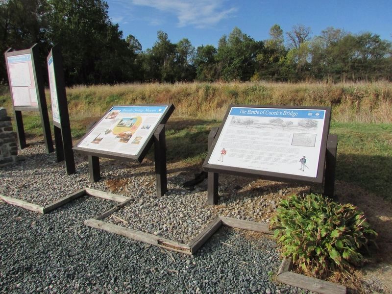
On Dayett Mills Road south of Old Baltimore Pike, on the right when traveling south. Reported permanently removed.
On September 3, 1777 over 800 Americans forming the Light Infantry Corps of Brigadier General William Maxwell engaged about 2,000 British Light Infantry and Hessian and Anspach "Jägers" (light infantry) in a series of skirmishes ending at . . . — — Map (db m157141) HM
Near South Old Baltimore Pike east of Whittaker Road, on the right when traveling west.
"War Between the States,
Brother Against Brother"
The civil war officially began on April 12, 1861 when Confederate forces bombarded the Union controlled Fort Sumter.
Delaware was a Border . . . — — Map (db m238413) HM
On Dayett Mills Road south of Old Baltimore Pike, on the right when traveling south.
What is a Hundred?
A hundred is an old English subdivision of a county. Although the origin is somewhat shrouded in mystery [,] basically it was a tract of land large enough to provide a hundred men to serve in the king’s wars. In American . . . — — Map (db m156916) HM
Near South Old Baltimore Pike east of Whittaker Road, on the right when traveling west.
"Almost all of the Africans who came to America before 1865 were enslaved… Struggling to establish stable lives despite harsh conditions. Once they were legally free, their troubles were far from over, since African Americans were . . . — — Map (db m238415) HM
The Philadelphia Campaign was so-named since that city was the British destination when they sailed from New York, landing 17,000 troops near Elkton, Maryland. Colonial sharpshooters engaged the British in a delaying action at the Battle of Cooch's . . . — — Map (db m203673) HM
On West Chestnut Hill Road west of Highfield Drive, on the right when traveling west.
This humble home was the first residence of Blues Hall Of Fame guitarist "Lonesome" George Thorogood purchased on July 1, 1981 after his national rise to prominence. It was the residence and home of George and was frequented by band . . . — — Map (db m274949) HM
On Dayett Mills Road south of Old Baltimore Pike, on the right when traveling south.
In August 1777, British forces under the command of General William Howe landed at the Head of Maryland's Elk River. Their goal was the capture of Philadelphia, the capital of the young republic. On September 3, advancing troops were engaged by an . . . — — Map (db m156810) HM
The Royal Deux-Ponts was a German-speaking infantry regiment in the French Expeditionary Force under the Comte de Rochambeau. Rochambeau’s forces embarked from France in March 1780, and arrived in Newport, Rhode Island, in July. The regiment was . . . — — Map (db m139927) HM
A Victorious Allied Army Passed Here
1781 was a momentous year for the United States. A French Army, led by General Rochambeau, had arrived in Rhode Island in July 1780. By June 1781, it was ready to join the U.S. Continental Army against . . . — — Map (db m189558) HM
On Sunset Lake Road (Delaware Route 72) north of Dayett Mill Road, on the left when traveling north. Reported permanently removed.
During the American Revolution Lauzun's Legion
spent the winter and spring of 1782-1783 in Wilmington to help guard Philadelphia and Baltimore from British attack. The troops were housed in the Wilmington Academy, located where the Grand Opera . . . — — Map (db m209340) HM
On South Old Baltimore Pike, on the right when traveling west.
Generals Washington, Greene and Lafayette came to Iron Hill, August 26, 1777 in hope of viewing British army then landing along Elk River. Only a few tents could be seen. A heavy storm coming up, they spent the night in a nearby farm house. — — Map (db m9778) HM
On Robert L. Melson Lane near Whitaker Road, on the left when traveling north.
One of the first tasks the Welsh performed was the establishment of two houses of worship. Among the Welsh were both Baptist and Presbyterian and the Baptist built their church on the north side of Iron Hill in 1703. Rebuilt in 1746, it remains . . . — — Map (db m158217) HM
Near South Old Baltimore Pike east of Whittaker Road, on the right when traveling west.
Could it be …
1. a natural hill that formed millions of years ago?
2. a Native American burial mound?
3. a spoils pile from iron mining?
4. an abandoned charcoal furnace or collier's hut used by Abbington Iron Works? . . . — — Map (db m238414) HM
On Dayett Mills Road near Old Baltimore Pike, on the right when traveling south.
Welsh Tract Church
William Penn granted a 30,000 acre tract of land to three Welshmen, (David Evans, William Davis, and William Willis) in 1701. They and their followers had left southern Wales in search of religious . . . — — Map (db m156971) HM
On James F. Hall Trail north of South Chapel Street, on the left when traveling north.
The Delaware portion of the Pomeroy and Newark Railroad was constructed in 1871 by the Delaware and Pennsylvania Railroad Company. The line ran from Pomeroy, Pennsylvania south through Avondale along the White Clay Creek, to Newark, for a length . . . — — Map (db m238435) HM
On East Main Street west of Academy Street, on the left when traveling west.
With deep gratitude for their commitment to education and service, the University of Delaware recognizes Albert Gallatin Lewis, his family and heirs, on whose land this building was built as a schoolhouse in 1884. — — Map (db m131156) HM
On East Main Street (Delaware Route 273) at The Green, on the right when traveling west on East Main Street.
[Left plaque]
Alumni Hall
has been placed on the
National Register
of
Historic Places
[Right plaque]
Alumni
Hall
Erected before 1810 — — Map (db m152669) HM
On The Green north of East Park Place, on the left when traveling south.
Some say the stars shine just a bit brighter over Cannon Hall, a residence hall built in 1952 and named for noted astronomer Annie Jump Cannon.
As curator of the Harvard College Observatory, Dr. Cannon classified 350,000 stars and discovered . . . — — Map (db m154026) HM
Near Hopkins Road 0.7 miles east of New London Road, on the right when traveling east.
1892
Field work executed by the United States Coast and Geodetic Survey
Pennsylvania
Wayne MacVeach • William H. Miller • R. Emmet Monaghan
Commissioners
Benj. H. Smith
Surveyor
Delaware
Thomas F. Bayard • John H. . . . — — Map (db m291543) HM
Near East Park Place west of Academy Street, on the right when traveling west.
Beatrice Hartshorn joined the Women's College at the University of Delaware in 1925 as head of the physical education program, which at the time consisted of rudimentary exercises and games.
Miss Hartshorn, who served on the University . . . — — Map (db m154035) HM
This chair is in honor of those who are still Prisoners of War (POW) or Missing in Action (MIA) and symbolizes there will always be a place in this community awaiting their return.
On Paper Mill Road, on the left when traveling north.
In 1783 Thomas Meeteer made a purchase of land in Mill Creek Hundred. By 1797, he owned about 285 acres on both sides of the White Clay Creek. On this land, he develops a farm, a sawmill, a paper mill and housing for his family and his workers. . . . — — Map (db m230055) HM
On West Main Street (Delaware Route 273), on the right when traveling west.
Since the mid-18th century an establishment for public hospitality has existed here. The first building, of wood construction, was known as St. Patrick's Inn. Famous visitors included surveyors Mason and Dixon. The property was purchased by James S. . . . — — Map (db m154817) HM
On Creek Road 0.2 miles north of Hopkins Road, on the right when traveling north.
The White Clay Creek Valley
The White Clay Creek Valley is a stream and floodplain habitat surrounded by rolling, forested hills. An important natural resource, the valley is home to more than 250 plant species, 30 species of mammals, and . . . — — Map (db m154633) HM
Near The Green south of East Delaware Avenue ( Route 273), on the left when traveling north.
Under President Hullihen's leadership, the two colleges known as Delaware College and the Women's College were officially joined and became known as the University of Delaware in 1921. Two years later, Hullihen inaugurated the internationally . . . — — Map (db m154399) HM
On South College Avenue at West Delaware Avenue ( Route 273), on the left when traveling north on South College Avenue.
This building is named in honor of E. Arthur Trabant, who served two terms as President of the University of Delaware: 1968-87 and 1988-90. During his presidency, enrollment at the University doubled, the Laird Campus was developed, the University . . . — — Map (db m131143) HM
On The Green north of East Park Place, on the right when traveling south.
Emalea Pusey Warner was one of the most influential women in the history of the University of Delaware. She was the first woman appointed to its Board of Trustees, serving from 1928-42.
The project closest to Mrs. Warner's heart was the . . . — — Map (db m131148) HM
On Veterans Drive 0.1 miles west of South Main Street ( Route 896), on the right when traveling west.
As we refresh our memories
Of all the wars gone by,
Let each of us be grateful
For our "heroes" you and I.
They gave their all that we may live
In a country good and free,
"Lest we forget" they did it all
For the likes of you and me. . . . — — Map (db m238445) WM
Near South College Avenue at Kent Way, on the right when traveling north.
Son of a weaver in Northern Ireland, Dr. Francis Alison (1705-1779) was educated at Scotland's leading universities. He migrated to America, where he became the father of higher education in the middle colonies. In 1743 Alison founded the Academy . . . — — Map (db m154832) HM
On The Green north of East Delaware Avenue ( Route 273), on the right when traveling north.
George Abram Harter served as President of Delaware College, now the University of Delaware, from 1896 to 1914. A quiet scholar who enjoyed teaching, he was an administrator respected for his unwavering dedication to the college.
Under his . . . — — Map (db m152709) HM
On The Green south of East Delaware Avenue (U.S. 273).
Delaware College, now University of Delaware, might have been a financial casualty of the Civil War period except for the assistance of George Gillespie Evans, a Newark merchant. Indeed, Delaware College did close for 11 years before, during and . . . — — Map (db m131107) HM
On Stanton-Ogletown Road 0.3 miles north of Ogletown-Stanton Road, on the right when traveling north.
George Washington's "General Staff Headquarters" on September 6, 1777. Here Generals Washington, Lafayette, Wayne, Maxwell, Sullivan, and Greene planned defense of Wilmington. House built circa 1750 by Samuel Hale. Owner 1776 — Daniel Byrnes — a . . . — — Map (db m13555) HM
On The Green south of East Delaware Avenue ( Route 273), on the right when traveling north.
A New Englander born into modest means, Harry Fletcher Brown was a chemist who developed smokeless powder. In 1904, he joined the Du Pont Company and later became a benefactor of education and social services.
Mr. Brown was an intense, . . . — — Map (db m154178) HM
On The Green north of East Delaware Avenue ( Route 273), on the left when traveling north.
During the height of the Great Depression, Harry Fletcher Brown first came to the aid of the University of Delaware and, over the next decade, became one of the University's most generous benefactors, financing construction of Brown Laboratory, . . . — — Map (db m154179) HM
On West Church Road, on the left when traveling south.
The first Presbyterian services in this area were conducted by Rev. John Wilson in 1706. Then pastor of New Castle Presbyterian Church, Rev. Wilson came every other Sunday to minister to the many residents of this area who had immigrated from . . . — — Map (db m9979) HM
On East Delaware Avenue (Delaware Route 273) at Haines Street, on the right when traveling east on East Delaware Avenue.
By the 1780's members of the Masonic fraternity were organized and meeting locally. On December 6, 1802, a charter was issued by the Grand Lodge of Pennsylvania for Lodge No. 96 in Newark. This was one of four Lodges whose representatives gathered . . . — — Map (db m154656) HM
On The Green south of East Delaware Avenue ( Route 273).
An 1898 graduate of Delaware College, now the University of Delaware, Hugh Martin Morris was one of Delaware's most distinguished jurists, serving as a Wilmington attorney and, from 1919-30, as a U.S. District Judge for Delaware.
A member of . . . — — Map (db m154480) HM
On The Green north of East Delaware Avenue ( Route 273), on the right when traveling north.
Born in Sussex County, Del., Hugh Rodney Sharp spent four happy years at Delaware College, now the University of Delaware, graduating in 1900 at the age of 20. He went on to become a successful business executive, a University Trustee and one of . . . — — Map (db m152661) HM
On The Green south of East Delaware Avenue ( Route 273), on the left.
H. Rodney Sharp was only 16 when he entered Delaware College in 1896, and he graduated four years later in what was termed the "Class of aughty-aught." In 1915, he was appointed a Trustee.
Mr. Sharp was deeply loyal to his alma mater. He . . . — — Map (db m152662) HM
On The Green south of East Delaware Avenue ( Route 273), in the median.
To the students of the University of Delaware who died in the service of their country during Asian Conflicts
Bird, Leonard A. '66 — Vietnam •
Flaherty, Kevin G. '63 — Vietnam •
Johnson, James R., Jr. '56 — Vietnam • . . . — — Map (db m154201) WM
On The Green south of East Delaware Avenue ( Route 273), on the left when traveling north.
To the men of the
University of Delaware
who died in the service of their country
during World War II
John H. Banks, III '46 •
Casimir L. Blaska '43 •
Robert J. Bostwick '31 •
Henry S. Brady, Jr. '34 •
Horace C. Brown '45 • . . . — — Map (db m154317) WM
Near East Main Street (Delaware Route 273) east of North College Avenue, on the right when traveling west.
Jastak-Burgess Hall, home of the Department of Foreign Languages and Literatures, is named in honor of psychologist Dr. Sarah Jastak-Burgess and Leslie M. Burgess ('43 B.S. UC Berkeley, '61 MBA Harvard). Their generous gifts in support of this . . . — — Map (db m154608) HM
On West Delaware Avenue (Delaware Route 273) west of Orchard Road, on the left when traveling east.
This building is named for renowned scholar John A. Munroe an authority on Delaware history and the author of many books, including a history of the University. After receiving his bachelor's and master's degrees from Delaware, he joined the . . . — — Map (db m154813) HM
On Academy Street north of Courtney Street, on the right when traveling north.
This building was named for John A. Perkins (1914-82), who served as President of the University of Delaware from 1950-67. His tenure marked one of the greatest periods of growth in the history of the University, with the undergraduate enrollment . . . — — Map (db m152056) HM
On The Green north of East Park Place, on the left when traveling south.
Kent Residence Hall, constructed in 1956, is named after Kent County, located in the central part of Delaware and home of the First State's capital city of Dover.
The adjoining Kent Dining Hall predates the residence hall by 31 years. The . . . — — Map (db m154027) HM
Near The Green south of East Delaware Avenue ( Route 273), on the left when traveling south.
This laboratory is named for Lammot du Pont (1831-1884), a gifted scientist and grandson of the founder of the DuPont Company. His many talents resulted in new products and enhancements to the company's operation.
Recognized as a skilled . . . — — Map (db m130514) HM
On The Green north of East Park Place, on the right when traveling south.
This building is named for the small southern Delaware town of Laurel, the birthplace of Mary Wooten Carpenter. Her Husband, Walter S. Carpenter Jr., who served as President of the University of Delaware Board of Trustees from 1959-62, supported . . . — — Map (db m153415) HM
Located at the heart of The Green, Memorial Hall is a welcoming landmark and a signature building of the University of Delaware. The University community marks the passage of time by carillon music from atop the building, including hourly chimes, . . . — — Map (db m154917) HM WM
On South College Avenue at Kent Way, on the right when traveling north on South College Avenue.
The University of Delaware has a proud legacy of being a teaching University and accordingly, acknowledges faculty who are distinguished by their contributions of teaching excellence and mentorship of students. The first member of the University's . . . — — Map (db m154180) HM
On New London Road (Delaware Route 896), on the right when traveling north.
Mt. Zion Union UAME was founded in 1868 in an abandoned blacksmith shop near Boogle Run at the corner of New London Rd and Ray St. Congregants walked three miles to St. Daniels UAME in Iron Hill before the establishment of Mt. Zion. In 1869 the . . . — — Map (db m154881) HM
On The Green north of East Park Place, on the left when traveling north.
This residence hall is named for the northernmost of Delaware's three counties, New Castle County. The City of Newark lies within its boundaries.
The dormitory was constructed with state funding in 1925, in response to the expansion of the . . . — — Map (db m131154) HM
On East Delaware Avenue (Delaware Route 273) at Haines Street, on the right when traveling east on East Delaware Avenue. Reported missing.
In 1893 a group of Newark women established a literary and social organization known as the Tuesday Club. Later renamed the New Century Club, the organization became part of the General Federation of Women's Clubs. Committed to matters of civic . . . — — Map (db m154776) HM
The first documented public school for African-American youth in the Newark community was established in 1867 by the Bureau of Refugees, Freedmen and Abandoned Lands. This was one of several schools established in Delaware during the post-Civil War . . . — — Map (db m154662) HM
On West Cleveland Avenue at New London Road ( Route 896), on the right when traveling east on West Cleveland Avenue.
The African American New London Road community can be traced back to 1786 when free black families began settling in the area. The community clustered around New London Road and was bounded by Cleveland Avenue to the south and Corbit and Ray Streets . . . — — Map (db m154318) HM
On Academy Street at E. Main Street, on the right when traveling north on Academy Street.
Founded at New London, Pennsylvania, in 1741 by Rev. Dr. Francis Alison, removed in 1752 to Cecil County, Md., and in 1767 to Newark. Chartered by Thomas and Richard Penn 1769. Closed from 1777 to 1780 on account of Revolutionary War. Merged with . . . — — Map (db m9781) HM
On East Main Street, on the left when traveling west.
By 1799 a small group of Methodists was organized and meeting in the homes of its members in the Newark area. Desiring a permanent place of worship, the congregation built the town's first church building on land that was provided by Isaac Tyson at . . . — — Map (db m9897) HM
On New London Road (Delaware Route 896) at Corbit Street, on the right when traveling south on New London Road.
You are standing in the heart of Newark's New London Road community — a historically African-American enclave whose story, though largely untold, is a vital part of the city's larger history and cultural heritage.
New London began in the . . . — — Map (db m154931) HM
On East Main Steet (Delaware Route 273), on the right when traveling west.
This building contained a chapel (called the Oratory) class, dormitory, dining, administrative, and student society rooms. Newark College chartered February 5, 1833, opened its doors for instruction May 8, 1834. Name changed to Delaware College . . . — — Map (db m154610) HM
On East Main Street, on the left when traveling west.
The origins of the Independent Order of Odd Fellows can be traced to the creation of beneficial trade societies in England. Composed of craftsmen who practiced a variety of different or "odd" occupations, the purpose of these organizations was to . . . — — Map (db m9898) HM
On The Green south of East Delaware Avenue ( Route 273), on the right when traveling north.
Pierre S. du Pont can fairly be described as the founder of the modern University of Delaware. In 1915, he donated the money to purchase the land that is now The Green, which physically unified Delaware College and Women's College.
President . . . — — Map (db m131108) HM
Preston Buenaga has struggled with the difficulties that Mitochondrial Disease has caused him throughout his life. His family always included him in their activities, as they were an active family. One thing that Preston loved was going to the . . . — — Map (db m243663) HM
On West Cleveland Avenue, on the right when traveling east.
The Improved Benevolent Protective Order of Elks of the World was formally organized in 1898. Designed to promote civic improvements, the IBPOEW is one of the largest fraternal organizations of its type in the world. Responding to the request of a . . . — — Map (db m9974) HM
On The Green south of East Delaware Avenue ( Route 273), on the right when traveling north.
In 1871, Theodore Wolf joined Delaware College as a 21-year-old Professor of Chemistry, fresh from receiving his doctorate at the University of Heidelberg, Germany.
Professor Wolf was a demanding but innovative and popular teacher. He worked to . . . — — Map (db m131112) HM
Dedicated by Governor Jack A. Markell and the Military Order of the Purple Heart
Department of Delaware
July 27, 2011
The National Purple Heart Trail memorializes those heroic soldiers, sailors, airmen and marines who have had the . . . — — Map (db m186858) WM
On West Main Street (Delaware Route 273), on the right when traveling west.
Completed in 1886, this was the home and place of business of Theodore F. Armstrong, a prominent local merchant and civic leader. Reflecting the growing prosperity of the community and its residents, this hybrid of Queen Anne and Gothic architecture . . . — — Map (db m130149) HM
Near Academy Street south of Lovett Avenue, on the left when traveling north.
Francis Alison came to America from Ireland in 1735 and served as a Presbyterian minister in New London, Pennsylvania, from 1736-52. In 1743, he started a free school there to which the University of Delaware traces its origin. His first class, . . . — — Map (db m153982) HM
On West Church Road south of Spring Valley Road, on the right when traveling west.
Amos Alexander • John Alexander • Capt. Walter Alexander • David Barr • Richard Bennett • Major James Black • Thomas Bradley • Jacob Casho • Benjamin Cowen • William Crawford • Levi Davis • Samuel Davis • John Evans • George Gillespie • George . . . — — Map (db m292920) HM WM
On The Green south of East Delaware Avenue ( Route 273), on the left when traveling north.
Robert ("Bob") Gore was a University of Delaware undergraduate studying chemical engineering when he invented GoreTexⓇ. This polymer material became key to the success of W.L. Gore and Associates, a company that Bob's father, Wilbert L. . . . — — Map (db m154281) HM
The origin of Methodism in this part of Delaware can be traced to the early 1770's when a Methodist Society was organized and began meeting in the home of Isaac Hersey, a prominent farmer and miller. Through the efforts of Hersey's step-son William . . . — — Map (db m94281) HM
On The Green south of East Delaware Avenue ( Route 273), on the left when traveling north.
In 1914, Samuel Chiles Mitchell was elected the 16th President of what was then known as Delaware College, now the University of Delaware.
During his six-year tenure as President, the Women's College was opened; the central campus was . . . — — Map (db m131105) HM
On The Green north of East Park Place, on the left when traveling south.
Squire Hall is named for Francis Hagar Squire, a popular Professor of History at the University from 1927-56, who also served as Dean of the College of Arts and Sciences from 1945-56.
Professor Squire helped establish the master's degree . . . — — Map (db m162072) HM
On Hillside Road at New London Road Rt. 896, on the right when traveling south on Hillside Road.
This congregation was organized circa 1848. Early meetings were held in a log cabin at this location on land that was conveyed to trustees of the "Protestant Methodist Church" in 1850. In 1866 the members of the First Colored Methodist Protestant . . . — — Map (db m9968) HM
On Chapel Street near E. Main Street ( Route 273), on the right when traveling north.
In 1868, the original Old Village Presbyterian Church, which stood on this location, was purchased by Charles A. Murphey. The property was donated to the Catholic Diocese of Wilmington, and the church was named St. Patrick's. It became a mission of . . . — — Map (db m176291) HM
On The Green north of East Park Place when traveling south.
This residence hall is named after Delaware's southernmost county and is one of the oldest buildings on the south Green. Sussex Hall was completed in 1917 and was built with an appropriation from the Delaware General Assembly. It was the second . . . — — Map (db m131152) HM
A historic house leaves, then returns to the family. The story of the Chambers House begins in 1775 when Benjamin Chambers bought 250 acres of land and set up a sawmill on nearby White Clay Creek. His son Joseph built this house about 1820 . . . — — Map (db m72723) HM
The Diamonds Walkway recognizes donors who make leadership level gifts to the University of Delaware for five consecutive years as members of the
Delaware Diamonds Society. Each brick in the walkway is inscribed to recognize the generosity of . . . — — Map (db m154614) HM
On West Main Street at South College Avenue, on the right when traveling west on West Main Street.
The Diamonds Walkway recognizes Delaware Diamonds Society donors who have generously contributed to UD for five consecutive years. As a special thank you, these loyal donors are offered the opportunity to have a personalized brick on the Walkway. . . . — — Map (db m238439) HM
On East Cleveland Avenue at Paper Mill Road, on the right when traveling west on East Cleveland Avenue.
Newark was once the home of several factories producing paper, wood laminates and a variety of textiles. Some were located on the White Clay Creek. Harnessing its water flow to generate power. The Pomeroy and Newark Railroad service these . . . — — Map (db m174922) HM
Near South College Avenue north of Sunset Road, on the right when traveling north.
The beauty of the surrounding landscape on the University's South Green is the result of careful planning in the 1920s by one of the first female landscape architects in the United States, Marian Cruger Coffin. Miss Coffin designed and directed . . . — — Map (db m154197) HM
On The Green south of East Delaware Avenue ( Route 273), on the right when traveling north.
In 1995, to celebrate the fifth anniversary of President David Roselle and his wife, Louise, at the University of Delaware, the Board of Trustees chose to name this section of campus, long known as The Grove, in recognition of the Roselles' service. . . . — — Map (db m154674) HM
On Newark and Pomeroy Rail Trail at East Main Street, on the right when traveling south on Newark and Pomeroy Rail Trail.
Pomeroy and Newark Rail Line Facts
⇒ Rail service between Pomeroy, PA and Newark, DE began in May of 1873.
⇒ The rail line between Newark and Pomeroy included 65 bridges. It follows the bank of the White Clay Creek . . . — — Map (db m238437) HM
On New London Road (Delaware Route 896) north of Hopkins Bridge Road, on the right when traveling north. Reported permanently removed.
The wedge-shape tract, west of the Maryland and Delaware curve, consists of approximately 800 acres of land. For more than a century, the property was claimed by Pennsylvania but governed by Delaware. In 1889, a joint committee appointed from both . . . — — Map (db m9961) HM
On New London Road east of Harvest Lane, on the right when traveling west.
Created from the difficulty in surveying the twelve-mile circle tangent point and the Tangent Line defined by Charles Mason and Jeremiah Dixon, this land between the State of Maryland and the Delaware curve is a wedge-shaped tract that was claimed . . . — — Map (db m291388) HM
On Nottingham Road, on the left when traveling west.
Created from the difficulty in surveying the twelve-mile circle tangent point and the Tangent Line defined by Charles Mason and Jeremiah Dixon, this land between the State of Maryland and the Delaware curve is a wedge-shaped tract that was claimed . . . — — Map (db m243121) HM
On East Main Street at Thorogood Alley, on the right when traveling east on East Main Street.
In honor of George Thorogood, whose contributions to rock and blues music have left an indelible mark on fans throughout the world. Born on February 24, 1950 in Wilmington, Delaware, George's signature guitar style and soulful, gritty vocals have . . . — — Map (db m308454) HM
The University of Delaware traces its origins to a school founded by the Rev. Francis Alison in 1743, which later became the Academy of Newark. In 1833, the state of Delaware chartered its first institute of higher education, called Newark . . . — — Map (db m154335) HM
On The Green south of East Delaware Avenue ( Route 273), on the right when traveling south.
The University of Delaware traces its origins to a school founded by the Rev. Francis Alison in 1743, which later became the Academy of Newark. In 1833, the state of Delaware chartered its first institute of higher education, called Newark . . . — — Map (db m154472) HM
On East Main Street at The Green, on the left when traveling west on East Main Street.
The University of Delaware traces its origins to a school founded by the Rev. Francis Alison in 1743, which later became the Academy of Newark. In 1833, the state of Delaware chartered its first institute of higher education, called Newark . . . — — Map (db m308451) HM
Near East Main Street east of South College Avenue, on the right when traveling west.
The UD Alumni Association (UDAA) has strengthened the commitment of graduates to the University of Delaware since 1846 and is governed by a volunteer Board of Directors. The names that follow are those who served as president along with the . . . — — Map (db m238444) HM
On East Main Street at Academy Street, on the left when traveling west on East Main Street.
In memory of the men from Newark who gave their lives in World War II and in honor of those who served in the great wars Ralph E. Adams • Woodrow W. Gravenor • Harold N. Sheaffer Robert G. Allen • Charles W. Greer, Jr. • Ralph R. Skillman James . . . — — Map (db m9901) WM
On Elkton Road at West Park Place, on the right on Elkton Road.
Victor Gazaway Willis was born April 12, 1876 and spent his youth and much of his life in Newark, Delaware. He attended and played baseball for Delaware College (now the University of Delaware) in 1897. The Delaware Peach," as he was known, became . . . — — Map (db m92141) HM
On East Main Street east of North College Avenue, on the right when traveling west.
The Emalea Pusey Warner and Alexander J. Taylor Sr. Awards honor an outstanding woman and man, respectively, of the senior class. Recipients demonstrate leadership, academic success and community service as exemplified by Mrs. Warner and Mr. . . . — — Map (db m238442) HM
5333 entries matched your criteria. Entries 301 through 400 are listed above. ⊲ Previous 100 — Next 100 ⊳