611 entries match your criteria. Entries 301 through 400 are listed.⊲ Previous 100 — Next 100 ⊳
Civilian Conservation Corps (CCC) Historical Markers
Markers relating to the Great Depression-era New Deal federal work relief program that operated from 1933 to 1942 in the United States for unemployed, unmarried young men from relief families.
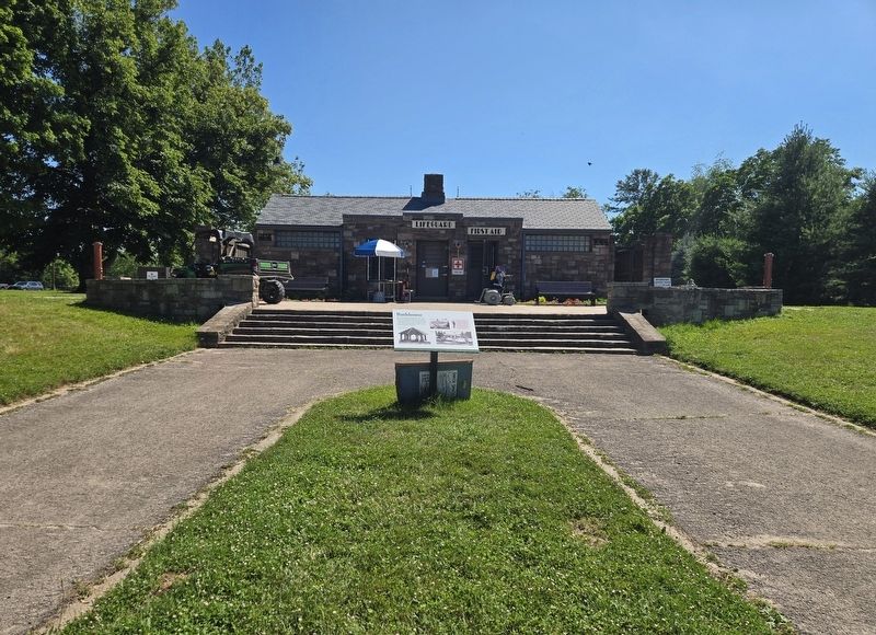
Gambin Construction from Buffalo, New York, built Hamlin Beach's bathhouse. Their contract for $27,705 began July 15, 1939, and work was to be completed by November 1. The young men of Civilian Conservation Corps Company 1252 built the stone . . . — — Map (db m305109) HM
Originally called Northwest Beach Park when Monroe County began its development in 1929, the park's name was changed to Hamlin Beach State Park when New York State took title in January 1938. Company 1252 of the Civilian Conservation Corps . . . — — Map (db m306559) HM
In 1935 and 1936, the young men of Civilian Conservation Corps Company 1252 pruned trees, cleared the beach, and built roads and a large parking area in the park. They also quarried stone in Orleans County that would later be used to construct the . . . — — Map (db m82655) HM
The West Shelter, or Shelter 3 as it is known today, was built by the men of the Civilian Conservation Corps (CCC) Company 1252 in 1937. They quarried the stone locally and cut the timbers in the CCC camp sawmill. The West Shelter as it . . . — — Map (db m82681) HM
Civilian Conservation Corps.
Camp SP-11 • Company 212
1933-1941
Gilbert Lake State Park • Laurens, N.Y.
Dedicated this 4th day of August 1985 to the
memory of those young men of the Civilian
Conservation Corps who lived and worked at . . . — — Map (db m149019) HM
U.S. Army
Rotterdam Housing Area
Home of Jimmy Carter
October 1952 - October 1953
James Earl Carter, Jr., President of the United States
1977-1981, and his wife Rosalynn, lived in Quarters
Number 7 when he . . . — — Map (db m6870) HM
Watkins Glen State Park is one of the top attractions in New York State. Considered a flagship park by the State of New York, this incredible destination has been leaving visitors spellbound for generations. It features 19 waterfalls in less than . . . — — Map (db m246349) HM
Between 1933 & 1941 men from
Civilian Conservation Corps
Company 1265 built many of
the facilities at Buttermilk
Falls & R.H. Treman St. Parks.
Town of Ithaca
1996 — — Map (db m118660) HM
This sign is part of the Letchworth State Park CCC Legacy Pathway honoring the Civilian Conservation Corps (1933-1942), a federal works project designed to relieve unemployment and conserve natural resources during the Great Depression.
Over a . . . — — Map (db m179436) HM
For many enrollees, the CCC camp was their first experience away from home. Discipline, order, and uniform dress were part of the camp experience. The enrollees worked seven hours a day and then had some free time. On Saturdays, a half day was set . . . — — Map (db m143200) HM
This sign is part of the Letchworth State Park CCC Legacy Pathway honoring the Civilian Conservation Corps (1933-1942), a federal works project designed to relieve unemployment and conserve natural resources during the Great Depression.
An . . . — — Map (db m179699) HM
The village of St. Helena was originally part of Mary Jemison's Gardeau Reservation. Settlers moved here after she sold most of her property in 1823. At its peak, St. Helena was a prosperous riverside hamlet with a flour mill, two sawmills, a . . . — — Map (db m170750) HM
One of the greatest challenges to the ingenuity and perseverance of three of Letchworth State Park's four CCC camps was the construction of a trail down the sheer cliff walls to cross the Genesee River at the Lower Falls. It was Camp SP-49 that . . . — — Map (db m143199) HM
This statue is dedicated to the more than 3,000 men who served in four Civilian Conservation Corps camps in Letchworth State Park between 1933 and 1941. They joined more than three million others nationwide during the "Great Depression" in an . . . — — Map (db m75933) HM
On this field stood the 24 buildings of Camp SP-49, one of four Civilian Conservation Corps camps in Letchworth State Park. In operation from July 1935 until October 1941, Camp SP-49 included a tree nursery of over 30,000 plants for use in . . . — — Map (db m75910) HM
During the depths of the Great Depression, Franklin D. Roosevelt devised a plan by which the government would create jobs for unemployed young men restoring our natural resources. On March 31, 1933, a bill establishing the Civilian Conservation . . . — — Map (db m179778) HM
Gibsonville Camp 40 (State Park) 17 was the second of four camps established in the Park. After the site was approved and selected in September 1933, unemployed local carpenters and workmen began work on the camp’s buildings using lumber from the . . . — — Map (db m269100) HM
During the depths of the Great Depression, Franklin D. Roosevelt devised a plan by which the government would create jobs for unemployed young men restoring our natural resources. On March 31, 1933, a bill establishing the Civilian Conservation . . . — — Map (db m269113) HM
This sign is part of the Letchworth State Park CCC Legacy Pathway honoring the Civilian Conservation Corps (1933-1942), a federal works project designed to relieve unemployment and conserve natural resources during the Great Depression.
Life . . . — — Map (db m180804) HM
This sign is part of the Letchworth State Park CCC Legacy Pathway honoring the Civilian Conservation Corps (1933–1942), a federal works project designed to relieve unemployment and conserve natural resources during the Great Depression.
The . . . — — Map (db m180750) HM
This sign is part of the Letchworth State Park CCC Legacy Pathway honoring the Civilian Conservation Corps (1933-1942), a federal works project designed to relieve unemployment and conserve natural resources during the Great Depression. This . . . — — Map (db m179689) HM
In 1933, during the depths of the Great Depression, the U.S. Congress
passed the Emergency Conservation Work Act forming the Civilian
Conservation Corp (CCC). The resolution organized and employed
unmarried young men, ages 18-25, to battle . . . — — Map (db m240987) HM
A Popular Destination With its cool summer climate, beautiful azaleas, and fabulous panoramic views, Wayah Bald has been attracting visitors for centuries. During the late 1800s and early 1900s, groups of people camped together. For some . . . — — Map (db m169105) HM
You are standing alongside the Appalachian Trail, one of the longest continuous footpaths in the world. The trail winds more than 2,150 miles through 14 states. Few stretches are more remote or difficult than the section through the Great Smokies. . . . — — Map (db m20064) HM
(Side One):
The Great Smokies: scenic, diverse, culturally rich.
The scenic view here are well known; lesser known is the abundance of life. The Smokies' rugged topography creates a diversity of species found in few other places in North . . . — — Map (db m20066) HM
The Blue Ridge Parkway is a collection of diverse and inspiring places. The 469-mile road links Shenandoah National Park to Great Smoky Mountains National Park. Like a long beautiful ribbon connecting distinctive gems, the Parkway joins high . . . — — Map (db m150299) HM
In Honor of the Civilian Conservation Corps 1933 – 1942 whose hands built roads, trails, bridges, buildings, campgrounds, and picnic areas in Great Smoky Mountains National Park for the benefit and enjoyment of the people. . . . — — Map (db m58439) HM
Nature forged the Great Smokies, but the hands of the Civilian Conservation Corps (CCC) helped shape the national park we know today. During the 1930s, enrollment peaked as 4,300 men worked here, building roads, campgrounds, trails, and buildings. . . . — — Map (db m99065) HM
Here served members of Companies 413 and 2410 at Camp SP-2 of the Civilian Conservation Corps (1933-1942) that magnificent Army of Youth and Peace which put into action the awakening of the people to the facts of conservation and recreation. May, . . . — — Map (db m108614) HM
The drought and depression of the 1930’s hit the badlands region hard. Small landowners, no longer able to eke out a living, sold their lands to the government with the hope of finding a new start elsewhere. Throughout the country, men were out of . . . — — Map (db m88610) HM
The Civilian Conservation Corps was a peacetime “army” of civilians between 1933 and 1941 which served to create jobs for unemployed men and to protect natural resources. Two CCC camps were located near Medora. In 1934 the CCC camp of . . . — — Map (db m87782) HM
“I propose to create a Civilian Conservation Corps . . . We can take a vast army of these unemployed out into healthful surroundings. We can eliminate to some extent at least the threat that enforced idleness brings to spiritual and moral . . . — — Map (db m87538) HM
The stone shelter your are now standing by was constructed in the 1930s as one of many projects completed throughout the state by the Civilian Conservation Corps (CCC) and the Works Progress Administration (WPA). The CCC and the WPA were programs . . . — — Map (db m154396) HM
This commemorative plaque is placed in honor of the work performed by Company's 2770, 4737, and 764 of the Civilian Conservation Corp (CCC) between 1934 and 1941 under the direction of the Nat'l Park Service. While the main project of these crews . . . — — Map (db m183703) HM
This commemorative plaque is placed near the site where CCC Camp #2760 of the CCC was located in the City of LaMoure, North Dakota--when this Dam was constructed by the CCC in 1934.
CCC Co #2760 built the Dam across the James River just . . . — — Map (db m112158) HM
The drought and depression of the 1930’s hit the badlands region hard. Small landowners, no longer able to eke out a living, sold their lands to the government with the hope of finding a new start elsewhere. Throughout the country, men were out of . . . — — Map (db m282220) HM
The stone shelter you are standing in was constructed in the 1930s as one of the many projects completed throughout the state by the Civilian Conservation Corps (CCC) and the Works Progress Administration (WPA). The CCC and the WPA were programs . . . — — Map (db m162476) HM
"The Worker" commemorates the valuable contributions of the Civilian Conservation Corps (CCC) across this great country during the years 1933 to 1943. That depression-era decade was a critical period in American history. The CCC played a major role . . . — — Map (db m227237) HM
Let this be a reminder to future generations of the invaluable service rendered by so many young men in preserving and maintaining parks and wildlife areas of this country.
The CCC assisted in the development of Fort Abraham Lincoln State . . . — — Map (db m227761) HM
The Civilian Conservation Corps (CCC) Company 765 located in the city of Mohall, North Dakota. This plaque has been placed as a reminder to the future generation that invaluable service was rendered by many young men in preserving and maintaining . . . — — Map (db m231762) HM
Explore Iconic Landmarks!
Clear Fork Gorge Scenic Overlook
Marvel at dramatic views of the Clear Fork of the Mohican River from two stone decks. Constructed in the 1930s by the Civilian Conservation Corps, this area is designated as a . . . — — Map (db m269905) HM
Explore Iconic Landmarks!
Clear Fork Gorge Scenic Overlook
Marvel at dramatic views of the Clear Fork of the Mohican River from two stone decks. Constructed in the 1930s by the Civilian Conservation Corps, this area is designated as a . . . — — Map (db m269907) HM
Retracing Historic Paths
Experience a place where nature's history meets your adventure! Once the hunting grounds of the Delaware nation, it's now a sanctuary for outdoor enthusiasts. Hike, bike, ride horseback, or paddle through varied . . . — — Map (db m269906) HM
Reconstructed on this site, this lookout tower once stood off S.R. 278 southwest of Nelsonville in Athens County. Known as the Snake Ridge Lookout Tower this tower was originally built in 1939.
Many of the lookout towers were built by the . . . — — Map (db m28511) HM
Fort Amanda and the surrounding area is built
atop a glacial moraine (soil, sand and gravel left
behind by glaciers). It is safe to say the area was
used throughout prehistory for short- and
long-term habitation. During the Archaic . . . — — Map (db m167018) HM
The Wright brothers were the most memorialized of Americans in the 20th century. Of all their countrymen, only Washington, Jefferson, and Lincoln have inspired commemorative zeal to match.
Wright biographer Tom . . . — — Map (db m304833) HM
America needed hope in
the early 1930s, as The Great
Depression took its toll.
Newly elected President
Franklin
D.
Roosevelt
implemented social programs,
such as the Works Progress
Administration (W.P.A) . . . — — Map (db m173228) HM
Named for the Miami and Erie Canal's
'side cut' to Maumee City this canal land,
later abandoned, became the first Metropark.
Opened during the Great Depression, Side Cut
Metropark's landscape is dotted with remnants
of work done by 500 men . . . — — Map (db m173279) HM
During the Great Depression, over 300
companies closed in Toledo, and 50%
unemployment plagued the city. Federal
work programs like the WPA and CCC
employed thousands of Americans during
this time of hardship. In Toledo, these
men built the . . . — — Map (db m173206) HM
The earliest development of Pearson Park was completed by 200 men from the Civilian Conservation Corps. Begun in 1933 under the New Deal, the CCC hired unemployed young Americans to work for the government in reforestation, conservation and . . . — — Map (db m173487) HM
Situated in an agriculturally rich area, county fairs have long been a significant tradition and event in Meigs County. The Meigs County Agricultural Society held its first fair on October 22, 1851, in Middleport and its second at the Rock-Spring . . . — — Map (db m28495) HM
Many changes have occurred at Fort Ancient over the last 2,000 years. Hopewell Indians built the site and used it as a ceremonial and social gathering area. The Fort Ancient Indians lived in the South Fort 500 years after the Hopewell people left. . . . — — Map (db m26618) HM
The Civilian Conservation Corps. During the Great Depression of the 1930s, the federal government established the Civilian Conservation Corps, known as the CCC or triple C's under the direction of President Franklin D. Roosevelt's New Deal . . . — — Map (db m26482) HM
One of Oklahoma's original seven state parks, the vision of Roman Nose State Park was realized through the combined efforts of the Civilian Conservation Corps, the National Park Service, community leaders, and the State of Oklahoma.
Work . . . — — Map (db m185621) HM
The Civilian Conservation Corps was organized by President Franklin Roosevelt during the Great Depression. The program provided useful employment for nearly three million young men ages 17 to 26 and served to enhance and preserve our nation’s . . . — — Map (db m108855) HM
The creation of the Civilian Conservation Corps (CCC) by President Franklin D. Roosevelt in 1933 gave promise to many communities affected by the Great Depression of the 30s. Through the cooperative efforts of the Chamber of Commerce, city . . . — — Map (db m226076) HM
Franklin D. Roosevelt pledged that he would do everything in his power to ease the impact of the Depression. One of the most successful programs was the Civilian Conservation Corps (CCC). From 1933-1942, the CCC enrolled young men and assigned them . . . — — Map (db m172582) HM
This park was created between 1933 and 1936 by Civilian Conservation Corps Companies 872, 875 and 895 for future generations of Americans.
The CCC was organized by the federal government during the Great Depression to provide useful employment . . . — — Map (db m280282) HM
NW/4 NE/4 SEC 4 - TWP 17N - RGE 3E
Payne County, Oklahoma
Made possible by a generous donation from Merrill Gates in memory Charles & Mary Evans — — Map (db m187209) HM
Boiling Springs has long been a prairie oasis. Before pioneer settlement, Plains Indians came here to camp and rest. After the Land Run of 1893, this park area was part of several pioneer homesteads. In 1925 William Shaul purchased land containing . . . — — Map (db m191656) HM
During the 1930's, one of the most important programs within President Roosevelt's "New Deal" was the Civilian Conservation Corps. The CCC enrollees were unmarried men who were between the ages of 18 and 25. Each CCC worker received a monthly wage . . . — — Map (db m191653) HM
Most CCC enrollees from company 2822 were young, unmarried, men who were between the ages of 18 and 25. Each CCC enrollee received a monthly wage of $30, of which $25 was sent home to help their family. The members of the CCC lived in work camps . . . — — Map (db m191680) HM
Gold Beach Ranger Station constructed 1936–37 placed on the National Register of Historic Places April 8, 1986 The nine original buildings on this site were designed by W.I. Turner and constructed by Civilian Conservation Corps . . . — — Map (db m113206) HM
Welcome to historic Fish Lake.
Now a quiet and peaceful place, it was once filled with the hustle and bustle of people working and traveling across the Cascades.
Nearby is the Fish Lake Remount Depot which has been in continuous use as a . . . — — Map (db m62025) HM
These buildings, constructed by the Civilian Conservation Corps (CCC) during the period between 1933 – 1942, are excellent examples of the Depression-era, rustic style of U.S. Forest Service structures.
The building in the upper left . . . — — Map (db m113336) HM
The CCC was created in 1933 to provide young men useful work during the Depression. Camp Canyon Creek (Company 1231) was established in 1937. The CCC built numerous facilities such as District offices, the John Day Compound, fire guard stations, . . . — — Map (db m107548) HM
Welcome! Your Oregon Department of Fish and Wildlife invites you to find out about what we do here to ensure the future of our state's fish resources.
A Brief History
1920s - the Oregon State Game Commission began raising trout in . . . — — Map (db m113208) HM
When Dee Wright began work in 1910, he did not know where 24 years in the Forest Service would take him. Packing supplies for fire camps, work crews and lookouts; locating part of the Pacific Crest trail; and stories around the campfire all found . . . — — Map (db m114237) HM
This observation point has been provided to facilitate public enjoyment of the unusual and interesting combination of historical and geological features nearby. The development was planned and supervised by the Willamette National Forest and . . . — — Map (db m114229) HM
I was hired as a stone mason LEM for the Civilian Conservation Corps.
What’s a LEM you ask? Local Experienced Men.
Know all ‘bout stone masonry and it was wisely reasoned to pepper experienced man about the young Corps enrollees.
They’re . . . — — Map (db m114238) HM
Before Columbus sailed to the Americas, this Sitka spruce began its life nourished by a nurse log. As it grew, it shared Cape Creek with the Indians who lived just one-half mile west at their large seasonal campsite by the ocean.
When the . . . — — Map (db m114265) HM
Agriculture has always been a part of the culture of the South Mountain area. Settlers were originally drawn to a wild land to cultivate the soils and raise crops, and today agricultural and community leaders to work together to inspire a new . . . — — Map (db m284665) HM
Roxbury Park & Luna Park
Roxbury Park was created in 1895 by the Roxbury Driving Association; it hosted highly popular horse races. The park also catered to group picnics and other events. African-Americans celebrated the Emancipation . . . — — Map (db m310949) HM
Timbering — Clinton County, at one time of settlement was considered one of the most remote parts of Pennsylvania. It is likely that during this early time most of the area was densely covered with white pine, eastern hemlock, and hardwoods . . . — — Map (db m176028) HM
Timbering — Clinton County, at one time of settlement was considered one of the most remote parts of Pennsylvania. It is likely that during this early time most of the area was densely covered with white pine, eastern hemlock, and hardwoods . . . — — Map (db m282643) HM
During WWII, the US War Dept. operated this secret facility a mile north along Michaux Rd., one of three such sites in the US. Military intelligence relating to topics such as weaponry development and Axis operations was gained from thousands of . . . — — Map (db m84036) HM
This is the site of Pine Grove Furnace Prisoner of War Interrogation Camp (1943-1945). Here the U.S War Department operated a clandestine facility where intelligence officers interrogated enemy prisoners. During its thirty-month existence, thousands . . . — — Map (db m84037) WM
By 1933, the fourth year of the Great Depression, America's unemployment rate stood at twenty-five percent. To alleviate this and other economic issues, newly elected President Franklin Delano Roosevelt initiated his New Deal reforms. The best . . . — — Map (db m152695) HM
Portions of this trail system pass through the Great Meadows where George Washington and his troops fought a large French and Indian force on July 3, 1754.
The Braddock Road Trace is the remnant of the road built by Washington in 1754 and . . . — — Map (db m152678) HM
By the 20th century, iron furnaces like these belonged to the past. The growing cost of transporting raw materials and finished products to and from rural furnaces reduced profits. The forest, the source of wood for charcoal fuel, had been . . . — — Map (db m90827) HM
One of Pennsylvania’s outstanding natural treasures, the Pine Creek Valley carves a winding path from Ansonia to Jersey Shore. Here, clear-flowing streams make the Pine Creek Valley a popular trout fishing destination. The Pine Creek Rail Trail, . . . — — Map (db m304566) HM
Before time had a name, these forests were here. Pine, hemlock and chestnut grew to enormous sizes. The forest ecosystem naturally found the proper balance of life. But in time, this serene landscape was changed. The first European settlers . . . — — Map (db m304591) HM
Though it's hard to imagine when looking at today's verdant forests and clear-flowing streams, in the early 1900s, intensive logging had ravaged north-central Pennsylvania's seemingly limitless forests. Rain eroded treeless hillsides, depleting the . . . — — Map (db m191989) HM
In March 1933, the federal government created the CCC to combat the Great Depression. During nine years, the CCC enrolled some 3,000,000 youths nationwide--including 194,572 men at 114 camps in Pennsylvania. Members of the 367th CCC company first . . . — — Map (db m43552) HM
A big spring in the far western end of Perry County has long been a popular place to visit. Stagecoaches traveling over the mountain in the 19th century stopped here to rest and water their horses. A Saturday picnic in 1903 was attended by 4,000 . . . — — Map (db m257349) HM
1929: Stock market crash.
1932: PA unemployment at 35%. Banks fail nationwide.
1933: President Franklin D. Roosevelt initiated New Deal.
1935: Social Security enacted.
After WW I ended, industrial . . . — — Map (db m242106) HM
The CCC reshaped lives, both on and off the job. Each day began with reveille at 6:00 AM and ended with lights out at 10:00 PM Everything had a time and place including meals, education, recreation, and the fondly-remembered antics of young men at . . . — — Map (db m209140) HM
The rugged sandstone that forms Laurel Hill is ancient, but the CCC recruits planted many of the trees in the forest around you. They stand as monuments to the ability of nature to recover from overharvesting. Laurel Hill State Park has the largest . . . — — Map (db m209146) HM
It had a dual purpose. Created in 1933, during the Great Depression, the Civilian Conservation Corps (CCC) provided young men an opportunity to be engaged in gainful employment while transforming hundreds of thousands of acres of American landscape. . . . — — Map (db m209136) HM
The Civilian Conservation Corps, established during the Great Depression, reduced unemployment among young men from poor families. Three million CCC "boys" engaged in conservation projects that created a legacy of national treasures including . . . — — Map (db m300221) HM
" I propose to create a Civilian Conservation Corps to be used in simple work...more important, however, than the material gains will be the moral and spiritual value of such work."
Franklin D. Roosevelt
March 9, 1933
Born at our . . . — — Map (db m300222) HM
In March 1933, the federal government created the CCC to combat the massive unemployment of the Great Depression. Continuing until 1942, the CCC enrolled some three million youths nationwide. In Pennsylvania, 194,572 men were enrolled at 114 camps. . . . — — Map (db m43209) HM
Born at our nation’s lowest point, the CCC rebuilt a land and its people. We all owe thanks to the thousands of men who helped build Pennsylvania’s parks and reforest its hills.
Beginning late in 1929, the Great Depression was a desperate time . . . — — Map (db m90048) HM
Born at our nation’s lowest point, the CCC rebuilt a land and its people. We all owe thanks to the thousands of men who helped build Pennsylvania’s parks and reforest its hills.
Beginning late in 1929, the Great Depression was a desperate time . . . — — Map (db m199464) HM
611 entries matched your criteria. Entries 301 through 400 are listed above. ⊲ Previous 100 — Next 100 ⊳