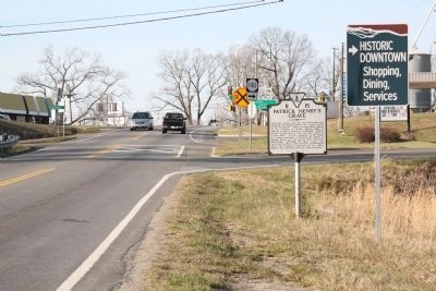
Five miles east is Red Hill, the last home and
gravesite of Patrick Henry, the great orator
of the Revolution. Henry is especially famous
for his “Liberty or Death” speech made in
1775 in St. John’s Church in Richmond. Henry
moved . . . — — Map (db m64434) HM
Two miles east is Shady Grove, which was built in 1825 by Dr. George Cabell, of Point of Honor in Lynchburg, for his daughter Paulina and her husband Alexander Spotswood Henry, son of Patrick Henry. Shady Grove is a handsomely proportioned and . . . — — Map (db m64247) HM
Two miles north stand massive sandstone walls and four chimneys, the ruins of Mount Athos, overlooking a bend of the James River. The house was built about 1800 for William J. Lewis (1766-1828) on land that had been patented in 1742 by John Bolling . . . — — Map (db m42896) HM
Just south across Little Beaver Creek stand the ruins of the last of three Oxford Iron Works furnaces built in the vicinity. Virginia and Pennsylvania investors began the ironworks nearby between 1768 and 1772 as a small bloomery forge. According to . . . — — Map (db m42897) HM
This place, on the old stage road, was the first county seat of Bedford; the first courthouse, built in 1755, was standing until 1856. In 1781, New London was raided by the British cavalryman, Tarleton, seeking military stores. It came into Campbell . . . — — Map (db m65383) HM
Campbell County Training School (CCTS) opened here ca. 1923 after African American citizens campaigned for better schools. The black community, the county, and the Julius Rosenwald Fund paid for its construction. Rosenwald, inspired . . . — — Map (db m181140) HM
Born in Lynchburg in 1913, Col. Vincent W.
“Squeek” Burnett learned to fly at age 16.
By the mid-1930s, he was one of America’s
renowned aerobatic pilots and a member of
the Flying Aces Air Circus. He performed
such signature . . . — — Map (db m64207) HM
Rustburg was named after Jeremiah Rust, who patented land here in 1780. Rust donated 50 acres of land, known as Rust Meadows, in 1784, for the county seat of Campbell County. A temporary courthouse and other public buildings were constructed . . . — — Map (db m65564) HM
Born in Washington D.C., John Cephas grew up
there and in Caroline County. He was influenced
at an early age by his mother's singing. A cousin
taught him the highly syncopated and danceable
guitar style now known as Piedmont Blues, . . . — — Map (db m75730) HM
The earthworks in the angle between this stream and the North Anna River, held by a small Confederate force, were taken by Grant's troops moving southward on May 23, 1864. The Unionists then advanced to the river, on the south side of which was . . . — — Map (db m266256) HM
Caroline County
Area 529 Square Miles
Formed in 1727 from Essex, King and Queen, and King William. Named for Queen Caroline, wife of King George II. George Rogers Clark, Conqueror of the Northwest, passed his youth in this . . . — — Map (db m308596) HM
On this site overlooking the North Anna River, archaeological investigations conducted in 2006 in cooperation with Virginia tribes identified toolmaking camps dating to 8000 B.C. Indians used these camps repeatedly, especially from about 1000 B.C. . . . — — Map (db m10640) HM
Lee and Grant faced each other on the North Anna, May 23-26, 1864. Union forces crossed here and four miles to the west but found they could not dislodge Lee's center, which rested on the stream. Grant then turned east to Cold Harbor. — — Map (db m10644) HM
This famous horsebreeding farm was established in 1936 by Christopher T. Chenery and continued under the management of his daughter, Helen “Penny” Chenery until 1979. Secretariat (1970–-1989), also known as “Big Red,” . . . — — Map (db m1890) HM
Caroline County. Area 529 Square Miles. Formed in 1727 from Essex, King and Queen, and King William. Named for Queen Caroline, wife of King George II. George Rogers Clark, conqueror of the Northwest, passed his youth in this . . . — — Map (db m17789) HM
Pioneers in asserting the right to religious freedom, the Caroline Friends (Quakers) held their first meeting nearby on 12 March 1739 together with their partner, Cedar Creek Friends Meeting of Hanover County. At a meeting on 9 May 1767, members . . . — — Map (db m9213) HM
Caroline County. Area 529 Square Miles. Formed in 1727 from Essex, King and Queen, and King William. Named for Queen Caroline, wife of King George II. George Rogers Clark, conqueror of the Northwest, passed his youth in this . . . — — Map (db m22269) HM
On 24 Aug. 1800, slave Ben Woolfolk met with other slaves at nearby Littlepage’s Bridge to recruit individuals for an insurrection planned for 30 Aug. The insurgents led by Gabriel, a slave owned by Thomas Henry Prosser of Henrico County, intended . . . — — Map (db m5611) HM
In 1754, John and Ann Rogers Clark, with their sons Jonathan and George Rogers, moved from Albemarle County to a farm four miles west. There were born Ann, John, Richard, Edmund, Lucy, Elizabeth, William and Frances. During the Revolutionary War, . . . — — Map (db m9215) HM
Lee camped here, on May 21, 1864, on his way to the North Anna to oppose Grant moving southward. Ewell's and Longstreet's corps rested here that night. — — Map (db m294964) HM
Unable to defeat Gen. Robert E. Lee's Confederates during the Spotsylvania Courthouse battles 8-19 May 1864, Union commander Lt. Gen. Ulysses S. Grant's forces maneuvered east and south forcing Lee to abandon his entrenched position. The . . . — — Map (db m9214) HM
Born in Caroline County in 1770, York was a slave of the William Clark family and the only African American on the 1803-1806 Lewis and Clark Expedition. Approximately 34 years old at the time, York was one of the hunters and also accompanied groups . . . — — Map (db m47378) HM
Caroline County. Area 529 Square Miles. Formed in 1727 from Essex, King and Queen, and King William. Named for Queen Caroline, wife of King George II. George Rogers Clark, conqueror of the Northwest, passed his youth in this . . . — — Map (db m22585) HM
Six miles southeast is the site of Edmundsbury, home of Edmund Pendleton. Pendleton, born September 9, 1721, was in the House of Burgesses; a delegate to the Continental Congress; chairman of the Virginia Committee of Safety, 1775-6; president of . . . — — Map (db m22259) HM
Lt. Col. George Armistead (1780-1818). Known for his service in the War of 1812, George Armistead was born here at Newmarket plantation. Armistead distinguished himself in 1813 during the capture of Fort George, Canada, but is best known as . . . — — Map (db m82167) HM
Richard Loving and Mildred Jeter, of different racial backgrounds, grew up near Central Point, 11 miles east of here. They fell in love and in June 1958 were married in Washington, D.C. After returning to Central Point, they were arrested for . . . — — Map (db m119182) HM
Two miles north on the Rappahannock River. There Jubal A. Early, in December, 1862, confronted Burnside’s army on the other side of the river. His alertness prevented a crossing and battle at this point. — — Map (db m22576) HM
In 1669 and 1670, German-born John Lederer led three expeditions to explore Virginia’s Piedmont and the Carolinas that encouraged further European exploration. The third expedition began nearby at Robert Talifer’s house near the Rappahannock . . . — — Map (db m308593) HM
This is the ancient Woodford Estate. Governor Spotswood and the Knights of the Golden Horseshoe stopped here on their way to the mountains, August, 1716. Here General William Woodford was born, October 6, 1734. He defeated Governor Lord Dunmore at . . . — — Map (db m22577) HM
A little to the east, at Nancy Wright's, Warren's (Fifth) and Wright's (Sixth) Corps, coming from the east, on May 22, 1864, turned south. Wright camped here on May 22. — — Map (db m3318) HM
This is the site of Locust Hill, Richard Henry Garrett's farm. Early on the morning of 26 April 1865, a 16th New York Cavalry detachment cornered John Wilkes Booth, the assassin of President Abraham Lincoln, and his co-conspirator, David E. Herold, . . . — — Map (db m151255) HM
Essex County. Area 258 square miles. Formed in 1691 from Old Rappahannock County, and named for Essex County, England. R.M.T. Hunter, United States Senator and Confederate Secretary of State, lived in this county.
Caroline . . . — — Map (db m7302) HM
Here was the home of John Taylor of Caroline, Jefferson’s chief political lieutenant and leading advocate of states rights. He died here in 1824. — — Map (db m22582) HM
Hazelwood was the home plantation of John Taylor of Caroline (1753-1824), agricultural reformer and political theorist. Taylor studied law under his uncle, the jurist Edmund Pendleton, and was an officer in the Revolutionary War. He served in the . . . — — Map (db m186681) HM
This is the Garrett place where John Wilkes Booth, assassin of Lincoln, was cornered by Union soldiers and killed, April 26, 1865. The house stood a short distance from this spot. — — Map (db m1584) HM
The town was established in 1744 and was one of the principal shipping points on the Rappahannock River in colonial times. In December, 1862, Burnside, commanding the Army of the Potomac, considered crossing the river here but finally moved up to . . . — — Map (db m21457) HM
On this road two miles south is the Garrett place. There John Wilkes Booth, Lincoln's assassin, was found by Union cavalry and killed while resisting arrest, April 26, 1865. — — Map (db m22246) HM
On this site stood colonial Mount Church, built about 1750. In 1808 the parish glebe was sold and the proceeds were used to establish a school; the church building was turned into Rappahannock Academy, one of the most noted schools in Virginia. — — Map (db m22578) HM
Here, at Mount Carmel Church, on May 23, 1864, Hancock’s (Second) Corps turned south to the North Anna River; Warren’s (Fifth) Corps and Wright’s (Sixth) Corps here turned west to Jericho Mills on the River. Grant had his headquarters in the church . . . — — Map (db m3696) HM
William Clark was born to John and Ann Rogers Clark on 1 Aug. 1770 on the family farm about one mile north. The Clark family moved to Louisville, Kentucky, in 1784. William Clark served in the Kentucky militia and in the Indian campaigns in the Old . . . — — Map (db m22561) HM
York was the only African American on the Lewis and Clark Expedition to the Pacific Ocean (1803-1806). Enslaved at birth, he grew up near here in the household of William Clark's parents, moved to Kentucky with the family, and came under Clark's . . . — — Map (db m272318) HM
In an outhouse here at Moss Neck, Stonewall Jackson had his headquarters, December, 1862-March, 1863. He was engaged in guarding the line of the Rappahannock with his corps of Lee's army. — — Map (db m19286) HM
Moss Neck Manor, just south of here, was the headquarters of Confederate Maj. Gen. Thomas J. "Stonewall" Jackson during the winter of 1862-1863. Jackson arrived in mid-December, shortly after the First Battle of Fredericksburg. He declined an . . . — — Map (db m309472) HM
Spotsylvania County. Area 413 Square Miles. Formed in 1720 from Essex, King and Queen, and King William, and named for Alexander Spotswood, governor of Virginia, 1710-1722. The battles of Fredericksburg, Chancellorsville, the . . . — — Map (db m21586) HM
Spotsylvania County. Straddling the fall line, Spotsylvania County was formed from Essex, King William, and King and Queen Counties in 1720. It was named for Alexander Spotswood, lieutenant governor of Virginia from 1710 to 1722. The Civil War . . . — — Map (db m3319) HM
Carroll County. Area 458 Square Miles. Formed in 1842 from Grayson, and named for Charles Carroll of Carrollton, signer of the Declaration of Independence. New River runs through this county.
Floyd County. Area 376 . . . — — Map (db m25470) HM
Grayson County Formed in 1792 from Wythe. Named for William Grayson, one of the first two United States senators from Virginia. Headwaters of New River are in this county.
Carroll County Formed in 1842 from Grayson, and named for . . . — — Map (db m228312) HM
This place became the county seat when Carroll County was formed. The first court was held here, 1842; A. W. C. Nowlin was the first judge. The courthouse, built in 1872, was remodeled some years ago. The town was incorporated in 1900 and . . . — — Map (db m65641) HM
During the 1842 session of the Virginia General Assembly, despite opposition, John Carroll successfully sponsored a bill partitioning Grayson County and forming a new county, thus fulfilling his campaign pledge. Local tradition holds that the . . . — — Map (db m190031) HM
Wythe County Area 479 square miles. Formed in 1789 from Montgomery, and named for George Wythe, signer of the Declaration of Independence. New River flows through this county.
Carroll County Area 458 square . . . — — Map (db m228315) HM
Caroll County. Area 458 Square Miles. Formed in 1842 from Grayson, and named for Charles Caroll of Carrollton, signer of the Declaration of Independence. New River runs through this county.
Floyd County. Area 376 . . . — — Map (db m65640) HM
Woodlawn Mate and Female Academy, a private
school, was Founded in 1878 and became the
Woodlawn Normal Institute in 1898, a preparatory
school for teachers. Named Woodlawn in 1907,
it became the first public high school in Carroll
County after . . . — — Map (db m104653) HM
A short distance south. The place was first settled in 1619 but was abandoned. It was repatented in 1636. Benjamin Harrison, signer of the Declaration of Independence, lived here; his son, William Henry Harrison, President of the United States, was . . . — — Map (db m30225) HM
A short distance south, it was first settled in 1619, when the first Thanksgiving was held here. The present mansion, built in 1726, was the birthplace of Benjamin Harrison, signer of the Declaration of Independence, and President William Henry . . . — — Map (db m9284) HM
English settlers established Berkeley Hundred just south of there in 1619. Benjamin Harrison III, a merchant and planter, purchased the property in 1691. A Georgian-style house was built in 1726 for Benjamin Harrison IV and his wife, Anne Carter. . . . — — Map (db m175928) HM
In 1959, Ebony magazine identified Charles City as "Virginia's Model County," recognizing years of political activism by its majority-Black population. Edward T. Banks and the local Civic League had mobilized Black residents since the 1940 to . . . — — Map (db m250384) HM
In 1702 Charles City County, which then included both sides of James River, was divided; the courthouse here was built about 1730. Here Simcoe's British Cavalry surprised a party of militia, January 8, 1781. Here Grant's Army passed on its way to . . . — — Map (db m9557) HM
Charles City County, named for King Charles I, was one of Virginia's eight original shires formed by 1634. It encompassed land south of the James River until 1702, when Prince George County was established. The courthouse was completed here in 1757. . . . — — Map (db m175947) HM
Originally part of William Byrd's Westover, Evelynton has been occupied by the Ruffin family since 1847, when it was purchased by Edmund Ruffin, Jr. Fierce skirmishes took place on the property during the 1862 Peninsula Campaign. Confederate troops . . . — — Map (db m9404) HM
Originally part of William Byrd's Westover, Evelynton was occupied by the Ruffin family from 1847, when it was purchased by Edmund Ruffin, Jr. through 2008. Fierce skirmishes took place on the property during the 1862 Peninsula Campaign. Confederate . . . — — Map (db m175932) HM
On 4 Dec. 1619, Capt. John Woodlief, a member of the Virginia Company, arrived aboard the ship Margaret with 35 men to take charge of Berkeley Hundred. An experienced former Jamestown settler, he became Berkeley's first governor. He bore . . . — — Map (db m70545) HM
South of here, on a bluff overlooking the James River, stands the half-mile-long Fort Pocahontas, built in the spring of 1864 by Union soldiers during the Civil War. The fort protected Union vessels on the river and guarded the landing at Wilson’s . . . — — Map (db m9520) HM
In mid-June 1864, Grant abandoned his works at Cold Harbor and marched to Petersburg, a vital rail center. A mile south of here, at Wilcox Wharf (now Lawrence Lewis Jr. Park), steamboats ferried the troops and wagons of two corps across the James . . . — — Map (db m289017) HM
This was the home of John Tyler, Governor of Virginia, 1808-1811. His son, John Tyler, President of the United States, was born here, March 29, 1790. — — Map (db m200091) HM
A mob of about 75 masked men dragged Isaac Brandon from a cell in the old Charles City County jail and hanged him from a tree on this hillside on the night of 6 April 1892. Brandon, a 43-year-old black man, had been held in jail on a charge of . . . — — Map (db m244424) HM
Located 1 ½ miles south of the James River is Kennon's Landing. Richard Kennon married Anne Hunt about 1735 and lived there until his death in 1761. Anne Hunt's father was Captain William Hunt whose father William Hunt, a supporter of Nathaniel . . . — — Map (db m86171) HM
A mile and a half northwest, Lott Cary was born in slavery about 1780. In 1804 his owner, John Bowry, a Methodist minister, hired him out to a Richmond tobacco firm. Cary joined the First Baptist Church in 1807. He purchased his freedom and became a . . . — — Map (db m26338) HM
Located nearby was the main town of the Paspahegh Indians, tributaries to paramount chief Powhatan. When Jamestown was built in their territory, the Paspahegh consistently resisted the English settlement. In Aug. 1610, George Percy, on orders from . . . — — Map (db m23610) HM
During the 18th century this property was established as a Southall family seat. Notable family members include James Barrett Southall, owner of Williamsburg's Raleigh Tavern, Turner Southall, member of the committee to build Thomas Jefferson's . . . — — Map (db m18588) HM
Just to the south is Sherwood Forest, where President John Tyler lived after his retirement from the presidency until his death in 1862. He bought the place in 1842 and came to it as his home in March, 1845. Here Tyler, with his young second wife, . . . — — Map (db m9556) HM
This church, four miles north, was used as a field hospital, June, 1864, following the action an Nance's Shop, where the Union cavalryman Gregg, guarding a wagon train, was attacked by Wade Hampton. Gregg was driven from the field but saved the . . . — — Map (db m9600) HM
John Tyler purchased this plantation one mile west in his native Charles City in 1842 while serving as tenth president of the United States, and made it his home from 1845 until his death in 1862. Tyler lengthened the wooden 18th-century house to . . . — — Map (db m9518) HM
The house a short distance south, Shirley was first occupied in 1613 and was known as West-and-Shirley Hundred. In 1664, Edward Hill patented the place, which was left by the third Edward Hill to his sister, Elizabeth Carter, in 1720. Here was born . . . — — Map (db m9602) HM
West and Shirley Hundred, one of Virginia's earliest English settlements, was established along the James River just to the south ca. 1613. Edward Hill purchased land here by 1656 and acquired about 2,500 acres by 1660. The labor of enslaved African . . . — — Map (db m315909) HM
In 1619 the first settlement was made at Westover, about 2 miles southeast. Two settlers died in the Powhatan uprising of 1622. Theodorick Bland bought Westover in 1666; William Byrd I acquired it in 1688. About 1730 his son, Colonel William Byrd . . . — — Map (db m9285) HM
A short distance south is Westover Church. It was first built on the James River near Westover House early in the Seventeeth century. About 1730 the site was changed and the present building erected. Defaced in the campaign of 1862, the church was . . . — — Map (db m9401) HM
Two miles east is the site of “The Forest,” home of Martha Wayles Skelton, widow of Bathurst Skelton. There she was married to Thomas Jefferson, January 1, 1772. The bridal couple drove in the snow to Jefferson’s home, . . . — — Map (db m86172) HM
Benjamin Harrison (1726-1791) - Virginia planter, politician, and signer of the Declaration of Independence - was born at nearby Berkeley plantation. He first served in the Virginia House of Burgesses in 1752, though elected in 1749, and remained in . . . — — Map (db m86174) HM
In this vicinity the Union cavalryman, Gregg, guarding army trains moving to Petersburg, was attacked by Wade Hampton, June 24, 1864. Gregg was driven back toward Charles City Courthouse, but the wagon trains crossed the James safely. This action . . . — — Map (db m17755) HM
Eight miles west on "The Old Main Road" is Piney Grove. The original portion, built ca. 1800 on Southall's Plantation, is a rare survival of Tidewater log architecture. Edmund Archer Saunders, a successful Richmond businessman, operated a store at . . . — — Map (db m9506) HM
Three miles south is North Bend, a Greek Revival residence built in 1819. Sarah Minge, sister of President William Henry Harrison, and her husband, John, built the original portion of the house located on Kittiewan Creek. Thomas H. Wilcox greatly . . . — — Map (db m9431) HM
In 1617, Opechancanough, Chief of Powhatan's younger brother, gave land to the south to future governor Capt. George Yeardley. Yeardley patented it and a portion became Upper Weyanoke, a James River plantation. Archaeological investigations there . . . — — Map (db m9432) HM
Just to the north stands Briery Church, organized in 1755 following the missionary work of Presbyterian minister Samuel Davies. The first church was built about 1760 and was replaced in 1824. The present Gothic Revival church was built about 1855 . . . — — Map (db m40794) HM
The historic district, a rare example of a 19th-century rural courthouse town, is concentrated on two main streets. Begun as Dalstonburg in 1775 during the French and Indian War, and later called Marysville and Smithville, the town was named . . . — — Map (db m31022) HM
Six miles south is Cub Creek Presbyterian Church, the oldest church in this section. The neighborhood was known as the Caldwell Settlement for John Caldwell, grandfather of John C. Calhoun of South Carolina. About 1738 he brought here a colony of . . . — — Map (db m66062) HM
Cub Creek Presbyterian Church, the oldest church in this area, stood four miles southwest of here. The neighborhood was known as the Caldwell Settlement for John Caldwell, great grandfather of U.S. senator and vice president John C. Calhoun, of . . . — — Map (db m182500) HM
Three miles north is Edgehill, home of Clement Carrington. He ran away from Hampden-Sydney College to join the Revolutionary army, served in Lee's Legion, 1780-81, and was wounded at Eutaw Springs, September 8, 1781. — — Map (db m31023) HM
Half a mile north is Greenfield, built in 1771 by Isaac Read. Read was a member of the House of Burgesses, 1769-1771, and of the Virginia conventions of 1774 and 1775. He served as an officer in the Revolutionary War, dying of wounds in 1777. — — Map (db m313759) HM
Early in 1799, at the urging of George Washington, Patrick Henry emerged from retirement to run for Charlotte County's seat in the Virginia House of Delegates. He gave a speech here in March in front of a large crowd. Although Henry had opposed the . . . — — Map (db m182497) HM
Here, in March, 1799, took place the noted debate between Patrick Henry and John Randolph of Roanoke on the question of States' Rights. Henry denied the right of a state to oppose oppressive Federal laws. Randolph affirmed that right. This was . . . — — Map (db m31018) HM
Charlotte County. Area 496 square miles. Formed in 1764 from Lunenburg, and named for Queen Charlotte, wife of King George III. Patrick Henry and John Randolph of Roanoke lived in this county, and Henry is buried here. . . . — — Map (db m31001) HM
Charlotte County. Area 496 Square Miles. Formed in 1764 from Lunenburg, and named for Queen Charlotte, wife of King George III. Patrick Henry and John Randolph of Roanoke lived in this county, and Henry is buried here. . . . — — Map (db m66002) HM
Abraham Wood, a trader and militia commander, commissioned Thomas Batte and Robert Hallom to explore the Appalachian Mountains in 1671. Their objective was to search the western slopes for tidal rivers, an indication that the Pacific Ocean was . . . — — Map (db m182503) HM
Seven miles west stood Roanoke Bridge, the colonial homestead of Joseph Morton, who patented land near by in the 1740s. He was an elder of Briery Presbyterian Church on its founding in Prince Edward County in 1755, and later a trustee. He served as . . . — — Map (db m40854) HM
A chapel was built here in 1765-1769 by order of the vestry of Cornwall Parrish. Following the disestablishment and a brief period of irregular use, the property passed to the Republican Methodists, a denomination then active in the South. It was . . . — — Map (db m66061) HM
This old tavern was built by Martin Hancock about 1813 on the site of his earlier cabin. It was a noted stopping place and trade center on the old south road to the West. — — Map (db m66060) HM
2743 entries matched your criteria. Entries 301 through 400 are listed above. ⊲ Previous 100 — Next 100 ⊳