860 entries match your criteria. Entries 301 through 400 are listed.⊲ Previous 100 — Next 100 ⊳
Historical Markers and War Memorials in Maine
By Bill Coughlin, July 10, 2017
The YWCA and Jesup Memorial Library Marker
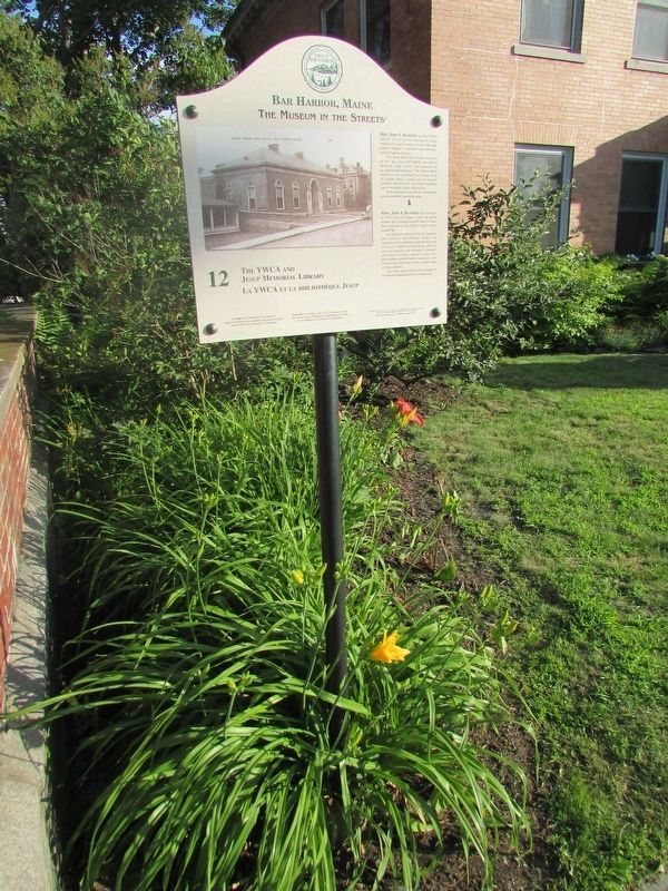
| 301 ► Maine, Hancock County, Bar Harbor — 12 — The YWCA and Jesup Memorial Library / La YWCA et la bibliothèque Jesup — Bar Harbor, Maine — The Museum in the Streets — |
| On Mt. Desert Street (Maine Route 3) east of Kavanaugh Place, on the right when traveling east. | |||
| 302 ► Maine, Hancock County, Bar Harbor — Thunder Hole — |
| On Park Loop Road. | |||
| 303 ► Maine, Hancock County, Bar Harbor — Thunder Hole Ranger Station — |
| 304 ► Maine, Hancock County, Bar Harbor — To the Top! — Acadia National Park — |
| On Cadillac Summit Road, on the left. | |||
| 305 ► Maine, Hancock County, Bar Harbor — Unusual Pocket Beach — Acadia National Park — |
| Near Park Loop Road, on the left when traveling south. | |||
| 306 ► Maine, Hancock County, Bar Harbor — Veterans Memorial — |
| On Mt. Desert Street (Maine Route 3) at Main Street, on the right when traveling west on Mt. Desert Street. | |||
| 307 ► Maine, Hancock County, Bar Harbor — Village Green — |
| On Kennebec Street at Mount Desert Street (Maine Route 3), on the right when traveling north on Kennebec Street. | |||
| 308 ► Maine, Hancock County, Bar Harbor — Volcanic Landscape Exposed — Acadia National Park — |
| Near Cadillac Summit Road. | |||
| 309 ► Maine, Hancock County, Bar Harbor — Wabanaki Traditions — Acadia National Park — |
| Near Suier de Monts Road. | |||
| 310 ► Maine, Hancock County, Bar Harbor — What Do Park Rangers Do? — Acadia National Park — |
| On Park Loop Road, on the right when traveling south. | |||
| 311 ► Maine, Hancock County, Bar Harbor — Wigwam/wikuwam — Acadia — |
| Near Suier de Monts Road. | |||
| 312 ► Maine, Hancock County, Bass Harbor — Bass Harbor Head Light — |
| On Lighthouse Road. | |||
| 313 ► Maine, Hancock County, Bass Harbor — Bass Harbor Head Light — |
| On Lighthouse Road. | |||
| 314 ► Maine, Hancock County, Bass Harbor — Bass Harbor Head Light Station — 1858 — |
| Near Lighthouse Road, on the left when traveling south. | |||
| 315 ► Maine, Hancock County, Bass Harbor — Mariners Beware! — Acadia National Park — National Park Service, U.S. Department of the Interior — |
| Near Lighthouse Road. | |||
| 316 ► Maine, Hancock County, Brooksville — Eggemoggin Reach History — |
| On Catapillar Hill Road (Maine Route 15) at Browns Avenue, on the right when traveling south on Catapillar Hill Road. | |||
| 317 ► Maine, Hancock County, Bucksport — 75 Years of Quality Paper Making — Bucksport Paper Mill 75th Anniversary — November 2005 — |
| Near Main Street (Maine Route 15) at Steamboat Wharf Lane, on the right when traveling east. | |||
| 318 ► Maine, Hancock County, Bucksport — Bucksport, Maine — The Museum In The Streets — |
| Near Main Street north of Mechanic Street. | |||
| 319 ► Maine, Hancock County, Bucksport — Fort Knox — |
| 320 ► Maine, Hancock County, Bucksport — Looking to the Future — |
| On Main Street (Maine Route 15) at 1st Street, on the left when traveling north on Main Street. | |||
| 321 ► Maine, Hancock County, Bucksport — Of Ships and Men — |
| On Main Street (Maine Route 15) at 1st Street, on the left when traveling north on Main Street. | |||
| 322 ► Maine, Hancock County, Bucksport — Penobscot River — |
| 323 ► Maine, Hancock County, Bucksport — Rich in Heritage — |
| On Main Street (Maine Route 15) at 1st Street, on the right when traveling north on Main Street. | |||
| 324 ► Maine, Hancock County, Bucksport — River of Life — |
| Near Bucksport Waterfront Walkway, 0.1 miles east of Steamboat Wharf Lane, on the right when traveling east. | |||
| 325 ► Maine, Hancock County, Bucksport — Site of the First Sawmill — |
| Near Main Street (Maine Route 15) at Mill Street, on the right when traveling east. | |||
| 326 ► Maine, Hancock County, Bucksport — The Legend of the Buck Memorial — |
| On U.S. 1 at Hinks Street, on the left when traveling east on U.S. 1. | |||
| 327 ► Maine, Hancock County, Bucksport — 5 — The Penobscot Expedition — Bucksport, Maine — The Museum in the Streets — |
| 328 ► Maine, Hancock County, Bucksport — The Phineas Heywood House — Circa 1824 — |
| On Main Street (Maine Route 15) near Elm Street, on the right when traveling west. | |||
| 329 ► Maine, Hancock County, Bucksport — The Town of Bucksport — |
| 330 ► Maine, Hancock County, Bucksport — Times of War — |
| On Main Street (Maine Route 15) at 1st Street, on the left when traveling north on Main Street. | |||
| 331 ► Maine, Hancock County, Bucksport — Waldo-Hancock Bridge — |
| Near Main Street (Maine Route 15) at Central Street, on the right when traveling east. | |||
| 332 ► Maine, Hancock County, Castine — Burial Place of British officers, — |
| On Battle Avenue (Maine Route 166) near Pleasant Street, on the left when traveling south. | |||
| 333 ► Maine, Hancock County, Castine — Fort George — |
| On Battle Avenue (Maine Route 166) near Pleasant Street, on the right when traveling south. | |||
| 334 ► Maine, Hancock County, Castine — Fort George & the Penobscot Expedition — |
| On Battle Avenue (Maine Route 166) near Pleasant Street, on the right when traveling south. | |||
| 335 ► Maine, Hancock County, Castine — Line of Argyle Street — |
| On Main Steet, on the left when traveling east. | |||
| 336 ► Maine, Hancock County, Eastbrook — Eastbrook War Memorial — |
| On Eastbrook Road (Maine Route 200) at Molasses Pond Road, on the right when traveling north on Eastbrook Road. | |||
| 337 ► Maine, Hancock County, Ellsworth — Civil War Memorial — |
| On U.S. 1 at Surry Road, on the left when traveling west on U.S. 1. | |||
| 338 ► Maine, Hancock County, Franklin — Civil War Memorial — 1861 - 1865 — |
| On Blackswoods Road (Maine Route 182) at Hog Bay Road / Main Street (Maine Route 200), on the left when traveling west on Blackswoods Road. | |||
| 339 ► Maine, Hancock County, Franklin — Curbstone Exhibit — |
| On West Franklin Road (Maine Route 182) at Grist Mill Road, on the right when traveling north on West Franklin Road. | |||
| 340 ► Maine, Hancock County, Franklin — Exhibit of the Granite Industry — In Eastern Hancock County — |
| On West Franklin Road (Maine Route 182) at Grist Mill Road, on the right when traveling north on West Franklin Road. | |||
| 341 ► Maine, Hancock County, Franklin — Franklin Revolutionary War Memorial — |
| On West Franklin Road (Maine Route 182) at Grist Mill Road, on the right when traveling north on West Franklin Road. | |||
| 342 ► Maine, Hancock County, Franklin — Franklin Veterans Memorial — |
| On Blackswoods Road (Maine Route 182) near Hog Bay Road (Maine Route 200), on the right when traveling east. | |||
| 343 ► Maine, Hancock County, Franklin — Galamander — |
| On West Franklin Road (Maine Route 182) at Grist Mill Road, on the right when traveling north on West Franklin Road. | |||
| 344 ► Maine, Hancock County, Franklin — Old Town Hall Site — 1874 - 1975 — |
| On Blackswoods Road (Maine Route 182) near Hog Bay Road (Maine Route 200), on the right when traveling east. | |||
| 345 ► Maine, Hancock County, Franklin — World War Memorial — 1914 - 1918 — |
| On Hog Bay Road (Maine Route 200) at Blackswoods Road / Main Street (Maine Route 182), on the right when traveling west on Hog Bay Road. | |||
| 346 ► Maine, Hancock County, Hancock — Defenders of the Union — |
| On U.S. 1 at Point Road, on the right when traveling east on U.S. 1. | |||
| 347 ► Maine, Hancock County, Northeast Harbor — Carriage Roads - Building the Roads — |
| Near Maine Route 3, 0.5 miles north of Route 198. | |||
| 348 ► Maine, Hancock County, Northeast Harbor — Joseph T. Musetti Jr. Veterans Memorial Park — In Honor Of All Who Served — Freedom Is Not Free — |
| On Harbor Drive, on the left when traveling south. | |||
| 349 ► Maine, Hancock County, Northeast Harbor — Seawater Bay — Acadia National Park — |
| On Sergeant Drive, on the left when traveling north. | |||
| 350 ► Maine, Hancock County, Northeast Harbor — Somes Sound — |
| On Sargeant Drive, on the right when traveling south. | |||
| 351 ► Maine, Hancock County, Prospect Harbor — Down East Lights — |
| On Main Street (Maine Route 186) at Kelley Lane, on the right when traveling west on Main Street. | |||
| 352 ► Maine, Hancock County, Prospect Harbor — Gouldsboro Town Park — |
| On Pond Road (Maine Route 195) at Main Street (Maine Route 186), on the right when traveling south on Pond Road. | |||
| 353 ► Maine, Hancock County, Prospect Harbor — Gouldsboro Veterans Memorial — |
| On Main Street (Maine Route 186) at Kelley Lane, on the right when traveling south on Main Street. | |||
| 354 ► Maine, Hancock County, Prospect Harbor — Life on the Ocean’s Edge — Prospect Harbor — This small community has seen many changes — |
| On Main Street (Maine Route 186) at Pond Road (Maine Route 195), on the right when traveling east on Main Street. | |||
| 355 ► Maine, Hancock County, Prospect Harbor — When the ocean was the great highway for travel — |
| On Main Street (Maine Route 186) at Kelley Lane, on the right when traveling south on Main Street. | |||
| 356 ► Maine, Hancock County, Seal Harbor — Carriage Roads - The Gate Lodges — |
| Near Park Loop Road, 2.5 miles north of Route 3. | |||
| 357 ► Maine, Hancock County, Seal Harbor — Cobbling the Cove — Acadia National Park — |
| On Park Loop Road, on the left when traveling west. | |||
| 358 ► Maine, Hancock County, Somesville — Linking oceans, rivers and lakes — |
| On Main Street (Maine Route 102) at Oak Hill Road, on the right when traveling south on Main Street. | |||
| 359 ► Maine, Hancock County, Southwest Harbor — Natural Seawall — |
| Near Seawall Road (Maine Route 102A), on the left when traveling south. | |||
| 360 ► Maine, Hancock County, Stonington — Stonecutter — |
| On Main Street (Maine Route 15) at Robbins St., on the right when traveling east on Main Street. | |||
| 361 ► Maine, Hancock County, Stonington — Stonington War Memorial — |
| On Main Street (Maine Route 15) near Atlantic Avenue, on the right when traveling east. | |||
| 362 ► Maine, Hancock County, Sullivan — Historic Architecture in Sullivan Harbor — |
| On U.S. 1 near Benvenuto Avenue, on the right when traveling east. | |||
| 363 ► Maine, Hancock County, Sullivan — Summer Rusticators, the Tourist Trade and the Waukeag House Hotel — |
| On U.S. 1 near Benvenuto Avenue, on the right when traveling east. | |||
| 364 ► Maine, Hancock County, Sullivan — The view of Frenchman Bay — |
| On U.S. 1 near Benvenuto Avenue, on the right when traveling east. | |||
| 365 ► Maine, Hancock County, Tremont — A Steadfast Light — |
| On Lighthouse Road. | |||
| 366 ► Maine, Hancock County, West Gouldsboro — West Gouldsboro Great War Memorial — |
| On South Gouldsboro Road (Maine Route 186) at Clinic Road, on the right when traveling north on South Gouldsboro Road. | |||
| 367 ► Maine, Hancock County, Winter Harbor — Connected by Water — |
| On Schoodic Loop Road, 2.4 miles south of Route 186, on the right when traveling south. | |||
| 368 ► Maine, Hancock County, Winter Harbor — Discover Architectural Gems in a DownEast Village — |
| On Main Street at Harbor Lane, on the right when traveling west on Main Street. | |||
| 369 ► Maine, Hancock County, Winter Harbor — Fires Changed the Face of Winter Harbor Again & Again — |
| On Main Street at Harbor Road, on the right when traveling west on Main Street. | |||
| 370 ► Maine, Hancock County, Winter Harbor — John Godfrey Moore — |
| On Arey Cove Road. | |||
| 371 ► Maine, Hancock County, Winter Harbor — Karl A. Jacobson — |
| Near Farview Drive east of Schoodic Loop Road, on the right when traveling east. | |||
| 372 ► Maine, Hancock County, Winter Harbor — Lighthouses Warned Ships of Danger Down East — |
| On Main Street (Maine Route 186) near Newman Street (Maine Route 186), on the right when traveling east. | |||
| 373 ► Maine, Hancock County, Winter Harbor — Not a Typical Military Barracks — |
| On Atterbury Circle. | |||
| 374 ► Maine, Kennebec County, Augusta — 9 — Comfort Magazine / Le Magazine Comfort — Augusta, Maine — The Museum in the Streets® — |
| On Willow Street north of Cony Street, on the left when traveling north. | |||
| 375 ► Maine, Kennebec County, Augusta — 103rd Infantry Regiment — |
| On Winthrop Street just west of Blaine Avenue, on the left when traveling west. | |||
| 376 ► Maine, Kennebec County, Augusta — 1775 Quebec Expedition — |
| 377 ► Maine, Kennebec County, Augusta — 25 — A New Look for Water Street / Un nouvel arrivant dans Water Street — Augusta, Maine — The Museum in the Streets® — |
| On Water Street at Oak Street, on the left when traveling north on Water Street. | |||
| 378 ► Maine, Kennebec County, Augusta — 5 — A Tribute to a Memorable Day / Un Anniversaire Mémorable — Augusta, Maine — The Museum in the Streets® — |
| On Cony Street at Noyes Street Place, on the right when traveling west on Cony Street. | |||
| 379 ► Maine, Kennebec County, Augusta — Adolphe J. Gingras — 1896 to 1966 — |
| On Water Street at Commercial Street, on the left when traveling south on Water Street. | |||
| 380 ► Maine, Kennebec County, Augusta — 26 — An Ornament to the City / Un joyau de la ville — Augusta, Maine — The Museum in the Streets® — |
| On Water Street north of Oak Street, on the left when traveling north. | |||
| 381 ► Maine, Kennebec County, Augusta — 9 — Augusta Mourns Lincoln / Augusta Pleur Lincoln — Augusta, Maine – The Civil War — The Museum in the Streets® — |
| On State Street (Maine Route 104) just north of Court Street, on the right when traveling north. | |||
| 382 ► Maine, Kennebec County, Augusta — Map — Augusta, Maine — The Museum in the Streets — |
| On Cony Street just west of Arsenal Street, on the left when traveling west. | |||
| 383 ► Maine, Kennebec County, Augusta — Map — Augusta, Maine – The Civil War — The Museum in the Streets — |
| On Winthrop Street at Blaine Avenue, on the right when traveling west on Winthrop Street. | |||
| 384 ► Maine, Kennebec County, Augusta — Map — Augusta, Maine – The Civil War — The Museum in the Streets — |
| On Union Street, 0.2 miles east of State Street (U.S. 201), on the right when traveling east. | |||
| 385 ► Maine, Kennebec County, Augusta — 23 — Augusta's Publishing Empire / L'empire de l'édition à Augusta — Augusta, Maine — The Museum in the Streets® — |
| On Water Street at Winthrop Street, on the left when traveling north on Water Street. | |||
| 386 ► Maine, Kennebec County, Augusta — Augusta's Vietnam War Dead Memorial — 1964 - 1975 — "Duty" — |
| On State Street at Chandler Street, on the left when traveling south on State Street. | |||
| 387 ► Maine, Kennebec County, Augusta — Birds and Fish of the Kennebec — |
| On Cony Street at the East Side of the Kennebec River Bridge, on the left when traveling west on Cony Street. | |||
| 388 ► Maine, Kennebec County, Augusta — Blaine Mansion — |
| On Capitol Street east of State Street (U.S. 201), on the right when traveling east. | |||
| 389 ► Maine, Kennebec County, Augusta — 4 — Capitol Park & Augusta's Doughnut Brigade / Le Parc du Capitole et la Manne de Beignets — Augusta, Maine – The Civil War — The Museum in the Streets™ — |
| On Union Street, 0.1 miles east of Columbia Street, on the right when traveling east. | |||
| 390 ► Maine, Kennebec County, Augusta — Civil War Memorial — |
| On Water Street east of Memorial Circle, on the left when traveling east. | |||
| 391 ► Maine, Kennebec County, Augusta — Civilian Conservation Corps — |
| 392 ► Maine, Kennebec County, Augusta — 13 — Cony U.S. Hospital / Hôpital Militaire Cony — Augusta, Maine – The Civil War — The Museum in the Streets® — |
| On Winthrop Street at Blaine Avenue, on the right when traveling west on Winthrop Street. | |||
| 393 ► Maine, Kennebec County, Augusta — 20 — Cornerstone Day / La pose des premières pierres — Augusta, Maine — The Museum in the Streets® — |
| On Water Street south of Winthrop Street/Front Street, on the left when traveling north. | |||
| 394 ► Maine, Kennebec County, Augusta — Cushnoc Trading Post — 1628 - 1661 — |
| 395 ► Maine, Kennebec County, Augusta — 1 — Cushnoc Trading Post / Le Comptoir Commercial De Cushnoc — Augusta, Maine — The Museum in the Streets® — |
| Near Cony Street. | |||
| 396 ► Maine, Kennebec County, Augusta — 12 — D.W. Adams Department Store / Le grand magasin de D.W. Adams — Augusta, Maine — The Museum in the Streets® — |
| On Water Street north of Oak Street, on the right when traveling north. | |||
| 397 ► Maine, Kennebec County, Augusta — Dedicated to You, A Free Citizen in a Free Land — Maine's Liberty Bell Replica — |
| Near Capitol Street east of Chamberlain Street, on the right when traveling east. | |||
| 398 ► Maine, Kennebec County, Augusta — 10 — First Kennebec Bridge / Le premier pont du Kennebec — Augusta, Maine — The Museum in the Streets® — |
| On Cony Street at the east side of the Kennebec River Bridge, on the left when traveling west on Cony Street. | |||
| 399 ► Maine, Kennebec County, Augusta — 22 — Flag Protest ~ War of 1812 / Drapeau en berne - Guerre de 1812 — Augusta, Maine — The Museum in the Streets® — |
| On Water Street south of Winthrop Street/Front Street, on the left when traveling north. | |||
| 400 ► Maine, Kennebec County, Augusta — Garden of Remembrance — |
| Near Blue Star Avenue. | |||
860 entries matched your criteria. Entries 301 through 400 are listed above. ⊲ Previous 100 — Next 100 ⊳